Lane End Wood

Wood, Forest in Sussex Wealden

England

Lane End Wood

Ford on footpath Rotherfield 3b The otherwise excellent East Sussex interactive rights of way map marks this with a bridge. There was no sign of any bridge being here in the recent past. Fortunately the stream is narrow enough to jump on the left.
Ford on footpath Rotherfield 3b Credit: Robin Webster

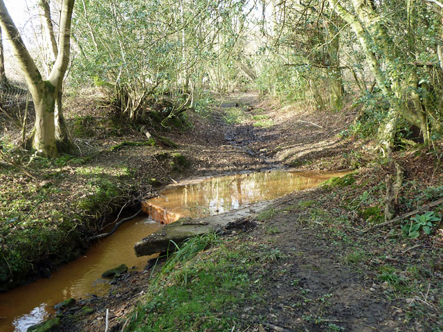
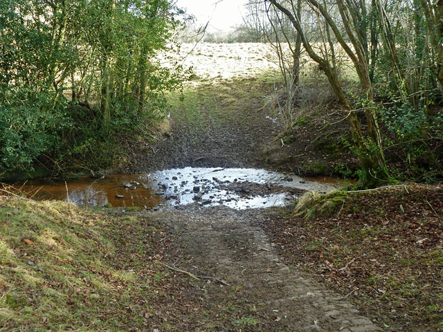
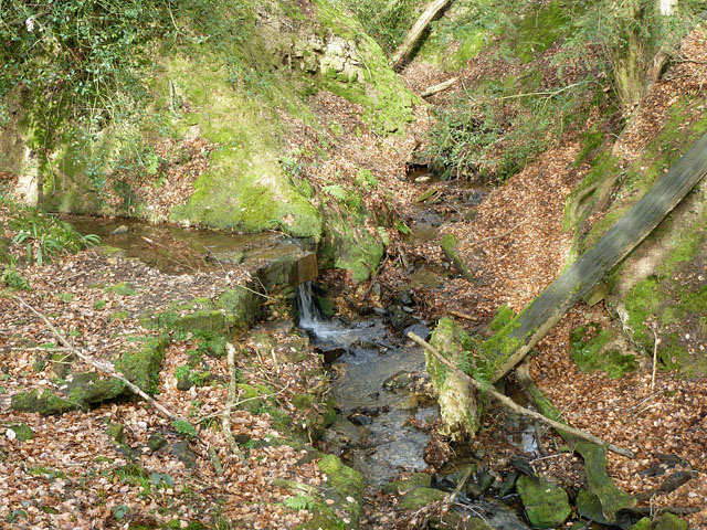
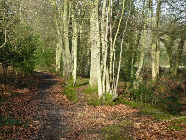
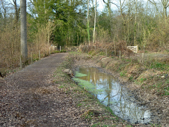
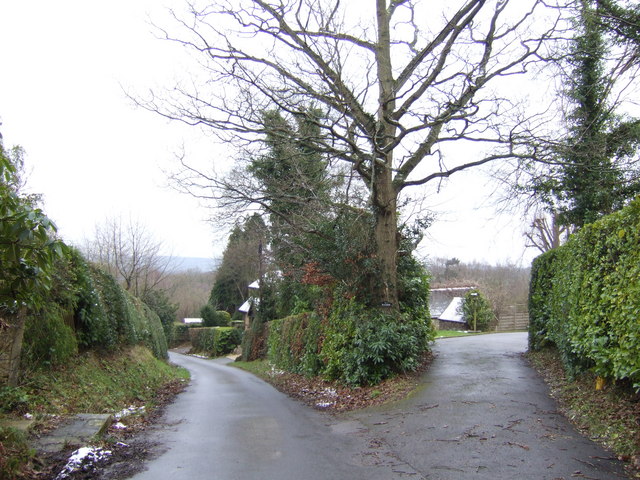
Lane End Wood is a picturesque forest located in Sussex, England. Covering an area of approximately 100 hectares, it is known for its diverse flora and fauna, making it a popular destination for nature enthusiasts and hikers.

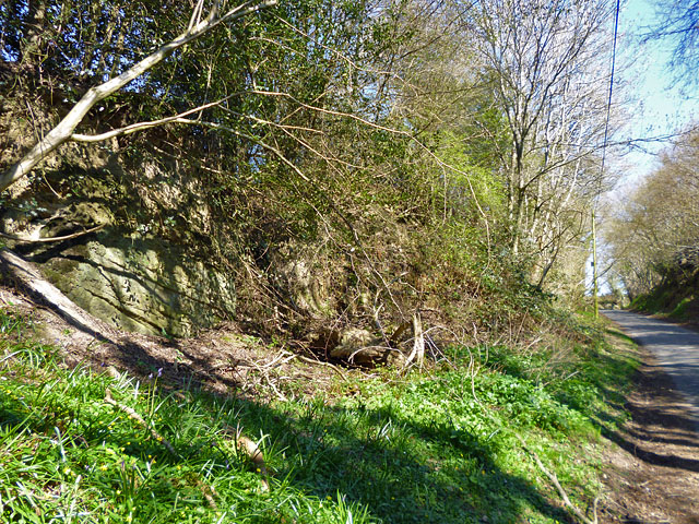
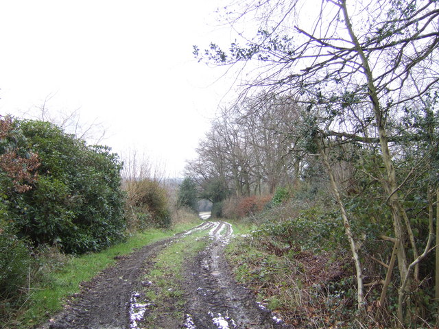
The wood is primarily composed of deciduous trees such as oak, beech, and birch, which create a dense canopy that provides shade and shelter to the forest floor. This enables the growth of a wide variety of plants, including bluebells, wood anemones, and wild garlic, which carpet the ground during the spring months, creating a stunning display of colors.

The woodland is also a haven for wildlife, with a number of species calling it home. Visitors often spot squirrels scampering through the treetops and deer grazing peacefully in the glades. The forest is also frequented by a variety of bird species, including woodpeckers, tits, and finches, making it a paradise for birdwatchers.

For those looking to explore the wood, there are several well-marked trails that wind through its enchanting paths. These trails cater to different levels of difficulty, ensuring that visitors of all ages and abilities can enjoy the beauty of Lane End Wood.

Lane End Wood offers a tranquil escape from the hustle and bustle of daily life, allowing visitors to immerse themselves in the wonders of nature. Whether it's a leisurely stroll, a picnic amongst the trees, or simply taking in the sights and sounds of the forest, Lane End Wood is a must-visit destination for nature lovers in Sussex.

If you have any feedback on the listing, please let us know in the comments section below.

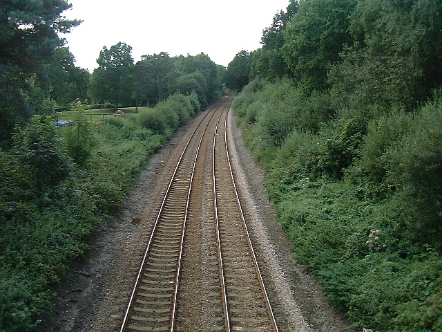
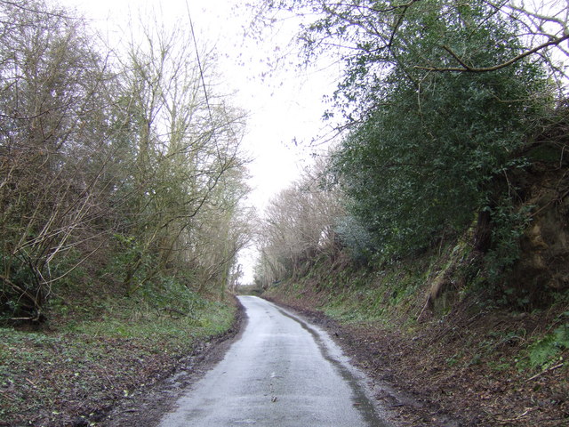
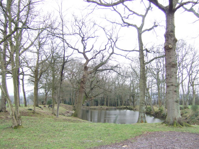
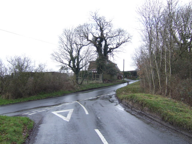
Lane End Wood Images

Images are sourced within 2km of 51.022271/0.13338887 or Grid Reference TQ4926. Thanks to Geograph Open Source API. All images are credited.

Ford on footpath Rotherfield 3b The otherwise excellent East Sussex interactive rights of way map marks this with a bridge. There was no sign of any bridge being here in the recent past. Fortunately the stream is narrow enough to jump on the left.
Ford on footpath Rotherfield 3b
The otherwise excellent East Sussex interactive rights of way map marks this with a bridge. There was no sign of any bridge being here in the recent past. Fortunately the stream is narrow enough to jump on the left.
Ford on footpath Rotherfield 51 The otherwise excellent East Sussex interactive rights of way map marks this with a bridge, so does the OS map. There was no sign here of there ever being a bridge. Perhaps it lurks in the undergrowth a little further up the stream?
Ford on footpath Rotherfield 51
The otherwise excellent East Sussex interactive rights of way map marks this with a bridge, so does the OS map. There was no sign here of there ever being a bridge. Perhaps it lurks in the undergrowth a little further up the stream?
Gill stream junction It is rather hard to get a sense of scale here, but the fallen tree on the right is of some size. The main gill stream comes down from the right and is joined by a side stream falling over a substantial seam of sandstone.
Gill stream junction
It is rather hard to get a sense of scale here, but the fallen tree on the right is of some size. The main gill stream comes down from the right and is joined by a side stream falling over a substantial seam of sandstone.
Bridleway Crowborough 27a Here it is following the west edge of a dwindling gill on the right, with the wood known as Sinnock's Rough on the left.
Bridleway Crowborough 27a
Here it is following the west edge of a dwindling gill on the right, with the wood known as Sinnock's Rough on the left.
Bridleway Buxted 36b A bridleway improved not so long ago, and consequently pleasant going. The wayside pond is a nice feature.
Bridleway Buxted 36b
A bridleway improved not so long ago, and consequently pleasant going. The wayside pond is a nice feature.
Rocky bank on Fowly Lane An Ardingly Sandstone exposure by the lane which passes though a sunken section on the hill up from a stream valley.
Rocky bank on Fowly Lane
An Ardingly Sandstone exposure by the lane which passes though a sunken section on the hill up from a stream valley.
Railway Viaduct , Uckfield Line This is on a slight curve, with this view of the convex side.
Railway Viaduct , Uckfield Line
This is on a slight curve, with this view of the convex side.
Cross Road at Burnt Oak This is just within this grid square although a referee's decision must be final !
Cross Road at Burnt Oak
This is just within this grid square although a referee's decision must be final !
Railway bridge The Uckfield to London railway line passes under this bridge.
Railway bridge
The Uckfield to London railway line passes under this bridge.
Railway line from Uckfield to London After leaving Uckfield the train passes through Buxted before reaching this bridge. There are now hourly train services (2005) from Uckfield to London bridge during the week with the journey taking 1 1/4 hours.
Railway line from Uckfield to London
After leaving Uckfield the train passes through Buxted before reaching this bridge. There are now hourly train services (2005) from Uckfield to London bridge during the week with the journey taking 1 1/4 hours.
Fowly Lane This deeply banked section of the lane is the only stretch within the gridsquare.
Fowly Lane
This deeply banked section of the lane is the only stretch within the gridsquare.
Pond off Fowly Lane This isn't a hammer pond. Hammer ponds were constructed on streams and dammed in order to provide power at all times; this one doesn't have streams connected to them making them useless for operating the wheels that powered the blast furnaces. The most likely scenario is that both were dug to get something out of the ground, either marl to fertilise nearby fields or to dig up any stray bits of sandstone that lie in the area in order to build something with. They are also next to a highway which would have enabled easy transportation to either fields or nearby settlements. 
Description thanks to another member.
Pond off Fowly Lane
This isn't a hammer pond. Hammer ponds were constructed on streams and dammed in order to provide power at all times; this one doesn't have streams connected to them making them useless for operating the wheels that powered the blast furnaces. The most likely scenario is that both were dug to get something out of the ground, either marl to fertilise nearby fields or to dig up any stray bits of sandstone that lie in the area in order to build something with. They are also next to a highway which would have enabled easy transportation to either fields or nearby settlements. Description thanks to another member.
Lane junction at Burnt Oak Reference to charcoal industry associated with iron smelting in the middle ages.
Lane junction at Burnt Oak
Reference to charcoal industry associated with iron smelting in the middle ages.
Sweethaws Lane A private drive forks off to the right.
Sweethaws Lane
A private drive forks off to the right.
Wealden footpath Heading south from Sweethaws towards Burnt Oak.
Wealden footpath
Heading south from Sweethaws towards Burnt Oak.
Fowly Lane Just beyond Kiln Farm, about to go downhill.
Fowly Lane
Just beyond Kiln Farm, about to go downhill.
Road to Greenhurst Farm Off Fowly Lane
Road to Greenhurst Farm
Off Fowly Lane
Pond and house in the Weald This isn't a hammer pond. Hammer ponds were constructed on streams and dammed in order to provide power at all times; this one doesn't have streams connected to them making them useless for operating the wheels that powered the blast furnaces. The most likely scenario is that both were dug to get something out of the ground, either marl to fertilise nearby fields or to dig up any stray bits of sandstone that lie in the area in order to build something with. They are also next to a highway which would have enabled easy transportation to either fields or nearby settlements. 
Description thanks to another member.
Pond and house in the Weald
This isn't a hammer pond. Hammer ponds were constructed on streams and dammed in order to provide power at all times; this one doesn't have streams connected to them making them useless for operating the wheels that powered the blast furnaces. The most likely scenario is that both were dug to get something out of the ground, either marl to fertilise nearby fields or to dig up any stray bits of sandstone that lie in the area in order to build something with. They are also next to a highway which would have enabled easy transportation to either fields or nearby settlements. Description thanks to another member.
Show me another place!

Lane End Wood is located at Grid Ref: TQ4926 (Lat: 51.022271, Lng: 0.13338887)

Administrative County: East Sussex

District: Wealden

Police Authority: Sussex

What 3 Words

///rucksack.decoding.blanket. Near Buxted, East Sussex

Related Wikis

Richard Hill (RAF officer)

Lieutenant Richard Frank Hill (28 April 1899 – 17 September 1918) was a British World War I flying ace credited with seven aerial victories. == Biography... ==

High Hurstwood

High Hurstwood is a village in the Wealden district of East Sussex. == External links == High Hurstwood village history Holy Trinity Church, High Hurstwood...

Temple Grove School

Temple Grove School was a preparatory school for boys, and after 1984 also for girls, originally at Parsons Green, London, later at East Sheen, London...

St John the Evangelist Church, Heron's Ghyll

St John's Church or St John the Evangelist Church is a Roman Catholic Parish Church in the Heron's Ghyll settlement of Buxted, East Sussex, England. It...

Heron's Ghyll

Heron's Ghyll is a hamlet in the Wealden district of East Sussex. St John the Evangelist Church is a Catholic church in the village. There is a late 19th...

Poundgate

Poundgate is a hamlet in East Sussex on the A26 Uckfield Road at the junction with Chillies Road, just south of Crowborough. It has one pub, the Crow and...

Brickfield Meadow

Brickfield Meadow is a 1.4-hectare (3.5-acre) nature reserve north of Maresfield in East Sussex. It is managed by the Sussex Wildlife Trust.This wildflower...

Fairwarp

Fairwarp is a small village within the civil parish of Maresfield in the Wealden district of East Sussex, England. Its nearest town is Uckfield, which...

Nearby Amenities

Located within 500m of 51.022271,0.13338887
Post Box
Post Box Type: wall
Ref: TN22 54
Royal Cypher: GR
Royal Cypher Wikidata: Q33102273
Lat/Long: 51.020182/0.1291401
Post Box
Post Box Type: lamp
Ref: TN22 55
Royal Cypher: EIIR
Royal Cypher Wikidata: Q33102113
Lat/Long: 51.0188075/0.1352323
Greystone Farm
Place: isolated_dwelling
Lat/Long: 51.023875/0.131793
The data included in this document is from www.openstreetmap.org. The data is made available under ODbL.

Have you been to Lane End Wood?

Leave your review of Lane End Wood below (or comments, questions and feedback).