Stubbs Wood

Wood, Forest in Kent Sevenoaks

England

Stubbs Wood

Cooper’s Corner: postbox № TN14 209 This Victorian postbox is set into a pillar-like addition projecting from the frontage of a building which I think was once a pub: there is a 'PH' marked here on some large-scale maps and the Royal Mail's listing names this postbox as Frog & Bucket so I am assuming that is what the pub was called.
Cooper’s Corner: postbox № TN14 209 Credit: Chris Downer

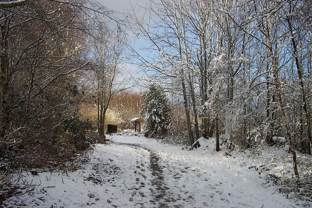
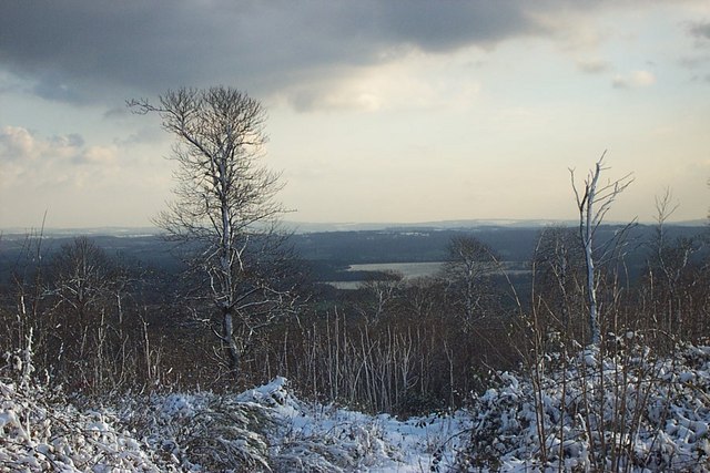
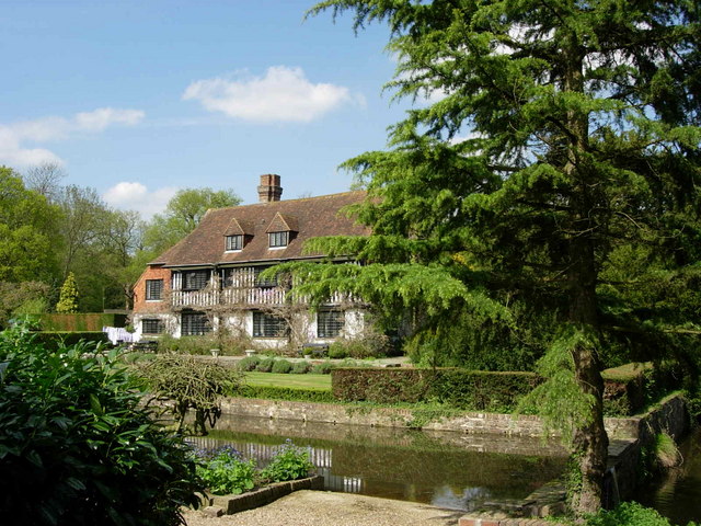
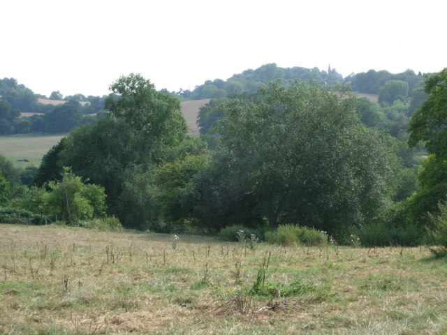
Stubbs Wood is a picturesque woodland area located in the county of Kent, England. Situated near the village of Stubbs Cross, the wood covers an area of approximately 50 acres and is known for its natural beauty and diverse wildlife.

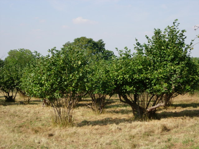
The wood is predominantly made up of broadleaved trees, including oak, beech, and ash, which create a dense and vibrant canopy overhead. The forest floor is adorned with a rich carpet of ferns, bluebells, and wildflowers, making it a haven for nature enthusiasts and photographers.

The wood is crisscrossed with a network of well-maintained footpaths and trails, allowing visitors to explore its enchanting surroundings. Walking through the peaceful woodland, visitors can spot a variety of bird species, such as woodpeckers, owls, and songbirds, as well as small mammals like foxes, badgers, and squirrels.

Stubbs Wood is a popular destination for outdoor activities such as walking, jogging, and nature walks. It offers a tranquil escape from the hustle and bustle of everyday life, providing visitors with an opportunity to connect with nature and enjoy the beauty of the surrounding countryside.

The wood is well-preserved and managed by local conservation groups, ensuring the protection of its natural habitats and wildlife. It is also a designated Site of Special Scientific Interest (SSSI), highlighting its ecological significance and importance for biodiversity.

Overall, Stubbs Wood in Kent is a charming and idyllic woodland, offering a peaceful retreat for nature lovers and a chance to immerse oneself in the beauty of the natural world.

If you have any feedback on the listing, please let us know in the comments section below.

Stubbs Wood Images

Images are sourced within 2km of 51.244465/0.13712149 or Grid Reference TQ4951. Thanks to Geograph Open Source API. All images are credited.

Cooper’s Corner: postbox № TN14 209 This Victorian postbox is set into a pillar-like addition projecting from the frontage of a building which I think was once a pub: there is a 'PH' marked here on some large-scale maps and the Royal Mail's listing names this postbox as Frog & Bucket so I am assuming that is what the pub was called.
Cooper’s Corner: postbox № TN14 209
This Victorian postbox is set into a pillar-like addition projecting from the frontage of a building which I think was once a pub: there is a 'PH' marked here on some large-scale maps and the Royal Mail's listing names this postbox as Frog & Bucket so I am assuming that is what the pub was called.
Emmetts The House at Emmetts is private, but the gardens are National Trust.  Towards East of gridsquare.
Emmetts
The House at Emmetts is private, but the gardens are National Trust. Towards East of gridsquare.
Goathurst Common Well Prior to the sinking of the well in 1901, villagers used water from rainwater storage tanks. When these ran dry, villagers had to walk down a steep hill to the springs south of Stubbs Woods, to collect their water. Piped water was brought to the area during the 1920s.
Goathurst Common Well
Prior to the sinking of the well in 1901, villagers used water from rainwater storage tanks. When these ran dry, villagers had to walk down a steep hill to the springs south of Stubbs Woods, to collect their water. Piped water was brought to the area during the 1920s.
St Mary's Church Ide Hill The church was built in 1865 and has the distinction of being the highest church in Kent.
St Mary's Church Ide Hill
The church was built in 1865 and has the distinction of being the highest church in Kent.
Woodland footpath to viewing point at top of York's Hill This mixed deciduous woodland was ravaged by the Great Storm of 1987.
Woodland footpath to viewing point at top of York's Hill
This mixed deciduous woodland was ravaged by the Great Storm of 1987.
Stubbs Wood - Hanging Bank This view through Stubbs Wood, showing Bough Beech Reservoir in the distant valley, would not have been possible before the Great Storm of 1987. Many of the mature beech and other native trees were flattened overnight.
Stubbs Wood - Hanging Bank
This view through Stubbs Wood, showing Bough Beech Reservoir in the distant valley, would not have been possible before the Great Storm of 1987. Many of the mature beech and other native trees were flattened overnight.
Old Wagon Lodge & Scollops Oast House These buildings are situated at the bottom of York's Hill, near Ide Hill village. This is an extremely steep narrow road where every October cyclists gather for a gruelling uphill ride.
Old Wagon Lodge & Scollops Oast House
These buildings are situated at the bottom of York's Hill, near Ide Hill village. This is an extremely steep narrow road where every October cyclists gather for a gruelling uphill ride.
Henden Farm - Looking towards Toy's Hill Henden Farm, south of Ide Hill village must have started its history as a clearing in the forest made by a swineherd who came to pasture his pigs, perhaps a thousand years ago. Later it became a farm, part of the Manor of Sundridge, although it was soon an independent manor.
Henden Farm - Looking towards Toy's Hill
Henden Farm, south of Ide Hill village must have started its history as a clearing in the forest made by a swineherd who came to pasture his pigs, perhaps a thousand years ago. Later it became a farm, part of the Manor of Sundridge, although it was soon an independent manor.
Henden Manor - Ide Hill In 1516 Henry VIII gave Henden to Sir Thomas Boleyn, father of the future Queen.  The house which stands here now is sixteenth century, but much restored. The moat probably surrounded an earlier house, although it is not certain why a simple Manor house, far from the coast, should have required a moat.
Henden Manor - Ide Hill
In 1516 Henry VIII gave Henden to Sir Thomas Boleyn, father of the future Queen. The house which stands here now is sixteenth century, but much restored. The moat probably surrounded an earlier house, although it is not certain why a simple Manor house, far from the coast, should have required a moat.
Little Norman Street Farmhouse I am indebted to Jean Barrow of Ide Hill for supplying the name of this attractive house on the north side of Penn Lane about half a mile west of Brook Street, near Sevenoaks, Kent
Little Norman Street Farmhouse
I am indebted to Jean Barrow of Ide Hill for supplying the name of this attractive house on the north side of Penn Lane about half a mile west of Brook Street, near Sevenoaks, Kent
Penn Farm, Penn Lane, near Sevenoaks, Kent The substantial farm house shown here stands on the west side of Penn Lane, whereas most of the farm buildings are on the other side of the lane, behind the photographer.
Penn Farm, Penn Lane, near Sevenoaks, Kent
The substantial farm house shown here stands on the west side of Penn Lane, whereas most of the farm buildings are on the other side of the lane, behind the photographer.
Farm buildings at Penn Farm - Ide Hill These farm buildings are on the other side of a very narrow road opposite Penn Farmhouse. The name "Penn" derives from the Old English Pynd, meaning an enclosure.
Farm buildings at Penn Farm - Ide Hill
These farm buildings are on the other side of a very narrow road opposite Penn Farmhouse. The name "Penn" derives from the Old English Pynd, meaning an enclosure.
Penn Farmhouse gate - Ide Hill An interesting notice on a farmhouse gate.
Penn Farmhouse gate - Ide Hill
An interesting notice on a farmhouse gate.
Converted farm buildings - near Ide Hill Sevenoaks Little Norman Street Farm buildings now converted into housing.  Something that is happening a great deal in this part of Kent.
Converted farm buildings - near Ide Hill Sevenoaks
Little Norman Street Farm buildings now converted into housing. Something that is happening a great deal in this part of Kent.
Cob Tree Orchard - Great Norman Street Farm The cob orchard at Great Norman Street farm is a hundred years old and two nearby fields are known, according to a map of 1840, as Walnut Tree Field and Cherry Field, giving an indication of the crops grown at that time.
Cob Tree Orchard - Great Norman Street Farm
The cob orchard at Great Norman Street farm is a hundred years old and two nearby fields are known, according to a map of 1840, as Walnut Tree Field and Cherry Field, giving an indication of the crops grown at that time.
Little Norman Street Farmhouse  Ide Hill, Kent The farm buildings of this small farm have now been converted into housing. Little Norman Street is fortunate in having deeds which show that it has been an independent small-holding of under ten acres for at least three hundred years. Until 1900 it was described as "Brook, near Brook Place".
Little Norman Street Farmhouse Ide Hill, Kent
The farm buildings of this small farm have now been converted into housing. Little Norman Street is fortunate in having deeds which show that it has been an independent small-holding of under ten acres for at least three hundred years. Until 1900 it was described as "Brook, near Brook Place".
Farmland suffering from a summer of drought This photograph was taken from Back Lane. Part of Hawks Wood is in the near distance whilst in the far distance can just be seen the shingled spire of Ide Hill Church.
Farmland suffering from a summer of drought
This photograph was taken from Back Lane. Part of Hawks Wood is in the near distance whilst in the far distance can just be seen the shingled spire of Ide Hill Church.
Cottage, Emmetts Garden Emmetts Garden is a National Trust Property near Sevenoaks.
Cottage, Emmetts Garden
Emmetts Garden is a National Trust Property near Sevenoaks.
Show me another place!

Stubbs Wood is located at Grid Ref: TQ4951 (Lat: 51.244465, Lng: 0.13712149)

Administrative County: Kent

District: Sevenoaks

Police Authority: Kent

What 3 Words

///tight.puts.could. Near Sundridge, Kent

Nearby Locations

York's Hill Stubbs Wood

Related Wikis

Stubbs Wood Country Park

Stubbs Wood Country Park is in Sevenoaks, in Kent, England. It is located on the Greensand Ridge, close to Ide Hill village. The site is owned and managed...

Ide Hill

Ide Hill is a village within the civil parish of Sundridge with Ide Hill, in the Sevenoaks District of Kent, England. It stands on one of the highest...

Emmetts Garden

Emmetts Garden is an Edwardian estate located at Ide Hill, near Sevenoaks in Kent, UK. It is now owned by the National Trust for Places of Historic Interest...

Scord's Wood and Brockhoult Mount

Scord's Wood and Brockhoult Mount is a 252.3-hectare (623-acre) biological Site of Special Scientific Interest west of Sevenoaks in Kent. Scord's Wood...

Bough Beech Reservoir

Bough Beech Reservoir is a 42-hectare (100-acre) nature reserve in Bough Beech, south-west of Sevenoaks in Kent. It was managed by the Kent Wildlife Trust...

Sundridge, Kent

Sundridge is a village within the civil parish of Sundridge with Ide Hill, in the Sevenoaks district of Kent, England. The village is located on the A25...

Toys Hill

Toys Hill is a hamlet which lies within Brasted civil parish in the Sevenoaks district of Kent, England. It lies to the south of Brasted Chart, also in...

Bessels Green

Bessels Green is a village now incorporated into the built-up area of Sevenoaks in Kent, England. It is on the north-western outskirts of Sevenoaks, in...

Nearby Amenities

Located within 500m of 51.244465,0.13712149
Parking
Fee: no
Lat/Long: 51.2452358/0.1309899
Ide Hill Community Shop
Addr Postcode: TN14 6JG
Alt Name: Ide Hill Village Hall
Fhrs Id: 267014
Shop: convenience
Source: Local Knowledge
Source Addr: FHRS Open Data
Lat/Long: 51.2453361/0.1309709
Kindergarten
Ide Hill Pre School
Addr Postcode: TN14 6JG
Fhrs Id: 266969
Source Addr: FHRS Open Data
Lat/Long: 51.2453221/0.1311905
Stubbs Wood
Natural: wood
Lat/Long: 51.2440921/0.1379752
Windmill Point
Natural: wood
Lat/Long: 51.2438991/0.134398
Hanging Bank
Natural: wood
Lat/Long: 51.2427531/0.134921
Bus Stop
Nightingale Lane
Local Ref: adj
Naptan AtcoCode: 2400A075360A
Naptan Bearing: E
Naptan BusStopType: MKD
Naptan CommonName: Nightingale Lane
Naptan Indicator: adj
Naptan Landmark: Nightingale Lane
Naptan NaptanCode: kntjwmtm
Naptan RevisionNumber: 6
Naptan Status: act
Naptan Street: Wheatsheaf Hill
Naptan Verified: no
Public Transport: platform
Ref: kntjwmtm
Source: naptan_import
Source Date: 2018-04-27
Lat/Long: 51.2462076/0.1426933
Bus Stop
Nightingale Lane
Flag: no
Local Ref: opp
Naptan AtcoCode: 2400107961
Naptan Bearing: W
Naptan BusStopType: CUS
Naptan CommonName: Nightingale Lane
Naptan Indicator: opp
Naptan Landmark: Nightingale Lane
Naptan NaptanCode: kntjwmtp
Naptan RevisionNumber: 2
Naptan Status: act
Naptan Street: Wheatsheaf Hill
Naptan Verified: no
Public Transport: platform
Ref: kntjwmtp
Source: naptan_import
Source Date: 2016-06-30
Lat/Long: 51.2461242/0.1428583
Bus Stop
Community Shop
Local Ref: behind
Naptan AtcoCode: 2400109353
Naptan Bearing: NE
Naptan BusStopType: CUS
Naptan CommonName: Community Shop
Naptan Indicator: behind
Naptan NaptanCode: kntmpdmt
Naptan RevisionNumber: 0
Naptan Status: act
Naptan Street: Ide Hill Road
Naptan Verified: no
Public Transport: platform
Ref: kntmpdmt
Source: naptan_import
Source Date: 2020-06-30
Lat/Long: 51.2452792/0.1305251
The data included in this document is from www.openstreetmap.org. The data is made available under ODbL.

Have you been to Stubbs Wood?

Leave your review of Stubbs Wood below (or comments, questions and feedback).