Magog Wood

Wood, Forest in Cambridgeshire South Cambridgeshire

England

Magog Wood

Fields on the edge of Wandlebury Country Park Beautiful open countryside just a couple of miles to the south east of Cambridge.
Fields on the edge of Wandlebury Country Park Credit: Peter S

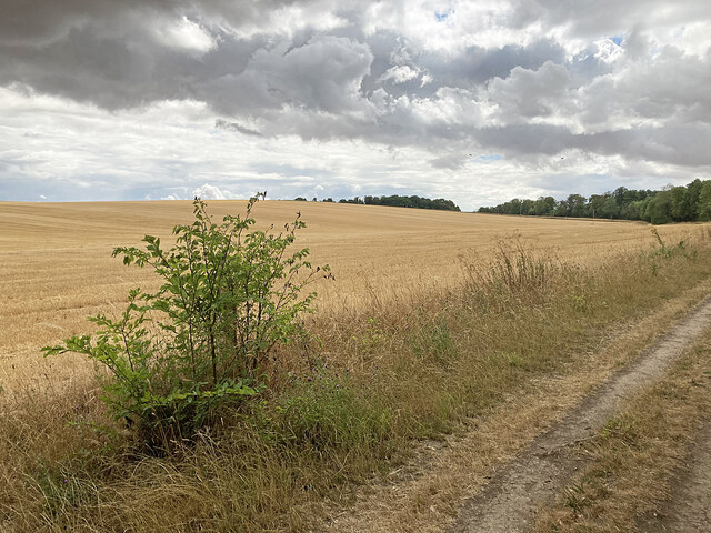
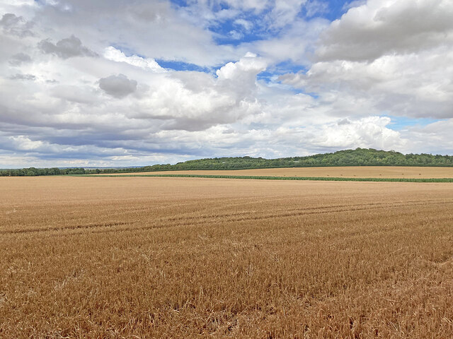
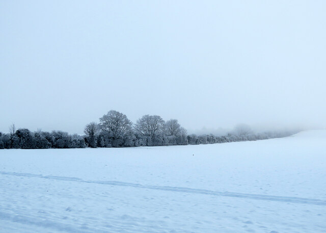
Magog Wood is a beautiful forest located in the county of Cambridgeshire, England. Situated just a few miles south of the city of Cambridge, it covers an area of approximately 163 acres. The wood is named after the legendary giant, Magog, who was said to be the brother of Gog and the protector of the city.

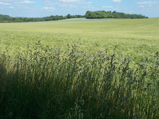
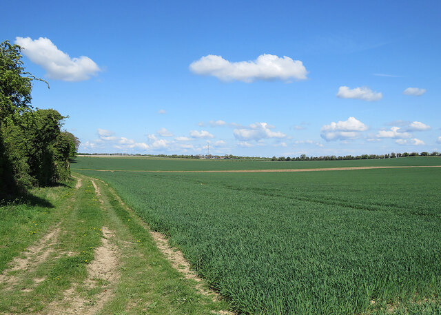
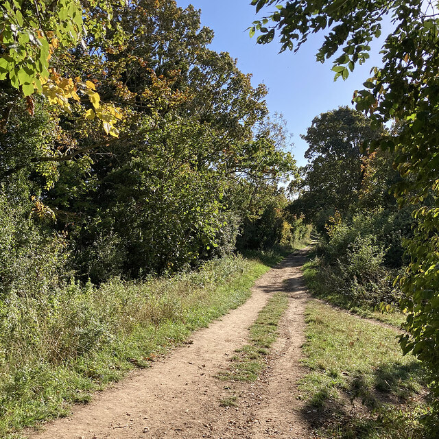
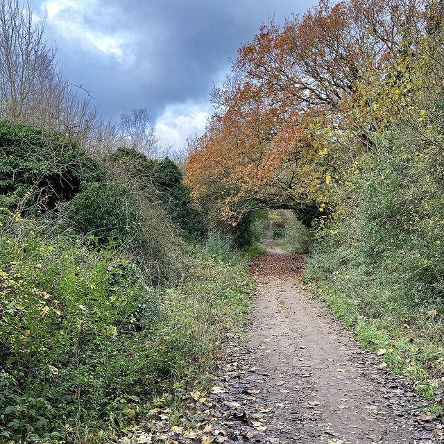
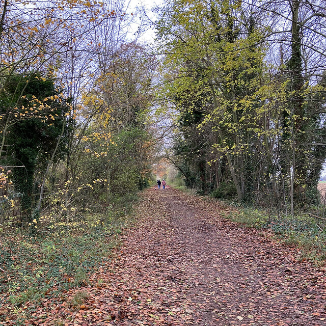
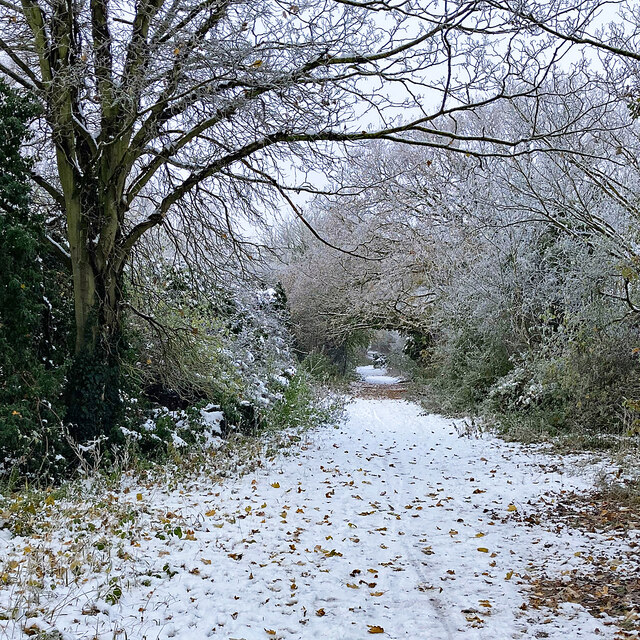
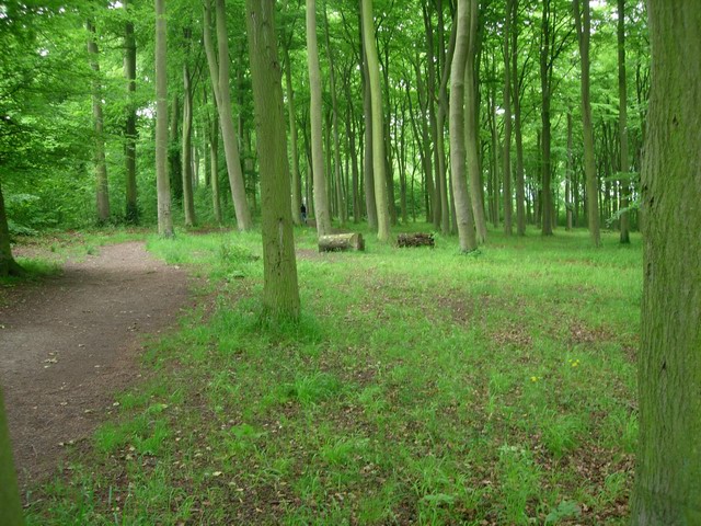
This woodland area is a popular destination for nature lovers, hikers, and families looking for outdoor activities. The wood is predominantly made up of mixed deciduous trees, including oak, beech, and birch, creating a picturesque and diverse landscape. It also boasts an array of wildlife, such as deer, rabbits, and a variety of bird species, making it a haven for nature enthusiasts.

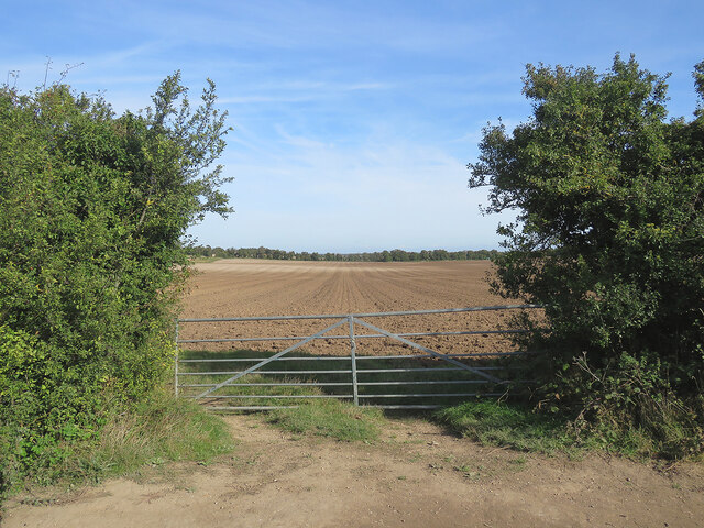
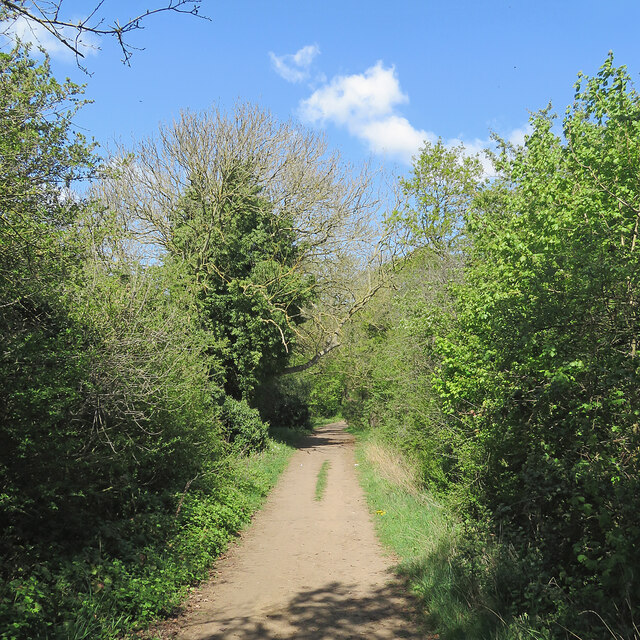
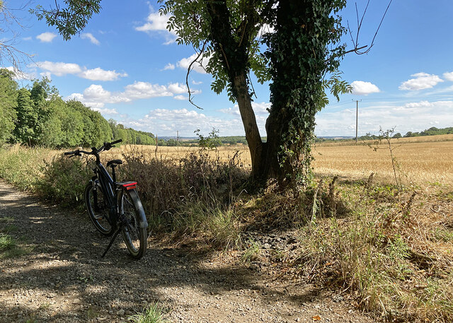
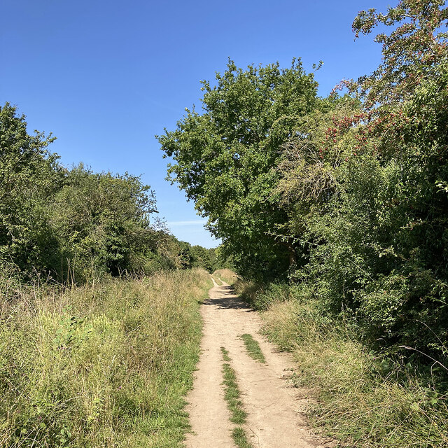
Magog Wood offers several well-maintained walking trails, providing visitors with the opportunity to explore the beauty of the forest at their own pace. The paths are clearly marked, making it easy to navigate through the woodland. Along the way, visitors can enjoy the tranquility of the surroundings, with the peaceful sound of birdsong and the rustling of leaves underfoot.

Additionally, there are picnic areas and benches scattered throughout the wood, allowing visitors to take a break and enjoy a meal amidst the natural splendor. The wood is open to the public year-round, and there is no admission fee, making it a fantastic destination for a day trip or a leisurely weekend stroll.

Overall, Magog Wood is a captivating forest that offers a peaceful retreat from the hustle and bustle of everyday life. Its natural beauty, abundant wildlife, and well-maintained trails make it an ideal destination for outdoor enthusiasts and those seeking a connection with nature.

If you have any feedback on the listing, please let us know in the comments section below.

Magog Wood Images

Images are sourced within 2km of 52.155973/0.17693097 or Grid Reference TL4953. Thanks to Geograph Open Source API. All images are credited.

Fields on the edge of Wandlebury Country Park Beautiful open countryside just a couple of miles to the south east of Cambridge.
Fields on the edge of Wandlebury Country Park
Beautiful open countryside just a couple of miles to the south east of Cambridge.
Autumn cultivation on The Gogs Looking north-east through a gateway on The Roman Road. <a href="https://www.geograph.org.uk/photo/4209983">TL5053 : Field gate on The Roman Road</a> and <a href="https://www.geograph.org.uk/photo/6904416">TL5053 : Harvest time on The Gogs</a> are two of several pictures of the view uphill in the opposite direction.
Autumn cultivation on The Gogs
Looking north-east through a gateway on The Roman Road. TL5053 : Field gate on The Roman Road and TL5053 : Harvest time on The Gogs are two of several pictures of the view uphill in the opposite direction.
A spring morning on The Roman Road Bright and warm, with a lot of vivid greens.
A spring morning on The Roman Road
Bright and warm, with a lot of vivid greens.
Wheatfields on The Gogs Taken from just inside a gateway on The Roman Road on a fine morning in late April. Hill Farm is on the skyline in the centre, getting on for a mile away.
Wheatfields on The Gogs
Taken from just inside a gateway on The Roman Road on a fine morning in late April. Hill Farm is on the skyline in the centre, getting on for a mile away.
Stubble on the Gogs Looking uphill towards Fox's Burrow Plantation from the track which runs from The Roman Road to the A1307.
Stubble on the Gogs
Looking uphill towards Fox's Burrow Plantation from the track which runs from The Roman Road to the A1307.
Stubble and big sky Harvest time in South Cambridgeshire, seen from a gap in the trees lining The Roman Road. The plantations at Lodge Farm are on the skyline.
Stubble and big sky
Harvest time in South Cambridgeshire, seen from a gap in the trees lining The Roman Road. The plantations at Lodge Farm are on the skyline.
Stubble on The Gogs An August view from the bridle track from the A1307 to The Roman Road (ahead), skirting Wandlebury Country Park.
Stubble on The Gogs
An August view from the bridle track from the A1307 to The Roman Road (ahead), skirting Wandlebury Country Park.
Café sign on the edge of Wandlebury Country Park
On The Roman Road in early autumn Looking south east on a cloudless Sunday morning in early October. Some leaves have turned in the last week.
On The Roman Road in early autumn
Looking south east on a cloudless Sunday morning in early October. Some leaves have turned in the last week.
The Roman Road: dark sky and bright leaves On the Gog Magog Hills, looking towards the Cambridge end of The Roman Road on the first Saturday morning of December.
The Roman Road: dark sky and bright leaves
On the Gog Magog Hills, looking towards the Cambridge end of The Roman Road on the first Saturday morning of December.
Roman Road walk Looking in the Cambridge direction on the cloudy first Saturday morning of December.
Roman Road walk
Looking in the Cambridge direction on the cloudy first Saturday morning of December.
A cold morning on The Roman Road Looking uphill towards the Cambridge end of The Roman Road, with the temperature below zero, as it had been all week. <a href="https://www.geograph.org.uk/photo/7355096">TL5053 : The Roman Road: dark sky and bright leaves</a> was taken hereabouts eleven days before.
A cold morning on The Roman Road
Looking uphill towards the Cambridge end of The Roman Road, with the temperature below zero, as it had been all week. TL5053 : The Roman Road: dark sky and bright leaves was taken hereabouts eleven days before.
Snow, frost, fog and The Roman Road The line of frosted trees and bushes - lost in the mist to the right as it rises towards Copley Hill - marks the course of The Roman Road. This was a fiercely cold morning during the cold spell in mid December 2022.
Snow, frost, fog and The Roman Road
The line of frosted trees and bushes - lost in the mist to the right as it rises towards Copley Hill - marks the course of The Roman Road. This was a fiercely cold morning during the cold spell in mid December 2022.
The sun breaking through on Mile Road I had come through thick mist along the A1307 from the southern edge of Cambridge, but on Mile Road the sun was breaking through and by the time I reached Copley Hill and The Roman Road the sky was clear to the north and north-west. Behind the camera the mist lingered - see <a href="https://www.geograph.org.uk/photo/7399948">TL5052 : Mist on Mile Road</a>, taken not long before.

Mile Road is a prehistoric track which was reused by the Romans.
The sun breaking through on Mile Road
I had come through thick mist along the A1307 from the southern edge of Cambridge, but on Mile Road the sun was breaking through and by the time I reached Copley Hill and The Roman Road the sky was clear to the north and north-west. Behind the camera the mist lingered - see TL5052 : Mist on Mile Road, taken not long before. Mile Road is a prehistoric track which was reused by the Romans.
Mist on Mile Road Mist persisted on the southern slopes of the Gog Magog Hills, but behind the camera it was clearing (see <a href="https://www.geograph.org.uk/photo/7399945">TL5052 : The sun breaking through on Mile Road</a>) and by the time I reached Copley Hill and The Roman Road the sky was blue to the north and north-west.

Mile Road is a prehistoric track which was reused by the Romans.
Mist on Mile Road
Mist persisted on the southern slopes of the Gog Magog Hills, but behind the camera it was clearing (see TL5052 : The sun breaking through on Mile Road) and by the time I reached Copley Hill and The Roman Road the sky was blue to the north and north-west. Mile Road is a prehistoric track which was reused by the Romans.
Almost summer on The Roman Road Looking towards Cambridge on a fine morning towards the end of May - late spring or early summer.
Almost summer on The Roman Road
Looking towards Cambridge on a fine morning towards the end of May - late spring or early summer.
On The Roman Road in early June The Cambridge end of The Roman Road, which runs beside the Gog Magog Golf Course (over the hedge on the right), is more wooded and in places narrower than many stretches to the south east. After a long cool spring, summer had finally arrived, with dog roses in the hedgerows.
On The Roman Road in early June
The Cambridge end of The Roman Road, which runs beside the Gog Magog Golf Course (over the hedge on the right), is more wooded and in places narrower than many stretches to the south east. After a long cool spring, summer had finally arrived, with dog roses in the hedgerows.
Late summer on The Roman Road Looking towards Cambridge on a fine August morning. Greens have lost their midsummer lushness.
Late summer on The Roman Road
Looking towards Cambridge on a fine August morning. Greens have lost their midsummer lushness.
Show me another place!

Magog Wood is located at Grid Ref: TL4953 (Lat: 52.155973, Lng: 0.17693097)

Administrative County: Cambridgeshire

District: South Cambridgeshire

Police Authority: Cambridgeshire

What 3 Words

///maternal.reference.misty. Near Sawston, Cambridgeshire

Related Wikis

Little Trees Hill

Little Trees Hill is one of the highest points of the Gog Magog Hills, a ridge of low chalk hills extending for several miles to the south-east of Cambridge...

Wandlebury Hill

Wandlebury Hill (grid reference TL493534) is a peak in the Gog Magog Hills, a ridge of low chalk hills extending for several miles to the southeast of...

Wandlebury Hill Fort

Wandlebury Hill Fort, also known as the Wandlebury Ring, is an Iron Age hillfort located on Wandlebury Hill in the Gog Magog Hills, Cambridgeshire, England...

Gog Magog Golf Course

Gog Magog Golf Course is an 88.4-hectare (218-acre) biological Site of Special Scientific Interest on Gog Magog Golf Club south-east of Cambridge in Cambridgeshire...

Gog Magog Golf Club

Gog Magog Golf Club is a golf club, located in Shelford Bottom, Cambridgeshire, England. It is located about 4 miles south of Cambridge. == History... ==

Middlefield, Stapleford

Middlefield is a mansion in Stapleford, Cambridgeshire, England, designed in 1908–9 by Edwin Lutyens. It is a grade II* listed building.Middlefield was...

Gog Magog Hills

The Gog Magog Hills are a range of low chalk hills, extending for several miles to the southeast of Cambridge in England. The highest points are situated...

Beechwoods

Beechwoods is a 9.8 hectare Local Nature Reserve south-east of Cambridge, England. It is owned by County Farms and managed by the Wildlife Trust for Bedfordshire...

Nearby Amenities

Located within 500m of 52.155973,0.17693097
Parking
Wandlebury
Access: yes
Fee: yes
Opening Hours: sunrise-sunset
Parking: surface
Lat/Long: 52.1573846/0.1806489
Wandlebury Ring (Iron Age Hill Fort)
Historic: archaeological_site
Lat/Long: 52.1587892/0.1816366
Magog Down
Tourism: attraction
Lat/Long: 52.1570225/0.1736894
Post Box
Collection Times: Mo-Fr 09:00; Sa 07:00
Operator: Royal Mail
Post Box Type: lamp
Ref: CB22 324
Royal Cypher: EIIR
Royal Cypher Wikidata: Q33102113
Source: survey
Lat/Long: 52.1575376/0.1773957
Parking
Magog Down
Access: yes
Fee: yes
Parking: surface
Payment Cash: yes
Payment Contactless: yes
Lat/Long: 52.1574048/0.1723642
Created By: YahooApplet 1.0
Lat/Long: 52.1581559/0.1744717
Created By: YahooApplet 1.0
Lat/Long: 52.1564475/0.1789633
Barrier: stile
Lat/Long: 52.1583559/0.1750135
Bicycle Parking
Bicycle Parking: stands
Capacity: 6
Covered: no
Lat/Long: 52.1573028/0.1731241
Little Trees Hill
Ele: 74
Natural: peak
Source: npe
Wikidata: Q6652354
Wikipedia: en:Little Trees Hill
Lat/Long: 52.1548568/0.1747944
Bus Stop
Fort
Bus: yes
Naptan AtcoCode: 0500SSTAP007
Naptan Bearing: NW
Naptan CommonName: Fort
Naptan Indicator: opp
Naptan Landmark: Wandlebury Woods
Naptan NaptanCode: cmbgatgj
Naptan ShortCommonName: Fort
Naptan Street: Babraham Road
Naptan Verified: no
Public Transport: platform
Source: naptan_import
Lat/Long: 52.1576097/0.1772462
Bus Stop
Fort
Bench: yes
Bin: no
Bus: yes
Naptan AtcoCode: 0500SSTAP013
Naptan Bearing: SE
Naptan CommonName: Fort
Naptan Indicator: near
Naptan Landmark: Wandlebury Woods
Naptan NaptanCode: cmbgatjd
Naptan ShortCommonName: Fort
Naptan Street: Babraham Road
Naptan Verified: no
Public Transport: platform
Shelter: no
Source: naptan_import
Tactile Paving: no
Lat/Long: 52.157882/0.1775958
Toilets
Lat/Long: 52.158219/0.1823128
Horse Grave Godolphin Arabian (c. 1724 – 1753)
Tourism: information
Lat/Long: 52.1582499/0.1822493
Wandlebury Hill
Ele: 74
Natural: hill
Wikidata: Q7967272
Wikipedia: en:Wandlebury Hill
Lat/Long: 52.1578117/0.183484
Parking
Lat/Long: 52.1560773/0.1824765
Barrier: kissing_gate
Lat/Long: 52.1568236/0.17918
Parking
Source: survey
Lat/Long: 52.1577151/0.177065
Bicycle Parking
Bicycle Parking: stands
Capacity: 30
Covered: no
Lat/Long: 52.1576104/0.1812434
Bench
Lat/Long: 52.1585013/0.1820877
Bench
Lat/Long: 52.1584116/0.1827993
Barrier: entrance
Lat/Long: 52.158875/0.1812473
Board Type: nature
Check Date: 2021-02-27
Information: board
Marker: plate
Operator: CPPF
Orienteering: marker
Ref: 52
Sport: orienteering
Tourism: information
Lat/Long: 52.157603/0.1813519
Board Type: nature
Information: board
Operator: Magog Trust
Tourism: information
Lat/Long: 52.1573821/0.1731589
Covered: no
Leisure: picnic_table
Lat/Long: 52.1577939/0.1734447
Barrier: kissing_gate
Lat/Long: 52.1555105/0.1701246
Bicycle Parking
Bicycle Parking: stands
Capacity: 8
Covered: no
Lat/Long: 52.1574313/0.1731637
Bench
Backrest: yes
Material: wood
Seats: 4
Lat/Long: 52.1568056/0.1729404
Bench
Backrest: yes
Material: wood
Seats: 4
Lat/Long: 52.1555368/0.1726791
Bench
Backrest: yes
Material: wood
Seats: 4
Lat/Long: 52.1547654/0.1740372
Bench
Backrest: yes
Material: wood
Seats: 4
Lat/Long: 52.1545913/0.1739134
Bench
Backrest: yes
Material: wood
Seats: 4
Lat/Long: 52.1544948/0.1738264
Bench
Backrest: yes
Material: wood
Seats: 4
Lat/Long: 52.1543689/0.1736831
Bench
Backrest: yes
Material: wood
Seats: 4
Lat/Long: 52.1548778/0.1742922
Bench
Backrest: yes
Material: wood
Seats: 4
Lat/Long: 52.1549174/0.1746309
Bench
Backrest: yes
Material: wood
Seats: 4
Lat/Long: 52.1549327/0.1751383
Bench
Backrest: yes
Material: wood
Seats: 4
Lat/Long: 52.1559721/0.1767074
Bench
Backrest: yes
Material: wood
Seats: 4
Lat/Long: 52.1561484/0.1766686
Bench
Backrest: yes
Material: wood
Lat/Long: 52.1580786/0.1753444
Bench
Backrest: yes
Material: wood
Lat/Long: 52.1577964/0.175998
Bench
Backrest: yes
Material: wood
Lat/Long: 52.1574363/0.1764922
Covered: no
Leisure: picnic_table
Lat/Long: 52.1582946/0.1743999
Colour: red and white
Fixme: This looks like an unusually short version of a standard aerial gas marker, though without any of the usual labelling, and made of wood. Has black pipes near by. Not sure what sort of utility this marks.
Marker: yes
Lat/Long: 52.1575425/0.171886
Bench
Lat/Long: 52.1574294/0.1734611
Covered: no
Leisure: picnic_table
Lat/Long: 52.1566904/0.1715823
Covered: no
Leisure: picnic_table
Lat/Long: 52.1561393/0.1720905
Bench
Lat/Long: 52.156236/0.1716254
Waste Basket
Waste: dog_excrement
Lat/Long: 52.1568522/0.172855
Bench
Lat/Long: 52.154424/0.1758186
Colin's Bank
Board Type: nature
Information: board
Tourism: information
Lat/Long: 52.1542511/0.1752406
Bench
Lat/Long: 52.1542266/0.1751549
Bench
Lat/Long: 52.1540282/0.1745548
Bench
Lat/Long: 52.1536802/0.1743702
Waste Basket
Waste: dog_excrement
Lat/Long: 52.1585458/0.1753387
Bench
Lat/Long: 52.1569497/0.1730695
Waste Basket
Waste: dog_excrement
Lat/Long: 52.1570956/0.1730797
Bench
Lat/Long: 52.1533349/0.1756029
Waste Basket
Waste: dog_excrement
Lat/Long: 52.1544144/0.1723666
Bench
Lat/Long: 52.1528299/0.1765373
Bench
Lat/Long: 52.1526706/0.1769078
Bench
Lat/Long: 52.1525498/0.1775546
Bench
Lat/Long: 52.1524069/0.1783357
Bench
Lat/Long: 52.1518363/0.1792779
Bench
Lat/Long: 52.155681/0.1812181
Waste Basket
Waste: dog_excrement
Lat/Long: 52.1571101/0.1782449
Waste Basket
Waste: dog_excrement
Lat/Long: 52.158056/0.1738361
Leisure: picnic_table
Lat/Long: 52.1583252/0.174059
Bench
Lat/Long: 52.1595763/0.1800799
Vending Machine
Payment Credit Cards: yes
Payment Debit Cards: yes
Vending: parking_tickets
Lat/Long: 52.1576669/0.1811836
Clock
Display: sundial
Lat/Long: 52.1583111/0.1828614
Waste Basket
Waste: dog_excrement
Lat/Long: 52.1576093/0.1814465
Wandlebury Orchard
Information: board
Operator: CPPF
Tourism: information
Lat/Long: 52.1589175/0.1811796
Leisure: picnic_table
Material: wood
Lat/Long: 52.158682/0.1823191
Leisure: picnic_table
Material: wood
Lat/Long: 52.1586573/0.1824023
Power: pole
Lat/Long: 52.1601115/0.1797254
Man Made: utility_pole
Lat/Long: 52.158097/0.1779149
Man Made: utility_pole
Lat/Long: 52.1580374/0.1777446
Material: wood
Power: portal
Lat/Long: 52.158255/0.1786365
Material: wood
Power: portal
Lat/Long: 52.1592711/0.1797925
Leisure: picnic_table
Material: wood
Lat/Long: 52.1585426/0.1827827
Bench
Backrest: yes
Material: wood
Seats: 3
Lat/Long: 52.1584062/0.1830228
Information: guidepost
Tourism: information
Lat/Long: 52.1573613/0.1837783
Leisure: picnic_table
Material: wood
Lat/Long: 52.1586451/0.182771
Covered: no
Leisure: picnic_table
Lat/Long: 52.1580699/0.1730286
Covered: no
Leisure: picnic_table
Lat/Long: 52.158023/0.1735812
Covered: no
Leisure: picnic_table
Lat/Long: 52.157907/0.1734176
The data included in this document is from www.openstreetmap.org. The data is made available under ODbL.

Have you been to Magog Wood?

Leave your review of Magog Wood below (or comments, questions and feedback).