New Grant Plantation

Wood, Forest in Sussex Wealden

England

New Grant Plantation

Framfield Stream Small tributary of the Uck that rises near Blackboys. Taken from the footbridge that carries the footpath to Palehouse Common Farm.
Framfield Stream Credit: Simon Carey

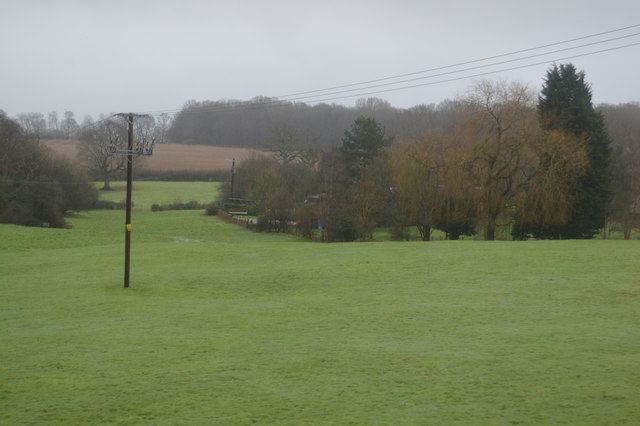
New Grant Plantation is a vast and picturesque woodland located in Sussex, England. Nestled between the rolling hills and lush green fields, this plantation covers a substantial area, offering a serene and captivating retreat for nature enthusiasts and outdoor adventurers alike.

The plantation is predominantly composed of dense and ancient woodlands, boasting a wide variety of tree species, including oak, beech, and maple. These towering trees create a dense canopy, providing shade and shelter for an abundance of wildlife that call this place home.

Visitors to New Grant Plantation are greeted by a network of well-maintained trails that wind their way through the forest, allowing for leisurely strolls and more challenging hikes. The trails are marked with informative signposts, providing interesting facts about the surrounding flora and fauna. Along these paths, visitors may encounter a diverse range of wildlife, such as deer, foxes, badgers, and an array of bird species.

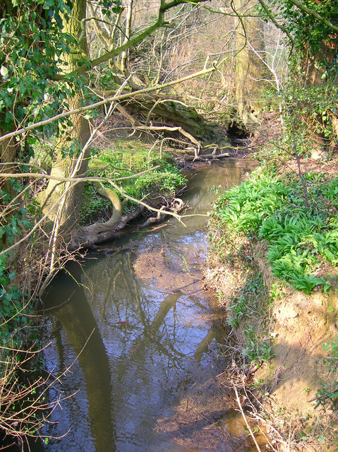
New Grant Plantation also boasts a small lake, which adds to the overall beauty of the area. This tranquil body of water is home to various aquatic plants and creatures, and it provides a serene spot for visitors to relax and observe the surrounding natural beauty.

In addition to its mesmerizing natural features, New Grant Plantation offers several picnic areas and designated camping spots, allowing visitors to fully immerse themselves in the tranquil ambience of the forest. It is a popular destination for families, nature enthusiasts, and outdoor enthusiasts seeking solace and adventure amidst the stunning Sussex countryside.

If you have any feedback on the listing, please let us know in the comments section below.

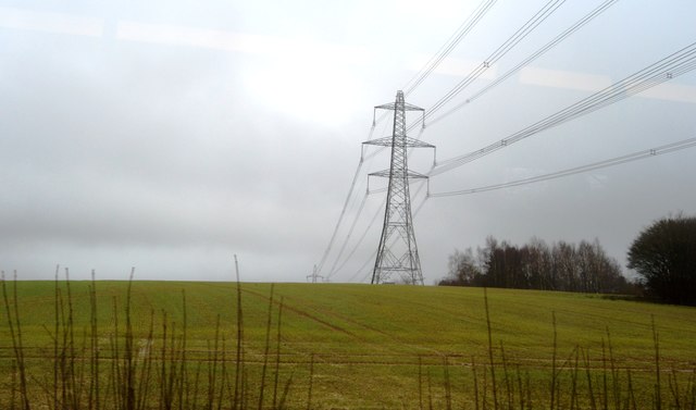
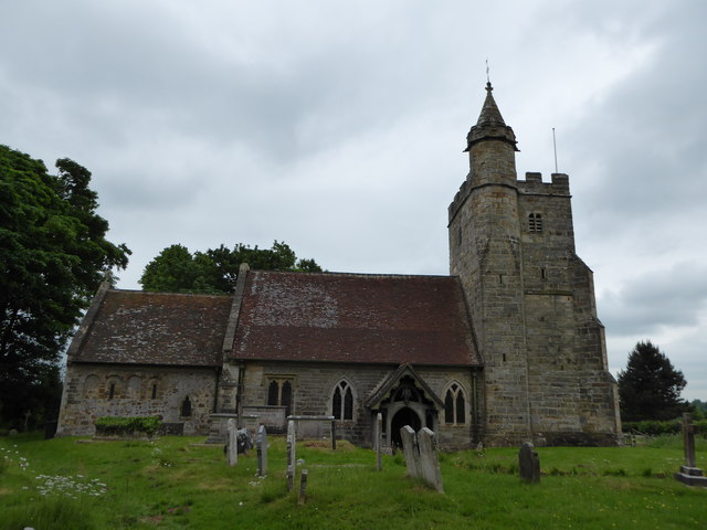
New Grant Plantation Images

Images are sourced within 2km of 50.95217/0.11042866 or Grid Reference TQ4819. Thanks to Geograph Open Source API. All images are credited.

Framfield Stream Small tributary of the Uck that rises near Blackboys. Taken from the footbridge that carries the footpath to Palehouse Common Farm.
Framfield Stream
Small tributary of the Uck that rises near Blackboys. Taken from the footbridge that carries the footpath to Palehouse Common Farm.
Highview Lane
Highview Lane
New Rd
New Rd
Trees, Horsted Pond Farm
A22, looking south The A22 is one of the  major roads in the south east of England. It carries traffic from London to Eastbourne on the East Sussex coast. The route goes through Purley, East Grinstead, Forest Row, Hailsham and Polegate. A distance of 48 miles.
<span class="nowrap"><a title="http://www.sabre-roads.org.uk/wiki/index.php?title=B2104" rel="nofollow ugc noopener" href="http://www.sabre-roads.org.uk/wiki/index.php?title=B2104">Link</a><img style="margin-left:2px;" alt="External link" title="External link - shift click to open in new window" src="https://s1.geograph.org.uk/img/external.png" width="10" height="10"/></span>
A22, looking south
The A22 is one of the major roads in the south east of England. It carries traffic from London to Eastbourne on the East Sussex coast. The route goes through Purley, East Grinstead, Forest Row, Hailsham and Polegate. A distance of 48 miles. LinkExternal link
Pylon, Little Horsted
Church of St michael & All Angels Most of the church dates from a rebuild in 1863, however some wall arches of the north wall of the chancel are 12th Century, containing 2 small round-headed windows. 
The tall tower is 15th C. and the turret was raised and given a conical top in 1863, when Sir George Gilbert Scott oversaw the rebuilding with 14th C details.
There is an interesting tomb slab of about 1500 in a recess in the chancel, said to be a member of the Delves family, Yeomen in the parish. However it has also been claimed to belong to William Dean, Knight. Currently it is blocked by pews and furniture.
Church of St michael & All Angels
Most of the church dates from a rebuild in 1863, however some wall arches of the north wall of the chancel are 12th Century, containing 2 small round-headed windows. The tall tower is 15th C. and the turret was raised and given a conical top in 1863, when Sir George Gilbert Scott oversaw the rebuilding with 14th C details. There is an interesting tomb slab of about 1500 in a recess in the chancel, said to be a member of the Delves family, Yeomen in the parish. However it has also been claimed to belong to William Dean, Knight. Currently it is blocked by pews and furniture.
Roundabout on the A22, Little Horsted
Parking area by the A22, Little Horsted
Field by the A22, Little Horsted
Parking area by the A22, Little Horsted
Field by the A22, Uckfield
The A22, Uckfield
The A22, Uckfield
East Sussex National The Club House at East Sussex National.
East Sussex National
The Club House at East Sussex National.
East Sussex National The golf course at the East Sussex National.
East Sussex National
The golf course at the East Sussex National.
St Michael & All Angels, Little Horsted (front)
St Michael & All Angels, Little Horsted: seat
St Michael & All Angels, Little Horsted (rear)
Show me another place!

New Grant Plantation is located at Grid Ref: TQ4819 (Lat: 50.95217, Lng: 0.11042866)

Administrative County: East Sussex

District: Wealden

Police Authority: Sussex

What 3 Words

///resonated.directly.narrating. Near Uckfield, East Sussex

Related Wikis

East Sussex National Golf Club

East Sussex National Golf Club is a golf course located near to Uckfield in East Sussex. It is considered one of the finer golf courses in the British...

Little Horsted

Little Horsted (also known as Horsted Parva) is a village and civil parish in the Wealden district of East Sussex, England. It is located two miles (3...

Horsted Place

Horsted Place is a Tudor Revival country house, now a hotel, in Little Horsted, East Sussex, England. The current building dates to 1850, when it was built...

Framfield

Framfield is a village and civil parish in the Wealden District of East Sussex, England. The village is located two miles (3 km) east of Uckfield; the...

Uckfield Town F.C.

Uckfield Town F.C. was a football club based in Uckfield, East Sussex, England. For their final season, 2013–14, they were members of the Sussex County...

Hempstead Meadow

Hempstead Meadow is a 1.6-hectare (4.0-acre) Local Nature Reserve in Uckfield in East Sussex. It is owned and managed by Uckfield Town Council.The site...

Uckfield

Uckfield () is a town in the Wealden District of East Sussex in South East England. The town is on the River Uck, one of the tributaries of the River Ouse...

Uckfield railway station

Uckfield railway station is the southern terminus of a branch of the Oxted Line in England, serving the town of Uckfield, East Sussex. It is 46 miles 8...

Nearby Amenities

Located within 500m of 50.95217,0.11042866
Material: wood
Power: pole
Lat/Long: 50.9483533/0.1102424
Material: wood
Power: pole
Lat/Long: 50.9494002/0.1102481
Material: wood
Power: pole
Lat/Long: 50.9516379/0.112227
Material: wood
Power: pole
Lat/Long: 50.952373/0.112865
Material: wood
Power: pole
Lat/Long: 50.9533823/0.1136949
Material: wood
Power: pole
Lat/Long: 50.9544361/0.1145846
Material: wood
Power: pole
Lat/Long: 50.9550495/0.1151577
Post Box
Brand: Royal Mail
Brand Wikidata: Q638098
Brand Wikipedia: en:Royal Mail
Operator: Royal Mail
Operator Wikidata: Q638098
Post Box Type: lamp
Ref: TN22 94
Royal Cypher: EIIR
Royal Cypher Wikidata: Q33102113
Lat/Long: 50.9529886/0.1166651
Cysleys Farm
Place: farm
Lat/Long: 50.9556835/0.11372
Shipreed
Is In: New Road;Ridgewood;Uckfield;East Sussex;England
Place: farm
Lat/Long: 50.9540258/0.1087729
Bus Stop
Rajdutt Restaurant
Bus: yes
Public Transport: platform
Shelter: yes
Lat/Long: 50.9529346/0.11669
Bus Stop
Rajdutt Restaurant
Bus: yes
Naptan AtcoCode: 1400WE0400
Naptan NaptanCode: esudadga
Public Transport: platform
Lat/Long: 50.9529177/0.1169509
Stable Cottage
Building: yes
Lat/Long: 50.95595/0.1112872
Framfield Lodge
Building: yes
Lat/Long: 50.9560784/0.111137
High Tree Medical Clinic
Building: yes
Lat/Long: 50.9562102/0.1110914
Mount Ephraim
Place: hamlet
Source: OS_OpenData_Streetview
Lat/Long: 50.9522428/0.1156676
Barrier: stile
Lat/Long: 50.9535749/0.1110814
Barrier: kissing_gate
Foot: yes
Lat/Long: 50.9529762/0.1165071
Barrier: kissing_gate
Lat/Long: 50.9566551/0.1104956
Ford: yes
Lat/Long: 50.9531929/0.104553
Bus Stop
Cysleys Farm
Bus: yes
Naptan AtcoCode: 1400LE10032
Naptan NaptanCode: esudgpgm
Public Transport: platform
Lat/Long: 50.9551351/0.1132947
Bus Stop
Cysleys Farm
Bus: yes
Naptan AtcoCode: 1400LE10031
Naptan NaptanCode: esudgpgj
Public Transport: platform
Lat/Long: 50.9552133/0.113406
The data included in this document is from www.openstreetmap.org. The data is made available under ODbL.

Have you been to New Grant Plantation?

Leave your review of New Grant Plantation below (or comments, questions and feedback).