Fanellan

Settlement in Inverness-shire

Scotland

Fanellan

Canoes on the River Beauly at Aigas Dam
Canoes on the River Beauly at Aigas Dam Credit: Mike Pennington

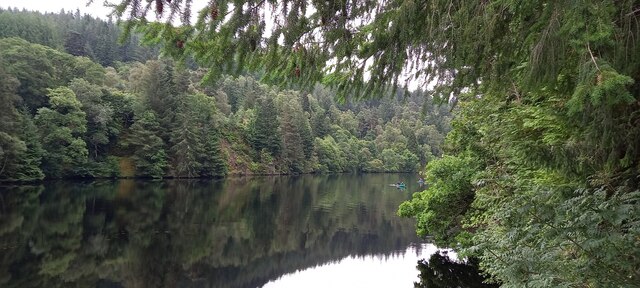
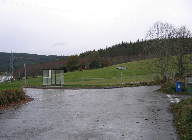
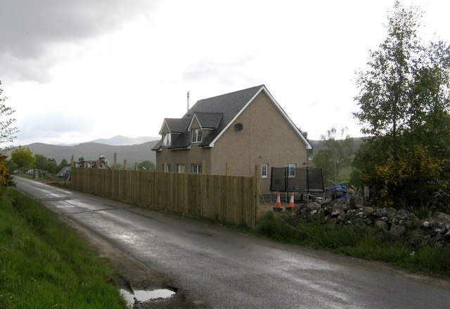
Fanellan is a small hamlet located in the county of Inverness-shire, in the Highlands of Scotland. Situated near the shores of Loch Ness, Fanellan is known for its picturesque surroundings and tranquil atmosphere.

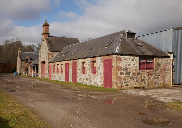
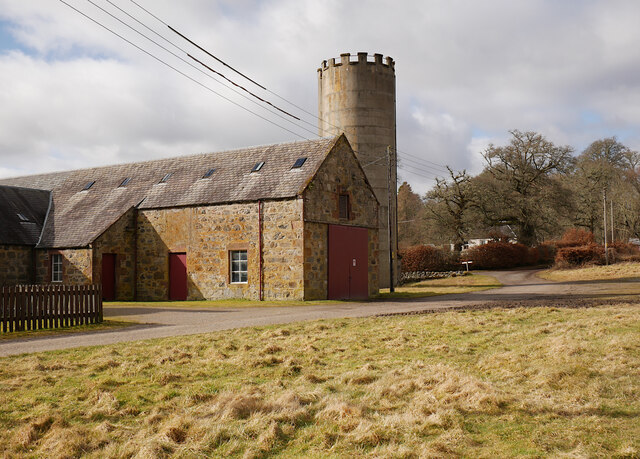
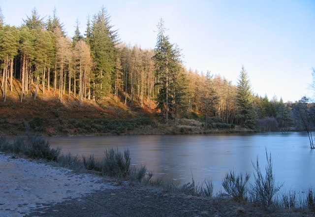
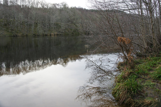
The hamlet is made up of a handful of traditional stone cottages and farmhouses, surrounded by rolling hills and lush greenery. The area is popular with hikers and outdoor enthusiasts, who come to explore the nearby forests and mountains.

Fanellan is a quiet and peaceful place, offering a retreat from the hustle and bustle of city life. The community is close-knit and friendly, with a strong sense of local pride and heritage.

Visitors to Fanellan can enjoy scenic walks along the shores of Loch Ness, where they may catch a glimpse of the elusive Loch Ness Monster. The nearby town of Inverness offers a range of amenities and attractions, including historic sites, shops, and restaurants.

Overall, Fanellan is a charming and idyllic destination for those seeking a taste of rural Scotland's beauty and tranquility.

If you have any feedback on the listing, please let us know in the comments section below.

Fanellan Images

Images are sourced within 2km of 57.450409/-4.521375 or Grid Reference NH4842. Thanks to Geograph Open Source API. All images are credited.

Canoes on the River Beauly at Aigas Dam
Home Farm, Beaufort Estate The farm steading includes several houses, sheds, and a tall silo.
It is a Category B listed building. <span class="nowrap"><a title="https://portal.historicenvironment.scot/designation/LB8073" rel="nofollow ugc noopener" href="https://portal.historicenvironment.scot/designation/LB8073">Link</a><img style="margin-left:2px;" alt="External link" title="External link - shift click to open in new window" src="https://s1.geograph.org.uk/img/external.png" width="10" height="10"/></span>
Home Farm, Beaufort Estate
The farm steading includes several houses, sheds, and a tall silo. It is a Category B listed building. LinkExternal link
Home Farm, Beaufort Estate Several sheds and a tall silo.
It is a Category B listed building. <span class="nowrap"><a title="https://portal.historicenvironment.scot/designation/LB8073" rel="nofollow ugc noopener" href="https://portal.historicenvironment.scot/designation/LB8073">Link</a><img style="margin-left:2px;" alt="External link" title="External link - shift click to open in new window" src="https://s1.geograph.org.uk/img/external.png" width="10" height="10"/></span>
Home Farm, Beaufort Estate
Several sheds and a tall silo. It is a Category B listed building. LinkExternal link
Helicopter surveying power lines, Kilmorack The helicopter was hovering over the power lines and pylons. It is an Aérospatiale AS350 Écureuil operated by PDG, registration G-ORKY.
Helicopter surveying power lines, Kilmorack
The helicopter was hovering over the power lines and pylons. It is an Aérospatiale AS350 Écureuil operated by PDG, registration G-ORKY.
Balblair Quarry The area of the quarry has been recently extended and now the rocks are being noisily harvested.
Balblair Quarry
The area of the quarry has been recently extended and now the rocks are being noisily harvested.
Track into Balblair Wood beside the River Beauly The track was rather muddy at this time.
Track into Balblair Wood beside the River Beauly
The track was rather muddy at this time.
Beech Tree in Balblair Wood A very fine tree passed by on the track into the wood. This time the tree is seen from the opposite direction.
Beech Tree in Balblair Wood
A very fine tree passed by on the track into the wood. This time the tree is seen from the opposite direction.
Bracken and beech tree in Balblair Wood The end of a short walk in the wood passing close to the expanded quarry.
Bracken and beech tree in Balblair Wood
The end of a short walk in the wood passing close to the expanded quarry.
Riverside path by the River Beauly in Balblair Wood A popular path especially for those dog-walking.
Riverside path by the River Beauly in Balblair Wood
A popular path especially for those dog-walking.
Riverside path in Balblair Wood returning to Black Bridge This section of the path catches the sun.
Riverside path in Balblair Wood returning to Black Bridge
This section of the path catches the sun.
Reindeer, Culburnie A group of wooden reindeer and a sleigh, next to the Kinerras road.
Reindeer, Culburnie
A group of wooden reindeer and a sleigh, next to the Kinerras road.
Hughton crossroads This junction was widened a few months ago, to allow for construction traffic for the Beauly-Denny power line. The junction priorities were changed, and the bus stop was moved over a bit.
See a previous view at this junction: <a href="https://www.geograph.org.uk/photo/446357">NH4741 : Bus stop, Hughton</a>
Hughton crossroads
This junction was widened a few months ago, to allow for construction traffic for the Beauly-Denny power line. The junction priorities were changed, and the bus stop was moved over a bit. See a previous view at this junction: NH4741 : Bus stop, Hughton
Kiltarlity Kirk
Kiltarlity Kirk
Frozen lochan in Ruttle Wood A track runs down the hill from Fanellan, past this lochan/pond, then towards the Eilean Aigas driveway. A few parts of the track were covered with ice today.
This lochan isn't marked on the OS 1:50,000 or 1:25,000 maps. Maybe it has been created fairly recently.
Frozen lochan in Ruttle Wood
A track runs down the hill from Fanellan, past this lochan/pond, then towards the Eilean Aigas driveway. A few parts of the track were covered with ice today. This lochan isn't marked on the OS 1:50,000 or 1:25,000 maps. Maybe it has been created fairly recently.
River Beauly at Teanassie Looking upstream, just below the dam.
River Beauly at Teanassie
Looking upstream, just below the dam.
River Beauly at Crask of Aigas The gorge just above the dam.
River Beauly at Crask of Aigas
The gorge just above the dam.
Eyot in the River Beauly at Aigas
Aigas Power Station Plenty of water in the river today, it is pouring down the spillway, and spraying up a fair bit.
The power station is on the River Beauly, and is part of the Affric-Beauly hydro-electric scheme, along with Kilmorack Power Station a short distance downstream.
For a similar view with less water, see <a href="https://www.geograph.org.uk/photo/54325">NH4743 : Aigas Power Station</a>
Aigas Power Station
Plenty of water in the river today, it is pouring down the spillway, and spraying up a fair bit. The power station is on the River Beauly, and is part of the Affric-Beauly hydro-electric scheme, along with Kilmorack Power Station a short distance downstream. For a similar view with less water, see NH4743 : Aigas Power Station
Show me another place!

Fanellan is located at Grid Ref: NH4842 (Lat: 57.450409, Lng: -4.521375)

Unitary Authority: Highland

Police Authority: Highlands and Islands

What 3 Words

///outgrown.notched.jogging. Near Beauly, Highland

Nearby Locations

Lonbuie Fanellan

Related Wikis

Culburnie, Highland

Culburnie (Scottish Gaelic: Cùil Braonaigh, Scots: Chainry) is a scattered hamlet near in the Highland council area of Scotland. It is 1.2 miles (2 km...

Kilmorack

Kilmorack (Scottish Gaelic: Cill Mhòraig) is a small hamlet in Inverness-shire, in the Highlands of Scotland and now in the Highland Council area. It...

Kilmorack Gallery

Kilmorack Gallery reuses a converted church building for its exhibitions, in a rural location near Beauly in Inverness-shire, Scotland. It was established...
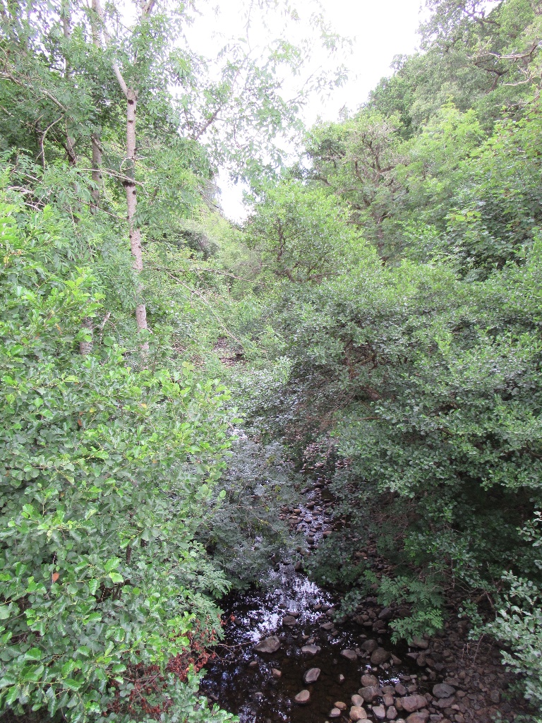
Breakachy Burn

Breakachy Burn (Scottish Gaelic: Allt Bhreacacaidh, meaning "Stream of the Speckled Field") is a mountain stream in the Highland council area of Scotland...

Nearby Amenities

Located within 500m of 57.450409,-4.521375
Fanellan
Place: hamlet
Lat/Long: 57.4502041/-4.5221155
Design: barrel
Power: tower
Source: bing
Lat/Long: 57.4531331/-4.5243811
Power: pole
Lat/Long: 57.4499813/-4.5189685
Power: pole
Lat/Long: 57.4504509/-4.5178769
Power: pole
Lat/Long: 57.4506507/-4.5166681
Power: pole
Lat/Long: 57.4508551/-4.5154572
Power: pole
Lat/Long: 57.4510525/-4.5143611
Power: pole
Lat/Long: 57.451251/-4.5132629
Power: pole
Lat/Long: 57.4463736/-4.5223324
Power: pole
Lat/Long: 57.4471195/-4.522655
Power: pole
Lat/Long: 57.4477832/-4.5229591
Power: pole
Lat/Long: 57.4482931/-4.5221626
Power: pole
Lat/Long: 57.4488139/-4.5212754
Power: pole
Lat/Long: 57.4491936/-4.5205898
Power: pole
Lat/Long: 57.4495399/-4.5199933
The data included in this document is from www.openstreetmap.org. The data is made available under ODbL.

Have you been to Fanellan?

Leave your review of Fanellan below (or comments, questions and feedback).