Park Wood

Wood, Forest in Kent Sevenoaks

England

Park Wood

Meadow near Scott's Lodge
Meadow near Scott's Lodge Credit: Pip Rolls

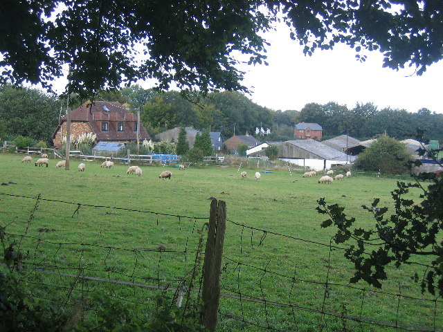
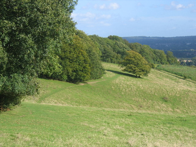
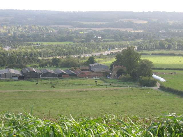
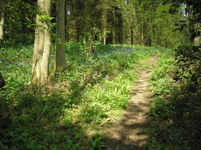
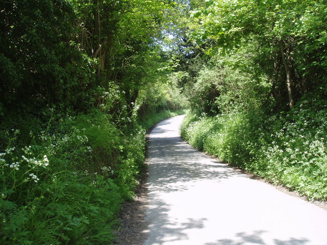
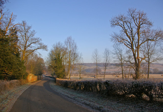
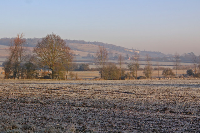
Park Wood is a small woodland area located in the county of Kent, England. Situated near the town of Rochester, it covers an area of approximately 50 acres. The wood is predominantly made up of oak and ash trees, with an undergrowth of ferns, brambles, and wildflowers.

Park Wood is a designated Site of Special Scientific Interest (SSSI) due to its high ecological value. It provides a habitat for a diverse range of wildlife, including various bird species such as woodpeckers and owls, as well as small mammals like squirrels and hedgehogs. The wood's dense vegetation and diverse flora also attract a wide variety of insects and butterflies.

The wood is a popular destination for nature enthusiasts and walkers, who can enjoy peaceful strolls along the well-maintained footpaths that wind through the woodland. There are also several benches and picnic areas scattered throughout the wood, providing visitors with the opportunity to relax and enjoy the natural surroundings.

Park Wood is managed and maintained by the local council, who ensure that the woodland remains a peaceful and safe environment for both visitors and wildlife. Regular conservation work is carried out to protect and enhance the biodiversity of the area.

Overall, Park Wood offers a tranquil escape from the hustle and bustle of nearby urban areas. Its natural beauty, rich biodiversity, and accessibility make it a cherished natural asset in the county of Kent.

If you have any feedback on the listing, please let us know in the comments section below.

Park Wood Images

Images are sourced within 2km of 51.303299/0.11774542 or Grid Reference TQ4758. Thanks to Geograph Open Source API. All images are credited.

Meadow near Scott's Lodge
The North Downs Way - a grassy stretch It's stretches like this that make the North Downs Way a pleasure.
The North Downs Way - a grassy stretch
It's stretches like this that make the North Downs Way a pleasure.
Turvins Farm and the M25
St. Botolphs Church Where my grandparents were married.
St. Botolphs Church
Where my grandparents were married.
M25 Motorway A photograph of the M25 near Sevenoaks taken early afternoon before the rush hour.
M25 Motorway
A photograph of the M25 near Sevenoaks taken early afternoon before the rush hour.
M25 Motorway - West Early afternoon traffic near Sevenoaks on the M25 going west.
M25 Motorway - West
Early afternoon traffic near Sevenoaks on the M25 going west.
The 'Tally Ho', Knockholt, Kent Excellent food and a choice of well-kept beers are on offer at this country 'local'.
The 'Tally Ho', Knockholt, Kent
Excellent food and a choice of well-kept beers are on offer at this country 'local'.
St Katharine's Church, Knockholt, Kent Restoration was in progress on the brick and flint tower of this old parish church.
St Katharine's Church, Knockholt, Kent
Restoration was in progress on the brick and flint tower of this old parish church.
Bluebells on the North Downs Way The North Downs Way is a very popular long-distance path, paralleling for long stretches the ancient Pilgrim's Way to Canterbury.  In mid-May it is seen at its best as it crosses the north-east corner of this gridsquare.
Bluebells on the North Downs Way
The North Downs Way is a very popular long-distance path, paralleling for long stretches the ancient Pilgrim's Way to Canterbury. In mid-May it is seen at its best as it crosses the north-east corner of this gridsquare.
Road junction, Knockholt Pound, Kent Knockholt Pound and its near neighbour Knockholt are not on the M.o.T A and B road network, but are served by a tangle of minor roads and lanes.  In this photograph, taken from the steps of the Harrow public house, the fork to the right leads to Pratt's Bottom and Chelsfield, while the left-hand road goes to Biggin Hill and Westerham
Road junction, Knockholt Pound, Kent
Knockholt Pound and its near neighbour Knockholt are not on the M.o.T A and B road network, but are served by a tangle of minor roads and lanes. In this photograph, taken from the steps of the Harrow public house, the fork to the right leads to Pratt's Bottom and Chelsfield, while the left-hand road goes to Biggin Hill and Westerham
Cooling's Nurseries and Landscape Centre, Knockholt, Kent If you are planning your garden on the grand scale, this is the place to come for supplies and advice.  Everyone is made welcome, and there is even a coffee shop.
Cooling's Nurseries and Landscape Centre, Knockholt, Kent
If you are planning your garden on the grand scale, this is the place to come for supplies and advice. Everyone is made welcome, and there is even a coffee shop.
The North Downs Way This deservedly popular long distance footpath runs close to Knockholt village. Here it is seen looking west where it crosses the minor lane from Knockholt to Sundridge.
The North Downs Way
This deservedly popular long distance footpath runs close to Knockholt village. Here it is seen looking west where it crosses the minor lane from Knockholt to Sundridge.
Sundridge Hill, Kent We are on the scarp slope of the North Downs here, and many of the lanes crossing it are both narrow and steep.  This one rates a "more than 14%" symbol on the OS map.  If you are motoring in this area, please use extra care.
Sundridge Hill, Kent
We are on the scarp slope of the North Downs here, and many of the lanes crossing it are both narrow and steep. This one rates a "more than 14%" symbol on the OS map. If you are motoring in this area, please use extra care.
Entrance to Brasted Hill Farm, Kent On approaching the farm gate, the two watchdogs - one a German Shepherd and the other a Dobermann - set up such a racket of barking that it must have been audible over half the County.  I took my photograph quickly and removed myself as rapidly as I was able.
Entrance to Brasted Hill Farm, Kent
On approaching the farm gate, the two watchdogs - one a German Shepherd and the other a Dobermann - set up such a racket of barking that it must have been audible over half the County. I took my photograph quickly and removed myself as rapidly as I was able.
Chevening This small village is set along the eastern boundary of the grounds of Chevening House, the official country residence of the Foreign Secretary.

For a similar photo in late spring, see <a href="https://www.geograph.org.uk/photo/1888129">TQ4857 : Chevening</a>.
Chevening
This small village is set along the eastern boundary of the grounds of Chevening House, the official country residence of the Foreign Secretary. For a similar photo in late spring, see TQ4857 : Chevening.
Bare tree in winter View from Chevening Lane, with the North Downs in the distance.
Bare tree in winter
View from Chevening Lane, with the North Downs in the distance.
Chevening Lane This is the lane leading into Chevening village.  The wall on the left is that of the grounds of Chevening House, the official country residence of the Foreign Secretary.  In the background are the North Downs.
Chevening Lane
This is the lane leading into Chevening village. The wall on the left is that of the grounds of Chevening House, the official country residence of the Foreign Secretary. In the background are the North Downs.
Winter fields by Chevening Lane Frosted fields - in the middle distance is Turvin's Farm, at the other edge of this square, with a disused quarry on the North Downs in the far distance.
Winter fields by Chevening Lane
Frosted fields - in the middle distance is Turvin's Farm, at the other edge of this square, with a disused quarry on the North Downs in the far distance.
Show me another place!

Park Wood is located at Grid Ref: TQ4758 (Lat: 51.303299, Lng: 0.11774542)

Administrative County: Kent

District: Sevenoaks

Police Authority: Kent

What 3 Words

///coffee.acted.guides. Near Sundridge, Kent

Related Wikis

Chevening

Chevening House () is a large country house in the parish of Chevening in Kent, England. Built between 1617 and 1630 to a design reputedly by Inigo Jones...

Knockholt

Knockholt is a village and civil parish in the Sevenoaks District of Kent, England. It is located 5 mi (8 km) north west of Sevenoaks & 5.7 mi (9.2 km...

St Katharine's Church, Knockholt

St Katharine's Church is an Anglican parish church in the village of Knockholt and the Sevenoaks deanery. St Katharine's and St Margaret's came together...

Chatham Vase

The Chatham Vase is a stone sculpture by John Bacon commissioned as a memorial to William Pitt the Elder by his wife, Hester, Countess of Chatham. It was...

Chevening, Kent

Chevening () is a village and civil parish in the Sevenoaks District of Kent, England. It was the location for the world's earliest known organised cricket...

Chevening Halt railway station

Chevening Halt is a now-closed intermediate railway station on the Westerham branch line in Kent. The line was built as single track with provision for...

Fort Halstead

Fort Halstead was a research site of the Defence Science and Technology Laboratory (Dstl), an executive agency of the UK Ministry of Defence. It is situated...

Radnor House Sevenoaks School

Radnor House Sevenoaks School (formerly Combe Bank School) is a coeducational private day school located in Sundridge (near Sevenoaks) in the English county...

Nearby Amenities

Located within 500m of 51.303299,0.11774542
Sundridge Hill
Natural: peak
Lat/Long: 51.3025789/0.1130199
Communication: pole
Lat/Long: 51.2998748/0.1140895
Communication: pole
Lat/Long: 51.300584/0.1137317
Communication: pole
Lat/Long: 51.3012779/0.1134105
Communication: pole
Lat/Long: 51.3032021/0.1136422
Communication: pole
Lat/Long: 51.3032198/0.1137723
Communication: pole
Lat/Long: 51.3040563/0.1138263
The data included in this document is from www.openstreetmap.org. The data is made available under ODbL.

Have you been to Park Wood?

Leave your review of Park Wood below (or comments, questions and feedback).