Broomland Shaw

Wood, Forest in Sussex Wealden

England

Broomland Shaw

Roman road near Holtye Near Holtye a section of the Roman road from London to Lewes was excavated and bought for preservation by the Sussex Archaeological Society.
Roman road near Holtye Credit: Ron Strutt

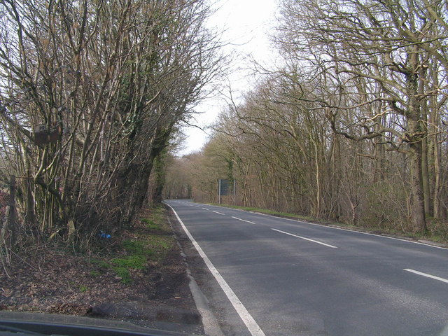
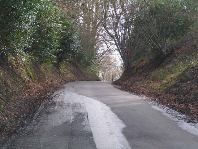
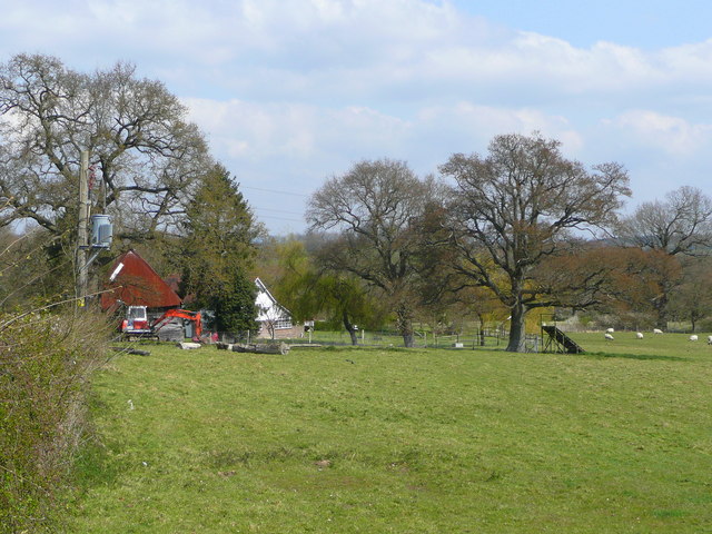
Broomland Shaw is a picturesque wood located in Sussex, England. Situated in the heart of the countryside, this dense forest covers an area of approximately 200 acres, making it a haven for nature enthusiasts and outdoor adventurers alike.

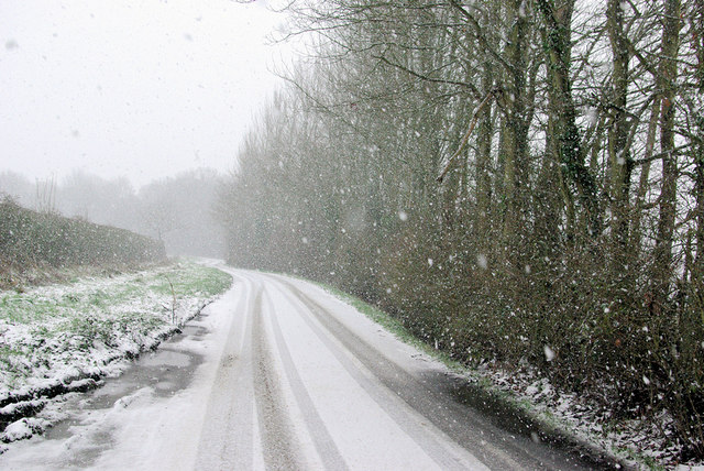
This ancient woodland boasts a diverse range of tree species, including oak, beech, birch, and ash. The towering trees create a dense canopy, allowing only dappled sunlight to filter through, giving the forest a mystical and ethereal ambiance. The forest floor is covered with a thick blanket of moss, ferns, and wildflowers, creating a vibrant and colorful carpet.

Broomland Shaw is home to a wide variety of wildlife, making it a popular spot for birdwatchers and nature lovers. Visitors may catch a glimpse of buzzards soaring high above the treetops, or perhaps encounter a shy deer darting through the undergrowth. The peaceful setting of the wood also serves as a sanctuary for smaller creatures such as squirrels, foxes, and rabbits.

Throughout the year, Broomland Shaw offers a range of recreational activities for visitors to enjoy. Nature trails wind through the forest, providing an opportunity for hikers and walkers to explore the area and discover its hidden treasures. Additionally, the wood is a fantastic spot for picnics, with designated areas equipped with benches and tables.

Broomland Shaw truly encapsulates the natural beauty of Sussex, offering a tranquil escape from the hustle and bustle of everyday life. With its enchanting woodland, diverse wildlife, and recreational activities, it is a must-visit destination for those seeking a connection with nature.

If you have any feedback on the listing, please let us know in the comments section below.

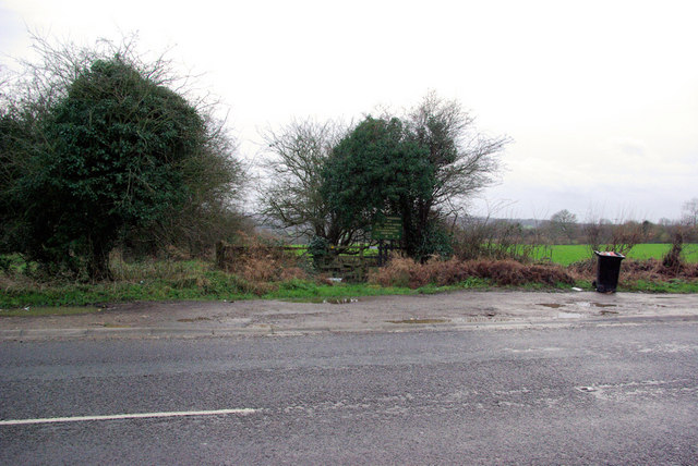
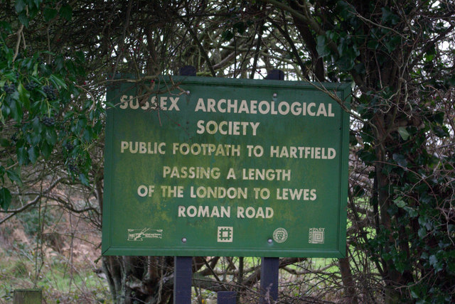
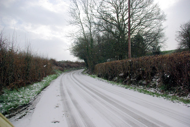
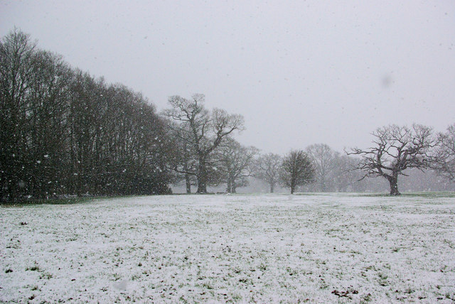
Broomland Shaw Images

Images are sourced within 2km of 51.127997/0.10762938 or Grid Reference TQ4738. Thanks to Geograph Open Source API. All images are credited.

Roman road near Holtye Near Holtye a section of the Roman road from London to Lewes was excavated and bought for preservation by the Sussex Archaeological Society.
Roman road near Holtye
Near Holtye a section of the Roman road from London to Lewes was excavated and bought for preservation by the Sussex Archaeological Society.
Bassett's Manor Looking northwards from the road/path towards Bassett's Manor farm buildings. Cattle in the far field.
Bassett's Manor
Looking northwards from the road/path towards Bassett's Manor farm buildings. Cattle in the far field.
Bassett's Manor fields Looking south west over the farm buildings towards the distant sunshine
Bassett's Manor fields
Looking south west over the farm buildings towards the distant sunshine
Bolebrook Castle Reputedly the earliest brick building in Sussex (around 1480) and legend has it that Henry VIII came here to hunt the deer, wild boar and woo Ann Boleyn who lived 5 miles away at Hever.
Bolebrook Castle
Reputedly the earliest brick building in Sussex (around 1480) and legend has it that Henry VIII came here to hunt the deer, wild boar and woo Ann Boleyn who lived 5 miles away at Hever.
The Road to Edenbridge (B2026) The B2026 runs 20 miles north - south from Westerham to Maresfield, via Edenbridge. It crosses Ashdown Forest.
<span class="nowrap"><a title="http://www.sabre-roads.org.uk/wiki/index.php?title=B2026" rel="nofollow ugc noopener" href="http://www.sabre-roads.org.uk/wiki/index.php?title=B2026">Link</a><img style="margin-left:2px;" alt="External link" title="External link - shift click to open in new window" src="https://s1.geograph.org.uk/img/external.png" width="10" height="10"/></span>
The Road to Edenbridge (B2026)
The B2026 runs 20 miles north - south from Westerham to Maresfield, via Edenbridge. It crosses Ashdown Forest. LinkExternal link
Kentish Byway
Kentish Byway
Sussex Oak Public House A large roadside inn on the A264 Tunbridge Wells to East Grinstead Road.
Sadly now closed, see <a href="https://www.geograph.org.uk/photo/2944951">TQ4839 : Formerly The Sussex Oak</a>
Sussex Oak Public House
A large roadside inn on the A264 Tunbridge Wells to East Grinstead Road. Sadly now closed, see TQ4839 : Formerly The Sussex Oak
Sand school and horse paddocks
A264 crossing of London-Lewes Roman Road The start of a footpath which passes further downhill a preserved section of Roman Road. The sign draws attention to this.
A264 crossing of London-Lewes Roman Road
The start of a footpath which passes further downhill a preserved section of Roman Road. The sign draws attention to this.
Roman Road sign on A264 A sign at the start of a path which passes a preserved section of Roman Road.
Roman Road sign on A264
A sign at the start of a path which passes a preserved section of Roman Road.
Butcherfield Lane in the snow The snow was increasing.
Butcherfield Lane in the snow
The snow was increasing.
B2026 by Tye Farm Cottages A snowy morning, but a well salted road.
B2026 by Tye Farm Cottages
A snowy morning, but a well salted road.
In the Snow The general direction of the footpath to Lodgefield Farm.
In the Snow
The general direction of the footpath to Lodgefield Farm.
Beech Green Lane in the Snow Falling snow confuses autofocus greatly.
Beech Green Lane in the Snow
Falling snow confuses autofocus greatly.
Red Telephone Box at B2026 crossroads near Holtye Red K6 telephone box at A264/B2026 crossroads near Holtye.
Red Telephone Box at B2026 crossroads near Holtye
Red K6 telephone box at A264/B2026 crossroads near Holtye.
The Sussex Oak Both pub and tree alongside the A264 between Ashurst and Holtye.
The welcome sight of Shepherd Neame's scarlet signage!
The Sussex Oak
Both pub and tree alongside the A264 between Ashurst and Holtye. The welcome sight of Shepherd Neame's scarlet signage!
Field by Blackham Lane View north from the junction with the A264 by the Sussex Oak.
Field by Blackham Lane
View north from the junction with the A264 by the Sussex Oak.
The Oast, Bassetts Manor, Buctherfield Lane, Hartfield, East Sussex
Show me another place!

Broomland Shaw is located at Grid Ref: TQ4738 (Lat: 51.127997, Lng: 0.10762938)

Administrative County: East Sussex

District: Wealden

Police Authority: Sussex

What 3 Words

///stars.career.like. Near Groombridge, East Sussex

Related Wikis

Bolebroke Castle

Bolebroke Castle is a 15th-century hunting lodge located north of the village of Hartfield, East Sussex, England. It is a Grade II* listed building.The...

Bolebroke Castle Miniature Railway

The Bolebroke Castle Miniature Railway or Bolebroke Castle and Lakes Railway (often abbreviated to BC&LR) was a 7+1⁄4 inches (180 mm) railway that ran...

Bassetts Manor

Bassetts Manor is a Grade II-listed building in Hartfield, East Sussex, England. == Location == The manor is located North of the village of Hartfield...

Mills Rocks

Mills Rocks is a 1.9-hectare (4.7-acre) biological Site of Special Scientific Interest south-east of East Grinstead in West Sussex.This site has rock outcrops...

Cowden

Cowden () is a small village and civil parish in the Sevenoaks District of Kent, England. The parish is located on the northern slopes of the Weald, south...

Hartfield railway station

Hartfield was a railway station serving Hartfield, England, on the Three Bridges to Tunbridge Wells Central Line which closed in 1967, a casualty of the...

Blackham

Blackham is a village in the Wealden district of East Sussex. It lies within the Withyham civil parish. Its nearest town is Royal Tunbridge Wells, which...

Cowden rail crash

The Cowden rail crash occurred on 15 October 1994, near Cowden Station in Kent (UK), when two trains collided head-on, killing five and injuring thirteen...

Nearby Amenities

Located within 500m of 51.127997,0.10762938
Removed Amenity: telephone
Lat/Long: 51.1317894/0.1085706
Post Box
Post Box Type: lamp
Ref: TN8 182
Royal Cypher: EIIR
Royal Cypher Wikidata: Q33102113
Lat/Long: 51.1317479/0.1086044
Power: tower
Lat/Long: 51.1294431/0.1082534
Power: tower
Lat/Long: 51.1291445/0.1055094
Power: tower
Lat/Long: 51.1287708/0.1020986
Give Way
Direction: forward
Lat/Long: 51.1315068/0.1092435
Give Way
Direction: backward
Lat/Long: 51.1315856/0.1084519
SUSSEX CARAVAN CENTRE EAST
Addr Postcode: TN8 7EA
Addr Street: Colestock Cross
Opening Hours: Mo-Sa 09:00-17:00; Su 10:00-16:00
Phone: +44 1342851393
Shop: outdoor
Website: https://www.sussexcaravancentre.co.uk
Lat/Long: 51.1318106/0.1091141
The data included in this document is from www.openstreetmap.org. The data is made available under ODbL.

Have you been to Broomland Shaw?

Leave your review of Broomland Shaw below (or comments, questions and feedback).