Falkenham Sink

Settlement in Suffolk East Suffolk

England

Falkenham Sink

The River Deben from the air Looking over Lower Falkenhan from a Stansted bound flight from Prague.
The River Deben from the air Credit: Thomas Nugent

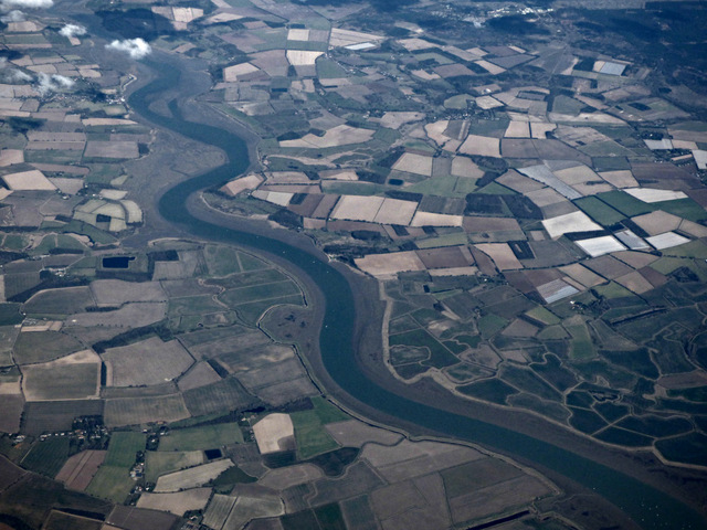
Falkenham Sink is a small village located in the county of Suffolk, England. Nestled on the eastern coast of the country, it is situated near the River Deben and is approximately 9 miles northeast of the town of Ipswich. With a population of around 200 residents, Falkenham Sink is known for its picturesque rural setting and tranquil atmosphere.

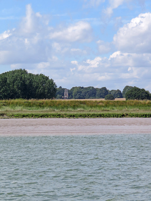
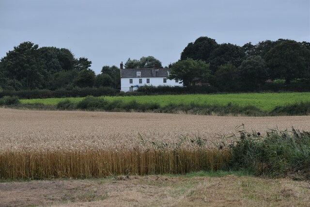
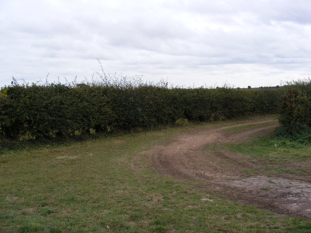
The village is characterized by its charming thatched-roof cottages, historic buildings, and scenic landscapes. It is surrounded by lush farmlands and green meadows, providing a beautiful backdrop for outdoor activities and leisurely walks. The River Deben, which runs nearby, offers opportunities for boating and fishing enthusiasts.

Falkenham Sink is also home to the 12th-century St. Ethelbert's Church, an architectural gem that attracts visitors with its medieval charm. The church features a Norman tower and a beautifully preserved interior with stained glass windows and intricate woodwork.

Despite its small size, the village boasts a close-knit community spirit, with various local events and activities organized throughout the year. The nearby Falkenham Hall, a Grade I listed country house, adds to the historical significance of the area and provides a glimpse into its past.

Overall, Falkenham Sink is a peaceful and idyllic village, offering a serene escape from the hustle and bustle of city life. Its natural beauty, rich history, and warm community atmosphere make it an appealing destination for both residents and visitors seeking a tranquil retreat in the heart of Suffolk.

If you have any feedback on the listing, please let us know in the comments section below.

Falkenham Sink Images

Images are sourced within 2km of 52.002178/1.3348424 or Grid Reference TM2939. Thanks to Geograph Open Source API. All images are credited.

The River Deben from the air Looking over Lower Falkenhan from a Stansted bound flight from Prague.
The River Deben from the air
Looking over Lower Falkenhan from a Stansted bound flight from Prague.
Towards Falkenham A view from a boat on the Deben estuary on a fine August morning. The church (in <a href="https://www.geograph.org.uk/gridref/TM2939">TM2939</a>) is dedicated to St Ethelbert.
Towards Falkenham
A view from a boat on the Deben estuary on a fine August morning. The church (in TM2939) is dedicated to St Ethelbert.
Reed-filled drainage ditches, Falkenham Marshes Looking north towards Red House Cottages.
Reed-filled drainage ditches, Falkenham Marshes
Looking north towards Red House Cottages.
Drainage ditch, Falkenham Marshes
Deben Lodge, Falkenham Deben Lodge is a late 18th Century farmhouse and Grade II Listed Building. It looks out over Falkenham Marshes.
Deben Lodge, Falkenham
Deben Lodge is a late 18th Century farmhouse and Grade II Listed Building. It looks out over Falkenham Marshes.
Trees on farmland near Sheepgate Lane The trees used to lie on a field boundary but now are surrounded by arable land.
Trees on farmland near Sheepgate Lane
The trees used to lie on a field boundary but now are surrounded by arable land.
View of Red House Cottages from Falkenham Marshes The tower of Falkenham parish church can be seen in the distance.
View of Red House Cottages from Falkenham Marshes
The tower of Falkenham parish church can be seen in the distance.
Red House Farm
Red House Farm
Lane heading east at Deben Lodge
Looking to the Deben over Falkenham Creek <span class="nowrap"><a title="https://en.wikipedia.org/wiki/Falkenham" rel="nofollow ugc noopener" href="https://en.wikipedia.org/wiki/Falkenham">Link</a><img style="margin-left:2px;" alt="External link" title="External link - shift click to open in new window" src="https://s1.geograph.org.uk/img/external.png" width="10" height="10"/></span>
Looking to the Deben over Falkenham Creek
Footpath to the River Deben Off Sheepgate Lane
Footpath to the River Deben
Off Sheepgate Lane
Red House Cottages, Lower Falkenham Taken from the footpath to the River Deben on Sheepgate Lane
Red House Cottages, Lower Falkenham
Taken from the footpath to the River Deben on Sheepgate Lane
Sheepgate Lane, Lower Falkenham Near Red House Farm
Sheepgate Lane, Lower Falkenham
Near Red House Farm
Sheepgate Lane,  Lower Falkenham Looking back to Lower Falkenham Road from the footpath
Sheepgate Lane, Lower Falkenham
Looking back to Lower Falkenham Road from the footpath
Field entrance off Sheepgate Lane <span class="nowrap"><a title="https://en.wikipedia.org/wiki/Falkenham" rel="nofollow ugc noopener" href="https://en.wikipedia.org/wiki/Falkenham">Link</a><img style="margin-left:2px;" alt="External link" title="External link - shift click to open in new window" src="https://s1.geograph.org.uk/img/external.png" width="10" height="10"/></span>
Field entrance off Sheepgate Lane
The entrance to Goseford Hall & Red House Farm Goseford Hall to the left & Red House Farm to the right
Off Sheepgate Lane
The entrance to Goseford Hall & Red House Farm
Goseford Hall to the left & Red House Farm to the right Off Sheepgate Lane
Red House Farm, Lower Falkenham Sheepgate Lane
Red House Farm, Lower Falkenham
Sheepgate Lane
Sheepgate Lane, Lower Falkenham Looking back to Red House Cottages
Sheepgate Lane, Lower Falkenham
Looking back to Red House Cottages
Show me another place!

Falkenham Sink is located at Grid Ref: TM2939 (Lat: 52.002178, Lng: 1.3348424)

Administrative County: Suffolk

District: East Suffolk

Police Authority: Suffolk

What 3 Words

///identify.tagging.protrude. Near Felixstowe, Suffolk

Nearby Locations

Falkenham Sink

Related Wikis

Falkenham

Falkenham is a village and a civil parish in the East Suffolk district, in the English county of Suffolk, near the village of Kirton and the towns of Ipswich...

Kirton, Suffolk

Kirton is a village and a civil parish in the shire county of Suffolk, England, situated off the A14 road, about 4.5 km (2.8 mi) from Felixstowe and around...

Trimley St Martin

Trimley St. Martin is a parish and village that lies between the rivers Orwell and the Deben, on the long narrow tongue of land from Ipswich to Felixstowe...

Colneis Hundred

Colneis is a hundred of Suffolk, consisting of 16,712 acres (67.63 km2).Running from the south-east outskirts of Ipswich to the North Sea coast, the hundred...

Trimley St Mary

Trimley St. Mary is a parish and village on the outskirts of Felixstowe, on a low-lying peninsula between Harwich Harbour and the River Deben, in Suffolk...

Trimley railway station

Trimley railway station is on the Felixstowe Branch Line in the east of England, serving the village of Trimley St. Mary, Suffolk. It is 14 miles 5 chains...

Upper Mill, Walton

Upper Mill or Walton Mill is a Grade II listed smock mill at Walton, Suffolk, England, which has been conserved. == History == Upper Mill was built in...

Alston, Suffolk

Alston was a medieval parish in the county of Suffolk. Without enough people to ensure its survival, the parish was consolidated with that of Trimley St...

Nearby Amenities

Located within 500m of 52.002178,1.3348424
Falkenham
Place: village
Wikidata: Q2244580
Lat/Long: 52.0021688/1.340107
Historic: wayside_shrine
Lat/Long: 51.9983141/1.3347473
Post Box
Operator: Royal Mail
Operator Type: private
Operator Wikidata: Q638098
Post Box Mounting: concrete_post
Post Box Type: lamp
Ref: IP10 1202
Royal Cypher: EIIR
Royal Cypher Wikidata: Q33102113
Lat/Long: 52.0020851/1.3405928
Telephone
Booth: K6
Covered: booth
Listed Status: Grade II
Lat/Long: 52.002099/1.3406777
Advertising: board
Lat/Long: 52.0021056/1.3407761
The data included in this document is from www.openstreetmap.org. The data is made available under ODbL.

Have you been to Falkenham Sink?

Leave your review of Falkenham Sink below (or comments, questions and feedback).