Fir Tree Grove

Wood, Forest in Sussex Wealden

England

Fir Tree Grove

Owlsbury Farm
Owlsbury Farm Credit: N Chadwick

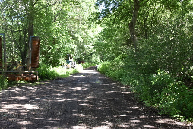
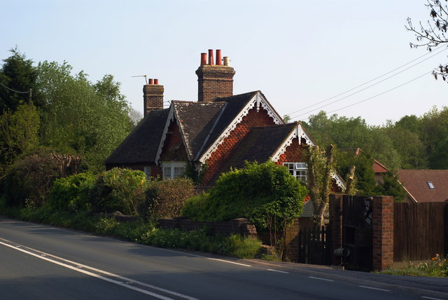
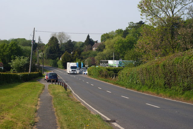
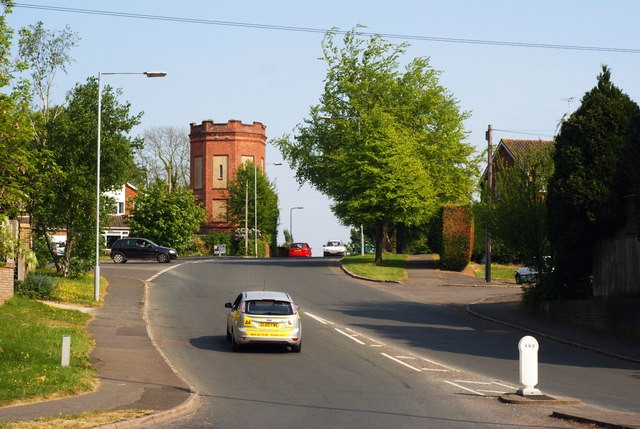
Fir Tree Grove is a picturesque woodland area located in Sussex, England. It is renowned for its dense population of fir trees, which lend the grove its name and distinct character. The grove covers a vast area, making it an ideal destination for nature enthusiasts, hikers, and photographers seeking to capture the beauty of the English countryside.

The towering fir trees create a sense of tranquility within the grove, providing a peaceful and immersive environment for visitors. The woodland floor is blanketed with a lush carpet of moss, ferns, and wildflowers, adding to the natural allure of the area. This rich ecosystem supports a diverse range of wildlife, including various bird species, small mammals, and insects.

Fir Tree Grove boasts a network of well-maintained footpaths and trails, allowing visitors to explore its enchanting surroundings at their own pace. The trails wind through the forest, offering glimpses of sunlight filtering through the dense canopy and casting ethereal beams of light onto the forest floor.

In addition to its aesthetic appeal, Fir Tree Grove is also of historical significance. Evidence of past human habitation, including ancient burial mounds and remnants of Iron Age settlements, can be found within the grove, providing a glimpse into the region's rich heritage.

Overall, Fir Tree Grove is a captivating destination that showcases the natural beauty and historical significance of Sussex. Its towering fir trees, diverse wildlife, and serene atmosphere make it a must-visit location for those seeking an escape into nature.

If you have any feedback on the listing, please let us know in the comments section below.

Fir Tree Grove Images

Images are sourced within 2km of 50.976513/0.08905274 or Grid Reference TQ4621. Thanks to Geograph Open Source API. All images are credited.

Owlsbury Farm
Owlsbury Farm
Dismantled railway line The Wealden line ran from Tunbridge Wells to Lewes via Uckfield. The line was built in between 1846 & 1858. Most of the line has now closed to regular services. Lewes to Uckfield closed in 1969, Tunbridge Wells to Eridge closed in 1985. Eidge to Uckfield remains open as part of the Oxted line <a title="https://www.geograph.org.uk/snippet/4332" href="https://www.geograph.org.uk/snippet/4332">Link</a> . The Spa Valley Railway has re-opened the section between Tunbridge Wells West and Groombridge as a preservation line. Isfield station has been re-opened as the Lavender line.
Wikipedia: <span class="nowrap"><a title="http://en.wikipedia.org/wiki/Wealden_Line" rel="nofollow ugc noopener" href="http://en.wikipedia.org/wiki/Wealden_Line">Link</a><img style="margin-left:2px;" alt="External link" title="External link - shift click to open in new window" src="https://s1.geograph.org.uk/img/external.png" width="10" height="10"/></span>
Dismantled railway line
The Wealden line ran from Tunbridge Wells to Lewes via Uckfield. The line was built in between 1846 & 1858. Most of the line has now closed to regular services. Lewes to Uckfield closed in 1969, Tunbridge Wells to Eridge closed in 1985. Eidge to Uckfield remains open as part of the Oxted line Link . The Spa Valley Railway has re-opened the section between Tunbridge Wells West and Groombridge as a preservation line. Isfield station has been re-opened as the Lavender line. Wikipedia: LinkExternal link
Former Signal Box at Uckfield, Sussex Formerly a significant intermediate station on the London- Lewes branch line (via Oxted). The route now terminates at Uckfield; with the new station out of picture, to the right. A taxi company is now based in this building.
Former Signal Box at Uckfield, Sussex
Formerly a significant intermediate station on the London- Lewes branch line (via Oxted). The route now terminates at Uckfield; with the new station out of picture, to the right. A taxi company is now based in this building.
Train at Uckfield Station, Sussex The end of the line; which runs to London, via Oxted. Whilst many trains run through to London; this one was shortly to depart, for Oxted, to connect with a service from East Grinstead.
Train at Uckfield Station, Sussex
The end of the line; which runs to London, via Oxted. Whilst many trains run through to London; this one was shortly to depart, for Oxted, to connect with a service from East Grinstead.
Sculpture at Uckfield, Sussex Sculpture of a Town Crier, located close to the bridge over the River Uck.
Sculpture at Uckfield, Sussex
Sculpture of a Town Crier, located close to the bridge over the River Uck.
Morris 1000 Traveller, Uckfield, Sussex A fine survivor, some 45 years old.
Morris 1000 Traveller, Uckfield, Sussex
A fine survivor, some 45 years old.
Morris 1000 Traveller, Uckfield, Sussex At some stage in its 45 year life, some of the timbers have been replaced on the car. Timber rot was always a problem with this model, especially if left out in all weathers.
Morris 1000 Traveller, Uckfield, Sussex
At some stage in its 45 year life, some of the timbers have been replaced on the car. Timber rot was always a problem with this model, especially if left out in all weathers.
The Mill House, Maresfield, Sussex The former mill house lies just within this grid square. The pond, serving this house, lies to the west; an aerial view suggests that the pond may have been truncated by the construction of the A22 Maresfield bypass, some years ago.
The Mill House, Maresfield, Sussex
The former mill house lies just within this grid square. The pond, serving this house, lies to the west; an aerial view suggests that the pond may have been truncated by the construction of the A22 Maresfield bypass, some years ago.
London Road, Budlett's Common, Sussex Chichester Caravans can be seen, in the centre of picture.
London Road, Budlett's Common, Sussex
Chichester Caravans can be seen, in the centre of picture.
London Road, Ringles Cross, Sussex Looking in the direction of Uckfield. The town sign can be seen, to the right of picture.
London Road, Ringles Cross, Sussex
Looking in the direction of Uckfield. The town sign can be seen, to the right of picture.
Road Junction at Ringles Cross, Sussex The junction of London Road with Coopers Green Road.
Road Junction at Ringles Cross, Sussex
The junction of London Road with Coopers Green Road.
Brown Lane, Uckfield, Sussex Looking in the direction of the water tower, from London Road.
Brown Lane, Uckfield, Sussex
Looking in the direction of the water tower, from London Road.
The Old Chapel, Uckfield, Sussex This chapel was re-built in the 1880s, but was built nearly 100 years earlier. To the left of picture, is the Veterinary Centre in Henley House.
The Old Chapel, Uckfield, Sussex
This chapel was re-built in the 1880s, but was built nearly 100 years earlier. To the left of picture, is the Veterinary Centre in Henley House.
Houses in Uckfield, Sussex Located beside London Road.
Houses in Uckfield, Sussex
Located beside London Road.
Uckfield High Street, Sussex Looking down the hill; towards the town centre, and railway station.
Uckfield High Street, Sussex
Looking down the hill; towards the town centre, and railway station.
Church Street, Uckfield in 1967 The imposing house on the right hand side of the road is called Andertons. It is a Georgian grade II listed building.
Church Street, Uckfield in 1967
The imposing house on the right hand side of the road is called Andertons. It is a Georgian grade II listed building.
Cricket and football at Victoria Pleasure Ground, Uckfield
Forward defensive stroke, Uckfield The game is between Uckfield Anderida I v Crawley CC I, which the later team won by ten wickets.
Forward defensive stroke, Uckfield
The game is between Uckfield Anderida I v Crawley CC I, which the later team won by ten wickets.
Show me another place!

Fir Tree Grove is located at Grid Ref: TQ4621 (Lat: 50.976513, Lng: 0.08905274)

Administrative County: East Sussex

District: Wealden

Police Authority: Sussex

What 3 Words

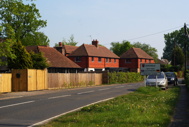
///hazelnuts.fortified.boost. Near Uckfield, East Sussex

Related Wikis

Copping Hall

Copping Hall is a Grade II* listed house in Uckfield, East Sussex, England. It is located at 1 Pudding Cake Lane, Uckfield, East Sussex TN22 1BT. Built...

West Park, Uckfield

West Park is a 10.5-hectare (26-acre) Local Nature Reserve on the western outskirts of Uckfield in East Sussex. It is owned and managed by Uckfield Town...

Uckfield Baptist Church

Uckfield Baptist Church is a Baptist congregation based in the town of Uckfield in East Sussex, England. Although services now take place in a school...

Uckfield College

Uckfield College (formerly Uckfield Community Technology College) is a community college situated in Uckfield, UK. It has approximately 1,720 students...

Uckfield railway station

Uckfield railway station is the southern terminus of a branch of the Oxted Line in England, serving the town of Uckfield, East Sussex. It is 46 miles 8...

Uckfield

Uckfield () is a town in the Wealden District of East Sussex in South East England. The town is on the River Uck, one of the tributaries of the River Ouse...

Hempstead Meadow

Hempstead Meadow is a 1.6-hectare (4.0-acre) Local Nature Reserve in Uckfield in East Sussex. It is owned and managed by Uckfield Town Council.The site...

Uckfield Town F.C.

Uckfield Town F.C. was a football club based in Uckfield, East Sussex, England. For their final season, 2013–14, they were members of the Sussex County...

Nearby Amenities

Located within 500m of 50.976513,0.08905274
Turning Circle
Lat/Long: 50.9740336/0.0868349
Turning Circle
Lat/Long: 50.9752501/0.0908022
Turning Circle
Lat/Long: 50.9770351/0.0921942
Turning Circle
Lat/Long: 50.9770774/0.093141
Turning Circle
Lat/Long: 50.9748059/0.0955438
Turning Circle
Lat/Long: 50.9728039/0.0883151
Turning Circle
Lat/Long: 50.9722492/0.0893519
Turning Circle
Lat/Long: 50.972782/0.0915443
Barrier: stile
Lat/Long: 50.9754462/0.0827353
Addr City: Uckfield
Addr Housename: site of The Rocks
Addr Street: Church Street
Building: yes
Lat/Long: 50.9751748/0.087995
Post Box
Brand: Royal Mail
Brand Wikidata: Q638098
Brand Wikipedia: en:Royal Mail
Operator: Royal Mail
Operator Wikidata: Q638098
Post Box Type: lamp
Ref: TN22 4D
Royal Cypher: EIIR
Royal Cypher Wikidata: Q33102113
Lat/Long: 50.9729947/0.0908617
Post Box
Brand: Royal Mail
Brand Wikidata: Q638098
Brand Wikipedia: en:Royal Mail
Operator: Royal Mail
Operator Wikidata: Q638098
Post Box Type: wall
Ref: TN22 3D
Royal Cypher: EIIR
Royal Cypher Wikidata: Q33102113
Lat/Long: 50.9765918/0.0955349
Bus Stop
Church Combe Manor Way
Bus: yes
Naptan AtcoCode: 1400WE1171
Naptan NaptanCode: esudjmwg
Public Transport: platform
Lat/Long: 50.9748472/0.0945689
Church Street
Operator: UK Power Networks
Operator Wikidata: Q7864927
Power: substation
Ref: 444342
Lat/Long: 50.9741544/0.0927809
The Drive
Power: substation
Lat/Long: 50.977198/0.0954514
Calvert Road
Power: substation
Lat/Long: 50.9738858/0.0842954
Barrier: kissing_gate
Lat/Long: 50.9748676/0.0859693
Public Footpath
Information: guidepost
Tourism: information
Lat/Long: 50.9785576/0.0937257
Tourism: viewpoint
Lat/Long: 50.9756778/0.082512
Crossing
Lat/Long: 50.9743559/0.0864847
Bus Stop
Bus: yes
Public Transport: platform
Lat/Long: 50.9755216/0.0939127
Generator Method: photovoltaic
Generator Output Electricity: yes
Generator Source: solar
Generator Type: solar_photovoltaic_panel
Power: generator
Lat/Long: 50.9725426/0.0896813
Generator Method: photovoltaic
Generator Output Electricity: yes
Generator Source: solar
Generator Type: solar_photovoltaic_panel
Power: generator
Lat/Long: 50.9724122/0.0908971
Generator Method: photovoltaic
Generator Orientation: 210
Generator Output Electricity: yes
Generator Source: solar
Generator Type: solar_photovoltaic_panel
Location: roof
Power: generator
Lat/Long: 50.9728817/0.0871126
Generator Method: photovoltaic
Generator Orientation: 210
Generator Output Electricity: yes
Generator Solar Modules: 14
Generator Source: solar
Generator Type: solar_photovoltaic_panel
Location: roof
Power: generator
Lat/Long: 50.9725482/0.0914987
Generator Method: photovoltaic
Generator Orientation: 220
Generator Output Electricity: yes
Generator Solar Modules: 16
Generator Source: solar
Generator Type: solar_photovoltaic_panel
Location: roof
Power: generator
Lat/Long: 50.9733758/0.0842398
Generator Method: photovoltaic
Generator Orientation: 150
Generator Output Electricity: yes
Generator Solar Modules: 16
Generator Source: solar
Generator Type: solar_photovoltaic_panel
Location: roof
Power: generator
Lat/Long: 50.9748399/0.0858555
Generator Method: photovoltaic
Generator Orientation: 210
Generator Output Electricity: yes
Generator Solar Modules: 14
Generator Source: solar
Generator Type: solar_photovoltaic_panel
Location: roof
Power: generator
Lat/Long: 50.9725874/0.0913708
Generator Method: photovoltaic
Generator Orientation: 200
Generator Output Electricity: yes
Generator Source: solar
Generator Type: solar_photovoltaic_panel
Location: roof
Power: generator
Lat/Long: 50.9754367/0.0902845
Generator Method: photovoltaic
Generator Orientation: 120
Generator Output Electricity: yes
Generator Source: solar
Generator Type: solar_photovoltaic_panel
Location: roof
Power: generator
Lat/Long: 50.9751707/0.0905567
Generator Method: photovoltaic
Generator Orientation: 120
Generator Output Electricity: yes
Generator Source: solar
Generator Type: solar_photovoltaic_panel
Location: roof
Power: generator
Lat/Long: 50.975229/0.0917289
Generator Method: photovoltaic
Generator Orientation: 240
Generator Output Electricity: yes
Generator Source: solar
Generator Type: solar_photovoltaic_panel
Location: roof
Power: generator
Lat/Long: 50.9752425/0.0924316
Generator Method: photovoltaic
Generator Orientation: 240
Generator Output Electricity: yes
Generator Source: solar
Generator Type: solar_photovoltaic_panel
Location: roof
Power: generator
Lat/Long: 50.9781751/0.0947316
Generator Method: photovoltaic
Generator Orientation: 220
Generator Output Electricity: yes
Generator Solar Modules: 10
Generator Source: solar
Generator Type: solar_photovoltaic_panel
Location: roof
Power: generator
Lat/Long: 50.9727382/0.0898238
Generator Method: photovoltaic
Generator Orientation: 220
Generator Output Electricity: yes
Generator Source: solar
Generator Type: solar_photovoltaic_panel
Location: roof
Power: generator
Lat/Long: 50.9726423/0.0864851
Generator Method: photovoltaic
Generator Orientation: 210
Generator Output Electricity: yes
Generator Solar Modules: 10
Generator Source: solar
Generator Type: solar_photovoltaic_panel
Location: roof
Power: generator
Lat/Long: 50.9727572/0.0892425
Generator Method: photovoltaic
Generator Orientation: 210
Generator Output Electricity: yes
Generator Solar Modules: 15
Generator Source: solar
Generator Type: solar_photovoltaic_panel
Location: roof
Power: generator
Lat/Long: 50.9742604/0.0869438
Generator Method: photovoltaic
Generator Orientation: 215
Generator Output Electricity: yes
Generator Solar Modules: 10
Generator Source: solar
Generator Type: solar_photovoltaic_panel
Location: roof
Power: generator
Lat/Long: 50.9745576/0.0840618
Generator Method: photovoltaic
Generator Orientation: 210
Generator Output Electricity: yes
Generator Solar Modules: 10
Generator Source: solar
Generator Type: solar_photovoltaic_panel
Location: roof
Power: generator
Lat/Long: 50.9743398/0.0838378
Generator Method: photovoltaic
Generator Orientation: 120
Generator Output Electricity: yes
Generator Solar Modules: 16
Generator Source: solar
Generator Type: solar_photovoltaic_panel
Location: roof
Power: generator
Lat/Long: 50.9741709/0.0833818
Generator Method: photovoltaic
Generator Orientation: 140
Generator Output Electricity: yes
Generator Solar Modules: 16
Generator Source: solar
Generator Type: solar_photovoltaic_panel
Location: roof
Power: generator
Lat/Long: 50.9734379/0.083878
Generator Method: photovoltaic
Generator Orientation: 140
Generator Output Electricity: yes
Generator Solar Modules: 16
Generator Source: solar
Generator Type: solar_photovoltaic_panel
Location: roof
Power: generator
Lat/Long: 50.973551/0.0840443
Generator Method: photovoltaic
Generator Orientation: 220
Generator Output Electricity: yes
Generator Solar Modules: 16
Generator Source: solar
Generator Type: solar_photovoltaic_panel
Location: roof
Power: generator
Lat/Long: 50.9725633/0.0904065
Lashbrooks Road
Operator: UK Power Networks
Operator Wikidata: Q7864927
Power: substation
Ref: 444770
Lat/Long: 50.9729296/0.0883678
Generator Method: photovoltaic
Generator Orientation: 230
Generator Output Electricity: yes
Generator Solar Modules: 10
Generator Source: solar
Generator Type: solar_photovoltaic_panel
Location: roof
Power: generator
Lat/Long: 50.9739744/0.0876308
Generator Method: photovoltaic
Generator Output Electricity: yes
Generator Source: solar
Generator Type: solar_photovoltaic_panel
Location: roof
Power: generator
Lat/Long: 50.9775653/0.0925362
Generator Method: photovoltaic
Generator Output Electricity: yes
Generator Source: solar
Generator Type: solar_photovoltaic_panel
Location: roof
Power: generator
Lat/Long: 50.9785081/0.0938442
Generator Method: photovoltaic
Generator Output Electricity: yes
Generator Source: solar
Generator Type: solar_photovoltaic_panel
Location: roof
Power: generator
Lat/Long: 50.9784468/0.0939733
Generator Method: photovoltaic
Generator Output Electricity: yes
Generator Source: solar
Generator Type: solar_photovoltaic_panel
Location: roof
Power: generator
Lat/Long: 50.977867/0.0926663
Hunters Way
Power: substation
Ref: 444872
Lat/Long: 50.9759973/0.0924132
Barrier: kissing_gate
Lat/Long: 50.9781377/0.0957159
Ford: yes
Lat/Long: 50.9798733/0.0909922
Fir tree Grove
Natural: wood
Lat/Long: 50.9766863/0.088822
Addr City: Uckfield
Addr Housename: The Pump House
Building: yes
Lat/Long: 50.9783949/0.0927095
Addr City: Uckfield
Addr Housename: Lily Pond View
Building: yes
Lat/Long: 50.9782763/0.0926002
Turning Circle
Lat/Long: 50.9770217/0.0932113
The data included in this document is from www.openstreetmap.org. The data is made available under ODbL.

Have you been to Fir Tree Grove?

Leave your review of Fir Tree Grove below (or comments, questions and feedback).