Fairwater

Settlement in Monmouthshire

Wales

Fairwater

The Incline below Penylan Way Cycle and pedestrian path on the site of a former tramway down from Henllys Colliery.
The Incline below Penylan Way Credit: M J Roscoe

Fairwater is a small village located in the county of Monmouthshire, Wales. Situated on the outskirts of the town of Abergavenny, Fairwater is surrounded by picturesque rolling hills and offers a tranquil and rural setting.

The village is home to a close-knit community, with a population of around 500 residents. It has a rich history, dating back to medieval times when it was primarily an agricultural area. Today, Fairwater retains its traditional charm, with several old stone cottages and buildings still standing.

The heart of the village is the village hall, which serves as a community hub and hosts various events and gatherings throughout the year. There is also a local pub where residents can socialize and enjoy a drink or a meal.

Fairwater offers a range of amenities to its residents. There is a primary school within the village, providing education for children up to the age of 11. For secondary education, students typically commute to nearby Abergavenny. There is also a small convenience store that caters to the daily needs of the community.

Nature lovers will appreciate the beautiful surrounding countryside, which offers numerous opportunities for outdoor activities such as hiking, cycling, and horse riding. The village is also close to the Brecon Beacons National Park, known for its stunning landscapes and walking trails.

Overall, Fairwater in Monmouthshire provides a peaceful and idyllic setting for residents who seek a quiet rural lifestyle while still having access to nearby towns and amenities.

If you have any feedback on the listing, please let us know in the comments section below.
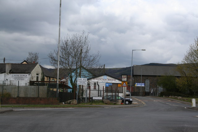
Fairwater Images

Images are sourced within 2km of 51.644786/-3.046096 or Grid Reference ST2794. Thanks to Geograph Open Source API. All images are credited.

The Incline below Penylan Way Cycle and pedestrian path on the site of a former tramway down from Henllys Colliery.
The Incline below Penylan Way
Cycle and pedestrian path on the site of a former tramway down from Henllys Colliery.
Sports pitches, Penylan Way, Cwmbran Cwmbran Town Football Club ground.
Sports pitches, Penylan Way, Cwmbran
Cwmbran Town Football Club ground.
Mon & Brec Canal, Forge Hammer Disused section of the canal at the end of retail centre's carpark, a few metres down stream from a culverted section of the canal <a href="https://www.geograph.org.uk/photo/6960413">ST2895 : Culvert, Mon & Brec Canal, Forge Hammer</a>.
Mon & Brec Canal, Forge Hammer
Disused section of the canal at the end of retail centre's carpark, a few metres down stream from a culverted section of the canal ST2895 : Culvert, Mon & Brec Canal, Forge Hammer.
Culvert, Mon & Brec Canal, Forge Hammer Outflow of culvert of two pipes under footpath near carpark. There was probably a lock here. In the past a railway line went across the canal here. A pedestrian/cycle route signpost can be seen in the distance.
Culvert, Mon & Brec Canal, Forge Hammer
Outflow of culvert of two pipes under footpath near carpark. There was probably a lock here. In the past a railway line went across the canal here. A pedestrian/cycle route signpost can be seen in the distance.
Mon & Brecon Canal above culvert, Forge Hammer The culvert, upper edge shown by bricks, was the site of a lock - one of several on this section of the canal.
Mon & Brecon Canal above culvert, Forge Hammer
The culvert, upper edge shown by bricks, was the site of a lock - one of several on this section of the canal.
Derelict lock on Mon & Brec Canal, Forge Hammer The overgrown lower opening to the lock is on the right; This appears to be the lower lock below Greenhill Road <a href="https://www.geograph.org.uk/photo/6961104">ST2895 : Mon & Brec Canal - derelict lock, Forge Hammer</a>.
Derelict lock on Mon & Brec Canal, Forge Hammer
The overgrown lower opening to the lock is on the right; This appears to be the lower lock below Greenhill Road ST2895 : Mon & Brec Canal - derelict lock, Forge Hammer.
Mon & Brec Canal - derelict lock, Forge Hammer Upper opening of lock below Greenhill Road; lower end - <a href="https://www.geograph.org.uk/photo/6961089">ST2895 : Derelict lock on Mon & Brec Canal, Forge Hammer</a>.
Mon & Brec Canal - derelict lock, Forge Hammer
Upper opening of lock below Greenhill Road; lower end - ST2895 : Derelict lock on Mon & Brec Canal, Forge Hammer.
Woodside House, Forge Hammer White house now a funeral home.
Woodside House, Forge Hammer
White house now a funeral home.
Cycle route signs, Greenhill Road Bilingual route direction signs at junction of NCR 492 with NCR 49 which follows the canal towpath straight ahead; the canal is culverted here. On the right is a disused public house.
Cycle route signs, Greenhill Road
Bilingual route direction signs at junction of NCR 492 with NCR 49 which follows the canal towpath straight ahead; the canal is culverted here. On the right is a disused public house.
Cycle underpass under Hollybush Way Underpass beside the Monmouthshire and Brecon Canal
Cycle underpass under Hollybush Way
Underpass beside the Monmouthshire and Brecon Canal
Monmouthshire and Brecon Canal in Ty Coch The Monmouthshire and Brecon Canal (popularly referred to as the Mon & Brec) was originally two separate canals: the Brecknock & Abergavenny Canal, and the Monmouthshire Canal. The 35-mile navigable section seen today is mostly the former. Following discussions in the 1790s, it was decided to link the two canals at Pontymoile. The Monmouthshire Canal, including a branch from Malpas to Crumlin, was opened in 1799 with the Brecknock & Abergavenny extending from Brecon to Gilwern by 1800, finally reaching Pontymoile by 1812.

Though originally constructed to transport coal, lime and agricultural products the canal was used extensively by ironmasters and industrialists as their main transport network, bringing the raw iron ore up the canal from Newport to Llanfoist Wharf and thence by tramroads to the iron works and returning with trams loaded with iron, the finished product. 

In 1880 the Monmouthshire & Brecon Canals were taken over by the Great Western Railway. Within 35 years, commercial carrying had all but ceased. Throughout the 20th century various parts of the Monmouthshire Canal were filled in for road construction. Both canals were abandoned by the early 1960s but restoration work from Brecon to Pontymoile began in 1968 following vigorous campaigning by canal enthusiasts. Recent developments have included a complete regeneration of the terminus at Brecon, and various works continue to reclaim the navigation between Pontymoile and Newport. The Blaenavon area and a section of the canal were granted World Heritage status in 2000 in recognition of its historical significance. 
<span class="nowrap"><a title="https://canalrivertrust.org.uk/enjoy-the-waterways/canal-and-river-network/monmouthshire-and-brecon-canal" rel="nofollow ugc noopener" href="https://canalrivertrust.org.uk/enjoy-the-waterways/canal-and-river-network/monmouthshire-and-brecon-canal">Link</a><img style="margin-left:2px;" alt="External link" title="External link - shift click to open in new window" src="https://s1.geograph.org.uk/img/external.png" width="10" height="10"/></span>  Canal and River Trust
Monmouthshire and Brecon Canal in Ty Coch
The Monmouthshire and Brecon Canal (popularly referred to as the Mon & Brec) was originally two separate canals: the Brecknock & Abergavenny Canal, and the Monmouthshire Canal. The 35-mile navigable section seen today is mostly the former. Following discussions in the 1790s, it was decided to link the two canals at Pontymoile. The Monmouthshire Canal, including a branch from Malpas to Crumlin, was opened in 1799 with the Brecknock & Abergavenny extending from Brecon to Gilwern by 1800, finally reaching Pontymoile by 1812. Though originally constructed to transport coal, lime and agricultural products the canal was used extensively by ironmasters and industrialists as their main transport network, bringing the raw iron ore up the canal from Newport to Llanfoist Wharf and thence by tramroads to the iron works and returning with trams loaded with iron, the finished product. In 1880 the Monmouthshire & Brecon Canals were taken over by the Great Western Railway. Within 35 years, commercial carrying had all but ceased. Throughout the 20th century various parts of the Monmouthshire Canal were filled in for road construction. Both canals were abandoned by the early 1960s but restoration work from Brecon to Pontymoile began in 1968 following vigorous campaigning by canal enthusiasts. Recent developments have included a complete regeneration of the terminus at Brecon, and various works continue to reclaim the navigation between Pontymoile and Newport. The Blaenavon area and a section of the canal were granted World Heritage status in 2000 in recognition of its historical significance. LinkExternal link Canal and River Trust
Llandowlais Street bridge over Monmouthshire and Brecon Canal The Monmouthshire and Brecon Canal (popularly referred to as the Mon & Brec) was originally two separate canals: the Brecknock & Abergavenny Canal, and the Monmouthshire Canal. The 35-mile navigable section seen today is mostly the former. Following discussions in the 1790s, it was decided to link the two canals at Pontymoile. The Monmouthshire Canal, including a branch from Malpas to Crumlin, was opened in 1799 with the Brecknock & Abergavenny extending from Brecon to Gilwern by 1800, finally reaching Pontymoile by 1812.

Though originally constructed to transport coal, lime and agricultural products the canal was used extensively by ironmasters and industrialists as their main transport network, bringing the raw iron ore up the canal from Newport to Llanfoist Wharf and thence by tramroads to the iron works and returning with trams loaded with iron, the finished product. 

In 1880 the Monmouthshire & Brecon Canals were taken over by the Great Western Railway. Within 35 years, commercial carrying had all but ceased. Throughout the 20th century various parts of the Monmouthshire Canal were filled in for road construction. Both canals were abandoned by the early 1960s but restoration work from Brecon to Pontymoile began in 1968 following vigorous campaigning by canal enthusiasts. Recent developments have included a complete regeneration of the terminus at Brecon, and various works continue to reclaim the navigation between Pontymoile and Newport. The Blaenavon area and a section of the canal were granted World Heritage status in 2000 in recognition of its historical significance. 
<span class="nowrap"><a title="https://canalrivertrust.org.uk/enjoy-the-waterways/canal-and-river-network/monmouthshire-and-brecon-canal" rel="nofollow ugc noopener" href="https://canalrivertrust.org.uk/enjoy-the-waterways/canal-and-river-network/monmouthshire-and-brecon-canal">Link</a><img style="margin-left:2px;" alt="External link" title="External link - shift click to open in new window" src="https://s1.geograph.org.uk/img/external.png" width="10" height="10"/></span>  Canal and River Trust
Llandowlais Street bridge over Monmouthshire and Brecon Canal
The Monmouthshire and Brecon Canal (popularly referred to as the Mon & Brec) was originally two separate canals: the Brecknock & Abergavenny Canal, and the Monmouthshire Canal. The 35-mile navigable section seen today is mostly the former. Following discussions in the 1790s, it was decided to link the two canals at Pontymoile. The Monmouthshire Canal, including a branch from Malpas to Crumlin, was opened in 1799 with the Brecknock & Abergavenny extending from Brecon to Gilwern by 1800, finally reaching Pontymoile by 1812. Though originally constructed to transport coal, lime and agricultural products the canal was used extensively by ironmasters and industrialists as their main transport network, bringing the raw iron ore up the canal from Newport to Llanfoist Wharf and thence by tramroads to the iron works and returning with trams loaded with iron, the finished product. In 1880 the Monmouthshire & Brecon Canals were taken over by the Great Western Railway. Within 35 years, commercial carrying had all but ceased. Throughout the 20th century various parts of the Monmouthshire Canal were filled in for road construction. Both canals were abandoned by the early 1960s but restoration work from Brecon to Pontymoile began in 1968 following vigorous campaigning by canal enthusiasts. Recent developments have included a complete regeneration of the terminus at Brecon, and various works continue to reclaim the navigation between Pontymoile and Newport. The Blaenavon area and a section of the canal were granted World Heritage status in 2000 in recognition of its historical significance. LinkExternal link Canal and River Trust
Two Locks Church For the background to this use of Ebenezer Baptist Chapel, see <a href="https://www.geograph.org.uk/photo/3249492">ST2994 : Two Locks Church, Cwmbran</a>
Two Locks Church
For the background to this use of Ebenezer Baptist Chapel, see ST2994 : Two Locks Church, Cwmbran
Looking over the lock to Two Locks Church View over the Monmouthshire and Brecon Canal to the church in the former Baptist Chapel
Looking over the lock to Two Locks Church
View over the Monmouthshire and Brecon Canal to the church in the former Baptist Chapel
Broadweir Road by Monmouthshire and Brecon Canal The Monmouthshire and Brecon Canal (popularly referred to as the Mon & Brec) was originally two separate canals: the Brecknock & Abergavenny Canal, and the Monmouthshire Canal. The 35-mile navigable section seen today is mostly the former. Following discussions in the 1790s, it was decided to link the two canals at Pontymoile. The Monmouthshire Canal, including a branch from Malpas to Crumlin, was opened in 1799 with the Brecknock & Abergavenny extending from Brecon to Gilwern by 1800, finally reaching Pontymoile by 1812.

Though originally constructed to transport coal, lime and agricultural products the canal was used extensively by ironmasters and industrialists as their main transport network, bringing the raw iron ore up the canal from Newport to Llanfoist Wharf and thence by tramroads to the iron works and returning with trams loaded with iron, the finished product. 

In 1880 the Monmouthshire & Brecon Canals were taken over by the Great Western Railway. Within 35 years, commercial carrying had all but ceased. Throughout the 20th century various parts of the Monmouthshire Canal were filled in for road construction. Both canals were abandoned by the early 1960s but restoration work from Brecon to Pontymoile began in 1968 following vigorous campaigning by canal enthusiasts. Recent developments have included a complete regeneration of the terminus at Brecon, and various works continue to reclaim the navigation between Pontymoile and Newport. The Blaenavon area and a section of the canal were granted World Heritage status in 2000 in recognition of its historical significance. 
<span class="nowrap"><a title="https://canalrivertrust.org.uk/enjoy-the-waterways/canal-and-river-network/monmouthshire-and-brecon-canal" rel="nofollow ugc noopener" href="https://canalrivertrust.org.uk/enjoy-the-waterways/canal-and-river-network/monmouthshire-and-brecon-canal">Link</a><img style="margin-left:2px;" alt="External link" title="External link - shift click to open in new window" src="https://s1.geograph.org.uk/img/external.png" width="10" height="10"/></span>  Canal and River Trust
Broadweir Road by Monmouthshire and Brecon Canal
The Monmouthshire and Brecon Canal (popularly referred to as the Mon & Brec) was originally two separate canals: the Brecknock & Abergavenny Canal, and the Monmouthshire Canal. The 35-mile navigable section seen today is mostly the former. Following discussions in the 1790s, it was decided to link the two canals at Pontymoile. The Monmouthshire Canal, including a branch from Malpas to Crumlin, was opened in 1799 with the Brecknock & Abergavenny extending from Brecon to Gilwern by 1800, finally reaching Pontymoile by 1812. Though originally constructed to transport coal, lime and agricultural products the canal was used extensively by ironmasters and industrialists as their main transport network, bringing the raw iron ore up the canal from Newport to Llanfoist Wharf and thence by tramroads to the iron works and returning with trams loaded with iron, the finished product. In 1880 the Monmouthshire & Brecon Canals were taken over by the Great Western Railway. Within 35 years, commercial carrying had all but ceased. Throughout the 20th century various parts of the Monmouthshire Canal were filled in for road construction. Both canals were abandoned by the early 1960s but restoration work from Brecon to Pontymoile began in 1968 following vigorous campaigning by canal enthusiasts. Recent developments have included a complete regeneration of the terminus at Brecon, and various works continue to reclaim the navigation between Pontymoile and Newport. The Blaenavon area and a section of the canal were granted World Heritage status in 2000 in recognition of its historical significance. LinkExternal link Canal and River Trust
Sustrans milepost and phone box, Commercial Street, Cwmbran
Bridge to Cwmbran Retail Park over Monmouthshire and Brecon Canal The Monmouthshire and Brecon Canal (popularly referred to as the Mon & Brec) was originally two separate canals: the Brecknock & Abergavenny Canal, and the Monmouthshire Canal. The 35-mile navigable section seen today is mostly the former. Following discussions in the 1790s, it was decided to link the two canals at Pontymoile. The Monmouthshire Canal, including a branch from Malpas to Crumlin, was opened in 1799 with the Brecknock & Abergavenny extending from Brecon to Gilwern by 1800, finally reaching Pontymoile by 1812.

Though originally constructed to transport coal, lime and agricultural products the canal was used extensively by ironmasters and industrialists as their main transport network, bringing the raw iron ore up the canal from Newport to Llanfoist Wharf and thence by tramroads to the iron works and returning with trams loaded with iron, the finished product. 

In 1880 the Monmouthshire & Brecon Canals were taken over by the Great Western Railway. Within 35 years, commercial carrying had all but ceased. Throughout the 20th century various parts of the Monmouthshire Canal were filled in for road construction. Both canals were abandoned by the early 1960s but restoration work from Brecon to Pontymoile began in 1968 following vigorous campaigning by canal enthusiasts. Recent developments have included a complete regeneration of the terminus at Brecon, and various works continue to reclaim the navigation between Pontymoile and Newport. The Blaenavon area and a section of the canal were granted World Heritage status in 2000 in recognition of its historical significance. 
<span class="nowrap"><a title="https://canalrivertrust.org.uk/enjoy-the-waterways/canal-and-river-network/monmouthshire-and-brecon-canal" rel="nofollow ugc noopener" href="https://canalrivertrust.org.uk/enjoy-the-waterways/canal-and-river-network/monmouthshire-and-brecon-canal">Link</a><img style="margin-left:2px;" alt="External link" title="External link - shift click to open in new window" src="https://s1.geograph.org.uk/img/external.png" width="10" height="10"/></span>  Canal and River Trust
Bridge to Cwmbran Retail Park over Monmouthshire and Brecon Canal
The Monmouthshire and Brecon Canal (popularly referred to as the Mon & Brec) was originally two separate canals: the Brecknock & Abergavenny Canal, and the Monmouthshire Canal. The 35-mile navigable section seen today is mostly the former. Following discussions in the 1790s, it was decided to link the two canals at Pontymoile. The Monmouthshire Canal, including a branch from Malpas to Crumlin, was opened in 1799 with the Brecknock & Abergavenny extending from Brecon to Gilwern by 1800, finally reaching Pontymoile by 1812. Though originally constructed to transport coal, lime and agricultural products the canal was used extensively by ironmasters and industrialists as their main transport network, bringing the raw iron ore up the canal from Newport to Llanfoist Wharf and thence by tramroads to the iron works and returning with trams loaded with iron, the finished product. In 1880 the Monmouthshire & Brecon Canals were taken over by the Great Western Railway. Within 35 years, commercial carrying had all but ceased. Throughout the 20th century various parts of the Monmouthshire Canal were filled in for road construction. Both canals were abandoned by the early 1960s but restoration work from Brecon to Pontymoile began in 1968 following vigorous campaigning by canal enthusiasts. Recent developments have included a complete regeneration of the terminus at Brecon, and various works continue to reclaim the navigation between Pontymoile and Newport. The Blaenavon area and a section of the canal were granted World Heritage status in 2000 in recognition of its historical significance. LinkExternal link Canal and River Trust
Footbridge into Cwmbran Retail Park over Monmouthshire and Brecon Canal The Monmouthshire and Brecon Canal (popularly referred to as the Mon & Brec) was originally two separate canals: the Brecknock & Abergavenny Canal, and the Monmouthshire Canal. The 35-mile navigable section seen today is mostly the former. Following discussions in the 1790s, it was decided to link the two canals at Pontymoile. The Monmouthshire Canal, including a branch from Malpas to Crumlin, was opened in 1799 with the Brecknock & Abergavenny extending from Brecon to Gilwern by 1800, finally reaching Pontymoile by 1812.

Though originally constructed to transport coal, lime and agricultural products the canal was used extensively by ironmasters and industrialists as their main transport network, bringing the raw iron ore up the canal from Newport to Llanfoist Wharf and thence by tramroads to the iron works and returning with trams loaded with iron, the finished product. 

In 1880 the Monmouthshire & Brecon Canals were taken over by the Great Western Railway. Within 35 years, commercial carrying had all but ceased. Throughout the 20th century various parts of the Monmouthshire Canal were filled in for road construction. Both canals were abandoned by the early 1960s but restoration work from Brecon to Pontymoile began in 1968 following vigorous campaigning by canal enthusiasts. Recent developments have included a complete regeneration of the terminus at Brecon, and various works continue to reclaim the navigation between Pontymoile and Newport. The Blaenavon area and a section of the canal were granted World Heritage status in 2000 in recognition of its historical significance. 
<span class="nowrap"><a title="https://canalrivertrust.org.uk/enjoy-the-waterways/canal-and-river-network/monmouthshire-and-brecon-canal" rel="nofollow ugc noopener" href="https://canalrivertrust.org.uk/enjoy-the-waterways/canal-and-river-network/monmouthshire-and-brecon-canal">Link</a><img style="margin-left:2px;" alt="External link" title="External link - shift click to open in new window" src="https://s1.geograph.org.uk/img/external.png" width="10" height="10"/></span>  Canal and River Trust
Footbridge into Cwmbran Retail Park over Monmouthshire and Brecon Canal
The Monmouthshire and Brecon Canal (popularly referred to as the Mon & Brec) was originally two separate canals: the Brecknock & Abergavenny Canal, and the Monmouthshire Canal. The 35-mile navigable section seen today is mostly the former. Following discussions in the 1790s, it was decided to link the two canals at Pontymoile. The Monmouthshire Canal, including a branch from Malpas to Crumlin, was opened in 1799 with the Brecknock & Abergavenny extending from Brecon to Gilwern by 1800, finally reaching Pontymoile by 1812. Though originally constructed to transport coal, lime and agricultural products the canal was used extensively by ironmasters and industrialists as their main transport network, bringing the raw iron ore up the canal from Newport to Llanfoist Wharf and thence by tramroads to the iron works and returning with trams loaded with iron, the finished product. In 1880 the Monmouthshire & Brecon Canals were taken over by the Great Western Railway. Within 35 years, commercial carrying had all but ceased. Throughout the 20th century various parts of the Monmouthshire Canal were filled in for road construction. Both canals were abandoned by the early 1960s but restoration work from Brecon to Pontymoile began in 1968 following vigorous campaigning by canal enthusiasts. Recent developments have included a complete regeneration of the terminus at Brecon, and various works continue to reclaim the navigation between Pontymoile and Newport. The Blaenavon area and a section of the canal were granted World Heritage status in 2000 in recognition of its historical significance. LinkExternal link Canal and River Trust
Show me another place!

Fairwater is located at Grid Ref: ST2794 (Lat: 51.644786, Lng: -3.046096)

Unitary Authority: Torfaen

Police Authority: Gwent

What 3 Words

///keys.vote.places. Near Cwmbran, Torfaen

Related Wikis

Fairwater, Torfaen

Fairwater is a community and suburb of Cwmbran in the county borough of Torfaen, in south east Wales, and was built by the Cwmbran Development Corporation...

Cwmbran High School

Cwmbran High School (Welsh: Ysgol Uwchradd Cwmbran), previously known as Fairwater High School, is a state-funded and non-selective comprehensive school...

Greenmeadow

Greenmeadow is a suburb of Cwmbran in the county borough of Torfaen, within the historic county boundaries of Monmouthshire, southern Wales, United Kingdom...

Henllys, Torfaen

Henllys means 'ancient court' with hen 'ancient' and llys 'court'. The name may refer to the former administrative court of the lordship of Machen Today...

St Dials

St Dials is a suburb of Cwmbran in the county borough of Torfaen, in south-east Wales. == History == Nothing is known about the Saint after which the suburb...

Coed Eva

Coed Eva (Welsh: Coed Efa) is a suburb of Cwmbran in Torfaen County Borough, Wales. It lies in the preserved county of Gwent and within the historic boundaries...

Cwmbran Central

Cwmbran Central is a community in the new town of Cwmbran, Torfaen, South Wales. It had a population of 9,947 as of the 2011 United Kingdom census. �...

Two Locks

Two Locks is a suburb of Cwmbran in the county borough of Torfaen, in south-east Wales. The locks in question are part of the Monmouthshire & Brecon Canal...

Nearby Amenities

Located within 500m of 51.644786,-3.046096
Mini Roundabout
Lat/Long: 51.6437493/-3.0406688
Fairwater
Is In: Cwmbran
Place: suburb
Wikidata: Q5430902
Lat/Long: 51.6463053/-3.0485186
Post Office
Fairwater Post Office
Addr Postcode: NP44 4TA
Brand: Post Office
Brand Wikidata: Q1783168
Ref Pol Id: 12682
Source: OS OpenData StreetView
Lat/Long: 51.6443866/-3.0476506
Fairwater Leisure Centre
Leisure: sports_centre
Lat/Long: 51.6472793/-3.0503493
Cheeky Monkeys
Leisure: indoor_play
Source: survey
Lat/Long: 51.6429164/-3.0484469
Kindergarten
Building Blocks Too
Website: https://www.buildingblocksnursery.net/
Lat/Long: 51.6428848/-3.0480017
Give Way
Direction: forward
Lat/Long: 51.6429595/-3.0522933
Direction: S
Generator Method: photovoltaic
Generator Output Electricity: yes
Generator Solar Modules: 16
Generator Source: solar
Generator Type: solar_photovoltaic_panel
Location: roof
Power: generator
Lat/Long: 51.6410613/-3.0435884
Direction: S
Generator Method: photovoltaic
Generator Output Electricity: yes
Generator Solar Modules: 16
Generator Source: solar
Generator Type: solar_photovoltaic_panel
Location: roof
Power: generator
Lat/Long: 51.6407246/-3.0436481
Direction: S
Generator Method: photovoltaic
Generator Output Electricity: yes
Generator Solar Modules: 9
Generator Source: solar
Generator Type: solar_photovoltaic_panel
Location: roof
Power: generator
Lat/Long: 51.6406722/-3.0434925
Direction: S
Generator Method: photovoltaic
Generator Output Electricity: yes
Generator Solar Modules: 15
Generator Source: solar
Generator Type: solar_photovoltaic_panel
Location: roof
Power: generator
Lat/Long: 51.6425377/-3.0451763
Direction: S
Generator Method: photovoltaic
Generator Output Electricity: yes
Generator Solar Modules: 16
Generator Source: solar
Generator Type: solar_photovoltaic_panel
Location: roof
Power: generator
Lat/Long: 51.6420372/-3.0515117
Direction: ENE
Generator Method: photovoltaic
Generator Output Electricity: yes
Generator Solar Modules: 10
Generator Source: solar
Generator Type: solar_photovoltaic_panel
Location: roof
Power: generator
Lat/Long: 51.648502/-3.0426966
Direction: SSE
Generator Method: photovoltaic
Generator Output Electricity: yes
Generator Solar Modules: 10
Generator Source: solar
Generator Type: solar_photovoltaic_panel
Location: roof
Power: generator
Lat/Long: 51.648899/-3.0434704
Direction: SSE
Generator Method: photovoltaic
Generator Output Electricity: yes
Generator Solar Modules: 10
Generator Source: solar
Generator Type: solar_photovoltaic_panel
Location: roof
Power: generator
Lat/Long: 51.6489264/-3.0433971
Direction: SSW
Generator Method: photovoltaic
Generator Output Electricity: yes
Generator Solar Modules: 6
Generator Source: solar
Generator Type: solar_photovoltaic_panel
Location: roof
Power: generator
Lat/Long: 51.6463659/-3.042545
Direction: SSW
Generator Method: photovoltaic
Generator Output Electricity: yes
Generator Solar Modules: 6
Generator Source: solar
Generator Type: solar_photovoltaic_panel
Location: roof
Power: generator
Lat/Long: 51.6463726/-3.0424511
Direction: SSW
Generator Method: photovoltaic
Generator Output Electricity: yes
Generator Solar Modules: 6
Generator Source: solar
Generator Type: solar_photovoltaic_panel
Location: roof
Power: generator
Lat/Long: 51.6463443/-3.0423653
Direction: WNW
Generator Method: photovoltaic
Generator Output Electricity: yes
Generator Solar Modules: 4
Generator Source: solar
Generator Type: solar_photovoltaic_panel
Location: roof
Power: generator
Lat/Long: 51.6457451/-3.0419093
Direction: ESE
Generator Method: photovoltaic
Generator Output Electricity: yes
Generator Solar Modules: 12
Generator Source: solar
Generator Type: solar_photovoltaic_panel
Location: roof
Power: generator
Lat/Long: 51.6457251/-3.0418342
Direction: ESE
Generator Method: photovoltaic
Generator Output Electricity: yes
Generator Solar Modules: 10
Generator Source: solar
Generator Type: solar_photovoltaic_panel
Location: roof
Power: generator
Lat/Long: 51.6457101/-3.0412415
Direction: ESE
Generator Method: photovoltaic
Generator Output Electricity: yes
Generator Solar Modules: 10
Generator Source: solar
Generator Type: solar_photovoltaic_panel
Location: roof
Power: generator
Lat/Long: 51.6457567/-3.0411771
Direction: SE
Generator Method: photovoltaic
Generator Output Electricity: yes
Generator Solar Modules: 12
Generator Source: solar
Generator Type: solar_photovoltaic_panel
Location: roof
Power: generator
Lat/Long: 51.6462128/-3.0392647
Direction: 130
Generator Method: photovoltaic
Generator Output Electricity: yes
Generator Solar Modules: 9
Generator Source: solar
Generator Type: solar_photovoltaic_panel
Location: roof
Power: generator
Lat/Long: 51.643712/-3.0392768
Direction: 185
Generator Method: photovoltaic
Generator Output Electricity: yes
Generator Solar Modules: 12
Generator Source: solar
Generator Type: solar_photovoltaic_panel
Location: roof
Power: generator
Lat/Long: 51.6434465/-3.039199
Direction: S
Generator Method: photovoltaic
Generator Output Electricity: yes
Generator Solar Modules: 16
Generator Source: solar
Generator Type: solar_photovoltaic_panel
Location: roof
Power: generator
Lat/Long: 51.6434632/-3.0393371
Direction: SSW
Generator Method: photovoltaic
Generator Output Electricity: yes
Generator Solar Modules: 10
Generator Source: solar
Generator Type: solar_photovoltaic_panel
Location: roof
Power: generator
Lat/Long: 51.6434532/-3.0403161
Direction: ESE
Generator Method: photovoltaic
Generator Output Electricity: yes
Generator Solar Modules: 6
Generator Source: solar
Generator Type: solar_photovoltaic_panel
Location: roof
Power: generator
Lat/Long: 51.6436488/-3.0403644
Direction: 145
Generator Method: photovoltaic
Generator Output Electricity: yes
Generator Solar Modules: 10
Generator Source: solar
Generator Type: solar_photovoltaic_panel
Location: roof
Power: generator
Lat/Long: 51.6444169/-3.0393934
Direction: 145
Generator Method: photovoltaic
Generator Output Electricity: yes
Generator Solar Modules: 12
Generator Source: solar
Generator Type: solar_photovoltaic_panel
Location: roof
Power: generator
Lat/Long: 51.6443836/-3.0394685
Direction: 145
Generator Method: photovoltaic
Generator Output Electricity: yes
Generator Solar Modules: 11
Generator Source: solar
Generator Type: solar_photovoltaic_panel
Location: roof
Power: generator
Lat/Long: 51.6443287/-3.0395973
Direction: 175
Generator Method: photovoltaic
Generator Output Electricity: yes
Generator Solar Modules: 6
Generator Source: solar
Generator Type: solar_photovoltaic_panel
Location: roof
Power: generator
Lat/Long: 51.6460035/-3.0517859
Direction: W
Generator Method: photovoltaic
Generator Output Electricity: yes
Generator Solar Modules: 15
Generator Source: solar
Generator Type: solar_photovoltaic_panel
Location: roof
Power: generator
Lat/Long: 51.6434324/-3.04639
Direction: W
Generator Method: photovoltaic
Generator Output Electricity: yes
Generator Solar Modules: 6
Generator Source: solar
Generator Type: solar_photovoltaic_panel
Location: roof
Power: generator
Lat/Long: 51.6432027/-3.0509115
Direction: W
Generator Method: photovoltaic
Generator Output Electricity: yes
Generator Solar Modules: 8
Generator Source: solar
Generator Type: solar_photovoltaic_panel
Location: roof
Power: generator
Lat/Long: 51.6431994/-3.0508404
Direction: S
Generator Method: photovoltaic
Generator Output Electricity: yes
Generator Solar Modules: 12
Generator Source: solar
Generator Type: solar_photovoltaic_panel
Location: roof
Power: generator
Lat/Long: 51.6418694/-3.0514996
Direction: 165
Generator Method: photovoltaic
Generator Output Electricity: yes
Generator Solar Modules: 9
Generator Source: solar
Generator Type: solar_photovoltaic_panel
Location: roof
Power: generator
Lat/Long: 51.6475467/-3.0460949
Direction: 255
Generator Method: photovoltaic
Generator Output Electricity: yes
Generator Solar Modules: 14
Generator Source: solar
Generator Type: solar_photovoltaic_panel
Location: roof
Power: generator
Lat/Long: 51.6467945/-3.0452245
Direction: SSW
Generator Method: photovoltaic
Generator Output Electricity: yes
Generator Solar Modules: 10
Generator Source: solar
Generator Type: solar_photovoltaic_panel
Location: roof
Power: generator
Lat/Long: 51.646378/-3.0448316
Direction: SSW
Generator Method: photovoltaic
Generator Output Electricity: yes
Generator Solar Modules: 10
Generator Source: solar
Generator Type: solar_photovoltaic_panel
Location: roof
Power: generator
Lat/Long: 51.6464088/-3.0449362
Direction: SSW
Generator Method: photovoltaic
Generator Output Electricity: yes
Generator Solar Modules: 10
Generator Source: solar
Generator Type: solar_photovoltaic_panel
Location: roof
Power: generator
Lat/Long: 51.6462785/-3.0445755
Direction: SSW
Generator Method: photovoltaic
Generator Output Electricity: yes
Generator Solar Modules: 10
Generator Source: solar
Generator Type: solar_photovoltaic_panel
Location: roof
Power: generator
Lat/Long: 51.646311/-3.044676
Direction: SSW
Generator Method: photovoltaic
Generator Output Electricity: yes
Generator Solar Modules: 8
Generator Source: solar
Generator Type: solar_photovoltaic_panel
Location: roof
Power: generator
Lat/Long: 51.6452699/-3.0475017
Direction: WNW
Generator Method: photovoltaic
Generator Output Electricity: yes
Generator Solar Modules: 6
Generator Source: solar
Generator Type: solar_photovoltaic_panel
Location: roof
Power: generator
Lat/Long: 51.6451684/-3.0475071
Direction: ESE
Generator Method: photovoltaic
Generator Output Electricity: yes
Generator Solar Modules: 8
Generator Source: solar
Generator Type: solar_photovoltaic_panel
Location: roof
Power: generator
Lat/Long: 51.645245/-3.0473918
Direction: ESE
Generator Method: photovoltaic
Generator Output Electricity: yes
Generator Solar Modules: 6
Generator Source: solar
Generator Type: solar_photovoltaic_panel
Location: roof
Power: generator
Lat/Long: 51.6451609/-3.0474722
Direction: SSW
Generator Method: photovoltaic
Generator Output Electricity: yes
Generator Solar Modules: 5
Generator Source: solar
Generator Type: solar_photovoltaic_panel
Location: roof
Power: generator
Lat/Long: 51.645597/-3.0431351
Direction: SSW
Generator Method: photovoltaic
Generator Output Electricity: yes
Generator Solar Modules: 8
Generator Source: solar
Generator Type: solar_photovoltaic_panel
Location: roof
Power: generator
Lat/Long: 51.6456727/-3.0434154
Direction: SSW
Generator Method: photovoltaic
Generator Output Electricity: yes
Generator Solar Modules: 14
Generator Source: solar
Generator Type: solar_photovoltaic_panel
Location: roof
Power: generator
Lat/Long: 51.6468669/-3.042258
Direction: ESE
Generator Method: photovoltaic
Generator Output Electricity: yes
Generator Solar Modules: 16
Generator Source: solar
Generator Type: solar_photovoltaic_panel
Location: roof
Power: generator
Lat/Long: 51.6459831/-3.0529949
Direction: 175
Generator Method: photovoltaic
Generator Output Electricity: yes
Generator Solar Modules: 8
Generator Source: solar
Generator Type: solar_photovoltaic_panel
Location: roof
Power: generator
Lat/Long: 51.6460064/-3.0517276
Direction: 175
Generator Method: photovoltaic
Generator Output Electricity: yes
Generator Solar Modules: 12
Generator Source: solar
Generator Type: solar_photovoltaic_panel
Location: roof
Power: generator
Lat/Long: 51.6460131/-3.0515686
Direction: SSW
Generator Method: photovoltaic
Generator Output Electricity: yes
Generator Solar Modules: 6
Generator Source: solar
Generator Type: solar_photovoltaic_panel
Location: roof
Power: generator
Lat/Long: 51.6450344/-3.0496824
Direction: SSW
Generator Method: photovoltaic
Generator Output Electricity: yes
Generator Solar Modules: 6
Generator Source: solar
Generator Type: solar_photovoltaic_panel
Location: roof
Power: generator
Lat/Long: 51.6450111/-3.0495966
Direction: SSW
Generator Method: photovoltaic
Generator Output Electricity: yes
Generator Solar Modules: 16
Generator Source: solar
Generator Type: solar_photovoltaic_panel
Location: roof
Power: generator
Lat/Long: 51.6458/-3.0490977
Direction: SSW
Generator Method: photovoltaic
Generator Output Electricity: yes
Generator Solar Modules: 12
Generator Source: solar
Generator Type: solar_photovoltaic_panel
Location: roof
Power: generator
Lat/Long: 51.6456219/-3.0486631
Direction: SSW
Generator Method: photovoltaic
Generator Output Electricity: yes
Generator Solar Modules: 12
Generator Source: solar
Generator Type: solar_photovoltaic_panel
Location: roof
Power: generator
Lat/Long: 51.6454838/-3.0481455
Direction: SSW
Generator Method: photovoltaic
Generator Output Electricity: yes
Generator Solar Modules: 12
Generator Source: solar
Generator Type: solar_photovoltaic_panel
Location: roof
Power: generator
Lat/Long: 51.6455121/-3.0482635
Direction: SSW
Generator Method: photovoltaic
Generator Output Electricity: yes
Generator Solar Modules: 12
Generator Source: solar
Generator Type: solar_photovoltaic_panel
Location: roof
Power: generator
Lat/Long: 51.6455637/-3.0484352
Direction: SSW
Generator Method: photovoltaic
Generator Output Electricity: yes
Generator Solar Modules: 12
Generator Source: solar
Generator Type: solar_photovoltaic_panel
Location: roof
Power: generator
Lat/Long: 51.6454355/-3.0491647
Direction: SSW
Generator Method: photovoltaic
Generator Output Electricity: yes
Generator Solar Modules: 12
Generator Source: solar
Generator Type: solar_photovoltaic_panel
Location: roof
Power: generator
Lat/Long: 51.6453922/-3.049787
Direction: SSW
Generator Method: photovoltaic
Generator Output Electricity: yes
Generator Solar Modules: 16
Generator Source: solar
Generator Type: solar_photovoltaic_panel
Location: roof
Power: generator
Lat/Long: 51.6459432/-3.0469412
Direction: SSW
Generator Method: photovoltaic
Generator Output Electricity: yes
Generator Solar Modules: 7
Generator Source: solar
Generator Type: solar_photovoltaic_panel
Location: roof
Power: generator
Lat/Long: 51.644506/-3.043465
Direction: ESE
Generator Method: photovoltaic
Generator Output Electricity: yes
Generator Solar Modules: 5
Generator Source: solar
Generator Type: solar_photovoltaic_panel
Location: roof
Power: generator
Lat/Long: 51.6448913/-3.0434945
Direction: ESE
Generator Method: photovoltaic
Generator Output Electricity: yes
Generator Solar Modules: 8
Generator Source: solar
Generator Type: solar_photovoltaic_panel
Location: roof
Power: generator
Lat/Long: 51.6448413/-3.0441061
Direction: ESE
Generator Method: photovoltaic
Generator Output Electricity: yes
Generator Solar Modules: 5
Generator Source: solar
Generator Type: solar_photovoltaic_panel
Location: roof
Power: generator
Lat/Long: 51.6451767/-3.0424713
Direction: ESE
Generator Method: photovoltaic
Generator Output Electricity: yes
Generator Solar Modules: 10
Generator Source: solar
Generator Type: solar_photovoltaic_panel
Location: roof
Power: generator
Lat/Long: 51.6451301/-3.0425048
Direction: SSW
Generator Method: photovoltaic
Generator Output Electricity: yes
Generator Solar Modules: 12
Generator Source: solar
Generator Type: solar_photovoltaic_panel
Location: roof
Power: generator
Lat/Long: 51.6451651/-3.0433939
Direction: SSW
Generator Method: photovoltaic
Generator Output Electricity: yes
Generator Solar Modules: 8
Generator Source: solar
Generator Type: solar_photovoltaic_panel
Location: roof
Power: generator
Lat/Long: 51.6451276/-3.0432209
Direction: SSW
Generator Method: photovoltaic
Generator Output Electricity: yes
Generator Solar Modules: 5
Generator Source: solar
Generator Type: solar_photovoltaic_panel
Location: roof
Power: generator
Lat/Long: 51.6448313/-3.0430533
Direction: SSW
Generator Method: photovoltaic
Generator Output Electricity: yes
Generator Solar Modules: 5
Generator Source: solar
Generator Type: solar_photovoltaic_panel
Location: roof
Power: generator
Lat/Long: 51.644828/-3.0428991
Direction: SSW
Generator Method: photovoltaic
Generator Output Electricity: yes
Generator Solar Modules: 16
Generator Source: solar
Generator Type: solar_photovoltaic_panel
Location: roof
Power: generator
Lat/Long: 51.6448064/-3.0429634
Direction: ESE
Generator Method: photovoltaic
Generator Output Electricity: yes
Generator Solar Modules: 10
Generator Source: solar
Generator Type: solar_photovoltaic_panel
Location: roof
Power: generator
Lat/Long: 51.6464225/-3.0433604
Direction: ESE
Generator Method: photovoltaic
Generator Output Electricity: yes
Generator Solar Modules: 10
Generator Source: solar
Generator Type: solar_photovoltaic_panel
Location: roof
Power: generator
Lat/Long: 51.6461146/-3.0431646
Direction: ESE
Generator Method: photovoltaic
Generator Output Electricity: yes
Generator Solar Modules: 10
Generator Source: solar
Generator Type: solar_photovoltaic_panel
Location: roof
Power: generator
Lat/Long: 51.6462078/-3.0431083
Direction: ESE
Generator Method: photovoltaic
Generator Output Electricity: yes
Generator Solar Modules: 9
Generator Source: solar
Generator Type: solar_photovoltaic_panel
Location: roof
Power: generator
Lat/Long: 51.6464508/-3.0444574
Direction: ESE
Generator Method: photovoltaic
Generator Output Electricity: yes
Generator Solar Modules: 9
Generator Source: solar
Generator Type: solar_photovoltaic_panel
Location: roof
Power: generator
Lat/Long: 51.6461296/-3.0442214
Direction: S
Generator Method: photovoltaic
Generator Output Electricity: yes
Generator Solar Modules: 9
Generator Source: solar
Generator Type: solar_photovoltaic_panel
Location: roof
Power: generator
Lat/Long: 51.6406984/-3.0434985
Bus Stop
Lat/Long: 51.6450637/-3.0523517
Bus Stop
Bus: yes
Naptan AtcoCode: 5340AWB30157
Naptan NaptanCode: toramjp
Public Transport: platform
Shelter: yes
Lat/Long: 51.6442057/-3.0470283
The data included in this document is from www.openstreetmap.org. The data is made available under ODbL.

Have you been to Fairwater?

Leave your review of Fairwater below (or comments, questions and feedback).