Butcher's Wood

Wood, Forest in Sussex Wealden

England

Butcher's Wood

Owlsbury Cottages
Owlsbury Cottages Credit: N Chadwick

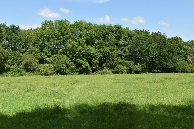
Butcher's Wood is a picturesque forest located in Sussex, England. Spanning approximately 100 acres, this woodland area is renowned for its natural beauty and diverse range of flora and fauna.

The wood is characterized by its dense canopies of towering trees, including oak, beech, and birch. These majestic trees create a lush and vibrant environment, providing a haven for various wildlife species. Visitors to Butcher's Wood can expect to encounter a rich variety of birdlife, such as woodpeckers, nuthatches, and warblers, as well as small mammals like badgers, foxes, and squirrels.

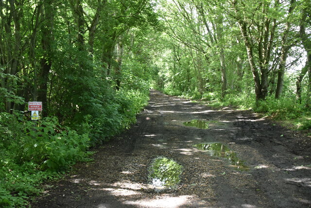
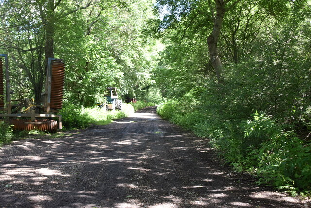
Tranquil walking paths wind through the forest, allowing visitors to immerse themselves in the peaceful ambiance and explore the wood at their own pace. The forest floor is carpeted with a tapestry of wildflowers and ferns, adding to the enchanting atmosphere.

Butcher's Wood also holds historical significance, as it is believed to have been a part of the ancient Forest of Andredsweald, which covered much of the Wealden area in ancient times. The wood is home to several archaeological sites, including old boundary banks and ditches, providing glimpses into its past.

The forest is maintained by local conservation organizations, ensuring the preservation of its unique ecosystem. It is a popular destination for nature enthusiasts, hikers, and families seeking a peaceful retreat in the heart of Sussex. Butcher's Wood truly offers a captivating experience, where visitors can connect with nature and appreciate the wonders of the natural world.

If you have any feedback on the listing, please let us know in the comments section below.

Butcher's Wood Images

Images are sourced within 2km of 50.975565/0.076673808 or Grid Reference TQ4521. Thanks to Geograph Open Source API. All images are credited.

Owlsbury Cottages
Owlsbury Cottages
Cattle grazing
Cattle grazing
Owlsbury Cottages
Owlsbury Cottages
Owlsbury Wood
Owlsbury Wood
Owlsbury Wood
Owlsbury Wood
Footpath across field
Dismantled railway line The Wealden line ran from Tunbridge Wells to Lewes via Uckfield. The line was built in between 1846 & 1858. Most of the line has now closed to regular services. Lewes to Uckfield closed in 1969, Tunbridge Wells to Eridge closed in 1985. Eidge to Uckfield remains open as part of the Oxted line <a title="https://www.geograph.org.uk/snippet/4332" href="https://www.geograph.org.uk/snippet/4332">Link</a> . The Spa Valley Railway has re-opened the section between Tunbridge Wells West and Groombridge as a preservation line. Isfield station has been re-opened as the Lavender line.
Wikipedia: <span class="nowrap"><a title="http://en.wikipedia.org/wiki/Wealden_Line" rel="nofollow ugc noopener" href="http://en.wikipedia.org/wiki/Wealden_Line">Link</a><img style="margin-left:2px;" alt="External link" title="External link - shift click to open in new window" src="https://s1.geograph.org.uk/img/external.png" width="10" height="10"/></span>
Dismantled railway line
The Wealden line ran from Tunbridge Wells to Lewes via Uckfield. The line was built in between 1846 & 1858. Most of the line has now closed to regular services. Lewes to Uckfield closed in 1969, Tunbridge Wells to Eridge closed in 1985. Eidge to Uckfield remains open as part of the Oxted line Link . The Spa Valley Railway has re-opened the section between Tunbridge Wells West and Groombridge as a preservation line. Isfield station has been re-opened as the Lavender line. Wikipedia: LinkExternal link
Owlsbury Farm
Owlsbury Farm
Dismantled railway line The Wealden line ran from Tunbridge Wells to Lewes via Uckfield. The line was built in between 1846 & 1858. Most of the line has now closed to regular services. Lewes to Uckfield closed in 1969, Tunbridge Wells to Eridge closed in 1985. Eidge to Uckfield remains open as part of the Oxted line <a title="https://www.geograph.org.uk/snippet/4332" href="https://www.geograph.org.uk/snippet/4332">Link</a> . The Spa Valley Railway has re-opened the section between Tunbridge Wells West and Groombridge as a preservation line. Isfield station has been re-opened as the Lavender line.
Wikipedia: <span class="nowrap"><a title="http://en.wikipedia.org/wiki/Wealden_Line" rel="nofollow ugc noopener" href="http://en.wikipedia.org/wiki/Wealden_Line">Link</a><img style="margin-left:2px;" alt="External link" title="External link - shift click to open in new window" src="https://s1.geograph.org.uk/img/external.png" width="10" height="10"/></span>
Dismantled railway line
The Wealden line ran from Tunbridge Wells to Lewes via Uckfield. The line was built in between 1846 & 1858. Most of the line has now closed to regular services. Lewes to Uckfield closed in 1969, Tunbridge Wells to Eridge closed in 1985. Eidge to Uckfield remains open as part of the Oxted line Link . The Spa Valley Railway has re-opened the section between Tunbridge Wells West and Groombridge as a preservation line. Isfield station has been re-opened as the Lavender line. Wikipedia: LinkExternal link
Former Signal Box at Uckfield, Sussex Formerly a significant intermediate station on the London- Lewes branch line (via Oxted). The route now terminates at Uckfield; with the new station out of picture, to the right. A taxi company is now based in this building.
Former Signal Box at Uckfield, Sussex
Formerly a significant intermediate station on the London- Lewes branch line (via Oxted). The route now terminates at Uckfield; with the new station out of picture, to the right. A taxi company is now based in this building.
Train at Uckfield Station, Sussex The end of the line; which runs to London, via Oxted. Whilst many trains run through to London; this one was shortly to depart, for Oxted, to connect with a service from East Grinstead.
Train at Uckfield Station, Sussex
The end of the line; which runs to London, via Oxted. Whilst many trains run through to London; this one was shortly to depart, for Oxted, to connect with a service from East Grinstead.
Sculpture at Uckfield, Sussex Sculpture of a Town Crier, located close to the bridge over the River Uck.
Sculpture at Uckfield, Sussex
Sculpture of a Town Crier, located close to the bridge over the River Uck.
Morris 1000 Traveller, Uckfield, Sussex A fine survivor, some 45 years old.
Morris 1000 Traveller, Uckfield, Sussex
A fine survivor, some 45 years old.
Morris 1000 Traveller, Uckfield, Sussex At some stage in its 45 year life, some of the timbers have been replaced on the car. Timber rot was always a problem with this model, especially if left out in all weathers.
Morris 1000 Traveller, Uckfield, Sussex
At some stage in its 45 year life, some of the timbers have been replaced on the car. Timber rot was always a problem with this model, especially if left out in all weathers.
London Road, Ringles Cross, Sussex Looking in the direction of Uckfield. The town sign can be seen, to the right of picture.
London Road, Ringles Cross, Sussex
Looking in the direction of Uckfield. The town sign can be seen, to the right of picture.
Road Junction at Ringles Cross, Sussex The junction of London Road with Coopers Green Road.
Road Junction at Ringles Cross, Sussex
The junction of London Road with Coopers Green Road.
Brown Lane, Uckfield, Sussex Looking in the direction of the water tower, from London Road.
Brown Lane, Uckfield, Sussex
Looking in the direction of the water tower, from London Road.
The Old Chapel, Uckfield, Sussex This chapel was re-built in the 1880s, but was built nearly 100 years earlier. To the left of picture, is the Veterinary Centre in Henley House.
The Old Chapel, Uckfield, Sussex
This chapel was re-built in the 1880s, but was built nearly 100 years earlier. To the left of picture, is the Veterinary Centre in Henley House.
Show me another place!

Butcher's Wood is located at Grid Ref: TQ4521 (Lat: 50.975565, Lng: 0.076673808)

Administrative County: East Sussex

District: Wealden

Police Authority: Sussex

What 3 Words

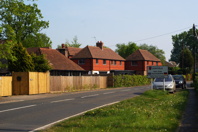
///traps.regularly.symphonic. Near Uckfield, East Sussex

Related Wikis

West Park, Uckfield

West Park is a 10.5-hectare (26-acre) Local Nature Reserve on the western outskirts of Uckfield in East Sussex. It is owned and managed by Uckfield Town...

Copping Hall

Copping Hall is a Grade II* listed house in Uckfield, East Sussex, England. It is located at 1 Pudding Cake Lane, Uckfield, East Sussex TN22 1BT. Built...

Uckfield railway station

Uckfield railway station is the southern terminus of a branch of the Oxted Line in England, serving the town of Uckfield, East Sussex. It is 46 miles 8...

Uckfield Baptist Church

Uckfield Baptist Church is a Baptist congregation based in the town of Uckfield in East Sussex, England. Although services now take place in a school...

Piltdown Man

The Piltdown Man was a paleoanthropological fraud in which bone fragments were presented as the fossilised remains of a previously unknown early human...

Uckfield Town F.C.

Uckfield Town F.C. was a football club based in Uckfield, East Sussex, England. For their final season, 2013–14, they were members of the Sussex County...

Hempstead Meadow

Hempstead Meadow is a 1.6-hectare (4.0-acre) Local Nature Reserve in Uckfield in East Sussex. It is owned and managed by Uckfield Town Council.The site...

Uckfield

Uckfield () is a town in the Wealden District of East Sussex in South East England. The town is on the River Uck, one of the tributaries of the River Ouse...

Nearby Amenities

Located within 500m of 50.975565,0.076673808
Barrier: stile
Lat/Long: 50.9754462/0.0827353
Barrier: kissing_gate
Lat/Long: 50.9751283/0.0802767
Addr City: Uckfield
Addr Housename: Old Copwood
Addr Postcode: TN22 3PT
Addr Street: Rocks Road
Building: house
Fhrs Id: 164358
Source: OS_OpenData_StreetView
Source Addr: FDRS Open Data
Lat/Long: 50.9715246/0.0763196
Barrier: kissing_gate
Lat/Long: 50.975252/0.0814478
Barrier: kissing_gate
Lat/Long: 50.975028/0.0802632
Footpath
Information: guidepost
Operator: East Sussex County Council
Tourism: information
Lat/Long: 50.9750178/0.0795319
Barrier: stile
Lat/Long: 50.9749965/0.0794925
Tourism: viewpoint
Lat/Long: 50.9756778/0.082512
Barrier: wall
Lat/Long: 50.9751476/0.0809978
Generator Method: photovoltaic
Generator Orientation: 120
Generator Output Electricity: yes
Generator Solar Modules: 16
Generator Source: solar
Generator Type: solar_photovoltaic_panel
Location: roof
Power: generator
Lat/Long: 50.9741709/0.0833818
Barrier: stile
Lat/Long: 50.9795451/0.0772973
Ford: yes
Lat/Long: 50.9789972/0.0754799
Footpath
Information: guidepost
Operator: East Sussex County Council
Tourism: information
Lat/Long: 50.9777379/0.0767144
Footpath
Information: guidepost
Operator: East Sussex County Council
Tourism: information
Lat/Long: 50.9776021/0.0769998
Footpath
Information: guidepost
Operator: East Sussex County Council
Tourism: information
Lat/Long: 50.9762706/0.0790212
Public Footpath
Information: guidepost
Tourism: information
Lat/Long: 50.9758085/0.0798816
Barrier: stile
Lat/Long: 50.9787086/0.0756338
Ford: yes
Lat/Long: 50.9722603/0.0812568
The data included in this document is from www.openstreetmap.org. The data is made available under ODbL.

Have you been to Butcher's Wood?

Leave your review of Butcher's Wood below (or comments, questions and feedback).