Cauk Wood
Wood, Forest in Kent Sevenoaks
England
Cauk Wood

Cauk Wood, located in Kent, England, is a charming and picturesque forest that attracts nature enthusiasts and outdoor lovers alike. Covering an area of approximately 200 acres, this woodland is known for its lush greenery, diverse wildlife, and tranquil atmosphere.
The wood is predominantly made up of native broadleaf trees, with species such as oak, beech, and birch dominating the landscape. These tall, majestic trees create a dense canopy that provides shade and shelter to a wide range of flora and fauna.
Walking through Cauk Wood, visitors can expect to encounter a variety of wildlife, including squirrels, rabbits, deer, and a plethora of bird species. The forest's rich biodiversity is a testament to its well-preserved ecosystem and the efforts of local conservationists.
There are several well-maintained walking trails that wind through the wood, offering visitors the opportunity to explore its natural beauty at their own pace. These paths lead to hidden clearings, babbling brooks, and beautiful viewpoints, providing ample opportunities for photography and moments of tranquility.
Cauk Wood is a popular destination for families, hikers, and nature lovers, as it offers a peaceful retreat away from the hustle and bustle of everyday life. Its accessibility and well-marked trails make it suitable for visitors of all ages and abilities.
Overall, Cauk Wood in Kent is a true gem of natural beauty, offering a peaceful and serene environment for individuals to connect with nature and appreciate the wonders of the British countryside.
If you have any feedback on the listing, please let us know in the comments section below.
Cauk Wood Images
Images are sourced within 2km of 51.202749/0.08607409 or Grid Reference TQ4546. Thanks to Geograph Open Source API. All images are credited.


Cauk Wood is located at Grid Ref: TQ4546 (Lat: 51.202749, Lng: 0.08607409)
Administrative County: Kent
District: Sevenoaks
Police Authority: Kent
What 3 Words
///acute.name.visual. Near Edenbridge, Kent
Nearby Locations
Related Wikis
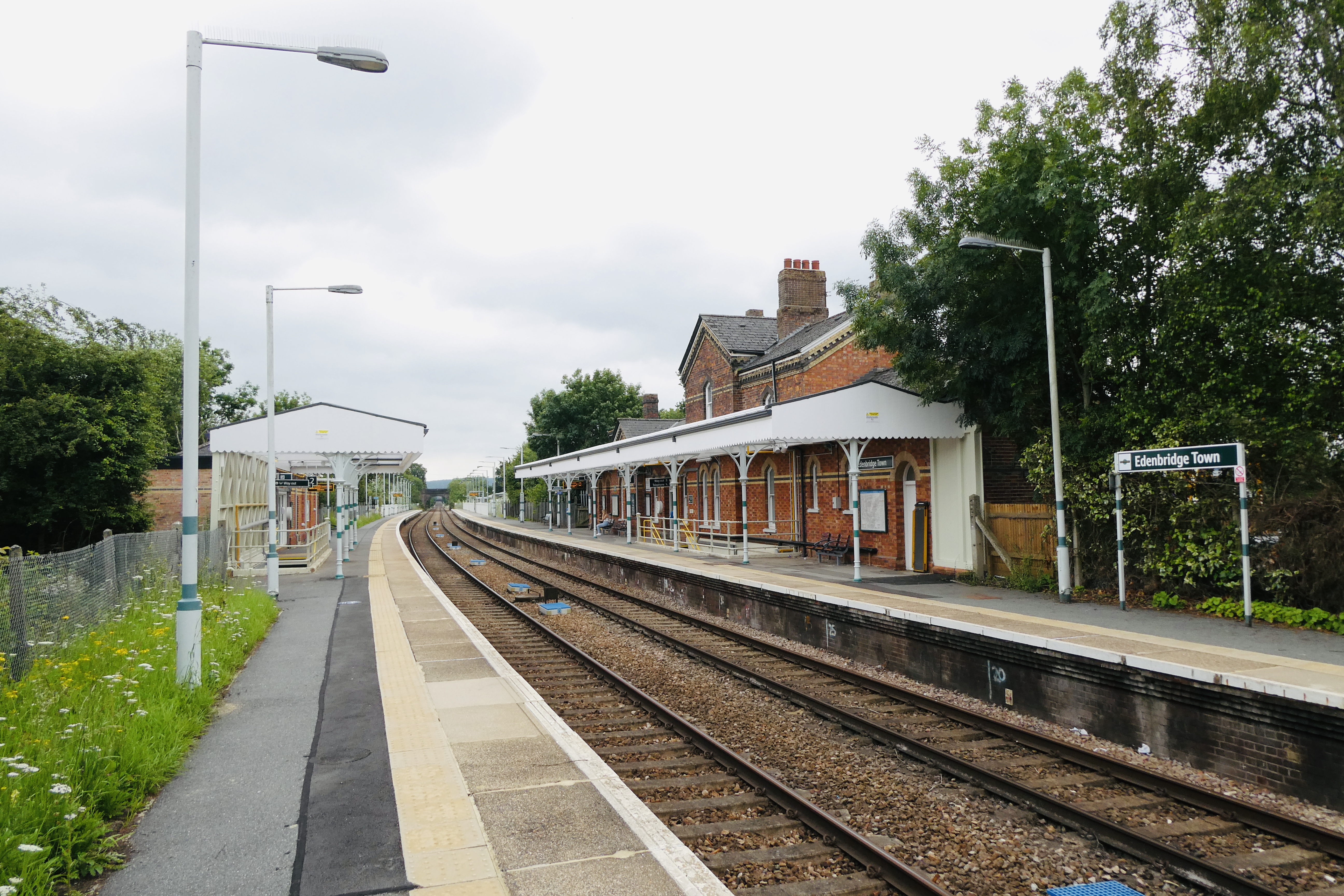
Edenbridge Town railway station
Edenbridge Town railway station is one of two stations serving Edenbridge in Kent, England. The station, and all trains serving it, are operated by Southern...
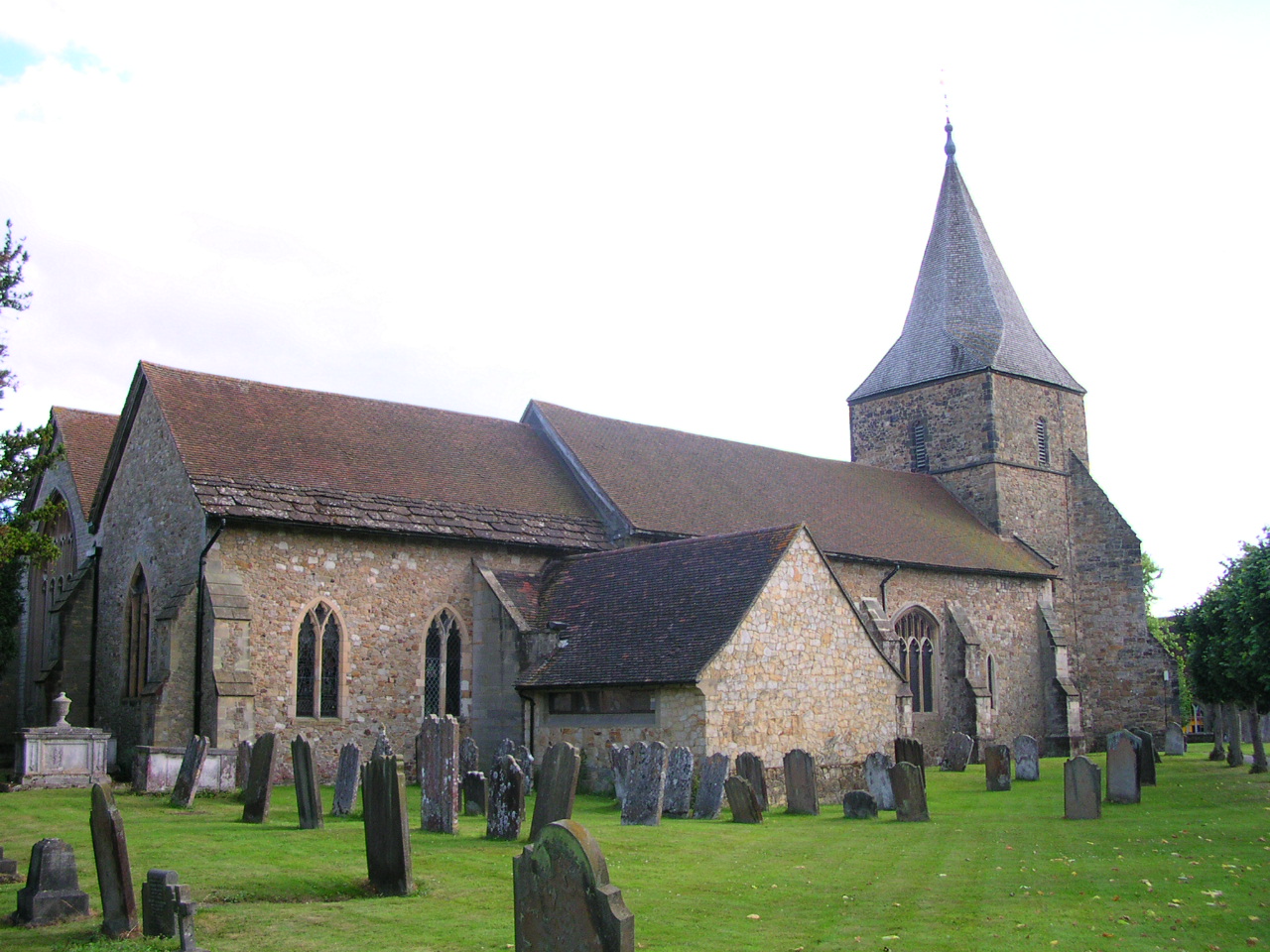
Church of St Peter and St Paul, Edenbridge
The Anglican Church of St Peter and St Paul in Edenbridge, Kent, England was built in the late 11th or early 12th century. It is a Grade I listed building...

Edenbridge, Kent
Edenbridge is a town and civil parish in the Sevenoaks district of Kent, England. Its name derives from Old English Eadhelmsbrigge (meaning "Eadhelm's...

Eden Valley Museum
The Eden Valley Museum is a local history museum in the market town of Edenbridge, Kent in England. The museum is housed within a Grade II* listed medieval...

How Green House
How Green House is an architecturally important Arts and Crafts movement style country house near Hever in the Sevenoaks District of Kent. It was designed...

Jaques of London
Jaques of London, formerly known as John Jaques of London and Jaques and Son of London is a long-established family company that manufactures sports and...

Four Elms
Four Elms is a village within the civil parish of Hever in the Sevenoaks District of Kent, England. The village is located on a crossroads between Edenbridge...

Edenbridge railway station
Edenbridge railway station is one of two stations serving Edenbridge in Kent, England. It is 33 miles 3 chains (33.04 miles, 53.17 km) measured from London...
Nearby Amenities
Located within 500m of 51.202749,0.08607409Have you been to Cauk Wood?
Leave your review of Cauk Wood below (or comments, questions and feedback).