The Larches

Wood, Forest in Kent

England

The Larches

Day nursery, Queen Mary's Hospital, Sidcup, Kent Queen Mary's is a very large hospital, so this purpose-built day nursery is provided where doctors, nurses and other staff can leave babies and small children to be looked after during the day.
And that, I believe, concludes the TQ47 hectad, to which I have contributed, by my reckoning, 64 first geographs.  No prizes, I know - it's been hard work, but very, very enjoyable!  See you soon in TQ46!
Day nursery, Queen Mary's Hospital, Sidcup, Kent Credit: Dr Neil Clifton

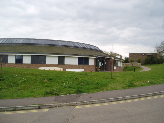
The Larches is a picturesque woodland located in Kent, England. Spread over a sprawling area, this forest is known for its lush greenery and diverse range of trees, particularly the larch trees that give the woodland its name. The forest is easily accessible, situated just a short distance from the town center.

The woodland is a popular spot for nature lovers and outdoor enthusiasts, offering a tranquil escape from the hustle and bustle of city life. The forest boasts a well-maintained network of walking trails, allowing visitors to explore its beauty at their own pace. These trails wind through the dense foliage, providing breathtaking views of the surrounding landscape.

The Larches is home to a variety of wildlife, making it a haven for nature enthusiasts. Birdwatchers can spot a wide range of avian species, including woodpeckers, owls, and various songbirds. Squirrels and rabbits are also commonly seen darting through the undergrowth, adding to the woodland's charm.

The forest is particularly enchanting during the autumn months when the larch trees showcase a vibrant display of golden and orange hues. The changing foliage creates a magical atmosphere, attracting photographers and artists seeking inspiration.

For those seeking a peaceful retreat or a scenic spot for a leisurely picnic, The Larches in Kent is an ideal destination. Its natural beauty and serene ambiance make it a must-visit location for anyone looking to immerse themselves in the tranquility of nature.

If you have any feedback on the listing, please let us know in the comments section below.

The Larches Images

Images are sourced within 2km of 51.406702/0.085608972 or Grid Reference TQ4569. Thanks to Geograph Open Source API. All images are credited.

Day nursery, Queen Mary's Hospital, Sidcup, Kent Queen Mary's is a very large hospital, so this purpose-built day nursery is provided where doctors, nurses and other staff can leave babies and small children to be looked after during the day.
And that, I believe, concludes the TQ47 hectad, to which I have contributed, by my reckoning, 64 first geographs.  No prizes, I know - it's been hard work, but very, very enjoyable!  See you soon in TQ46!
Day nursery, Queen Mary's Hospital, Sidcup, Kent
Queen Mary's is a very large hospital, so this purpose-built day nursery is provided where doctors, nurses and other staff can leave babies and small children to be looked after during the day. And that, I believe, concludes the TQ47 hectad, to which I have contributed, by my reckoning, 64 first geographs. No prizes, I know - it's been hard work, but very, very enjoyable! See you soon in TQ46!
Sayes Court Road, St Mary Cray Houses on Sayes Court Road in St Mary Cray, in the outer suburbs of South East London.
Sayes Court Road, St Mary Cray
Houses on Sayes Court Road in St Mary Cray, in the outer suburbs of South East London.
Houses on Leesons Hill, St Mary Cray Houses on Leesons Hill, in St Mary Cray in the outer suburbs of south east London.

This image was taken at around midday on a very sunny October day.  The shadows are nevertheless longer than during the summer months, as the sun is lower in the sky.
Houses on Leesons Hill, St Mary Cray
Houses on Leesons Hill, in St Mary Cray in the outer suburbs of south east London. This image was taken at around midday on a very sunny October day. The shadows are nevertheless longer than during the summer months, as the sun is lower in the sky.
Chislehurst Outside the railway station, a promotional vehicle for a nearby restaurant.
Chislehurst
Outside the railway station, a promotional vehicle for a nearby restaurant.
The Ramblers Rest Located beside the A222, on Summer Hill, Chislehurst.
The Ramblers Rest
Located beside the A222, on Summer Hill, Chislehurst.
The Ramblers Rest Located beside the A222, on Summer Hill, Chislehurst.
The Ramblers Rest
Located beside the A222, on Summer Hill, Chislehurst.
The Prince Imperial Monument Napoléon, Prince Imperial (Napoléon Eugène Louis Jean Joseph Bonaparte; 16 March 1856 – 1 June 1879). After his father was dethroned in 1870, he moved with his family to England. On his father's death in January 1873, he was proclaimed by the Bonapartist faction as Napoleon IV. 

In England, he trained as a soldier. Keen to see action, he persuaded the British to allow him to participate in the Anglo-Zulu War. In 1879, serving with British forces, he was killed in a skirmish with a group of Zulus.
The Prince Imperial Monument
Napoléon, Prince Imperial (Napoléon Eugène Louis Jean Joseph Bonaparte; 16 March 1856 – 1 June 1879). After his father was dethroned in 1870, he moved with his family to England. On his father's death in January 1873, he was proclaimed by the Bonapartist faction as Napoleon IV. In England, he trained as a soldier. Keen to see action, he persuaded the British to allow him to participate in the Anglo-Zulu War. In 1879, serving with British forces, he was killed in a skirmish with a group of Zulus.
The Prince Imperial Monument Napoléon, Prince Imperial (Napoléon Eugène Louis Jean Joseph Bonaparte; 16 March 1856 – 1 June 1879). After his father was dethroned in 1870, he moved with his family to England. On his father's death in January 1873, he was proclaimed by the Bonapartist faction as Napoleon IV.

In England, he trained as a soldier. Keen to see action, he persuaded the British to allow him to participate in the Anglo-Zulu War. In 1879, serving with British forces, he was killed in a skirmish with a group of Zulus.
The Prince Imperial Monument
Napoléon, Prince Imperial (Napoléon Eugène Louis Jean Joseph Bonaparte; 16 March 1856 – 1 June 1879). After his father was dethroned in 1870, he moved with his family to England. On his father's death in January 1873, he was proclaimed by the Bonapartist faction as Napoleon IV. In England, he trained as a soldier. Keen to see action, he persuaded the British to allow him to participate in the Anglo-Zulu War. In 1879, serving with British forces, he was killed in a skirmish with a group of Zulus.
Bear hug sculpture seat, Scadbury Park
Junction of Sevenoaks Way and Midfield Way
Autumn leaves beside Midfield Way
Houses in Midfield Way
Grassy slope above Hoblingwell Wood
Leesons Hill
Leesons Hill
Commercial buildings seen across St Mary Cray station
Sloping verge beside Amherst Drive
Poverest Road
Poverest Road
Autumn sunlight in Petts Wood
Show me another place!

The Larches is located at Grid Ref: TQ4569 (Lat: 51.406702, Lng: 0.085608972)

Unitary Authority: Bromley

Police Authority: Metropolitan

What 3 Words

///affair.recall.cooks. Near Chislehurst, London

Related Wikis

Coopers School

Coopers School is a mixed secondary school with academy status in Chislehurst in the London Borough of Bromley, England. The current Head of School is...

Manor of Scadbury

Scadbury is a historic manor in the parish of Chislehurst in the London Borough of Bromley, England. Much of the estate is preserved today as Scadbury...

Scadbury Park

Scadbury Park is a Local Nature Reserve in Chislehurst in the London Borough of Bromley. It is also a Site of Metropolitan Importance for Nature Conservation...

Chislehurst

Chislehurst () is a suburban district of south-east London, England, in the London Borough of Bromley. It lies east of Bromley, south-west of Sidcup and...

Nearby Amenities

Located within 500m of 51.406702,0.085608972
Barrier: swing_gate
Height: 1.1
Locked: yes
Material: metal
Width: 2.9
Lat/Long: 51.4076856/0.0857573
Willett Memorial
Historic: memorial
Memorial: obelisk
Lat/Long: 51.4032364/0.0833298
Barrier: cycle_barrier
Height: 1.2
Material: metal
Width: 1.1
Lat/Long: 51.4088622/0.081499
Bus Stop
Brenchley Road
Naptan AtcoCode: 490004281W
Naptan Bearing: N
Naptan CommonName: Brenchley Road
Naptan Street: ST PAULS WOOD HILL
Naptan Verified: no
Public Transport: platform
Lat/Long: 51.4054256/0.0924562
Bus Stop
St Pauls Cray Road / Leesons Hill
Bench: yes
Bin: no
Bus: yes
Local Ref: DA
Naptan AtcoCode: 490009067N
Naptan Bearing: N
Naptan CommonName: Leesons Hill
Naptan Indicator: Stop
Naptan Street: ST PAUL'S CRAY ROAD
Naptan Verified: no
Public Transport: platform
Ref: 58484
Shelter: yes
Source Ref: naptan
Tactile Paving: no
Lat/Long: 51.402367/0.0863247
Bus Stop
Manor Park Road
Bench: yes
Bus: yes
Naptan AtcoCode: 490009572S
Naptan Bearing: N
Naptan CommonName: Manor Park RdSt Pauls Cray Rd
Naptan Street: ST PAUL'S CRAY ROAD
Naptan Verified: no
Public Transport: platform
Ref: 50099
Shelter: no
Source Ref: naptan
Tactile Paving: no
Lat/Long: 51.408475/0.0811713
Bus Stop
St Peter and St Paul School
Bench: yes
Bin: no
Lit: yes
Local Ref: DM
Naptan AtcoCode: 490012884E
Naptan Bearing: E
Naptan CommonName: St.Peter & St.Paul School
Naptan Street: ST PAUL'S WOOD HILL
Naptan Verified: no
Public Transport: platform
Shelter: yes
Tactile Paving: no
Lat/Long: 51.4039047/0.089652
Bus Stop
St Peter and St Paul School
Bench: yes
Bin: no
Local Ref: DG
Naptan AtcoCode: 490012884S
Naptan Bearing: S
Naptan CommonName: St.Peter & St.Paul School
Naptan Street: ST PAUL'S WOOD HILL
Naptan Verified: no
Public Transport: platform
Shelter: yes
Tactile Paving: no
Lat/Long: 51.4036787/0.0896935
Crossing
Lat/Long: 51.4041743/0.0900453
Petts Wood and Hawkwood Estate
Information: map
Tourism: information
Lat/Long: 51.4034217/0.0817495
Barrier: bollard
Bollard Count: 2
Height: 0.6
Material: wood
Lat/Long: 51.4073616/0.0838157
Bench
Backrest: yes
Direction: S
Material: wood
Seats: 3
Lat/Long: 51.404629/0.0869366
Barrier: yes
Lat/Long: 51.4047302/0.0797182
Bench
Backrest: no
Lat/Long: 51.4039413/0.0812431
Post Box
Collection Times: Mo-Fr 18:00, Sa 12:00
Operator: Royal Mail
Operator Wikidata: Q638098
Ref: BR5 415
Ref GB Uprn: 10015293398
Royal Cypher: EIIR
Royal Cypher Wikidata: Q33102113
Lat/Long: 51.4030756/0.0893616
Barrier: yes
Lat/Long: 51.4057899/0.0797616
Post Box
Collection Times: Mo-Fr 16:00, Sa 12:00
Operator: Royal Mail
Operator Wikidata: Q638098
Post Box Type: pillar
Ref: BR7 125
Royal Cypher: VR
Royal Cypher Wikidata: Q33102356
Lat/Long: 51.4072474/0.0794697
Access: private
Barrier: swing_gate
Lat/Long: 51.4073587/0.0840006
The Larches
Place: locality
Lat/Long: 51.4071436/0.0872147
Holbrook Wood
Place: locality
Lat/Long: 51.4081441/0.0858414
Man Made: surveillance
Lat/Long: 51.4082586/0.0801919
Information: guidepost
Tourism: information
Lat/Long: 51.407644/0.08566
Bench
Backrest: no
Direction: NW
Material: wood
Lat/Long: 51.407621/0.0857469
Waste Basket
Colour: green
Waste: dog_excrement
Lat/Long: 51.4075191/0.0855991
Barrier: kissing_gate
Depth: 1.3
Height: 1.4
Material: metal
Width: 1.3
Lat/Long: 51.4076723/0.0858133
Bench
Backrest: no
Direction: W
Material: wood
Lat/Long: 51.4084252/0.0864516
Bench
Backrest: no
Direction: E;W
Material: wood
Lat/Long: 51.4098523/0.0863577
Bench
Backrest: yes
Direction: W
Material: wood
Lat/Long: 51.4104688/0.086567
Information: board
Tourism: information
Lat/Long: 51.4105261/0.0865688
Barrier: bollard
Bollard Count: 3
Height: 0.6
Material: wood
Lat/Long: 51.4087184/0.0809046
Bench
Backrest: no
Direction: NE
Length: 1.9
Material: wood
Lat/Long: 51.4068316/0.0858877
Bench
Backrest: no
Direction: W
Length: 1.6
Material: wood
Lat/Long: 51.4071507/0.0857496
Barrier: swing_gate
Height: 1.1
Locked: yes
Material: metal
Width: 2.9
Lat/Long: 51.4074793/0.0855686
Barrier: kissing_gate
Depth: 1.3
Height: 1.2
Material: metal
Width: 1.0
Lat/Long: 51.4074736/0.0855947
Barrier: yes
Lat/Long: 51.4089526/0.0864137
Ref GB Tflcid: RWG195549
Traffic Calming: hump
Lat/Long: 51.4064109/0.0788523
Barrier: bollard
Bollard Count: 4
Height: 0.6
Material: wood
Lat/Long: 51.408765/0.0809885
Barrier: bollard
Bollard Count: 1
Height: 0.6
Material: wood
Lat/Long: 51.4087512/0.081022
Barrier: bollard
Bollard Count: 1
Height: 0.6
Material: wood
Lat/Long: 51.4081842/0.0820581
Barrier: cycle_barrier
Height: 0.7
Material: wood
Width: 1.3
Lat/Long: 51.4081858/0.0832886
Bench
Backrest: no
Direction: SW
Length: 1.4
Material: wood
Lat/Long: 51.40783/0.0834735
Barrier: bollard
Bollard Count: 2
Height: 0.8
Material: wood
Lat/Long: 51.4073118/0.0838775
Artwork Type: statue
Description: Bear 23
Material: SE
Note: Waypoint on Chislehurst Bear Trail
Tourism: artwork
Lat/Long: 51.4074803/0.0893913
Bench
Backrest: no
Direction: SE
Length: 1.6
Lat/Long: 51.4074531/0.0891539
Bench
Lat/Long: 51.4085339/0.0812656
Barrier: bollard
Bollard Count: 1
Height: 0.6
Material: wood
Lat/Long: 51.4087615/0.0811811
Barrier: cycle_barrier
Height: 1.2
Material: metal
Width: 1.0
Lat/Long: 51.4090651/0.0817504
Barrier: swing_gate
Locked: yes
Material: metal
Lat/Long: 51.4070415/0.0823792
Barrier: swing_gate
Bollard Count: 2
Height: 0.7
Material: wood
Lat/Long: 51.4070338/0.0823981
Information: board
Material: wood
Tourism: information
Lat/Long: 51.404094/0.090178
Fixme: Where does this connect to the east?
Lat/Long: 51.405785/0.0855625
Barrier: bollard
Lat/Long: 51.4057917/0.0854713
Waste Basket
Lat/Long: 51.4043687/0.0886524
Barrier: bollard
Material: wood
Lat/Long: 51.4042331/0.0899023
The data included in this document is from www.openstreetmap.org. The data is made available under ODbL.

Have you been to The Larches?

Leave your review of The Larches below (or comments, questions and feedback).