Fairmile
Settlement in Hampshire
England
Fairmile
Fairmile is a small village located in the county of Hampshire, in southern England. Situated approximately 4 miles southeast of the town of Henley-on-Thames, Fairmile boasts a picturesque setting surrounded by rolling countryside and woodland areas.
The village is primarily residential, with a population of around 500 people. It is characterized by its charming cottages and traditional English architecture, which adds to its overall rustic charm. The village is well-connected to nearby towns and cities, with good road links to Henley-on-Thames and the larger towns of Reading and Oxford.
Fairmile is also known for its strong sense of community, with various social activities and events organized throughout the year. The village hall serves as a hub for these activities, hosting regular gatherings, clubs, and classes for residents of all ages.
Nature enthusiasts will find plenty to explore in Fairmile, as the village is surrounded by beautiful countryside and offers numerous walking and cycling trails. The nearby Chiltern Hills provide stunning views and opportunities for outdoor recreation.
Although small in size, Fairmile offers basic amenities, including a local convenience store and a village pub, where residents and visitors can enjoy a drink or a meal. For more extensive shopping and entertainment options, the nearby towns of Henley-on-Thames and Reading are easily accessible.
Overall, Fairmile is a tranquil and welcoming village, ideal for those seeking a peaceful rural retreat while still being within reach of larger towns and cities.
If you have any feedback on the listing, please let us know in the comments section below.
Fairmile Images
Images are sourced within 2km of 50.74581/-1.7888624 or Grid Reference SZ1494. Thanks to Geograph Open Source API. All images are credited.


Fairmile is located at Grid Ref: SZ1494 (Lat: 50.74581, Lng: -1.7888624)
Unitary Authority: Bournemouth, Christchurch and Poole
Police Authority: Dorset
What 3 Words
///free.rocky.glare. Near Christchurch, Dorset
Nearby Locations
Related Wikis
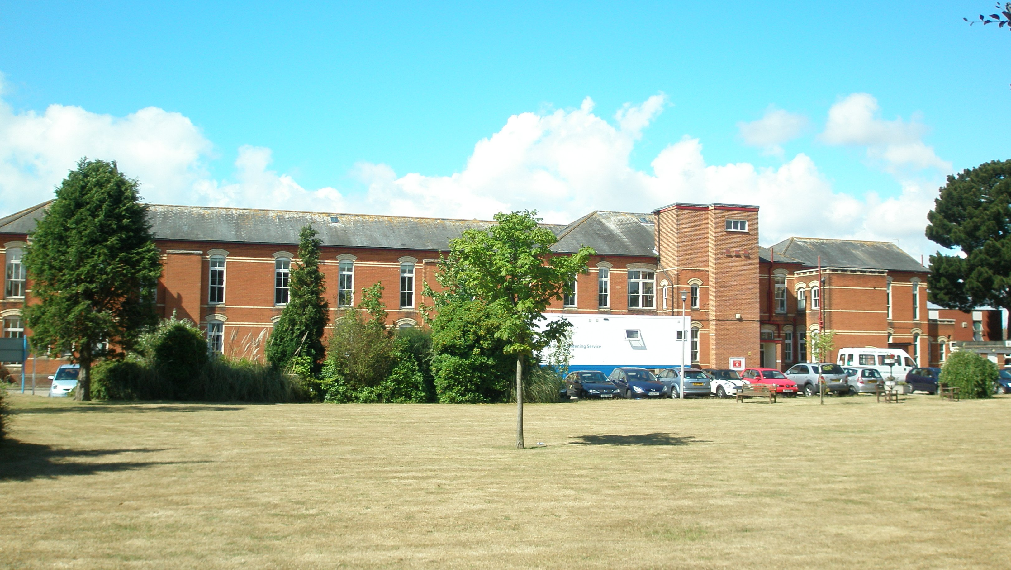
Christchurch Hospital, Dorset
Christchurch Hospital is run by the University Hospitals Dorset NHS Foundation Trust. It is located in Fairmile in Christchurch, Dorset, England. The hospital...

Christchurch railway station (1862–1886)
Christchurch was a railway station in Christchurch in Dorset, England. It was opened on 13 November 1862 by the Ringwood, Christchurch and Bournemouth...

Christchurch railway station (England)
Christchurch railway station serves the town of Christchurch in Dorset, England. The station is on the London Waterloo to Weymouth line operated by South...

St Catherine's Hill, Dorset
St Catherine's Hill is a 53-metre (174 ft) hill in the borough of Christchurch which, together with Ramsdown and Blackwater hills, forms a ridge between...
Twynham School
Twynham School (formerly Twynham Comprehensive School) is a coeducational secondary school and sixth form located in Christchurch, Dorset, England and...
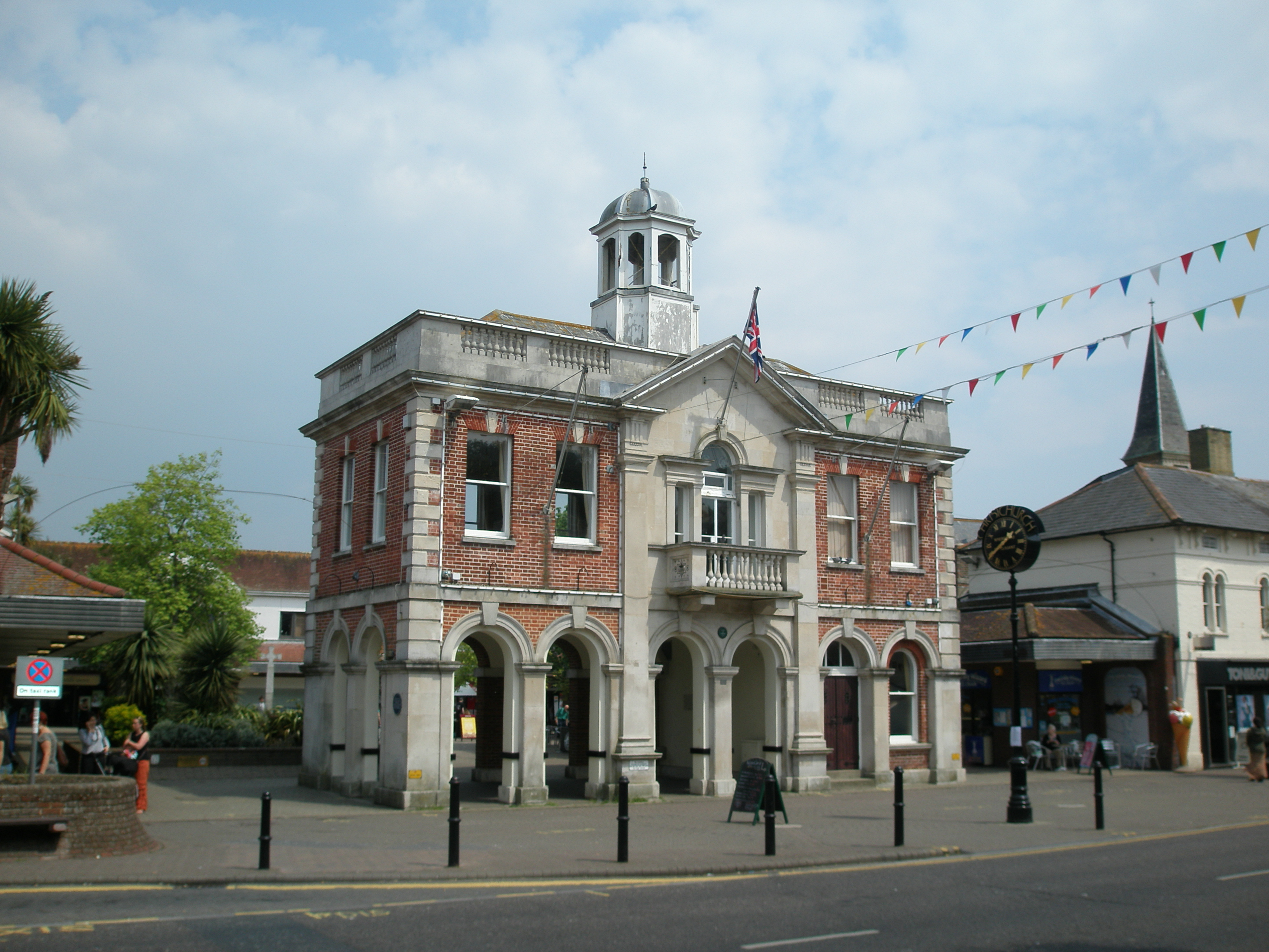
The Town Hall, Christchurch
The Town Hall, Christchurch is a municipal building in Christchurch, Dorset, England. The building, which incorporates a room known as the mayor's parlour...
Iford, Dorset
Iford () is a suburb of Bournemouth, situated in the eastern part of the borough. It is also known as a bridging point over the River Stour, connecting...
Tucktonia
Tucktonia was a late 1970s theme park located on Stour Road, Christchurch, Dorset, England. It was officially opened on 23 May 1976 by Arthur Askey. It...
Nearby Amenities
Located within 500m of 50.74581,-1.7888624Have you been to Fairmile?
Leave your review of Fairmile below (or comments, questions and feedback).