Netteswell Plantation

Wood, Forest in Essex Harlow

England

Netteswell Plantation

Sainsbury's supermarket car park, Harlow In front of the supermarket, a cycle path crosses the car park on a bridge.
Sainsbury's supermarket car park, Harlow Credit: Christopher Hilton

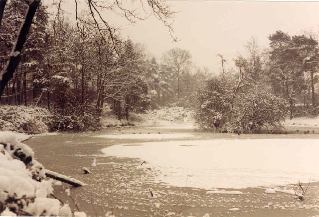
Netteswell Plantation is a picturesque woodland located in Essex, England. Covering an area of approximately 200 acres, it is a popular destination for nature enthusiasts and walkers alike.

The plantation is primarily composed of a variety of deciduous and coniferous trees, creating a diverse and vibrant ecosystem. Oak, beech, and birch trees dominate the landscape, while Douglas fir and Scots pine can also be found scattered throughout the woodland. This mix of tree species provides a rich habitat for a wide range of flora and fauna.

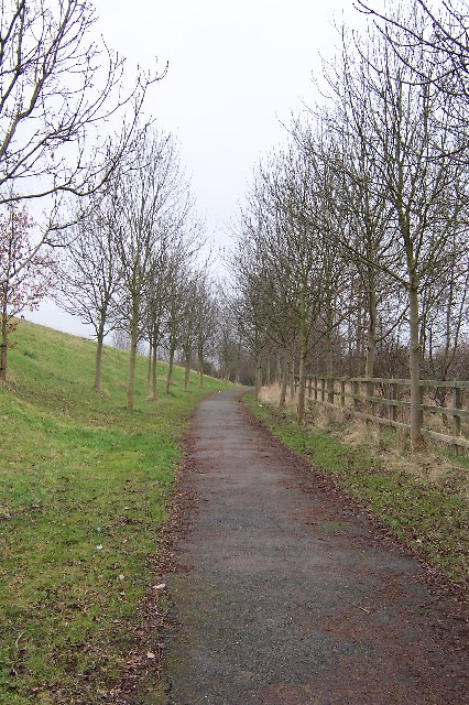
Traversing through Netteswell Plantation, visitors will find a network of well-maintained footpaths and trails, making it an ideal location for leisurely strolls or more adventurous hikes. The paths wind through the trees, allowing visitors to immerse themselves in the tranquility of nature. Along the way, there are several benches and picnic areas, providing opportunities for visitors to relax and enjoy the surroundings.

Wildlife is abundant within the plantation. Birdwatchers can spot a variety of species, including woodpeckers, thrushes, and finches, while small mammals like squirrels and hedgehogs can be glimpsed scurrying among the undergrowth. In spring, the woodland floor is carpeted with bluebells, creating a stunning display of color.

Netteswell Plantation is managed by the local authorities, ensuring the preservation and conservation of the woodland. The plantation is open to the public year-round and offers a peaceful escape from the hustle and bustle of urban life. Whether it's for a leisurely walk, wildlife spotting, or simply enjoying the natural beauty, Netteswell Plantation is a hidden gem waiting to be explored.

If you have any feedback on the listing, please let us know in the comments section below.

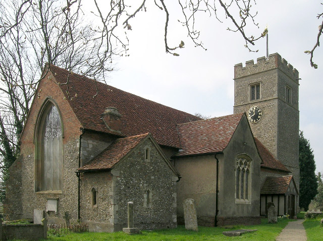
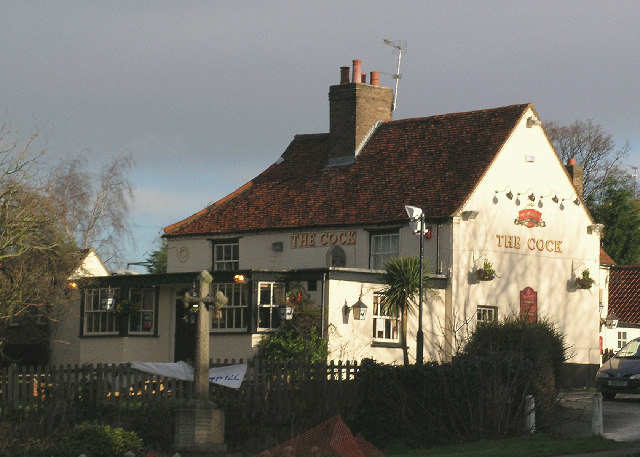
Netteswell Plantation Images

Images are sourced within 2km of 51.76552/0.099223311 or Grid Reference TL4409. Thanks to Geograph Open Source API. All images are credited.

Sainsbury's supermarket car park, Harlow In front of the supermarket, a cycle path crosses the car park on a bridge.
Sainsbury's supermarket car park, Harlow
In front of the supermarket, a cycle path crosses the car park on a bridge.
Offices overlooking supermarket car park, Harlow
Harlow industrial area: Burnt Mill Burnt Mill is a road lined with light industrial premises in the area along the northern edge of Harlow.
On the right, the distribution centre for Faber Music.
Harlow industrial area: Burnt Mill
Burnt Mill is a road lined with light industrial premises in the area along the northern edge of Harlow. On the right, the distribution centre for Faber Music.
River Stort outside the Moorhen pub, Burnt Mill Lane, Harlow
Church of St. Mary the Virgin, Great Parndon, Harlow, Essex Not far from 'The Cock' Public House
Church of St. Mary the Virgin, Great Parndon, Harlow, Essex
Not far from 'The Cock' Public House
'The Cock' Public House, Great Parndon, Harlow, Essex
Oakwood Pond, Harlow in Winter Oakwood Pond and the surrounding wood is one of the many "nature" or green areas in Harlow New Town, thus preserving wildlife for the residents
Oakwood Pond, Harlow in Winter
Oakwood Pond and the surrounding wood is one of the many "nature" or green areas in Harlow New Town, thus preserving wildlife for the residents
Winter Avenue of Trees, Jean McAlpine Park, Harlow Jean McAlpine Park is a landscaped land-fill site in Harlow. It is an area which provides good habitat for wildlife.
Winter Avenue of Trees, Jean McAlpine Park, Harlow
Jean McAlpine Park is a landscaped land-fill site in Harlow. It is an area which provides good habitat for wildlife.
Bishopsfield estate, Harlow This is the Podium area of Bishopsfield.
Bishopsfield estate, Harlow
This is the Podium area of Bishopsfield.
Looking South from Bishopsfield. This was taken from one of the many high points in Bishopsfield and shows the view towards Epping.
Looking South from Bishopsfield.
This was taken from one of the many high points in Bishopsfield and shows the view towards Epping.
Blueprint of Bishopsfield This is why Bishopsfield was nicknamed the HORSESHOE estate for many years.
Blueprint of Bishopsfield
This is why Bishopsfield was nicknamed the HORSESHOE estate for many years.
The Playhouse, Harlow The Playhouse, Harlow was open in November 1971 and provides a wide and varied range of entertainment for theatre goers.
The Playhouse, Harlow
The Playhouse, Harlow was open in November 1971 and provides a wide and varied range of entertainment for theatre goers.
St. Paul's church, Harlow New Town, Essex This is the main church of Harlow New Town, designed by Humphrys and Hurst.
St. Paul's church, Harlow New Town, Essex
This is the main church of Harlow New Town, designed by Humphrys and Hurst.
Staple Tye Shopping Centre, Harlow New Town, Essex
The Clock Tower The Clock Tower by the Clock Tower Roundabout.
The Clock Tower
The Clock Tower by the Clock Tower Roundabout.
Brays Grove School Brays Grove is a mixed secondary school of non denomination.
Brays Grove School
Brays Grove is a mixed secondary school of non denomination.
St. Andrews Community Learning Centre This pretty little church is now being used as a learning centre.
St. Andrews Community Learning Centre
This pretty little church is now being used as a learning centre.
St Andrews Community learning Centre This church building is now used as a learning centre. The Black building on the right is The Hummingbird Public House.
St Andrews Community learning Centre
This church building is now used as a learning centre. The Black building on the right is The Hummingbird Public House.
Show me another place!

Netteswell Plantation is located at Grid Ref: TL4409 (Lat: 51.76552, Lng: 0.099223311)

Administrative County: Essex

District: Harlow

Police Authority: Essex

What 3 Words

///fingernails.vision.sulk. Near Harlow, Essex

Related Wikis

St Mark's West Essex Catholic School

St Mark's West Essex Catholic School is a Roman Catholic secondary school and sixth form with academy status located in Harlow, Essex, England. The school...

BMAT STEM Academy

BMAT STEM Academy is a University Technical College within the Harlow College campus in Harlow, Essex, England, which opened in September 2014 as Sir Charles...

Harlow College

Harlow College is a further education college in Harlow, Essex, England. This medium-sized college has 5,900 students as of 2018 of which 2,585 are on...

Harlow (UK Parliament constituency)

Harlow is a constituency represented in the House of Commons of the UK Parliament since 2010 by Robert Halfon, a Conservative. == Constituency profile... ==

The Square, Harlow

The Square was a 250 capacity independent live music venue in Harlow, Essex, England. It was managed by SquareOne Entertainment LLP who took over the venue...

Harlow Jewish Community

Harlow Jewish Community, a member of the Movement for Reform Judaism, is a Reform Jewish congregation whose synagogue is at Harberts Road, Harlow, in Essex...

Princess Alexandra Hospital, Harlow

The Princess Alexandra Hospital is an acute general hospital in Harlow, Essex, England. It is managed by the Princess Alexandra Hospital NHS Trust. �...

Harlow Sportcentre

Harlow Sportcentre was a cricket ground in Harlow, Essex. The first recorded match on the ground was in 1964, when the Essex Second XI played the Warwickshire...

Nearby Amenities

Located within 500m of 51.76552,0.099223311
Harlow
Name Af: Harlow
Name Ar: هارلو
Name Arz: هارلو
Name Azb: هارلو
Name Be: Харлау
Name Bg: Харлоу
Name Br: Harlow
Name Ca: Harlow
Name Ceb: Harlow
Name Cs: Harlow
Name Cy: Harlow
Name Da: Harlow
Name De: Harlow
Name En: Harlow
Name Es: Harlow
Name Fa: هارلو
Name Fr: Harlow
Name Ga: Harlow
Name Id: Harlow
Name It: Harlow
Name Ja: ハーロウ
Name Ko: 할로
Name Kw: Harlow
Name Nan: Harlow
Name Nl: Harlow
Name Nn: Harlow
Name No: Harlow
Name Pl: Harlow
Name Pt: Harlow
Name Ro: Harlow
Name Ru: Харлоу
Name Sh: Harlow
Name Sv: Harlow
Name Szl: Harlow
Name Tr: Harlow
Name Tt: Һарлоу
Name Ur: ہارلو
Name Vo: Harlow
Name Yue: 哈勞
Name Zh: 哈洛
Place: town
Wikidata: Q852729
Wikipedia: en:Harlow
Lat/Long: 51.7676194/0.0974893
Created By: YahooApplet 1.0
Lat/Long: 51.7690651/0.1035374
Noexit: yes
Lat/Long: 51.7681555/0.1017135
Noexit: yes
Lat/Long: 51.7692394/0.1030063
Noexit: yes
Lat/Long: 51.7668521/0.0927097
Bus Stop
St. Marks School
Bus: yes
Naptan AtcoCode: 1500IM1410
Naptan Bearing: N
Naptan CommonName: St. Marks School
Naptan Indicator: Opp
Naptan Landmark: St. Marks School
Naptan NaptanCode: esxapmta
Naptan PlusbusZoneRef: HRLWTWN
Naptan Street: Tripton Road
Naptan Verified: no
Public Transport: platform
Source: naptan_import
Lat/Long: 51.7653994/0.1046645
Bus Stop
St. Marks School
Bus: yes
Naptan AtcoCode: 1500IM1410B
Naptan Bearing: S
Naptan CommonName: St. Marks School
Naptan Indicator: o/s
Naptan Landmark: St. Marks School
Naptan NaptanCode: esxapmpw
Naptan PlusbusZoneRef: HRLWTWN
Naptan Street: Tripton Road
Naptan Verified: no
Public Transport: platform
Source: naptan_import
Lat/Long: 51.7652525/0.1048316
Leisure Centre
Naptan AtcoCode: 1500LEISCEN1
Naptan Bearing: W
Naptan BusStopType: CUS
Naptan CommonName: Leisure Centre
Naptan Crossing: Third Avenue
Naptan Indicator: Opp
Naptan Landmark: Leisure Centre
Naptan NaptanCode: esxjdpwa
Naptan PlusbusZoneRef: HRLWTWN
Naptan Street: Second Avenue
Naptan Verified: no
Public Transport: platform
Shelter: yes
Source: naptan_import
Lat/Long: 51.7671987/0.0990163
Leisure Centre
Naptan AtcoCode: 1500LEISCEN2
Naptan Bearing: E
Naptan BusStopType: CUS
Naptan CommonName: Leisure Centre
Naptan Crossing: Third Avenue
Naptan Indicator: o/s
Naptan Landmark: Leisure Centre
Naptan NaptanCode: esxjdpwd
Naptan PlusbusZoneRef: HRLWTWN
Naptan Street: Second Avenue
Naptan Verified: no
Public Transport: platform
Source: naptan_import
Lat/Long: 51.7668129/0.1014297
Asda
Addr City: Harlow
Addr Country: GB
Addr Housename: The Water Gardens
Addr Postcode: CM20 1AN
Addr Street: South Gate
Brand: Asda
Brand Wikidata: Q297410
Brand Wikipedia: en:Asda
Contact Facebook: https://www.facebook.com/asda/
Contact Phone: +44 1279 459700
Contact Twitter: asda
Contact Website: https://storelocator.asda.com/east-of-england/harlow/watergardens-southgate
Fhrs Id: 872440
Opening Hours Covid19: Mo-Sa 08:00-22:00; Su 11:00-17:00
Operator: Asda Stores Ltd
Shop: supermarket
Lat/Long: 51.7671878/0.096197
Townhall
Harlow Council
Addr City: Harlow
Addr Postcode: CM20 1WG
Addr Street: College Square
Townhall Type: town
Website: https://www.harlow.gov.uk/
Lat/Long: 51.7675189/0.0938712
Restaurant
Nando's
Addr City: Harlow
Addr Housenumber: 3
Addr Postcode: CM20 1AQ
Addr Street: Civic Walk
Brand: Nando's
Brand Wikidata: Q3472954
Brand Wikipedia: en:Nando's
Cuisine: chicken;portuguese
Fhrs Id: 872450
Website: https://www.nandos.co.uk/restaurants/harlow
Lat/Long: 51.7676443/0.094596
Traffic Signals
Lat/Long: 51.7660161/0.095045
Noexit: yes
Lat/Long: 51.7682278/0.1013159
New Look
Brand: New Look
Brand Wikidata: Q12063852
Brand Wikipedia: en:New Look (company)
Shop: clothes
Lat/Long: 51.7691796/0.0950359
Barrier: bollard
Lat/Long: 51.767951/0.1043839
Bench
Lat/Long: 51.7672571/0.0946116
Bench
Lat/Long: 51.7672795/0.0947149
Bench
Lat/Long: 51.767243/0.0948436
Bench
Lat/Long: 51.7673243/0.0949187
Bench
Lat/Long: 51.7673467/0.0950247
Bench
Lat/Long: 51.7671741/0.0945526
Bench
Lat/Long: 51.7671143/0.0942469
Bench
Lat/Long: 51.7671259/0.0940055
Bench
Lat/Long: 51.7671517/0.0941101
Bench
Lat/Long: 51.7672181/0.0944145
Bench
Lat/Long: 51.7671948/0.0943166
Bench
Lat/Long: 51.7671583/0.0941557
Bench
Lat/Long: 51.7671824/0.0942804
Bench
Lat/Long: 51.7672488/0.0945701
Bench
Lat/Long: 51.7672894/0.0947632
Bench
Lat/Long: 51.7673193/0.0948825
Noexit: yes
Lat/Long: 51.7686694/0.0961977
Noexit: yes
Lat/Long: 51.7681482/0.0962964
Crossing
Crossing: unmarked
Lat/Long: 51.7658761/0.1053332
Crossing
Crossing: unmarked
Lat/Long: 51.7659287/0.1052098
Holiday Inn Express Harlow
Brand: Holiday Inn Express
Brand Wikidata: Q5880423
Brand Wikipedia: en:Holiday Inn Express
Tourism: hotel
Lat/Long: 51.7692955/0.0967175
Noexit: yes
Lat/Long: 51.7694183/0.09657
Matalan
Brand: Matalan
Brand Wikidata: Q12061509
Brand Wikipedia: en:Matalan
Shop: clothes
Lat/Long: 51.7664328/0.0932301
TK Maxx
Brand: TK Maxx
Brand Wikidata: Q23823668
Brand Wikipedia: en:TK Maxx
Shop: department_store
Lat/Long: 51.7658783/0.0933642
Barrier: lift_gate
Lat/Long: 51.769304/0.0969343
Noexit: yes
Lat/Long: 51.7672807/0.0997472
Noexit: yes
Lat/Long: 51.7672873/0.1000073
Next
Addr City: Harlow
Addr Street: South Gate
Brand: Next
Brand Wikidata: Q246655
Brand Wikipedia: en:Next plc
Shop: clothes
Lat/Long: 51.7675879/0.0954173
Bank
Santander
Addr City: Harlow
Addr Housenumber: 10
Addr Postcode: CM20 1AB
Addr Street: South Gate
Atm: yes
Brand: Santander
Brand Wikidata: Q7420065
Brand Wikipedia: en:Santander UK
Drive Through: no
Lat/Long: 51.7686046/0.0951682
Sports Direct
Addr City: Harlow
Addr Housenumber: 16
Addr Postcode: CM20 1AB
Addr Street: South Gate
Brand: Sports Direct
Brand Wikidata: Q7579661
Brand Wikipedia: en:SportsDirect.com
Shop: sports
Lat/Long: 51.7684816/0.0945383
Crossing
Crossing: unmarked
Crossing Island: no
Crossing Markings: no
Tactile Paving: yes
Lat/Long: 51.767889/0.0962601
Crossing
Crossing: marked
Crossing Markings: yes
Lat/Long: 51.7696113/0.0983525
Entrance: yes
Lat/Long: 51.7676143/0.0929441
Entrance: yes
Lat/Long: 51.767547/0.0927616
Entrance: yes
Lat/Long: 51.7671748/0.0932062
Crossing
Crossing: uncontrolled
Lat/Long: 51.7681165/0.093306
Crossing
Lat/Long: 51.7683182/0.0998714
Crossing
Crossing: unmarked
Lat/Long: 51.7676506/0.1002423
Crossing
Lat/Long: 51.7681071/0.0996211
Crossing
Crossing: unmarked
Lat/Long: 51.7660258/0.0923181
Crossing
Crossing: unmarked
Lat/Long: 51.7661183/0.0923065
Crossing
Crossing: unmarked
Lat/Long: 51.7663683/0.1056795
Crossing
Crossing: unmarked
Lat/Long: 51.7663343/0.1057741
H&M
Addr City: Harlow
Addr Housenumber: 15
Addr Postcode: CM20 1AJ
Addr Street: South Gate
Brand: H&M
Brand Wikidata: Q188326
Brand Wikipedia: en:H&M
Opening Hours: Mo-Fr 09:00-17:30; Sa 09:00-18:00; Su 10:30-18:30
Shop: clothes
Source Addr Postcode: code-point_open
Lat/Long: 51.7683447/0.0946046
Tessuti
Addr City: Harlow
Addr Postcode: CM20 1AJ
Addr Street: South Gate
Clothes: men;underwear
Operator: Tessuti
Payment Cash: yes
Payment Credit Cards: yes
Payment Debit Cards: yes
Shop: clothes
Lat/Long: 51.7680418/0.09478
Pandora
Addr City: Harlow
Addr Street: South Gate
Brand: Pandora
Brand Wikidata: Q2241604
Brand Wikipedia: en:Pandora (jewelry)
Contact Website: https://stores.pandora.net/gb-nyk/harlow/pandora-jewellery-gb83cb91d1.html
Shop: jewelry
Lat/Long: 51.7680572/0.0951276
Clarks
Addr City: Harlow
Addr Street: South Gate
Brand: Clarks
Brand Wikidata: Q1095857
Brand Wikipedia: en:C. & J. Clark
Shop: shoes
Lat/Long: 51.7682722/0.0949972
Cafe
The Master Barista
Addr City: Harlow
Addr Housenumber: 9
Addr Postcode: CM20 1AB
Addr Street: South Gate
Cuisine: coffee_shop
Outdoor Seating: no
Start Date: 2021-11
Lat/Long: 51.7684293/0.0949906
JD Sports
Addr City: Harlow
Addr Housenumber: 11
Addr Postcode: CM20 1AB
Addr Street: South Gate
Brand: JD Sports
Brand Wikidata: Q6108019
Brand Wikipedia: en:JD Sports
Shop: sports
Lat/Long: 51.7686622/0.0953796
Bank
Barclays
Addr City: Harlow
Addr Housenumber: 14
Addr Postcode: CM20 1AN
Addr Street: South Gate
Atm: yes
Brand: Barclays
Brand Wikidata: Q245343
Brand Wikipedia: en:Barclays
Drive Through: no
Lat/Long: 51.7682733/0.0946442
Bank
Metro Bank
Addr City: Harlow
Addr Housenumber: 5B
Addr Postcode: CM20 1AQ
Addr Street: South Gate
Air Conditioning: yes
Atm: yes
Brand: Metro Bank
Brand Wikidata: Q6824499
Brand Wikipedia: en:Metro Bank (United Kingdom)
Fhrs Id: 872608
Internet Access: yes
Opening Hours: Mo-Sa 09:00-17:30
Opening Hours Covid19: off
Operator: Metro Bank
Outdoor Seating: yes
Lat/Long: 51.7679739/0.0948187
Cafe
Esquires Coffee
Addr City: Harlow
Addr Housenumber: 5A
Addr Postcode: CM20 1AQ
Addr Street: Civic Walk
Fhrs Id: 872630
Lat/Long: 51.7677202/0.0949382
Select
Addr City: Harlow
Addr Street: South Gate
Brand: Select
Brand Wikidata: Q105105307
Clothes: women
Shop: clothes
Lat/Long: 51.767786/0.0952902
River Island
Addr City: Harlow
Addr Street: South Gate
Brand: River Island
Brand Wikidata: Q2670328
Brand Wikipedia: en:River Island
Contact Website: https://www.riverisland.com/how-can-we-help/find-a-store/harlow
Shop: clothes
Lat/Long: 51.7678684/0.0952246
Topman
Addr City: Harlow
Addr Street: South Gate
Brand: Topman
Brand Wikidata: Q1090880
Brand Wikipedia: en:Topman
Clothes: men
Shop: clothes
Lat/Long: 51.7679674/0.0951757
Quasar
Leisure: playground
Lat/Long: 51.7689872/0.0948163
Crossing
Crossing: unmarked
Crossing Island: no
Crossing Markings: no
Tactile Paving: yes
Lat/Long: 51.7677676/0.0968359
Toilets
Access: customers
Operator: Asda
Wheelchair: yes
Lat/Long: 51.7671086/0.0958622
Barbers
Shop: hairdresser
Lat/Long: 51.7678171/0.095016
Crossing
Crossing: traffic_signals
Crossing Ref: pelican
Lat/Long: 51.7660683/0.0950199
Traffic Signals
Lat/Long: 51.7660809/0.0951762
Crossing
Crossing: traffic_signals
Crossing Ref: pelican
Lat/Long: 51.766104/0.0950826
Parking Entrance
Maxheight: 2.1
Lat/Long: 51.766167/0.0949462
Pharmacy
Asda
Brand: Asda
Brand Wikidata: Q297410
Brand Wikipedia: en:Asda
Contact Phone: +44 1279 459710
Contact Website: https://storelocator.asda.com/east-of-england/harlow/watergardens-southgate/pharmacy
Fixme: Location not accurate
Healthcare: pharmacy
Opening Hours Covid19: Mo-Th, Sa 08:00-22:00; Fr 09:00-18:00; Su 11:00-17:00
Operator: Asda Stores Ltd
Lat/Long: 51.7672954/0.0961304
Cafe
Asda Café
Brand: Asda
Brand Wikidata: Q297410
Brand Wikipedia: en:Asda
Contact Phone: +44 1279 459700
Contact Website: https://storelocator.asda.com/east-of-england/harlow/watergardens-southgate/cafe
Cuisine: coffee_shop
Drinking Water Refill: yes
Drinking Water Refill Network: Refill
Fixme: Location not accurate
Internet Access: wlan
Internet Access Fee: no
Opening Hours Covid19: Mo-Su off
Operator: Asda Stores Ltd
Takeaway: yes
Lat/Long: 51.7672423/0.0959855
Traffic Calming: island
Lat/Long: 51.7658903/0.1052767
Traffic Calming: island
Lat/Long: 51.7660191/0.1059572
Crossing
Crossing: unmarked
Lat/Long: 51.765971/0.1059503
Crossing
Crossing: unmarked
Lat/Long: 51.7660527/0.1059766
Bench
Lat/Long: 51.7657892/0.1062308
Crossing
Crossing: unmarked
Lat/Long: 51.7690592/0.0972551
Crossing
Crossing: unmarked
Lat/Long: 51.7690284/0.0973989
Crossing
Crossing: unmarked
Lat/Long: 51.7690356/0.097599
Crossing
Crossing: unmarked
Lat/Long: 51.7690546/0.0972765
Crossing
Crossing: marked
Crossing Markings: yes
Lat/Long: 51.7695594/0.0970252
Crossing
Crossing: traffic_signals
Lat/Long: 51.7695194/0.0971557
Crossing
Crossing: traffic_signals
Lat/Long: 51.7695904/0.0973161
Crossing
Crossing: marked
Lat/Long: 51.7696106/0.0974223
Noexit: yes
Lat/Long: 51.7690349/0.0979164
Crossing
Lat/Long: 51.7677143/0.1001047
Crossing
Lat/Long: 51.7677546/0.1008793
Crossing
Lat/Long: 51.7676968/0.1006158
Crossing
Lat/Long: 51.7677646/0.1005834
Traffic Calming: island
Lat/Long: 51.7655299/0.0927938
Crossing
Crossing: unmarked
Lat/Long: 51.7654987/0.092684
Crossing
Crossing: unmarked
Lat/Long: 51.7655669/0.0928365
Crossing
Lat/Long: 51.7660932/0.095008
Crossing
Lat/Long: 51.7661154/0.0950364
Entrance: yes
Lat/Long: 51.7668778/0.0963479
Crossing
Crossing: unmarked
Crossing Markings: no
Lat/Long: 51.7680401/0.0974985
Crossing
Crossing: unmarked
Crossing Markings: no
Lat/Long: 51.7679822/0.0976883
Traffic Calming: island
Lat/Long: 51.7680149/0.0975809
Crossing
Crossing: traffic_signals
Crossing Island: no
Crossing Markings: yes
Tactile Paving: yes
Lat/Long: 51.7671693/0.0995735
Traffic Calming: choker
Lat/Long: 51.7671767/0.1001377
Crossing
Lat/Long: 51.7672035/0.1000934
Crossing
Crossing: unmarked
Lat/Long: 51.7671775/0.1002223
Noexit: yes
Lat/Long: 51.7684473/0.0956544
Crossing
Lat/Long: 51.7683127/0.0958645
Jobcentre Plus
Brand: Jobcentre Plus
Brand Wikidata: Q6206793
Brand Wikipedia: en:Jobcentre Plus
Office: employment_agency
Lat/Long: 51.7688225/0.0959884
Noexit: yes
Lat/Long: 51.7689345/0.0969459
Noexit: yes
Lat/Long: 51.7685859/0.096097
Noexit: yes
Lat/Long: 51.7693925/0.0977856
Crossing
Crossing: marked
Lat/Long: 51.7695365/0.0984532
Crossing
Crossing: uncontrolled
Crossing Island: no
Crossing Markings: no
Tactile Paving: no
Lat/Long: 51.7695649/0.0981356
Crossing
Crossing: marked
Crossing Markings: yes
Lat/Long: 51.7695199/0.097922
Traffic Calming: island
Lat/Long: 51.7695489/0.0972388
Noexit: yes
Lat/Long: 51.7680549/0.0966665
Noexit: yes
Lat/Long: 51.7673148/0.1038262
Traffic Calming: island
Lat/Long: 51.7663598/0.1057031
Crossing
Crossing: unmarked
Lat/Long: 51.7659807/0.0922108
Traffic Calming: island
Lat/Long: 51.7660091/0.0922783
Crossing
Crossing: unmarked
Lat/Long: 51.7662389/0.0921713
Traffic Calming: island
Lat/Long: 51.7662045/0.0922099
Barrier: kissing_gate
Lat/Long: 51.7654922/0.1017952
Superdry
Addr City: Harlow
Addr Street: South Gate
Brand: Superdry
Brand Wikidata: Q1684445
Brand Wikipedia: en:Superdry
Contact Website: https://stores.superdry.com/gb/harlow/the-water-gardens-shopping-centre
Shop: clothes
Lat/Long: 51.768112/0.0947428
Photo Booth
Lat/Long: 51.7671814/0.0954709
Entrance: yes
Lat/Long: 51.7671993/0.0954641
Entrance: yes
Lat/Long: 51.7657477/0.0938502
Fast Food
Five Guys
Addr City: Harlow
Addr Housename: The Water Garden
Addr Housenumber: A3.4
Addr Postcode: CM20 1AQ
Addr Street: Civic Walk
Brand: Five Guys
Brand Wikidata: Q1131810
Brand Wikipedia: en:Five Guys
Contact Website: https://restaurants.fiveguys.co.uk/east-of-england/unit-34-civic-walk
Cuisine: burger
Fhrs Id: 872753
Official Name: Five Guys Burgers and Fries
Source Addr Postcode: code-point_open
Takeaway: yes
Lat/Long: 51.7676724/0.094765
Fast Food
Addr City: Harlow
Addr Housename: The Water Gardens
Addr Housenumber: 1
Addr Postcode: CM20 1AN
Addr Street: Civic Walk
Cuisine: pizza
Lat/Long: 51.7675545/0.0941557
Restaurant
Fat Burgers
Addr City: Harlow
Addr Housename: The Water Gardens
Addr Housenumber: 2
Addr Postcode: CM20 1AQ
Addr Street: Civic Walk
Cuisine: burger
Lat/Long: 51.7675809/0.0942663
Ice Cream
Ben & Jerry's
Brand: Ben & Jerry's
Brand Wikidata: Q816412
Brand Wikipedia: en:Ben & Jerry's
Cuisine: ice_cream
Lat/Long: 51.7686075/0.0947565
Information: board
Tourism: information
Lat/Long: 51.7686108/0.0948969
Bench
Material: concrete
Lat/Long: 51.7686207/0.0948598
Bench
Material: concrete
Lat/Long: 51.7685969/0.0948147
Bar
Riley's
Lat/Long: 51.7686699/0.0945534
Entrance: yes
Lat/Long: 51.7687393/0.0949709
Information: board
Tourism: information
Lat/Long: 51.7687616/0.0952191
Noexit: yes
Lat/Long: 51.7691866/0.0959981
Crossing
Lat/Long: 51.7689568/0.1028057
Crossing
Lat/Long: 51.7686839/0.1018129
Fixme: Needs survey.
Lat/Long: 51.7660188/0.1005594
Heraldic Panel
Artist Name: William Mitchell
Artwork Type: relief
Material: concrete
Start Date: 1961
Tourism: artwork
Lat/Long: 51.7685069/0.0942668
Ripple
Artist Name: Diane MacLean
Artwork Type: sculpture
Material: stainless_steel
Start Date: 2004
Tourism: artwork
Lat/Long: 51.7685353/0.0947631
Noexit: yes
Lat/Long: 51.767863/0.0939739
The Philosopher
Artist Name: Keith Godwin
Artwork Type: statue
Material: fibreglass
Start Date: 1962
Tourism: artwork
Lat/Long: 51.7677613/0.0930531
Entrance: yes
Lat/Long: 51.7671431/0.0929921
Entrance: yes
Lat/Long: 51.7673777/0.0929722
Entrance: yes
Lat/Long: 51.7672759/0.0930291
Mother and Child
Artist Name: Christopher Salaman
Artwork Type: statue
Material: metal;bronze
Start Date: 1972
Tourism: artwork
Lat/Long: 51.7677466/0.0938423
Sir Frederick Gibberd
Artist Name: Gerda Rubenstein
Artwork Type: bust
Inscription: FREDERICK GIBBERD Portrait by GERDA RUBENSTEIN
Material: metal;bronze
Tourism: artwork
Lat/Long: 51.7676583/0.0937068
Physical Energy
Artist Name: T.H. Wren
Artwork Type: statue
Material: bronze
Start Date: 1913
Tourism: artwork
Lat/Long: 51.767595/0.0938452
Cat
Artist Name: Jane Ackroyd
Artwork Type: sculpture
Material: steel
Start Date: 1983
Tourism: artwork
Lat/Long: 51.7676244/0.0939893
Courtyard
Artist Name: Paul Mason
Artwork Type: sculpture
Material: stone;marble
Start Date: 1985
Tourism: artwork
Lat/Long: 51.767628/0.0940066
Screen
Artist Name: Gerda Rubenstein
Artwork Type: sculpture
Material: bronze
Start Date: 1999
Tourism: artwork
Lat/Long: 51.7676333/0.0941536
Wrestlers
Artist Name: Sally Doig
Artwork Type: sculpture
Material: concrete
Start Date: 1957
Tourism: artwork
Lat/Long: 51.7675201/0.093825
Moore Waiting Room
Artist Name: Finn Thompson
Artwork Type: sculpture
Material: concrete;wood;metal
Start Date: 2017
Tourism: artwork
Lat/Long: 51.7674862/0.0938409
Harlow Family Group
Artist Name: Henry Moore
Artwork Type: sculpture
Material: stone
Start Date: 1954
Tourism: artwork
Lat/Long: 51.7674255/0.0937371
Ecstasy
Artist Name: Paul Mount
Artwork Type: sculpture
Material: stainless_steel
Start Date: 1972
Tourism: artwork
Lat/Long: 51.7674839/0.0939937
Moon Gate
Artist Name: Grenville Davey
Artwork Type: sculpture
Material: wood;steel
Start Date: 2009
Tourism: artwork
Lat/Long: 51.7675173/0.0941183
Boar
HE Ref: 1431373
Artist Name: Elisabeth Frink
Artwork Type: statue
Heritage: 2
Heritage Operator: he
Listed Status: Grade II
Material: bronze
Start Date: 1957
Tourism: artwork
Lat/Long: 51.7673698/0.0941849
Bird
Artist Name: Hebe Comerford
Artwork Type: sculpture
Material: metal;bronze
Start Date: 1983
Tourism: artwork
Lat/Long: 51.7674691/0.0946306
Eve
Alt Name: Freezing Cold Frida
Artist Wikidata: Q30755
Artist Name: Auguste Rodin
Artwork Type: statue
Material: bronze
Tourism: artwork
Lat/Long: 51.7675541/0.0950121
Relief
Artist Name: William Mitchell
Artwork Type: relief
Material: concrete
Start Date: 1963
Tourism: artwork
Lat/Long: 51.7673434/0.0966197
Landing Site
Emergency: landing_site
Surface: grass
Lat/Long: 51.7666393/0.0978283
Noexit: yes
Lat/Long: 51.7681715/0.0980822
Energise
Artist Name: Clare Bigger
Artwork Type: sculpture
Material: stainless_steel
Start Date: 2010
Tourism: artwork
Lat/Long: 51.7682306/0.0994156
Addr City: Harlow
Addr Housenumber: 7B
Addr Street: The Water Gardens
Lat/Long: 51.7683477/0.0955104
Barrier: bollard
Lat/Long: 51.7677531/0.1049728
Barrier: lift_gate
Fee: yes
Lat/Long: 51.7676924/0.1004196
Barrier: lift_gate
Fee: yes
Lat/Long: 51.7683825/0.0993366
Barrier: lift_gate
Fee: yes
Lat/Long: 51.7683846/0.0993021
Taxi
Metro Taxis Pickup Point
Access: yes
Operator: Metro
Lat/Long: 51.7670567/0.0954152
Crossing
Crossing: unmarked
Crossing Island: no
Crossing Markings: no
Tactile Paving: yes
Traffic Calming: table
Lat/Long: 51.7692487/0.0962021
Crossing
Crossing: unmarked
Crossing Island: no
Crossing Markings: no
Tactile Paving: yes
Traffic Calming: table
Lat/Long: 51.7692321/0.0961265
Crossing
Crossing: unmarked
Crossing Island: yes
Crossing Markings: no
Tactile Paving: yes
Lat/Long: 51.7690814/0.0963715
Crossing
Crossing: unmarked
Crossing Island: yes
Crossing Markings: no
Tactile Paving: yes
Lat/Long: 51.7690645/0.0962362
Crossing
Crossing: unmarked
Crossing Island: yes
Crossing Markings: no
Tactile Paving: yes
Lat/Long: 51.7690239/0.096363
Crossing
Crossing: unmarked
Crossing Island: no
Crossing Markings: no
Tactile Paving: yes
Lat/Long: 51.7692258/0.0969762
Crossing
Crossing: uncontrolled
Crossing Island: no
Crossing Markings: no
Tactile Paving: no
Lat/Long: 51.7694786/0.0981867
The data included in this document is from www.openstreetmap.org. The data is made available under ODbL.

Have you been to Netteswell Plantation?

Leave your review of Netteswell Plantation below (or comments, questions and feedback).