The Coppice

Wood, Forest in Essex Epping Forest

England

The Coppice

Rolling Essex farmland
Rolling Essex farmland Credit: N Chadwick

The Coppice is a picturesque woodland located in Essex, England. Spanning over a vast area, it is considered one of the most beautiful and serene forests in the region. The woodland is predominantly composed of native tree species such as oak, beech, birch, and pine, creating a diverse and vibrant ecosystem.

Visitors to The Coppice can enjoy a range of activities and attractions. The forest is crisscrossed with well-maintained footpaths, allowing visitors to explore its natural beauty on foot. These paths wind through ancient groves and dense undergrowth, offering a tranquil escape from the bustling city life.

Wildlife enthusiasts will be delighted by the abundance of animals that call The Coppice their home. The forest provides a habitat for various species, including deer, foxes, badgers, and a wide variety of birdlife. It is not uncommon to spot rare and endangered species within the woodland, making it a popular destination for nature lovers and photographers.

The Coppice also boasts several picnic areas and designated camping spots, making it a perfect destination for families and outdoor enthusiasts. Its peaceful atmosphere and breathtaking scenery make it an ideal location for a leisurely stroll, a picnic, or simply to unwind and connect with nature.

Overall, The Coppice in Essex is a haven for nature enthusiasts, offering a diverse range of flora and fauna, tranquil walking paths, and a serene atmosphere. It is a must-visit destination for anyone seeking to escape the hustle and bustle of city life and immerse themselves in the beauty of the natural world.

If you have any feedback on the listing, please let us know in the comments section below.

The Coppice Images

Images are sourced within 2km of 51.673868/0.092682607 or Grid Reference TQ4499. Thanks to Geograph Open Source API. All images are credited.

Rolling Essex farmland
M25 The M25 is a 117 mile orbital motorway that encircles London. It was constructed between 1975 and 1986.
The motorway is not a continuous loop as a section to the East of London at The Dartford Crossing is an A-Road.
Wikipedia; <span class="nowrap"><a title="http://en.wikipedia.org/wiki/M25_motorway" rel="nofollow ugc noopener" href="http://en.wikipedia.org/wiki/M25_motorway">Link</a><img style="margin-left:2px;" alt="External link" title="External link - shift click to open in new window" src="https://s1.geograph.org.uk/img/external.png" width="10" height="10"/></span>
M25
The M25 is a 117 mile orbital motorway that encircles London. It was constructed between 1975 and 1986. The motorway is not a continuous loop as a section to the East of London at The Dartford Crossing is an A-Road. Wikipedia; LinkExternal link
Footpath by M25
Footpath by M25
Essex farmland
Essex farmland
Subway below M25
Subway below M25
Footpath under M25
Footpath under M25
Gantry, M25 The M25 is a 117 mile orbital motorway that encircles London. It was constructed between 1975 and 1986.
The motorway is not a continuous loop as a section to the East of London at The Dartford Crossing is an A-Road.
Wikipedia; <span class="nowrap"><a title="http://en.wikipedia.org/wiki/M25_motorway" rel="nofollow ugc noopener" href="http://en.wikipedia.org/wiki/M25_motorway">Link</a><img style="margin-left:2px;" alt="External link" title="External link - shift click to open in new window" src="https://s1.geograph.org.uk/img/external.png" width="10" height="10"/></span>
Gantry, M25
The M25 is a 117 mile orbital motorway that encircles London. It was constructed between 1975 and 1986. The motorway is not a continuous loop as a section to the East of London at The Dartford Crossing is an A-Road. Wikipedia; LinkExternal link
Woodland footpath A few years ago I read a book by Mark Mason "Walking the lines" in which he walked the route of the London Underground lines, overground. I will repeat this visiting all 272 stations (some more than once). My route tries to follow the line of the railway as closely as possible, using footpaths and roads, deviations are made to make the walk more "interesting".
Woodland footpath
A few years ago I read a book by Mark Mason "Walking the lines" in which he walked the route of the London Underground lines, overground. I will repeat this visiting all 272 stations (some more than once). My route tries to follow the line of the railway as closely as possible, using footpaths and roads, deviations are made to make the walk more "interesting".
Pylon, Epping Golf Course
Mast, Gardeners Farm
Epping Golf Course
Epping Golf Course
London Orbital Motorway approaching the Bell Common Tunnel The proposed route of the motorway in this area was forced into a very narrow gap between the ecologically important Epping Forest to the south and the settlements to the north. The decision was therefore made to put the motorway underground. The tunnel, which is 470 metres long and is situated between junctions 26 and 27 of the motorway, was constructed between 1982 and 1984 using the cut and cover <span class="nowrap"><a title="https://en.wikipedia.org/wiki/Tunnel#Cut-and-cover" rel="nofollow ugc noopener" href="https://en.wikipedia.org/wiki/Tunnel#Cut-and-cover">Link</a><img style="margin-left:2px;" alt="External link" title="External link - shift click to open in new window" src="https://s1.geograph.org.uk/img/external.png" width="10" height="10"/></span> method. It opened in January 1984 (at the same time as the Holmesdale Tunnel which is of similar construction). A major refurbishment scheme occurred in 2009.
London Orbital Motorway approaching the Bell Common Tunnel
The proposed route of the motorway in this area was forced into a very narrow gap between the ecologically important Epping Forest to the south and the settlements to the north. The decision was therefore made to put the motorway underground. The tunnel, which is 470 metres long and is situated between junctions 26 and 27 of the motorway, was constructed between 1982 and 1984 using the cut and cover LinkExternal link method. It opened in January 1984 (at the same time as the Holmesdale Tunnel which is of similar construction). A major refurbishment scheme occurred in 2009.
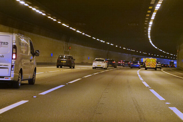
Bell Common Tunnel, M25 Clockwise The proposed path for the motorway in this region was squeezed into a narrow gap between the ecologically important Epping Forest to the south and the settlements to the north. Due to this, the motorway was constructed underground in a tunnel that spans a length of 470 metres. This tunnel is situated between junctions 26 and 27 of the motorway. It was built between 1982 and 1984 using the cut-and-cover <span class="nowrap"><a title="https://en.wikipedia.org/wiki/Tunnel#Cut-and-cover" rel="nofollow ugc noopener" href="https://en.wikipedia.org/wiki/Tunnel#Cut-and-cover">Link</a><img style="margin-left:2px;" alt="External link" title="External link - shift click to open in new window" src="https://s1.geograph.org.uk/img/external.png" width="10" height="10"/></span> method. The tunnel was opened to the public in January 1984, along with the Holmesdale Tunnel, which was constructed in a similar manner. A major refurbishment scheme was carried out in 2009.
Bell Common Tunnel, M25 Clockwise
The proposed path for the motorway in this region was squeezed into a narrow gap between the ecologically important Epping Forest to the south and the settlements to the north. Due to this, the motorway was constructed underground in a tunnel that spans a length of 470 metres. This tunnel is situated between junctions 26 and 27 of the motorway. It was built between 1982 and 1984 using the cut-and-cover LinkExternal link method. The tunnel was opened to the public in January 1984, along with the Holmesdale Tunnel, which was constructed in a similar manner. A major refurbishment scheme was carried out in 2009.
London Orbital Motorway (M26) near to Theydon Bois Officially named the London Orbital and frequently derided as nothing more than a very big car park, the M25 is a 117-mile orbital motorway that encircles London; one of the world's biggest ring roads (Europe's second longest orbital road after the Berliner Ring, which is 122 miles). It is not, however, a continuous loop of motorway as the Dartford Crossing section (comprising the Dartford Tunnels and the Queen Elizabeth II Bridge) over the Thames and its approach roads are designated as the A282. 

Constructed between 1975 and 1986, the M25 is reputedly the most expensive motorway Britain ever built, costing a total of £909m or roughly £7.5m per mile, but at the time of its planning, the demand for the road was considerably underestimated so that when it was finally completed in 1986, it was already out of date. Demand outstripped capacity within a few years and ever since then it's been very heavily congested. 

The M25 is one of the UK’s busiest motorways, carrying up to 200,000 vehicles and 10,000 HGVs per day (AADT - Annual Average Daily Traffic flow) on the section near to Heathrow Airport. Since its opening in the 1980s, the southern, western and eastern sections have been widened to largely dual four lane (D4M) standard, but much of the motorway retains its dual three lane road (D3M) cross-section as originally built. 

The M25 was home to England's first Variable Speed Limits on motorways between the A3 and M4 in the early 1990s.

<span class="nowrap"><a title="http://www.cbrd.co.uk/motorway/m25/" rel="nofollow ugc noopener" href="http://www.cbrd.co.uk/motorway/m25/">Link</a><img style="margin-left:2px;" alt="External link" title="External link - shift click to open in new window" src="https://s1.geograph.org.uk/img/external.png" width="10" height="10"/></span>  cbrd
<span class="nowrap"><a title="http://www.sabre-roads.org.uk/wiki/index.php?title=M25" rel="nofollow ugc noopener" href="http://www.sabre-roads.org.uk/wiki/index.php?title=M25">Link</a><img style="margin-left:2px;" alt="External link" title="External link - shift click to open in new window" src="https://s1.geograph.org.uk/img/external.png" width="10" height="10"/></span>  SABRE
London Orbital Motorway (M26) near to Theydon Bois
Officially named the London Orbital and frequently derided as nothing more than a very big car park, the M25 is a 117-mile orbital motorway that encircles London; one of the world's biggest ring roads (Europe's second longest orbital road after the Berliner Ring, which is 122 miles). It is not, however, a continuous loop of motorway as the Dartford Crossing section (comprising the Dartford Tunnels and the Queen Elizabeth II Bridge) over the Thames and its approach roads are designated as the A282. Constructed between 1975 and 1986, the M25 is reputedly the most expensive motorway Britain ever built, costing a total of £909m or roughly £7.5m per mile, but at the time of its planning, the demand for the road was considerably underestimated so that when it was finally completed in 1986, it was already out of date. Demand outstripped capacity within a few years and ever since then it's been very heavily congested. The M25 is one of the UK’s busiest motorways, carrying up to 200,000 vehicles and 10,000 HGVs per day (AADT - Annual Average Daily Traffic flow) on the section near to Heathrow Airport. Since its opening in the 1980s, the southern, western and eastern sections have been widened to largely dual four lane (D4M) standard, but much of the motorway retains its dual three lane road (D3M) cross-section as originally built. The M25 was home to England's first Variable Speed Limits on motorways between the A3 and M4 in the early 1990s. LinkExternal link cbrd LinkExternal link SABRE
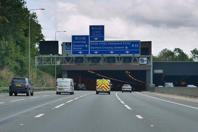
Approach to Junction 27 of M25 M25 Eastbound showing the approach to Junction 27 where M25 meets Junction 6 of the M11
Approach to Junction 27 of M25
M25 Eastbound showing the approach to Junction 27 where M25 meets Junction 6 of the M11
Junction 27 on M25 where it meets the M11 Eastbound section of M25 near junction with M11.
Junction 27 on M25 where it meets the M11
Eastbound section of M25 near junction with M11.
Show me another place!

The Coppice is located at Grid Ref: TQ4499 (Lat: 51.673868, Lng: 0.092682607)

Administrative County: Essex

District: Epping Forest

Police Authority: Essex

What 3 Words

///twins.atoms.master. Near Theydon Bois, Essex

Related Wikis

Epping Forest (UK Parliament constituency)

Epping Forest is a constituency in Essex represented in the House of Commons of the UK Parliament since 1997 by Eleanor Laing, a Conservative. == Constituency... ==

Theydon Bois tube station

Theydon Bois (, ) is a London Underground station in the village of Theydon Bois in Essex, England. It is served by the Central line and is between Debden...

Theydon Bois

Theydon Bois ( or ) is a village and civil parish in the Epping Forest district of Essex, England. It is 1 mile (1.6 km) south of Epping, 1 mile (1.6 km...

Bell Common

Bell Common is a settlement in Essex, England and is south of the town of Epping. == Tunnel == The Bell Common Tunnel is a covered section of the M25 motorway...

Davenant Foundation School

Davenant Foundation School is a Christian Ecumenical secondary school, founded in 1680, currently in Loughton, Essex, England. == History == === Foundation... ===

Ambresbury Banks

Ambresbury Banks is the name given to the remains of an Iron Age hill fort in Epping Forest, Essex, England. == Description == The fort encircles an area...

Debden House

Debden House is a conference centre and campsite located in Loughton, Essex, England. The house is owned and operated by Newham London Borough Council...

Home Mead

Home Mead is a 1.8 hectare Local Nature Reserve in Loughton in Essex. It is owned and managed by Epping Forest District Council.This site has woodland...

Nearby Amenities

Located within 500m of 51.673868,0.092682607
Bus Stop
Village Hall
Bench: no
Bin: yes
Covered: no
Lit: no
Naptan AtcoCode: 150021003007
Naptan Bearing: W
Naptan CommonName: Village Hall
Naptan Indicator: Opp
Naptan Landmark: Village Hall
Naptan NaptanCode: esxgatwp
Naptan Street: Coppice Row
Naptan Verified: no
Public Transport: platform
Shelter: no
Source: naptan_import
Tactile Paving: no
Lat/Long: 51.6725233/0.0955381
Bus Stop
Morgan Crescent
Naptan AtcoCode: 150021003008
Naptan Bearing: S
Naptan CommonName: Morgan Crescent
Naptan Crossing: Morgan Crescent
Naptan Indicator: Adj
Naptan Landmark: Morgan Crescent
Naptan NaptanCode: esxgataw
Naptan Street: Piercing Hill
Naptan Verified: no
Public Transport: platform
Source: naptan_import
Lat/Long: 51.6744865/0.0936019
Bus Stop
Morgan Crescent
Naptan AtcoCode: 150021003009
Naptan Bearing: N
Naptan CommonName: Morgan Crescent
Naptan Crossing: Morgan Crescent
Naptan Indicator: Opp
Naptan Landmark: Morgan Crescent
Naptan NaptanCode: esxgatda
Naptan Street: Piercing Hill
Naptan Verified: no
Public Transport: platform
Source: naptan_import
Lat/Long: 51.6750138/0.0932134
Bus Stop
Village Hall
Bench: no
Bin: no
Lit: no
Naptan AtcoCode: 1500THYBOIS2
Naptan Bearing: E
Naptan CommonName: Village Hall
Naptan Indicator: o/s
Naptan Landmark: Village Hall
Naptan NaptanCode: esxgatwm
Naptan Street: Coppice Row
Naptan Verified: no
Public Transport: platform
Shelter: no
Source: naptan_import
Tactile Paving: no
Lat/Long: 51.6725844/0.095643
Noexit: yes
Lat/Long: 51.6740658/0.0878796
Noexit: yes
Lat/Long: 51.6725298/0.096606
Noexit: yes
Lat/Long: 51.6726627/0.096689
Entrance: yes
Lat/Long: 51.6726886/0.0961539
Ford: yes
Lat/Long: 51.6747308/0.0911111
Noexit: yes
Lat/Long: 51.6702316/0.0952137
Noexit: yes
Lat/Long: 51.6708907/0.0936421
Turning Circle
Lat/Long: 51.6732237/0.0994671
Noexit: yes
Lat/Long: 51.6735474/0.0930286
Post Box
Post Box Type: pillar
Royal Cypher: GR
Source: survey
Lat/Long: 51.6726715/0.0944032
The Coppice
Place: locality
Lat/Long: 51.6742868/0.0930774
Noexit: yes
Lat/Long: 51.6726321/0.0901316
Noexit: yes
Lat/Long: 51.6701438/0.096255
Noexit: yes
Lat/Long: 51.6704578/0.0960438
Give Way
Direction: forward
Lat/Long: 51.6749813/0.093379
Give Way
Direction: backward
Lat/Long: 51.6727034/0.0947041
Give Way
Direction: backward
Lat/Long: 51.6726469/0.0946771
Crossing
Crossing: unmarked
Crossing Island: yes
Lat/Long: 51.6727763/0.0947157
Noexit: yes
Lat/Long: 51.6746376/0.0985972
Give Way
Direction: forward
Traffic Sign: GB:1003A
Lat/Long: 51.6719587/0.0952534
Give Way
Direction: forward
Traffic Sign: GB:1003A
Lat/Long: 51.6711152/0.0960442
Give Way
Direction: forward
Lat/Long: 51.6722393/0.0974875
Bus: yes
Public Transport: stop_position
Lat/Long: 51.6725493/0.0957012
Waste Basket
Lat/Long: 51.672366/0.096388
Bench
Backrest: yes
Material: wood
Lat/Long: 51.672349/0.0963267
Give Way
Direction: backward
Lat/Long: 51.6719567/0.0988664
Give Way
Direction: backward
Lat/Long: 51.6730263/0.0909599
Crossing
Crossing: unmarked
Lat/Long: 51.6766573/0.0977152
Give Way
Direction: backward
Lat/Long: 51.6766677/0.0977053
Give Way
Direction: forward
Lat/Long: 51.6750297/0.0946427
Description: SLOW
Direction: backward
Traffic Sign: GB:1024
Lat/Long: 51.6771906/0.0925549
Description: SLOW
Direction: backward
Traffic Sign: GB:1024
Lat/Long: 51.6773831/0.0924623
Maxspeed Backward: 30 mph
Maxspeed Forward: 40 mph
Traffic Sign Backward: GB:670[30 mph]
Traffic Sign Forward: GB:670[40 mph]
Lat/Long: 51.6769686/0.092667
Bus: yes
Public Transport: stop_position
Lat/Long: 51.6744932/0.0935044
Bus: yes
Public Transport: stop_position
Lat/Long: 51.6749904/0.0933152
Direction: forward
Maxwidth: 7'6"
Note: Max width 7'6" except for loading, except for buses and coaches
Traffic Sign: GB:629A[7'6"]
Lat/Long: 51.6727597/0.0947131
Noexit: yes
Lat/Long: 51.6699159/0.0927147
Noexit: yes
Lat/Long: 51.6705367/0.0931187
Noexit: yes
Lat/Long: 51.6701024/0.0951514
Give Way
Direction: backward
Traffic Sign: GB:1003A
Lat/Long: 51.6699972/0.0948493
Noexit: yes
Lat/Long: 51.6711893/0.0943501
Noexit: yes
Lat/Long: 51.6719258/0.0918712
Post Box
Lat/Long: 51.6773382/0.0920657
Post Box
Collection Times: Mo-Fr 09:00; Sa 07:00
Ref: CM16 314D
Royal Cypher: GR
Royal Cypher Wikidata: Q33102273
Lat/Long: 51.6707217/0.0955381
Man Made: flagpole
Lat/Long: 51.6726465/0.096192
Bench
Backrest: yes
Material: wood
Seats: 4
Lat/Long: 51.6725472/0.0954068
Historic: memorial
Material: stone
Memorial: cross
Lat/Long: 51.6730134/0.0929238
Noexit: yes
Lat/Long: 51.6737445/0.0929922
Bench
Backrest: yes
Material: wood
Seats: 3
Lat/Long: 51.6732554/0.0927763
Bench
Backrest: yes
Material: wood
Seats: 4
Lat/Long: 51.6738759/0.0913534
Bench
Backrest: no
Material: wood
Seats: 4
Lat/Long: 51.6731644/0.0905353
Bench
Backrest: yes
Material: wood
Seats: 4
Lat/Long: 51.6744015/0.088639
Bench
Backrest: no
Material: wood
Seats: 6
Lat/Long: 51.6747574/0.0878584
The data included in this document is from www.openstreetmap.org. The data is made available under ODbL.

Have you been to The Coppice?

Leave your review of The Coppice below (or comments, questions and feedback).