Agmond's Wood

Wood, Forest in Sussex Lewes

England

Agmond's Wood

Oast House Single round kiln oast house.

Grade II listed.
Oast House Credit: Oast House Archive

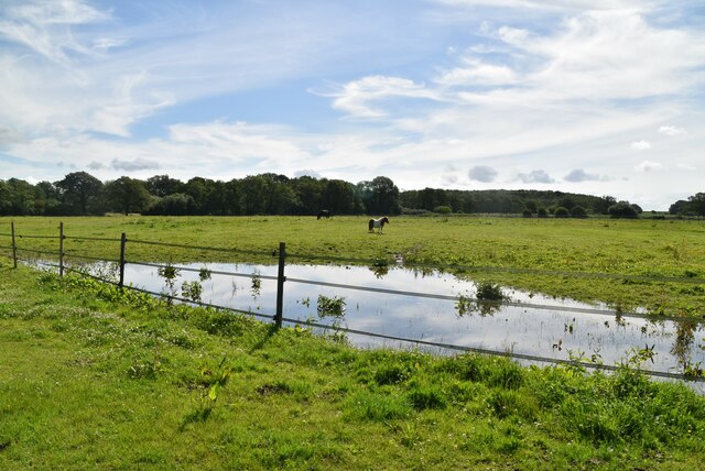
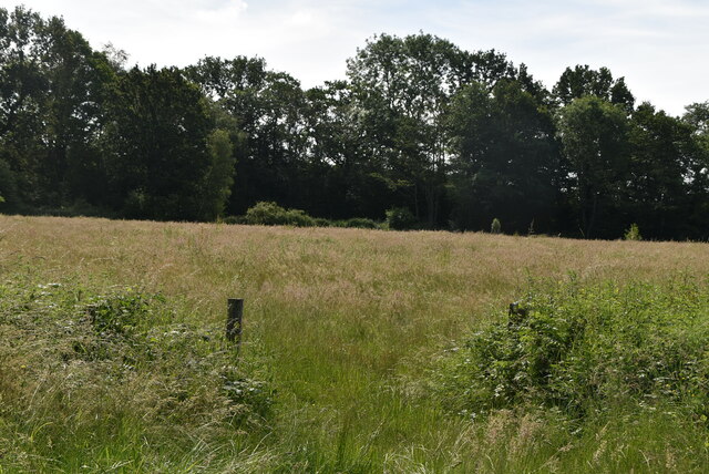
Agmond's Wood is a picturesque woodland located in Sussex, England. Covering an area of approximately 100 acres, it is a popular destination for nature enthusiasts and hikers alike. The wood is characterized by its diverse range of tree species, including oak, beech, and ash, creating a vibrant and lush environment.

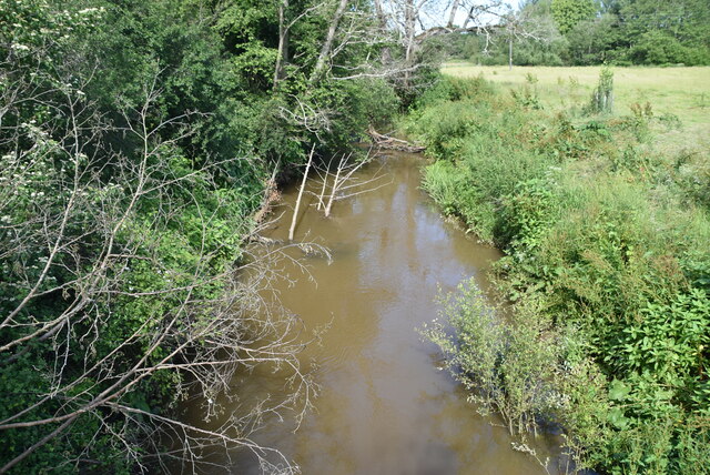
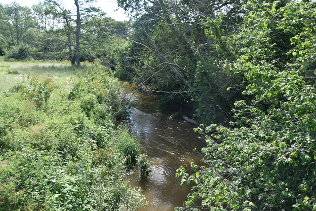
The wood is known for its tranquil atmosphere and peaceful surroundings. Walking through its well-maintained paths, visitors can enjoy the sights and sounds of nature, including the chirping of birds and the rustling of leaves. The natural beauty of Agmond's Wood is further enhanced by the presence of a small stream that meanders through the forest, providing a calming backdrop to the experience.

The wood is home to a rich variety of flora and fauna, making it a haven for wildlife enthusiasts. Foxes, badgers, and deer are commonly spotted within the woodland, providing an opportunity for wildlife observation. The diverse range of bird species, including woodpeckers and owls, also make Agmond's Wood a popular spot for birdwatching.

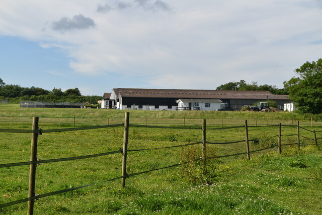
Agmond's Wood offers several well-marked trails and picnic areas, making it an ideal destination for outdoor activities and family outings. Additionally, the wood is well-preserved and maintained, with regular conservation efforts to protect its natural ecosystem.

Overall, Agmond's Wood is a natural gem in Sussex, offering a serene and idyllic setting for individuals seeking solace in nature or wanting to explore the diverse wildlife and plant species that thrive within its boundaries.

If you have any feedback on the listing, please let us know in the comments section below.

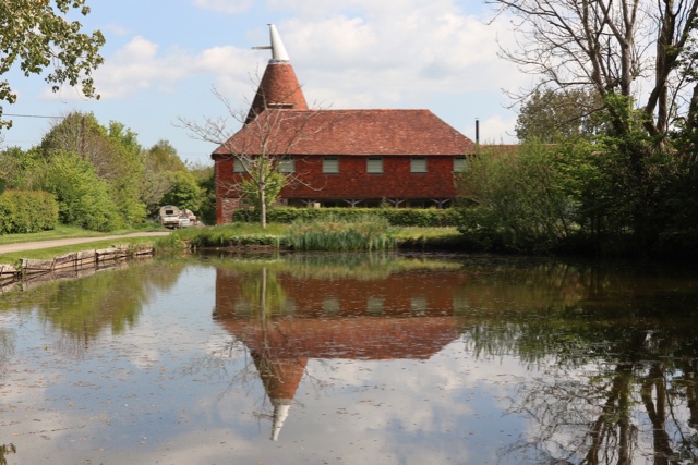
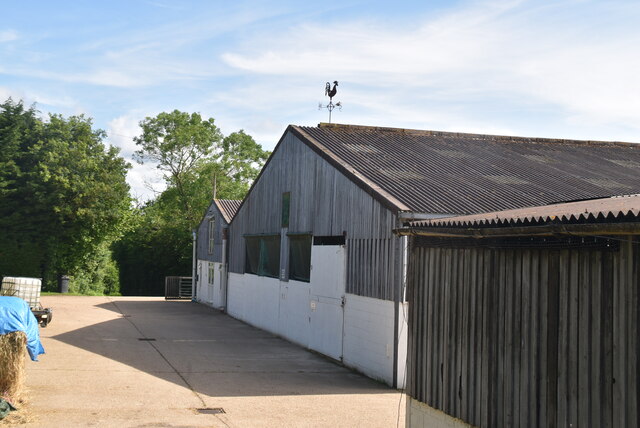
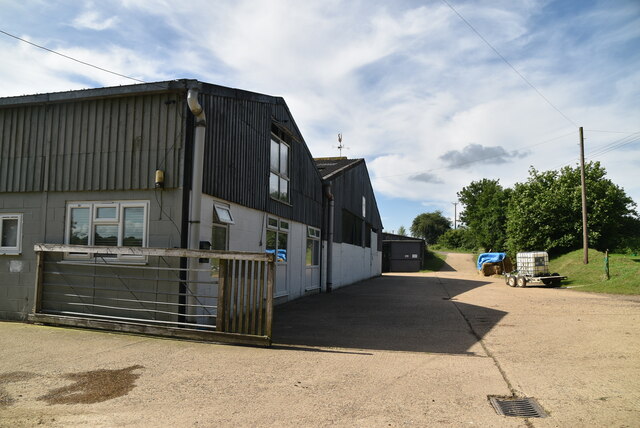
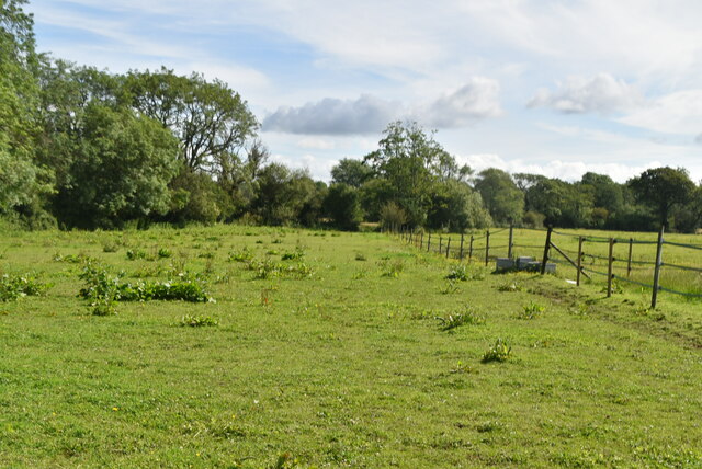
Agmond's Wood Images

Images are sourced within 2km of 50.939087/0.041498489 or Grid Reference TQ4317. Thanks to Geograph Open Source API. All images are credited.

Oast House Single round kiln oast house.

Grade II listed.
Oast House
Single round kiln oast house. Grade II listed.
The Oast House Single square kiln oast house.
The Oast House
Single square kiln oast house.
Isfield Village Hall Isfield lies just off the main A26 Uckfield to Lewes main road, and is well hidden in the Ouse valley. The Romans established a staging post in the village, near a ford across the Ouse, this was on a section of Ermine Street which ran from Newhaven to London, passing through Lewes and Isfield and Maresfield. The village was recorded as Sifelle in the Domesday book.
More info at <span class="nowrap"><a title="http://www.villagenet.co.uk/ashdownforest/villages/isfield.php" rel="nofollow ugc noopener" href="http://www.villagenet.co.uk/ashdownforest/villages/isfield.php">Link</a><img style="margin-left:2px;" alt="External link" title="External link - shift click to open in new window" src="https://s1.geograph.org.uk/img/external.png" width="10" height="10"/></span>
Isfield Village Hall
Isfield lies just off the main A26 Uckfield to Lewes main road, and is well hidden in the Ouse valley. The Romans established a staging post in the village, near a ford across the Ouse, this was on a section of Ermine Street which ran from Newhaven to London, passing through Lewes and Isfield and Maresfield. The village was recorded as Sifelle in the Domesday book. More info at LinkExternal link
Station Rd Isfield lies just off the main A26 Uckfield to Lewes main road, and is well hidden in the Ouse valley. The Romans established a staging post in the village, near a ford across the Ouse, this was on a section of Ermine Street which ran from Newhaven to London, passing through Lewes and Isfield and Maresfield. The village was recorded as Sifelle in the Domesday book.
More info at <span class="nowrap"><a title="http://www.villagenet.co.uk/ashdownforest/villages/isfield.php" rel="nofollow ugc noopener" href="http://www.villagenet.co.uk/ashdownforest/villages/isfield.php">Link</a><img style="margin-left:2px;" alt="External link" title="External link - shift click to open in new window" src="https://s1.geograph.org.uk/img/external.png" width="10" height="10"/></span>
Station Rd
Isfield lies just off the main A26 Uckfield to Lewes main road, and is well hidden in the Ouse valley. The Romans established a staging post in the village, near a ford across the Ouse, this was on a section of Ermine Street which ran from Newhaven to London, passing through Lewes and Isfield and Maresfield. The village was recorded as Sifelle in the Domesday book. More info at LinkExternal link
Track in Isfield
Track in Isfield
Faulkners
Faulkners
Pasture
Pasture
Tile Barn Farmhouse
Tile Barn Farmhouse
Tile Barn Farm
Tile Barn Farm
Tile Barn Farm
Tile Barn Farm
A green lane
A green lane
Grassy footpath
Grassy footpath
A small pond
A small pond
Tile Barn Farm
Tile Barn Farm
Meadow
Meadow
Meadow
Meadow
River Uck The River Uck is a river in East Sussex, which drains a catchment starting near Crowborough in the North, Hadlow Down to the East and Laughton Common to the South.It flows through the town of Uckfield and into the river Ouse about 3 miles north of Lewes. The river Uck also has a scenic walk alongside it. The river burst its banks in 2000, flooding much of Uckfield and the surrounding countryside.
River Uck
The River Uck is a river in East Sussex, which drains a catchment starting near Crowborough in the North, Hadlow Down to the East and Laughton Common to the South.It flows through the town of Uckfield and into the river Ouse about 3 miles north of Lewes. The river Uck also has a scenic walk alongside it. The river burst its banks in 2000, flooding much of Uckfield and the surrounding countryside.
Show me another place!

Agmond's Wood is located at Grid Ref: TQ4317 (Lat: 50.939087, Lng: 0.041498489)

Administrative County: East Sussex

District: Lewes

Police Authority: Sussex

What 3 Words

///creatures.composes.typified. Near South Chailey, East Sussex

Related Wikis

River Uck

The River Uck is a river in East Sussex, United Kingdom, which drains a catchment starting near Crowborough in the North, Hadlow Down to the East and Laughton...

Isfield

Isfield is a small village and civil parish in the Wealden District of East Sussex in England, located north-east of Lewes. == History == The village of...

Isfield railway station

Isfield is a preserved railway station on the closed section of the Wealden Line which served the East Sussex village of Isfield near Uckfield. Originally...

Lavender Line

The Lavender Line is a heritage railway based at Isfield Station, near Uckfield in East Sussex, England. == History == The Lavender Line was originally...

Barcombe Mills

Barcombe Mills is a small settlement and an area of countryside including a local nature reserve near the village of Barcombe Cross in East Sussex, England...

Barcombe

Barcombe is an East Sussex village and civil parish in the Lewes District of East Sussex. The parish has four settlements: old Barcombe (TQ 418 143), the...

Barcombe railway station

Barcombe was a railway station serving the village of Barcombe in East Sussex. It was part of the East Grinstead to Lewes line, part of which now makes...

Barcombe Mills railway station

Barcombe Mills is a disused railway station in the hamlet of Barcombe Mills, on the closed section of the Wealden Line. The station was opened in 1858...

Nearby Amenities

Located within 500m of 50.939087,0.041498489
Fixme: this track (&FP) carries on to Dallas lane
Lat/Long: 50.9407841/0.0435824
The data included in this document is from www.openstreetmap.org. The data is made available under ODbL.

Have you been to Agmond's Wood?

Leave your review of Agmond's Wood below (or comments, questions and feedback).