Cinder Wood

Wood, Forest in Sussex Wealden

England

Cinder Wood

St Stephen's Church Hammerwood
St Stephen's Church Credit: Roger W Haworth

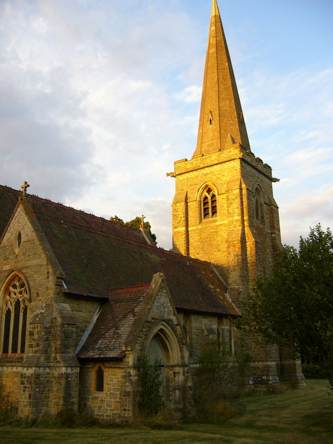
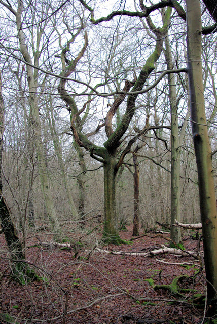
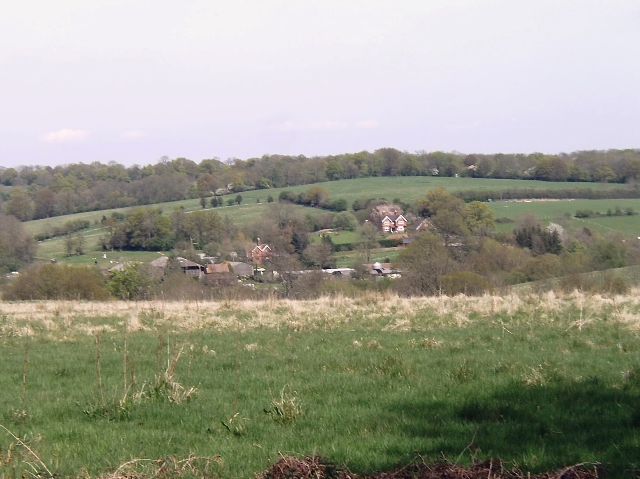
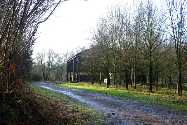
Cinder Wood is a picturesque forest located in Sussex, England. Spread across a sprawling area, it is renowned for its natural beauty and tranquil surroundings. The wood is predominantly composed of oak and beech trees, which create a dense canopy that filters the sunlight and casts a soothing shade on the forest floor.

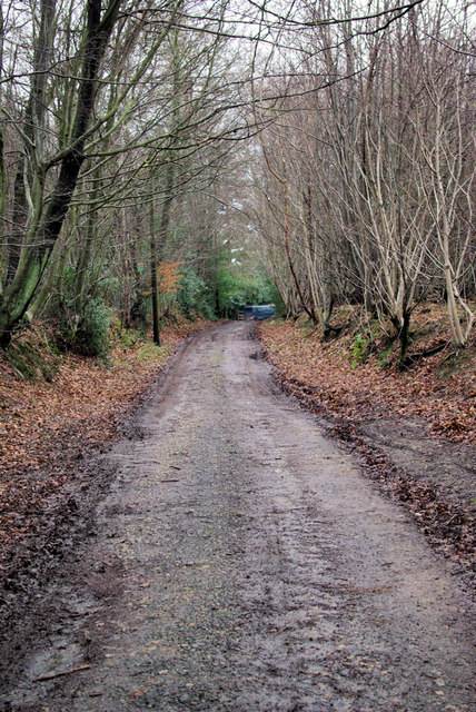
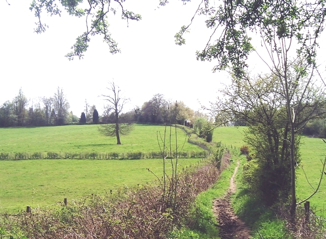
Nestled within the South Downs National Park, Cinder Wood offers a myriad of recreational opportunities for nature enthusiasts. Walking trails meander through the forest, allowing visitors to explore its diverse flora and fauna. The forest floor is adorned with vibrant wildflowers, ferns, and mosses, creating a vibrant tapestry of colors.

Wildlife thrives in Cinder Wood, with a plethora of species calling it home. Birdwatchers can spot numerous avian species, including woodpeckers, owls, and warblers. The forest is also inhabited by various mammals, such as deer, foxes, and badgers, which can occasionally be spotted during dawn and dusk.

For those seeking solitude and tranquility, Cinder Wood offers secluded picnic spots and serene clearings. The peaceful ambiance of the forest provides a perfect escape from the hustle and bustle of everyday life. Additionally, the wood is a popular destination for photographers, who are drawn to its enchanting vistas and magical atmosphere.

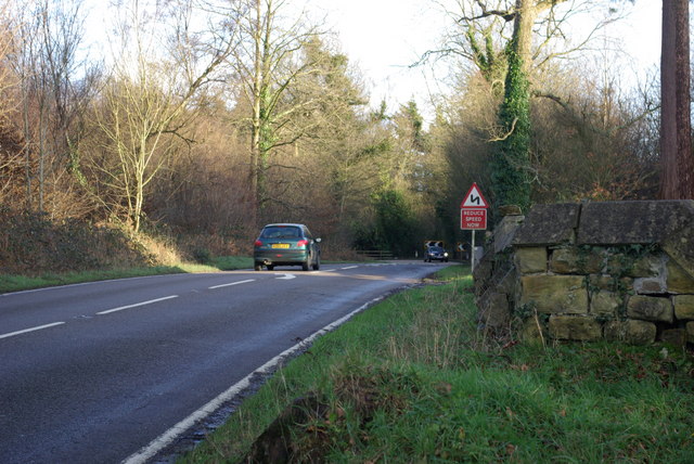
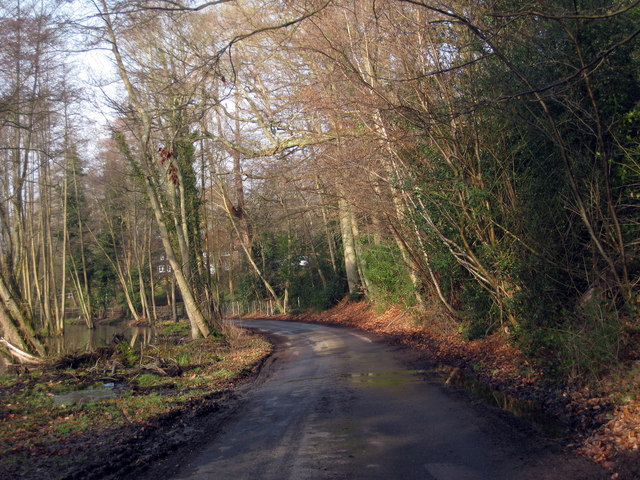
Cinder Wood is easily accessible, with well-maintained parking facilities and marked trails. Visitors are encouraged to respect the environment and follow the designated paths to preserve the delicate ecosystem. With its natural charm and abundant wildlife, Cinder Wood is a treasure trove of natural beauty and a haven for nature lovers.

If you have any feedback on the listing, please let us know in the comments section below.

Cinder Wood Images

Images are sourced within 2km of 51.138726/0.049978478 or Grid Reference TQ4339. Thanks to Geograph Open Source API. All images are credited.

St Stephen's Church Hammerwood
St Stephen's Church
Hammerwood
Bend on A264 east of Hammerwood Church A view east from the gateway into Hammerwood churchyard (its wall is on the right). The feature is the left-hand bend that the approaching car is rounding.
Bend on A264 east of Hammerwood Church
A view east from the gateway into Hammerwood churchyard (its wall is on the right). The feature is the left-hand bend that the approaching car is rounding.
In Fifty Acre Wood A rather neglected wood notable for the old iron ore diggings downhill from this spot.
In Fifty Acre Wood
A rather neglected wood notable for the old iron ore diggings downhill from this spot.
Bridleway from Kent to Sussex A view towards the end of the bridleway (also a private track) where it meets the A264 at a tricky bend.
Bridleway from Kent to Sussex
A view towards the end of the bridleway (also a private track) where it meets the A264 at a tricky bend.
Dog Gate Lodge At a crossroads of tracks. The Vanguard way comes from the south and turns initially west (out of sight), a private track goes north, and a public bridleway goes east.
Dog Gate Lodge
At a crossroads of tracks. The Vanguard way comes from the south and turns initially west (out of sight), a private track goes north, and a public bridleway goes east.
Hammerwood House Hammer Wood is to the right. The Hammer reference is derived from the Wealden iron industry.
Hammerwood House
Hammer Wood is to the right. The Hammer reference is derived from the Wealden iron industry.
Cowshed, Owlett's Farm The moment they saw the camera, the cows retreated from the mangers into the depths of the shed.
Cowshed, Owlett's Farm
The moment they saw the camera, the cows retreated from the mangers into the depths of the shed.
Wealden farmland Taken just north of the main road from East Grinstead to Tunbridge Wells.
Wealden farmland
Taken just north of the main road from East Grinstead to Tunbridge Wells.
Vanguard Way footpath Taken from the footbridge over an un-named stream south of Hammerwood.
Vanguard Way footpath
Taken from the footbridge over an un-named stream south of Hammerwood.
Lane near Cowden, Kent
Oast House at The Barn, Old Surrey Hall, Lingfield, Surrey
Surrey/West Sussex/East Sussex meeting point The three counties meet on this bridge over the small stream visible on the left of the photo.  West Sussex is in the left foreground, East Sussex is in the right foreground and Surrey is beyond the stream.
Surrey/West Sussex/East Sussex meeting point
The three counties meet on this bridge over the small stream visible on the left of the photo. West Sussex is in the left foreground, East Sussex is in the right foreground and Surrey is beyond the stream.
County boundary This lane, which leads from Gotwick Farm on the A264 to Old Surrey Hall, forms the boundary between West Sussex (on the left) and East Sussex (on the right).  These two counties then meet Surrey at the dip in the distance (see <a href="https://www.geograph.org.uk/photo/1205436">TQ4139 : Surrey/West Sussex/East Sussex meeting point</a> for close up).
County boundary
This lane, which leads from Gotwick Farm on the A264 to Old Surrey Hall, forms the boundary between West Sussex (on the left) and East Sussex (on the right). These two counties then meet Surrey at the dip in the distance (see TQ4139 : Surrey/West Sussex/East Sussex meeting point for close up).
Pumphouse Farm Pumphouse Farm is on the left of the road, which is the A264 running from Tunbridge Wells to East Grinstead.  The building on the right is part of Gotwick Farm.  Both are grade II listed - for listing particulars see <span class="nowrap"><a title="www.historicengland.org.uk/listing/the-list/list-entry/1248943" rel="nofollow ugc noopener" href="http://www.historicengland.org.uk/listing/the-list/list-entry/1248943">Link</a><img style="margin-left:2px;" alt="External link" title="External link - shift click to open in new window" src="https://s1.geograph.org.uk/img/external.png" width="10" height="10"/></span> and <span class="nowrap"><a title="www.historicengland.org.uk/listing/the-list/list-entry/1248942" rel="nofollow ugc noopener" href="http://www.historicengland.org.uk/listing/the-list/list-entry/1248942">Link</a><img style="margin-left:2px;" alt="External link" title="External link - shift click to open in new window" src="https://s1.geograph.org.uk/img/external.png" width="10" height="10"/></span> respectively.
Pumphouse Farm
Pumphouse Farm is on the left of the road, which is the A264 running from Tunbridge Wells to East Grinstead. The building on the right is part of Gotwick Farm. Both are grade II listed - for listing particulars see LinkExternal link and LinkExternal link respectively.
Border crossing Looking into West Sussex from East Sussex on the A264, the border being somewhere in the vicinity of the assorted road signs.
Border crossing
Looking into West Sussex from East Sussex on the A264, the border being somewhere in the vicinity of the assorted road signs.
Barn near Gotwick Manor Behind a gate off Shepherdsgrove Lane.
Barn near Gotwick Manor
Behind a gate off Shepherdsgrove Lane.
A264, Holtye Road Past Hammerwood.
A264, Holtye Road
Past Hammerwood.
A264, Holtye Road
A264, Holtye Road
Show me another place!

Cinder Wood is located at Grid Ref: TQ4339 (Lat: 51.138726, Lng: 0.049978478)

Administrative County: East Sussex

District: Wealden

Police Authority: Sussex

What 3 Words

///lives.about.doctor. Near Dormansland, Surrey

Related Wikis

Hammerwood

Hammerwood is a hamlet in the civil parish of Forest Row in East Sussex, England. Its nearest town is East Grinstead, which lies approximately 3.5 miles...

Hammerwood Park

Hammerwood Park is a country house in Hammerwood, near East Grinstead, in East Sussex, England. It is a Grade I listed building. One of the first houses...

London to Lewes Way

The London to Lewes Way is a 71 kilometres (44 mi) long Roman road between Watling Street at Peckham and Lewes in Sussex. The road passes through Beckenham...

Stoke Brunswick School

Stoke Brunswick School was a small co-educational day and boarding independent school for children aged 3 to 13 years, situated in Ashurst Wood, West Sussex...

Cowden

Cowden () is a small village and civil parish in the Sevenoaks District of Kent, England. The parish is located on the northern slopes of the Weald, south...

Sundridge with Ide Hill

Sundridge and Ide Hill is a civil parish in the Sevenoaks District of Kent, England. It is located in the Darenth valley and lies between Sevenoaks and...

Greathed Manor

Greathed Manor, Dormansland, Surrey, is a Victorian country house. Designed by the architect Robert Kerr in 1862–8, it is a Grade II listed building....

Queen Victoria Hospital

The Queen Victoria Hospital (QVH), located in East Grinstead, West Sussex, England is the specialist reconstructive surgery centre for the south east of...

Nearby Amenities

Located within 500m of 51.138726,0.049978478
Post Box
Operator: Royal Mail
Post Box Type: lamp
Ref: RH19 12
Royal Cypher: EIIR
Royal Cypher Wikidata: Q33102113
Lat/Long: 51.1370964/0.0535497
The data included in this document is from www.openstreetmap.org. The data is made available under ODbL.

Have you been to Cinder Wood?

Leave your review of Cinder Wood below (or comments, questions and feedback).