Beecher Wood

Wood, Forest in Sussex Wealden

England

Beecher Wood

Wealden outcrop in Homestall Road which is in East Sussex but continue away from the photographer along that road for a couple of hundred yards and you come to Ashurst Wood, West Sussex. Stoke Brunswick School lies behind the outcrop. The rock is rusty because it contains iron ore.
Wealden outcrop Credit: Roger W Haworth

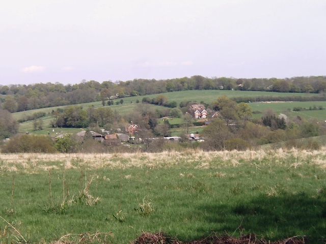
Beecher Wood is a beautiful forest located in the county of Sussex, England. Spread over an area of approximately 100 acres, this woodland is known for its stunning natural beauty and rich biodiversity. The wood is situated near the village of Beecher, which adds to its charm and accessibility.

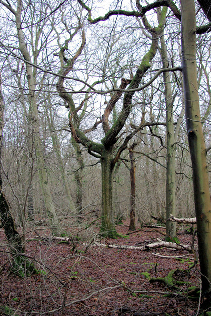
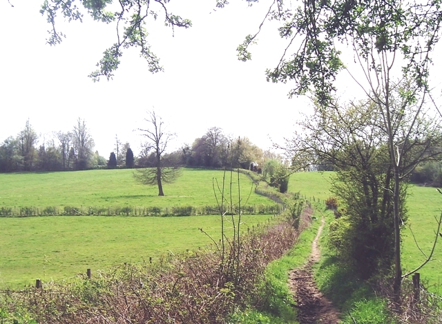
The woodland is predominantly composed of broadleaf trees, including oak, beech, and birch. These trees create a dense canopy that provides a habitat for a wide variety of flora and fauna. Walking through Beecher Wood, visitors can expect to encounter a plethora of wildflowers, ferns, and mosses that thrive in the damp and shaded environment.

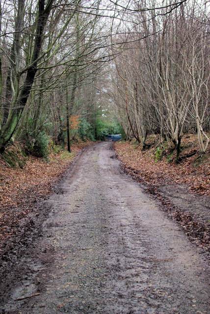
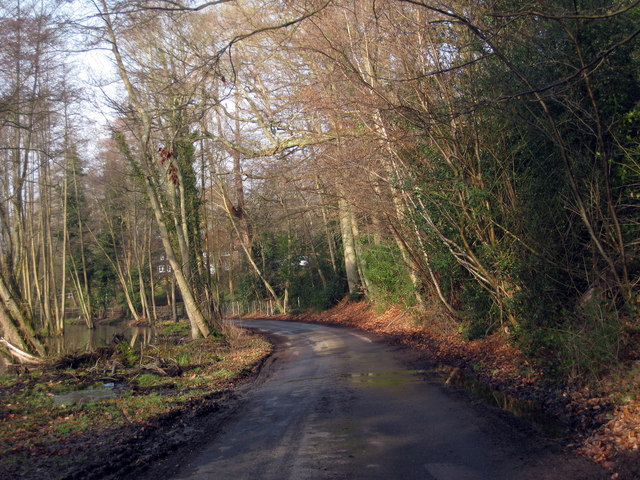
The forest is crisscrossed with numerous trails and footpaths, making it a popular destination for hikers, nature enthusiasts, and families. These pathways offer a chance to explore the wood's different sections and discover its hidden treasures, such as a small stream that meanders through the heart of the forest.

Beecher Wood is also home to a diverse range of wildlife, including birds, squirrels, and deer. Birdwatchers can spot species such as woodpeckers, owls, and various songbirds. The wood's tranquil setting provides an ideal habitat for these animals, offering them shelter and a source of food throughout the year.

With its picturesque landscapes and abundant wildlife, Beecher Wood is a haven for those seeking a peaceful retreat in nature. The wood's proximity to the village of Beecher makes it easily accessible, attracting both locals and tourists alike. Whether it's a leisurely stroll, a family picnic, or a birdwatching adventure, Beecher Wood has something to offer for everyone who appreciates the wonders of the natural world.

If you have any feedback on the listing, please let us know in the comments section below.
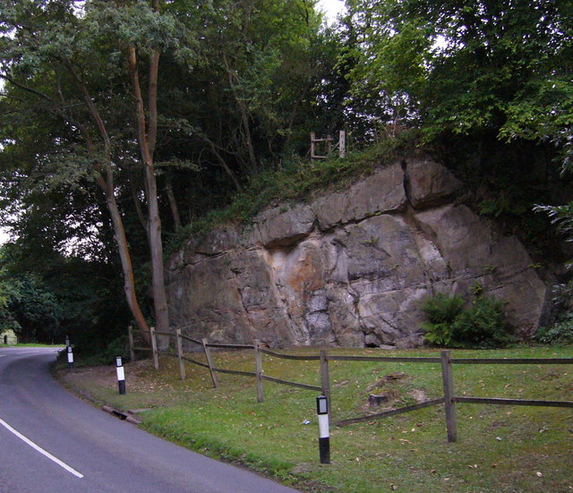
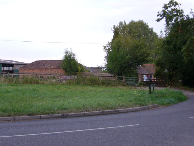
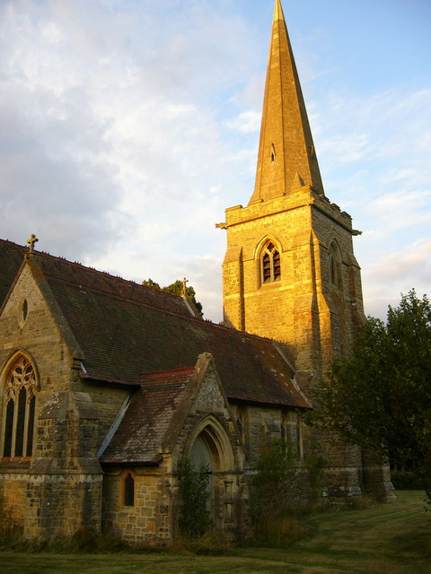
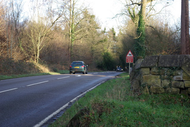
Beecher Wood Images

Images are sourced within 2km of 51.133338/0.048510569 or Grid Reference TQ4339. Thanks to Geograph Open Source API. All images are credited.

Wealden outcrop in Homestall Road which is in East Sussex but continue away from the photographer along that road for a couple of hundred yards and you come to Ashurst Wood, West Sussex. Stoke Brunswick School lies behind the outcrop. The rock is rusty because it contains iron ore.
Wealden outcrop
in Homestall Road which is in East Sussex but continue away from the photographer along that road for a couple of hundred yards and you come to Ashurst Wood, West Sussex. Stoke Brunswick School lies behind the outcrop. The rock is rusty because it contains iron ore.
Near Shovelstrode Farm in Homestall Road near Ashurst Wood. Shovelstrode Farm is out of shot to the right.
Near Shovelstrode Farm
in Homestall Road near Ashurst Wood. Shovelstrode Farm is out of shot to the right.
St Stephen's Church Hammerwood
St Stephen's Church
Hammerwood
Bend on A264 east of Hammerwood Church A view east from the gateway into Hammerwood churchyard (its wall is on the right). The feature is the left-hand bend that the approaching car is rounding.
Bend on A264 east of Hammerwood Church
A view east from the gateway into Hammerwood churchyard (its wall is on the right). The feature is the left-hand bend that the approaching car is rounding.
In Fifty Acre Wood A rather neglected wood notable for the old iron ore diggings downhill from this spot.
In Fifty Acre Wood
A rather neglected wood notable for the old iron ore diggings downhill from this spot.
Bridleway from Kent to Sussex A view towards the end of the bridleway (also a private track) where it meets the A264 at a tricky bend.
Bridleway from Kent to Sussex
A view towards the end of the bridleway (also a private track) where it meets the A264 at a tricky bend.
Thornhill An imposing house viewed from the Vanguard Way footpath.
Thornhill
An imposing house viewed from the Vanguard Way footpath.
Dog Gate Lodge At a crossroads of tracks. The Vanguard way comes from the south and turns initially west (out of sight), a private track goes north, and a public bridleway goes east.
Dog Gate Lodge
At a crossroads of tracks. The Vanguard way comes from the south and turns initially west (out of sight), a private track goes north, and a public bridleway goes east.
Hammerwood House Hammer Wood is to the right. The Hammer reference is derived from the Wealden iron industry.
Hammerwood House
Hammer Wood is to the right. The Hammer reference is derived from the Wealden iron industry.
Power Line Gap A power line heads east in the general direction of Great Cansiron Farm, hidden behind the modestly named Acre Wood in the distance.
Power Line Gap
A power line heads east in the general direction of Great Cansiron Farm, hidden behind the modestly named Acre Wood in the distance.
Cowshed, Owlett's Farm The moment they saw the camera, the cows retreated from the mangers into the depths of the shed.
Cowshed, Owlett's Farm
The moment they saw the camera, the cows retreated from the mangers into the depths of the shed.
A Lorry in a Field The lorry has not moved from this spot for over a year, and has remained half tipped.
A Lorry in a Field
The lorry has not moved from this spot for over a year, and has remained half tipped.
Cansiron Lane A snowy morning.
Cansiron Lane
A snowy morning.
Wealden farmland Taken just north of the main road from East Grinstead to Tunbridge Wells.
Wealden farmland
Taken just north of the main road from East Grinstead to Tunbridge Wells.
Vanguard Way footpath Taken from the footbridge over an un-named stream south of Hammerwood.
Vanguard Way footpath
Taken from the footbridge over an un-named stream south of Hammerwood.
Lane near Cowden, Kent
Oast House at The Barn, Old Surrey Hall, Lingfield, Surrey
Surrey/West Sussex/East Sussex meeting point The three counties meet on this bridge over the small stream visible on the left of the photo.  West Sussex is in the left foreground, East Sussex is in the right foreground and Surrey is beyond the stream.
Surrey/West Sussex/East Sussex meeting point
The three counties meet on this bridge over the small stream visible on the left of the photo. West Sussex is in the left foreground, East Sussex is in the right foreground and Surrey is beyond the stream.
Show me another place!

Beecher Wood is located at Grid Ref: TQ4339 (Lat: 51.133338, Lng: 0.048510569)

Administrative County: East Sussex

District: Wealden

Police Authority: Sussex

What 3 Words

///scary.damp.tables. Near Dormansland, Surrey

Related Wikis

Hammerwood

Hammerwood is a hamlet in the civil parish of Forest Row in East Sussex, England. Its nearest town is East Grinstead, which lies approximately 3.5 miles...

Hammerwood Park

Hammerwood Park is a country house in Hammerwood, near East Grinstead, in East Sussex, England. It is a Grade I listed building. One of the first houses...

Stoke Brunswick School

Stoke Brunswick School was a small co-educational day and boarding independent school for children aged 3 to 13 years, situated in Ashurst Wood, West Sussex...

London to Lewes Way

The London to Lewes Way is a 71 kilometres (44 mi) long Roman road between Watling Street at Peckham and Lewes in Sussex. The road passes through Beckenham...

Ashurst Wood

Ashurst Wood is a village and civil parish in the Mid Sussex District of West Sussex, within the historic county of Sussex, England. It is 1 mile (2 km...

East Grinstead Town F.C.

East Grinstead Town Football Club is a football club based in East Grinstead, West Sussex, England. They are currently members of the Isthmian League South...

Queen Victoria Hospital

The Queen Victoria Hospital (QVH), located in East Grinstead, West Sussex, England is the specialist reconstructive surgery centre for the south east of...

Sackville School, East Grinstead

Sackville School is a coeducational secondary school and sixth form located in East Grinstead, England. In 2020, the number of students was approximately...

Nearby Amenities

Located within 500m of 51.133338,0.048510569
Hammerwood
Place: hamlet
Source: OS_OpenData_StreetView
Wikidata: Q21061451
Lat/Long: 51.1339709/0.0526648
The data included in this document is from www.openstreetmap.org. The data is made available under ODbL.

Have you been to Beecher Wood?

Leave your review of Beecher Wood below (or comments, questions and feedback).