Sidehill Wood

Wood, Forest in Hertfordshire East Hertfordshire

England

Sidehill Wood

The Palace, Much Hadham - south elevation The site historically housed a residence of the Bishops of London. The present, early C16 house was sequestrated during the English Civil War but then reverted to the Bishop at the Restoration. It became a lunatic asylum in 1817 until it passed back to the Ecclesiastical Commissioners in 1868. It was sold as a private house in 1888 and after World War II became the home of Major Sir Edward Beddington-Behrens. The property is now divided into three separate dwellings. Taken from the nearby churchyard of St Andrew.
The Palace, Much Hadham - south elevation Credit: David Kemp

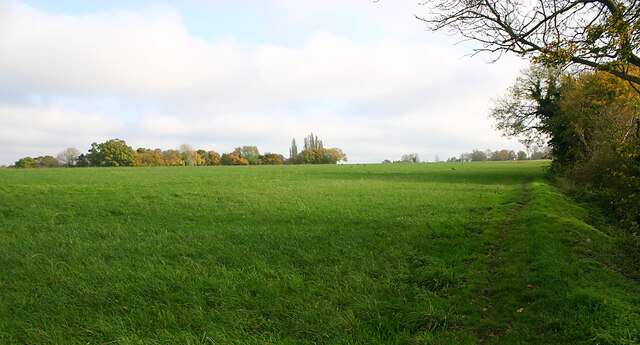
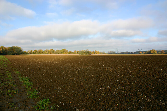
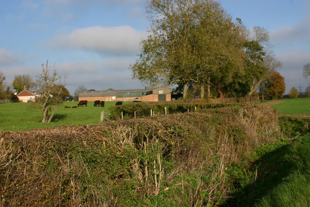
Sidehill Wood is a picturesque woodland located in the county of Hertfordshire, England. Covering an area of approximately 20 hectares, it is nestled within the Chiltern Hills, a designated Area of Outstanding Natural Beauty. The woodland is situated near the village of Sidehill and is easily accessible from the nearby town of Tring.

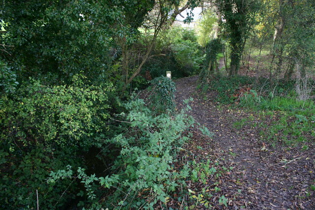
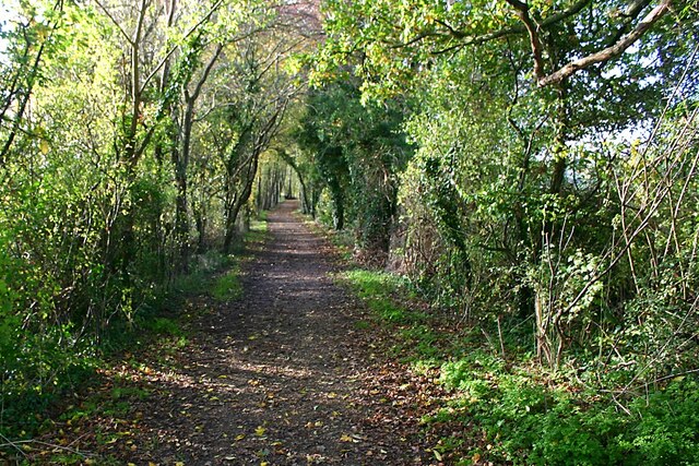
Sidehill Wood is predominantly made up of broadleaf trees, including oak, beech, and ash. These towering trees create a dense canopy, providing a sheltered habitat for a variety of wildlife. The forest floor is carpeted with an array of wildflowers, ferns, and mosses, adding to its natural beauty.

Visitors to Sidehill Wood can enjoy a network of well-maintained footpaths that wind their way through the woodland, allowing for pleasant walks and exploration. The paths are suitable for all ages and abilities, making it an ideal destination for families and nature enthusiasts alike.

The woodland is home to a diverse range of wildlife, including several species of birds such as woodpeckers, thrushes, and owls. It is also a haven for small mammals like squirrels, rabbits, and foxes. Nature lovers may also spot butterflies, dragonflies, and other insects that thrive in this enchanting habitat.

Sidehill Wood offers a tranquil and peaceful setting, allowing visitors to immerse themselves in nature and escape the hustle and bustle of everyday life. Whether it's a leisurely stroll, birdwatching, or simply enjoying the serenity of the surroundings, Sidehill Wood is a delightful destination for anyone seeking a connection with the natural world.

If you have any feedback on the listing, please let us know in the comments section below.

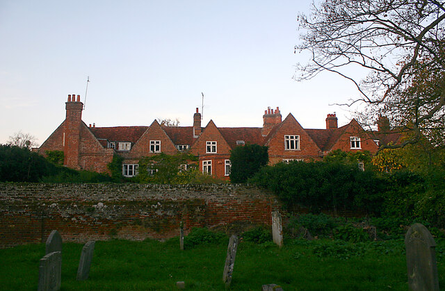
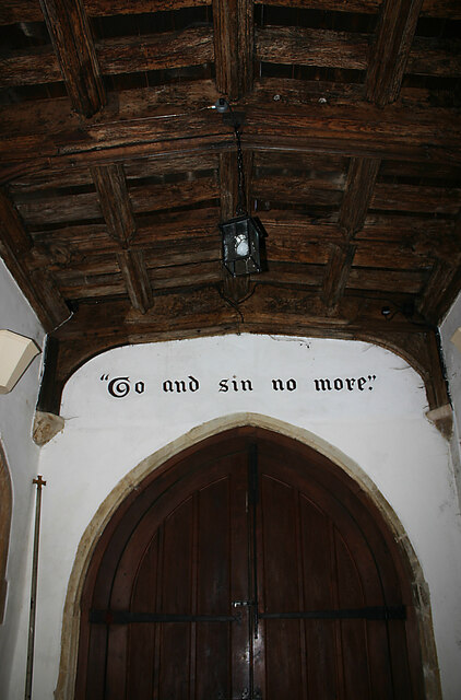
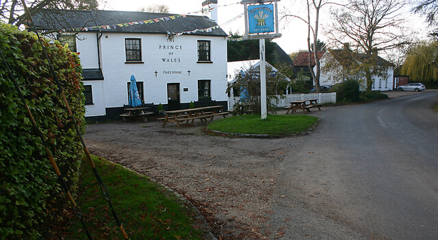
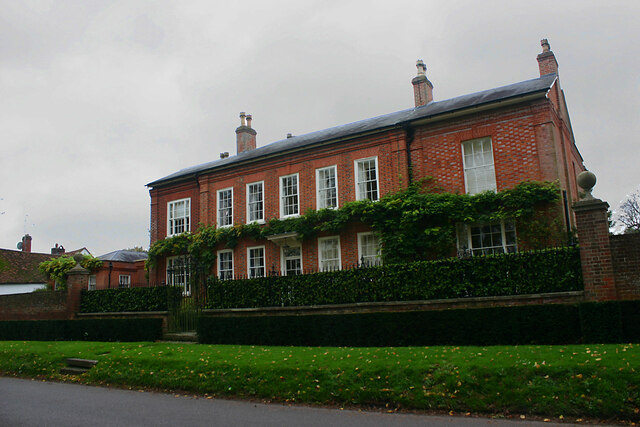
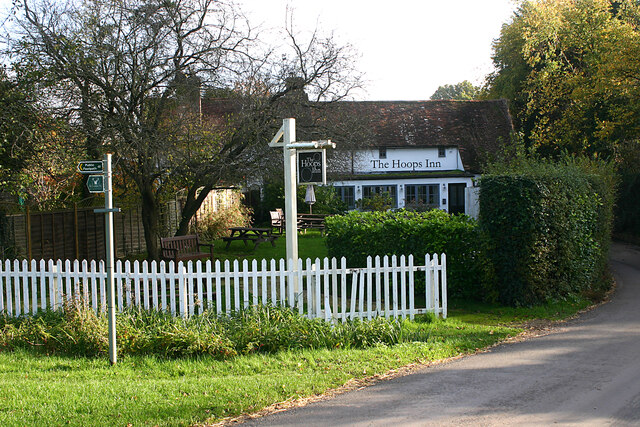
Sidehill Wood Images

Images are sourced within 2km of 51.843887/0.074993129 or Grid Reference TL4318. Thanks to Geograph Open Source API. All images are credited.

The Palace, Much Hadham - south elevation The site historically housed a residence of the Bishops of London. The present, early C16 house was sequestrated during the English Civil War but then reverted to the Bishop at the Restoration. It became a lunatic asylum in 1817 until it passed back to the Ecclesiastical Commissioners in 1868. It was sold as a private house in 1888 and after World War II became the home of Major Sir Edward Beddington-Behrens. The property is now divided into three separate dwellings. Taken from the nearby churchyard of St Andrew.
The Palace, Much Hadham - south elevation
The site historically housed a residence of the Bishops of London. The present, early C16 house was sequestrated during the English Civil War but then reverted to the Bishop at the Restoration. It became a lunatic asylum in 1817 until it passed back to the Ecclesiastical Commissioners in 1868. It was sold as a private house in 1888 and after World War II became the home of Major Sir Edward Beddington-Behrens. The property is now divided into three separate dwellings. Taken from the nearby churchyard of St Andrew.
St Andrew, Much Hadham - south-east elevation
St Andrew, Much Hadham - north-east elevation
St Andrew, Much Hadham - entrance from south porch The text above the door is from Ecclesiastes 5:1. In modern terms it exhorts you to watch your step and show appropriate respect.
St Andrew, Much Hadham - entrance from south porch
The text above the door is from Ecclesiastes 5:1. In modern terms it exhorts you to watch your step and show appropriate respect.
St Andrew, Much Hadham - exit from south porch The exhortation is taken from John 8:11 and was addressed by Christ to the woman taken in adultery. The rest of this part of the verse reads "Neither do I condemn thee. Go and sin no more".
St Andrew, Much Hadham - exit from south porch
The exhortation is taken from John 8:11 and was addressed by Christ to the woman taken in adultery. The rest of this part of the verse reads "Neither do I condemn thee. Go and sin no more".
St Andrew, Much Hadham - north aisle looking east
St Andrew, Much Hadham - south aisle looking west
Cottages in Church Lane, Much Hadham Like many of the others in the village these C16-17 cottages are Listed Buildings.
Cottages in Church Lane, Much Hadham
Like many of the others in the village these C16-17 cottages are Listed Buildings.
Downtown Green Tye Green Tye is a small hamlet comprising a public house and a few houses.
Downtown Green Tye
Green Tye is a small hamlet comprising a public house and a few houses.
North Leys, High Street, Much Hadham A Listed Building dating from c.1720.
North Leys, High Street, Much Hadham
A Listed Building dating from c.1720.
The Red House, High Street, Much Hadham A Listed Building dating from the early C18.
The Red House, High Street, Much Hadham
A Listed Building dating from the early C18.
Hill House, Tower Hill, Much Hadham A Listed Building dating from the mid-C19 and formerly The Barn School.
Hill House, Tower Hill, Much Hadham
A Listed Building dating from the mid-C19 and formerly The Barn School.
Footpath leading to Danebridge Road, Much Hadham The path makes a gentle descent through woodland from a grassy plateau in the valley of the River Ash.
Footpath leading to Danebridge Road, Much Hadham
The path makes a gentle descent through woodland from a grassy plateau in the valley of the River Ash.
Grassy plateau north-west of Green Tye The countryside hereabouts is characterised by flat terrains incised by streams which have created wooded mini-valleys.
Grassy plateau north-west of Green Tye
The countryside hereabouts is characterised by flat terrains incised by streams which have created wooded mini-valleys.
Brook Lane, near Perry Green Brook Lane is a by-way between farms to the west of Perry Green.
Brook Lane, near Perry Green
Brook Lane is a by-way between farms to the west of Perry Green.
Plateau country west of Perry Green The countryside hereabouts is characterised by flat terrains incised by streams which have created wooded mini-valleys. The OS map shows the track on the left as "a road used as a public path" but there was little evidence of its recent use as a road.
Plateau country west of Perry Green
The countryside hereabouts is characterised by flat terrains incised by streams which have created wooded mini-valleys. The OS map shows the track on the left as "a road used as a public path" but there was little evidence of its recent use as a road.
Grazing land at Bucklers Hall Farm, Perry Green
The Hoops Inn, Perry Green (2022) This is the rear view as seen from the green.
The Hoops Inn, Perry Green (2022)
This is the rear view as seen from the green.
Show me another place!

Sidehill Wood is located at Grid Ref: TL4318 (Lat: 51.843887, Lng: 0.074993129)

Administrative County: Hertfordshire

District: East Hertfordshire

Police Authority: Hertfordshire

What 3 Words

///loved.phones.lasted. Near Much Hadham, Hertfordshire

Related Wikis

Hadham railway station

Hadham railway station served the village of Much Hadham, Hertfordshire, England, from 1863 to 1965 on the Buntingford branch line. == History == The station...

Perry Green, Hertfordshire

Perry Green is a scattered hamlet in Hertfordshire, England, near Much Hadham. The sculptor Henry Moore settled there in 1941. His house Hoglands now forms...

Henry Moore Foundation

The Henry Moore Foundation is a registered charity in England, established for education and promotion of the fine arts — in particular, to advance understanding...

Hadham Rural District

Hadham Rural District was a rural district in Hertfordshire, England from 1894 to 1935, covering an area in the east of the county. == Evolution == The...

Much Hadham

Much Hadham, formerly known as Great Hadham, is a village and civil parish in the district of East Hertfordshire, Hertfordshire, England. The parish of...

Moor Place, Hertfordshire

Moor Place is a country house within the civil parish of Much Hadham, in the East Hertfordshire district, in the county of Hertfordshire, England. It is...

Much Hadham Palace

Much Hadham House is a manor house adjacent to the church in Much Hadham, Hertfordshire, England, formerly belonging to the Bishops of London. It is a...

Widford, Hertfordshire

Widford is a village and civil parish between Ware and Much Hadham in the East Hertfordshire district of Hertfordshire in England. It covers an area of...

Nearby Amenities

Located within 500m of 51.843887,0.074993129
Fuel
Lat/Long: 51.8433738/0.0692216
Depth Gauge: yes
Ford: yes
Lat/Long: 51.8482614/0.0746799
Depth Gauge: yes
Ford: yes
Surface: paved
Lat/Long: 51.847543/0.0772407
Bus Stop
Station Road
Bench: yes
Bin: no
Bus: yes
Lit: no
Naptan AtcoCode: 210021303880
Naptan Bearing: N
Naptan CommonName: Station Road
Naptan Crossing: Station Road
Naptan Indicator: adj
Naptan Landmark: Station Road
Naptan NaptanCode: hrtdtjpd
Naptan ShortCommonName: NA
Naptan Street: Widford Road
Naptan Verified: no
Public Transport: platform
Shelter: no
Source: naptan_import
Tactile Paving: no
Lat/Long: 51.8436268/0.0688659
Bus Stop
Broadfield Way
Bus: yes
Naptan AtcoCode: 210021303900
Naptan Bearing: N
Naptan CommonName: Broadfield Way
Naptan Crossing: Fire Station
Naptan Indicator: adj
Naptan Landmark: Fire Station
Naptan NaptanCode: hrtdtjpg
Naptan ShortCommonName: NA
Naptan Street: Tower Hill
Naptan Verified: no
Public Transport: platform
Source: naptan_import
Lat/Long: 51.8460493/0.0689916
Bus Stop
Broadfield Way
Bus: yes
Naptan AtcoCode: 210021308980
Naptan Bearing: S
Naptan CommonName: Broadfield Way
Naptan Crossing: opp Fire Station
Naptan Indicator: opp
Naptan Landmark: opp Fire Station
Naptan NaptanCode: hrtdpmgd
Naptan ShortCommonName: NA
Naptan Street: Tower Hill
Naptan Verified: no
Public Transport: platform
Source: naptan_import
Lat/Long: 51.846455/0.069424
Bus Stop
Station Road
Bench: no
Bin: no
Bus: yes
Lit: no
Naptan AtcoCode: 210021309000
Naptan Bearing: S
Naptan CommonName: Station Road
Naptan Crossing: Station Road
Naptan Indicator: opp
Naptan Landmark: Station Road
Naptan NaptanCode: hrtdpmgj
Naptan ShortCommonName: NA
Naptan Street: Widford Road
Naptan Verified: no
Public Transport: platform
Shelter: no
Source: naptan_import
Tactile Paving: no
Lat/Long: 51.8439799/0.0690564
Barrier: kissing_gate
Foot: yes
Lat/Long: 51.847084/0.0761381
Barrier: kissing_gate
Foot: yes
Source: GPS
Lat/Long: 51.8479833/0.0758046
Bench
Backrest: no
Lat/Long: 51.8459608/0.0756775
Bench
Backrest: no
Lat/Long: 51.8411883/0.0734767
Bench
Backrest: yes
Material: wood
Lat/Long: 51.8458495/0.0787667
Daneswood
Building: house
Listed Status: Grade II
Note: https://mapservices.historicengland.org.uk/printwebservicehle/StatutoryPrint.svc/263264/HLE_A4L_Grade%7CHLE_A3L_Grade.pdf
Source: https://mapservices.historicengland.org.uk/printwebservicehle/StatutoryPrint.svc/263264/HLE_A4L_Grade%7CHLE_A3L_Grade.pdf
Source Listed Status: Historic England
Lat/Long: 51.846736/0.0787667
Direction: forward
Traffic Calming: yes
Lat/Long: 51.8457693/0.0690599
Barrier: kissing_gate
Lat/Long: 51.8481968/0.0747961
Barrier: kissing_gate
Lat/Long: 51.8471884/0.0724049
Ford: yes
Lat/Long: 51.8479465/0.0757902
Material: wood
Power: pole
Lat/Long: 51.841609/0.0770774
Material: wood
Power: pole
Lat/Long: 51.8422853/0.0791346
Material: wood
Power: pole
Lat/Long: 51.8429581/0.081181
Power: pole
Lat/Long: 51.8456876/0.0812629
Material: wood
Power: pole
Lat/Long: 51.8410848/0.0742222
Material: wood
Power: pole
Lat/Long: 51.8410262/0.0707298
Material: wood
Power: pole
Lat/Long: 51.8410452/0.0722721
Material: wood
Power: pole
Lat/Long: 51.8411111/0.0755149
The data included in this document is from www.openstreetmap.org. The data is made available under ODbL.

Have you been to Sidehill Wood?

Leave your review of Sidehill Wood below (or comments, questions and feedback).