Deershelter Plain

Wood, Forest in Essex Epping Forest

England

Deershelter Plain

Bridge over the M25 near Upshire Officially named the London Orbital and frequently derided as nothing more than a very big car park, the M25 is a 117-mile orbital motorway that encircles London; one of the world's biggest ring roads (Europe's second longest orbital road after the Berliner Ring, which is 122 miles). It is not, however, a continuous loop of motorway as the Dartford Crossing section (comprising the Dartford Tunnels and the Queen Elizabeth II Bridge) over the Thames and its approach roads are designated as the A282. 

Constructed between 1975 and 1986, the M25 is reputedly the most expensive motorway Britain ever built, costing a total of £909m or roughly £7.5m per mile, but at the time of its planning, the demand for the road was considerably underestimated so that when it was finally completed in 1986, it was already out of date. Demand outstripped capacity within a few years and ever since then it's been very heavily congested. 

The M25 is one of the UK’s busiest motorways, carrying up to 200,000 vehicles and 10,000 HGVs per day (AADT - Annual Average Daily Traffic flow) on the section near to Heathrow Airport. Since its opening in the 1980s, the southern, western and eastern sections have been widened to largely dual four lane (D4M) standard, but much of the motorway retains its dual three lane road (D3M) cross-section as originally built. 

The M25 was home to England's first Variable Speed Limits on motorways between the A3 and M4 in the early 1990s.

<span class="nowrap"><a title="http://www.cbrd.co.uk/motorway/m25/" rel="nofollow ugc noopener" href="http://www.cbrd.co.uk/motorway/m25/">Link</a><img style="margin-left:2px;" alt="External link" title="External link - shift click to open in new window" src="https://s1.geograph.org.uk/img/external.png" width="10" height="10"/></span>  cbrd
<span class="nowrap"><a title="http://www.sabre-roads.org.uk/wiki/index.php?title=M25" rel="nofollow ugc noopener" href="http://www.sabre-roads.org.uk/wiki/index.php?title=M25">Link</a><img style="margin-left:2px;" alt="External link" title="External link - shift click to open in new window" src="https://s1.geograph.org.uk/img/external.png" width="10" height="10"/></span>  SABRE
Bridge over the M25 near Upshire Credit: David Dixon

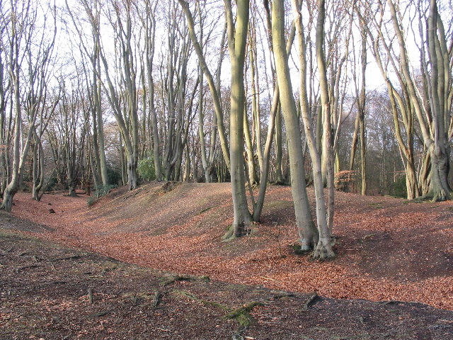
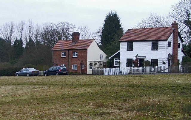
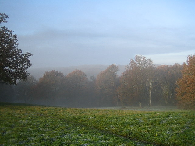
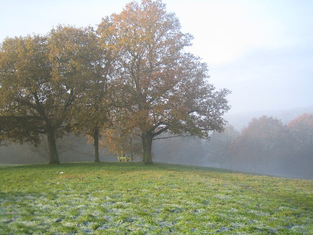
Deershelter Plain is a picturesque woodland area located in the county of Essex, England. Situated within a vast forest, it is a popular destination for nature enthusiasts and those seeking tranquility amidst the beauty of nature.

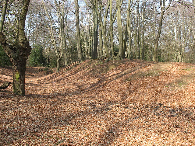
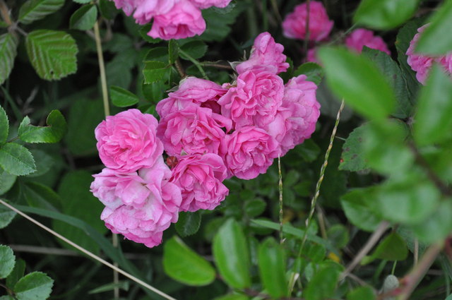
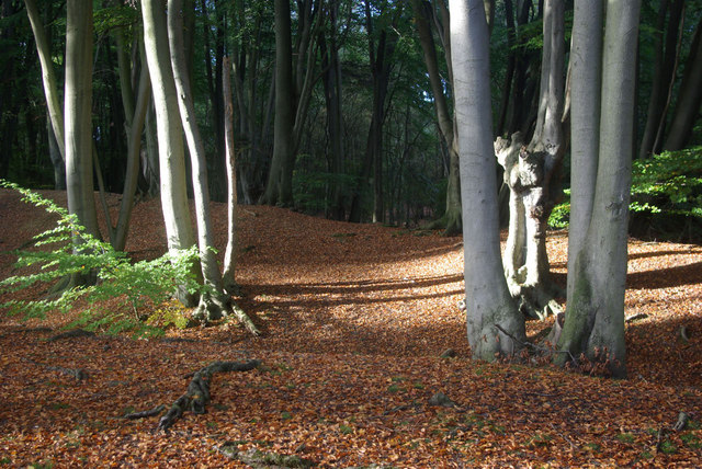
Covering an expansive area, Deershelter Plain is characterized by its dense woodland, abundant wildlife, and diverse flora. The forest is primarily composed of deciduous trees, including oak, beech, and birch, creating a rich tapestry of colors throughout the seasons. The forest floor is adorned with a carpet of wildflowers during springtime, adding to the enchanting atmosphere.

As the name suggests, the plain is also home to a significant population of deer, offering visitors the opportunity to observe these majestic creatures in their natural habitat. The deer, including fallow and roe species, roam freely throughout the woodland, making for a truly immersive wildlife experience.

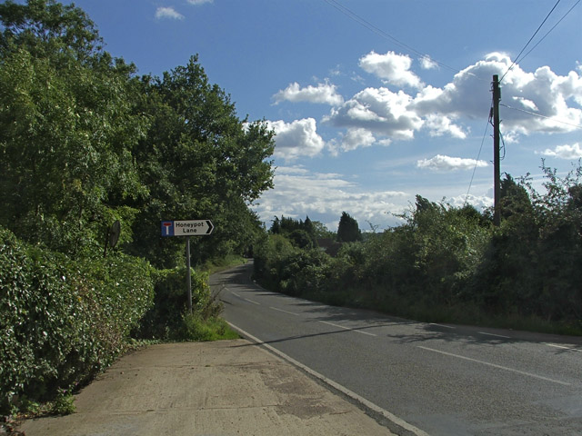
For those interested in exploring the forest, Deershelter Plain offers an extensive network of walking trails and paths. These trails cater to various levels of difficulty, accommodating both casual strollers and avid hikers. Along the way, visitors can discover hidden streams, peaceful ponds, and even ancient ruins, adding an element of intrigue to their journey.

Deershelter Plain is also a haven for birdwatchers, with a diverse range of avian species inhabiting the area. From the melodious song of the nightingale to the colorful plumage of woodpeckers, bird enthusiasts will be delighted by the array of feathered friends that call this forest home.

Overall, Deershelter Plain in Essex is a captivating woodland oasis, offering a blend of natural beauty, wildlife encounters, and peaceful serenity for all who venture into its depths.

If you have any feedback on the listing, please let us know in the comments section below.

Deershelter Plain Images

Images are sourced within 2km of 51.671263/0.059934929 or Grid Reference TQ4298. Thanks to Geograph Open Source API. All images are credited.

Bridge over the M25 near Upshire Officially named the London Orbital and frequently derided as nothing more than a very big car park, the M25 is a 117-mile orbital motorway that encircles London; one of the world's biggest ring roads (Europe's second longest orbital road after the Berliner Ring, which is 122 miles). It is not, however, a continuous loop of motorway as the Dartford Crossing section (comprising the Dartford Tunnels and the Queen Elizabeth II Bridge) over the Thames and its approach roads are designated as the A282. 

Constructed between 1975 and 1986, the M25 is reputedly the most expensive motorway Britain ever built, costing a total of £909m or roughly £7.5m per mile, but at the time of its planning, the demand for the road was considerably underestimated so that when it was finally completed in 1986, it was already out of date. Demand outstripped capacity within a few years and ever since then it's been very heavily congested. 

The M25 is one of the UK’s busiest motorways, carrying up to 200,000 vehicles and 10,000 HGVs per day (AADT - Annual Average Daily Traffic flow) on the section near to Heathrow Airport. Since its opening in the 1980s, the southern, western and eastern sections have been widened to largely dual four lane (D4M) standard, but much of the motorway retains its dual three lane road (D3M) cross-section as originally built. 

The M25 was home to England's first Variable Speed Limits on motorways between the A3 and M4 in the early 1990s.

<span class="nowrap"><a title="http://www.cbrd.co.uk/motorway/m25/" rel="nofollow ugc noopener" href="http://www.cbrd.co.uk/motorway/m25/">Link</a><img style="margin-left:2px;" alt="External link" title="External link - shift click to open in new window" src="https://s1.geograph.org.uk/img/external.png" width="10" height="10"/></span>  cbrd
<span class="nowrap"><a title="http://www.sabre-roads.org.uk/wiki/index.php?title=M25" rel="nofollow ugc noopener" href="http://www.sabre-roads.org.uk/wiki/index.php?title=M25">Link</a><img style="margin-left:2px;" alt="External link" title="External link - shift click to open in new window" src="https://s1.geograph.org.uk/img/external.png" width="10" height="10"/></span>  SABRE
Bridge over the M25 near Upshire
Officially named the London Orbital and frequently derided as nothing more than a very big car park, the M25 is a 117-mile orbital motorway that encircles London; one of the world's biggest ring roads (Europe's second longest orbital road after the Berliner Ring, which is 122 miles). It is not, however, a continuous loop of motorway as the Dartford Crossing section (comprising the Dartford Tunnels and the Queen Elizabeth II Bridge) over the Thames and its approach roads are designated as the A282. Constructed between 1975 and 1986, the M25 is reputedly the most expensive motorway Britain ever built, costing a total of £909m or roughly £7.5m per mile, but at the time of its planning, the demand for the road was considerably underestimated so that when it was finally completed in 1986, it was already out of date. Demand outstripped capacity within a few years and ever since then it's been very heavily congested. The M25 is one of the UK’s busiest motorways, carrying up to 200,000 vehicles and 10,000 HGVs per day (AADT - Annual Average Daily Traffic flow) on the section near to Heathrow Airport. Since its opening in the 1980s, the southern, western and eastern sections have been widened to largely dual four lane (D4M) standard, but much of the motorway retains its dual three lane road (D3M) cross-section as originally built. The M25 was home to England's first Variable Speed Limits on motorways between the A3 and M4 in the early 1990s. LinkExternal link cbrd LinkExternal link SABRE
Variable Message Sign on the M25 at Copthall Green Variable message signs (VMS), also sometimes referred to as matrix signs, are electronic traffic signs used on motorways (and some other major routes) to give drivers information about special events and to warn them about traffic congestion, accidents, incidents, roadworks or speed limits on specific sections of the route. They may also suggest (or instruct) drivers to take alternative routes, limit speed, warn of the duration and location of the incidents or just inform them of the traffic conditions. Drivers carrying freight bound for the cross-channel port of Dover are instructed to use the M20 by this sign.
Variable Message Sign on the M25 at Copthall Green
Variable message signs (VMS), also sometimes referred to as matrix signs, are electronic traffic signs used on motorways (and some other major routes) to give drivers information about special events and to warn them about traffic congestion, accidents, incidents, roadworks or speed limits on specific sections of the route. They may also suggest (or instruct) drivers to take alternative routes, limit speed, warn of the duration and location of the incidents or just inform them of the traffic conditions. Drivers carrying freight bound for the cross-channel port of Dover are instructed to use the M20 by this sign.
Beeches on Ambresbury Banks Ambresbury Banks is an Iron Age hill fort, situated at one of the highest points of Epping forest.
Beeches on Ambresbury Banks
Ambresbury Banks is an Iron Age hill fort, situated at one of the highest points of Epping forest.
Cottages, Crown Hill, Copthall Green Cottages, Crown Hill, Copthall Green near Upshire, Essex
Cottages, Crown Hill, Copthall Green
Cottages, Crown Hill, Copthall Green near Upshire, Essex
Honeypot Lane Road Sign from Woodgreen Road, Upshire, Essex
Woodgreen Road, Upshire, Essex.
A Forest Road The road through Epping Forest to Upshire.
A Forest Road
The road through Epping Forest to Upshire.
Epping Forest: Ambresbury Banks Another winter view of <a href="https://www.geograph.org.uk/photo/110134">TL4300 : Beeches on Ambresbury Banks</a>.  According to the information board, the Banks are believed to have been built around 500 BCE, and been in use as animal corrals until at least the Roman invasion in 55 BCE.  Local legend apparently claims the site as that of the death of the Queen Boudicca, though the story has no historical basis.
Epping Forest: Ambresbury Banks
Another winter view of TL4300 : Beeches on Ambresbury Banks. According to the information board, the Banks are believed to have been built around 500 BCE, and been in use as animal corrals until at least the Roman invasion in 55 BCE. Local legend apparently claims the site as that of the death of the Queen Boudicca, though the story has no historical basis.
Rhododendrons in Epping Forest This part of Epping Forest, known as The Warren, was added to the Forest in 1992, having once formed part of an enclosed hunting ground. It is adjacent to the grounds of Copped Hall, a mansion destroyed by fire in 1917, now in the hands of a trust dedicated to restoration of the hall and outbuildings.
Rhododendrons in Epping Forest
This part of Epping Forest, known as The Warren, was added to the Forest in 1992, having once formed part of an enclosed hunting ground. It is adjacent to the grounds of Copped Hall, a mansion destroyed by fire in 1917, now in the hands of a trust dedicated to restoration of the hall and outbuildings.
Abandoned Forest Road This link road was closed to traffic in the 1990s, and is now blocked by banks and both ends. The road is gradually returning to nature.
Abandoned Forest Road
This link road was closed to traffic in the 1990s, and is now blocked by banks and both ends. The road is gradually returning to nature.
The Gatehouse of Copped Hall Estate.
The Good Intent..
The Good Intent..
Wild Roses. Wild roses growing on the roadside.
Wild Roses.
Wild roses growing on the roadside.
Copthall Green: Good Intent The pub and restaurant is on Crown Hill and has an excellent informative website here <span class="nowrap"><a title="http://www.goodintentupshire.co.uk/index.php" rel="nofollow ugc noopener" href="http://www.goodintentupshire.co.uk/index.php">Link</a><img style="margin-left:2px;" alt="External link" title="External link - shift click to open in new window" src="https://s1.geograph.org.uk/img/external.png" width="10" height="10"/></span>
Copthall Green: Good Intent
The pub and restaurant is on Crown Hill and has an excellent informative website here LinkExternal link
Ambresbury Banks Hidden among the beech trees at the northern end of Epping Forest, are earthworks believed to date from around 500BC. They may have been built as animal folds or possibly as a lookout or boundary marker between the territories of rival tribes. What is known for certain is that , despite local legend, this is not where Queen Boudicca was defeated and killed.
Ambresbury Banks
Hidden among the beech trees at the northern end of Epping Forest, are earthworks believed to date from around 500BC. They may have been built as animal folds or possibly as a lookout or boundary marker between the territories of rival tribes. What is known for certain is that , despite local legend, this is not where Queen Boudicca was defeated and killed.
Epping Forest From Baldwins Hill Within the M25!
Epping Forest From Baldwins Hill
Within the M25!
Bench in Epping Forest from Baldwins Hill
House restoration, Baldwins Hill This building has been painted white but it has been removed to reveal interesting brickwork detail.
House restoration, Baldwins Hill
This building has been painted white but it has been removed to reveal interesting brickwork detail.
Show me another place!

Deershelter Plain is located at Grid Ref: TQ4298 (Lat: 51.671263, Lng: 0.059934929)

Administrative County: Essex

District: Epping Forest

Police Authority: Essex

What 3 Words

///rams.charm.hurray. Near Theydon Bois, Essex

Related Wikis

A121 road (England)

The A121 road is a road in England connecting Waltham Cross and Woodford Wells. == Major settlements == The main settlements on it are Waltham Abbey and...

Great Monk Wood

Great Monk Wood is a wood within Epping Forest, in Essex, England. The wood, in the parish of Loughton, is centred on the Wakes Arms junction roundabout...

Epping Forest

Epping Forest is a 2,400-hectare (5,900-acre) area of ancient woodland, and other established habitats, which straddles the border between Greater London...

Debden House

Debden House is a conference centre and campsite located in Loughton, Essex, England. The house is owned and operated by Newham London Borough Council...

Loughton Camp

Loughton Camp is an Iron Age (~500 BC) Hill fort in Epping Forest, one mile (1.6 km) northwest of the town of Loughton. The camp's earthworks cover an...

Bell Common

Bell Common is a settlement in Essex, England and forms the southern part of the town of Epping. == Tunnel == The Bell Common Tunnel is a covered section...

Home Mead

Home Mead is a 1.8 hectare Local Nature Reserve in Loughton in Essex. It is owned and managed by Epping Forest District Council.This site has woodland...
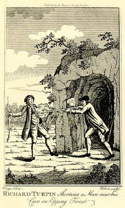
Turpin's Cave

Turpin's Cave is an area of Epping Forest in Essex which has been attributed as a hiding place of the highwayman Dick Turpin. Dick Turpin knew Epping...

Nearby Amenities

Located within 500m of 51.671263,0.059934929
Bus Stop
Wake Arms
Naptan AtcoCode: 150022016007
Naptan Bearing: W
Naptan CommonName: Wake Arms
Naptan Crossing: Epping Road B1393
Naptan Indicator: W-bound
Naptan Landmark: Wake Arms
Naptan NaptanCode: esxdgtwj
Naptan Street: Woodridden Hill
Naptan Verified: no
Public Transport: platform
Source: naptan_import
Lat/Long: 51.6753541/0.0602562
Bus Stop
Wake Arms
Naptan AtcoCode: 150022016008
Naptan Bearing: E
Naptan CommonName: Wake Arms
Naptan Crossing: Epping Road B1393
Naptan Indicator: E-bound
Naptan Landmark: Wake Arms
Naptan NaptanCode: esxdgtwm
Naptan Street: Woodridden Hill
Naptan Verified: no
Public Transport: platform
Source: naptan_import
Lat/Long: 51.6753146/0.061994
Bus Stop
Goldings Hill Forest
Naptan AtcoCode: 150042001005
Naptan Bearing: N
Naptan CommonName: Goldings Hill Forest
Naptan Indicator: N-bound
Naptan Landmark: Goldings Hill Forest
Naptan NaptanCode: esxatmpd
Naptan Street: Golding's Hill
Naptan Verified: no
Public Transport: platform
Source: naptan_import
Lat/Long: 51.6680013/0.0643126
Bus Stop
Goldings Hill Forest
Naptan AtcoCode: 150042001006
Naptan Bearing: S
Naptan CommonName: Goldings Hill Forest
Naptan Indicator: S-bound
Naptan Landmark: Goldings Hill Forest
Naptan NaptanCode: esxatmpg
Naptan Street: Golding's Hill
Naptan Verified: no
Public Transport: platform
Source: naptan_import
Lat/Long: 51.668113/0.0644684
Deershelter Plain
Place: locality
Lat/Long: 51.6708232/0.0611215
Dulsmead Hollow
Place: locality
Lat/Long: 51.6728612/0.0632141
Sunshine Plain
Place: locality
Lat/Long: 51.6725744/0.0538264
Hangboy Slade
Place: locality
Lat/Long: 51.6711113/0.0669552
Barrier: cattle_grid
Lat/Long: 51.6751892/0.0608265
Give Way
Direction: forward
Lat/Long: 51.6752971/0.0610232
Entrance: main
Lat/Long: 51.6754673/0.0623271
Waste Basket
Lat/Long: 51.6680169/0.0646961
Information: board
Tourism: information
Lat/Long: 51.6680231/0.0647061
The data included in this document is from www.openstreetmap.org. The data is made available under ODbL.

Have you been to Deershelter Plain?

Leave your review of Deershelter Plain below (or comments, questions and feedback).