Copped Hall Green

Wood, Forest in Essex Epping Forest

England

Copped Hall Green

Bridge over the M25 near Upshire Officially named the London Orbital and frequently derided as nothing more than a very big car park, the M25 is a 117-mile orbital motorway that encircles London; one of the world's biggest ring roads (Europe's second longest orbital road after the Berliner Ring, which is 122 miles). It is not, however, a continuous loop of motorway as the Dartford Crossing section (comprising the Dartford Tunnels and the Queen Elizabeth II Bridge) over the Thames and its approach roads are designated as the A282. 

Constructed between 1975 and 1986, the M25 is reputedly the most expensive motorway Britain ever built, costing a total of £909m or roughly £7.5m per mile, but at the time of its planning, the demand for the road was considerably underestimated so that when it was finally completed in 1986, it was already out of date. Demand outstripped capacity within a few years and ever since then it's been very heavily congested. 

The M25 is one of the UK’s busiest motorways, carrying up to 200,000 vehicles and 10,000 HGVs per day (AADT - Annual Average Daily Traffic flow) on the section near to Heathrow Airport. Since its opening in the 1980s, the southern, western and eastern sections have been widened to largely dual four lane (D4M) standard, but much of the motorway retains its dual three lane road (D3M) cross-section as originally built. 

The M25 was home to England's first Variable Speed Limits on motorways between the A3 and M4 in the early 1990s.

<span class="nowrap"><a title="http://www.cbrd.co.uk/motorway/m25/" rel="nofollow ugc noopener" href="http://www.cbrd.co.uk/motorway/m25/">Link</a><img style="margin-left:2px;" alt="External link" title="External link - shift click to open in new window" src="https://s1.geograph.org.uk/img/external.png" width="10" height="10"/></span>  cbrd
<span class="nowrap"><a title="http://www.sabre-roads.org.uk/wiki/index.php?title=M25" rel="nofollow ugc noopener" href="http://www.sabre-roads.org.uk/wiki/index.php?title=M25">Link</a><img style="margin-left:2px;" alt="External link" title="External link - shift click to open in new window" src="https://s1.geograph.org.uk/img/external.png" width="10" height="10"/></span>  SABRE
Bridge over the M25 near Upshire Credit: David Dixon

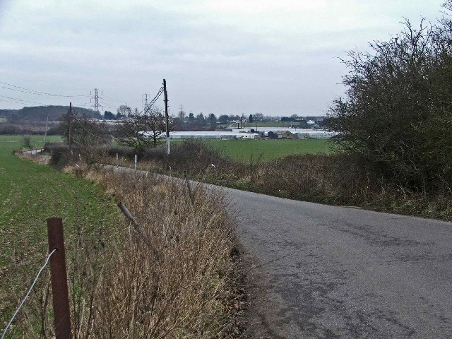
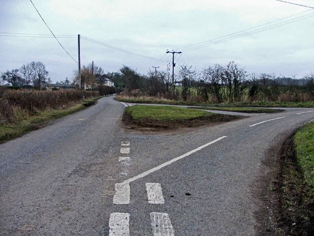
Copped Hall Green is a picturesque woodland located in Essex, England. Situated near the town of Epping, this green area covers a vast expanse of approximately 40 acres. The forest is characterized by its dense canopy of trees, mainly consisting of oak, beech, and birch, which create a serene and tranquil atmosphere.

The woodland is home to a diverse range of flora and fauna. The forest floor is adorned with a carpet of bluebells in spring, creating a stunning spectacle for visitors. Wildlife enthusiasts will be delighted to spot various species of birds, such as woodpeckers, owls, and blackbirds, as well as small mammals like foxes, rabbits, and squirrels.

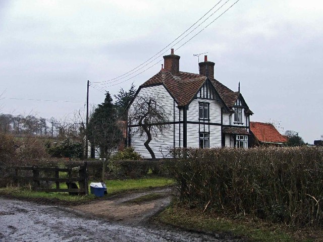
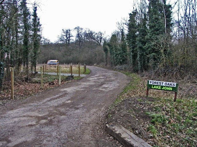
Copped Hall Green is a popular destination for nature lovers and outdoor enthusiasts. It offers a network of well-maintained walking trails, allowing visitors to explore the beauty of the woodland at their own pace. These trails wind through ancient trees and allow glimpses of breathtaking vistas. The forest also provides a peaceful setting for picnics and family outings, with designated areas equipped with picnic tables and benches.

The woodland is managed by the local authorities, who ensure its preservation and protection. They organize guided nature walks and educational programs, allowing visitors to learn about the history, ecology, and conservation efforts of the area.

Overall, Copped Hall Green is a haven of tranquility, offering a chance to escape the hustle and bustle of daily life and immerse oneself in the beauty of nature. It is a cherished natural treasure in Essex, attracting visitors from near and far.

If you have any feedback on the listing, please let us know in the comments section below.

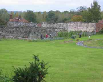
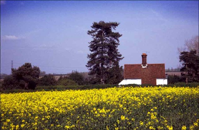
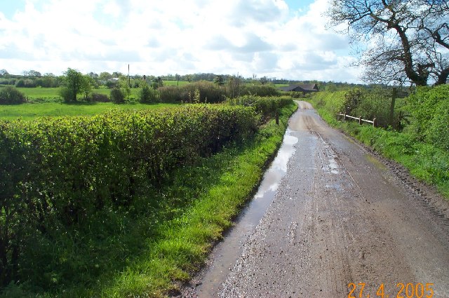
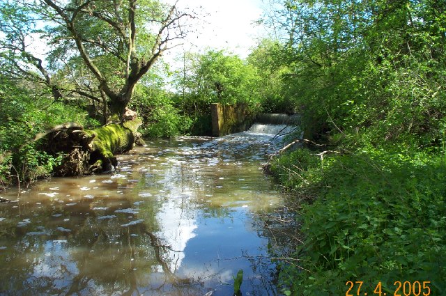
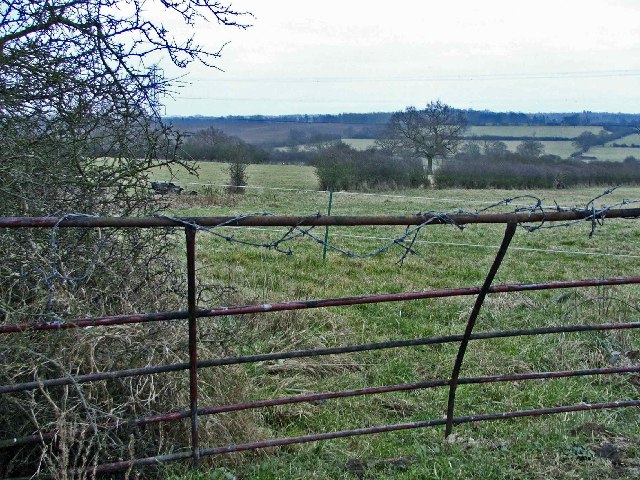
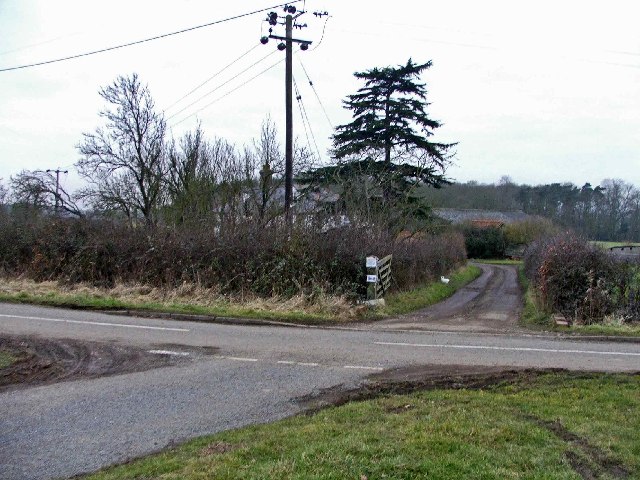
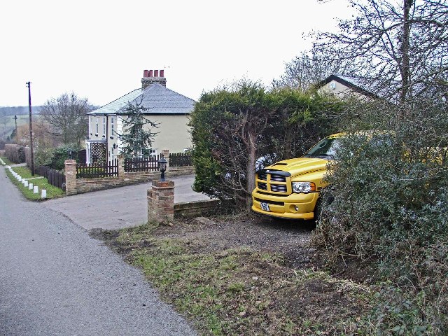
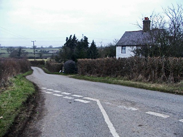
Copped Hall Green Images

Images are sourced within 2km of 51.694823/0.055375756 or Grid Reference TL4201. Thanks to Geograph Open Source API. All images are credited.

Bridge over the M25 near Upshire Officially named the London Orbital and frequently derided as nothing more than a very big car park, the M25 is a 117-mile orbital motorway that encircles London; one of the world's biggest ring roads (Europe's second longest orbital road after the Berliner Ring, which is 122 miles). It is not, however, a continuous loop of motorway as the Dartford Crossing section (comprising the Dartford Tunnels and the Queen Elizabeth II Bridge) over the Thames and its approach roads are designated as the A282. 

Constructed between 1975 and 1986, the M25 is reputedly the most expensive motorway Britain ever built, costing a total of £909m or roughly £7.5m per mile, but at the time of its planning, the demand for the road was considerably underestimated so that when it was finally completed in 1986, it was already out of date. Demand outstripped capacity within a few years and ever since then it's been very heavily congested. 

The M25 is one of the UK’s busiest motorways, carrying up to 200,000 vehicles and 10,000 HGVs per day (AADT - Annual Average Daily Traffic flow) on the section near to Heathrow Airport. Since its opening in the 1980s, the southern, western and eastern sections have been widened to largely dual four lane (D4M) standard, but much of the motorway retains its dual three lane road (D3M) cross-section as originally built. 

The M25 was home to England's first Variable Speed Limits on motorways between the A3 and M4 in the early 1990s.

<span class="nowrap"><a title="http://www.cbrd.co.uk/motorway/m25/" rel="nofollow ugc noopener" href="http://www.cbrd.co.uk/motorway/m25/">Link</a><img style="margin-left:2px;" alt="External link" title="External link - shift click to open in new window" src="https://s1.geograph.org.uk/img/external.png" width="10" height="10"/></span>  cbrd
<span class="nowrap"><a title="http://www.sabre-roads.org.uk/wiki/index.php?title=M25" rel="nofollow ugc noopener" href="http://www.sabre-roads.org.uk/wiki/index.php?title=M25">Link</a><img style="margin-left:2px;" alt="External link" title="External link - shift click to open in new window" src="https://s1.geograph.org.uk/img/external.png" width="10" height="10"/></span>  SABRE
Bridge over the M25 near Upshire
Officially named the London Orbital and frequently derided as nothing more than a very big car park, the M25 is a 117-mile orbital motorway that encircles London; one of the world's biggest ring roads (Europe's second longest orbital road after the Berliner Ring, which is 122 miles). It is not, however, a continuous loop of motorway as the Dartford Crossing section (comprising the Dartford Tunnels and the Queen Elizabeth II Bridge) over the Thames and its approach roads are designated as the A282. Constructed between 1975 and 1986, the M25 is reputedly the most expensive motorway Britain ever built, costing a total of £909m or roughly £7.5m per mile, but at the time of its planning, the demand for the road was considerably underestimated so that when it was finally completed in 1986, it was already out of date. Demand outstripped capacity within a few years and ever since then it's been very heavily congested. The M25 is one of the UK’s busiest motorways, carrying up to 200,000 vehicles and 10,000 HGVs per day (AADT - Annual Average Daily Traffic flow) on the section near to Heathrow Airport. Since its opening in the 1980s, the southern, western and eastern sections have been widened to largely dual four lane (D4M) standard, but much of the motorway retains its dual three lane road (D3M) cross-section as originally built. The M25 was home to England's first Variable Speed Limits on motorways between the A3 and M4 in the early 1990s. LinkExternal link cbrd LinkExternal link SABRE
Variable Message Sign on the M25 at Copthall Green Variable message signs (VMS), also sometimes referred to as matrix signs, are electronic traffic signs used on motorways (and some other major routes) to give drivers information about special events and to warn them about traffic congestion, accidents, incidents, roadworks or speed limits on specific sections of the route. They may also suggest (or instruct) drivers to take alternative routes, limit speed, warn of the duration and location of the incidents or just inform them of the traffic conditions. Drivers carrying freight bound for the cross-channel port of Dover are instructed to use the M20 by this sign.
Variable Message Sign on the M25 at Copthall Green
Variable message signs (VMS), also sometimes referred to as matrix signs, are electronic traffic signs used on motorways (and some other major routes) to give drivers information about special events and to warn them about traffic congestion, accidents, incidents, roadworks or speed limits on specific sections of the route. They may also suggest (or instruct) drivers to take alternative routes, limit speed, warn of the duration and location of the incidents or just inform them of the traffic conditions. Drivers carrying freight bound for the cross-channel port of Dover are instructed to use the M20 by this sign.
Emergency Refuge Area on the M25 near Bell Common “Smart” motorways deploy traffic management methods to increase capacity and reduce congestion in busy areas and at peak times. These methods include using the hard shoulder as a ‘live’ lane and enforcing variable speed limits to control the flow of traffic.

Emergency refuge areas (ERAs) are located on smart motorways and designed to offer a ‘safe haven’ for stranded vehicles on busy vehicles. They are positioned up to every 1.5 miles apart, with an emergency telephone available to request assistance. Emergency refuge areas are only to be used in the event of a breakdown or an accident. They are not to be used for a rest stop, to make a phone call or to use the toilet. To increase visibility, each ERA has been designed using a highly visible orange road surface and a large blue sign featuring an orange SOS telephone symbol.

Stranded motorists should use the SOS telephone to speak to a representative at Highways England who will provide further instructions.
Emergency Refuge Area on the M25 near Bell Common
“Smart” motorways deploy traffic management methods to increase capacity and reduce congestion in busy areas and at peak times. These methods include using the hard shoulder as a ‘live’ lane and enforcing variable speed limits to control the flow of traffic. Emergency refuge areas (ERAs) are located on smart motorways and designed to offer a ‘safe haven’ for stranded vehicles on busy vehicles. They are positioned up to every 1.5 miles apart, with an emergency telephone available to request assistance. Emergency refuge areas are only to be used in the event of a breakdown or an accident. They are not to be used for a rest stop, to make a phone call or to use the toilet. To increase visibility, each ERA has been designed using a highly visible orange road surface and a large blue sign featuring an orange SOS telephone symbol. Stranded motorists should use the SOS telephone to speak to a representative at Highways England who will provide further instructions.
Copped  Hall The original house was a retreat for Princess Elizabeth now in ruins but Copped Hall was a later structure which is now a burnt shell but is cared for by a trust.
Copped Hall
The original house was a retreat for Princess Elizabeth now in ruins but Copped Hall was a later structure which is now a burnt shell but is cared for by a trust.
Copped Hall Greenhouses These greenhouses are in a very poor state and will 
probably fall apart due to lack of funds
Copped Hall Greenhouses
These greenhouses are in a very poor state and will probably fall apart due to lack of funds
The White House near Copped Hall The White House with its red roof stands out against the blue sky and the oilseed rape in the foreground.
The White House near Copped Hall
The White House with its red roof stands out against the blue sky and the oilseed rape in the foreground.
Cobbinsend Road near Waltham Abbey View looking south along the lane over the bridge over Cobbin's Brook towards Fernhall Farm
Cobbinsend Road near Waltham Abbey
View looking south along the lane over the bridge over Cobbin's Brook towards Fernhall Farm
Weir on Cobbin's Brook Viewed looking east this weir is on Cobbin's Brook where it flows through Warlies Park. The water level was higher than normal due to a period of heavy rain.
Weir on Cobbin's Brook
Viewed looking east this weir is on Cobbin's Brook where it flows through Warlies Park. The water level was higher than normal due to a period of heavy rain.
Breach Barns Lane leads from Dallance Farm to Oakwood Nursery Breach Barns Lane is a small road off Galleyhill Road, leading from Dallance Farm to Oakwood Nursery
Breach Barns Lane leads from Dallance Farm to Oakwood Nursery
Breach Barns Lane is a small road off Galleyhill Road, leading from Dallance Farm to Oakwood Nursery
Cobbinsend Farm, Cobbinsend Road, near Waltham Abbey
Maynards Farm, Cobbinsend Road, near Waltham Abbey Entrance to Maynards Farm opposite Cobbinsend Farm on Cobbinsend Road, near Waltham Abbey.
Maynards Farm, Cobbinsend Road, near Waltham Abbey
Entrance to Maynards Farm opposite Cobbinsend Farm on Cobbinsend Road, near Waltham Abbey.
Cobbinsend Road, near Waltham Abbey Cobbinsend Road looking north with Cobbinsend Farm on the right
Cobbinsend Road, near Waltham Abbey
Cobbinsend Road looking north with Cobbinsend Farm on the right
Three Gates where Claverhambury Road joins Cobbinsend Road Farmland in the area called three gates where Claverhambury Road joins Cobbinsend Road
Three Gates where Claverhambury Road joins Cobbinsend Road
Farmland in the area called three gates where Claverhambury Road joins Cobbinsend Road
Entrance to Fernhall Farm, Fernhall Lane Entrance to Fernhall Farm where Cobbinsend Road meets Fernhall Lane and Long Street
Entrance to Fernhall Farm, Fernhall Lane
Entrance to Fernhall Farm where Cobbinsend Road meets Fernhall Lane and Long Street
The Cottages, Long Street, near Copthall Green
Cottage opposite Fernhall Farm opposite junction with Fernhall Road
Long Street looking towards the Cottages Junction of Long Street, Fernhall Lane and Cobbinsend Road, looking towards the Cottages in Long Street
Long Street looking towards the Cottages
Junction of Long Street, Fernhall Lane and Cobbinsend Road, looking towards the Cottages in Long Street
Newhouse Farm, Long Street, Copthall Green Newhouse Farm, Copthall Stud, Long Street, Copthall Green
Newhouse Farm, Long Street, Copthall Green
Newhouse Farm, Copthall Stud, Long Street, Copthall Green
Show me another place!

Copped Hall Green is located at Grid Ref: TL4201 (Lat: 51.694823, Lng: 0.055375756)

Administrative County: Essex

District: Epping Forest

Police Authority: Essex

What 3 Words

///strict.share.join. Near Theydon Bois, Essex

Related Wikis

Upshire

Upshire is a village and area of Waltham Abbey in the Epping Forest District of Essex, England. The centre of the village is on Horseshoe Hill (a minor...
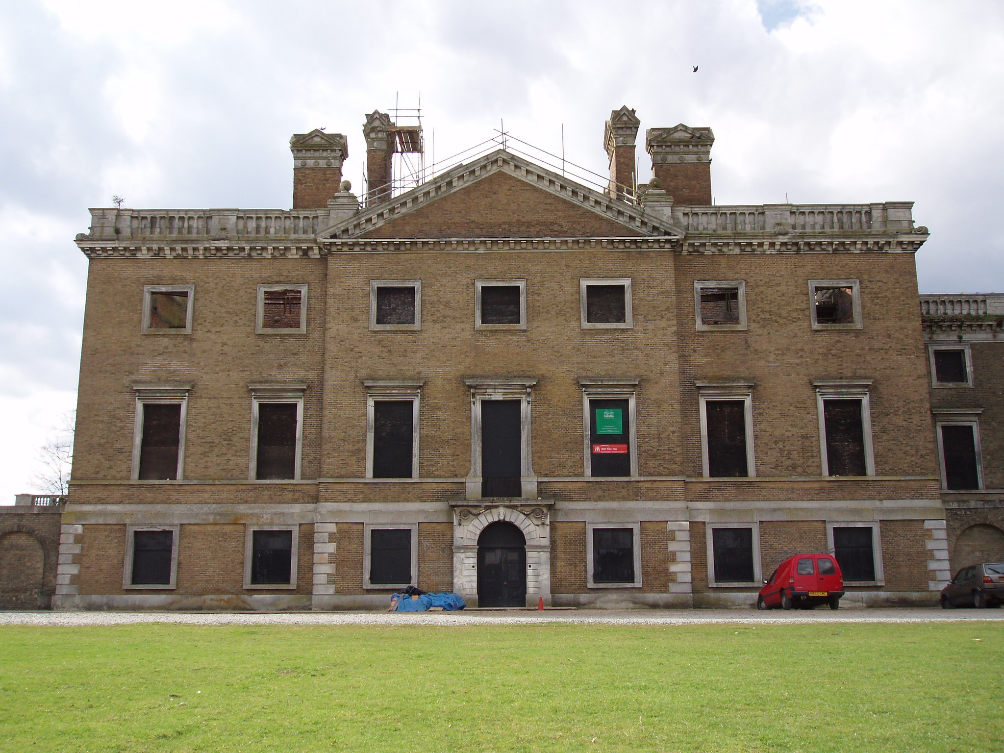
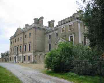
Copped Hall

Copped Hall, also known as Copt Hall or Copthall, is a mid-18th-century English country house close to Waltham Abbey, Essex, which has been undergoing...

Ambresbury Banks

Ambresbury Banks is the name given to the remains of an Iron Age hill fort in Epping Forest, Essex, England. == Description == The fort encircles an area...

Bell Common

Bell Common is a settlement in Essex, England and is south of the town of Epping. == Tunnel == The Bell Common Tunnel is a covered section of the M25 motorway...

Aimes Green

Aimes Green is a Hamlet in Essex, England. It is near the hamlet of Holyfield and the town of Waltham Abbey. == References == A-Z Essex, 2010 edition....

King Harold Business and Enterprise Academy

King Harold Business and Enterprise Academy (formerly King Harold School) is a secondary school and specialist business and enterprise college located...

Epping St John's School

Epping St John's School, formerly known as St John's Church of England Voluntary Controlled School, is a school in Epping, Essex.Epping St. John's was...

Great Monk Wood

Great Monk Wood is a wood within Epping Forest, in Essex, England. The wood, in the parish of Loughton, is centred on the Wakes Arms junction roundabout...

Related Videos

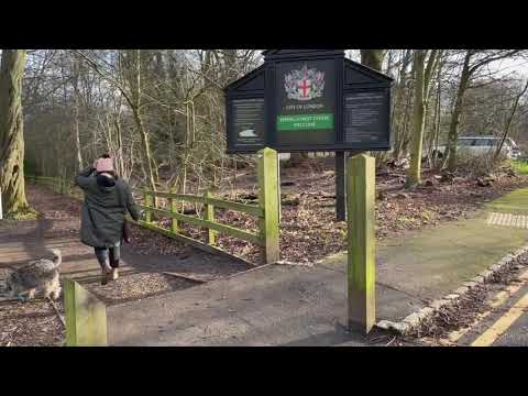
Winter Walk in Epping Forest | During Lockdown | ENGLAND

A Winter walk through Epping Forest. #lockdown #january2021 #cold #walk #walking #walkingtour #walkthrough #covid19 ...

19 August 2023

High Beach, Epping Forest.

Discover the Enchanting Ambresbury Banks in Epping Forest with us

This walk goes around most of Ambresbury Banks, which is an Iron Age earthworks and reputedly to be where Queen Boudicca ...

Exploring Waltham Abbey-Upshire Circular

Its July 2022 and still blistering hot I ascend to the Epping Uplands to make the most of the weather while it lasts my other rainy ...

Nearby Amenities

Located within 500m of 51.694823,0.055375756
Temple Hill
Natural: peak
Lat/Long: 51.6925594/0.0494282
Boudicca's Obelisk
Historic: memorial
Material: stone
Memorial: obelisk
Lat/Long: 51.6962636/0.0515118
Noexit: yes
Lat/Long: 51.6987877/0.0551183
Noexit: yes
Lat/Long: 51.6986408/0.055472
Noexit: yes
Lat/Long: 51.6984424/0.0556361
Noexit: yes
Lat/Long: 51.6985244/0.056032
Noexit: yes
Lat/Long: 51.6967208/0.0566209
The data included in this document is from www.openstreetmap.org. The data is made available under ODbL.

Have you been to Copped Hall Green?

Leave your review of Copped Hall Green below (or comments, questions and feedback).