Beeches Wood

Wood, Forest in Sussex Lewes

England

Beeches Wood

Barcombe Mills Lane
Barcombe Mills Lane Credit: N Chadwick

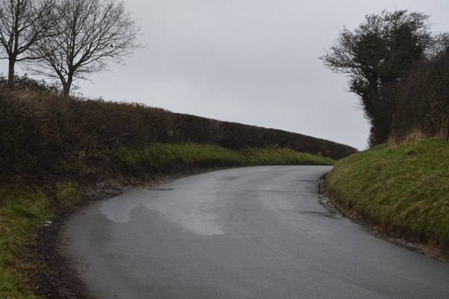
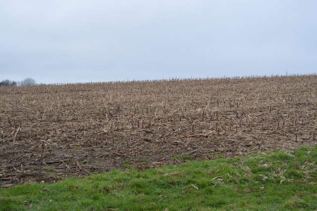
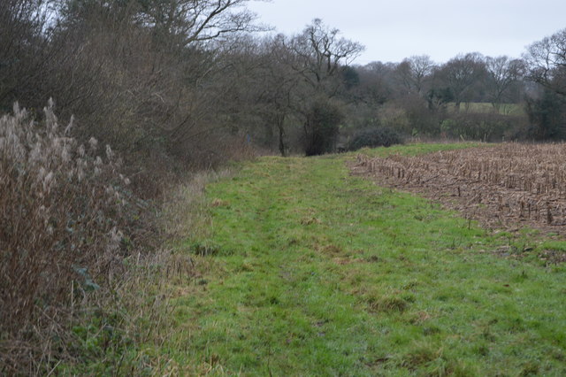
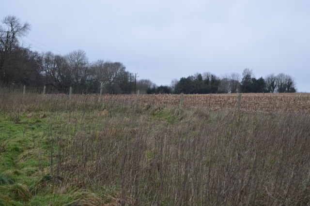
Beeches Wood, located in Sussex, England, is a picturesque forest known for its beautiful beech trees and diverse wildlife. Covering an area of approximately 500 acres, the wood is a popular destination for nature lovers, hikers, and wildlife enthusiasts.

The most striking feature of Beeches Wood is undoubtedly the towering beech trees that dominate the landscape. These majestic trees, with their smooth silver-grey bark and vibrant green leaves in summer, create a serene and tranquil atmosphere throughout the wood. In autumn, the beech trees put on a spectacular display of colors, with their leaves turning shades of golden yellow, fiery orange, and deep red.

The wood is home to a wide range of wildlife, making it a haven for nature enthusiasts. Birdwatchers can spot various species of birds, including woodpeckers, owls, and warblers, as they flit among the branches. The forest floor is also teeming with life, with squirrels scurrying about and small mammals such as foxes and badgers making occasional appearances.

For visitors looking to explore the wood, there are well-maintained trails that wind through the forest, allowing for pleasant walks and hikes. These trails provide an opportunity to immerse oneself in the natural beauty of the wood and discover its hidden gems, such as babbling brooks and small clearings.

Beeches Wood offers a peaceful escape from the hustle and bustle of everyday life, providing a serene environment to connect with nature and enjoy the beauty of the Sussex countryside. Whether it's a leisurely stroll, a picnic amidst the trees, or an exploration of the diverse wildlife, Beeches Wood has something to offer for everyone seeking a respite in nature.

If you have any feedback on the listing, please let us know in the comments section below.

Beeches Wood Images

Images are sourced within 2km of 50.933075/0.021082491 or Grid Reference TQ4216. Thanks to Geograph Open Source API. All images are credited.

Barcombe Mills Lane
Barcombe Mills Lane
Pillbox by Barcombe Mills Lane In 1940 a network of defences was hastily built all over Britain to prevent an expected German invasion. The most common of these defences were called “pillboxes”, squat concrete forts that were sited at road junctions, canals and other strategic points.

With the passage of time it is estimated that fewer than 6,000 of a total of 28,000 pillboxes built still survive. They remain as permanent monuments and a silent tribute to the courage and tenacity of the British people during the dark days of 1940 when Britain stood alone against Nazi Germany.

More detail see <span class="nowrap"><a title="www.pillboxesuk.co.uk" rel="nofollow ugc noopener" href="http://www.pillboxesuk.co.uk">Link</a><img style="margin-left:2px;" alt="External link" title="External link - shift click to open in new window" src="https://s1.geograph.org.uk/img/external.png" width="10" height="10"/></span>
Pillbox by Barcombe Mills Lane
In 1940 a network of defences was hastily built all over Britain to prevent an expected German invasion. The most common of these defences were called “pillboxes”, squat concrete forts that were sited at road junctions, canals and other strategic points. With the passage of time it is estimated that fewer than 6,000 of a total of 28,000 pillboxes built still survive. They remain as permanent monuments and a silent tribute to the courage and tenacity of the British people during the dark days of 1940 when Britain stood alone against Nazi Germany. More detail see LinkExternal link
Barcombe Mills Lane
Barcombe Mills Lane
Grassy slope by Barcombe Mills Lane
Pillbox by Barcombe Mills Lane In 1940 a network of defences was hastily built all over Britain to prevent an expected German invasion. The most common of these defences were called “pillboxes”, squat concrete forts that were sited at road junctions, canals and other strategic points.

With the passage of time it is estimated that fewer than 6,000 of a total of 28,000 pillboxes built still survive. They remain as permanent monuments and a silent tribute to the courage and tenacity of the British people during the dark days of 1940 when Britain stood alone against Nazi Germany.

More detail see <span class="nowrap"><a title="www.pillboxesuk.co.uk" rel="nofollow ugc noopener" href="http://www.pillboxesuk.co.uk">Link</a><img style="margin-left:2px;" alt="External link" title="External link - shift click to open in new window" src="https://s1.geograph.org.uk/img/external.png" width="10" height="10"/></span>
Pillbox by Barcombe Mills Lane
In 1940 a network of defences was hastily built all over Britain to prevent an expected German invasion. The most common of these defences were called “pillboxes”, squat concrete forts that were sited at road junctions, canals and other strategic points. With the passage of time it is estimated that fewer than 6,000 of a total of 28,000 pillboxes built still survive. They remain as permanent monuments and a silent tribute to the courage and tenacity of the British people during the dark days of 1940 when Britain stood alone against Nazi Germany. More detail see LinkExternal link
Arable stubble
Arable stubble
Sussex Ouse Valley Way Opened in 2005, the Sussex Ouse Valley Way is a beautiful 42 mile journey that broadly follows the River Ouse from its source close to Lower Beeding in the High Weald to the sea at Seaford Bay. It is signed using a picture of the Ouse Valley Viaduct. Website: <span class="nowrap"><a title="http://www.sussexousevalleyway.co.uk/index.htm" rel="nofollow ugc noopener" href="http://www.sussexousevalleyway.co.uk/index.htm">Link</a><img style="margin-left:2px;" alt="External link" title="External link - shift click to open in new window" src="https://s1.geograph.org.uk/img/external.png" width="10" height="10"/></span>
Sussex Ouse Valley Way
Opened in 2005, the Sussex Ouse Valley Way is a beautiful 42 mile journey that broadly follows the River Ouse from its source close to Lower Beeding in the High Weald to the sea at Seaford Bay. It is signed using a picture of the Ouse Valley Viaduct. Website: LinkExternal link
Stubble field
Stubble field
Barcombe Cross The public car park in Barcombe Cross.
Barcombe Cross
The public car park in Barcombe Cross.
Barcombe Cross Early morning in Barcombe Cross.
Barcombe Cross
Early morning in Barcombe Cross.
Clapper’s Bridge Clapper’s Bridge near Barcombe Cross.
Clapper’s Bridge
Clapper’s Bridge near Barcombe Cross.
Boast Lane Boast Lane just North of Barcombe Cross.
Boast Lane
Boast Lane just North of Barcombe Cross.
Fields near to Boast Lane Fields leading away from Boast Lane over which a public footpath passes but is not evident due to recent ploughing.
Fields near to Boast Lane
Fields leading away from Boast Lane over which a public footpath passes but is not evident due to recent ploughing.
Dallas Lane Dallas Lane with a woodpile beside the footpath.
Dallas Lane
Dallas Lane with a woodpile beside the footpath.
Dallas Lane Heading North on Dallas Lane towards Burtenshaw’s Wood.
Dallas Lane
Heading North on Dallas Lane towards Burtenshaw’s Wood.
Burtenshaw’s Wood A crossing path on Dallas Lane in Burtenshaw’s Wood.
Burtenshaw’s Wood
A crossing path on Dallas Lane in Burtenshaw’s Wood.
Burtenshaw’s Wood Forestry work in Burtenshaw’s Wood.
Burtenshaw’s Wood
Forestry work in Burtenshaw’s Wood.
Pond in Burtenshaw’s Wood A small pond in Burtenshaw’s Wood viewed from Dallas Lane.
Pond in Burtenshaw’s Wood
A small pond in Burtenshaw’s Wood viewed from Dallas Lane.
Show me another place!

Beeches Wood is located at Grid Ref: TQ4216 (Lat: 50.933075, Lng: 0.021082491)

Administrative County: East Sussex

District: Lewes

Police Authority: Sussex

What 3 Words

///riskiest.skylights.hoaxes. Near South Chailey, East Sussex

Related Wikis

Barcombe

Barcombe is an East Sussex village and civil parish in the Lewes District of East Sussex. The parish has four settlements: old Barcombe (TQ 418 143), the...

Barcombe railway station

Barcombe was a railway station serving the village of Barcombe in East Sussex. It was part of the East Grinstead to Lewes line, part of which now makes...

Barcombe Mills

Barcombe Mills is a small settlement and an area of countryside including a local nature reserve near the village of Barcombe Cross in East Sussex, England...

Barcombe Mills railway station

Barcombe Mills is a disused railway station in the hamlet of Barcombe Mills, on the closed section of the Wealden Line. The station was opened in 1858...

River Uck

The River Uck is a river in East Sussex, United Kingdom, which drains a catchment starting near Crowborough in the North, Hadlow Down to the East and Laughton...

Isfield

Isfield is a small village and civil parish in the Wealden District of East Sussex in England, located north-east of Lewes. == History == The village of...

Lavender Line

The Lavender Line is a heritage railway based at Isfield Station, near Uckfield in East Sussex, England. == History == The Lavender Line was originally...

Isfield railway station

Isfield is a preserved railway station on the closed section of the Wealden Line which served the East Sussex village of Isfield near Uckfield. Originally...

Nearby Amenities

Located within 500m of 50.933075,0.021082491
Telephone
Booth: K6
Covered: booth
Man Made: telephone_box
Lat/Long: 50.9327095/0.0252809
Post Box
Collection Times: Mo-Fr 09:00, Sa 07:00
Operator: Royal Mail
Operator Wikidata: Q638098
Post Box Mounting: brick_pillar
Post Box Type: wall
Ref: BN8 490D
Royal Cypher: GR
Royal Cypher Wikidata: Q33102273
Lat/Long: 50.9326483/0.0252642
Mount Pleasant
Place: hamlet
Lat/Long: 50.9341185/0.0263207
Oaktree Farm
Place: farm
Lat/Long: 50.9351737/0.0250143
Mount Pleasant Farm
Addr City: Barcombe
Addr Hamlet: Mount Pleasant
Addr Postcode: BN8 5EF
Addr Street: Spithurst Road
Place: farm
Lat/Long: 50.9323727/0.0243008
Barrier: kissing_gate
Lat/Long: 50.929325/0.0240076
Power: pole
Lat/Long: 50.9307769/0.0215848
Power: pole
Lat/Long: 50.9316902/0.0220144
Power: pole
Lat/Long: 50.9324649/0.0223988
Power: pole
Lat/Long: 50.9330802/0.022966
Power: pole
Lat/Long: 50.9336566/0.0234922
Power: pole
Lat/Long: 50.9342343/0.0240472
Power: pole
Lat/Long: 50.9350543/0.0247892
Power: pole
Lat/Long: 50.9354675/0.0251756
Power: pole
Lat/Long: 50.9289536/0.020692
Power: pole
Lat/Long: 50.9299085/0.0211686
The data included in this document is from www.openstreetmap.org. The data is made available under ODbL.

Have you been to Beeches Wood?

Leave your review of Beeches Wood below (or comments, questions and feedback).