Parsons Shaw

Wood, Forest in Surrey Tandridge

England

Parsons Shaw

Sheep at Beddlestead
Sheep at Beddlestead Credit: denise stevens

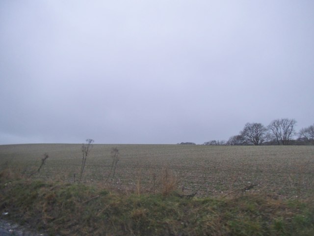
Parsons Shaw, Surrey, is a picturesque wooded area located in the southeastern county of Surrey, England. Nestled within the South East Woodlands, Parsons Shaw is renowned for its stunning natural beauty and abundant forested landscapes.

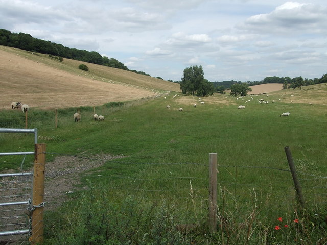
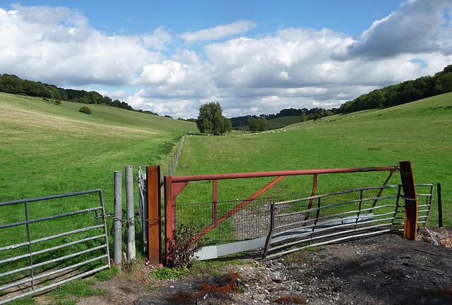
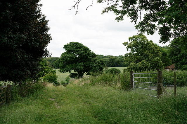
Covering an area of approximately 500 acres, the woodland in Parsons Shaw predominantly consists of a mix of deciduous and coniferous trees, creating a diverse and vibrant ecosystem. The dense tree cover provides a sanctuary for a variety of wildlife, including deer, foxes, badgers, and a wide array of bird species, making it a popular destination for nature enthusiasts and birdwatchers.

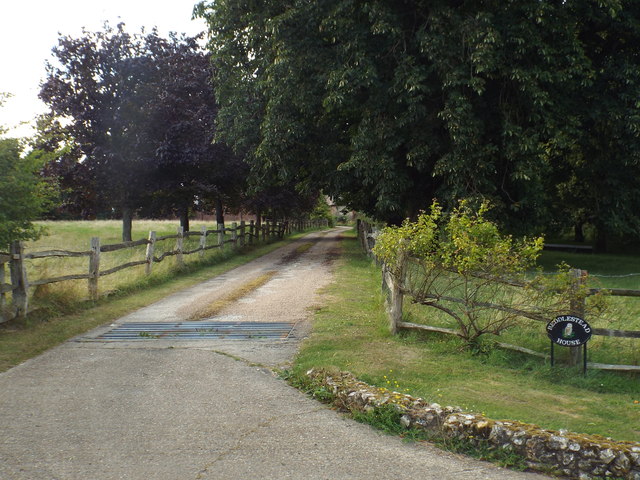
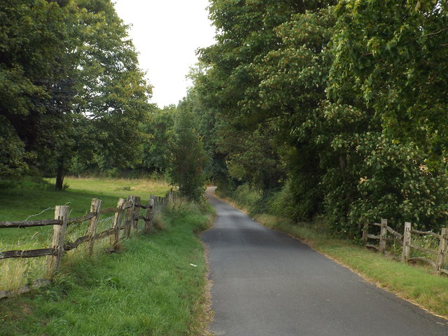
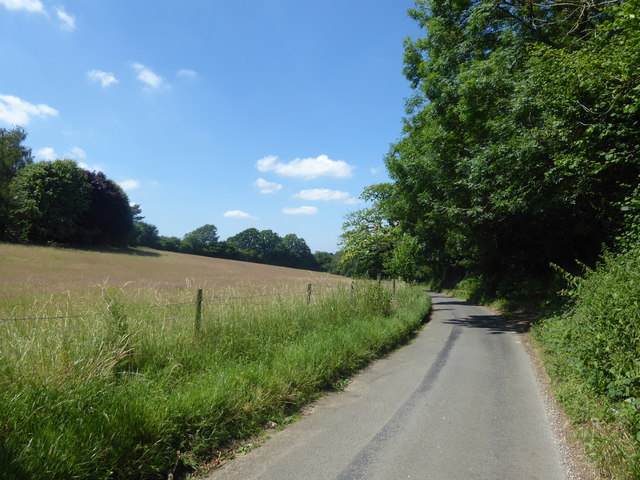
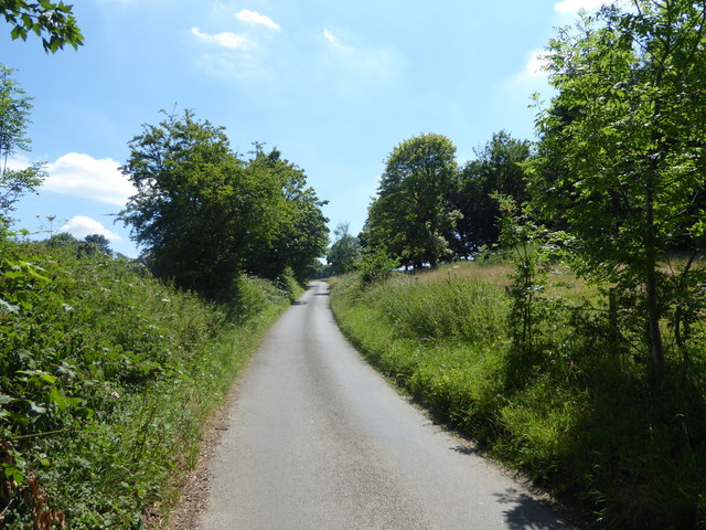
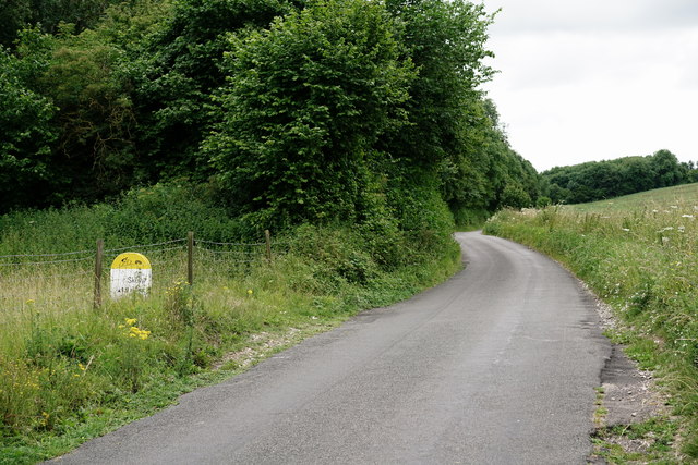
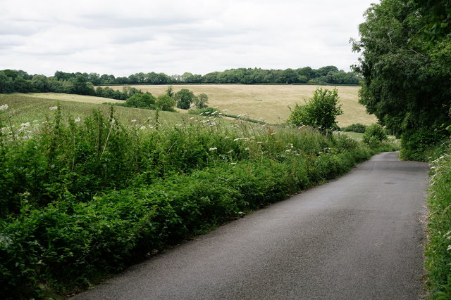
Traversing through Parsons Shaw, visitors will find a network of well-maintained footpaths and trails, allowing for leisurely walks and peaceful strolls in the heart of nature. These paths wind their way through the enchanting forest, offering breathtaking views and opportunities to spot the local flora and fauna.

The woodland also features a number of picnic areas, making it an ideal spot for families and friends to relax and enjoy a meal amidst the tranquil surroundings. Additionally, Parsons Shaw offers designated areas for camping and barbecues, providing visitors with the chance to immerse themselves in a memorable outdoor experience.

Parsons Shaw is easily accessible by both private and public transportation, with ample parking facilities available nearby. It is a true haven for those seeking respite from the hustle and bustle of everyday life, offering a serene and rejuvenating escape in the heart of Surrey's woodlands.

If you have any feedback on the listing, please let us know in the comments section below.
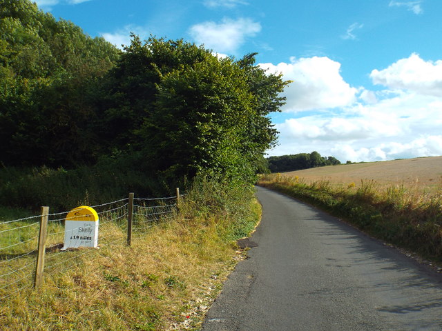
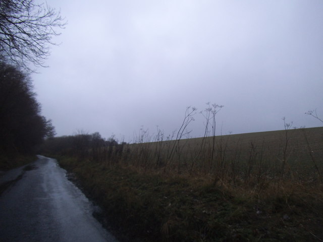
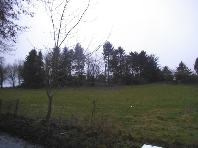
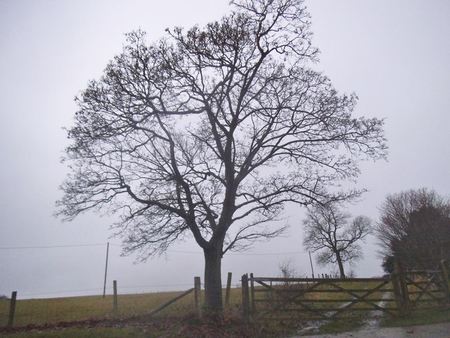
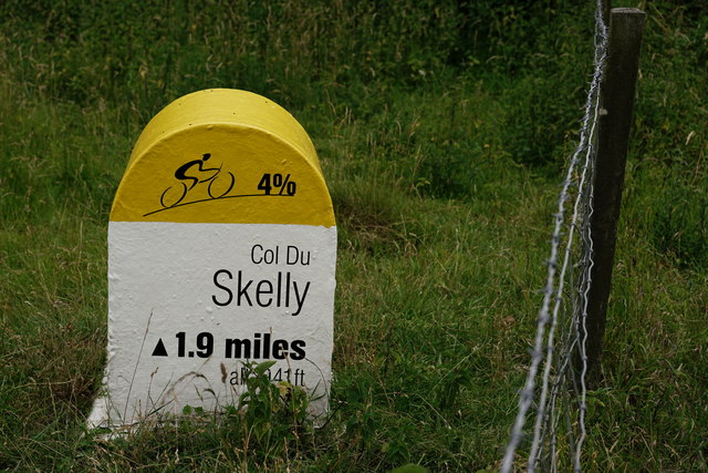
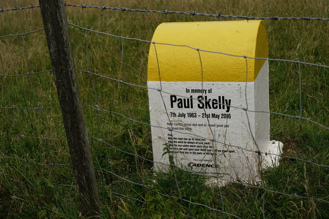
Parsons Shaw Images

Images are sourced within 2km of 51.305137/0.03028394 or Grid Reference TQ4158. Thanks to Geograph Open Source API. All images are credited.

Sheep at Beddlestead
Fields near Fickleshole Clear evidence of a fire by the gate. Perhaps joyriders had stolen a car and then set fire to it. Or the sheep were chilly one night, lit a fire ... one can guess the rest.
Fields near Fickleshole
Clear evidence of a fire by the gate. Perhaps joyriders had stolen a car and then set fire to it. Or the sheep were chilly one night, lit a fire ... one can guess the rest.
Driveway near Biggin Hill This private driveway leads to Beddlestead House, on the North Downs.
Driveway near Biggin Hill
This private driveway leads to Beddlestead House, on the North Downs.
Beddlestead Lane, near Biggin Hill Beddlestead Lane, high up on the North Downs.
Beddlestead Lane, near Biggin Hill
Beddlestead Lane, high up on the North Downs.
"Col du Skelly" marker post, Beddlestead Lane, near Biggin Hill The marker post to the left of the road commemorates a keen cyclist who died in 2016.  Beddlestead Lane, a quiet country lane in the North Downs had been one of his favourite climbs when cycling.  The post is in the style of a French mountain milepost.  As a privately-arranged memorial it is sited on private land, with permission of the land owner, rather than on the public right of way.
"Col du Skelly" marker post, Beddlestead Lane, near Biggin Hill
The marker post to the left of the road commemorates a keen cyclist who died in 2016. Beddlestead Lane, a quiet country lane in the North Downs had been one of his favourite climbs when cycling. The post is in the style of a French mountain milepost. As a privately-arranged memorial it is sited on private land, with permission of the land owner, rather than on the public right of way.
Field by Beddlestead Road near Biggin Hill
Copse by Beddlestead Lane, near Biggin Hill
Tree on Beddlestead Lane, Biggin Hill
Field by Beddlestead Road near Biggin Hill
Beddlestead Lane This is the view north from where the track known as Norheads Lane comes down from Biggin Hill. Beddlestead House is just up the hill to the left.
Beddlestead Lane
This is the view north from where the track known as Norheads Lane comes down from Biggin Hill. Beddlestead House is just up the hill to the left.
Beddlestead Lane This is the view north from where the track known as Norheads Lane comes down from Biggin Hill. Beddlestead House is just up the hill to the right.
Beddlestead Lane
This is the view north from where the track known as Norheads Lane comes down from Biggin Hill. Beddlestead House is just up the hill to the right.
View from Hesiers Hill Hesiers Hill drops steeply downhill into a valley where it becomes Beddlestead Lane and rises up the other side. Although it seems remote countryside it is not far from Biggin Hill which can be seen in the distance in this photograph. The large rectangular building on the left horizon is part of Biggin Hill Airport.
View from Hesiers Hill
Hesiers Hill drops steeply downhill into a valley where it becomes Beddlestead Lane and rises up the other side. Although it seems remote countryside it is not far from Biggin Hill which can be seen in the distance in this photograph. The large rectangular building on the left horizon is part of Biggin Hill Airport.
Beddlestead Lane On the outskirts of Chelsham.

Now also known as Col du Skelly, following the placement of a memorial to cyclist Paul Skelly in 2016.

<a href="https://www.geograph.org.uk/photo/5456933">TQ3958 : Memorial to Paul Skelly</a>
<a href="https://www.geograph.org.uk/photo/5456941">TQ3958 : Memorial to Paul Skelly</a>
Beddlestead Lane
On the outskirts of Chelsham. Now also known as Col du Skelly, following the placement of a memorial to cyclist Paul Skelly in 2016. TQ3958 : Memorial to Paul Skelly TQ3958 : Memorial to Paul Skelly
Memorial to Paul Skelly Located beside Beddlestead Lane, near Chelsham.

<a href="https://www.geograph.org.uk/photo/5456941">TQ3958 : Memorial to Paul Skelly</a>
<a href="https://www.geograph.org.uk/photo/5456929">TQ3958 : Beddlestead Lane</a>
Memorial to Paul Skelly
Located beside Beddlestead Lane, near Chelsham. TQ3958 : Memorial to Paul Skelly TQ3958 : Beddlestead Lane
Memorial to Paul Skelly Located beside Beddlestead Lane, near Chelsham.

<a href="https://www.geograph.org.uk/photo/5456933">TQ3958 : Memorial to Paul Skelly</a>
<a href="https://www.geograph.org.uk/photo/5456929">TQ3958 : Beddlestead Lane</a>
Memorial to Paul Skelly
Located beside Beddlestead Lane, near Chelsham. TQ3958 : Memorial to Paul Skelly TQ3958 : Beddlestead Lane
Track at Beddlestead House The farmhouse and outbuildings lie to the left of this location. The public footpath runs from left to right, directly behind the photographer.
Track at Beddlestead House
The farmhouse and outbuildings lie to the left of this location. The public footpath runs from left to right, directly behind the photographer.
Beddlestead Lane Looking in the direction of Chelsham.
Beddlestead Lane
Looking in the direction of Chelsham.
Downland valley north of Beddlestead Lane (1) Looking north-east from Beddlestead Lane.  The white-painted buildings close to the sky-line are on the steep slope at Biggin Hill.

The main land-use here seems to be as sheep-pasture - sheep can be seen on the distant slope to the left, and there were more behind the camera, in the field just south of the road.
Downland valley north of Beddlestead Lane (1)
Looking north-east from Beddlestead Lane. The white-painted buildings close to the sky-line are on the steep slope at Biggin Hill. The main land-use here seems to be as sheep-pasture - sheep can be seen on the distant slope to the left, and there were more behind the camera, in the field just south of the road.
Show me another place!

Parsons Shaw is located at Grid Ref: TQ4158 (Lat: 51.305137, Lng: 0.03028394)

Administrative County: Surrey

District: Tandridge

Police Authority: Surrey

What 3 Words

///film.hours.shadow. Near Biggin Hill, London

Nearby Locations

Parsons Shaw

Related Wikis

Tatsfield

Tatsfield is a village and civil parish in the Tandridge District of Surrey, England. It is located 3.3 miles north west of Westerham and 3.9 miles north...

Biggin Hill

Biggin Hill is a town in South East London, England, within the London Borough of Bromley. It is situated beyond London's contiguous built-up area in the...

Aperfield

Aperfield is a hamlet and area in London, England, within the London Borough of Bromley, 16.2 miles (26 km) south-southeast of Charing Cross, and outside...

Charles Darwin School

Charles Darwin School is the only secondary school in the Biggin Hill area of the London Borough of Bromley, England. The school consists of 1,320 secondary...

South Street, Bromley

South Street is a hamlet in the far south of the London Borough of Bromley, 16.5 miles (27 km) south south-east from Charing Cross. It is the highest settlement...

Old Jail, Biggin Hill

The Old Jail was a pub in Jail Lane, Biggin Hill, Westerham, Kent, in the London Borough of Bromley. At this time of writing, (February 2023), it is permanently...

Tatsfield Receiving Station

The Tatsfield Receiving Station – known formally as the BBC Engineering Measurement and Receiving Station – was a radio broadcasting signals-receiving...

Berry's Green

Berry's Green a small hamlet in the London Borough of Bromley in Greater London, UK, situated outside of London's contiguous built-up area. It is a fairly...

Nearby Amenities

Located within 500m of 51.305137,0.03028394
Left County: Surrey
Right County: Greater London
Lat/Long: 51.307184/0.0328373
Left County: Surrey
Right County: Greater London
Lat/Long: 51.3045948/0.0280776
Post Box
Collection Times: Mo-Fr 09:00; Sa 07:00; Su off
Colour: red
Ref: TN16 293
Royal Cypher: EIIR
Royal Cypher Wikidata: Q33102113
Lat/Long: 51.3073251/0.0264537
Bus Stop
Charlton Drive
Naptan AtcoCode: 490005009W1
Naptan Bearing: N
Naptan CommonName: Charlton Drive
Naptan Street: SUNNINGVALE AVENUE
Naptan Verified: no
Public Transport: platform
Lat/Long: 51.3079774/0.0320304
Bus Stop
Charlton Drive
Naptan AtcoCode: 490005009W2
Naptan Bearing: N
Naptan CommonName: Charlton Drive
Naptan Street: SUNNINGVALE ROAD
Naptan Verified: no
Public Transport: platform
Wheelchair: yes
Lat/Long: 51.3080076/0.0314779
Bus Stop
Swievelands Road
Local Ref: F
Naptan AtcoCode: 490013114E
Naptan Bearing: E
Naptan CommonName: Swievelands Road
Naptan Indicator: F
Naptan Verified: no
Public Transport: platform
Wheelchair: yes
Lat/Long: 51.3085435/0.0300758
Bus Stop
Swievelands Road
Local Ref: H
Naptan AtcoCode: 490013114W
Naptan Bearing: W
Naptan CommonName: Swievelands Road
Naptan Indicator: H
Naptan Street: SUNNINGVALE AVENUE
Naptan Verified: no
Public Transport: platform
Wheelchair: yes
Lat/Long: 51.3087353/0.029037
Sunningvale Service Station
Addr Housename: Sunningvale Service Station
Addr Postcode: TN16 3TL
Addr Street: Sunningvale Avenue
Shop: car_repair
Website: http://www.sunningvaleonline.com/
Lat/Long: 51.3079247/0.0325542
Fuel
Sunningvale Service Station
Lat/Long: 51.3079147/0.0323129
Lusted Stores
Shop: convenience
Lat/Long: 51.3070513/0.0321922
Beauty Hut
Shop: hairdresser
Website: http://www.beautyhutltd.co.uk
Lat/Long: 51.3070169/0.0321466
Post Box
Collection Times: Mo-Fr 09:00; Sa 07:00; Su off
Colour: Red
Operator: Royal Mail
Ref: TN16 80
Royal Cypher: EIIR
Royal Cypher Wikidata: Q33102113
Lat/Long: 51.3073541/0.0329392
Ref GB Tflcid: RWG203073
Traffic Calming: hump
Lat/Long: 51.3064904/0.0363143
Ref GB Tflcid: RWG203090
Traffic Calming: hump
Lat/Long: 51.3076942/0.033938
Ref GB Tflcid: RWG203071
Traffic Calming: hump
Lat/Long: 51.3072695/0.0348787
Ref GB Tflcid: RWG203074
Traffic Calming: hump
Lat/Long: 51.3059972/0.0371306
Ref GB Tflcid: RWG203072
Traffic Calming: hump
Lat/Long: 51.3069531/0.0355483
Ref GB Tflcid: RWG203079
Traffic Calming: hump
Lat/Long: 51.306482/0.0241316
The data included in this document is from www.openstreetmap.org. The data is made available under ODbL.

Have you been to Parsons Shaw?

Leave your review of Parsons Shaw below (or comments, questions and feedback).