Mill Rough

Wood, Forest in Sussex Wealden

England

Mill Rough

Ketche's Lane
Ketche's Lane Credit: N Chadwick

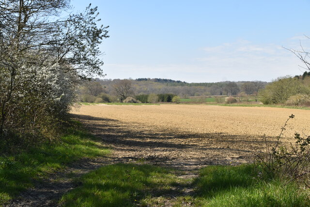
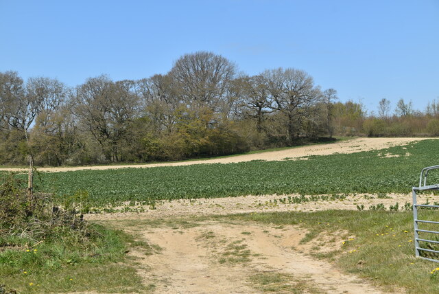
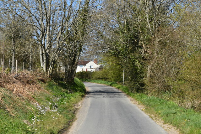
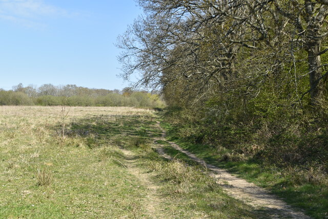
Mill Rough is a picturesque woodland located in the county of Sussex, England. Spread across a vast area, it is known for its natural beauty and diverse range of flora and fauna. The woodland is situated near the village of Milltown, surrounded by rolling hills and meandering streams.

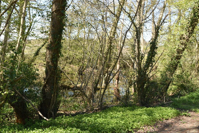
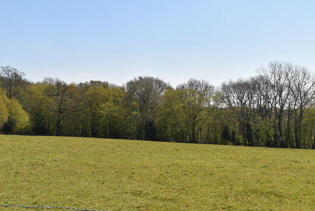
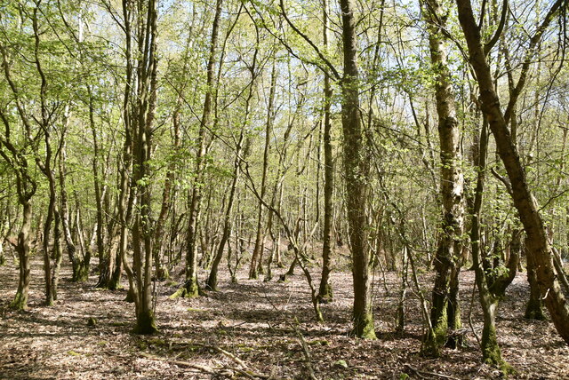
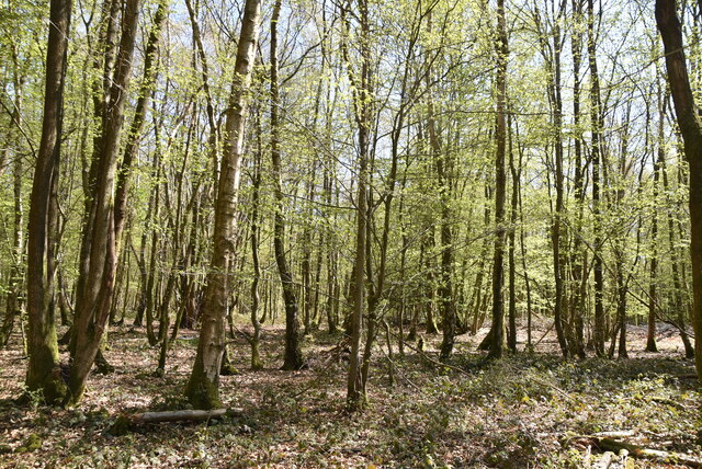
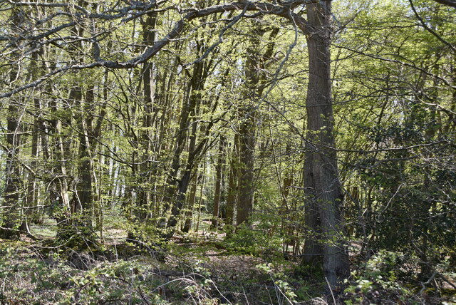
Mill Rough is characterized by its dense and ancient trees, predominantly consisting of oak, beech, and birch. These trees form a dense canopy, creating a serene and tranquil atmosphere within the forest. The woodland floor is covered with a vibrant carpet of mosses, ferns, and wildflowers, adding to its overall charm.

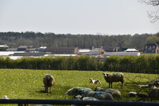
The forest is home to a variety of wildlife species, making it a haven for nature enthusiasts and photographers. It is not uncommon to spot deer, foxes, rabbits, and a multitude of bird species, including woodpeckers and owls. The woodland also provides a habitat for several endangered species, such as the dormouse and the red squirrel.

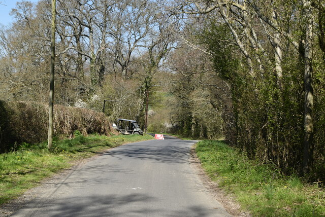
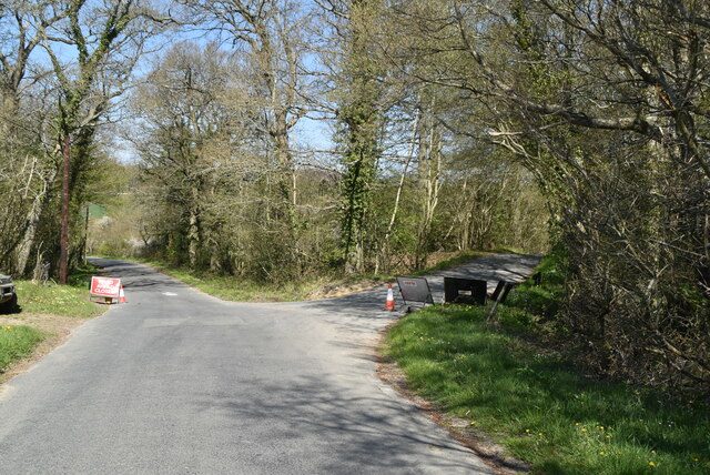
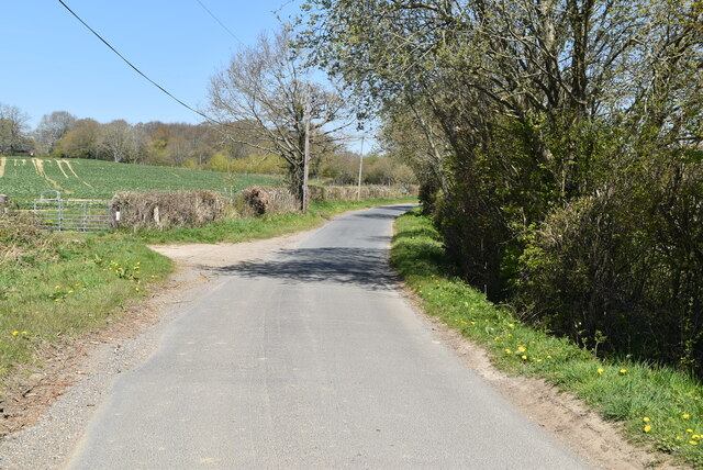
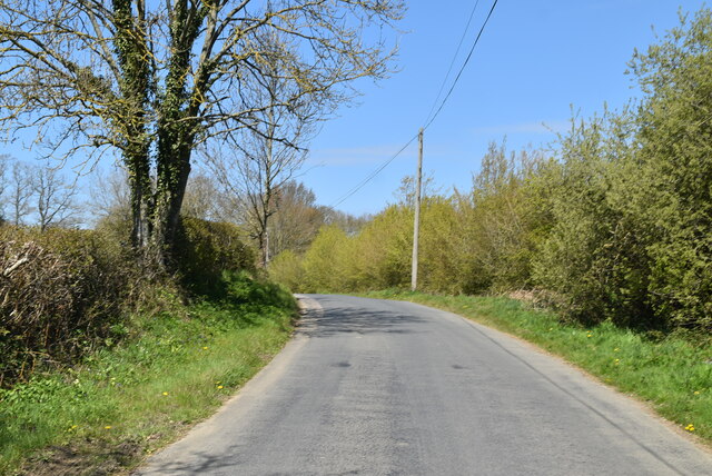
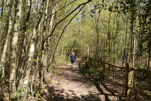
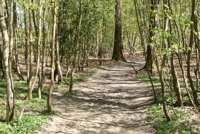
Mill Rough offers numerous walking trails and footpaths, allowing visitors to explore the forest at their own pace. These trails meander through the woodland, providing glimpses of its natural beauty at every turn. The forest is also equipped with picnic areas and benches, making it an ideal spot for a leisurely day out with family and friends.

In addition to its natural wonders, Mill Rough boasts a rich history. It is believed that the area was once used as a hunting ground by ancient kings and nobility. The remains of an old mill can still be found within the woodland, serving as a reminder of its past.

Overall, Mill Rough is a captivating woodland that offers a unique blend of natural beauty and historical significance. It is a place where visitors can immerse themselves in nature, enjoying the tranquility and serenity that this enchanting forest has to offer.

If you have any feedback on the listing, please let us know in the comments section below.

Mill Rough Images

Images are sourced within 2km of 51.010222/0.017349314 or Grid Reference TQ4125. Thanks to Geograph Open Source API. All images are credited.

Ketche's Lane
Ketche's Lane
Ketche's Lane, Sliders Lane junction
Woodland pond
Woodland pond
Ploughed field
Ploughed field
Ketche's Lane
Ketche's Lane
Arable field by Ketche's Lane
Brickpits Farm
Brickpits Farm
Ketche's Lane
Ketche's Lane
Ketche's Lane
Ketche's Lane
Sheep grazing
Sheep grazing
Farmland and Northland Wood
Sussex Border Path, Northland Wood The Sussex Border Path is a footpath route nearly 150 miles long around the inland boundary of the county of Sussex. The county owes its origins to the kingdom of the South Saxons and can claim to have one of the longest inland county boundaries from Emsworth to Rye. The route was devised in 1983 and is well signed along most of the route. Website <span class="nowrap"><a title="http://www.sussexborderpath.co.uk/" rel="nofollow ugc noopener" href="http://www.sussexborderpath.co.uk/">Link</a><img style="margin-left:2px;" alt="External link" title="External link - shift click to open in new window" src="https://s1.geograph.org.uk/img/external.png" width="10" height="10"/></span> 
Map: <a title="https://www.geograph.org.uk/search.php?i=40140109&page=1&displayclass=map#i=40140109&page=1&displayclass=map&zoom=2&lat=51.03263&lon=-0.05427&layers=FTTB00000000000T" href="https://www.geograph.org.uk/search.php?i=40140109&page=1&displayclass=map#i=40140109&page=1&displayclass=map&zoom=2&lat=51.03263&lon=-0.05427&layers=FTTB00000000000T">Link</a>
Sussex Border Path, Northland Wood
The Sussex Border Path is a footpath route nearly 150 miles long around the inland boundary of the county of Sussex. The county owes its origins to the kingdom of the South Saxons and can claim to have one of the longest inland county boundaries from Emsworth to Rye. The route was devised in 1983 and is well signed along most of the route. Website LinkExternal link Map: Link
Northland Wood
Northland Wood
Sussex Border Path, Northland Wood The Sussex Border Path is a footpath route nearly 150 miles long around the inland boundary of the county of Sussex. The county owes its origins to the kingdom of the South Saxons and can claim to have one of the longest inland county boundaries from Emsworth to Rye. The route was devised in 1983 and is well signed along most of the route. Website <span class="nowrap"><a title="http://www.sussexborderpath.co.uk/" rel="nofollow ugc noopener" href="http://www.sussexborderpath.co.uk/">Link</a><img style="margin-left:2px;" alt="External link" title="External link - shift click to open in new window" src="https://s1.geograph.org.uk/img/external.png" width="10" height="10"/></span> 
Map: <a title="https://www.geograph.org.uk/search.php?i=40140109&page=1&displayclass=map#i=40140109&page=1&displayclass=map&zoom=2&lat=51.03263&lon=-0.05427&layers=FTTB00000000000T" href="https://www.geograph.org.uk/search.php?i=40140109&page=1&displayclass=map#i=40140109&page=1&displayclass=map&zoom=2&lat=51.03263&lon=-0.05427&layers=FTTB00000000000T">Link</a>
Sussex Border Path, Northland Wood
The Sussex Border Path is a footpath route nearly 150 miles long around the inland boundary of the county of Sussex. The county owes its origins to the kingdom of the South Saxons and can claim to have one of the longest inland county boundaries from Emsworth to Rye. The route was devised in 1983 and is well signed along most of the route. Website LinkExternal link Map: Link
Sussex Border Path The Sussex Border Path is a footpath route nearly 150 miles long around the inland boundary of the county of Sussex. The county owes its origins to the kingdom of the South Saxons and can claim to have one of the longest inland county boundaries from Emsworth to Rye. The route was devised in 1983 and is well signed along most of the route. Website <span class="nowrap"><a title="http://www.sussexborderpath.co.uk/" rel="nofollow ugc noopener" href="http://www.sussexborderpath.co.uk/">Link</a><img style="margin-left:2px;" alt="External link" title="External link - shift click to open in new window" src="https://s1.geograph.org.uk/img/external.png" width="10" height="10"/></span> 
Map: <a title="https://www.geograph.org.uk/search.php?i=40140109&page=1&displayclass=map#i=40140109&page=1&displayclass=map&zoom=2&lat=51.03263&lon=-0.05427&layers=FTTB00000000000T" href="https://www.geograph.org.uk/search.php?i=40140109&page=1&displayclass=map#i=40140109&page=1&displayclass=map&zoom=2&lat=51.03263&lon=-0.05427&layers=FTTB00000000000T">Link</a>
Sussex Border Path
The Sussex Border Path is a footpath route nearly 150 miles long around the inland boundary of the county of Sussex. The county owes its origins to the kingdom of the South Saxons and can claim to have one of the longest inland county boundaries from Emsworth to Rye. The route was devised in 1983 and is well signed along most of the route. Website LinkExternal link Map: Link
Heaven Wood
Heaven Wood
Show me another place!

Mill Rough is located at Grid Ref: TQ4125 (Lat: 51.010222, Lng: 0.017349314)

Administrative County: East Sussex

District: Wealden

Police Authority: Sussex

What 3 Words

///directs.swoop.defected. Near Newick, East Sussex

Related Wikis

Furner's Green

Furner's Green is a hamlet in the civil parish of Danehill in East Sussex, England. == Geography == Furner's Green lies on the Greenwich Meridian about...

Sheffield Park and Garden

Sheffield Park and Garden is an informal landscape garden five miles east of Haywards Heath, in East Sussex, England. It was originally laid out in the...

Sheffield Park cricket ground

Sheffield Park is a cricket ground at the Sheffield Park estate, located near Uckfield, East Sussex, England. From 1881 to 1896 it was the home ground...

Sussex

Sussex (; from the Old English Sūþsēaxe; lit. 'South Saxons') is a historic county in South East England that is bounded to the west by Hampshire, north...

Sussex Wildlife Trust

The Sussex Wildlife Trust (SWT) is a conservation charity which aims to protect natural life in Sussex. It was founded in 1961 and is one of 46 wildlife...

Sheffield Park railway station

Sheffield Park is the southern terminus of the Bluebell Railway and also the headquarters of the line. It is located on the southern bank of the River...

Fletching, East Sussex

Fletching is a village and civil parish in the Wealden District of East Sussex, England. It is located three miles (4.8 km) to the north-west of Uckfield...

Danehill, East Sussex

Danehill is a village in East Sussex, England. == Religious sites == There are two Anglican churches in the parish: one at Danehill (dedicated to All Saints...

Nearby Amenities

Located within 500m of 51.010222,0.017349314
Sheffield Mill
Waterway: waterfall
Lat/Long: 51.0140837/0.0163215
Northhall Farm
Addr City: Fletching
Addr Postcode: TN22 3SA
Addr Street: North Hall Lane
Place: isolated_dwelling
Lat/Long: 51.0090886/0.0179788
Barrier: turnstile
Lat/Long: 51.0140111/0.0166763
Northall C.P.C
Email: info@northallcpc.co.uk
Leisure: sports_centre
Sport: shooting
Website: https://northallcpc.co.uk/
Lat/Long: 51.0121351/0.0212755
The data included in this document is from www.openstreetmap.org. The data is made available under ODbL.

Have you been to Mill Rough?

Leave your review of Mill Rough below (or comments, questions and feedback).