Long Hills
Wood, Forest in Essex Epping Forest
England
Long Hills
Long Hills is a small village located in the district of Essex, England. Situated within the area known as Wood, Forest, it is surrounded by picturesque landscapes and natural beauty. The village is nestled within the rolling hills, offering residents and visitors stunning views and a tranquil atmosphere.
Known for its charming and idyllic setting, Long Hills is a popular destination for those seeking a peaceful retreat away from the hustle and bustle of city life. The village is home to a close-knit community, where locals enjoy a tight bond and a strong sense of community spirit.
Long Hills is rich in history, with evidence of human habitation dating back thousands of years. Archaeological findings have revealed ancient artifacts, indicating that the area has been inhabited since prehistoric times. The village's historical significance is further enhanced by the presence of several well-preserved medieval buildings and landmarks.
The natural surroundings of Long Hills offer abundant outdoor recreational opportunities. The nearby woodlands and forests provide a haven for nature lovers, hikers, and wildlife enthusiasts. The village is also known for its well-maintained trails and pathways, perfect for leisurely walks or invigorating jogs.
Despite its rural setting, Long Hills is conveniently located within close proximity to larger towns and cities. This allows residents to enjoy the benefits of both a peaceful village lifestyle and easy access to modern amenities and services.
In conclusion, Long Hills, Essex (Wood, Forest) is a charming and historic village that offers a peaceful retreat, stunning scenery, and a tight-knit community. Its proximity to nature and convenient location make it a desirable place to live or visit for those seeking a tranquil and picturesque setting.
If you have any feedback on the listing, please let us know in the comments section below.
Long Hills Images
Images are sourced within 2km of 51.64557/0.028502627 or Grid Reference TQ4096. Thanks to Geograph Open Source API. All images are credited.
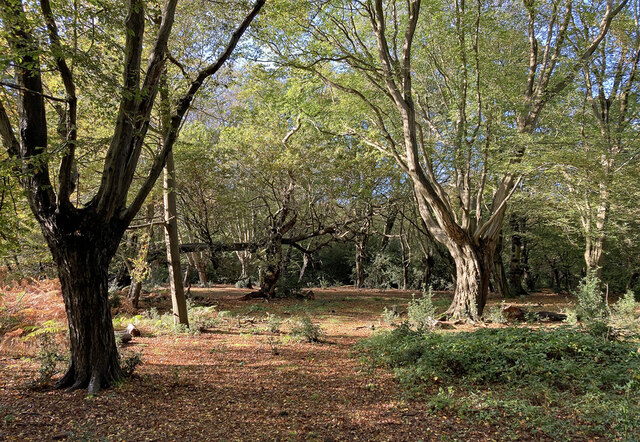
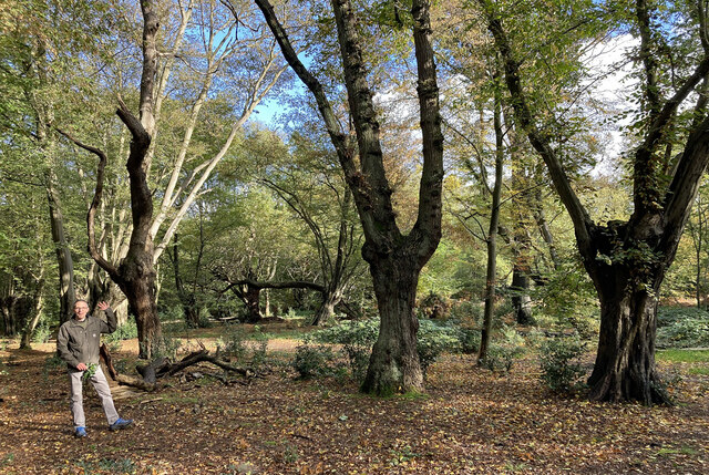
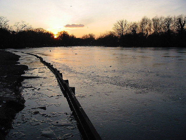
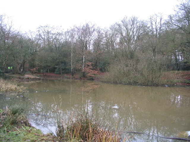
![Looking to Waltham Cross from Lippitts Hill Epping Forest (formerly known as Waltham Forest) is an ancient woodland north-east of London. As a former royal forest dating from the 12th century, it is managed by the City of London Corporation.
The forest is 2,476 hectares in area, comprising woodland, grassland and open heath, forming a 19km long green corridor.
[abstract from Wikipedia article: <span class="nowrap"><a title="http://en.wikipedia.org/wiki/Epping_Forest" rel="nofollow ugc noopener" href="http://en.wikipedia.org/wiki/Epping_Forest">Link</a><img style="margin-left:2px;" alt="External link" title="External link - shift click to open in new window" src="https://s1.geograph.org.uk/img/external.png" width="10" height="10"/></span> ]](https://s1.geograph.org.uk/geophotos/07/36/80/7368061_d3b94360.jpg)


Long Hills is located at Grid Ref: TQ4096 (Lat: 51.64557, Lng: 0.028502627)
Administrative County: Essex
District: Epping Forest
Police Authority: Essex
What 3 Words
///prove.puts.fits. Near Buckhurst Hill, Essex
Nearby Locations
Related Wikis
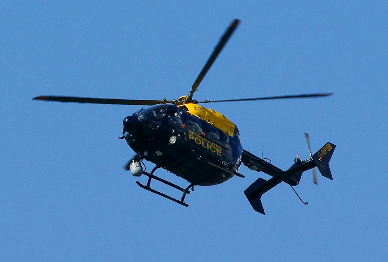
Air Support Unit (Metropolitan Police)
The Air Support Unit (ASU) was a Central Operations branch of London's Metropolitan Police Service. The main responsibility of the unit was to provide...

Lippitts Hill
Lippitts Hill is a hill located in Epping Forest at High Beach, Waltham Abbey. It has played several historic roles in the defence and policing of London...
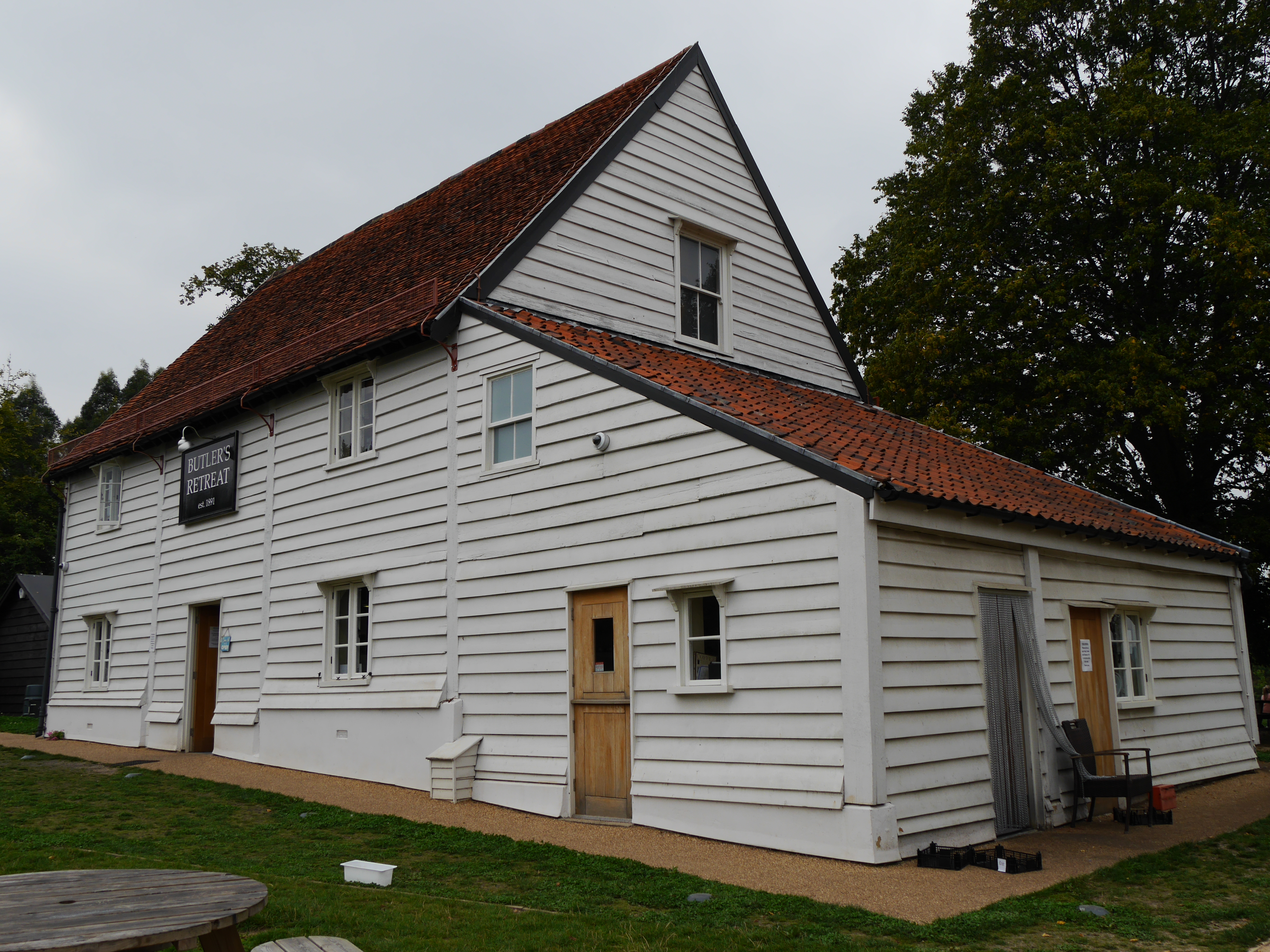
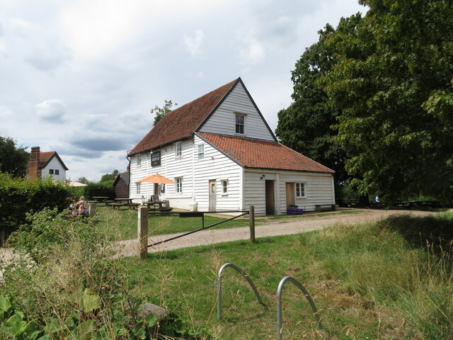
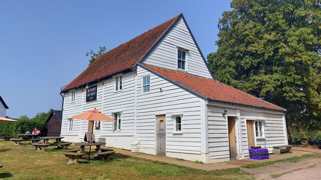
Butler's Retreat
Butler's Retreat is a Grade II listed building at Rangers Road, Chingford, London E4. Originally a barn thought to have been built in the early 19th century...

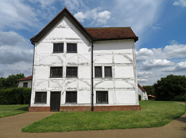
Queen Elizabeth's Hunting Lodge
Queen Elizabeth's Hunting Lodge is a Grade II* listed former hunting lodge, now a museum, on the edge of Epping Forest, at 8 Rangers Road, Chingford, London...
Buckhurst Hill
Buckhurst Hill, nestled within the picturesque Epping Forest district of Essex, England, epitomizes an enclave of refined suburban living. This charming...

Braeside School, Buckhurst Hill
Braeside School is an independent school located in Buckhurst Hill in Essex that is part of The Oak-Tree Group of Schools. The school is an all-through...

High Beach
High Beach (or High Beech) is a village inside Epping Forest in south-west Essex, England. Part of the civil parish of Waltham Abbey, the village is within...
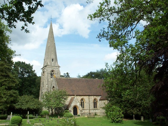
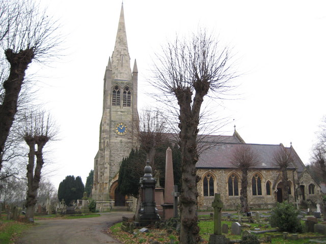
St John the Baptist Church, Buckhurst Hill
St John the Baptist Church, or St John's, is a Church of England parish church in the town of Buckhurst Hill in Essex, England. == History == The church...
Related Videos
![Epping Forest - A massive forest in London with peaceful sounds [4K UHD]](https://i.ytimg.com/vi/m3_bPF-N2bo/hqdefault.jpg)
Epping Forest - A massive forest in London with peaceful sounds [4K UHD]
A relaxing walk through Epping Forest with a natural & peaceful atmosphere as well as a very scenic route. Follow us with a first ...

Loughton to Epping walk | 🇬🇧 Hiking UK | England
The ancient woodland of Epping Forest within Zone 6 Length: 13.4km (8.4miles) Maps: OS Explorer 174 1:25000 and OS ...

OAK TRAIL IN EPPING FOREST | Oak Trail Walk | Essex Walk | Best Epping Forest Walk | Theydon Bois
This video is about walking the Oak Trail in Epping Forest in Essex, England. The Oak Trail walk in Epping Forest is one of the ...
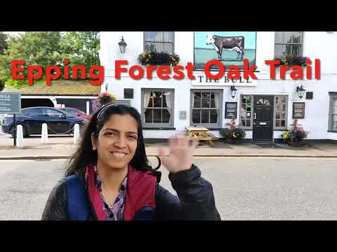
Epping Forest Oak Trail | #london #travel #uk #nature #travelogue #marathi #flowers #trail #vlog
Epping Forest Oak Trail | #london #travel #uk #nature #travelogue #marathi #flowers #trail This trail is undulating, uneven and ...
Nearby Amenities
Located within 500m of 51.64557,0.028502627Have you been to Long Hills?
Leave your review of Long Hills below (or comments, questions and feedback).