Eyeworth

Settlement in Bedfordshire

England

Eyeworth

Dangerous bends, Eyeworth, Beds A dangerous double bend on the road between Eyeworth and Wrestlingworth has been the scene of many accidents. The landscape of the chalky boulder clay plateau is fairly open with long gentle slopes.
Dangerous bends, Eyeworth, Beds Credit: Rodney Burton

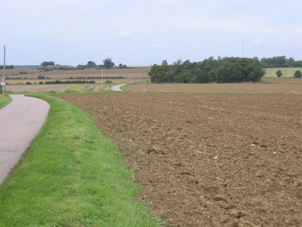
Eyeworth is a small village located in the county of Bedfordshire, England. Situated in the southeastern part of the county, Eyeworth is nestled within the Central Bedfordshire district. The village is surrounded by picturesque countryside, offering residents and visitors alike a tranquil and idyllic setting.

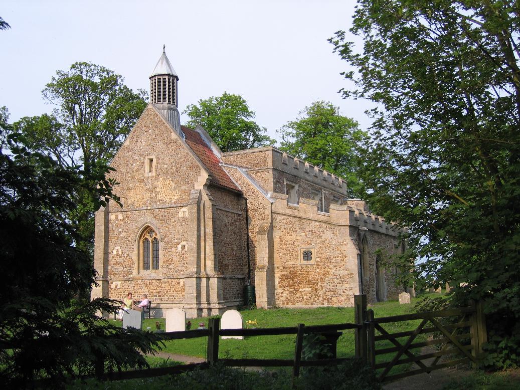
Eyeworth is a close-knit community with a population of around 150 people. The village is known for its charming character and traditional architecture, with many buildings dating back several centuries. The local church, St. Mary's, is a notable landmark and holds regular services for the community.

The village is primarily residential, with a mix of traditional cottages and more modern houses. Eyeworth is dotted with beautiful gardens and green spaces, contributing to its peaceful atmosphere. The surrounding countryside provides ample opportunities for outdoor activities such as walking, cycling, and picnicking.

Although small in size, Eyeworth benefits from its proximity to nearby towns and amenities. The larger town of Biggleswade is just a short drive away, offering a wider range of shops, supermarkets, and services. Eyeworth also benefits from good transportation links, with easy access to major roads and nearby railway stations.

Overall, Eyeworth is a charming village in Bedfordshire, offering a serene and peaceful lifestyle with beautiful countryside surroundings. Its close-knit community and traditional architecture contribute to its unique and welcoming atmosphere.

If you have any feedback on the listing, please let us know in the comments section below.

Eyeworth Images

Images are sourced within 2km of 52.096272/-0.17636785 or Grid Reference TL2545. Thanks to Geograph Open Source API. All images are credited.

Dangerous bends, Eyeworth, Beds A dangerous double bend on the road between Eyeworth and Wrestlingworth has been the scene of many accidents. The landscape of the chalky boulder clay plateau is fairly open with long gentle slopes.
Dangerous bends, Eyeworth, Beds
A dangerous double bend on the road between Eyeworth and Wrestlingworth has been the scene of many accidents. The landscape of the chalky boulder clay plateau is fairly open with long gentle slopes.
All Saints' Church, Eyeworth, Beds Church in the Early English Style with neatly tended churchyard.
All Saints' Church, Eyeworth, Beds
Church in the Early English Style with neatly tended churchyard.
Dunton Water Works, Beds
Sutton Road, Eyeworth, Beds View NW towards a wide shallow valley on the Chalky Boulder Clay plateau.
Sutton Road, Eyeworth, Beds
View NW towards a wide shallow valley on the Chalky Boulder Clay plateau.
View towards Manor Farm, Wrestlingworth, Beds
Farmland SE of Sutton, Beds
View towards Havannah Farm, Sutton, Beds
Farmland S of Wrestlingworth, Beds View N from the plateau towards the B1042 Tadlow Road and the crossroads.
Farmland S of Wrestlingworth, Beds
View N from the plateau towards the B1042 Tadlow Road and the crossroads.
Guilden Morden Road, Wrestlingworth, Beds view NW across the Gault clay valley of the Cam towards the Chalky Boulder Clay-capped plateau.
Guilden Morden Road, Wrestlingworth, Beds
view NW across the Gault clay valley of the Cam towards the Chalky Boulder Clay-capped plateau.
Beds-Cambs county boundary, Wrestlingworth one large arable field has resulted from the amalgamation of many small ones, but the unrationalised county boundary still follows the old field boundaries with many angular bends.
Beds-Cambs county boundary, Wrestlingworth
one large arable field has resulted from the amalgamation of many small ones, but the unrationalised county boundary still follows the old field boundaries with many angular bends.
Cottages, Eyeworth, Beds located at the NE end of this small settlement, beside the road to Wrestlingworth.
Cottages, Eyeworth, Beds
located at the NE end of this small settlement, beside the road to Wrestlingworth.
St Peter's church, Wrestlingworth, Beds a building of stone and cobbles, in the Early English style, consisting of chancel and nave, aisles and an embattled western tower containing a clock and 1 bell; restored in 1847.
St Peter's church, Wrestlingworth, Beds
a building of stone and cobbles, in the Early English style, consisting of chancel and nave, aisles and an embattled western tower containing a clock and 1 bell; restored in 1847.
St Peter's church, Wrestlingworth, Beds view N from Church Lane.
St Peter's church, Wrestlingworth, Beds
view N from Church Lane.
Manor Farm House, Eyeworth, Beds on the High Street.
Manor Farm House, Eyeworth, Beds
on the High Street.
Bridleway
Bridleway
Farmland
Farmland
Yellow crop
Yellow crop
footpath
footpath
Show me another place!

Eyeworth is located at Grid Ref: TL2545 (Lat: 52.096272, Lng: -0.17636785)

Unitary Authority: Central Bedfordshire

Police Authority: Bedfordshire

What 3 Words

///craftsmen.specifies.grills. Near Sutton, Bedfordshire

Nearby Locations

Eyeworth Eyeworth

Related Wikis

Eyeworth

Eyeworth (also Eyworth) is a small, rural village and civil parish in the Central Bedfordshire district of the county of Bedfordshire, England; about 12...

Church of St Peter, Wrestlingworth

Church of St Peter is a Grade I listed church in Wrestlingworth, Bedfordshire, England. It became a listed building on 31 October 1966. == See also... ==

Dunton, Bedfordshire

Dunton is a village and civil parish in the Central Bedfordshire district of the county of Bedfordshire, England; about 12 miles (19 km) east south-east...

Wrestlingworth

Wrestlingworth is a village and former civil parish, now in the parish of Wrestlingworth and Cockayne Hatley, in the Central Bedfordshire district of the...

Nearby Amenities

Located within 500m of 52.096272,-0.17636785
Eyeworth
Created By: Potlatch 0.10f
Place: village
Wikidata: Q1520566
Lat/Long: 52.0956751/-0.1754689
Power: pole
Lat/Long: 52.0991638/-0.1723911
Power: pole
Lat/Long: 52.0985411/-0.1742418
Power: pole
Lat/Long: 52.0979874/-0.1759262
Power: pole
Lat/Long: 52.0968812/-0.1775837
Power: pole
Lat/Long: 52.097381/-0.1768704
Post Box
Post Box Type: lamp
Ref: SG19 224
Royal Cypher: EIIR
Royal Cypher Wikidata: Q33102113
Lat/Long: 52.0960973/-0.1766342
The data included in this document is from www.openstreetmap.org. The data is made available under ODbL.

Have you been to Eyeworth?

Leave your review of Eyeworth below (or comments, questions and feedback).