Comberton Plantation

Wood, Forest in Cambridgeshire South Cambridgeshire

England

Comberton Plantation

Madingley, St Mary Magdalene <span class="nowrap"><a title="http://www.druidic.org/camchurch/churches/madingley.htm" rel="nofollow ugc noopener" href="http://www.druidic.org/camchurch/churches/madingley.htm">Link</a><img style="margin-left:2px;" alt="External link" title="External link - shift click to open in new window" src="https://s1.geograph.org.uk/img/external.png" width="10" height="10"/></span>
Madingley, St Mary Magdalene Credit: mym

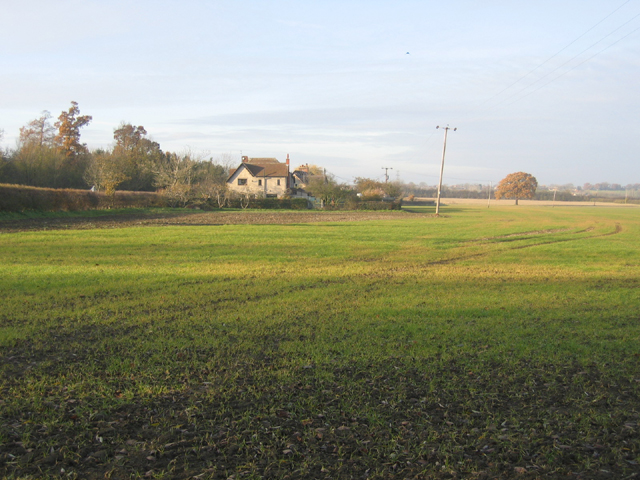
Comberton Plantation is a picturesque woodland located in Cambridgeshire, England. Spanning over a vast area, it is a designated Site of Special Scientific Interest (SSSI) due to its rich biodiversity and unique ecosystem. The plantation is situated just south of the village of Comberton and is easily accessible to visitors.

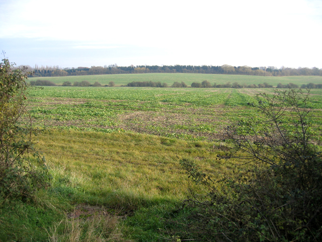
The woodland is predominantly composed of a mix of broadleaf and coniferous trees, creating a diverse and enchanting landscape. Oak, beech, and birch trees provide a lush canopy, while spruce and pine trees add a touch of evergreen charm. The varying tree species create an ideal habitat for an array of wildlife, including numerous bird species, small mammals, and insects.

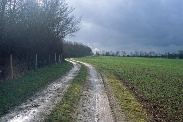
Comberton Plantation offers a tranquil escape for nature enthusiasts and outdoor lovers alike. Visitors can explore the woodland via a network of well-maintained walking trails, providing opportunities for leisurely strolls or more vigorous hikes. The plantation is especially popular among birdwatchers, who come to spot and observe rare avian species that inhabit the area.

In addition to its natural beauty, Comberton Plantation also holds historical significance. It is believed that the site was once part of an ancient royal hunting ground, and remnants of this past can still be seen today.

Overall, Comberton Plantation is a cherished natural gem in Cambridgeshire, offering a peaceful retreat for those seeking solace in nature and a chance to immerse themselves in the region's diverse flora and fauna.

If you have any feedback on the listing, please let us know in the comments section below.

Comberton Plantation Images

Images are sourced within 2km of 52.21583/0.034476602 or Grid Reference TL3959. Thanks to Geograph Open Source API. All images are credited.

Madingley, St Mary Magdalene <span class="nowrap"><a title="http://www.druidic.org/camchurch/churches/madingley.htm" rel="nofollow ugc noopener" href="http://www.druidic.org/camchurch/churches/madingley.htm">Link</a><img style="margin-left:2px;" alt="External link" title="External link - shift click to open in new window" src="https://s1.geograph.org.uk/img/external.png" width="10" height="10"/></span>
Madingley, St Mary Magdalene
“Things You’d Not Believe in Madingley” Not something you see everyday, a thatched village hall. I wonder if Rupert Brooke ever went to a wild party there one Christmas eve? Probably not…see <span class="nowrap"><a title="http://www.poetsgraves.co.uk/Classic%20Poems/Brooke/grantchester.htm" rel="nofollow ugc noopener" href="http://www.poetsgraves.co.uk/Classic%20Poems/Brooke/grantchester.htm">Link</a><img style="margin-left:2px;" alt="External link" title="External link - shift click to open in new window" src="https://s1.geograph.org.uk/img/external.png" width="10" height="10"/></span> to catch the full quote.
“Things You’d Not Believe in Madingley”
Not something you see everyday, a thatched village hall. I wonder if Rupert Brooke ever went to a wild party there one Christmas eve? Probably not…see LinkExternal link to catch the full quote.
Farmland and cottages, Madingley, Cambs – view NW, from the bridlepath, of New Farm and cottages on the Dry Drayton Road.
Farmland and cottages, Madingley, Cambs
– view NW, from the bridlepath, of New Farm and cottages on the Dry Drayton Road.
Callow Brook valley, Dry Drayton, Cambs – view E across the northern edge of the square from Scotland Road.
Callow Brook valley, Dry Drayton, Cambs
– view E across the northern edge of the square from Scotland Road.
Track from New Farm to Park Farm This track lies adjacent to the long shelter bed planted at the boundary of the original Madingley Hall estate.
Track from New Farm to Park Farm
This track lies adjacent to the long shelter bed planted at the boundary of the original Madingley Hall estate.
Scratch sundial on Madingley church This dial is located on the outside East wall of the chancel (a location where it could never have worked and therefore must have been moved at some point).
Scratch sundial on Madingley church
This dial is located on the outside East wall of the chancel (a location where it could never have worked and therefore must have been moved at some point).
Madingley Hall in the mist
Madingley village sign
Madingley Hall, the iron gates
Madingley village mini roundabout
Madingley Hall, the lake The lake was frozen, with the Sun just starting to break through the mist.
Madingley Hall, the lake
The lake was frozen, with the Sun just starting to break through the mist.
Madingley Hall,  East Front
Madingley Hall, East Front
Church of St Mary Magdalene, Madingley
Madingley Hall, East front
Madingley Hall, path and grounds
Madingley Hall, walk and grounds
Show me another place!

Comberton Plantation is located at Grid Ref: TL3959 (Lat: 52.21583, Lng: 0.034476602)

Administrative County: Cambridgeshire

District: South Cambridgeshire

Police Authority: Cambridgeshire

What 3 Words

///chucks.shelving.tripled. Near Comberton, Cambridgeshire

Nearby Locations

Comberton Plantation

Related Wikis

Madingley Wood

Madingley Wood is a 15.4-hectare (38-acre) biological Site of Special Scientific Interest near Madingley, on the western outskirts of Cambridge.The western...

University of Cambridge Institute of Continuing Education

The University of Cambridge Institute of Continuing Education (ICE) is a department of the University of Cambridge dedicated to providing continuing education...
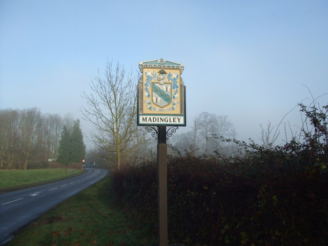
Madingley

Madingley is a small village near Cambridge, England. It is located close to the nearby villages of Coton and Dry Drayton on the western outskirts of Cambridge...

Cambridge American Cemetery and Memorial

Cambridge American Cemetery and Memorial is a World War II American military war grave cemetery, located between the villages of Coton and Madingley, 7...

Hardwick, Cambridgeshire

Hardwick is a village and civil parish in the county of Cambridgeshire, England with a large housing estate located about 6 miles (9.7 km) west of the...

Coton, Cambridgeshire

Coton is a small village and civil parish about three miles (about 5 km) west of Cambridge in Cambridgeshire, England and about the same distance east...

Dry Drayton

Dry Drayton is a village and civil parish about 5 miles (8 km) northwest of Cambridge in Cambridgeshire, England, listed as Draitone in the Domesday Book...

Comberton

Comberton is a village and civil parish in South Cambridgeshire, England, just east of the Prime Meridian. == History == Archaeological finds, including...

Nearby Amenities

Located within 500m of 52.21583,0.034476602
Post Box
Brand: Royal Mail
Brand Wikidata: Q638098
Brand Wikipedia: en:Royal Mail
Collection Times: Mo-Fr 16:30; Sa 11:30
Operator: Royal Mail
Operator Wikidata: Q638098
Post Box Mounting: wooden_post
Post Box Type: lamp
Ref: CB23 276
Royal Cypher: EIIR
Royal Cypher Wikidata: Q33102113
Lat/Long: 52.2154449/0.0407001
Man Made: mast
Lat/Long: 52.2154596/0.0367134
Parking
Type: unseparated lay-by
Lat/Long: 52.2171144/0.033652
Bus Stop
Inglewood
Naptan AtcoCode: 0500SMADI001
Naptan Bearing: E
Naptan BusStopType: CUS
Naptan CommonName: Inglewood
Naptan Indicator: opp
Naptan Landmark: St Neots Road
Naptan NaptanCode: cmbgajgp
Naptan PlusbusZoneRef: CAMBDGE
Naptan Street: St Neots Road
Naptan Verified: no
Public Transport: platform
Source: naptan_import
Lat/Long: 52.2155241/0.0417359
Bus Stop
Inglewood
Naptan AtcoCode: 0500SMADI005
Naptan Bearing: W
Naptan CommonName: Inglewood
Naptan Indicator: near
Naptan Landmark: St Neots Road
Naptan NaptanCode: cmbgajmd
Naptan PlusbusZoneRef: CAMBDGE
Naptan Street: St Neots Road
Naptan Verified: no
Public Transport: platform
Source: naptan_import
Lat/Long: 52.2154343/0.0417319
Power: pole
Lat/Long: 52.2155677/0.0303464
Line Management: split
Power: pole
Lat/Long: 52.2154445/0.0316312
Power: pole
Lat/Long: 52.2156696/0.0290536
Power: pole
Lat/Long: 52.2153674/0.0330659
Power: pole
Lat/Long: 52.2157386/0.0282275
Entrance: main
Ref: F/HIGHFIELD-A
Lat/Long: 52.2188765/0.0389626
Man Made: mast
Lat/Long: 52.2153912/0.0370299
Power: pole
Source: Maxar
Lat/Long: 52.2171882/0.0408822
Line Attachment: anchor
Power: pole
Source: Maxar
Lat/Long: 52.2172309/0.0398254
Power: pole
Source: Maxar
Lat/Long: 52.2164388/0.0394285
Power: pole
Source: Maxar
Lat/Long: 52.2151242/0.0380015
Power: pole
Source: survey
Source Position: Maxar
Transformer: distribution
Lat/Long: 52.2151636/0.0372827
Power: pole
Source: Maxar
Lat/Long: 52.215226/0.0358933
Power: pole
Source: Maxar
Lat/Long: 52.2153082/0.0345039
Line Attachment: anchor
Phases: 3
Power: pole
Transformer: distribution
Voltage Primary: 11000
Lat/Long: 52.2188167/0.0393265
Power: pole
Lat/Long: 52.2176016/0.0397001
Power: pole
Lat/Long: 52.2184371/0.0394177
Line Attachment: anchor
Power: pole
Lat/Long: 52.2157158/0.0390369
Power: pole
Source Position: estimation
Lat/Long: 52.2155169/0.0387177
Line Attachment: anchor
Power: pole
Source Position: Esri
Transformer: distribution
Lat/Long: 52.2150979/0.038652
Note: Way through hedge obstructed, detour along Long Road.
Lat/Long: 52.2162223/0.0315971
Power: pole
Lat/Long: 52.2146689/0.0315778
Power: pole
Lat/Long: 52.2122382/0.031408
Power: pole
Lat/Long: 52.213014/0.0314601
Power: pole
Lat/Long: 52.2138135/0.0315171
Content: soil
Man Made: bunker_silo
Lat/Long: 52.2152111/0.038752
The data included in this document is from www.openstreetmap.org. The data is made available under ODbL.

Have you been to Comberton Plantation?

Leave your review of Comberton Plantation below (or comments, questions and feedback).