Brown's Wood

Wood, Forest in Surrey Tandridge

England

Brown's Wood

Cook's Pond Viaduct Dormans Park. Confusingly, the water is now called Wilderness Lake. This Surrey County Council page <span class="nowrap"><a title="http://www.surreycc.gov.uk/sccwebsite/sccwspublications.nsf/WebLookupFileResourcesByUNID/docidD191D18A952E56438025704300522D14?openDocument" rel="nofollow ugc noopener" href="http://www.surreycc.gov.uk/sccwebsite/sccwspublications.nsf/WebLookupFileResourcesByUNID/docidD191D18A952E56438025704300522D14?openDocument">Link</a><img style="margin-left:2px;" alt="External link" title="External link - shift click to open in new window" src="https://s1.geograph.org.uk/img/external.png" width="10" height="10"/></span> states that the viaduct is the largest structure on the Croydon to East Grinstead railway.
Cook's Pond Viaduct Credit: Roger W Haworth

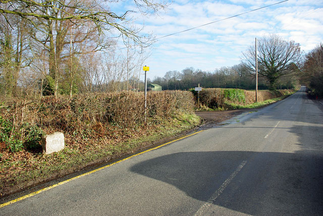
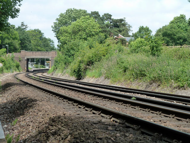
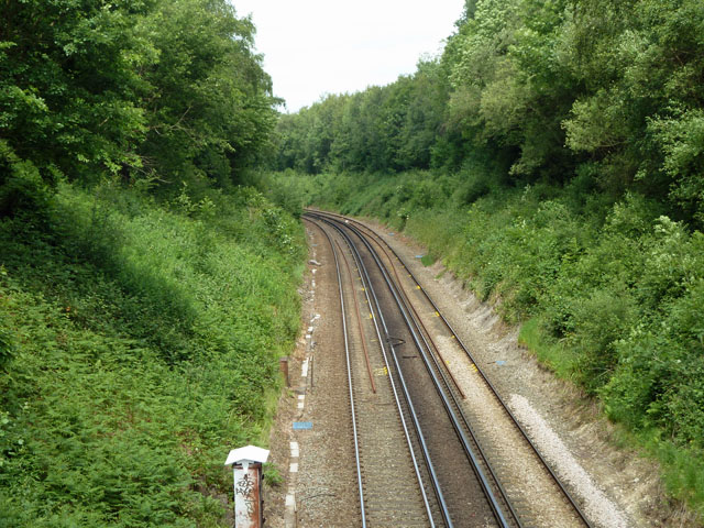
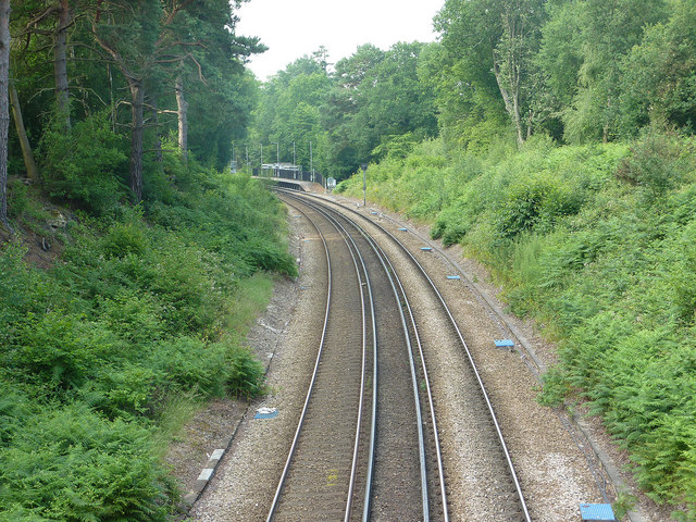
Brown's Wood is a picturesque woodland located in the county of Surrey, England. Situated near the town of Guildford, this woodland covers an area of approximately 100 acres and is a popular destination for nature enthusiasts, hikers, and families seeking tranquility and outdoor activities.

The wood is primarily composed of deciduous trees such as oak, birch, and beech, creating a diverse and vibrant ecosystem. The forest floor is adorned with a rich carpet of bluebells in the spring, enhancing the beauty of the surroundings. Additionally, a small stream meanders through the wood, providing a serene backdrop and attracting various species of wildlife.

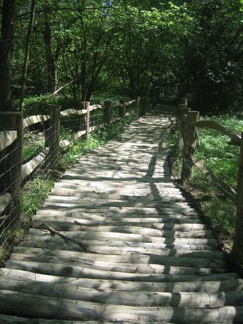
Walking trails crisscross the wood, allowing visitors to explore its hidden treasures. These trails range in difficulty, accommodating both casual strollers and more experienced hikers. The woodland also features several picnic areas and benches, providing opportunities for visitors to relax and enjoy a meal amidst the tranquil environment.

Brown's Wood is known for its biodiversity, hosting a wide array of flora and fauna. Birdwatchers can delight in spotting various avian species, including woodpeckers, owls, and a variety of songbirds. Squirrels, foxes, and deer are also frequently spotted, adding to the charm of the woodland experience.

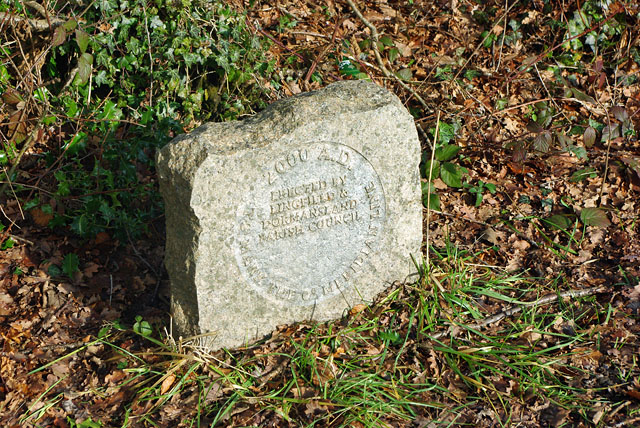
Managed by the local council, Brown's Wood has been carefully maintained to preserve its natural beauty and ecological balance. Special events and educational programs are occasionally organized, providing opportunities for visitors to learn about the wood's history, wildlife, and conservation efforts.

Overall, Brown's Wood offers a serene and enchanting escape into nature, making it a beloved destination for both locals and tourists alike.

If you have any feedback on the listing, please let us know in the comments section below.
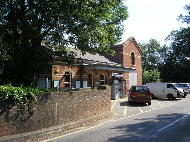
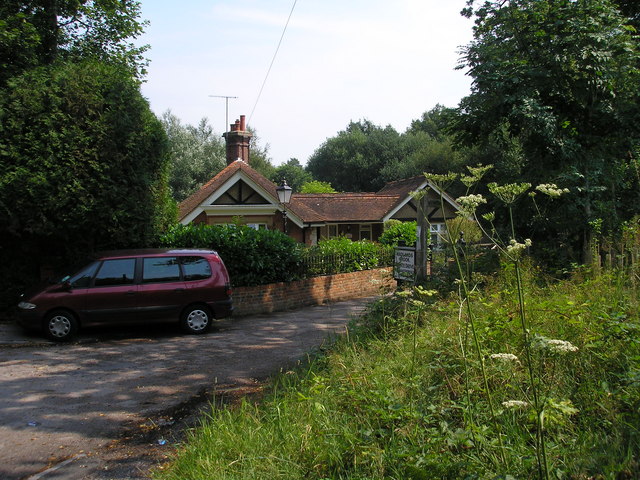
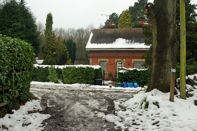
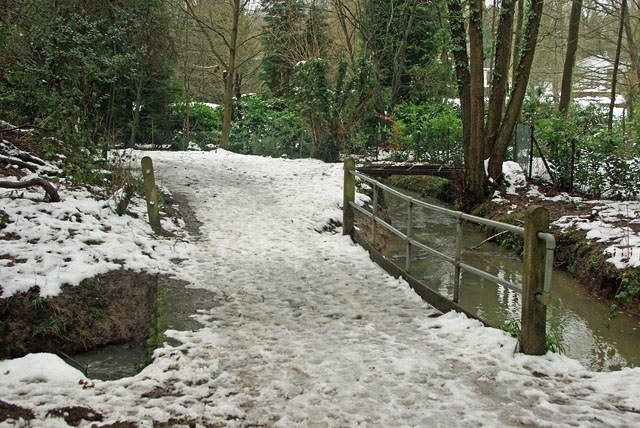
Brown's Wood Images

Images are sourced within 2km of 51.140158/-0.013173923 or Grid Reference TQ3939. Thanks to Geograph Open Source API. All images are credited.

Cook's Pond Viaduct Dormans Park. Confusingly, the water is now called Wilderness Lake. This Surrey County Council page <span class="nowrap"><a title="http://www.surreycc.gov.uk/sccwebsite/sccwspublications.nsf/WebLookupFileResourcesByUNID/docidD191D18A952E56438025704300522D14?openDocument" rel="nofollow ugc noopener" href="http://www.surreycc.gov.uk/sccwebsite/sccwspublications.nsf/WebLookupFileResourcesByUNID/docidD191D18A952E56438025704300522D14?openDocument">Link</a><img style="margin-left:2px;" alt="External link" title="External link - shift click to open in new window" src="https://s1.geograph.org.uk/img/external.png" width="10" height="10"/></span> states that the viaduct is the largest structure on the Croydon to East Grinstead railway.
Cook's Pond Viaduct
Dormans Park. Confusingly, the water is now called Wilderness Lake. This Surrey County Council page LinkExternal link states that the viaduct is the largest structure on the Croydon to East Grinstead railway.
Dormans railway station A down train, ie. towards East Grinstead is standing in the station.
Dormans railway station
A down train, ie. towards East Grinstead is standing in the station.
Dormans station, Surrey This quiet station in the south-east corner of Surrey is on the East Grinstead line, and attracts many park-and-ride commuters to London.  But since there is no station car park, these commuters park along the road past the station, which does not make things easy for other road-users.
Dormans station, Surrey
This quiet station in the south-east corner of Surrey is on the East Grinstead line, and attracts many park-and-ride commuters to London. But since there is no station car park, these commuters park along the road past the station, which does not make things easy for other road-users.
Foxes Lodge, Wadlands Brook Road, Surrey This is just north of the Surrey-Sussex border.  The bungalow sits in the angle formed by Felcourt Road and Wadlands Brook Road, the latter being the beginning of a bridleway which leads to Dormans station.
Foxes Lodge, Wadlands Brook Road, Surrey
This is just north of the Surrey-Sussex border. The bungalow sits in the angle formed by Felcourt Road and Wadlands Brook Road, the latter being the beginning of a bridleway which leads to Dormans station.
The Little House, Felcourt Road, Surrey That is the name, as it appears on a board outside the substantial house, centre left in the picture.  The road from East Grinstead is behind the photographer, whilst straight ahead leads to Lingfield.
The Little House, Felcourt Road, Surrey
That is the name, as it appears on a board outside the substantial house, centre left in the picture. The road from East Grinstead is behind the photographer, whilst straight ahead leads to Lingfield.
Bridleway near Garfield Farm, Surrey Garfield Farm is just off the eastern side of the A22 not far north of the Surrey-Sussex border.  There is much animal activity around here:  Garfield Farm provides boarding kennels, hounds for hunting are kept nearby and there are stables.
Bridleway near Garfield Farm, Surrey
Garfield Farm is just off the eastern side of the A22 not far north of the Surrey-Sussex border. There is much animal activity around here: Garfield Farm provides boarding kennels, hounds for hunting are kept nearby and there are stables.
The Cottage So says the name plaque on this cottage at the footpath corner. The footpath goes left, and becomes Wadlands Brook Road, although only a track here.
The Cottage
So says the name plaque on this cottage at the footpath corner. The footpath goes left, and becomes Wadlands Brook Road, although only a track here.
Two bridges The near bridge takes the public bridleway over a side stream of the one seen at right. There is a far steel bridge over the main stream, possibly an old lorry deck frame, but lacking the deck and blocked with a garden fence at one end.
Two bridges
The near bridge takes the public bridleway over a side stream of the one seen at right. There is a far steel bridge over the main stream, possibly an old lorry deck frame, but lacking the deck and blocked with a garden fence at one end.
Looking into the eastern hemisphere The stone at left marks the Greenwich meridian, and was placed to mark the millennium.
Looking into the eastern hemisphere
The stone at left marks the Greenwich meridian, and was placed to mark the millennium.
Greenwich meridian marker stone Inscribed "2000 A.D. TO MARK THE 0° MERIDIAN LINE   ERECTED BY LINGFIELD & DORMANSLAND PARISH COUNCIL"
Greenwich meridian marker stone
Inscribed "2000 A.D. TO MARK THE 0° MERIDIAN LINE ERECTED BY LINGFIELD & DORMANSLAND PARISH COUNCIL"
Dormans Railway Station
Corduroy Road at Dormans Park This 'Corduroy Road' is a reconstruction of a prehistoric path across swampy ground on Public Footpath 426, Dormansland. The earliest evidence of these roads is dated at around 4000BC from near Glastonbury and they were well used up to and including Roman times. This one was built by volunteers from the East Surrey Ramblers group. For more information please visit <span class="nowrap"><a title="http://en.wikipedia.org/wiki/Corduroy_road" rel="nofollow ugc noopener" href="http://en.wikipedia.org/wiki/Corduroy_road">Link</a><img style="margin-left:2px;" alt="External link" title="External link - shift click to open in new window" src="https://s1.geograph.org.uk/img/external.png" width="10" height="10"/></span> .
Corduroy Road at Dormans Park
This 'Corduroy Road' is a reconstruction of a prehistoric path across swampy ground on Public Footpath 426, Dormansland. The earliest evidence of these roads is dated at around 4000BC from near Glastonbury and they were well used up to and including Roman times. This one was built by volunteers from the East Surrey Ramblers group. For more information please visit LinkExternal link .
Railway towards Dormans station The road bridge is number HGG1 871, with Dormans station beyond. There is a 40 limit through the station. The view is from a public footpath from Dormans Park estate. The path closely parallels the railway, and appears to be formed from the edge of the railway property - probably a railway investment to assist customers to their station.
Railway towards Dormans station
The road bridge is number HGG1 871, with Dormans station beyond. There is a 40 limit through the station. The view is from a public footpath from Dormans Park estate. The path closely parallels the railway, and appears to be formed from the edge of the railway property - probably a railway investment to assist customers to their station.
Railway looking north, Dormans Park A view from the bridge carrying one of the principal roads in the estate - The Approach.
Railway looking north, Dormans Park
A view from the bridge carrying one of the principal roads in the estate - The Approach.
Railway looking south, Dormans Park A view from the bridge carrying The Approach, Dormans Park. Down the line is the Cooks Pond Viaduct, much better seen in <a href="https://www.geograph.org.uk/photo/163811">TQ3940 : Cook's Pond Viaduct</a>.
Railway looking south, Dormans Park
A view from the bridge carrying The Approach, Dormans Park. Down the line is the Cooks Pond Viaduct, much better seen in TQ3940 : Cook's Pond Viaduct.
Dormans station The platform of Dormans station just visible on the curve south of Mill Lane bridge
Dormans station
The platform of Dormans station just visible on the curve south of Mill Lane bridge
New house, Hillcrest, Dormans Park
Bridge over the Chalybeate Spring Heading westwards along the Tandridge Border Path from Dormans Park to Felcourt. 

I can understand having barriers on the side of the bridge (ie to prevent people falling into the stream), but why are there bars across the face of the bridge path?
Bridge over the Chalybeate Spring
Heading westwards along the Tandridge Border Path from Dormans Park to Felcourt. I can understand having barriers on the side of the bridge (ie to prevent people falling into the stream), but why are there bars across the face of the bridge path?
Show me another place!

Brown's Wood is located at Grid Ref: TQ3939 (Lat: 51.140158, Lng: -0.013173923)

Administrative County: Surrey

District: Tandridge

Police Authority: Surrey

What 3 Words

///spirit.senior.market. Near East Grinstead, West Sussex

Related Wikis

107 Meridian FM

107 Meridian FM is a community radio station broadcasting to the West Sussex town of East Grinstead and its surrounding area. == History == The station...

Bush Davies School of Theatre Arts

Bush Davies School of Theatre Arts was a dance and performing arts school in the United Kingdom. Founded by the dance teacher Pauline Bush in Nottingham...

Thedden Grange

Thedden Grange is a privately owned country house and estate in the civil parish of Bentworth, on the outskirts of Alton, Hampshire, England. Since renovation...

Queen Victoria Hospital

The Queen Victoria Hospital (QVH), located in East Grinstead, West Sussex, England is the specialist reconstructive surgery centre for the south east of...

East Grinstead Meridian (electoral division)

East Grinstead Meridian is an electoral division of West Sussex in the United Kingdom, and returns one member to sit on West Sussex County Council. �...

Our Lady and St Peter's Church, East Grinstead

Our Lady and St Peter's Church is a Roman Catholic Parish church in East Grinstead. It was built from 1897 to 1898 and designed by Frederick Walters. It...

East Grinstead Town F.C.

East Grinstead Town Football Club is a football club based in East Grinstead, West Sussex, England. They are currently members of the Isthmian League South...

East Grinstead

East Grinstead is a town in West Sussex, England, near the East Sussex, Surrey, and Kent borders, 27 miles (43 km) south of London, 21 miles (34 km) northeast...

Nearby Amenities

Located within 500m of 51.140158,-0.013173923
Baldwins Hill
Natural: peak
Source: npe
Lat/Long: 51.1409489/-0.0181463
Frith Farm
Landuse: farm
Note Retag: CS #48756035
Source: npe
Lat/Long: 51.1428931/-0.0175683
Bus Stop
Prince of Wales
Bus: yes
Naptan AtcoCode: 4400EG0315
Naptan Bearing: S
Naptan CommonName: Prince of Wales
Naptan Indicator: opposite Lowdells Lane
Naptan Landmark: Hermitage Road
Naptan NaptanCode: wsxapjdw
Naptan Street: Lingfield Road
Naptan Verified: no
Public Transport: platform
Source: naptan_import
Wheelchair: limited
Lat/Long: 51.138397/-0.0193625
Bus Stop
Furzefield Road
Bus: yes
Naptan AtcoCode: 4400EG0316
Naptan Bearing: S
Naptan CommonName: Furzefield Road
Naptan Indicator: adj Furzefield Road
Naptan Landmark: Furzefield Lane
Naptan NaptanCode: wsxapjga
Naptan Street: Lingfield Road
Naptan Verified: no
Public Transport: platform
Source: naptan_import
Wheelchair: limited
Lat/Long: 51.1396739/-0.0199222
Bus Stop
Furzefield Road
Bus: yes
Naptan AtcoCode: 4400EG0317
Naptan Bearing: N
Naptan CommonName: Furzefield Road
Naptan Indicator: opposite Furzefield lane
Naptan Landmark: Furzefield Lane
Naptan NaptanCode: wsxapjgd
Naptan Street: Lingfield Road
Naptan Verified: no
Public Transport: platform
Source: naptan_import
Wheelchair: no
Lat/Long: 51.1397286/-0.0200796
Turning Circle
Source: Bing
Lat/Long: 51.1382812/-0.0136559
Turning Circle
Lat/Long: 51.1362429/-0.0143002
Barrier: motorcycle_barrier
Foot: yes
Motor Vehicle: no
Lat/Long: 51.1382746/-0.0071867
Post Box
Brand: Royal Mail
Brand Wikidata: Q638098
Brand Wikipedia: en:Royal Mail
Collection Times: Mo-Fr 09:00; Sa 07:00
Drive Through: no
Operator: Royal Mail
Operator Wikidata: Q638098
Post Box Type: lamp
Ref: RH19 5
Royal Cypher: EIIR
Royal Cypher Wikidata: Q33102113
Lat/Long: 51.1382526/-0.0195987
Post Box
Brand: Royal Mail
Brand Wikidata: Q638098
Brand Wikipedia: en:Royal Mail
Collection Times: Mo-Fr 09:00; Sa 07:00
Drive Through: yes
Operator: Royal Mail
Operator Wikidata: Q638098
Post Box Type: lamp
Ref: RH19 32D
Royal Cypher: EIIR
Royal Cypher Wikidata: Q33102113
Lat/Long: 51.136051/-0.0159873
Barrier: motorcycle_barrier
Lat/Long: 51.142411/-0.013155
Post Box
Brand: Royal Mail
Brand Wikidata: Q638098
Brand Wikipedia: en:Royal Mail
Collection Times: Mo-Fr 09:00; Sa 07:00
Drive Through: no
Operator: Royal Mail
Operator Wikidata: Q638098
Post Box Type: lamp
Ref: RH19 125D
Royal Cypher: EIIR
Royal Cypher Wikidata: Q33102113
Lat/Long: 51.1368297/-0.0097874
Barrier: bollard
Bollard: fixed
Material: concrete
Lat/Long: 51.1359785/-0.0118697
The data included in this document is from www.openstreetmap.org. The data is made available under ODbL.

Have you been to Brown's Wood?

Leave your review of Brown's Wood below (or comments, questions and feedback).