Ewlo

Settlement in Flintshire

Wales

Ewlo

A55, North Wales Expressway near Ewloe The A55, also known as the North Wales Expressway (Gwibffordd Gogledd Cymru), is the major road in North Wales running for 88 miles between Chester and Holyhead via Conwy and Bangor. 

The A55 is a very high quality road, much of it rebuilt since the 1970s in response to traffic problems in Colwyn Bay, Colwyn and Llandudno caused by traffic having to pass through town centres on totally unsuitable streets, (especially in Conwy where lorries often scraped their paintwork as they passed through 12th century arches in the town's walls), leading to the construction of an east-west expressway bypassing the urban centres. It is a dual carriageway primary route for its entire length with the exception of the point where it crosses the Britannia Bridge over the Menai Strait. All of its junctions are grade separated except for two roundabouts; one east of Penmaenmawr and one in Llanfairfechan. The road originally ran from Chester to Bangor but was extended parallel to the A5 across Anglesey right into Holyhead Docks in 2001.

<span class="nowrap"><a title="http://www.sabre-roads.org.uk/wiki/index.php?title=A55" rel="nofollow ugc noopener" href="http://www.sabre-roads.org.uk/wiki/index.php?title=A55">Link</a><img style="margin-left:2px;" alt="External link" title="External link - shift click to open in new window" src="https://s1.geograph.org.uk/img/external.png" width="10" height="10"/></span>  SABRE
A55, North Wales Expressway near Ewloe Credit: David Dixon

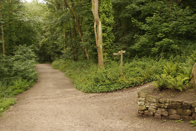
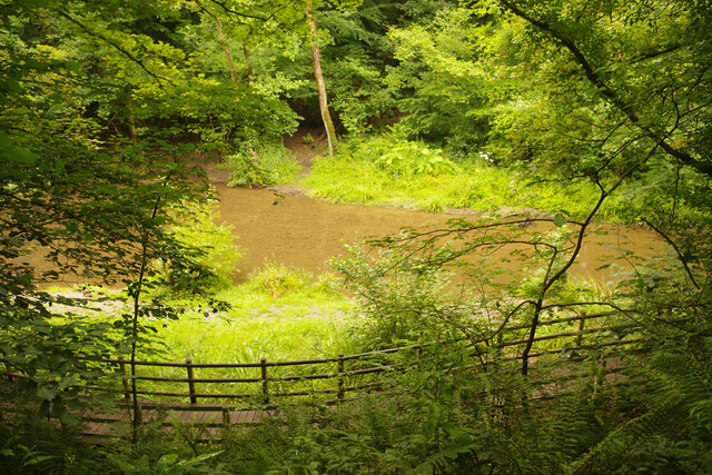
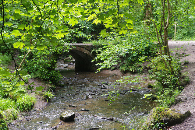
Ewloe is a village located in Flintshire, Wales. It is situated near the town of Buckley and is part of the Deeside conurbation. The village is known for its picturesque surroundings, with rolling green hills and wooded areas providing a tranquil setting for residents and visitors alike.

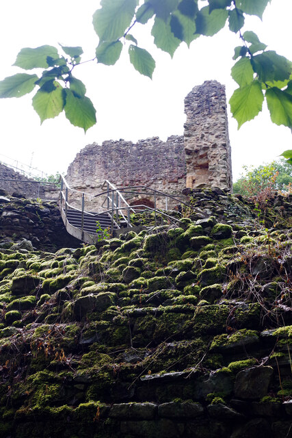
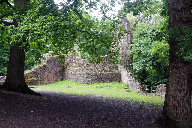
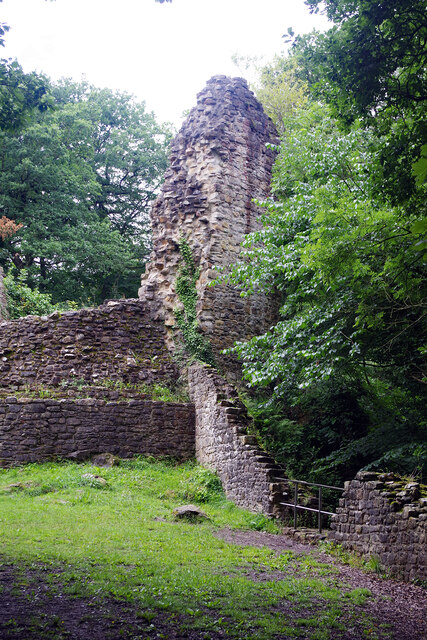
Ewloe has a rich history dating back to medieval times, with the ruins of Ewloe Castle serving as a prominent landmark in the area. The castle was built in the 13th century by the Welsh prince Llywelyn the Great and played a significant role in the conflicts between the Welsh and English during this period.

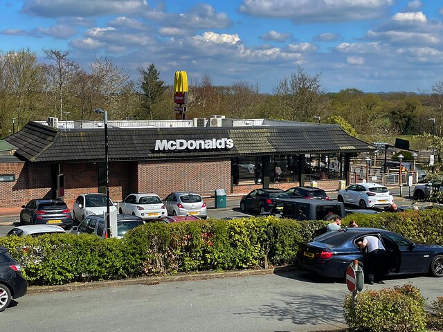
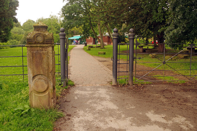
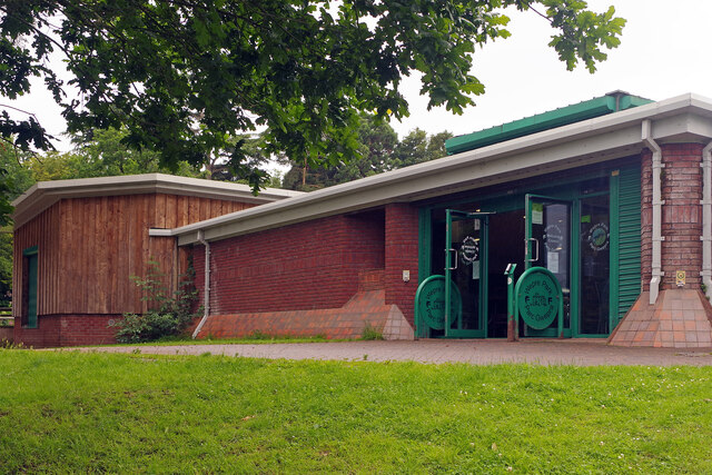
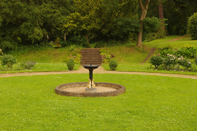
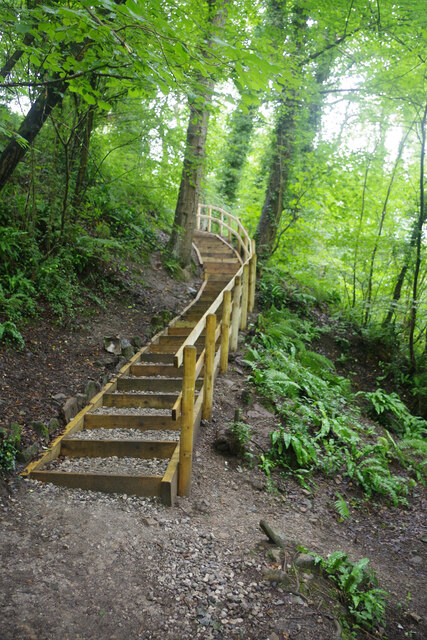
In addition to its historical significance, Ewloe is also a thriving community with a range of amenities and attractions for residents and visitors to enjoy. The village has a primary school, community center, and several local shops and restaurants. There are also plenty of opportunities for outdoor recreation, with numerous walking trails and parks in the surrounding area.

Overall, Ewloe is a charming village with a strong sense of community and a rich cultural heritage, making it a popular destination for those looking to explore the beauty of North Wales.

If you have any feedback on the listing, please let us know in the comments section below.

Ewlo Images

Images are sourced within 2km of 53.190891/-3.055741 or Grid Reference SJ2966. Thanks to Geograph Open Source API. All images are credited.

A55, North Wales Expressway near Ewloe The A55, also known as the North Wales Expressway (Gwibffordd Gogledd Cymru), is the major road in North Wales running for 88 miles between Chester and Holyhead via Conwy and Bangor. 

The A55 is a very high quality road, much of it rebuilt since the 1970s in response to traffic problems in Colwyn Bay, Colwyn and Llandudno caused by traffic having to pass through town centres on totally unsuitable streets, (especially in Conwy where lorries often scraped their paintwork as they passed through 12th century arches in the town's walls), leading to the construction of an east-west expressway bypassing the urban centres. It is a dual carriageway primary route for its entire length with the exception of the point where it crosses the Britannia Bridge over the Menai Strait. All of its junctions are grade separated except for two roundabouts; one east of Penmaenmawr and one in Llanfairfechan. The road originally ran from Chester to Bangor but was extended parallel to the A5 across Anglesey right into Holyhead Docks in 2001.

<span class="nowrap"><a title="http://www.sabre-roads.org.uk/wiki/index.php?title=A55" rel="nofollow ugc noopener" href="http://www.sabre-roads.org.uk/wiki/index.php?title=A55">Link</a><img style="margin-left:2px;" alt="External link" title="External link - shift click to open in new window" src="https://s1.geograph.org.uk/img/external.png" width="10" height="10"/></span>  SABRE
A55, North Wales Expressway near Ewloe
The A55, also known as the North Wales Expressway (Gwibffordd Gogledd Cymru), is the major road in North Wales running for 88 miles between Chester and Holyhead via Conwy and Bangor. The A55 is a very high quality road, much of it rebuilt since the 1970s in response to traffic problems in Colwyn Bay, Colwyn and Llandudno caused by traffic having to pass through town centres on totally unsuitable streets, (especially in Conwy where lorries often scraped their paintwork as they passed through 12th century arches in the town's walls), leading to the construction of an east-west expressway bypassing the urban centres. It is a dual carriageway primary route for its entire length with the exception of the point where it crosses the Britannia Bridge over the Menai Strait. All of its junctions are grade separated except for two roundabouts; one east of Penmaenmawr and one in Llanfairfechan. The road originally ran from Chester to Bangor but was extended parallel to the A5 across Anglesey right into Holyhead Docks in 2001. LinkExternal link SABRE
Ewloe Interchange (Junction 34), North Wales Expressway (A55) The A55, also known as the North Wales Expressway (Gwibffordd Gogledd Cymru), is the major road in North Wales running for 88 miles between Chester and Holyhead via Conwy and Bangor. 

The A55 is a very high quality road, much of it rebuilt since the 1970s in response to traffic problems in Colwyn Bay, Colwyn and Llandudno caused by traffic having to pass through town centres on totally unsuitable streets, (especially in Conwy where lorries often scraped their paintwork as they passed through 12th century arches in the town's walls), leading to the construction of an east-west expressway bypassing the urban centres. It is a dual carriageway primary route for its entire length with the exception of the point where it crosses the Britannia Bridge over the Menai Strait. All of its junctions are grade separated except for two roundabouts; one east of Penmaenmawr and one in Llanfairfechan. The road originally ran from Chester to Bangor but was extended parallel to the A5 across Anglesey right into Holyhead Docks in 2001.

<span class="nowrap"><a title="http://www.sabre-roads.org.uk/wiki/index.php?title=A55" rel="nofollow ugc noopener" href="http://www.sabre-roads.org.uk/wiki/index.php?title=A55">Link</a><img style="margin-left:2px;" alt="External link" title="External link - shift click to open in new window" src="https://s1.geograph.org.uk/img/external.png" width="10" height="10"/></span>  SABRE
Ewloe Interchange (Junction 34), North Wales Expressway (A55)
The A55, also known as the North Wales Expressway (Gwibffordd Gogledd Cymru), is the major road in North Wales running for 88 miles between Chester and Holyhead via Conwy and Bangor. The A55 is a very high quality road, much of it rebuilt since the 1970s in response to traffic problems in Colwyn Bay, Colwyn and Llandudno caused by traffic having to pass through town centres on totally unsuitable streets, (especially in Conwy where lorries often scraped their paintwork as they passed through 12th century arches in the town's walls), leading to the construction of an east-west expressway bypassing the urban centres. It is a dual carriageway primary route for its entire length with the exception of the point where it crosses the Britannia Bridge over the Menai Strait. All of its junctions are grade separated except for two roundabouts; one east of Penmaenmawr and one in Llanfairfechan. The road originally ran from Chester to Bangor but was extended parallel to the A5 across Anglesey right into Holyhead Docks in 2001. LinkExternal link SABRE
McDonald's restaurant at Northop Services
Benchmark by Drury Lane, Drury near Buckley Ordnance Survey benchmark on the north side of Drury Lane, Drury. Levelled at 122.008m above Newlyn Datum, verified 1959. For a view of the road see <a href="https://www.geograph.org.uk/photo/7517148">SJ2964 : Drury Lane at its junction with Bank Lane, Drury</a> 
Benchmark database: <span class="nowrap"><a title="https://www.bench-marks.org.uk/bm195202" rel="nofollow ugc noopener" href="https://www.bench-marks.org.uk/bm195202">Link</a><img style="margin-left:2px;" alt="External link" title="External link - shift click to open in new window" src="https://s1.geograph.org.uk/img/external.png" width="10" height="10"/></span>
Benchmark by Drury Lane, Drury near Buckley
Ordnance Survey benchmark on the north side of Drury Lane, Drury. Levelled at 122.008m above Newlyn Datum, verified 1959. For a view of the road see SJ2964 : Drury Lane at its junction with Bank Lane, Drury Benchmark database: LinkExternal link
Drury Lane at its junction with Bank Lane, Drury There is an Ordnance Survey benchmark on the stone wall close to the speed-calming pads on the road <a href="https://www.geograph.org.uk/photo/7517127">SJ2964 : Benchmark by Drury Lane, Drury near Buckley</a>
Drury Lane at its junction with Bank Lane, Drury
There is an Ordnance Survey benchmark on the stone wall close to the speed-calming pads on the road SJ2964 : Benchmark by Drury Lane, Drury near Buckley
Benchmark in Mount Pleasant Road, Burntwood Pentre Ordnance Survey benchmark on an old bridge abutment, which is no longer a bridge, in Mount Pleasant Road, Burntwood Pentre. Levelled at 141.830m above Newlyn Datum. For a wider view see <a href="https://www.geograph.org.uk/photo/7517250">SJ2864 : Bridge abutment in Mount Pleasant Road, Burntwood Pentre</a> 
Benchmark database: <span class="nowrap"><a title="https://www.bench-marks.org.uk/bm195205" rel="nofollow ugc noopener" href="https://www.bench-marks.org.uk/bm195205">Link</a><img style="margin-left:2px;" alt="External link" title="External link - shift click to open in new window" src="https://s1.geograph.org.uk/img/external.png" width="10" height="10"/></span>
Benchmark in Mount Pleasant Road, Burntwood Pentre
Ordnance Survey benchmark on an old bridge abutment, which is no longer a bridge, in Mount Pleasant Road, Burntwood Pentre. Levelled at 141.830m above Newlyn Datum. For a wider view see SJ2864 : Bridge abutment in Mount Pleasant Road, Burntwood Pentre Benchmark database: LinkExternal link
Bridge abutment in Mount Pleasant Road, Burntwood Pentre The brick abutment is the only sign that there was ever a railway bridge crossing the road here. In times past this area was a hive of activity with brick and tile works as well as coal mines to power the furnaces, all long gone. There is an Ordnance Survey benchmark low down on the corner of the abutment, but it is partly hidden by ivy <a href="https://www.geograph.org.uk/photo/7517223">SJ2864 : Benchmark in Mount Pleasant Road, Burntwood Pentre</a>
Bridge abutment in Mount Pleasant Road, Burntwood Pentre
The brick abutment is the only sign that there was ever a railway bridge crossing the road here. In times past this area was a hive of activity with brick and tile works as well as coal mines to power the furnaces, all long gone. There is an Ordnance Survey benchmark low down on the corner of the abutment, but it is partly hidden by ivy SJ2864 : Benchmark in Mount Pleasant Road, Burntwood Pentre
Wepre Park - skatepark Complete with graffiti-style artistry, the skatepark is one of the facilities aimed primarily at youngsters in Wepre Park. On this rather dismal day before the start of the school summer holidays it was deserted.
Wepre Park - skatepark
Complete with graffiti-style artistry, the skatepark is one of the facilities aimed primarily at youngsters in Wepre Park. On this rather dismal day before the start of the school summer holidays it was deserted.
Wepre Park Visitor Centre The old stone gatepost hints that this was the approach to a grander building than a modern visitor centre. In fact there was a hall on this site built in Georgian times that had to be demolished in the 1960s for safety reasons. The original cellars still exist beneath the visitor centre.
Wepre Park Visitor Centre
The old stone gatepost hints that this was the approach to a grander building than a modern visitor centre. In fact there was a hall on this site built in Georgian times that had to be demolished in the 1960s for safety reasons. The original cellars still exist beneath the visitor centre.
Wepre Park Visitor Centre The modern visitor centre stands on the site of the old Wepre Hall demolished in the 1960s. The original cellars still exist beneath the building.
Wepre Park Visitor Centre
The modern visitor centre stands on the site of the old Wepre Hall demolished in the 1960s. The original cellars still exist beneath the building.
Wepre Park - formal garden Although the house was demolished in the early 1960s, the formal garden at Wepre Park, originally laid out in the 18th and 19th centuries, has survived. The garden includes this circular lawn with a central fountain.
Wepre Park - formal garden
Although the house was demolished in the early 1960s, the formal garden at Wepre Park, originally laid out in the 18th and 19th centuries, has survived. The garden includes this circular lawn with a central fountain.
Path into Wepre Wood The path leads south from the Wepre Park visitor centre to Ewloe Castle, following Wepre Brook.
Path into Wepre Wood
The path leads south from the Wepre Park visitor centre to Ewloe Castle, following Wepre Brook.
Wepre Brook Wepre Brook flows through Wepre Wood (part of Wepre Park) and the path from the visitor centre to Ewloe Castle follows its course upstream.
Wepre Brook
Wepre Brook flows through Wepre Wood (part of Wepre Park) and the path from the visitor centre to Ewloe Castle follows its course upstream.
Wepre Brook Wepre Brook (Nant Gwepra in Welsh) flows through Wepre Wood and this footbridge forms part of the network of paths that invite exploration. The bridge, called Pont Aber, was originally sited further up the valley but was relocated here in about 1800 to improve access to Wepre Hall.
Wepre Brook
Wepre Brook (Nant Gwepra in Welsh) flows through Wepre Wood and this footbridge forms part of the network of paths that invite exploration. The bridge, called Pont Aber, was originally sited further up the valley but was relocated here in about 1800 to improve access to Wepre Hall.
Steps to Ewloe Castle After crossing Wepre Brook the path to the castle heads up these steps.
Steps to Ewloe Castle
After crossing Wepre Brook the path to the castle heads up these steps.
Ewloe Castle Showing the steps providing public access (originally ramps would have been provided for crossing the walls - there were no gatehouses as such) and the western tower.
Ewloe Castle
Showing the steps providing public access (originally ramps would have been provided for crossing the walls - there were no gatehouses as such) and the western tower.
Ewloe Castle Looking towards the western tower built later than the Welsh tower which is out of shot to the left.
Ewloe Castle
Looking towards the western tower built later than the Welsh tower which is out of shot to the left.
Ewloe Castle Showing the western tower. The wooded surroundings of the castle can be clearly seen in this view.
Ewloe Castle
Showing the western tower. The wooded surroundings of the castle can be clearly seen in this view.
Show me another place!

Ewlo is located at Grid Ref: SJ2966 (Lat: 53.190891, Lng: -3.055741)

Unitary Authority: Flintshire

Police Authority: North Wales

Also known as: Ewloe

What 3 Words

///braced.contemplate.motivator. Near Deeside, Flintshire

Nearby Locations

Ewloe Ewlo St Davids Park

Related Wikis

Ewloe

Ewloe (; Welsh: Ewlo, [ˈɛʊlɔ] ) is a village and electoral ward in the community of Hawarden in Flintshire, Wales. It is situated close to the Flintshire/Cheshire...
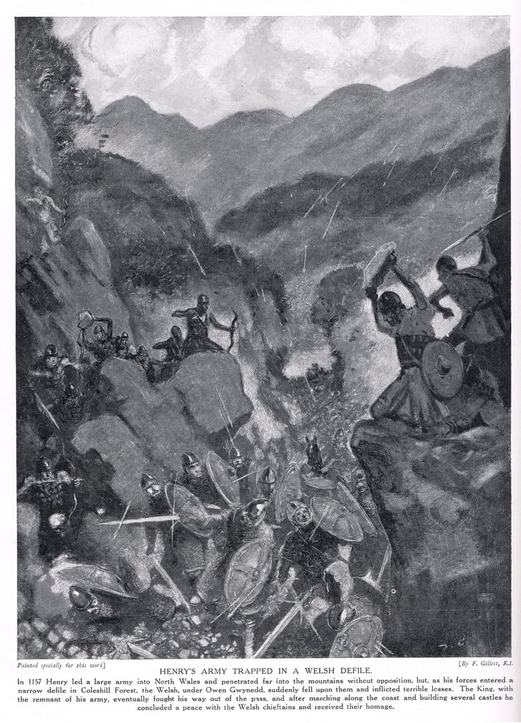
Battle of Ewloe

The Battle of Ewloe (also known as the Battle of Coleshill, or Counsylth, or Coleshille, or Cennadlog) was a battle fought in July 1157 between the army...

Ewloe Castle

Ewloe Castle (Welsh: Castell Ewlo) is a native Welsh castle built by the Kingdom of Gwynedd near the town of Ewloe in Flintshire, Wales. The castle, which...

Aston Park, Flintshire

Aston Park, also known as Aston, is a village in the community of Hawarden, in the principal area of Flintshire, north Wales. It is near to Hawarden and...

Nearby Amenities

Located within 500m of 53.190891,-3.055741
Ele: 82.798706
Lat/Long: 53.1887812/-3.0578803
Motorway Junction
Ewloe Interchange
Ref: 34
Lat/Long: 53.1881796/-3.0597261
Motorway Junction
St David's Park Interchange
Lat/Long: 53.1893722/-3.0568917
Power: tower
Lat/Long: 53.1870547/-3.0543906
Power: tower
Lat/Long: 53.1877521/-3.0587698
Power: tower
Lat/Long: 53.1868946/-3.0523955
Barrier: cycle_barrier
Lat/Long: 53.1893031/-3.0577169
Post Box
Operator: Royal Mail
Operator Wikidata: Q638098
Ref: CH5 490
Lat/Long: 53.1914292/-3.0494422
Barrier: cycle_barrier
Lat/Long: 53.1898336/-3.0588505
Ewloe Green
Place: village
Wikidata: Q107032518
Lat/Long: 53.1921333/-3.0558056
Post Box
Operator: Royal Mail
Operator Wikidata: Q638098
Ref: CH5 373
Lat/Long: 53.192598/-3.0535469
Barrier: bollard
Lat/Long: 53.1889255/-3.0503264
Crossing: informal
Lat/Long: 53.1869381/-3.0573657
Bench
Backrest: yes
Lat/Long: 53.1876206/-3.0553493
Bench
Backrest: yes
Lat/Long: 53.1876238/-3.0550328
Fibrespeed
Man Made: tower
Tower Type: communication
Lat/Long: 53.1887617/-3.0564436
Crossing
Button Operated: yes
Crossing: traffic_signals
Crossing Island: no
Tactile Paving: yes
Traffic Signals Sound: yes
Traffic Signals Vibration: yes
Lat/Long: 53.1879045/-3.0556219
Barrier: stile
Lat/Long: 53.1911115/-3.0560231
Tourism: hostel
Lat/Long: 53.1921944/-3.0545896
Maxspeed: 20 mph
Lat/Long: 53.1923239/-3.049643
Fast Food
Fayvon Fish and Chips
Addr Postcode: CH5 3AU
Addr Street: Old Mold Road
Cuisine: fish_and_chips
Fhrs Id: 471046
Source Addr: FHRS Open Data
Lat/Long: 53.1921215/-3.0548471
Maxspeed: 20 mph
Lat/Long: 53.1884386/-3.0499402
Power: pole
Lat/Long: 53.188712/-3.0594206
Material: wood
Power: pole
Lat/Long: 53.1882893/-3.0585355
Power: pole
Lat/Long: 53.1907209/-3.063165
Weighbridge
Lat/Long: 53.1913067/-3.0557728
Bus Stop
Ewloe Green, Mold Road / Ewloe Green School
Bus: yes
Naptan AtcoCode: 5120AWF80964
Naptan Bearing: NE
Naptan CommonName: Ewloe Green School
Naptan Crossing: Broadway
Naptan Indicator: opp
Naptan Landmark: Ewloe Green School
Naptan LocalityName: Ewloe Green
Naptan NaptanCode: fliapgj
Naptan Street: Mold Road
Naptan Verified: no
Public Transport: platform
Public Transport Version: 2
Source: naptan_import
Lat/Long: 53.1909118/-3.0603492
Bus Stop
Ewloe Green, Mold Road / Ewloe Green School
Bus: yes
Naptan AtcoCode: 5120AWF80965
Naptan Bearing: SW
Naptan CommonName: Ewloe Green School
Naptan Crossing: Grenville Avenue
Naptan Indicator: after
Naptan Landmark: Ewloe Green School
Naptan LocalityName: Ewloe Green
Naptan NaptanCode: fliapgm
Naptan Street: Mold Road
Naptan Verified: no
Public Transport: platform
Public Transport Version: 2
Source: naptan_import
Lat/Long: 53.1905213/-3.0617144
Turning Circle
Lat/Long: 53.1902971/-3.0615321
Power: pole
Lat/Long: 53.189256/-3.0605266
Power: Dead Pilon
Lat/Long: 53.1905987/-3.0622137
Direction: 195
Generator Method: photovoltaic
Generator Output Electricity: yes
Generator Solar Modules: 16
Generator Source: solar
Generator Type: solar_photovoltaic_panel
Location: roof
Power: generator
Lat/Long: 53.1864228/-3.0553712
Direction: 215
Generator Method: photovoltaic
Generator Output Electricity: yes
Generator Solar Modules: 14
Generator Source: solar
Generator Type: solar_photovoltaic_panel
Location: roof
Power: generator
Lat/Long: 53.1912973/-3.048773
Direction: 215
Generator Method: photovoltaic
Generator Output Electricity: yes
Generator Solar Modules: 11
Generator Source: solar
Generator Type: solar_photovoltaic_panel
Location: roof
Power: generator
Lat/Long: 53.1917007/-3.0500699
Bus Stop
Ewloe Green, Old Mold Road / Boar`s Head
Bus: yes
Naptan AtcoCode: 5120WDB22093
Naptan Bearing: NE
Naptan CommonName: Boar`s Head
Naptan Crossing: Holywell Road
Naptan Indicator: before
Naptan Landmark: Boar`s Head PH
Naptan LocalityName: Ewloe Green
Naptan NaptanCode: flijpwt
Naptan PlusbusZoneRef: SHOTTON
Naptan Street: Old Mold Road
Naptan Verified: no
Public Transport: platform
Public Transport Version: 2
Source: naptan_import
Lat/Long: 53.1921511/-3.055657
Bus Stop
Ewloe Green, Old Mold Road / Boar`s Head
Bus: yes
Naptan AtcoCode: 5120AWF80963
Naptan Bearing: SW
Naptan CommonName: Boar`s Head
Naptan Crossing: Holywell Road
Naptan Indicator: opp
Naptan Landmark: Boar`s Head PH
Naptan LocalityName: Ewloe Green
Naptan NaptanCode: fliapdt
Naptan PlusbusZoneRef: SHOTTON
Naptan Street: Old Mold Road
Naptan Verified: no
Public Transport: platform
Public Transport Version: 2
Source: naptan_import
Lat/Long: 53.1921744/-3.0551004
Bus Stop
Ewloe Green, Old Aston Hill / Castle Garage
Bus: yes
Naptan AtcoCode: 5120AWF80617
Naptan Bearing: NE
Naptan CommonName: Castle Garage
Naptan Crossing: St David`s Close
Naptan Indicator: after
Naptan LocalityName: Ewloe Green
Naptan NaptanCode: fliapga
Naptan PlusbusZoneRef: SHOTTON
Naptan Street: Old Aston Hill
Naptan Verified: no
Public Transport: platform
Public Transport Version: 2
Source: naptan_import
Lat/Long: 53.1932447/-3.0525926
Barrier: entrance
Lat/Long: 53.1891107/-3.0558172
Bench
Backrest: yes
Colour: brown
Material: wood
Seats: 2
Lat/Long: 53.1890005/-3.0568265
Site of the Boars Head pub
Historic: memorial
Memorial: plaque
Lat/Long: 53.1924252/-3.0548642
Direction: 215
Generator Method: photovoltaic
Generator Output Electricity: yes
Generator Solar Modules: 14
Generator Source: solar
Generator Type: solar_photovoltaic_panel
Location: roof
Power: generator
Lat/Long: 53.1913926/-3.0483741
Direction: 215
Generator Method: photovoltaic
Generator Output Electricity: yes
Generator Solar Modules: 14
Generator Source: solar
Generator Type: solar_photovoltaic_panel
Location: roof
Power: generator
Lat/Long: 53.1913741/-3.0483929
Direction: 215
Generator Method: photovoltaic
Generator Output Electricity: yes
Generator Solar Modules: 14
Generator Source: solar
Generator Type: solar_photovoltaic_panel
Location: roof
Power: generator
Lat/Long: 53.1913548/-3.0484117
Direction: 195
Generator Method: photovoltaic
Generator Output Electricity: yes
Generator Solar Modules: 16
Generator Source: solar
Generator Type: solar_photovoltaic_panel
Location: ground
Power: generator
Lat/Long: 53.187/-3.0557567
Bus Stop
Hawarden, The Highway / Carlines Park
Bus: yes
Naptan AtcoCode: 5120AWF80608
Naptan Bearing: SE
Naptan CommonName: Carlines Park
Naptan Crossing: Carlines Park
Naptan Indicator: nr
Naptan LocalityName: Hawarden
Naptan NaptanCode: fliamwm
Naptan Street: The Highway
Public Transport: platform
Shelter: no
Source: naptan_import
Lat/Long: 53.19104/-3.0489969
Bus Stop
Hawarden, The Highway / Carlines Park
Bus: yes
Naptan AtcoCode: 5120WDB22168
Naptan Bearing: NW
Naptan CommonName: Carlines Park
Naptan Crossing: Carlines Park
Naptan Indicator: nr
Naptan LocalityName: Hawarden
Naptan NaptanCode: flijwjd
Naptan Street: The Highway
Public Transport: platform
Source: naptan_import
Lat/Long: 53.1909062/-3.0491028
Bus Stop
Ewloe Green, Old Aston Hill / Castle Garage
Bus: yes
Naptan AtcoCode: 5120WDB22325
Naptan Bearing: SW
Naptan CommonName: Castle Garage
Naptan Crossing: St David`s Close
Naptan Indicator: before
Naptan LocalityName: Ewloe Green
Naptan NaptanCode: flimgmj
Naptan PlusbusZoneRef: SHOTTON
Naptan Street: Old Aston Hill
Public Transport: platform
Source: naptan_import
Lat/Long: 53.1932137/-3.0523822
The data included in this document is from www.openstreetmap.org. The data is made available under ODbL.

Have you been to Ewlo?

Leave your review of Ewlo below (or comments, questions and feedback).