Norwich Grove

Wood, Forest in Hertfordshire East Hertfordshire

England

Norwich Grove

Approaching the end of the Buntingford bypass The A10 runs 161 miles from London to King's Lynn. via Cambridge and Ely. 
<span class="nowrap"><a title="http://www.sabre-roads.org.uk/wiki/index.php?title=A10" rel="nofollow ugc noopener" href="http://www.sabre-roads.org.uk/wiki/index.php?title=A10">Link</a><img style="margin-left:2px;" alt="External link" title="External link - shift click to open in new window" src="https://s1.geograph.org.uk/img/external.png" width="10" height="10"/></span>
Approaching the end of the Buntingford bypass Credit: N Chadwick

Norwich Grove is a charming woodland area located in Hertfordshire, England. Situated in the heart of a lush forest, it offers a serene and tranquil environment for nature enthusiasts and those seeking a peaceful retreat.

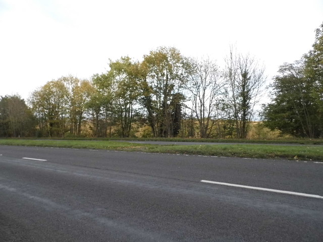
Covering an expansive area, Norwich Grove is known for its abundant greenery and diverse wildlife. The woodland is home to a variety of tree species, including oak, ash, and beech, which create a picturesque and enchanting landscape. The dense canopy provides shade during the summer months, making it an ideal spot for picnics or leisurely walks.

The forest is teeming with wildlife, offering nature lovers the opportunity to observe and appreciate the local fauna. Squirrels, rabbits, and various species of birds can often be spotted amidst the trees, adding a touch of wilderness to the area. Norwich Grove is also home to several nature trails, allowing visitors to explore the forest's hidden gems at their own pace.

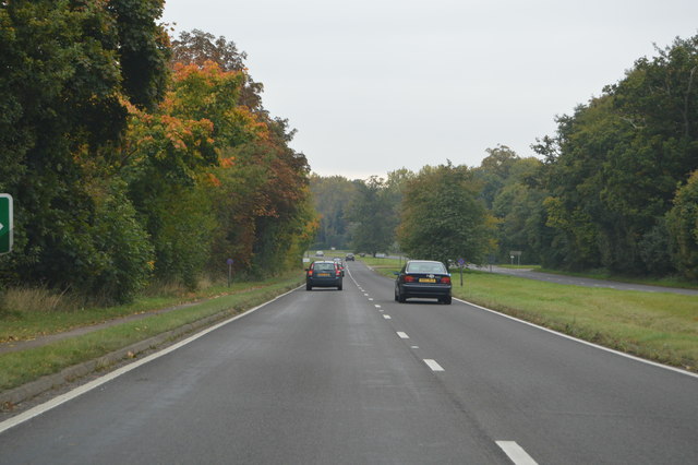
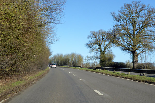
In addition to its natural beauty, Norwich Grove offers a range of recreational activities for visitors. The forest is equipped with well-maintained walking and cycling paths, providing opportunities for outdoor exercise and exploration. There are also designated picnic areas with benches and tables, perfect for enjoying a meal surrounded by nature.

Norwich Grove is easily accessible, with ample parking and well-marked trails. The forest is open year-round, offering a different experience with each season. Whether it's the vibrant colors of autumn, the crisp winter air, the blossoming spring flowers, or the lush greenery of summer, Norwich Grove is a haven for nature lovers seeking a peaceful and idyllic escape from the hustle and bustle of everyday life.

If you have any feedback on the listing, please let us know in the comments section below.

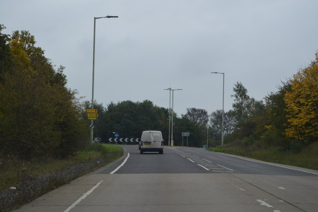
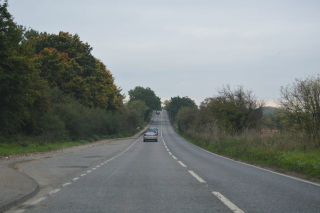
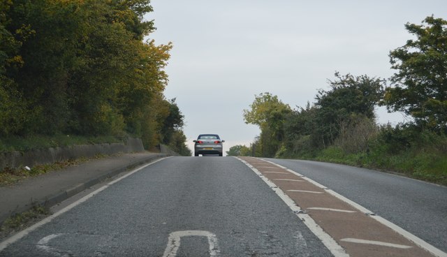
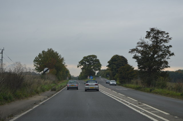
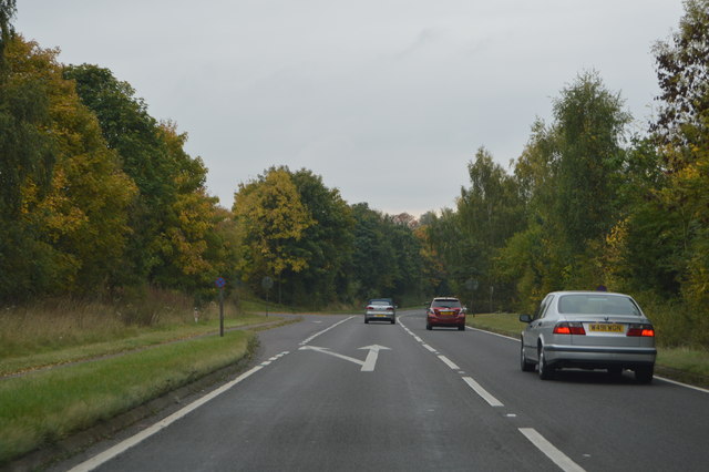
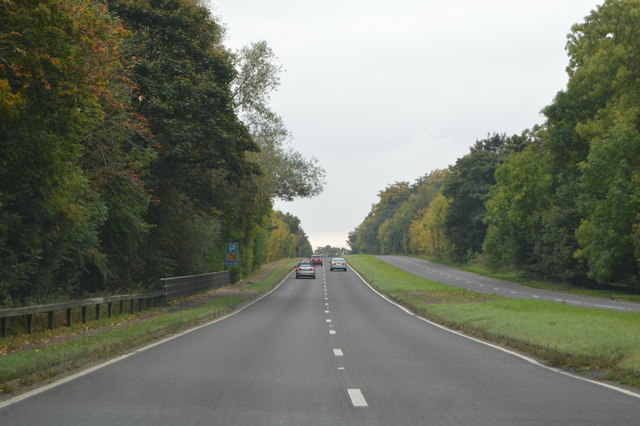
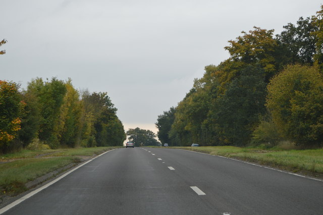
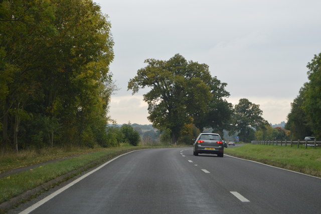
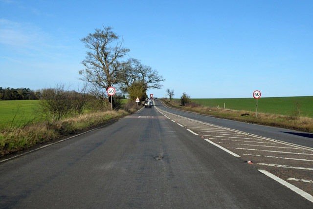
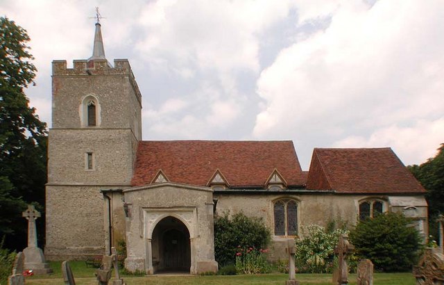
Norwich Grove Images

Images are sourced within 2km of 51.919575/-0.002998498 or Grid Reference TL3726. Thanks to Geograph Open Source API. All images are credited.

Approaching the end of the Buntingford bypass The A10 runs 161 miles from London to King's Lynn. via Cambridge and Ely. 
<span class="nowrap"><a title="http://www.sabre-roads.org.uk/wiki/index.php?title=A10" rel="nofollow ugc noopener" href="http://www.sabre-roads.org.uk/wiki/index.php?title=A10">Link</a><img style="margin-left:2px;" alt="External link" title="External link - shift click to open in new window" src="https://s1.geograph.org.uk/img/external.png" width="10" height="10"/></span>
Approaching the end of the Buntingford bypass
The A10 runs 161 miles from London to King's Lynn. via Cambridge and Ely. LinkExternal link
A10, Ermine Street The A10 runs 161 miles from London to King's Lynn. via Cambridge and Ely. 
<span class="nowrap"><a title="http://www.sabre-roads.org.uk/wiki/index.php?title=A10" rel="nofollow ugc noopener" href="http://www.sabre-roads.org.uk/wiki/index.php?title=A10">Link</a><img style="margin-left:2px;" alt="External link" title="External link - shift click to open in new window" src="https://s1.geograph.org.uk/img/external.png" width="10" height="10"/></span>
A10, Ermine Street
The A10 runs 161 miles from London to King's Lynn. via Cambridge and Ely. LinkExternal link
Ermine Street The old Roman Road from London to Lincoln and York.

Wikipedia entry: <span class="nowrap"><a title="http://en.wikipedia.org/wiki/Ermine_Street" rel="nofollow ugc noopener" href="http://en.wikipedia.org/wiki/Ermine_Street">Link</a><img style="margin-left:2px;" alt="External link" title="External link - shift click to open in new window" src="https://s1.geograph.org.uk/img/external.png" width="10" height="10"/></span>
Ermine Street
The old Roman Road from London to Lincoln and York. Wikipedia entry: LinkExternal link
A10, southbound The A10 runs 161 miles from London to King's Lynn. via Cambridge and Ely. 
<span class="nowrap"><a title="http://www.sabre-roads.org.uk/wiki/index.php?title=A10" rel="nofollow ugc noopener" href="http://www.sabre-roads.org.uk/wiki/index.php?title=A10">Link</a><img style="margin-left:2px;" alt="External link" title="External link - shift click to open in new window" src="https://s1.geograph.org.uk/img/external.png" width="10" height="10"/></span>
A10, southbound
The A10 runs 161 miles from London to King's Lynn. via Cambridge and Ely. LinkExternal link
Beginning of Dual Carriageway, A10 The A10 runs 161 miles from London to King's Lynn. via Cambridge and Ely. 
<span class="nowrap"><a title="http://www.sabre-roads.org.uk/wiki/index.php?title=A10" rel="nofollow ugc noopener" href="http://www.sabre-roads.org.uk/wiki/index.php?title=A10">Link</a><img style="margin-left:2px;" alt="External link" title="External link - shift click to open in new window" src="https://s1.geograph.org.uk/img/external.png" width="10" height="10"/></span>
Beginning of Dual Carriageway, A10
The A10 runs 161 miles from London to King's Lynn. via Cambridge and Ely. LinkExternal link
A10, southbound The A10 runs 161 miles from London to King's Lynn. via Cambridge and Ely. 
<span class="nowrap"><a title="http://www.sabre-roads.org.uk/wiki/index.php?title=A10" rel="nofollow ugc noopener" href="http://www.sabre-roads.org.uk/wiki/index.php?title=A10">Link</a><img style="margin-left:2px;" alt="External link" title="External link - shift click to open in new window" src="https://s1.geograph.org.uk/img/external.png" width="10" height="10"/></span>
A10, southbound
The A10 runs 161 miles from London to King's Lynn. via Cambridge and Ely. LinkExternal link
A10 at New Bridge The A10 runs 161 miles from London to King's Lynn. via Cambridge and Ely. 
<span class="nowrap"><a title="http://www.sabre-roads.org.uk/wiki/index.php?title=A10" rel="nofollow ugc noopener" href="http://www.sabre-roads.org.uk/wiki/index.php?title=A10">Link</a><img style="margin-left:2px;" alt="External link" title="External link - shift click to open in new window" src="https://s1.geograph.org.uk/img/external.png" width="10" height="10"/></span>
A10 at New Bridge
The A10 runs 161 miles from London to King's Lynn. via Cambridge and Ely. LinkExternal link
A10, southbound The A10 runs 161 miles from London to King's Lynn. via Cambridge and Ely. 
<span class="nowrap"><a title="http://www.sabre-roads.org.uk/wiki/index.php?title=A10" rel="nofollow ugc noopener" href="http://www.sabre-roads.org.uk/wiki/index.php?title=A10">Link</a><img style="margin-left:2px;" alt="External link" title="External link - shift click to open in new window" src="https://s1.geograph.org.uk/img/external.png" width="10" height="10"/></span>
A10, southbound
The A10 runs 161 miles from London to King's Lynn. via Cambridge and Ely. LinkExternal link
Church of St Mary the Virgin, Westmill Grade II* listed church, described at this <span class="nowrap"><a title="https://historicengland.org.uk/listing/the-list/list-entry/1173980" rel="nofollow ugc noopener" href="https://historicengland.org.uk/listing/the-list/list-entry/1173980">Link</a><img style="margin-left:2px;" alt="External link" title="External link - shift click to open in new window" src="https://s1.geograph.org.uk/img/external.png" width="10" height="10"/></span>.
Church of St Mary the Virgin, Westmill
Grade II* listed church, described at this LinkExternal link.
The A10, Braughing
The A10, Braughing
The A10, Braughing
The A10, Braughing
Isolated bus shelter on the A10, Westmill
The A10, Westmill
The A10, Westmill
Northbound A10
Northbound A10
Northbound A10 A widely separated dual carriageway here, a swansong as the road becomes single carriageway not far ahead.
Northbound A10
A widely separated dual carriageway here, a swansong as the road becomes single carriageway not far ahead.
A10 heading north At the end of the dual carriageway, and a 50 limit to boot. The Roman Ermine Street.
A10 heading north
At the end of the dual carriageway, and a 50 limit to boot. The Roman Ermine Street.
Show me another place!

Norwich Grove is located at Grid Ref: TL3726 (Lat: 51.919575, Lng: -0.002998498)

Administrative County: Hertfordshire

District: East Hertfordshire

Police Authority: Hertfordshire

What 3 Words

///elastic.stilted.searcher. Near Buntingford, Hertfordshire

Related Wikis

West Mill railway station

West Mill railway station served the village of Westmill, Hertfordshire, England, from 1863 to 1964 on the Buntingford branch line. == History == The station...

Westmill

Westmill is an English village and civil parish in the East Hertfordshire district of Hertfordshire, with an area of 1036 hectares. A population of 264...

Dassels

Dassels is a hamlet in the district of East Hertfordshire, in the county of Hertfordshire. Nearby settlements include the town of Ware and the village...

Aspenden

Aspenden is a village and civil parish in the East Hertfordshire district of Hertfordshire, England. It is just to the south of Buntingford. The Prime...

North East Hertfordshire (UK Parliament constituency)

North East Hertfordshire is a constituency represented in the House of Commons of the UK Parliament since 1997 by Oliver Heald, a Conservative. == Constituency... ==

Cherry Green, Hertfordshire

Cherry Green is a hamlet in the East Hertfordshire District, in the county of Hertfordshire, England. The post town for Cherry Green is the nearby town...

Puckeridge

Puckeridge is a village in East Hertfordshire, England with a population of 3,561 (2011 Census). It is in the civil parish of Standon. == History == The...

East Hertfordshire

East Hertfordshire is one of ten local government districts in Hertfordshire, England. Its council is based in Hertford, the county town of Hertfordshire...

Nearby Amenities

Located within 500m of 51.919575,-0.002998498
Power: pole
Source: Bing
Lat/Long: 51.9213541/0.0035998
Material: steel
Power: pole
Source: Bing
Lat/Long: 51.9206521/0.0023981
Power: pole
Lat/Long: 51.921573/-0.0084732
Power: pole
Lat/Long: 51.921198/-0.0097831
Power: pole
Lat/Long: 51.921451/-0.0066366
Power: pole
Lat/Long: 51.9209261/-0.0043223
Power: pole
Lat/Long: 51.9199468/-1.1E-5
Power: pole
Lat/Long: 51.9205324/-0.0025862
Old Lodge Bank
Place: locality
Source: https://webmaps.hertfordshire.gov.uk/row/row.htm
Lat/Long: 51.9158505/-0.0017356
The data included in this document is from www.openstreetmap.org. The data is made available under ODbL.

Have you been to Norwich Grove?

Leave your review of Norwich Grove below (or comments, questions and feedback).