Burloes Plantation

Wood, Forest in Hertfordshire North Hertfordshire

England

Burloes Plantation

A505 The A505 runs 50 miles from Great Abington to Leighton Buzzard.
<span class="nowrap"><a title="http://www.sabre-roads.org.uk/wiki/index.php?title=A505" rel="nofollow ugc noopener" href="http://www.sabre-roads.org.uk/wiki/index.php?title=A505">Link</a><img style="margin-left:2px;" alt="External link" title="External link - shift click to open in new window" src="https://s1.geograph.org.uk/img/external.png" width="10" height="10"/></span>
A505 Credit: N Chadwick

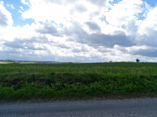
Burloes Plantation is a picturesque woodland located in Hertfordshire, England. Covering an area of approximately 200 acres, this enchanting forest is renowned for its natural beauty and rich history. The plantation is situated on the grounds of Burloes Hall, a Grade II listed Georgian manor house.

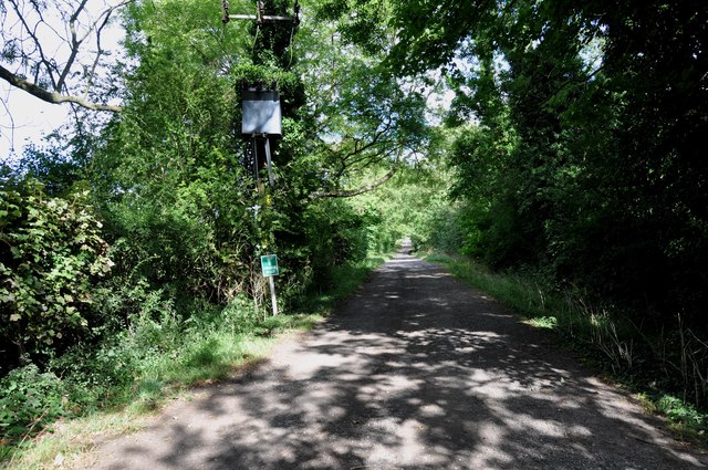
The woodland is predominantly composed of native English trees such as oak, beech, ash, and birch, creating a diverse and vibrant ecosystem. The plantation is also home to a variety of wildlife, including deer, foxes, rabbits, and a multitude of bird species. Nature enthusiasts can enjoy exploring the well-maintained paths and trails that wind through the forest, providing ample opportunities for leisurely walks, jogging, and cycling.

Burloes Plantation has a rich historical background, dating back centuries. It is believed that the woodland served as a hunting ground for the aristocracy in medieval times. The plantation also played a significant role during World War II, serving as a training ground for the Home Guard. The remnants of old military structures can still be found within the woodland, offering a glimpse into its past.

Today, Burloes Plantation is a popular destination for locals and visitors alike, seeking respite from the hustle and bustle of everyday life. Its tranquil atmosphere, coupled with its natural beauty, makes it an ideal location for picnics, photography, and wildlife observation. The plantation also hosts various events throughout the year, including guided nature walks, educational programs, and seasonal festivities.

Overall, Burloes Plantation is a hidden gem in Hertfordshire, offering a peaceful retreat and an opportunity to connect with nature.

If you have any feedback on the listing, please let us know in the comments section below.

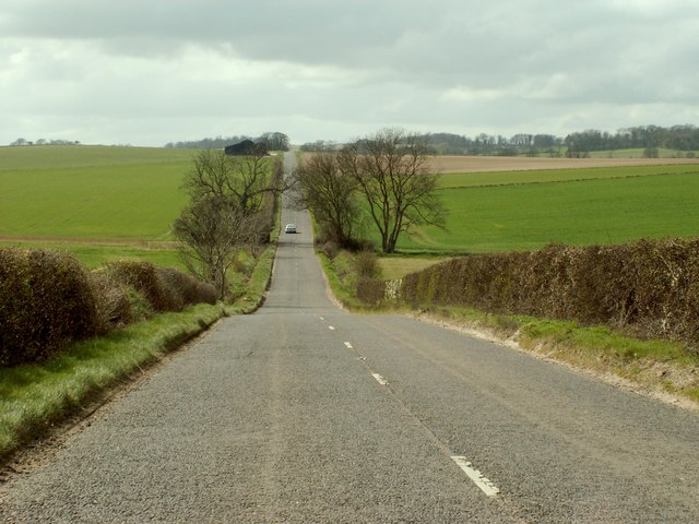
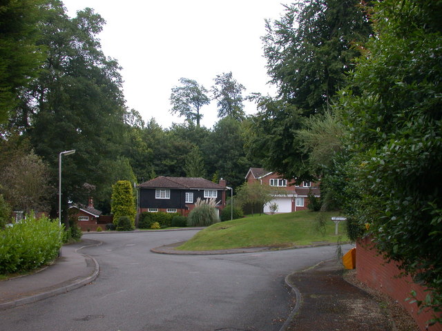
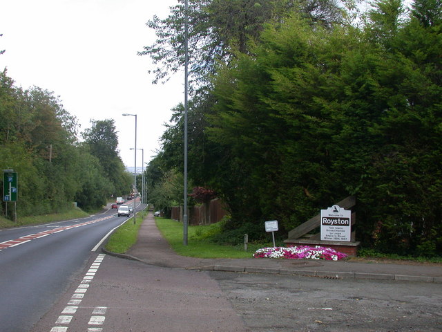
Burloes Plantation Images

Images are sourced within 2km of 52.047795/-0.000509679 or Grid Reference TL3740. Thanks to Geograph Open Source API. All images are credited.

A505 The A505 runs 50 miles from Great Abington to Leighton Buzzard.
<span class="nowrap"><a title="http://www.sabre-roads.org.uk/wiki/index.php?title=A505" rel="nofollow ugc noopener" href="http://www.sabre-roads.org.uk/wiki/index.php?title=A505">Link</a><img style="margin-left:2px;" alt="External link" title="External link - shift click to open in new window" src="https://s1.geograph.org.uk/img/external.png" width="10" height="10"/></span>
A505
The A505 runs 50 miles from Great Abington to Leighton Buzzard. LinkExternal link
Royston Station Royston station is on the Cambridge Line. The station opened in 1850.
Wikipedia: <span class="nowrap"><a title="https://en.wikipedia.org/wiki/Royston_railway_station" rel="nofollow ugc noopener" href="https://en.wikipedia.org/wiki/Royston_railway_station">Link</a><img style="margin-left:2px;" alt="External link" title="External link - shift click to open in new window" src="https://s1.geograph.org.uk/img/external.png" width="10" height="10"/></span>
Royston Station
Royston station is on the Cambridge Line. The station opened in 1850. Wikipedia: LinkExternal link
The B.1039 between Barley and Royston
The entrance to Heath Farm
Track that leads to Flint Hall Farm
Shrubbery Grove, Royston A turning off the A10 on the southern edge of town.
Shrubbery Grove, Royston
A turning off the A10 on the southern edge of town.
Welcome to Royston The approach from the south of the A10. The sign notes the town's twinning with Grossalmerode and La loupe, and its victory in the "Anglia in Bloom" competition in 1994 and 1997.
Welcome to Royston
The approach from the south of the A10. The sign notes the town's twinning with Grossalmerode and La loupe, and its victory in the "Anglia in Bloom" competition in 1994 and 1997.
Avenue leading south from The Grange
Private Driveway to Flint Hall Farm
The entrance to Royston Cottage Hospital This super little Hospital has been serving Royston and surrounding areas for a great many years, it is amazing that it still up and running.
The entrance to Royston Cottage Hospital
This super little Hospital has been serving Royston and surrounding areas for a great many years, it is amazing that it still up and running.
Farm land adjacent to B1039 There is very little oil seed rape around this year apparently because of the unusually cold weather in March. The crop here is not as advanced as it usually is at this time of year. The transmitter mast near to Barkway (2.5 miles away) is visible in the distance.
Farm land adjacent to B1039
There is very little oil seed rape around this year apparently because of the unusually cold weather in March. The crop here is not as advanced as it usually is at this time of year. The transmitter mast near to Barkway (2.5 miles away) is visible in the distance.
Isolated barn and B1039
Not the footpath The signs point you this way, but the sign on the gate says these are just permissive paths at the landowners discretion. The actual footpath must therefore still be valid, but is blocked off by stud farm fences.
Not the footpath
The signs point you this way, but the sign on the gate says these are just permissive paths at the landowners discretion. The actual footpath must therefore still be valid, but is blocked off by stud farm fences.
Odd sign at Newsells Park stud The signed route is apparently only a permissive path, meaning the actual public footpath must still be valid, despite being blocked off by the landowner's fences.
Odd sign at Newsells Park stud
The signed route is apparently only a permissive path, meaning the actual public footpath must still be valid, despite being blocked off by the landowner's fences.
Bridleway to Whiteley Hill
Your guess is as good as mine The sign marks the route of the permissive path (the actual public footpath is blocked by a multitude of stud farm fences). How you are meant to follow it is however uncertain.
Your guess is as good as mine
The sign marks the route of the permissive path (the actual public footpath is blocked by a multitude of stud farm fences). How you are meant to follow it is however uncertain.
Permissive path at Newells Farm Stud The actual public footpath is blocked by several stud farm fences. the path should be diverted permanently.
Permissive path at Newells Farm Stud
The actual public footpath is blocked by several stud farm fences. the path should be diverted permanently.
Bridleway to Whiteley Hill
Show me another place!

Burloes Plantation is located at Grid Ref: TL3740 (Lat: 52.047795, Lng: -0.000509679)

Administrative County: Hertfordshire

District: North Hertfordshire

Police Authority: Hertfordshire

What 3 Words

///fakes.protrude.tricycle. Near Royston, Hertfordshire

Related Wikis

Icknield Walk First School

Icknield Walk First School is a larger than average first school located in Royston, Hertfordshire, England. It has approximately 335 registered students...

Meridian School, Royston

The Meridian School was a secondary school and sixth form located in Royston, Hertfordshire, England. It was an academy, and had approximately 474 registered...

King James Academy Royston

King James Academy Royston (KJAR) is a through school located in Royston, Hertfordshire, England. It is an academy, and opened in September 2019, as a...

Greneway Middle School, Royston

The Greneway Middle School was a middle school in Royston, Hertfordshire, England, which has been combined with Roysia Middle School and Meridian School...

Nearby Amenities

Located within 500m of 52.047795,-0.000509679
Man Made: mast
Lat/Long: 52.049986/-0.0002811
Leisure: playground
Lat/Long: 52.0497909/-0.0056077
Sport: skateboard
Lat/Long: 52.0493911/-0.0054391
Power: pole
Lat/Long: 52.0504666/0.002328
Power: pole
Lat/Long: 52.0499268/0.0033723
Power: pole
Lat/Long: 52.0498216/-0.0027601
Power: pole
Lat/Long: 52.0492971/-0.0036077
Material: wood
Power: pole
Lat/Long: 52.0505853/-0.0015853
Power: pole
Lat/Long: 52.0503725/-0.0023927
Material: wood
Power: pole
Lat/Long: 52.0506761/0.000421
Power: pole
Lat/Long: 52.0502702/-0.0038679
Power: pole
Lat/Long: 52.04789/-0.0056489
Power: pole
Lat/Long: 52.0504468/-0.001191
Power: pole
Lat/Long: 52.0495214/0.0041117
Power: pole
Lat/Long: 52.0469679/-0.0070114
Power: pole
Lat/Long: 52.0501732/-0.005622
Material: wood
Power: pole
Lat/Long: 52.0519795/-0.0020135
Source: survey
Lat/Long: 52.0489447/-0.0053276
The data included in this document is from www.openstreetmap.org. The data is made available under ODbL.

Have you been to Burloes Plantation?

Leave your review of Burloes Plantation below (or comments, questions and feedback).