Broom Wood

Wood, Forest in Surrey

England

Broom Wood

The Harrow Inn, Old Farleigh Road, Farleigh, CR6
The Harrow Inn, Old Farleigh Road, Farleigh, CR6 Credit: Philip Talmage

Broom Wood is a picturesque woodland located in Surrey, England. Covering an area of approximately 50 hectares, it forms part of the larger Surrey Hills Area of Outstanding Natural Beauty. The wood is situated near the village of Betchworth, just south of the M25 motorway.

The woodland consists mainly of mixed broadleaf trees, such as oak, beech, and birch, creating a beautiful and diverse canopy. The forest floor is adorned with an array of wildflowers, including bluebells, wood anemones, and primroses, which bloom in vibrant colors during the spring months.

Broom Wood is a popular destination for nature enthusiasts and walkers, offering a range of trails and paths that wind through the woodland. The tranquil atmosphere and natural beauty make it an ideal place for relaxation and birdwatching. Visitors may catch a glimpse of various bird species, including woodpeckers, buzzards, and tawny owls.

The wood also provides a habitat for a variety of wildlife, including deer, foxes, and squirrels. It is a designated Site of Special Scientific Interest (SSSI) due to its ecological importance and the presence of rare species, such as the purple emperor butterfly.

In addition to its natural qualities, Broom Wood has historical significance. It was once part of the estate surrounding Betchworth Castle, a medieval fortification. Today, the castle's ruins can still be seen nearby, adding a touch of historical charm to the woodland.

Overall, Broom Wood is a captivating and cherished natural area in Surrey, offering visitors a chance to immerse themselves in the beauty of the English countryside.

If you have any feedback on the listing, please let us know in the comments section below.

Broom Wood Images

Images are sourced within 2km of 51.334342/-0.045632957 or Grid Reference TQ3661. Thanks to Geograph Open Source API. All images are credited.

The Harrow Inn, Old Farleigh Road, Farleigh, CR6
New housing development at Kingswood Lane, Hamsey Green, Surrey More little boxes...
New housing development at Kingswood Lane, Hamsey Green, Surrey
More little boxes...
Harrow Inn, Farleigh, Surrey
Limpsfield Road, Sanderstead
Harewood Gardens, Sanderstead
Limpsfield Road, Sanderstead
Holt Wood, Chelsham (2) Plenty of oaks in this woodland.
Holt Wood, Chelsham (2)
Plenty of oaks in this woodland.
A junior match at Farleigh Rovers FC Farleigh Rovers are playing in their colours of red (claret) and black.
A junior match at Farleigh Rovers FC
Farleigh Rovers are playing in their colours of red (claret) and black.
Oakenshaw Close A very new development off Kingswood Lane, shoe-horned into the space formerly occupied by two or three houses with rather large gardens.
Oakenshaw Close
A very new development off Kingswood Lane, shoe-horned into the space formerly occupied by two or three houses with rather large gardens.
A study in brown A lone walker crosses a ploughed field following footpath 587, or actually the straight line version customarily used - the legal line bends somewhat across the field for no obvious reason.
A study in brown
A lone walker crosses a ploughed field following footpath 587, or actually the straight line version customarily used - the legal line bends somewhat across the field for no obvious reason.
Field opposite Great Farleigh Green Great Farleigh Green is just north of Warlingham and west of the rather scattered hamlet of Farleigh. This field is near the south end of the green, on the opposite side of Old Farleigh Road.
Field opposite Great Farleigh Green
Great Farleigh Green is just north of Warlingham and west of the rather scattered hamlet of Farleigh. This field is near the south end of the green, on the opposite side of Old Farleigh Road.
Field alongside Old Farleigh Road Great Farleigh Green is just north of Warlingham and west of the rather scattered hamlet of Farleigh. This field is near the south end of the green, on the opposite side of Old Farleigh Road, which is beyond the belt of trees on the right.
Field alongside Old Farleigh Road
Great Farleigh Green is just north of Warlingham and west of the rather scattered hamlet of Farleigh. This field is near the south end of the green, on the opposite side of Old Farleigh Road, which is beyond the belt of trees on the right.
The Vanguard Way approaching Farleigh Church Ian Nairn in 'The Buildings of England: Surrey' says of Farleigh - "Tiny hamlet on the North Downs, quite unspoilt - almost the most rural in Surrey. This extraordinary place is four miles from the centre of Croydon, eleven from the Isle of Dogs, and almost within sight of some of the worst sprawl in the country at New Addington." St Mary's Church is "as surprising a survival for Surrey as the village: Simple village-Norman, fairly gently restored, with new chancel arch and simple new bell-turret. All stuccoed, and not a window later than 1250. Nave and chancel c.1100."

Basil Cracknell in 'A Portrait of Surrey' writes about Farleigh - "My favourite oasis is Farleigh, with its tiny Norman church of St Mary's, damaged badly by fire in 1964 but still standing, as it has stood for 850 years, the smallest and one of the oldest churches in Surrey." Farleigh resisted its incorporation into Greater London in the 1960s so fiercely that it won its case and stayed in Surrey. "The essence of Farleigh's claim was that it was not an oasis at all, since it did not lie within the desert but belonged to the green country beyond it. Farleigh they said was rural in character, had been rural for all its recorded history, and wanted to stay that way - and they won their case."

St Mary's Church is just beyond the trees in the centre with the church car park on this side of the trees - see <a title="https://www.geograph.org.uk/photo/5453495" href="https://www.geograph.org.uk/photo/5453495">Link</a>
The Vanguard Way approaching Farleigh Church
Ian Nairn in 'The Buildings of England: Surrey' says of Farleigh - "Tiny hamlet on the North Downs, quite unspoilt - almost the most rural in Surrey. This extraordinary place is four miles from the centre of Croydon, eleven from the Isle of Dogs, and almost within sight of some of the worst sprawl in the country at New Addington." St Mary's Church is "as surprising a survival for Surrey as the village: Simple village-Norman, fairly gently restored, with new chancel arch and simple new bell-turret. All stuccoed, and not a window later than 1250. Nave and chancel c.1100." Basil Cracknell in 'A Portrait of Surrey' writes about Farleigh - "My favourite oasis is Farleigh, with its tiny Norman church of St Mary's, damaged badly by fire in 1964 but still standing, as it has stood for 850 years, the smallest and one of the oldest churches in Surrey." Farleigh resisted its incorporation into Greater London in the 1960s so fiercely that it won its case and stayed in Surrey. "The essence of Farleigh's claim was that it was not an oasis at all, since it did not lie within the desert but belonged to the green country beyond it. Farleigh they said was rural in character, had been rural for all its recorded history, and wanted to stay that way - and they won their case." St Mary's Church is just beyond the trees in the centre with the church car park on this side of the trees - see Link
Farleigh Church seen from Greatpark Wood Ian Nairn in 'The Buildings of England: Surrey' says of Farleigh - "Tiny hamlet on the North Downs, quite unspoilt - almost the most rural in Surrey. This extraordinary place is four miles from the centre of Croydon, eleven from the Isle of Dogs, and almost within sight of some of the worst sprawl in the country at New Addington." St Mary's Church is "as surprising a survival for Surrey as the village: Simple village-Norman, fairly gently restored, with new chancel arch and simple new bell-turret. All stuccoed, and not a window later than 1250. Nave and chancel c.1100."

Basil Cracknell in 'A Portrait of Surrey' writes about Farleigh - "My favourite oasis is Farleigh, with its tiny Norman church of St Mary's, damaged badly by fire in 1964 but still standing, as it has stood for 850 years, the smallest and one of the oldest churches in Surrey." Farleigh resisted its incorporation into Greater London in the 1960s so fiercely that it won its case and stayed in Surrey. "The essence of Farleigh's claim was that it was not an oasis at all, since it did not lie within the desert but belonged to the green country beyond it. Farleigh they said was rural in character, had been rural for all its recorded history, and wanted to stay that way - and they won their case."

St Mary's Church can just be seen above the trees in the centre with the church car park on this side of the trees beyond the horses - see <a title="https://www.geograph.org.uk/photo/5453495" href="https://www.geograph.org.uk/photo/5453495">Link</a>  The Vanguard Way is just the other side of the fence on the left - see <a title="https://www.geograph.org.uk/photo/5453510" href="https://www.geograph.org.uk/photo/5453510">Link</a>
Farleigh Church seen from Greatpark Wood
Ian Nairn in 'The Buildings of England: Surrey' says of Farleigh - "Tiny hamlet on the North Downs, quite unspoilt - almost the most rural in Surrey. This extraordinary place is four miles from the centre of Croydon, eleven from the Isle of Dogs, and almost within sight of some of the worst sprawl in the country at New Addington." St Mary's Church is "as surprising a survival for Surrey as the village: Simple village-Norman, fairly gently restored, with new chancel arch and simple new bell-turret. All stuccoed, and not a window later than 1250. Nave and chancel c.1100." Basil Cracknell in 'A Portrait of Surrey' writes about Farleigh - "My favourite oasis is Farleigh, with its tiny Norman church of St Mary's, damaged badly by fire in 1964 but still standing, as it has stood for 850 years, the smallest and one of the oldest churches in Surrey." Farleigh resisted its incorporation into Greater London in the 1960s so fiercely that it won its case and stayed in Surrey. "The essence of Farleigh's claim was that it was not an oasis at all, since it did not lie within the desert but belonged to the green country beyond it. Farleigh they said was rural in character, had been rural for all its recorded history, and wanted to stay that way - and they won their case." St Mary's Church can just be seen above the trees in the centre with the church car park on this side of the trees beyond the horses - see Link The Vanguard Way is just the other side of the fence on the left - see Link
Old Farleigh Road, Warlingham Old Farleigh Road heading into Warlingham, in north east Surrey.  The signs indicate that the speed limit changes to 30mph here
Old Farleigh Road, Warlingham
Old Farleigh Road heading into Warlingham, in north east Surrey. The signs indicate that the speed limit changes to 30mph here
The Harrow, Warlingham The Harrow pub in Warlingham, in north east Surrey.
The Harrow, Warlingham
The Harrow pub in Warlingham, in north east Surrey.
Coal tax post, Warlingham A coal tax post alongside Old Farleigh Road in Warlingham, in north east Surrey.
Coal tax post, Warlingham
A coal tax post alongside Old Farleigh Road in Warlingham, in north east Surrey.
Farleigh The end of Daniels Lane.
Farleigh
The end of Daniels Lane.
Show me another place!

Broom Wood is located at Grid Ref: TQ3661 (Lat: 51.334342, Lng: -0.045632957)

Unitary Authority: Croydon

Police Authority: Metropolitan

What 3 Words

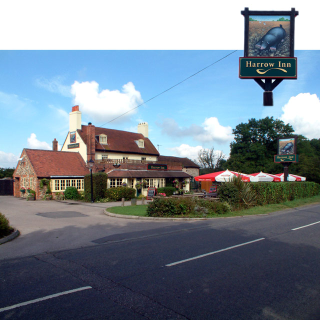
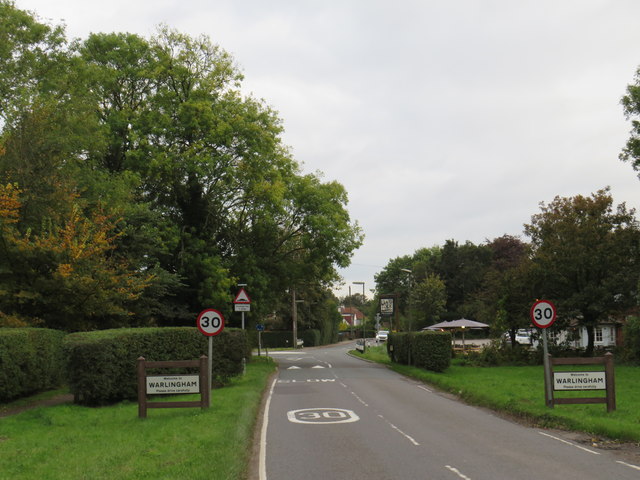
///blame.chef.money. Near Warlingham, Surrey

Related Wikis

Selsdon Wood

Selsdon Wood is a woodland area located in the London Borough of Croydon. The park is owned by the National Trust but managed by the London Borough of...
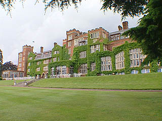
Birch Selsdon Hotel

Birch Selsdon was a luxury hotel located in Selsdon, London, England. It is housed in a country house. == History == Selsdon Park passed through several...

Forestdale, London

Forestdale is a residential neighbourhood of southeast London in the London Borough of Croydon. It is sometimes considered to be part of Addington, its...

Croydon High School

Croydon High School is a private day school for girls located near Croydon, London, England. It is one of the original schools founded by the Girls' Day...

Selsdon

Selsdon is an area in South London, England, located in the London Borough of Croydon, in the ceremonial county of Greater London. Prior to 1965 it was...

Farleigh, Surrey

Farleigh is a village and former civil parish, now in the parish of Chelsham and Farleigh in the Tandridge district of Surrey, England. It is located in...

Hutchinson's Bank

Hutchinson's Bank is 21.8 hectare Local Nature Reserve and Site of Metropolitan Importance for Nature Conservation in New Addington in the London Borough...

John Ruskin College

John Ruskin College is a further education college in South Croydon offering full-time vocational courses and apprenticeships as well as part-time courses...

Nearby Amenities

Located within 500m of 51.334342,-0.045632957
Bus Stop
Selsdon Nature Reserve
Bus: yes
Naptan AtcoCode: 490011991N
Naptan Bearing: N
Naptan CommonName: Selsdon Nature Reserve
Naptan Street: OLD FARLEIGH ROAD
Naptan Verified: no
Public Transport: platform
Wheelchair: limited
Lat/Long: 51.3355164/-0.052028
Bus Stop
Beech Way
Bus: yes
Naptan AtcoCode: 490015666N
Naptan Bearing: N
Naptan CommonName: Beech Way
Naptan Street: OLD FARLEIGH ROAD
Naptan Verified: no
Public Transport: platform
Wheelchair: limited
Lat/Long: 51.3338383/-0.0511376
Barrier: kissing_gate
Fixme: check if there really is a gate on the main path
Lat/Long: 51.3345494/-0.041013
Note: Additional node marks deviation of Low Emission Zone.
Lat/Long: 51.3326505/-0.0501507
Barrier: kissing_gate
Lat/Long: 51.3345319/-0.0414846
Golf: pin
Lat/Long: 51.3324128/-0.0396648
Golf: pin
Lat/Long: 51.3300244/-0.0436832
Golf: pin
Lat/Long: 51.331845/-0.0401405
The data included in this document is from www.openstreetmap.org. The data is made available under ODbL.

Have you been to Broom Wood?

Leave your review of Broom Wood below (or comments, questions and feedback).