Wheatley Spring

Wood, Forest in Hertfordshire East Hertfordshire

England

Wheatley Spring

A rolling field Echo Wood is beyond.
A rolling field Credit: Robin Webster

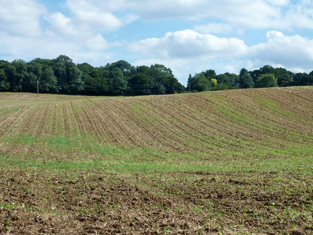
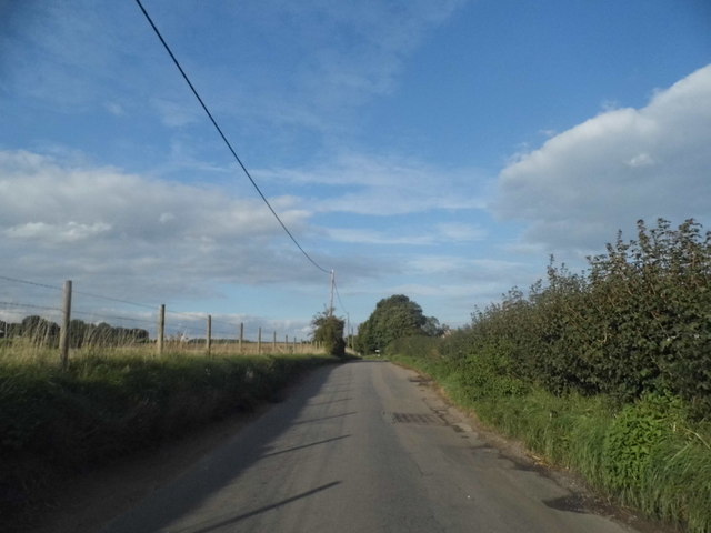
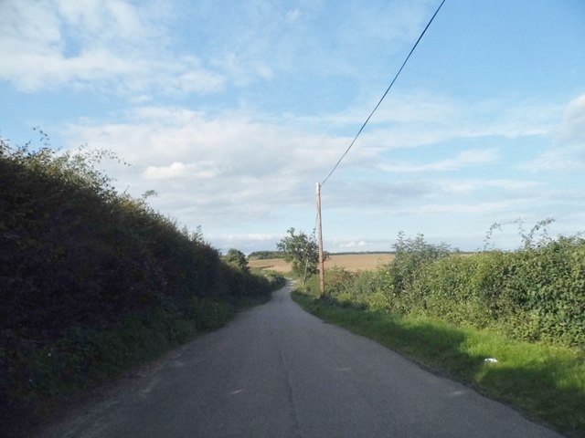
Wheatley Spring is a charming woodland area located in Hertfordshire, England. Situated in the heart of the county, this idyllic spot is known for its vast and diverse woodlands, making it a popular destination for nature enthusiasts and hikers alike.

Covering an area of approximately 100 acres, Wheatley Spring boasts a rich variety of tree species, including oak, beech, and birch, creating a picturesque landscape that changes with the seasons. The forest floor is adorned with an array of wildflowers, enhancing the beauty of the surroundings.

The woodlands are home to a diverse range of wildlife, providing a haven for various species. Visitors can spot squirrels darting between the trees, rabbits grazing in the meadows, and a plethora of bird species soaring overhead. The peaceful ambiance of Wheatley Spring makes it an ideal location for birdwatching and animal spotting.

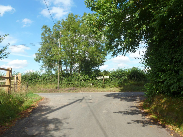
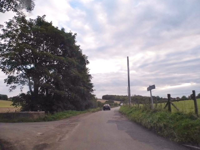
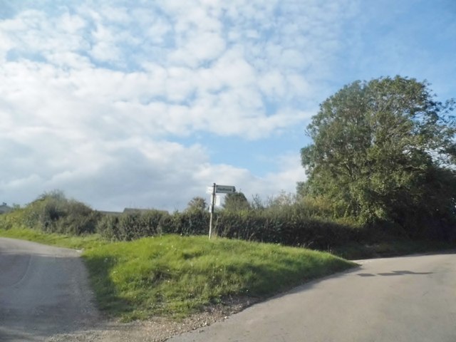
For those seeking outdoor activities, Wheatley Spring offers numerous walking trails and paths, allowing visitors to explore the woodlands at their own pace. The well-maintained trails cater to different fitness levels, making it suitable for families and individuals of all ages. The forest also features dedicated picnic areas and benches, providing the perfect opportunity for visitors to unwind and enjoy a packed lunch amidst the serene surroundings.

Wheatley Spring is easily accessible by both car and public transportation, with ample parking available onsite. Whether seeking a peaceful retreat or an adventurous hike, this enchanting woodland in Hertfordshire offers a refreshing escape from the hustle and bustle of everyday life.

If you have any feedback on the listing, please let us know in the comments section below.

Wheatley Spring Images

Images are sourced within 2km of 51.878132/-0.029229314 or Grid Reference TL3521. Thanks to Geograph Open Source API. All images are credited.

A rolling field Echo Wood is beyond.
A rolling field
Echo Wood is beyond.
Road junction, Potters Green Rowney Lane meets Whitehill.
Road junction, Potters Green
Rowney Lane meets Whitehill.
Junction on Munden Road, Dane End
Turn right to Haultwick Junction in Dane End
Turn right to Haultwick
Junction in Dane End
Munden Road, Dane End
The road to Haultwick from Dane End
Bridge over the A10 The A10 runs 161 miles from London to King's Lynn. via Cambridge and Ely. 
<span class="nowrap"><a title="http://www.sabre-roads.org.uk/wiki/index.php?title=A10" rel="nofollow ugc noopener" href="http://www.sabre-roads.org.uk/wiki/index.php?title=A10">Link</a><img style="margin-left:2px;" alt="External link" title="External link - shift click to open in new window" src="https://s1.geograph.org.uk/img/external.png" width="10" height="10"/></span>
Bridge over the A10
The A10 runs 161 miles from London to King's Lynn. via Cambridge and Ely. LinkExternal link
Houses on Ermine Street, Colliers End These are the first houses coming in from the north. This is the original Roman road now bypassed by the newer A10.
Houses on Ermine Street, Colliers End
These are the first houses coming in from the north. This is the original Roman road now bypassed by the newer A10.
St Mary's Church, Colliers End Redundant. According to this <span class="nowrap"><a title="https://hertfordshirechurches.wordpress.com/2013/05/12/st-mary-colliers-end/" rel="nofollow ugc noopener" href="https://hertfordshirechurches.wordpress.com/2013/05/12/st-mary-colliers-end/">Link</a><img style="margin-left:2px;" alt="External link" title="External link - shift click to open in new window" src="https://s1.geograph.org.uk/img/external.png" width="10" height="10"/></span> the church dates from 1910, and was built to the designs of "the donor of the land Ernest Wickham and the builder Mr C. Pritlove of nearby Wadesmill."
St Mary's Church, Colliers End
Redundant. According to this LinkExternal link the church dates from 1910, and was built to the designs of "the donor of the land Ernest Wickham and the builder Mr C. Pritlove of nearby Wadesmill."
Chapel, St Edmunds College, Old Hall Green St Edmund's College Chapel was built between 1845 and 1853 to the designs of architect August Welby Pugin. For a full account of the chapel see this <span class="nowrap"><a title="http://www.stedmundscollege.org/assets/Pugin_Chapel.pdf" rel="nofollow ugc noopener" href="http://www.stedmundscollege.org/assets/Pugin_Chapel.pdf">Link</a><img style="margin-left:2px;" alt="External link" title="External link - shift click to open in new window" src="https://s1.geograph.org.uk/img/external.png" width="10" height="10"/></span>.
Chapel, St Edmunds College, Old Hall Green
St Edmund's College Chapel was built between 1845 and 1853 to the designs of architect August Welby Pugin. For a full account of the chapel see this LinkExternal link.
Colliers End village hall Mid 19th-century village hall. Built in 1862 as a Church of England school - as reported at this <span class="nowrap"><a title="http://www.british-history.ac.uk/vch/herts/vol3/pp347-366" rel="nofollow ugc noopener" href="http://www.british-history.ac.uk/vch/herts/vol3/pp347-366">Link</a><img style="margin-left:2px;" alt="External link" title="External link - shift click to open in new window" src="https://s1.geograph.org.uk/img/external.png" width="10" height="10"/></span>.
Colliers End village hall
Mid 19th-century village hall. Built in 1862 as a Church of England school - as reported at this LinkExternal link.
Farmhouse at Fisher's Farm, Colliers End Grade II listed weatherboarded farmhouse: architectural description at this <span class="nowrap"><a title="https://historicengland.org.uk/listing/the-list/list-entry/1102358" rel="nofollow ugc noopener" href="https://historicengland.org.uk/listing/the-list/list-entry/1102358">Link</a><img style="margin-left:2px;" alt="External link" title="External link - shift click to open in new window" src="https://s1.geograph.org.uk/img/external.png" width="10" height="10"/></span>.
Farmhouse at Fisher's Farm, Colliers End
Grade II listed weatherboarded farmhouse: architectural description at this LinkExternal link.
Northbound A10 Dowsetts Lane crosses the bridge.
Northbound A10
Dowsetts Lane crosses the bridge.
Old Milestone by Ermine Street, Colliers End, Standon parish Metal plate attached to stone post by the former A10, in parish of STANDON (EAST HERTFORDSHIRE District), Colliers End, near 'Lamb and Flag' PH, in pavement adjacent to telephone kiosk, on West side of road. Wadesmill plate, erected by the Wadesmill turnpike trust in the 19th century. 

Inscription reads:-
LONDON
25
WARE
4
BUNTINGFORD
6

Grade II listed.  
List Entry Number: 1347490 <span class="nowrap"><a title="https://historicengland.org.uk/listing/the-list/list-entry/1347490" rel="nofollow ugc noopener" href="https://historicengland.org.uk/listing/the-list/list-entry/1347490">Link</a><img style="margin-left:2px;" alt="External link" title="External link - shift click to open in new window" src="https://s1.geograph.org.uk/img/external.png" width="10" height="10"/></span>

Milestone Society National ID: HE_LK25.
Old Milestone by Ermine Street, Colliers End, Standon parish
Metal plate attached to stone post by the former A10, in parish of STANDON (EAST HERTFORDSHIRE District), Colliers End, near 'Lamb and Flag' PH, in pavement adjacent to telephone kiosk, on West side of road. Wadesmill plate, erected by the Wadesmill turnpike trust in the 19th century. Inscription reads:- LONDON 25 WARE 4 BUNTINGFORD 6 Grade II listed. List Entry Number: 1347490 LinkExternal link Milestone Society National ID: HE_LK25.
Dane End Typical rolling arable farmland viewed from the road from Dane End to Levens Green.
Dane End
Typical rolling arable farmland viewed from the road from Dane End to Levens Green.
Dane End Tributary The valley of Dane End Tributary and ripening wheat caught in soft evening sunshine.
Dane End Tributary
The valley of Dane End Tributary and ripening wheat caught in soft evening sunshine.
Dane End Tributary In this photo the stream "flows" from left to right in the valley bottom, towards Dane End, across a ford on the lane between Great Munden and Old Hall Green. In this context "flows" is not the right word as the streambed is totally dry at this time of year.
Dane End Tributary
In this photo the stream "flows" from left to right in the valley bottom, towards Dane End, across a ford on the lane between Great Munden and Old Hall Green. In this context "flows" is not the right word as the streambed is totally dry at this time of year.
Show me another place!

Wheatley Spring is located at Grid Ref: TL3521 (Lat: 51.878132, Lng: -0.029229314)

Administrative County: Hertfordshire

District: East Hertfordshire

Police Authority: Hertfordshire

What 3 Words

///payer.shunning.refills. Near Puckeridge, Hertfordshire

Related Wikis

Standon Priory

Standon Priory was a priory in Essex, England. == References ==

Old Hall Green

Old Hall Green is a hamlet in Hertfordshire, England. At the 2011 Census the population was included in the civil parish of Standon. In 1793, an academy...

St Edmund's College, Ware

St Edmund's College is a coeducational private day and boarding school in the British public school tradition, set in 440 acres (1.8 km2) in Ware, Hertfordshire...

Colliers End

Colliers End is a village in the civil parish of Standon, in the East Hertfordshire district, in Hertfordshire, England. It lies upon what was the A10...

Standon Green End

Standon Green End is a hamlet situated just off the A10 road between Ware and Puckeridge in Hertfordshire. At the 2011 Census the population of the hamlet...

Little Munden

Little Munden or Munden-Frewell or Munden Parva is a civil parish in the East Hertfordshire district, in the county of Hertfordshire, England. In 2011...

Little Munden Primary School

Little Munden Primary School is a Church of England voluntary controlled primary school in the village of Dane End, near Ware in Hertfordshire. It is a...

Great Munden

Great Munden is a village and civil parish in Hertfordshire, England. The parish, in the district of East Hertfordshire, spans 3,758 acres (5.872 sq mi...

Nearby Amenities

Located within 500m of 51.878132,-0.029229314
Barrier: stile
Foot: yes
Lat/Long: 51.8755924/-0.0330846
Power: pole
Lat/Long: 51.880768/-0.0278547
Power: pole
Lat/Long: 51.8802997/-0.0255464
Power: pole
Lat/Long: 51.8793695/-0.0258179
Power: pole
Lat/Long: 51.8805676/-0.0268649
Power: pole
Lat/Long: 51.8802398/-0.0233405
Power: pole
Lat/Long: 51.8785244/-0.026063
Power: pole
Lat/Long: 51.8802547/-0.0311189
Power: pole
Lat/Long: 51.8779449/-0.0311726
Power: pole
Lat/Long: 51.8797726/-0.0322579
Power: pole
Lat/Long: 51.8797637/-0.0298422
Power: pole
Lat/Long: 51.878748/-0.0301211
Power: pole
Lat/Long: 51.8807598/-0.0299119
Power: pole
Lat/Long: 51.8800183/-0.0241436
Power: pole
Lat/Long: 51.8807667/-0.0289045
Power: pole
Lat/Long: 51.8809434/-0.029936
Power: pole
Lat/Long: 51.8816852/-0.0294773
Power: pole
Lat/Long: 51.8794963/-0.0329481
Beggarman's Green
Place: locality
Lat/Long: 51.8780516/-0.031728
The data included in this document is from www.openstreetmap.org. The data is made available under ODbL.

Have you been to Wheatley Spring?

Leave your review of Wheatley Spring below (or comments, questions and feedback).