Home Wood

Wood, Forest in Sussex Mid Sussex

England

Home Wood

Kingscote Station On the Bluebell Railway
Kingscote Station Credit: Stephen Dawson

Home Wood, Sussex, also known as Wood or Forest, is a beautiful woodland located in the county of Sussex in southern England. Spread over an area of approximately 500 acres, this ancient woodland is a haven for nature lovers and outdoor enthusiasts.

Home Wood is characterized by its diverse range of tree species, including oak, beech, ash, and birch. The woodland is densely populated with tall, mature trees that provide a picturesque canopy and create a tranquil atmosphere. The forest floor is covered with a rich carpet of wildflowers and ferns, adding to the natural beauty of the area.

The wood is home to a variety of wildlife, making it a popular spot for birdwatchers and animal enthusiasts. Visitors may catch a glimpse of deer, foxes, badgers, and numerous species of birds, including woodpeckers, owls, and warblers. The wood's proximity to water sources also attracts a wide range of aquatic life, including frogs, newts, and dragonflies.

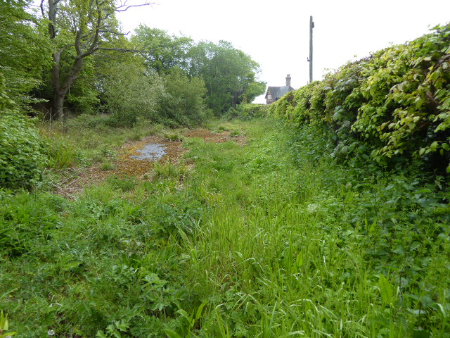
There are several walking trails and footpaths that wind their way through the wood, allowing visitors to explore the area and soak in its natural splendor. These paths are well-maintained and offer stunning views of the surrounding countryside.

Home Wood, Sussex, offers a peaceful retreat from the hustle and bustle of everyday life. Its unspoiled beauty, diverse flora and fauna, and serene atmosphere make it an ideal destination for nature enthusiasts and those seeking a tranquil escape in the heart of Sussex.

If you have any feedback on the listing, please let us know in the comments section below.

Home Wood Images

Images are sourced within 2km of 51.111515/-0.069006821 or Grid Reference TQ3536. Thanks to Geograph Open Source API. All images are credited.

Kingscote Station On the Bluebell Railway
Kingscote Station
On the Bluebell Railway
Turners Hill St Leonard's Church
Turners Hill
St Leonard's Church
Turners Hill A busy cross road at the top of the hill
Turners Hill
A busy cross road at the top of the hill
The Red Lion at Turners Hill Set back down a side road is this great local with good food and drink. In the winter the logs are always burning. A typical Sussex pub.
The Red Lion at Turners Hill
Set back down a side road is this great local with good food and drink. In the winter the logs are always burning. A typical Sussex pub.
London to Brighton Bike Ride Turners Hill when the L2B comes through.
London to Brighton Bike Ride
Turners Hill when the L2B comes through.
Wallage Lane from Worth Way Taken from the former railway bridge just after the lane has taken a sharp right to go underneath it.
Wallage Lane from Worth Way
Taken from the former railway bridge just after the lane has taken a sharp right to go underneath it.
Old railway bridge, Crawley Down Carries the B2028 over the Worth Way.
Old railway bridge, Crawley Down
Carries the B2028 over the Worth Way.
Ducks on Crawley Down Pond Taken from Worth Way looking north
Ducks on Crawley Down Pond
Taken from Worth Way looking north
Kingscote Station, Bluebell Railway
Looking south from East Street The road from Turners hill to East Grinstead is windy. At this point it is fairly straight and you can see across the valley. The lane is also a public footpath that leads across the valley.
Looking south from East Street
The road from Turners hill to East Grinstead is windy. At this point it is fairly straight and you can see across the valley. The lane is also a public footpath that leads across the valley.
Kingscote Station - Bluebell Railway Looking South-West.
Engine is "Blackmoor Vale" West Country Class
Kingscote Station - Bluebell Railway
Looking South-West. Engine is "Blackmoor Vale" West Country Class
Fen Cottage Fen Cottage near Turners Hill West Sussex is located at a footpath Junction you have the choice of a walk to Turners Hill, Crawley Down, or The Alexander House Hotel.
Fen Cottage
Fen Cottage near Turners Hill West Sussex is located at a footpath Junction you have the choice of a walk to Turners Hill, Crawley Down, or The Alexander House Hotel.
Pots And Pithoi The business located  in these buildings near Turners Hill supply ceramic pots of Greek origin; see <span class="nowrap"><a title="http://www.pots-and-pithoi.co.uk/" rel="nofollow ugc noopener" href="http://www.pots-and-pithoi.co.uk/">Link</a><img style="margin-left:2px;" alt="External link" title="External link - shift click to open in new window" src="https://s1.geograph.org.uk/img/external.png" width="10" height="10"/></span>. In the Background you can just see Alexander House a manor house dating back to the 17th century you can find a history at <span class="nowrap"><a title="http://www.alexanderhotels.co.uk/alexander_house/alexander-house-history.shtml" rel="nofollow ugc noopener" href="http://www.alexanderhotels.co.uk/alexander_house/alexander-house-history.shtml">Link</a><img style="margin-left:2px;" alt="External link" title="External link - shift click to open in new window" src="https://s1.geograph.org.uk/img/external.png" width="10" height="10"/></span>
Pots And Pithoi
The business located in these buildings near Turners Hill supply ceramic pots of Greek origin; see LinkExternal link. In the Background you can just see Alexander House a manor house dating back to the 17th century you can find a history at LinkExternal link
Bluebell Bridge This disused railway bridge located on the B2110 between Turners Hill and Kingscote would need to be brought back into use if the <a href="https://www.geograph.org.uk/photo/66912">TQ3729 : Bluebell Railway</a> were ever again to reach East Grinstead. Currently the line terminates at <a href="https://www.geograph.org.uk/photo/66909">TQ3635 : Kingscote Station, Bluebell Railway</a> .
Bluebell Bridge
This disused railway bridge located on the B2110 between Turners Hill and Kingscote would need to be brought back into use if the TQ3729 : Bluebell Railway were ever again to reach East Grinstead. Currently the line terminates at TQ3635 : Kingscote Station, Bluebell Railway .
Bridleway near Hophurst Farm
Haven Sports Field The sports field comprises four football pitches and a dog exercise route. Adjacent to the field is a car park with recycling facilities and the Haven Community Centre.
Haven Sports Field
The sports field comprises four football pitches and a dog exercise route. Adjacent to the field is a car park with recycling facilities and the Haven Community Centre.
Haven Sports Field car park Recycling facilities in the Haven Sports Field car park.
Haven Sports Field car park
Recycling facilities in the Haven Sports Field car park.
Footpath across the fields from lake From the mill lakes at Fen Place, this footpath runs towards the Sussex border Path at the top of the field
Footpath across the fields from lake
From the mill lakes at Fen Place, this footpath runs towards the Sussex border Path at the top of the field
Show me another place!

Home Wood is located at Grid Ref: TQ3536 (Lat: 51.111515, Lng: -0.069006821)

Administrative County: West Sussex

District: Mid Sussex

Police Authority: Sussex

What 3 Words

///rated.horizons.protrude. Near Crawley Down, West Sussex

Related Wikis

Worth Way

The Worth Way is a 7-mile (11 km) footpath and bridleway linking the West Sussex towns of Crawley and East Grinstead via the village of Crawley Down. Mostly...

Grange Road railway station

Grange Road was a railway station on the Three Bridges to Tunbridge Wells Central Line. The station opened in 1860 and was rebuilt on an enlarged scale...

Crawley Down

Crawley Down is a village in the Mid Sussex district of West Sussex, England. There is one church, one school, and a number of social groups. It lies...

Turners Hill

Turners Hill is a village and civil parish in the Mid Sussex District of West Sussex, England. The civil parish covers an area of 1,390 hectares (3,400...

Kingscote railway station

Kingscote railway station is a preserved railway station on the heritage Bluebell Railway, located in West Sussex, England. == History == The station was...

Crawley Down Gatwick F.C.

Crawley Down Gatwick Football Club is a football club based in Crawley Down, West Sussex, England. They are currently members of the Southern Combination...

Turners Hill SSSI

Turners Hill SSSI is a 0.2-hectare (0.49-acre) geological Site of Special Scientific Interest in Turners Hill in West Sussex. It is a Geological Conservation...

Imberdown (electoral division)

Imberdown is an electoral division of West Sussex in the United Kingdom, and returns one member to sit on West Sussex County Council. == Extent == The...

Nearby Amenities

Located within 500m of 51.111515,-0.069006821
Bus Stop
Turners Hill Park
Naptan AtcoCode: 4400EG0337
Naptan Bearing: E
Naptan CommonName: Turners Hill Park
Naptan Indicator: adj
Naptan Landmark: Fen Place Farm
Naptan NaptanCode: wsxapjta
Naptan ShortCommonName: Turners Hill Park
Naptan Street: East Street
Naptan Verified: yes
Public Transport: platform
Ref: wsxapjta
Shelter: yes
Source: naptan_import
Source Date: 2017-08-29T14:34:00
Lat/Long: 51.1071006/-0.0687346
Entrance: yes
Lat/Long: 51.1080013/-0.0676558
Turners Hill Park
Place: locality
Source: OS_OpenData_StreetView
Lat/Long: 51.1094262/-0.0672093
Generator Method: photovoltaic
Generator Output Electricity: yes
Generator Source: solar
Generator Type: solar_photovoltaic_panel
Location: roof
Power: generator
Lat/Long: 51.1082274/-0.0664544
Generator Method: photovoltaic
Generator Output Electricity: yes
Generator Source: solar
Generator Type: solar_photovoltaic_panel
Location: roof
Power: generator
Lat/Long: 51.1081785/-0.0675729
Generator Method: photovoltaic
Generator Output Electricity: yes
Generator Source: solar
Generator Type: solar_photovoltaic_panel
Location: roof
Power: generator
Lat/Long: 51.1075706/-0.0698313
Generator Method: photovoltaic
Generator Output Electricity: yes
Generator Source: solar
Generator Type: solar_photovoltaic_panel
Location: roof
Power: generator
Lat/Long: 51.1075622/-0.069783
Post Box
Collection Times: Mo-Fr 16:30; Sa 09:00
Description: This is a private post box, as per the plaque on the box
Operator: Royal Mail
Post Box Mounting: brick_pillar
Post Box Type: wall
Ref: RH10 41
Royal Cypher: EIIR
Royal Cypher Wikidata: Q33102113
Lat/Long: 51.1102279/-0.0681375
Post Box
Collection Times: Mo-Fr 09:00; Sa 07:00
Operator: Royal Mail
Post Box Mounting: pier
Post Box Type: lamp
Ref: RH10 49D
Royal Cypher: EIIR
Royal Cypher Wikidata: Q33102113
Lat/Long: 51.1071066/-0.0686632
Capacity: 1
Man Made: charge_point
Operator: VendElectric
Socket Type2: 1
Socket Type2 Output: 7kW
Lat/Long: 51.1085673/-0.0668633
Capacity: 1
Man Made: charge_point
Operator: VendElectric
Socket Type2: 1
Socket Type2 Output: 7kW
Lat/Long: 51.1085693/-0.0668295
Capacity: 1
Man Made: charge_point
Operator: VendElectric
Socket Type2: 1
Socket Type2 Output: 7kW
Lat/Long: 51.1085716/-0.0667938
The data included in this document is from www.openstreetmap.org. The data is made available under ODbL.

Have you been to Home Wood?

Leave your review of Home Wood below (or comments, questions and feedback).