Ettrick

Settlement in Selkirkshire

Scotland

Ettrick

Minor road at Ettrickhill Looking north-eastward.
Minor road at Ettrickhill Credit: Peter Wood

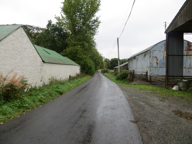
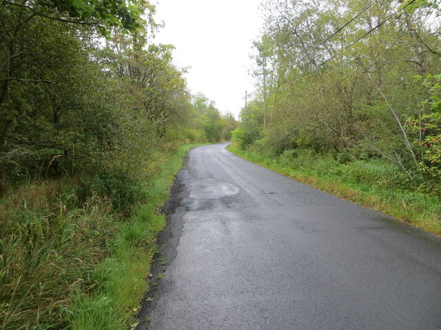
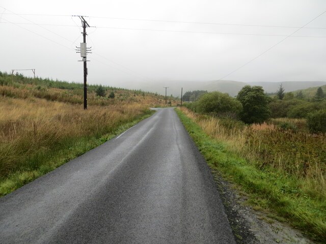
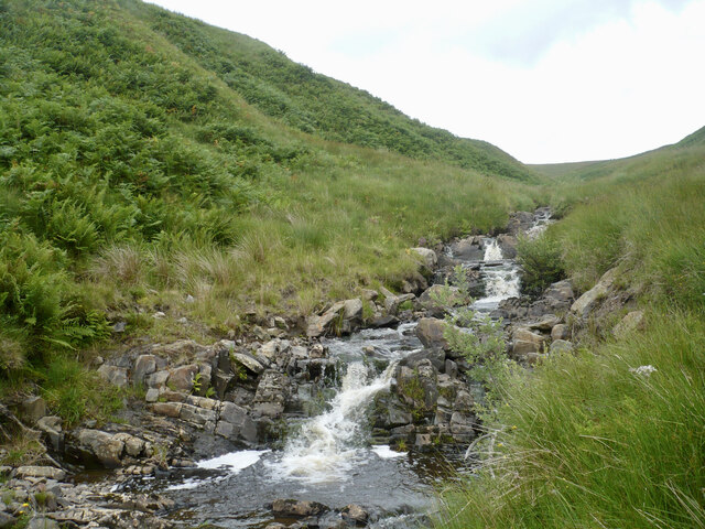
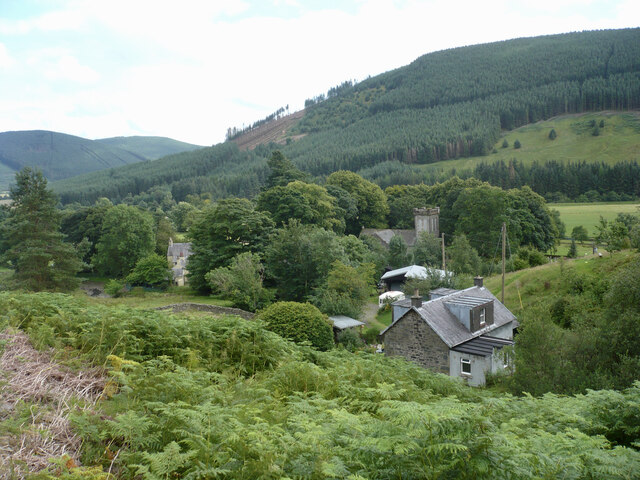
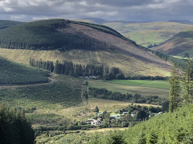
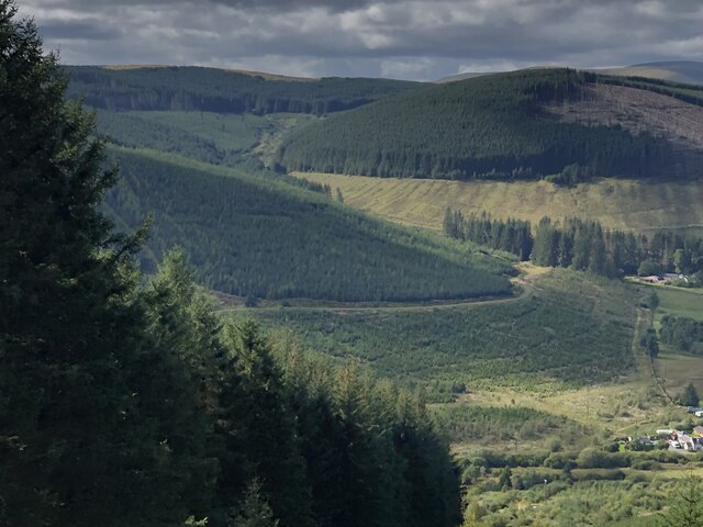
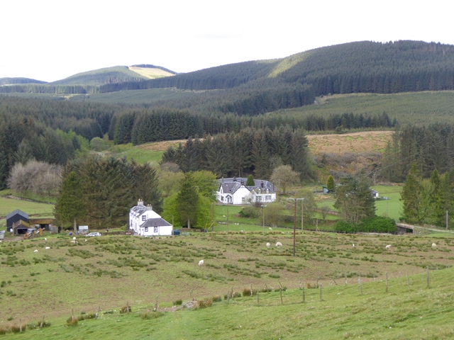
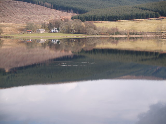
Ettrick is a small village located in Selkirkshire, in the Scottish Borders region of Scotland. Situated in the southern part of the country, Ettrick lies about 10 miles southwest of Selkirk, the county town, and is nestled in the picturesque Ettrick Valley. The village is characterized by its rural and tranquil setting, surrounded by rolling hills, lush green fields, and the meandering Ettrick Water.

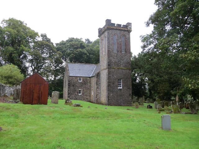
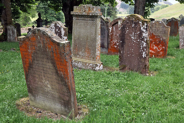
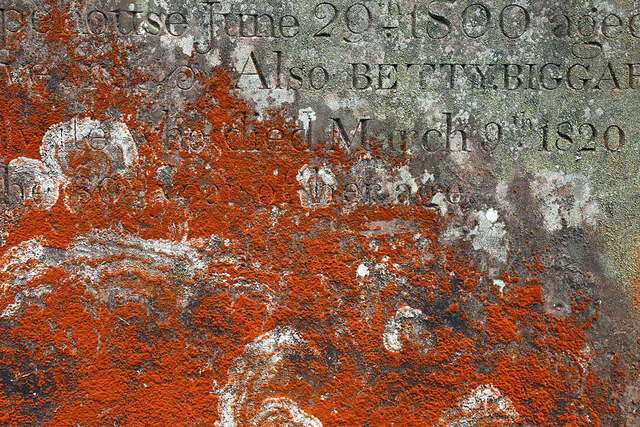
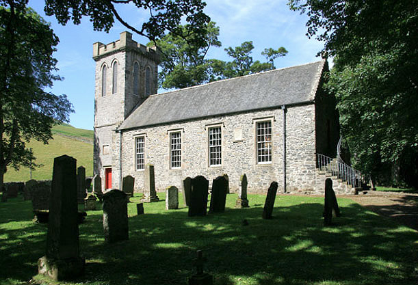
Ettrick has a rich historical background, with records of human settlement dating back to the Bronze Age. The area is closely associated with the famous Scottish poet James Hogg, also known as the "Ettrick Shepherd," who was born and raised in nearby Ettrick Forest. Visitors can explore the Hogg Monument, a memorial erected in his honor in the village.

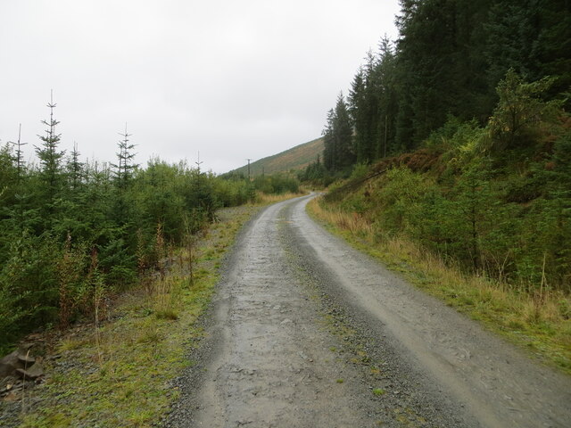
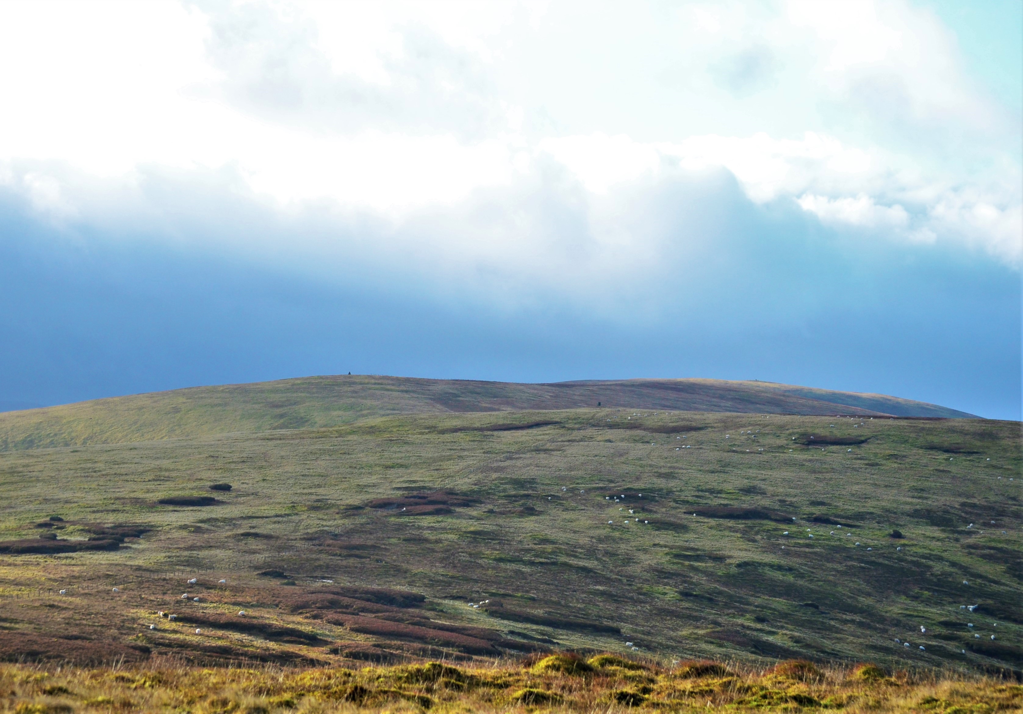
Despite its small size, Ettrick offers a variety of outdoor activities and attractions. The village is a popular destination for hikers and nature enthusiasts due to its proximity to the Southern Upland Way, a long-distance footpath that crosses through the area. The surrounding countryside provides ample opportunities for walking, cycling, and wildlife spotting.

Ettrick has limited amenities, with a few local shops and services catering to the needs of residents and visitors. For more extensive facilities, the nearby town of Selkirk offers a wider range of amenities, including shops, restaurants, and leisure facilities.

Overall, Ettrick is a peaceful and scenic village that provides a charming retreat for those seeking a rural getaway in the heart of the Scottish Borders.

If you have any feedback on the listing, please let us know in the comments section below.

Ettrick Images

Images are sourced within 2km of 55.419204/-3.152922 or Grid Reference NT2714. Thanks to Geograph Open Source API. All images are credited.

Minor road at Ettrickhill Looking north-eastward.
Minor road at Ettrickhill
Looking north-eastward.
Ettrick Kirk and part of its Burial Ground Viewed from the northwest.
Ettrick Kirk and part of its Burial Ground
Viewed from the northwest.
Road (B709) near to Thirlestane Gardens Looking north-eastward.
Road (B709) near to Thirlestane Gardens
Looking north-eastward.
Forest track giving access to Hay and Deephope Hills Looking north-westward.
Forest track giving access to Hay and Deephope Hills
Looking north-westward.
Road (B709) heading towards Angecroft and Etterick Looking north-westward.
Road (B709) heading towards Angecroft and Etterick
Looking north-westward.
Ordnance Survey Cut Mark This mark can be found on the roadside wall of a barn at Ettrickhill.
The recorded details give a height of 235.2752 metres above sea level.
For more details see : <span class="nowrap"><a title="https://www.bench-marks.org.uk/bm156448" rel="nofollow ugc noopener" href="https://www.bench-marks.org.uk/bm156448">Link</a><img style="margin-left:2px;" alt="External link" title="External link - shift click to open in new window" src="https://s1.geograph.org.uk/img/external.png" width="10" height="10"/></span>
Ordnance Survey Cut Mark
This mark can be found on the roadside wall of a barn at Ettrickhill. The recorded details give a height of 235.2752 metres above sea level. For more details see : LinkExternal link
Ordnance Survey Cut Mark with Bolt This mark and bolt can be found on the wall of Ettrick Kirk.
The recorded details give a height of 246.6228 metres above sea level.
For more details see : <span class="nowrap"><a title="https://www.bench-marks.org.uk/bm156449" rel="nofollow ugc noopener" href="https://www.bench-marks.org.uk/bm156449">Link</a><img style="margin-left:2px;" alt="External link" title="External link - shift click to open in new window" src="https://s1.geograph.org.uk/img/external.png" width="10" height="10"/></span>
Ordnance Survey Cut Mark with Bolt
This mark and bolt can be found on the wall of Ettrick Kirk. The recorded details give a height of 246.6228 metres above sea level. For more details see : LinkExternal link
Ordnance Survey Cut Mark This mark can be found on a roadside milestone near to Scabcleuch.
The recorded details give a height of 247.7354 metres above sea level.
For more details see : <span class="nowrap"><a title="https://www.bench-marks.org.uk/bm156450" rel="nofollow ugc noopener" href="https://www.bench-marks.org.uk/bm156450">Link</a><img style="margin-left:2px;" alt="External link" title="External link - shift click to open in new window" src="https://s1.geograph.org.uk/img/external.png" width="10" height="10"/></span>
Ordnance Survey Cut Mark
This mark can be found on a roadside milestone near to Scabcleuch. The recorded details give a height of 247.7354 metres above sea level. For more details see : LinkExternal link
Ettrick Parish Churchyard Rust-coloured lichen is growing on some of the headstones.
Ettrick Parish Churchyard
Rust-coloured lichen is growing on some of the headstones.
A gravestone detail at Ettrick Parish Churchyard Rust-coloured lichen is growing on some of the headstones. For a wider view of the gravestones in this area, see <a href="https://www.geograph.org.uk/photo/7542567">NT2514 : Ettrick Parish Churchyard</a>.
A gravestone detail at Ettrick Parish Churchyard
Rust-coloured lichen is growing on some of the headstones. For a wider view of the gravestones in this area, see NT2514 : Ettrick Parish Churchyard.
The Kirk Burn, Ettrick A burn tumbling down between Craig Hill and Ward Law, entering the Ettrick Water just beyond Ettrick Kirk.
The Kirk Burn, Ettrick
A burn tumbling down between Craig Hill and Ward Law, entering the Ettrick Water just beyond Ettrick Kirk.
Ettrick Kirk and Craighill From left to right, the buildings visible are the former Ettrick Manse, a Category C Listed Building formerly known as Alverhind; the Kirk, a Category B Listed Building, built in 1824; and a house, named Craighill on the map.
Ettrick Kirk and Craighill
From left to right, the buildings visible are the former Ettrick Manse, a Category C Listed Building formerly known as Alverhind; the Kirk, a Category B Listed Building, built in 1824; and a house, named Craighill on the map.
Road on Gatecleuch Hill, Ettrick I was getting worried - the lack of traffic shown by the grass suggested that there was a blockage ahead. Some trees were down and the road was blocked but a path had been cut so progress without a vehicle was easy.
Road on Gatecleuch Hill, Ettrick
I was getting worried - the lack of traffic shown by the grass suggested that there was a blockage ahead. Some trees were down and the road was blocked but a path had been cut so progress without a vehicle was easy.
Windthrow, Gatecleuch Hill The grassy road suggested blockages and some trees were down and in places lying across the track. Some had been removed others had a path cut through them. Passable without a vehicle.
Windthrow, Gatecleuch Hill
The grassy road suggested blockages and some trees were down and in places lying across the track. Some had been removed others had a path cut through them. Passable without a vehicle.
Upgraded road, Deephope Recently widened logging road. At the time it ended here continuing southwards as a grassed over track passable only on foot due to a modest amount of windthrow.
Upgraded road, Deephope
Recently widened logging road. At the time it ended here continuing southwards as a grassed over track passable only on foot due to a modest amount of windthrow.
Midgehope, Ettrick Beneath Wedder Law. Angecroft caravan park is in the foreground.
Midgehope, Ettrick
Beneath Wedder Law. Angecroft caravan park is in the foreground.
Wedder Law and Midge Hope Forestry above Ettrick
Wedder Law and Midge Hope
Forestry above Ettrick
Mid Hill and Hope Head Forested hills above the Tima Water. Mostly a young second generation.
Mid Hill and Hope Head
Forested hills above the Tima Water. Mostly a young second generation.
Show me another place!

Ettrick is located at Grid Ref: NT2714 (Lat: 55.419204, Lng: -3.152922)

Unitary Authority: The Scottish Borders

Police Authority: The Lothians and Scottish Borders

What 3 Words

///hiked.stapled.alright. Near Ettrick, Scottish Borders

Nearby Locations

Ramsey Cleuch Ettrick

Related Wikis

Ettrick, Scotland

Ettrick (Scottish Gaelic: Eadaraig, IPA: [ˈet̪əɾɪkʲ]) is a small village and civil parish in the Scottish Borders area of Scotland. It is located on the...

Tushielaw Tower

Tushielaw Tower is a 16th-century tower house, about 2.5 miles (4.0 km) north and east of Ettrick, Scottish Borders, Scotland, and west of Ettrick Water...

Buccleuch, Scottish Borders

East and West Buccleuch ( bə-KLOO) are two homesteads in the Scottish Borders, in the Ettrick parish of historic Selkirkshire. They are located off the...
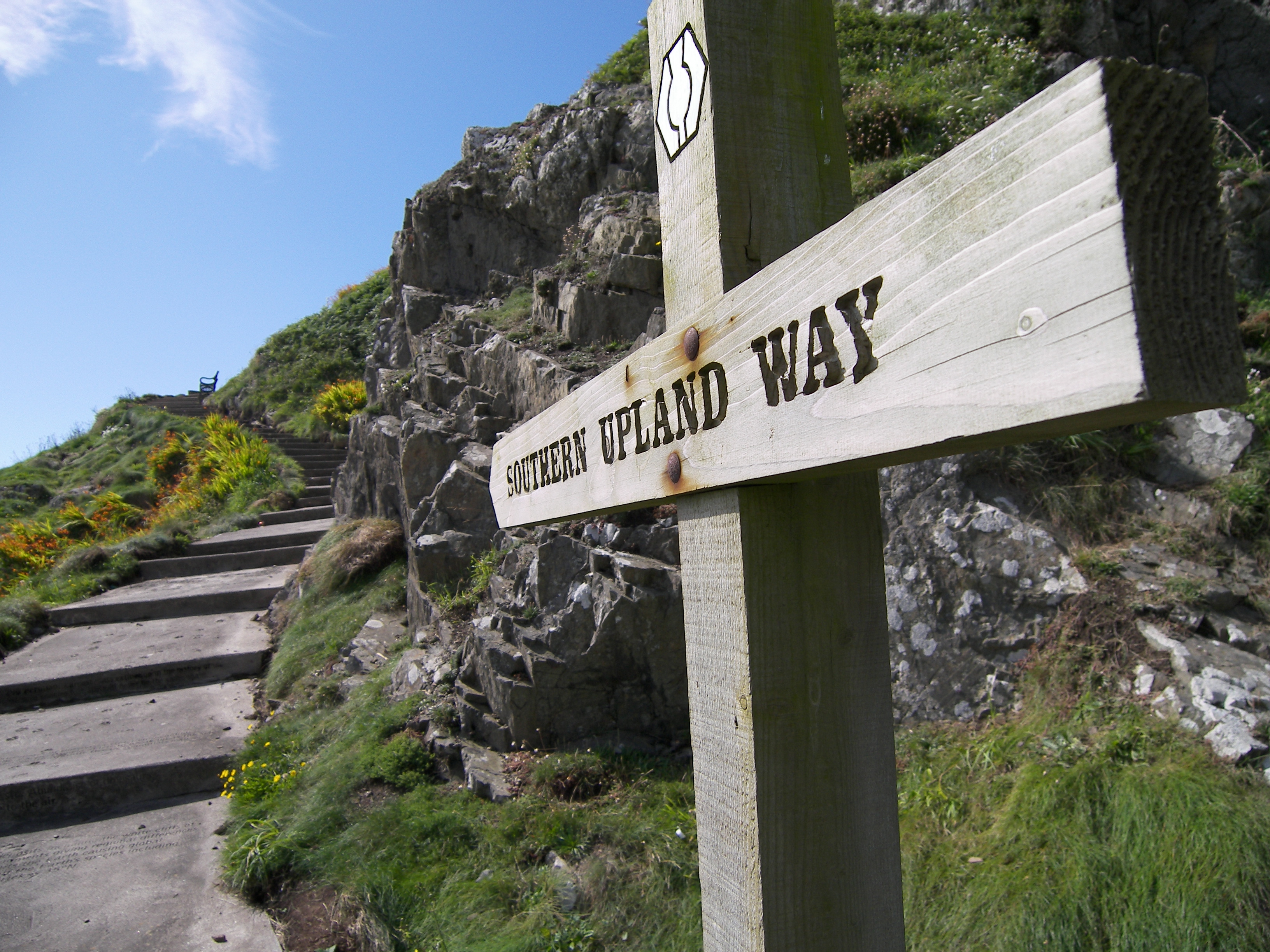
Southern Upland Way

The Southern Upland Way is a 344-kilometre (214 mi) coast-to-coast long-distance footpath in southern Scotland. The route links Portpatrick in the west...

Bowerhope

Bowerhope is a village off the A708, in the Scottish Borders area of Scotland, on the banks of St Mary's Loch in Ettrick Forest. == See also == List of...

Andrewhinney Hill

Andrewhinney Hill is a hill in the Ettrick Hills range, part of the Southern Uplands of Scotland. It is the highest summit of a ridge that runs parallel...

Dob's Linn

Dob's Linn is a small steep valley in Dumfries and Galloway, just north of the A708 road between Moffat and Selkirk, in Scotland. It is part of the Grey...

Southern Uplands

The Southern Uplands (Scottish Gaelic: Na Monaidhean a Deas) are the southernmost and least populous of mainland Scotland's three major geographic areas...

Nearby Amenities

Located within 500m of 55.419204,-3.152922
Ramseycleuch
Place: hamlet
Lat/Long: 55.4191233/-3.1499467
Ford: yes
Lat/Long: 55.4183091/-3.1485771
Material: wood
Power: pole
Lat/Long: 55.4172919/-3.159999
Material: wood
Power: pole
Lat/Long: 55.4168595/-3.1590468
Material: wood
Power: pole
Lat/Long: 55.4163046/-3.1578612
Material: wood
Power: pole
Lat/Long: 55.4157702/-3.1566891
Material: wood
Power: pole
Lat/Long: 55.4152457/-3.1555344
Bus Stop
Kilsyke
Bus: yes
Naptan AtcoCode: 69002070
Naptan Bearing: NE
Naptan CommonName: Kilsyke
Naptan Indicator: opp
Naptan NaptanCode: 7272070
Naptan Street: B709
Operator: Scottish Borders Council
Public Transport: platform
Ref: 69002070
Source: NaPTAN
Lat/Long: 55.4191803/-3.1491223
The data included in this document is from www.openstreetmap.org. The data is made available under ODbL.

Have you been to Ettrick?

Leave your review of Ettrick below (or comments, questions and feedback).