Bankey Wood

Wood, Forest in Sussex Lewes

England

Bankey Wood

Field edge footpath
Field edge footpath Credit: N Chadwick

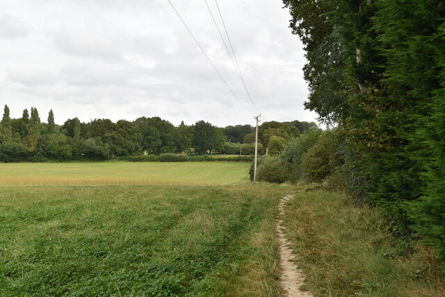
Bankey Wood is a picturesque and ancient woodland located in Sussex, England. Covering an area of approximately 100 acres, it is a notable example of a well-preserved forest ecosystem. The wood is situated in the heart of the South Downs National Park, surrounded by rolling hills and diverse wildlife.

Bankey Wood is primarily composed of broadleaf trees, including oak, beech, and ash, which create a dense canopy overhead. The forest floor is adorned with a rich variety of wildflowers, ferns, and mosses, adding to the wood's enchanting beauty. The wood is also home to numerous species of birds, such as woodpeckers, owls, and warblers, providing a haven for birdwatchers.

Walking through Bankey Wood, visitors can follow a network of well-maintained trails that meander through the trees, allowing for peaceful and tranquil walks. The wood is a popular destination for nature lovers, hikers, and families seeking a serene escape from the hustle and bustle of everyday life.

In addition to its natural beauty, Bankey Wood holds historical significance. It is believed that the wood has been present for centuries, with evidence of human activity dating back to the Neolithic period. Archaeological finds, including flint tools and pottery fragments, have been discovered within the wood, offering a glimpse into the area's past.

Overall, Bankey Wood is a cherished natural gem in Sussex, offering visitors a chance to immerse themselves in a tranquil and ancient woodland setting, while also appreciating its historical and ecological importance.

If you have any feedback on the listing, please let us know in the comments section below.

Bankey Wood Images

Images are sourced within 2km of 50.982804/-0.079381461 or Grid Reference TQ3422. Thanks to Geograph Open Source API. All images are credited.

Field edge footpath
Field edge footpath
A Sussex meadow
A Sussex meadow
Strood Farm
Strood Farm
Sussex farmland
Sussex farmland
Footpath across pasture
The White House
The White House
Sheep grazing
Sheep grazing
Farm building and sheep grazing
Sheep grazing
Sheep grazing
Gate in hedge
Gate in hedge
Gates to Wivelsfield Hall
White House Lodge
White House Lodge
Slugwash Lane
Slugwash Lane
Slugwash Lane The Sussex Border Path is a footpath route nearly 150 miles long around the inland boundary of the county of Sussex. The county owes its origins to the kingdom of the South Saxons and can claim to have one of the longest inland county boundaries from Emsworth to Rye. The route was devised in 1983 and is well signed along most of the route. Website <span class="nowrap"><a title="http://www.sussexborderpath.co.uk/" rel="nofollow ugc noopener" href="http://www.sussexborderpath.co.uk/">Link</a><img style="margin-left:2px;" alt="External link" title="External link - shift click to open in new window" src="https://s1.geograph.org.uk/img/external.png" width="10" height="10"/></span> 
Map: <a title="https://www.geograph.org.uk/search.php?i=40140109&page=1&displayclass=map#i=40140109&page=1&displayclass=map&zoom=2&lat=51.03263&lon=-0.05427&layers=FTTB00000000000T" href="https://www.geograph.org.uk/search.php?i=40140109&page=1&displayclass=map#i=40140109&page=1&displayclass=map&zoom=2&lat=51.03263&lon=-0.05427&layers=FTTB00000000000T">Link</a>
Slugwash Lane
The Sussex Border Path is a footpath route nearly 150 miles long around the inland boundary of the county of Sussex. The county owes its origins to the kingdom of the South Saxons and can claim to have one of the longest inland county boundaries from Emsworth to Rye. The route was devised in 1983 and is well signed along most of the route. Website LinkExternal link Map: Link
Townings Place
Townings Place
Slugwash Lane
Slugwash Lane
Slugwash Lane The Sussex Border Path is a footpath route nearly 150 miles long around the inland boundary of the county of Sussex. The county owes its origins to the kingdom of the South Saxons and can claim to have one of the longest inland county boundaries from Emsworth to Rye. The route was devised in 1983 and is well signed along most of the route. Website <span class="nowrap"><a title="http://www.sussexborderpath.co.uk/" rel="nofollow ugc noopener" href="http://www.sussexborderpath.co.uk/">Link</a><img style="margin-left:2px;" alt="External link" title="External link - shift click to open in new window" src="https://s1.geograph.org.uk/img/external.png" width="10" height="10"/></span> 
Map: <a title="https://www.geograph.org.uk/search.php?i=40140109&page=1&displayclass=map#i=40140109&page=1&displayclass=map&zoom=2&lat=51.03263&lon=-0.05427&layers=FTTB00000000000T" href="https://www.geograph.org.uk/search.php?i=40140109&page=1&displayclass=map#i=40140109&page=1&displayclass=map&zoom=2&lat=51.03263&lon=-0.05427&layers=FTTB00000000000T">Link</a>
Slugwash Lane
The Sussex Border Path is a footpath route nearly 150 miles long around the inland boundary of the county of Sussex. The county owes its origins to the kingdom of the South Saxons and can claim to have one of the longest inland county boundaries from Emsworth to Rye. The route was devised in 1983 and is well signed along most of the route. Website LinkExternal link Map: Link
Show me another place!

Bankey Wood is located at Grid Ref: TQ3422 (Lat: 50.982804, Lng: -0.079381461)

Administrative County: East Sussex

District: Lewes

Police Authority: Sussex

What 3 Words

///tender.supporter.gloves. Near Wivelsfield Green, East Sussex

Related Wikis

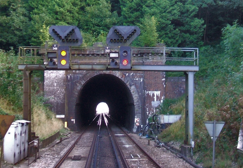
Haywards Heath Tunnel

Haywards Heath tunnel, also known as Folly Hill tunnel, is a railway tunnel on the Brighton Main Line between Haywards Heath and Wivelsfield. It is 249...

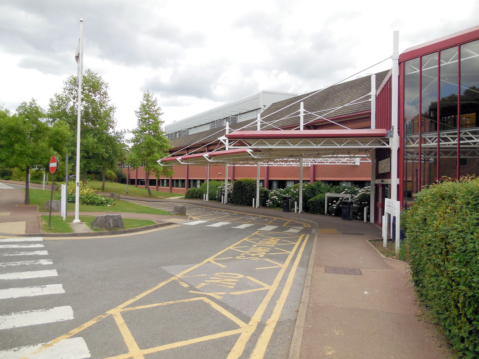
Princess Royal Hospital, Haywards Heath

The Princess Royal Hospital, also known as PRH, is an acute, teaching, general hospital located in Haywards Heath, West Sussex, England. It is the main...

St Francis Rangers F.C.

St Francis Rangers F.C. is a football club based in Haywards Heath, England. They are currently members of the Southern Combination Division Two and play...

Haywards Heath East (electoral division)

Haywards Heath East is an electoral division of West Sussex in the United Kingdom, and returns one member to sit on West Sussex County Council. == Extent... ==

St Francis Hospital, Haywards Heath

St Francis Hospital was a mental health facility in Haywards Heath, West Sussex, England. The main building survives and is a Grade II listed building...

Wivelsfield

Wivelsfield () village and the larger adjacent village of Wivelsfield Green are the core of the civil parish of Wivelsfield in the Lewes District of East...

Jireh Chapel, Haywards Heath

The Jireh Chapel is a Strict Baptist place of worship in the town of Haywards Heath in the English county of West Sussex. The chapel was built in 1879...

Haywards Heath Town F.C.

Haywards Heath Town Football Club is a football club based in Haywards Heath, West Sussex, England. They are currently members of the Southern Combination...

Nearby Amenities

Located within 500m of 50.982804,-0.079381461
Barrier: stile
Lat/Long: 50.9810778/-0.0843342
Barrier: stile
Lat/Long: 50.9810255/-0.0824119
Man Made: water_well
Lat/Long: 50.9834329/-0.0752306
Barrier: stile
Lat/Long: 50.9860707/-0.0767213
The data included in this document is from www.openstreetmap.org. The data is made available under ODbL.

Have you been to Bankey Wood?

Leave your review of Bankey Wood below (or comments, questions and feedback).