Burhill Wood

Wood, Forest in Hertfordshire East Hertfordshire

England

Burhill Wood

St. Andrew's Church - Buckland, Hertfordshire This church was built by Nicholas de Bokeland in 1348. The exact date is known because he left a note of this on the glass of one of the chancel windows. Although Nicholas's glass has now gone, some fragments of 14th century glass remain in other windows. St. Andrew's is no longer used for regular worship and is now cared for by The Churches Conservation Trust.
St. Andrew's Church - Buckland, Hertfordshire Credit: Catherine Edwards

Burhill Wood is a charming woodland located in Hertfordshire, England. Covering an area of approximately 50 acres, it is a delightful destination for nature enthusiasts and those seeking tranquility amidst the bustling city life. The wood is situated on the outskirts of the town of Rickmansworth, offering a peaceful retreat away from urban chaos.

The wood is predominantly composed of mixed deciduous trees, including oak, ash, and beech, which create a picturesque landscape throughout the seasons. The dense foliage provides a cool and shaded environment during summer months, making it a popular spot for picnics and leisurely walks. In spring, the wood bursts into color as wildflowers carpet the forest floor, creating a vibrant and magical atmosphere.

Several well-marked trails wind their way through Burhill Wood, ensuring visitors can explore every nook and cranny. These paths are suitable for all ages and abilities, and benches are thoughtfully placed along the way for those who want to take a moment to appreciate the surrounding beauty. A small pond can also be found within the wood, attracting various species of birds and other wildlife.

Burhill Wood is a designated Site of Special Scientific Interest (SSSI), due to its rich biodiversity and ecological importance. It is home to a variety of woodland creatures, including deer, badgers, and various bird species, making it a haven for wildlife enthusiasts and photographers.

Overall, Burhill Wood offers a serene and enchanting escape for nature lovers, providing a beautiful and peaceful environment to unwind and connect with the natural world.

If you have any feedback on the listing, please let us know in the comments section below.
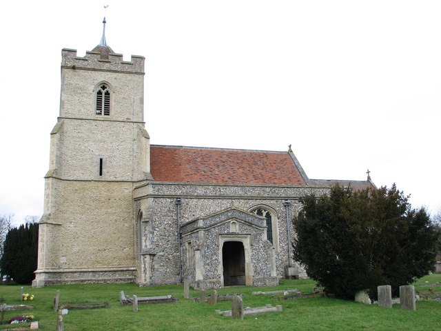
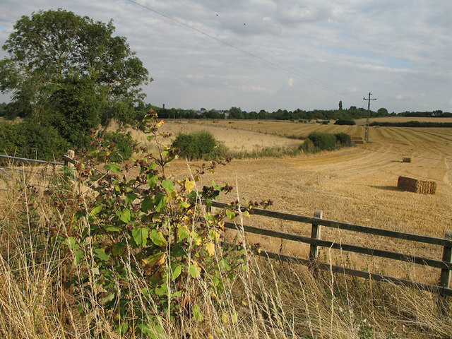
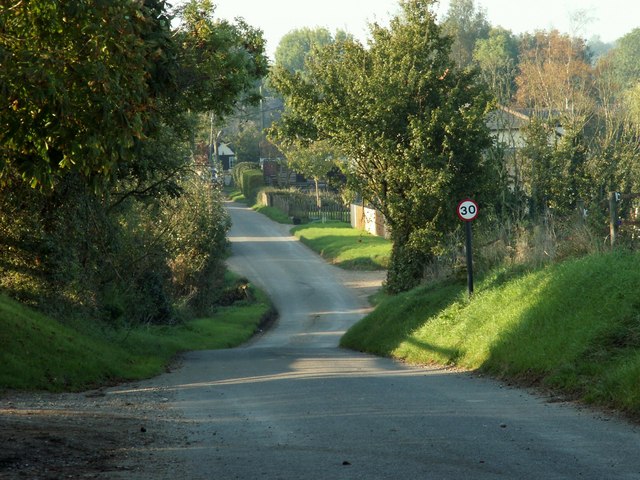
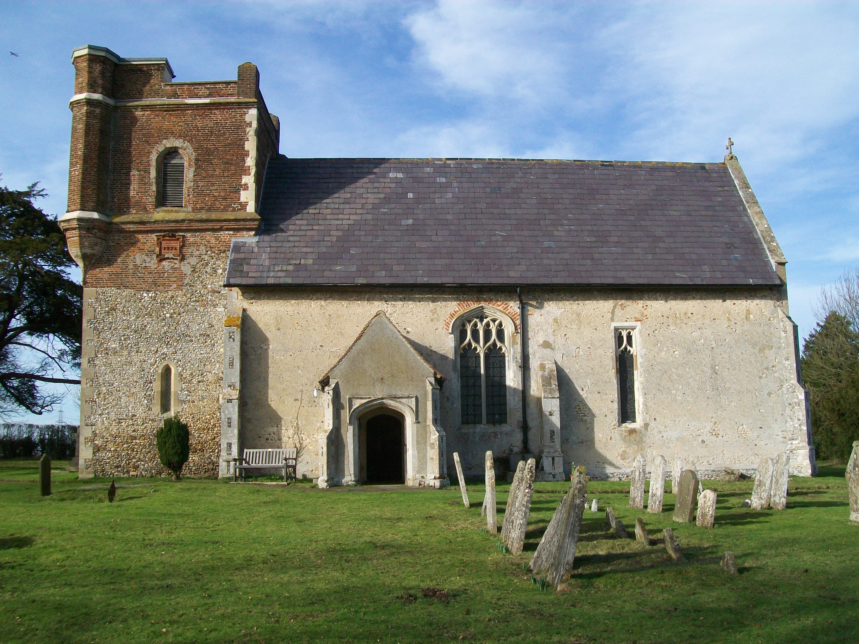
Burhill Wood Images

Images are sourced within 2km of 51.972139/-0.038064565 or Grid Reference TL3432. Thanks to Geograph Open Source API. All images are credited.

St. Andrew's Church - Buckland, Hertfordshire This church was built by Nicholas de Bokeland in 1348. The exact date is known because he left a note of this on the glass of one of the chancel windows. Although Nicholas's glass has now gone, some fragments of 14th century glass remain in other windows. St. Andrew's is no longer used for regular worship and is now cared for by The Churches Conservation Trust.
St. Andrew's Church - Buckland, Hertfordshire
This church was built by Nicholas de Bokeland in 1348. The exact date is known because he left a note of this on the glass of one of the chancel windows. Although Nicholas's glass has now gone, some fragments of 14th century glass remain in other windows. St. Andrew's is no longer used for regular worship and is now cared for by The Churches Conservation Trust.
Farmland near Buntingford A footpath to Park Farm Industrial Estate and Buntingford can be seen cutting diagonally across the fields in the photo.  A Burdock stands out in the foreground.  The flower heads distribute the seed by sticking to passing animals - great fun to throw at your friends clothes when you're a child.
Farmland near Buntingford
A footpath to Park Farm Industrial Estate and Buntingford can be seen cutting diagonally across the fields in the photo. A Burdock stands out in the foreground. The flower heads distribute the seed by sticking to passing animals - great fun to throw at your friends clothes when you're a child.
Harvesting Combine harvester trundles across a field mowing the wheat on a Sunday evening.  In the foreground is a bale of straw.
Harvesting
Combine harvester trundles across a field mowing the wheat on a Sunday evening. In the foreground is a bale of straw.
Safely Gathered In Even straw has a value.  After the wheat has gone to make bread the straw is kept to feed animals over the winter.  In the barn there are large cylindrical bales and traditional rectangular bales.  The reason for both types of baling is to meet the needs of different customers.  A small stable run by a single person will only be able to handle small rectangular bales.
Safely Gathered In
Even straw has a value. After the wheat has gone to make bread the straw is kept to feed animals over the winter. In the barn there are large cylindrical bales and traditional rectangular bales. The reason for both types of baling is to meet the needs of different customers. A small stable run by a single person will only be able to handle small rectangular bales.
'The Countryman' inn, Chipping, Herts. The road in the picture is the A.10, once the Roman road called Ermine Street.
'The Countryman' inn, Chipping, Herts.
The road in the picture is the A.10, once the Roman road called Ermine Street.
Bush Wood The lane leads to Hyde Hall Farm.
Bush Wood
The lane leads to Hyde Hall Farm.
The hamlet of Mill End, Herts. This shows the start of Mill End, travelling north.
The hamlet of Mill End, Herts.
This shows the start of Mill End, travelling north.
Five House Farm Barns These farm barns are rented out as business units.
Five House Farm Barns
These farm barns are rented out as business units.
Public Footpath, just west of Buckland, Herts.
St Andrew, Buckland, Herts
St Andrew, Buckland, Herts - Iron crosses in churchyard
St Andrew, Buckland, Herts - East end
St Andrew, Buckland, Herts - Wall monument
St Andrew, Buckland, Herts - Label head
St Andrew, Buckland, Herts - Window
Show me another place!

Burhill Wood is located at Grid Ref: TL3432 (Lat: 51.972139, Lng: -0.038064565)

Administrative County: Hertfordshire

District: East Hertfordshire

Police Authority: Hertfordshire

What 3 Words

///monks.caressing.highways. Near Buntingford, Hertfordshire

Nearby Locations

Bush Wood Burhill Wood

Related Wikis

Chipping, Hertfordshire

Chipping is a hamlet in the civil parish of Buckland in the East Hertfordshire district, in the county of Hertfordshire, England. Situated along the A10...

Buckland, Hertfordshire

Buckland is a village and civil parish in the East Hertfordshire district of Hertfordshire, England. The village is situated on the A10 road, with the...

St Andrew's Church, Buckland

St Andrew's Church is a redundant Anglican church in the village of Buckland, Hertfordshire, England. It is recorded in the National Heritage List for...

Freman College

Freman College is an upper school and sixth form with academy status in Buntingford, Hertfordshire, England. It was established as Ward Freman School in...

Throcking

Throcking is a village and former civil parish, now in the parish of Cottered, in the East Hertfordshire district, in the county of Hertfordshire, England...

Broadfield, Hertfordshire

Broadfield is a hamlet and former civil parish, now in the parish of Cottered, in the East Hertfordshire district, in the county of Hertfordshire, England...

Blagrove Common

Blagrove Common is a 4.0-hectare (9.9-acre) Site of Special Scientific Interest in Green End near Sandon in Hertfordshire. It is managed by the Hertfordshire...

Red House, Buntingford

The Red House is a Queen Anne style house built around 1710 opposite the intersection of Norfolk Road and High Street in Buntingford, Hertfordshire, England...

Nearby Amenities

Located within 500m of 51.972139,-0.038064565
Note: No marker post here but i've split the difference between the two to put the fork in footpaths here
Lat/Long: 51.9760141/-0.0346174
Ford: yes
Lat/Long: 51.9746421/-0.0332586
Power: pole
Ref: WPA 12
Source: Bing
Source Ref: interpolation
Lat/Long: 51.9748553/-0.0386129
Power: pole
Ref: WPA 11
Source: Bing
Source Ref: interpolation
Lat/Long: 51.9739135/-0.0388543
Power: pole
Ref: WPA 10
Source: Bing
Source Ref: interpolation
Lat/Long: 51.9729849/-0.0390528
Material: wood
Power: pole
Ref: WPA 13
Source: Bing
Source Ref: interpolation
Lat/Long: 51.9758335/-0.0384144
Power: pole
Ref: WPA 8
Source: Bing
Source Ref: interpolation
Lat/Long: 51.9710021/-0.0395249
Design: h-frame
Power: tower
Ref: WPA 9
Source: Bing
Source Ref: interpolation
Tower Type: anchor
Lat/Long: 51.9720695/-0.0392835
Power: pole
Ref: WPA 7
Source: Bing
Source Ref: interpolation
Lat/Long: 51.9700338/-0.0397609
Power: pole
Ref: WPA 6
Source: Bing
Source Ref: interpolation
Lat/Long: 51.9691018/-0.0399701
Note: This marker post shows the fork in footpaths to be here (but so does the marker post to the north)
Lat/Long: 51.9755383/-0.034364
Power: pole
Lat/Long: 51.9724752/-0.0323944
Power: pole
Lat/Long: 51.9695488/-0.0324111
Power: pole
Lat/Long: 51.9737533/-0.0324418
Power: pole
Lat/Long: 51.9709261/-0.0324032
The data included in this document is from www.openstreetmap.org. The data is made available under ODbL.

Have you been to Burhill Wood?

Leave your review of Burhill Wood below (or comments, questions and feedback).