Birchen Coppice

Wood, Forest in Surrey Tandridge

England

Birchen Coppice

Posterngate Farm, South Godstone, Surrey Part of the extensive grounds of Posterngate Farm, where the many activities include the maintenance of a herd of pedigree Charollais, and a lake for trout fishing.  There is even a small business park.  
And this photograph 'wraps up' the TQ34 hectad, of which I have claimed 48 first geographs.
Posterngate Farm, South Godstone, Surrey Credit: Dr Neil Clifton

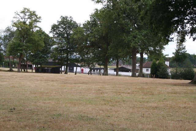
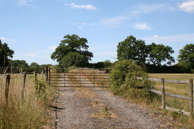
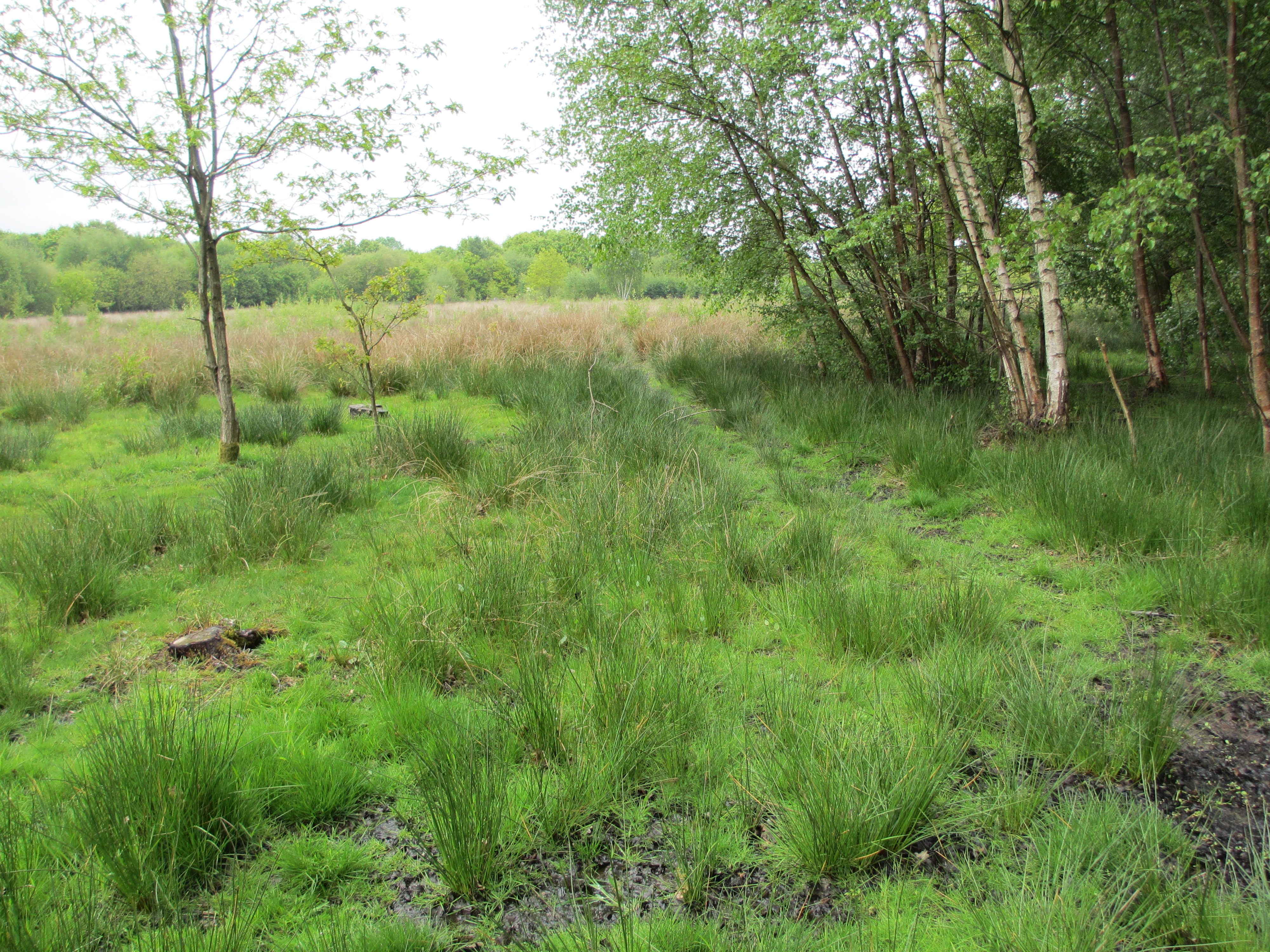
Birchen Coppice is a picturesque woodland located in Surrey, England. Covering an area of approximately 200 acres, it is a popular destination for nature enthusiasts and outdoor enthusiasts alike. The woodland is characterized by its dense canopy of birch trees, which give the area its name.

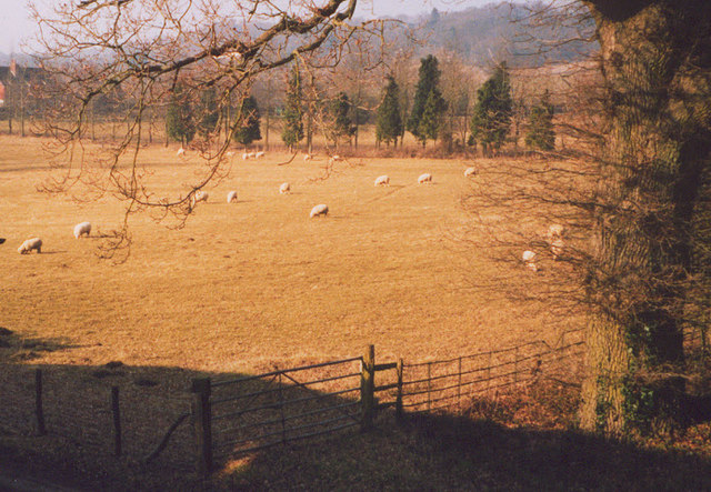
The forest is situated on the outskirts of Surrey, nestled between rolling hills and meandering streams. Its natural beauty and tranquil atmosphere make it an ideal place for walking, hiking, and birdwatching. The diverse range of flora and fauna found in Birchen Coppice attracts a wide variety of wildlife, including deer, foxes, and a multitude of bird species.

Visitors to Birchen Coppice can explore the numerous winding trails that crisscross the woods, offering stunning views of the surrounding countryside. The woodland is also home to a number of ancient trees, some of which are believed to be over 200 years old. These majestic giants add to the charm and character of the forest.

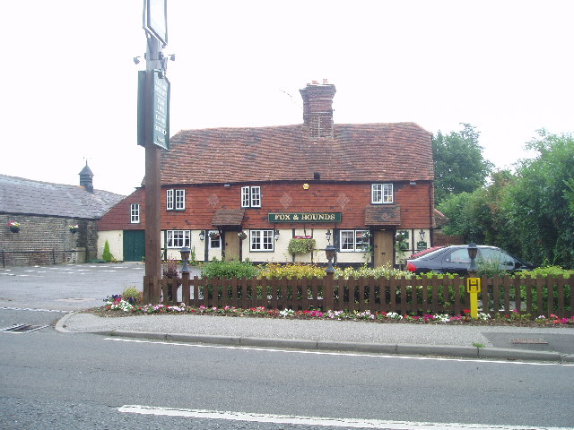
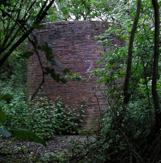
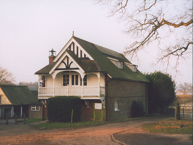
In addition to its natural beauty, Birchen Coppice also has historical significance. It is believed to have been a popular hunting ground for the local nobility in medieval times. Today, remnants of old hunting lodges and structures can still be found within the woodland, providing a glimpse into its rich past.

Overall, Birchen Coppice is a hidden gem in Surrey, offering visitors the chance to immerse themselves in nature and experience the beauty of a traditional English woodland. Whether it's for a leisurely stroll or a more adventurous hike, this forest has something to offer everyone.

If you have any feedback on the listing, please let us know in the comments section below.

Birchen Coppice Images

Images are sourced within 2km of 51.21478/-0.070488627 or Grid Reference TQ3447. Thanks to Geograph Open Source API. All images are credited.

Posterngate Farm, South Godstone, Surrey Part of the extensive grounds of Posterngate Farm, where the many activities include the maintenance of a herd of pedigree Charollais, and a lake for trout fishing.  There is even a small business park.  
And this photograph 'wraps up' the TQ34 hectad, of which I have claimed 48 first geographs.
Posterngate Farm, South Godstone, Surrey
Part of the extensive grounds of Posterngate Farm, where the many activities include the maintenance of a herd of pedigree Charollais, and a lake for trout fishing. There is even a small business park. And this photograph 'wraps up' the TQ34 hectad, of which I have claimed 48 first geographs.
South Godstone South Godstone is 3 miles south of Godstone village and developed when the Tonbridge railway line was built in the 19th century.
South Godstone
South Godstone is 3 miles south of Godstone village and developed when the Tonbridge railway line was built in the 19th century.
Fox and Hounds at South Godstone This building has served ale since the 17th century. On the Tilburstow Hill Road and well worth the diversion !
Fox and Hounds at South Godstone
This building has served ale since the 17th century. On the Tilburstow Hill Road and well worth the diversion !
St Mark's Foundation A private chapel at South Park Farm, listed grade II and occasionally used for public services.
St Mark's Foundation
A private chapel at South Park Farm, listed grade II and occasionally used for public services.
Wychcroft Retreat House Anglican Diocese of Southwark Retreat House used for residential training and quiet days
Wychcroft Retreat House
Anglican Diocese of Southwark Retreat House used for residential training and quiet days
Lower South Park A substantial old property near Godstone, connected via a bridleway to South Park itself
Lower South Park
A substantial old property near Godstone, connected via a bridleway to South Park itself
Air shaft of Bletchingley Tunnel When the Bletchingley railway tunnel <span class="nowrap"><a title="http://en.wikipedia.org/wiki/Redhill_to_Tonbridge_Line" rel="nofollow ugc noopener" href="http://en.wikipedia.org/wiki/Redhill_to_Tonbridge_Line">Link</a><img style="margin-left:2px;" alt="External link" title="External link - shift click to open in new window" src="https://s1.geograph.org.uk/img/external.png" width="10" height="10"/></span> was made in the 1830s trains were steam powered and slow by today's standards. Although the tunnel is just over a kilometre long, eleven air shafts were provided to vent the smoke. This is Shaft No. 2. The tunnel can be seen in <a href="https://www.geograph.org.uk/photo/174476">TQ3248 : from bridge in Outwood Lane</a>.
Air shaft of Bletchingley Tunnel
When the Bletchingley railway tunnel LinkExternal link was made in the 1830s trains were steam powered and slow by today's standards. Although the tunnel is just over a kilometre long, eleven air shafts were provided to vent the smoke. This is Shaft No. 2. The tunnel can be seen in TQ3248 : from bridge in Outwood Lane.
S K Camping and Leisure, Anglefield Corner, Surrey On the A22 south of Godstone.  A vast range of equipment for the outdoor holiday enthusiast. There is also a garden centre adjoining.
S K Camping and Leisure, Anglefield Corner, Surrey
On the A22 south of Godstone. A vast range of equipment for the outdoor holiday enthusiast. There is also a garden centre adjoining.
Bridleway alongside an oak wood, Surrey This lane is the western limb of a tangle of bridleways that straggle across country for many miles north and east of the village of Outwood.  This western section probably sees less use by riders than the main network, as it debouches onto the rather busy Outwood Lane, a motor road where, sadly, not all drivers show proper courtesy to equestrians.
Bridleway alongside an oak wood, Surrey
This lane is the western limb of a tangle of bridleways that straggle across country for many miles north and east of the village of Outwood. This western section probably sees less use by riders than the main network, as it debouches onto the rather busy Outwood Lane, a motor road where, sadly, not all drivers show proper courtesy to equestrians.
Lane past Tanglewood Stables, Surrey Go for a ramble or cycle ride in this part of Surrey and you will very likely see more horses than cows, sheep or even motor cars.  And most of the animals will be in first-class condition as befits this important horse-breeding and rearing area.
Lane past Tanglewood Stables, Surrey
Go for a ramble or cycle ride in this part of Surrey and you will very likely see more horses than cows, sheep or even motor cars. And most of the animals will be in first-class condition as befits this important horse-breeding and rearing area.
The road to Nowhere, Surrey Surprisingly this lane does not appear in any form at all on the 1:25000 map, nor is there any indication of anywhere it could serve.  The gate is firmly padlocked.  No farm stock or arable crop is visible.
The road to Nowhere, Surrey
Surprisingly this lane does not appear in any form at all on the 1:25000 map, nor is there any indication of anywhere it could serve. The gate is firmly padlocked. No farm stock or arable crop is visible.
Houses in Terra Cotta Road, Surrey Terra Cotta Road leads westwards off Tilburstow Hill Road.  It continues past these houses to end in a small business park.  These houses are probably the nearest you will get to 'affordable' houses in the Godstone area - but you will get a shock if you enquire the price.
Houses in Terra Cotta Road, Surrey
Terra Cotta Road leads westwards off Tilburstow Hill Road. It continues past these houses to end in a small business park. These houses are probably the nearest you will get to 'affordable' houses in the Godstone area - but you will get a shock if you enquire the price.
Little Chef restaurant, South Godstone, Surrey On the west side of the A22.
I suppose some people must actually eat in these establishments, otherwise they would not be there.
Little Chef restaurant, South Godstone, Surrey
On the west side of the A22. I suppose some people must actually eat in these establishments, otherwise they would not be there.
Paddocks, Tanglewood Stables
Grounds of Tanglewood Stables
The chapel at Wychcroft An unusual private chapel, dedicated to the People of God, part of the Southwark diocesan retreat house and training centre.
The chapel at Wychcroft
An unusual private chapel, dedicated to the People of God, part of the Southwark diocesan retreat house and training centre.
Sheep grazing at Wychcroft A pastoral scene near Bletchingley.
Sheep grazing at Wychcroft
A pastoral scene near Bletchingley.
Bridleway towards Lower South Park A well used, fenced bridleway connecting two roads, that could better be described as a green lane, and perhaps surprisingly is not classified as a byway.
Bridleway towards Lower South Park
A well used, fenced bridleway connecting two roads, that could better be described as a green lane, and perhaps surprisingly is not classified as a byway.
Show me another place!

Birchen Coppice is located at Grid Ref: TQ3447 (Lat: 51.21478, Lng: -0.070488627)

Administrative County: Surrey

District: Tandridge

Police Authority: Surrey

What 3 Words

///hiking.loft.soup. Near Blindley Heath, Surrey

Nearby Locations

Birchen Coppice Park Hill

Related Wikis

Godstone railway station

Godstone railway station is on the Redhill to Tonbridge Line and serves Godstone in Surrey, England. It is 28 miles 13 chains (28.16 miles, 45.32 km) measured...

Tilburstow Hill

Tilburstow Hill is a 9-hectare (22-acre) nature reserve south-east of Godstone in Surrey. It is managed by the Surrey Wildlife Trust.This is a semi-natural...

Graeme Hendrey Wood

Graeme Hendrey Wood is a 10-hectare (25-acre) nature reserve east of Bletchingley in Surrey. It is managed by the Surrey Wildlife Trust.This former sand...

Godstone Ponds

Godstone Ponds is a 13.6-hectare (34-acre) biological Site of Special Scientific Interest in Godstone in Surrey. Bay Pond is an educational nature reserve...

Outwood Windmill

Outwood Windmill is a Grade I listed post mill in Outwood, Surrey. Built in 1665 by Thomas Budgen, a miller from Nutfield in Surrey, it is Britain's oldest...

Church of St John the Baptist, Outwood

The Church of St John the Baptist, Outwood, is the parish church of Outwood, Surrey, England. == Clergy and style of worship == Part of the Diocese of...

Bletchingley

Bletchingley (historically "Blechingley") is a village in Surrey, England. It is on the A25 road to the east of Redhill and to the west of Godstone, has...

Blindley Heath SSSI

Blindley Heath SSSI is a 26.3-hectare (65-acre) biological Site of Special Scientific Interest in the hamlet Blindley Heath, on the southern outskirts...

Nearby Amenities

Located within 500m of 51.21478,-0.070488627
BLETCHINGLEY5
Man Made: petroleum_well
Source: DECC
Lat/Long: 51.2143758/-0.0708964
BLETCHINGLEY6
Man Made: petroleum_well
Source: DECC
Lat/Long: 51.2144025/-0.0708853
BLETCHINGLEY4
Disused: yes
Man Made: petroleum_well
Ref GB Decc: LR/25-4
Source: DECC
Lat/Long: 51.2181372/-0.0677503
M Partners Ltd
Addr City: Godstone
Addr Country: GB
Addr Housename: Lambs Business Park
Addr Housenumber: Unit J 11
Addr Postcode: RH9 8LJ
Addr Street: Terra Cotta Road
Addr Suburb: South Godstone
Office: company
Phone: +44 20 8835 2221
Website: http://www.mpartners.co.uk/
Lat/Long: 51.219019/-0.0689778
Barrier: stile
Lat/Long: 51.2118889/-0.0688956
Power: pole
Source: Bing
Lat/Long: 51.2157065/-0.0681281
Power: pole
Source: Bing
Lat/Long: 51.2148732/-0.0682461
Power: pole
Source: Bing
Lat/Long: 51.2140633/-0.0684124
Power: pole
Source: Bing
Lat/Long: 51.2129065/-0.0685854
Power: pole
Source: Bing
Lat/Long: 51.2118538/-0.0687598
Power: pole
Source: Bing
Lat/Long: 51.211154/-0.069606
Power: pole
Source: gps
Lat/Long: 51.2103155/-0.0705153
The data included in this document is from www.openstreetmap.org. The data is made available under ODbL.

Have you been to Birchen Coppice?

Leave your review of Birchen Coppice below (or comments, questions and feedback).