Long Shaw

Wood, Forest in Sussex Mid Sussex

England

Long Shaw

Bridleway 42 Ar This, together with its continuation 33Ba, follows the east side of Ardingly Reservoir.
Bridleway 42 Ar Credit: Robin Webster

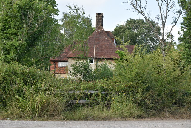
Long Shaw is a charming woodland located in Sussex, England. Situated near the village of Wood, it is a popular destination for nature enthusiasts and those seeking outdoor activities. With its abundant forest cover, Long Shaw offers a serene and picturesque setting for visitors to explore.

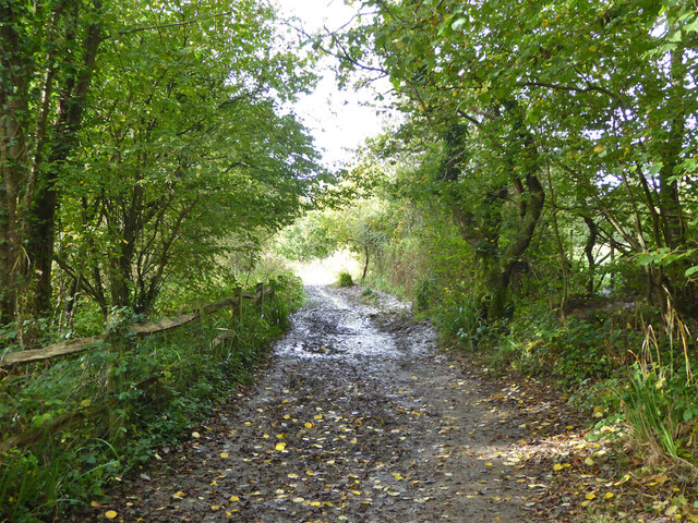
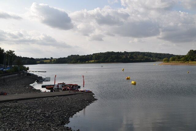
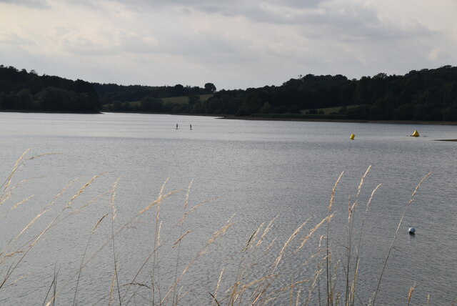
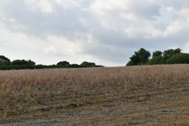
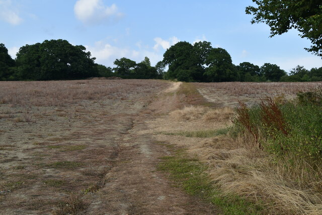
The woodland is characterized by its dense, mature trees that create a canopy above the forest floor. The dominant tree species include oak, beech, and birch, which provide a rich habitat for a variety of wildlife. Visitors may encounter squirrels, rabbits, and numerous bird species as they wander through the woodland.

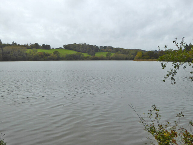
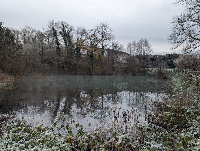
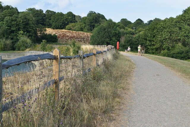
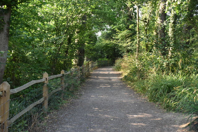
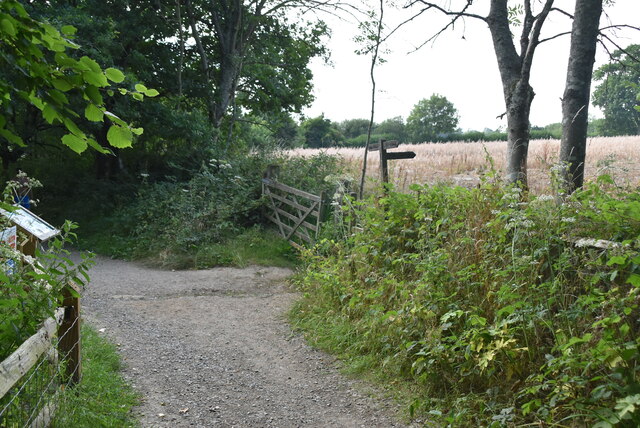
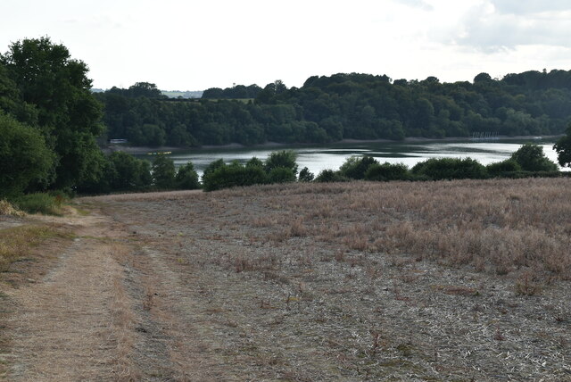
Long Shaw is crisscrossed by a network of footpaths and trails, allowing visitors to explore the area on foot or by bicycle. These paths wind their way through the forest, offering glimpses of tranquil ponds and meandering streams along the way. The diverse flora and fauna make it an ideal location for nature photography and birdwatching.

For those seeking a more immersive experience, Long Shaw offers camping facilities. The camping area is nestled within the woods, providing a peaceful and secluded setting for overnight stays. Campers can enjoy the sounds of nature and the opportunity to spot nocturnal wildlife.

Overall, Long Shaw in Sussex is a haven for nature lovers, offering a beautiful and tranquil woodland setting. Whether it's a leisurely walk, a camping trip, or simply a chance to reconnect with nature, Long Shaw provides an idyllic escape from the hustle and bustle of everyday life.

If you have any feedback on the listing, please let us know in the comments section below.
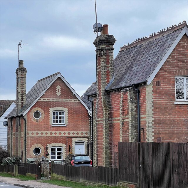
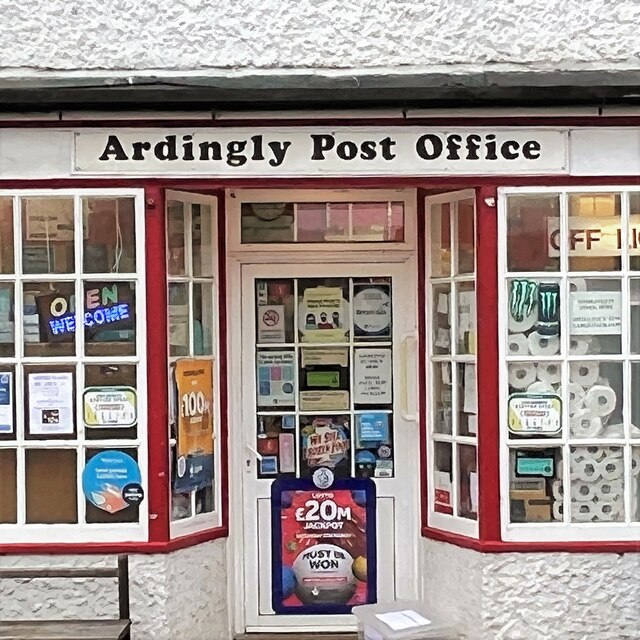
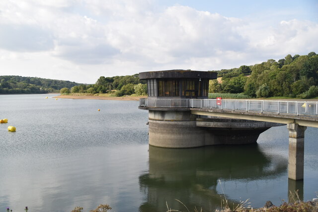
Long Shaw Images

Images are sourced within 2km of 51.055073/-0.080402508 or Grid Reference TQ3430. Thanks to Geograph Open Source API. All images are credited.

Bridleway 42 Ar This, together with its continuation 33Ba, follows the east side of Ardingly Reservoir.
Bridleway 42 Ar
This, together with its continuation 33Ba, follows the east side of Ardingly Reservoir.
Ardingly Reservoir
Ardingly Reservoir
Field near Townhouse Farm Looking up from the path by Ardingly Reservoir.
Field near Townhouse Farm
Looking up from the path by Ardingly Reservoir.
Ardingly Reservoir - from the dam
Houses on High Street
Ardingly Post Office
Saucelands Pond Ardingly College is beyond.
Saucelands Pond
Ardingly College is beyond.
Ardingly Reservoir overflow tower Ardingly Reservoir is a 198-acre (0.80 km2) reservoir that feeds the River Ouse in West Sussex, 5 miles (8 km) north of Haywards Heath. The villages of Ardingly and Balcombe are immediately to the east and north of the reservoir respectively. The reservoir was created in 1978 by damming Shell Brook, a tributary of the River Ouse which flows into the Ouse about 500m south of the Reservoir.

The Ardingly Activity Centre provides watersports for the public including wind surfing, canoeing, powerboating and dinghy sailing.

The reservoir is a popular fishing venue offering 3 miles (5 km) of freshwater fishing for carp, tench, pike, roach, rudd, eel, gudgeon, European perch and bream.

The west bank of the reservoir is private property of the Balcombe Estate but the north, south and east shores offer public rights of way and bridleways. Ornithologists are catered for with two bird hides situated on the east bank.

The site is a local Nature Reserve <span class="nowrap"><a title="http://en.wikipedia.org/wiki/Ardingly_Reservoir" rel="nofollow ugc noopener" href="http://en.wikipedia.org/wiki/Ardingly_Reservoir">Link</a><img style="margin-left:2px;" alt="External link" title="External link - shift click to open in new window" src="https://s1.geograph.org.uk/img/external.png" width="10" height="10"/></span>
Ardingly Reservoir overflow tower
Ardingly Reservoir is a 198-acre (0.80 km2) reservoir that feeds the River Ouse in West Sussex, 5 miles (8 km) north of Haywards Heath. The villages of Ardingly and Balcombe are immediately to the east and north of the reservoir respectively. The reservoir was created in 1978 by damming Shell Brook, a tributary of the River Ouse which flows into the Ouse about 500m south of the Reservoir. The Ardingly Activity Centre provides watersports for the public including wind surfing, canoeing, powerboating and dinghy sailing. The reservoir is a popular fishing venue offering 3 miles (5 km) of freshwater fishing for carp, tench, pike, roach, rudd, eel, gudgeon, European perch and bream. The west bank of the reservoir is private property of the Balcombe Estate but the north, south and east shores offer public rights of way and bridleways. Ornithologists are catered for with two bird hides situated on the east bank. The site is a local Nature Reserve LinkExternal link
Ardingly Reservoir Ardingly Reservoir is a 198-acre (0.80 km2) reservoir that feeds the River Ouse in West Sussex, 5 miles (8 km) north of Haywards Heath. The villages of Ardingly and Balcombe are immediately to the east and north of the reservoir respectively. The reservoir was created in 1978 by damming Shell Brook, a tributary of the River Ouse which flows into the Ouse about 500m south of the Reservoir.

The Ardingly Activity Centre provides watersports for the public including wind surfing, canoeing, powerboating and dinghy sailing.

The reservoir is a popular fishing venue offering 3 miles (5 km) of freshwater fishing for carp, tench, pike, roach, rudd, eel, gudgeon, European perch and bream.

The west bank of the reservoir is private property of the Balcombe Estate but the north, south and east shores offer public rights of way and bridleways. Ornithologists are catered for with two bird hides situated on the east bank.

The site is a local Nature Reserve <span class="nowrap"><a title="http://en.wikipedia.org/wiki/Ardingly_Reservoir" rel="nofollow ugc noopener" href="http://en.wikipedia.org/wiki/Ardingly_Reservoir">Link</a><img style="margin-left:2px;" alt="External link" title="External link - shift click to open in new window" src="https://s1.geograph.org.uk/img/external.png" width="10" height="10"/></span>
Ardingly Reservoir
Ardingly Reservoir is a 198-acre (0.80 km2) reservoir that feeds the River Ouse in West Sussex, 5 miles (8 km) north of Haywards Heath. The villages of Ardingly and Balcombe are immediately to the east and north of the reservoir respectively. The reservoir was created in 1978 by damming Shell Brook, a tributary of the River Ouse which flows into the Ouse about 500m south of the Reservoir. The Ardingly Activity Centre provides watersports for the public including wind surfing, canoeing, powerboating and dinghy sailing. The reservoir is a popular fishing venue offering 3 miles (5 km) of freshwater fishing for carp, tench, pike, roach, rudd, eel, gudgeon, European perch and bream. The west bank of the reservoir is private property of the Balcombe Estate but the north, south and east shores offer public rights of way and bridleways. Ornithologists are catered for with two bird hides situated on the east bank. The site is a local Nature Reserve LinkExternal link
Ardingly Reservoir Dam
Ardingly Reservoir Ardingly Reservoir is a 198-acre (0.80 km2) reservoir that feeds the River Ouse in West Sussex, 5 miles (8 km) north of Haywards Heath. The villages of Ardingly and Balcombe are immediately to the east and north of the reservoir respectively. The reservoir was created in 1978 by damming Shell Brook, a tributary of the River Ouse which flows into the Ouse about 500m south of the Reservoir.

The Ardingly Activity Centre provides watersports for the public including wind surfing, canoeing, powerboating and dinghy sailing.

The reservoir is a popular fishing venue offering 3 miles (5 km) of freshwater fishing for carp, tench, pike, roach, rudd, eel, gudgeon, European perch and bream.

The west bank of the reservoir is private property of the Balcombe Estate but the north, south and east shores offer public rights of way and bridleways. Ornithologists are catered for with two bird hides situated on the east bank.

The site is a local Nature Reserve <span class="nowrap"><a title="http://en.wikipedia.org/wiki/Ardingly_Reservoir" rel="nofollow ugc noopener" href="http://en.wikipedia.org/wiki/Ardingly_Reservoir">Link</a><img style="margin-left:2px;" alt="External link" title="External link - shift click to open in new window" src="https://s1.geograph.org.uk/img/external.png" width="10" height="10"/></span>
Ardingly Reservoir
Ardingly Reservoir is a 198-acre (0.80 km2) reservoir that feeds the River Ouse in West Sussex, 5 miles (8 km) north of Haywards Heath. The villages of Ardingly and Balcombe are immediately to the east and north of the reservoir respectively. The reservoir was created in 1978 by damming Shell Brook, a tributary of the River Ouse which flows into the Ouse about 500m south of the Reservoir. The Ardingly Activity Centre provides watersports for the public including wind surfing, canoeing, powerboating and dinghy sailing. The reservoir is a popular fishing venue offering 3 miles (5 km) of freshwater fishing for carp, tench, pike, roach, rudd, eel, gudgeon, European perch and bream. The west bank of the reservoir is private property of the Balcombe Estate but the north, south and east shores offer public rights of way and bridleways. Ornithologists are catered for with two bird hides situated on the east bank. The site is a local Nature Reserve LinkExternal link
Footpath, Ardingly Reservoir
Footpath waymarker
Footpath waymarker
Field by Ardingly Reservoir
Footpath to Ardingly
Ardingly Reservoir Ardingly Reservoir is a 198-acre (0.80 km2) reservoir that feeds the River Ouse in West Sussex, 5 miles (8 km) north of Haywards Heath. The villages of Ardingly and Balcombe are immediately to the east and north of the reservoir respectively. The reservoir was created in 1978 by damming Shell Brook, a tributary of the River Ouse which flows into the Ouse about 500m south of the Reservoir.

The Ardingly Activity Centre provides watersports for the public including wind surfing, canoeing, powerboating and dinghy sailing.

The reservoir is a popular fishing venue offering 3 miles (5 km) of freshwater fishing for carp, tench, pike, roach, rudd, eel, gudgeon, European perch and bream.

The west bank of the reservoir is private property of the Balcombe Estate but the north, south and east shores offer public rights of way and bridleways. Ornithologists are catered for with two bird hides situated on the east bank.

The site is a local Nature Reserve <span class="nowrap"><a title="http://en.wikipedia.org/wiki/Ardingly_Reservoir" rel="nofollow ugc noopener" href="http://en.wikipedia.org/wiki/Ardingly_Reservoir">Link</a><img style="margin-left:2px;" alt="External link" title="External link - shift click to open in new window" src="https://s1.geograph.org.uk/img/external.png" width="10" height="10"/></span>
Ardingly Reservoir
Ardingly Reservoir is a 198-acre (0.80 km2) reservoir that feeds the River Ouse in West Sussex, 5 miles (8 km) north of Haywards Heath. The villages of Ardingly and Balcombe are immediately to the east and north of the reservoir respectively. The reservoir was created in 1978 by damming Shell Brook, a tributary of the River Ouse which flows into the Ouse about 500m south of the Reservoir. The Ardingly Activity Centre provides watersports for the public including wind surfing, canoeing, powerboating and dinghy sailing. The reservoir is a popular fishing venue offering 3 miles (5 km) of freshwater fishing for carp, tench, pike, roach, rudd, eel, gudgeon, European perch and bream. The west bank of the reservoir is private property of the Balcombe Estate but the north, south and east shores offer public rights of way and bridleways. Ornithologists are catered for with two bird hides situated on the east bank. The site is a local Nature Reserve LinkExternal link
Townhouse Farmhouse
Townhouse Farmhouse
Track to Ardingly
Track to Ardingly
Show me another place!

Long Shaw is located at Grid Ref: TQ3430 (Lat: 51.055073, Lng: -0.080402508)

Administrative County: West Sussex

District: Mid Sussex

Police Authority: Sussex

What 3 Words

///guitars.fittingly.gazette. Near Ardingly, West Sussex

Related Wikis

South of England Show

The South of England Show is a county show held annually at its own showground in Ardingly, Sussex during June.The show was founded in 1967 and is organised...

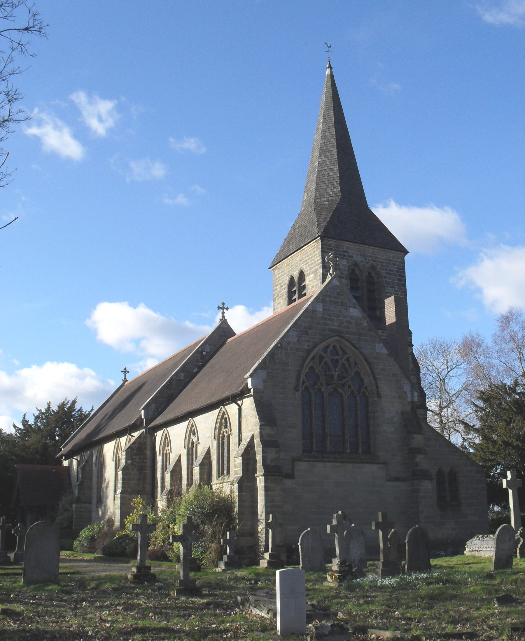
St Peter's Church, Ardingly

St Peter's Church is the Church of England parish church of the parish of Ardingly in Mid Sussex, one of seven local government districts in the English...
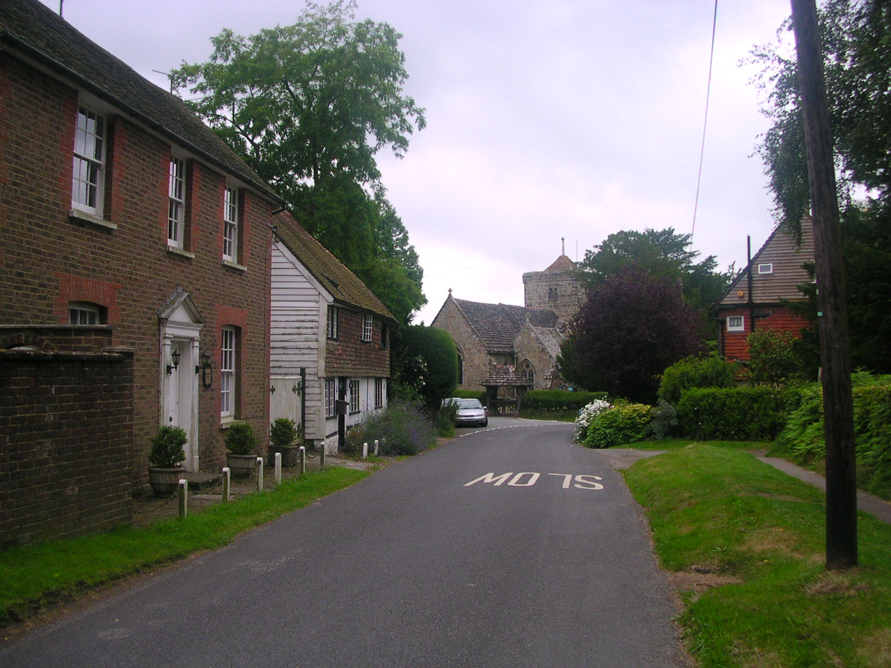
Ardingly

Ardingly ( AR-ding-lye) is an English village and civil parish in the Mid Sussex district of West Sussex, England. The village is in the High Weald Area...

Wakehurst Place

Wakehurst, previously known as Wakehurst Place, is a house and botanic gardens in West Sussex, England, owned by the National Trust but used and managed...

All Saints Church, Highbrook

All Saints Church is an Anglican church in the hamlet of Highbrook in Mid Sussex, one of seven local government districts in the English county of West...

Millennium Seed Bank Partnership

The Millennium Seed Bank Partnership (MSBP or MSB), formerly known as the Millennium Seed Bank Project, is the largest ex situ plant conservation programme...

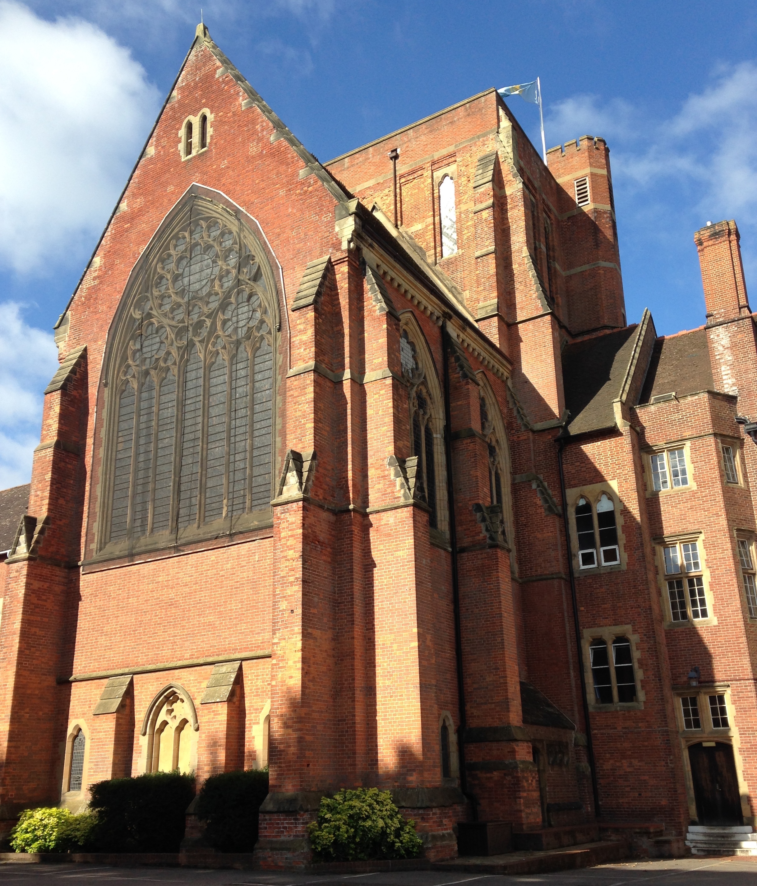
Ardingly College Chapel

The Chapel of S. Saviour is the chapel to Ardingly College in West Sussex, England, and is considered an example of Gothic Revival architecture. The chapel...

Ardingly College

Ardingly College () is a fee-charging boarding and day school in the English public school tradition located near Ardingly, West Sussex, England. The school...

Nearby Amenities

Located within 500m of 51.055073,-0.080402508
Selsfield Road B2028
Naptan AtcoCode: 4400EG0397
Naptan Bearing: S
Naptan BusStopType: CUS
Naptan CommonName: Selsfield Road B2028
Naptan Indicator: HAR
Naptan Landmark: Hail & Ride
Naptan NaptanCode: wsxdwtdp
Naptan Street: Selsfield Road B2028
Naptan Verified: no
Source: naptan_import
Lat/Long: 51.0560985/-0.0830397
Selsfield Road B2028
Naptan AtcoCode: 4400EG0398
Naptan Bearing: N
Naptan BusStopType: CUS
Naptan CommonName: Selsfield Road B2028
Naptan Indicator: HAR
Naptan Landmark: Hail & Ride
Naptan NaptanCode: wsxdwtdt
Naptan Street: Selsfield Road B2028
Naptan Verified: no
Source: naptan_import
Lat/Long: 51.0560283/-0.0831425
Selsfield Road B2028
Naptan AtcoCode: 4400EG0399
Naptan Bearing: S
Naptan BusStopType: CUS
Naptan CommonName: Selsfield Road B2028
Naptan Indicator: HAR
Naptan Landmark: Hail & Ride
Naptan NaptanCode: wsxdwtdw
Naptan Street: Selsfield Road B2028
Naptan Verified: no
Source: naptan_import
Lat/Long: 51.052493/-0.0798068
Selsfield Road B2028
Naptan AtcoCode: 4400EG0400
Naptan Bearing: N
Naptan BusStopType: CUS
Naptan CommonName: Selsfield Road B2028
Naptan Indicator: HAR
Naptan Landmark: Hail & Ride
Naptan NaptanCode: wsxdwtga
Naptan Street: Selsfield Road B2028
Naptan Verified: no
Source: naptan_import
Lat/Long: 51.0524698/-0.0800361
Bus Stop
Hett Close
Bus: yes
Naptan AtcoCode: 4400EG0460
Naptan Bearing: N
Naptan CommonName: Hett Close
Naptan Indicator: opp
Naptan Landmark: Hett Close
Naptan Street: High Street
Naptan Verified: yes
Public Transport: platform
Source: naptan_import
Lat/Long: 51.0514867/-0.0794785
Bus Stop
Hett Close
Bench: no
Bus: yes
Naptan AtcoCode: 4400EG0461
Naptan Bearing: S
Naptan CommonName: Hett Close
Naptan Indicator: Adj
Naptan Landmark: Hett Close
Naptan Street: High Street
Naptan Verified: yes
Public Transport: platform
Shelter: no
Source: naptan_import
Lat/Long: 51.0513565/-0.0792384
Ardingly Showground
Historic: monument
Name En: Ardingly Showground
Lat/Long: 51.0573057/-0.0851969
Crossing
Crossing: zebra
Tactile Paving: no
Lat/Long: 51.0529039/-0.0826784
Barrier: kissing_gate
Foot: permissive
Lat/Long: 51.0523477/-0.0800372
Grit Bin
Lat/Long: 51.0511895/-0.0794913
Bench
Backrest: yes
Seats: 3
Source: survey
Lat/Long: 51.0513227/-0.0816491
Bench
Backrest: yes
Source: survey
Lat/Long: 51.0515158/-0.0795825
Bench
Backrest: yes
Source: survey
Lat/Long: 51.0516456/-0.0796469
Bench
Backrest: yes
Source: survey
Lat/Long: 51.0517881/-0.0797005
Bench
Backrest: yes
Source: survey
Lat/Long: 51.0519474/-0.0797702
Bottle: yes
Drinking Water: yes
Man Made: water_tap
Lat/Long: 51.054115/-0.0829154
Bench
Backrest: yes
Lat/Long: 51.0543407/-0.0860459
Bench
Backrest: yes
Lat/Long: 51.0543686/-0.0859934
Bench
Backrest: yes
Lat/Long: 51.0543734/-0.0860427
Bench
Backrest: yes
Lat/Long: 51.054335/-0.0859963
Bottle: yes
Drinking Water: yes
Man Made: water_tap
Lat/Long: 51.0540038/-0.0858154
Bottle: yes
Drinking Water: yes
Man Made: water_tap
Lat/Long: 51.053987/-0.086211
Bench
Backrest: no
Lat/Long: 51.0542921/-0.0845539
The data included in this document is from www.openstreetmap.org. The data is made available under ODbL.

Have you been to Long Shaw?

Leave your review of Long Shaw below (or comments, questions and feedback).