Russell's Clump

Wood, Forest in Sussex

England

Russell's Clump

Redundant horse starting gate On the track to Balmer Huff.
Redundant horse starting gate Credit: Dave Spicer

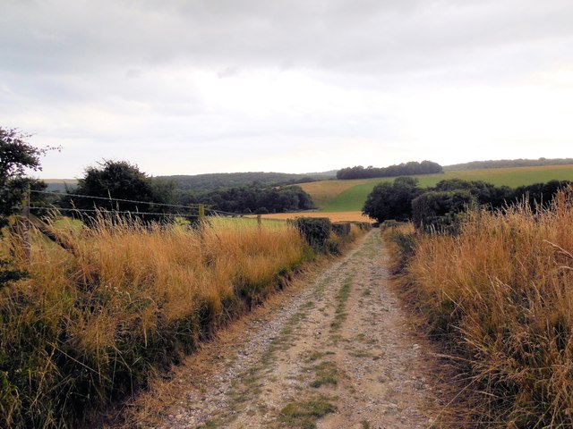
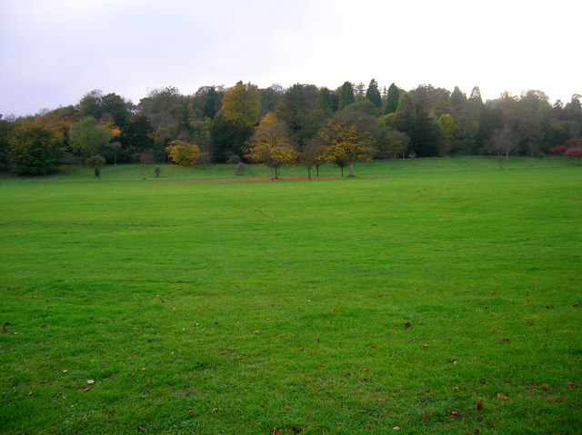
Russell's Clump is a picturesque woodland located in Sussex, England. Situated within the larger area of Sussex Wood, the forest is renowned for its natural beauty and tranquil atmosphere. Covering an area of approximately 100 acres, Russell's Clump is a haven for nature enthusiasts and those seeking solace in the great outdoors.

The woodland is predominantly composed of mature oak trees, which provide a dense canopy and create a sense of intimacy as visitors wander through the forest. The forest floor is covered with a rich carpet of ferns, bluebells, and other wildflowers, adding a splash of color to the otherwise green landscape.

Russell's Clump is home to a diverse range of wildlife, making it an ideal spot for birdwatching and animal spotting. Rare species such as the lesser spotted woodpecker and the dormouse have been sighted in the area, attracting nature enthusiasts from far and wide. The forest also hosts a variety of insects, including butterflies and beetles, which thrive in the diverse ecosystem.

Visitors to Russell's Clump can explore the forest via a network of well-maintained footpaths and trails. These paths meander through the trees, offering glimpses of the surrounding countryside and providing a peaceful setting for leisurely walks or invigorating hikes. The forest also boasts a small picnic area, allowing visitors to relax and enjoy the tranquility of their surroundings.

Russell's Clump is a true gem in the heart of Sussex, offering a serene escape from the hustle and bustle of everyday life. Its natural beauty, diverse wildlife, and peaceful ambiance make it an ideal destination for nature lovers and those seeking a rejuvenating outdoor experience.

If you have any feedback on the listing, please let us know in the comments section below.

Russell's Clump Images

Images are sourced within 2km of 50.865267/-0.09129301 or Grid Reference TQ3409. Thanks to Geograph Open Source API. All images are credited.

Redundant horse starting gate On the track to Balmer Huff.
Redundant horse starting gate
On the track to Balmer Huff.
Arable land on Waterpit Hill
Fields West of Stanmer Park Stanmer Park is a large open park immediately to the west of the University of Sussex, and to the north-east of Brighton, it consists of 200 hectares of open and wooded land 

The village of Stanmer, Stanmer House and Stanmer Church are within the park, which would once have been the estate of the house. All were private until bought by Brighton's Council in 1947.
More details at Wikipedia:  <span class="nowrap"><a title="http://en.wikipedia.org/wiki/Stanmer_Park" rel="nofollow ugc noopener" href="http://en.wikipedia.org/wiki/Stanmer_Park">Link</a><img style="margin-left:2px;" alt="External link" title="External link - shift click to open in new window" src="https://s1.geograph.org.uk/img/external.png" width="10" height="10"/></span>
Stanmer & Ditchling Beacon leaflet & map <span class="nowrap"><a title="http://www.brighton-hove.gov.uk/downloads/bhcc/Stanmer_and_Ditchling_Beacon.pdf" rel="nofollow ugc noopener" href="http://www.brighton-hove.gov.uk/downloads/bhcc/Stanmer_and_Ditchling_Beacon.pdf">Link</a><img style="margin-left:2px;" alt="External link" title="External link - shift click to open in new window" src="https://s1.geograph.org.uk/img/external.png" width="10" height="10"/></span>
Fields West of Stanmer Park
Stanmer Park is a large open park immediately to the west of the University of Sussex, and to the north-east of Brighton, it consists of 200 hectares of open and wooded land The village of Stanmer, Stanmer House and Stanmer Church are within the park, which would once have been the estate of the house. All were private until bought by Brighton's Council in 1947. More details at Wikipedia: LinkExternal link Stanmer & Ditchling Beacon leaflet & map LinkExternal link
Path near Flint Heap Stanmer Park is a large open park immediately to the west of the University of Sussex, and to the north-east of Brighton, it consists of 200 hectares of open and wooded land 

The village of Stanmer, Stanmer House and Stanmer Church are within the park, which would once have been the estate of the house. All were private until bought by Brighton's Council in 1947.
More details at Wikipedia:  <span class="nowrap"><a title="http://en.wikipedia.org/wiki/Stanmer_Park" rel="nofollow ugc noopener" href="http://en.wikipedia.org/wiki/Stanmer_Park">Link</a><img style="margin-left:2px;" alt="External link" title="External link - shift click to open in new window" src="https://s1.geograph.org.uk/img/external.png" width="10" height="10"/></span>
Stanmer & Ditchling Beacon leaflet & map <span class="nowrap"><a title="http://www.brighton-hove.gov.uk/downloads/bhcc/Stanmer_and_Ditchling_Beacon.pdf" rel="nofollow ugc noopener" href="http://www.brighton-hove.gov.uk/downloads/bhcc/Stanmer_and_Ditchling_Beacon.pdf">Link</a><img style="margin-left:2px;" alt="External link" title="External link - shift click to open in new window" src="https://s1.geograph.org.uk/img/external.png" width="10" height="10"/></span>
Path near Flint Heap
Stanmer Park is a large open park immediately to the west of the University of Sussex, and to the north-east of Brighton, it consists of 200 hectares of open and wooded land The village of Stanmer, Stanmer House and Stanmer Church are within the park, which would once have been the estate of the house. All were private until bought by Brighton's Council in 1947. More details at Wikipedia: LinkExternal link Stanmer & Ditchling Beacon leaflet & map LinkExternal link
Sculpted rock by path in Stanmer Park see <a href="https://www.geograph.org.uk/photo/1644234">TQ3310 : Animal designs on rock</a> for a close up of the rock
Sculpted rock by path in Stanmer Park
see TQ3310 : Animal designs on rock for a close up of the rock
Path near Granny's belt Granny's belt is the clump of trees on the right of the picture

The photo was taken during an evening walk in Stanmer Park
Path near Granny's belt
Granny's belt is the clump of trees on the right of the picture The photo was taken during an evening walk in Stanmer Park
Upper Ridge The name of the field according to Falmer's 1840 tithe map that follows a ridge that runs southwards from Waterpit Hill to the village of Falmer. The trees at the far end of the field mark the line of the access road to St Mary's Farm.
Upper Ridge
The name of the field according to Falmer's 1840 tithe map that follows a ridge that runs southwards from Waterpit Hill to the village of Falmer. The trees at the far end of the field mark the line of the access road to St Mary's Farm.
North Laine/Great Knowle The name of the fields according to Falmer's 1840 tithe map that have been joined together to form a larger unit. North Laine covers much of the foreground with the lone tree to the right the last remnant of the former field boundary that once existed between the two. North Laine itself extends southwards through the dry valley that separates the ridge north of Falmer from that containing Balmer.
North Laine/Great Knowle
The name of the fields according to Falmer's 1840 tithe map that have been joined together to form a larger unit. North Laine covers much of the foreground with the lone tree to the right the last remnant of the former field boundary that once existed between the two. North Laine itself extends southwards through the dry valley that separates the ridge north of Falmer from that containing Balmer.
House Mead The name of the field according to Falmer's 1840 tithe map that once backed onto the former farmhouse of Balmer Farm which lay out of shot to the left. A part of the American Express Community Stadium can be seen centre left whilst in the far distances are the high rise flats of central Brighton.
House Mead
The name of the field according to Falmer's 1840 tithe map that once backed onto the former farmhouse of Balmer Farm which lay out of shot to the left. A part of the American Express Community Stadium can be seen centre left whilst in the far distances are the high rise flats of central Brighton.
Balmer Green/Crooked Croft The name of the fields according to Falmer's 1840 tithe map that have been joined together to make a larger unit and lie to the immediate north of <a href="https://www.geograph.org.uk/photo/3863457">TQ3510 : House Mead</a>. Balmer Green originally lay on the left hand side and to the north whereas Crooked Croft lay to the right and filled the southern part of the left hand side nearer the former hamlet. The field may be one of the sites of the old medieval village as there seems to be an awful lot of earthworks suggesting platforms for former houses in this field.
Balmer Green/Crooked Croft
The name of the fields according to Falmer's 1840 tithe map that have been joined together to make a larger unit and lie to the immediate north of TQ3510 : House Mead. Balmer Green originally lay on the left hand side and to the north whereas Crooked Croft lay to the right and filled the southern part of the left hand side nearer the former hamlet. The field may be one of the sites of the old medieval village as there seems to be an awful lot of earthworks suggesting platforms for former houses in this field.
Track to Balmer The bridleway heads south towards the hamlet with an old starting gate on the left hand side which is probably used with jumps and gallops beyond the trees to the right, see <a href="https://www.geograph.org.uk/photo/3863466">TQ3510 : Thirteen Acres</a>. Central Brighton can be seen in the far distance.
Track to Balmer
The bridleway heads south towards the hamlet with an old starting gate on the left hand side which is probably used with jumps and gallops beyond the trees to the right, see TQ3510 : Thirteen Acres. Central Brighton can be seen in the far distance.
Thirteen Acres The name of the field according to Falmer's 1840 tithe map part of which is now used as gallops with jumps. Waterpit Hill is visible in the distance to the right whilst beyond are the woods to the north of Stanmer.
Thirteen Acres
The name of the field according to Falmer's 1840 tithe map part of which is now used as gallops with jumps. Waterpit Hill is visible in the distance to the right whilst beyond are the woods to the north of Stanmer.
Great East Laine The name of the field according to Falmer's 1840 tithe map. The field bends round and becomes <a href="https://www.geograph.org.uk/photo/3864539">TQ3510 : Little East Laine/East Laine</a> nearer to St Mary's Farm. Waterpit Hill is on the left.
Great East Laine
The name of the field according to Falmer's 1840 tithe map. The field bends round and becomes TQ3510 : Little East Laine/East Laine nearer to St Mary's Farm. Waterpit Hill is on the left.
Little East Laine/East Laine The name of the fields according to Falmer's 1840 tithe map. Little East Laine ran along the slope to the right whilst East Laine occupied the area closest to St Mary's Farm, the bottom of the valley and the slope to the left. See also <a href="https://www.geograph.org.uk/photo/3864543">TQ3510 : East Laine</a>. Millbank Wood is visible in the distance.
Little East Laine/East Laine
The name of the fields according to Falmer's 1840 tithe map. Little East Laine ran along the slope to the right whilst East Laine occupied the area closest to St Mary's Farm, the bottom of the valley and the slope to the left. See also TQ3510 : East Laine. Millbank Wood is visible in the distance.
East Laine The name of the field according to Falmer's 1840 tithe map that lies along the northern slope of Waterpit Hill. See also <a href="https://www.geograph.org.uk/photo/3864539">TQ3510 : Little East Laine/East Laine</a> that lies immediately out of shot to the right.
East Laine
The name of the field according to Falmer's 1840 tithe map that lies along the northern slope of Waterpit Hill. See also TQ3510 : Little East Laine/East Laine that lies immediately out of shot to the right.
Waterpit Hill Looking along the peak of the hill from the bridleway that links Buckland Bank to Ridge Road.
Waterpit Hill
Looking along the peak of the hill from the bridleway that links Buckland Bank to Ridge Road.
The Hob Field The name of the field according to Stanmer's 1840 tithe map that lies to the north east of the wood known as Grubbings and south of <a href="https://www.geograph.org.uk/photo/3891595">TQ3310 : Harry's Field</a>. The field is open access being part of the Stanmer estate.
The Hob Field
The name of the field according to Stanmer's 1840 tithe map that lies to the north east of the wood known as Grubbings and south of TQ3310 : Harry's Field. The field is open access being part of the Stanmer estate.
Harry's Field The name of the field according to Stanmer's 1840 tithe map which lies between <a href="https://www.geograph.org.uk/photo/3891589">TQ3410 : The Hob Field</a> to the south and <a href="https://www.geograph.org.uk/photo/3891600">TQ3310 : Little Field</a> to the north.
Harry's Field
The name of the field according to Stanmer's 1840 tithe map which lies between TQ3410 : The Hob Field to the south and TQ3310 : Little Field to the north.
Show me another place!

Russell's Clump is located at Grid Ref: TQ3409 (Lat: 50.865267, Lng: -0.09129301)

Unitary Authority: Brighton and Hove

Police Authority: Sussex

What 3 Words

///moth.hang.clap. Near Brighton, East Sussex

Related Wikis

University of Sussex

The University of Sussex is a public research-intensive university located in Falmer, East Sussex, England. It lies mostly within the city boundaries of...

Falmer railway station

Falmer railway station is in Brighton and Hove, East Sussex, south-east England, 3 miles 39 chains (5.6 km) from Brighton railway station on the East Coastway...

Falmer Stadium

Falmer Stadium, known for sponsorship purposes as the American Express Stadium and more commonly referred to as the Amex, is a football stadium in Falmer...

Falmer High School

Falmer High School was a community mixed-sex non-denominational comprehensive school for pupils aged 11 to 16 in Brighton, East Sussex, England. It closed...

Brighton Aldridge Community Academy

Brighton Aldridge Community Academy (BACA) is a coeducational academy school in Brighton. It opened on 1 September 2010. The school replaced Falmer High...

Aldridge Cricket Academy

Aldridge Cricket Academy is a specialist secondary school academy based at Brighton Aldridge Community Academy and Portslade Aldridge Community Academy...

Stanmer

Stanmer is a village on the northern edge of the city of Brighton and Hove, in the ceremonial county of East Sussex, England. It was formerly a civil parish...

Stanmer Park

Stanmer Park is a large public park immediately to the west of the University of Sussex, and to the north-east of the city of Brighton in the county of...

Nearby Amenities

Located within 500m of 50.865267,-0.09129301
Source: Landsat photo
Lat/Long: 50.8610201/-0.0902161
Bus Stop
Sports Centre
Bench: yes
Bin: yes
Bus: yes
Lit: yes
Naptan AtcoCode: 149000007072
Naptan NaptanCode: brijgmp
Public Transport: platform
Ref GB Uprn: 10025669230
Shelter: yes
Tactile Paving: no
Lat/Long: 50.8636852/-0.0897041
Traffic Calming: cushion
Lat/Long: 50.8670076/-0.0850869
Bus Stop
Falmer Station
Bench: yes
Bin: yes
Bus: yes
Lit: yes
Naptan AtcoCode: 149000007070
Naptan NaptanCode: brimjwg
Public Transport: platform
Ref GB Uprn: 10025673424
Shelter: yes
Tactile Paving: no
Lat/Long: 50.8631506/-0.0853434
Bus Stop
Falmer Station
Bench: yes
Bin: yes
Bus: yes
Lit: yes
Mapillary: 300217191571373
Passenger Information Display: yes
Public Transport: platform
Shelter: yes
Survey Date: 2019-12-26
Tactile Paving: no
Lat/Long: 50.8623946/-0.0883174
Post Office
University of Sussex Post Office
Addr City: Brighton
Addr Country: GB
Addr Housename: Bramber House
Addr Postcode: BN1 9QU
Addr Street: Refectory Road
Addr Village: Falmer
Brand: Post Office
Brand Wikidata: Q1783168
Brand Wikipedia: en:Post Office Ltd
Description: Inside the Cooperative at the back of the store.
Opening Hours: Mo-Fr 09:30-17:30
Operator: Post Office
Operator Wikidata: Q1783168
Ref Pol Id: 2784
Source: OS_OpenData_StreetView
Website: https://www.postoffice.co.uk/branch-finder/1489070/university-of-sussex
Wheelchair: yes
Lat/Long: 50.8675525/-0.0879735
Entrance: yes
Wheelchair: no
Lat/Long: 50.8649174/-0.0879588
Entrance: yes
Lat/Long: 50.8652864/-0.0894399
Bus Stop
Sussex House
Bench: no
Bin: no
Bus: yes
Lit: no
Public Transport: platform
Shelter: no
Tactile Paving: yes
Lat/Long: 50.8641343/-0.0866571
Bus Stop
North South Road
Bench: no
Bin: yes
Bus: yes
Covered: no
Lit: yes
Naptan AtcoCode: 149000009025
Naptan NaptanCode: brimjtg
Public Transport: platform
Shelter: no
Tactile Paving: no
Wheelchair: yes
Lat/Long: 50.8653941/-0.0865302
Man Made: surveillance
Surveillance Type: camera
Lat/Long: 50.8669175/-0.0868118
Bicycle Parking
Bicycle Parking: stands
Capacity: 10
Check Date Capacity: 2021-06-27
Covered: yes
Lat/Long: 50.8639722/-0.0861108
Bicycle Parking
Bicycle Parking: stands
Capacity: 10
Check Date Capacity: 2021-06-27
Covered: yes
Lat/Long: 50.8640643/-0.0862006
Bicycle Parking
Bicycle Parking: stands
Capacity: 10
Check Date Capacity: 2021-08-21
Covered: yes
Lat/Long: 50.8642639/-0.0860399
Bicycle Parking
Bicycle Parking: stands
Capacity: 20
Covered: no
Lat/Long: 50.8645522/-0.0858403
Bicycle Parking
Bicycle Parking: stands
Capacity: 20
Covered: no
Lat/Long: 50.8645293/-0.0858363
Bicycle Parking
Bicycle Parking: stands
Capacity: 10
Check Date Capacity: 2021-08-21
Covered: yes
Lat/Long: 50.8650147/-0.0862168
Bicycle Parking
Bicycle Parking: stands
Capacity: 10
Check Date Capacity: 2021-10-04
Covered: yes
Lat/Long: 50.8654216/-0.0866309
Bicycle Parking
Bicycle Parking: stands
Capacity: 10
Check Date Capacity: 2021-08-21
Covered: yes
Lat/Long: 50.8660194/-0.0864697
Bicycle Parking
Bicycle Parking: stands
Capacity: 10
Covered: yes
Lat/Long: 50.8662395/-0.0869722
Entrance: yes
Wheelchair: yes
Lat/Long: 50.8621296/-0.088606
Bus Stop
Stanmer Park
Bench: no
Bin: no
Bus: yes
Mapillary: 460391575262469
Public Transport: platform
Shelter: no
Survey Date: 2020-09-11
Lat/Long: 50.8618457/-0.0926439
Bus Stop
Bramber House
Bench: no
Bus: yes
Covered: no
Public Transport: platform
Shelter: no
Lat/Long: 50.868301/-0.088108
Turning Circle
Lat/Long: 50.8645951/-0.0893631
Crossing
Crossing: unmarked
Crossing Island: no
Tactile Paving: yes
Lat/Long: 50.8668911/-0.0903934
Parking Entrance
Access: yes
Level: 0
Maxheight: 2.1
Parking: multi-storey
Lat/Long: 50.8667828/-0.090537
Falmer
Public Transport: stop_position
Railway: stop
Ref: 1
Train: yes
Lat/Long: 50.8616197/-0.0883826
Falmer
Public Transport: stop_position
Railway: stop
Ref: 2
Train: yes
Lat/Long: 50.8621404/-0.086563
The Co-operative Food
Addr City: Brighton
Addr Housename: Bramber House
Addr Postcode: BN1 9QU
Addr Street: Refectory Road
Addr Village: Falmer
Brand: The Co-operative Food
Brand Wikidata: Q107617274
Check Date Opening Hours: 2023-09-08
Fhrs Id: 208134
Level: 0
Opening Hours: Mo-Su 07:00-23:00
Operator: The Southern Co-operative
Operator Wikidata: Q7569773
Ref GB Uprn: 22235784
Shop: convenience
Website: https://stores.southern.coop/east-sussex/brighton/bramber-house.html
Wheelchair: yes
Lat/Long: 50.8676024/-0.0880554
Crossing
Crossing: uncontrolled
Crossing Island: no
Tactile Paving: yes
Lat/Long: 50.8684078/-0.0886906
Entrance: yes
Lat/Long: 50.867181/-0.0898334
Toilets
Check Date: 2022-01-26
Fee: no
Level: 1
Wheelchair: yes
Lat/Long: 50.8677859/-0.0882113
Restaurant
Dine Central
Addr City: Brighton
Addr Housename: First Floor North, Bramber House
Addr Postcode: BN1 9QU
Addr Street: Refectory Road
Addr Village: Falmer
Fhrs Id: 605343
Toilets: yes
Toilets Wheelchair: yes
Wheelchair: yes
Lat/Long: 50.8679205/-0.0882186
Bench
Backrest: yes
Lat/Long: 50.8678854/-0.0888858
Waste Basket
Lat/Long: 50.8675228/-0.0882319
Student Union Shop
Addr City: Brighton
Addr Housename: Falmer House
Addr Postcode: BN1 9QF
Addr Street: Gardner Centre Road
Fhrs Id: 206689
Internet Access: yes
Internet Access Fee: no
Internet Access Ssid: O2 WiFi, Eduroam
Level: 0
Opening Hours: Mo-Fr 08:00-23:00; Sa,Su 10:00-18:00
Operator: University of Sussex Students' Union
Organic: yes
Phone: +44 1273 678147
Ref GB Uprn: 22235776
Shop: convenience
Website: https://www.sussexstudent.com/about-us/shops-and-bars/union-shop/
Lat/Long: 50.8643669/-0.0880837
Bar
Falmer Bar
Addr City: Brighton
Addr Housename: Falmer House
Addr Postcode: BN1 9QF
Addr Street: Gardner Centre Road
Fhrs Id: 207938;207688
Image: https://su.imgix.net/original_images/c650466c7e634bafb58d294eafd52ec9
Internet Access: yes
Internet Access Fee: no
Internet Access Ssid: O2 WiFi, Eduroam
Level: 0
Microbrewery: no
Opening Hours: Mo-Th 09:00-01:00, Fr 09:00-02:00, Sa 12:00-02:00, Su 12:00-20:00
Operator: University of Sussex Students' Union
Outdoor Seating: yes
Phone: +44 1273 678148
Smoking: outside
Website: https://www.sussexstudent.com/about-us/shops-and-bars/falmer-bar/
Wheelchair: yes
Lat/Long: 50.8645699/-0.0888801
Cafe
Arts Piazza
Addr City: Brighton
Addr Housename: Arts Building A
Addr Postcode: BN1 9SH
Addr Street: Arts Road
Fhrs Id: 668882
Opening Hours: Mo-Fr 08:00-17:00; Sa,Su 08:00-16:00
Wheelchair: yes
Lat/Long: 50.8659717/-0.0881485
Cafe
Bridge Cafe
Addr City: Brighton
Addr Housename: 2Pevensey Buildin
Addr Postcode: BN1 9QH
Addr Street: North-South Road
Contact Facebook: https://www.facebook.com/SussexUniFood
Fhrs Id: 629414
Internet Access: wlan
Internet Access Fee: no
Internet Access Ssid: O2 Wifi;Eduroam
Opening Hours: Mo-Fr 09:00-16:00; PH,Sa,Su off
Outdoor Seating: no
Website: https://www.sussex.ac.uk/catering/wheretoeat/bridgecafe
Wheelchair: yes
Lat/Long: 50.8648976/-0.0863455
Cafe
Dhaba Cafe
Addr City: Brighton
Addr Housename: Arts Building C
Addr Postcode: BN1 9SJ
Addr Street: Arts Road
Fhrs Id: 629415
Opening Hours: Mo-Fr 09:00-16:00; PH,Sa,Su off
Wheelchair: yes
Lat/Long: 50.8667006/-0.0888262
Entrance: yes
Lat/Long: 50.8631221/-0.090326
International Student Support
Addr City: Brighton
Addr Housename: Bramber House
Addr Postcode: BN1 9QU
Addr Street: Refectory Road
Addr Village: Falmer
Office: company
Lat/Long: 50.8680781/-0.0882512
Bus Stop
Sussex House
Bench: no
Bin: no
Bus: yes
Covered: no
Lit: yes
Public Transport: platform
Shelter: no
Tactile Paving: yes
Lat/Long: 50.8640511/-0.0861232
Cafe
Library Cafe
Addr City: Brighton
Addr Housename: Library
Addr Postcode: BN1 9QL
Addr Street: Library Road
Fhrs Id: 656172
Opening Hours: Mo-Th 09:00-20:00; Fr 09:00-16:00; Sa 12:00-16:00; Su off
Ref GB Uprn: 22235782
Wheelchair: yes
Lat/Long: 50.865146/-0.0893837
Careers and Entrepreneurship
Addr City: Brighton
Addr Housename: Student Centre
Addr Postcode: BN1 9BU
Addr Street: Refectory Road
Email: careers@sussex.ac.uk
Office: yes
Operator: University of Sussex
Phone: +44 1273 678429
Website: http://www.sussex.ac.uk/careers/
Lat/Long: 50.8690915/-0.0878109
Barrier: turnstile
Lat/Long: 50.86182/-0.0874274
Entrance: yes
Lat/Long: 50.8669356/-0.0892769
Entrance: yes
Lat/Long: 50.8668448/-0.08925
Crossing
Crossing: marked
Crossing Island: no
Tactile Paving: no
Lat/Long: 50.8665481/-0.0891476
Entrance: yes
Lat/Long: 50.8664497/-0.0891145
Entrance: yes
Lat/Long: 50.8663333/-0.0890792
Entrance: yes
Lat/Long: 50.8661232/-0.0890056
Crossing
Crossing: marked
Crossing Island: no
Tactile Paving: yes
Lat/Long: 50.8673246/-0.0876932
Bridge: yes
Entrance: emergency
Wheelchair: yes
Lat/Long: 50.8650525/-0.0881657
Bicycle Parking
Bicycle Parking: stands
Capacity: 152
Covered: yes
Lat/Long: 50.8648586/-0.0872472
Entrance: yes
Lat/Long: 50.8645614/-0.0896095
Crossing
Crossing: marked
Crossing Island: no
Tactile Paving: yes
Lat/Long: 50.8667853/-0.0871981
Direction: 75
Traffic Sign: GB:531.1[4.5m]
Lat/Long: 50.8666095/-0.0886596
Direction: 255
Traffic Sign: GB:531.1[4.5m]
Lat/Long: 50.8665913/-0.0888086
Cafe
Jubilee Cafe
Addr City: Brighton
Addr Housename: Jubilee Building
Addr Postcode: BN1 9SL
Addr Street: Arts Road
Cuisine: coffee_shop
Fhrs Id: 768470
Opening Hours: Mo-Fr 8:30-16:00
Smoking: no
Lat/Long: 50.8675572/-0.0898926
Cafe
IDS Cafe & Bar
Addr City: Brighton
Addr Housename: Institute Of Development Studies
Addr Postcode: BN1 9RE
Addr Street: Library Road
Cuisine: coffee_shop
Fhrs Id: 1212425
Opening Hours: Mo-Fr 12:00-14:30,17:00-22:30
Lat/Long: 50.8658779/-0.0903692
Check Date: 2021-09-29
Covered: no
Leisure: picnic_table
Lat/Long: 50.8657944/-0.0896296
Entrance: yes
Lat/Long: 50.8666744/-0.0894491
Crossing
Crossing: marked
Crossing Island: no
Tactile Paving: yes
Lat/Long: 50.8647822/-0.0862535
Entrance: emergency
Lat/Long: 50.8669619/-0.0883896
Entrance: emergency
Lat/Long: 50.8667585/-0.0883197
Barrier: lift_gate
Bicycle: yes
Foot: yes
Motor Vehicle: no
Lat/Long: 50.8642385/-0.0873095
Restaurant
Eat Central
Addr City: Brighton
Addr Housename: Ground Floor, Bramber House
Addr Postcode: BN1 9QU
Addr Street: Refectory Road
Addr Village: Falmer
Fhrs Id: 768469
Lat/Long: 50.8679755/-0.0881599
Cafe
Doctor's Orders
Addr City: Brighton
Addr Housename: Medical School
Addr Postcode: BN1 9PX
Addr Street: Biology Road
Fhrs Id: 656171
Opening Hours: Mo-Fr 08:30-15:15; Sa,Su off
Lat/Long: 50.8641513/-0.0857674
Bus Stop
Stanmer Park Gates
Bench: no
Bin: no
Bus: yes
Mapillary: 780572495986045
Naptan AtcoCode: 149099873
Naptan NaptanCode: brimpja
Public Transport: platform
Shelter: no
Survey Date: 2020-09-14
Lat/Long: 50.8622798/-0.0933815
Bus Stop
Stanmer Park Gates
Bus: yes
Naptan AtcoCode: 149099874
Naptan NaptanCode: brimpjp
Public Transport: platform
Lat/Long: 50.8622616/-0.0935682
Bench
Backrest: yes
Lat/Long: 50.8644049/-0.0906298
Barrier: block
Lat/Long: 50.8658742/-0.0919616
Entrance: yes
Lat/Long: 50.865887/-0.0856441
Crossing
Crossing: unmarked
Crossing Island: no
Kerb: lowered
Tactile Paving: no
Lat/Long: 50.8657429/-0.0865576
Door: yes
Entrance: main
Level: 0
Lat/Long: 50.8656947/-0.0871219
Entrance: yes
Lat/Long: 50.867651/-0.0881707
Entrance: yes
Lat/Long: 50.8677209/-0.0879093
Entrance: yes
Lat/Long: 50.8683147/-0.0882269
Entrance: yes
Lat/Long: 50.8646032/-0.0885532
Bicycle Rental
UoS Sports Centre
Bicycle Rental: docking_station
Capacity: 20
Covered: no
Email: support@beryl.cc
Fee: yes
Network: btnbikeshare
Note: Hire scheme suspened in December 2022 and relaunched with new operator at end of March 2023, but with limited stations open, planned rollout until the summer when all stations will be open.
Payment App: yes
Phone: +44 020 3003 5044
Ref: 26
Website: https://beryl.cc/scheme/brighton
Lat/Long: 50.8632128/-0.0899976
Bicycle Parking
Bicycle Parking: wall_loops
Capacity: 20
Covered: yes
Lat/Long: 50.8681216/-0.0885237
Bicycle Parking
Access: yes
Bicycle Parking: shed
Capacity: 40
Fee: no
Lat/Long: 50.8632433/-0.0897431
Entrance: yes
Lat/Long: 50.8659497/-0.0848531
Door: yes
Entrance: main
Level: 0
Lat/Long: 50.8657918/-0.0874738
Entrance: yes
Lat/Long: 50.8651188/-0.0871286
Bench
Backrest: yes
Lat/Long: 50.8653991/-0.0886494
Bench
Backrest: yes
Lat/Long: 50.8654262/-0.088451
Bench
Backrest: yes
Lat/Long: 50.8653955/-0.0882828
Direction: 345
Traffic Sign: GB:531.1[3.5m]
Lat/Long: 50.8653245/-0.089273
Door: yes
Entrance: main
Level: 0
Lat/Long: 50.8656683/-0.0869708
Post Box
Brand: Royal Mail
Brand Wikidata: Q638098
Brand Wikipedia: en:Royal Mail
Collection Plate: CP8
Collection Times: Mo-Fr 17:00; Sa 11:00
Drive Through: no
Note: Collection times correct as of 18th July 2021
Operator: Royal Mail
Operator Wikidata: Q638098
Post Box Type: pillar
Ref: BN1 352
Ref GB Uprn: 10015386316
Royal Cypher: EIIR
Royal Cypher Wikidata: Q33102113
Lat/Long: 50.8675064/-0.0882074
Crossing
Crossing: uncontrolled
Crossing Island: no
Crossing Ref: zebra
Tactile Paving: yes
Lat/Long: 50.8635891/-0.0881943
Traffic Calming: hump
Lat/Long: 50.8635902/-0.0882125
Barrier: lift_gate
Foot: yes
Motor Vehicle: permissive
Lat/Long: 50.8637773/-0.0889854
Barrier: kissing_gate
Lat/Long: 50.8686826/-0.0918233
Giant Turtle #2
Artist Name: John Skeaping
Artwork Type: statue
Material: granite
Start Date: 1938
Tourism: artwork
Website: https://www.sussex.ac.uk/broadcast/read/46635
Lat/Long: 50.8661034/-0.0883332
Giant Turtle #1
Artist Name: John Skeaping
Artwork Type: statue
Material: granite
Start Date: 1938
Tourism: artwork
Website: https://www.sussex.ac.uk/broadcast/read/46635
Lat/Long: 50.8660769/-0.0885057
Entrance: yes
Lat/Long: 50.8674635/-0.0897557
Phone
Emergency: phone
Indoor: no
Operator: University of Sussex
Lat/Long: 50.8636745/-0.0882014
Entrance: yes
Lat/Long: 50.8692933/-0.0886833
Entrance: yes
Lat/Long: 50.8692918/-0.0885754
Entrance: yes
Lat/Long: 50.8682314/-0.0901128
Entrance: yes
Lat/Long: 50.8679568/-0.0884658
Entrance: yes
Lat/Long: 50.8677209/-0.0891936
Entrance: yes
Lat/Long: 50.8679271/-0.0891161
Phone
Emergency: phone
Operator: University of Sussex
Lat/Long: 50.8670628/-0.0894475
Entrance: yes
Lat/Long: 50.8665092/-0.0897437
Entrance: yes
Lat/Long: 50.866115/-0.0864755
Entrance: yes
Wheelchair: no
Lat/Long: 50.8640232/-0.0849166
Entrance: yes
Lat/Long: 50.8641827/-0.0858834
Entrance: yes
Lat/Long: 50.8644427/-0.085797
Entrance: yes
Wheelchair: no
Lat/Long: 50.8645676/-0.0850732
Entrance: yes
Wheelchair: yes
Lat/Long: 50.8644931/-0.0850471
Entrance: yes
Lat/Long: 50.8649882/-0.0854271
Entrance: yes
Lat/Long: 50.865072/-0.0847771
Entrance: yes
Lat/Long: 50.8653502/-0.0858858
Entrance: yes
Lat/Long: 50.8643673/-0.0880979
Entrance: yes
Lat/Long: 50.8660419/-0.0881575
Entrance: yes
Lat/Long: 50.8661607/-0.0875277
Entrance: yes
Lat/Long: 50.8663545/-0.0877028
Entrance: yes
Wheelchair: yes
Lat/Long: 50.8656705/-0.0898431
Entrance: yes
Lat/Long: 50.8659002/-0.090423
Information: map
Tourism: information
Lat/Long: 50.8647713/-0.0861257
Information: map
Tourism: information
Lat/Long: 50.8652318/-0.0844246
Information: map
Tourism: information
Lat/Long: 50.8650092/-0.0847489
Entrance: yes
Lat/Long: 50.8643351/-0.0857916
Toilets
Access: permissive
Fee: no
Operator: University of Sussex
Toilets Disposal: flush
Lat/Long: 50.8643883/-0.0857362
Crossing
Crossing: marked
Crossing Island: no
Tactile Paving: yes
Lat/Long: 50.8641368/-0.0847983
Entrance: yes
Wheelchair: yes
Lat/Long: 50.8640681/-0.0848715
Parking
Access: permissive
Capacity: 2
Capacity Disabled: 2
Operator: University of Sussex
Park Ride: no
Parking: surface
Supervised: yes
Surface: asphalt
Wheelchair: yes
Lat/Long: 50.8641431/-0.0844568
Traffic Calming: cushion
Lat/Long: 50.8637538/-0.0878234
Entrance: yes
Lat/Long: 50.8641311/-0.0886424
Entrance: yes
Lat/Long: 50.8628502/-0.0902288
Entrance: yes
Lat/Long: 50.8629811/-0.0896656
Entrance: yes
Lat/Long: 50.862932/-0.0900504
Cafe
ACCA Cafe
Addr City: Brighton
Addr Housename: Attenborough Centre for the Creative Arts
Addr Postcode: BN1 9RA
Addr Street: Gardner Centre Road
Fhrs Id: 924989
Opening Hours: Mo-Fr 08:30-18:00
Lat/Long: 50.8643853/-0.0898609
Entrance: yes
Lat/Long: 50.8645499/-0.088964
Entrance: yes
Lat/Long: 50.8649155/-0.0863175
Parking
Access: permit
Capacity: 4
Operator: University of Sussex
Parking: surface
Surface: asphalt
Wheelchair: yes
Lat/Long: 50.8659795/-0.08653
Parking
Access: private
Capacity: 3
Operator: University of Sussex
Parking: street_side
Lat/Long: 50.8662108/-0.0868584
Traffic Calming: cushion
Lat/Long: 50.8668777/-0.0861847
Entrance: yes
Lat/Long: 50.8668681/-0.0904729
Crossing
Crossing: marked
Lat/Long: 50.8660352/-0.0895112
Entrance: yes
Lat/Long: 50.8674009/-0.0867463
Theatre
East Slope Amphitheatre
Theatre Type: amphi
Lat/Long: 50.8677055/-0.085919
Waste Basket
Waste: dog_excrement
Lat/Long: 50.8622088/-0.0933145
Waste Basket
Lat/Long: 50.8622291/-0.0933735
Barrier: height_restrictor
Lat/Long: 50.8622407/-0.0932271
Post Box
Brand: Royal Mail
Brand Wikidata: Q638098
Brand Wikipedia: en:Royal Mail
Collection Plate: CP1D
Collection Times: Mo-Fr 09:00; Sa 07:00
Drive Through: no
Operator: Royal Mail
Operator Wikidata: Q638098
Post Box Type: pillar
Ref: BN1 349D
Ref GB Uprn: 10015320677
Royal Cypher: EIIR
Royal Cypher Wikidata: Q33102113
Lat/Long: 50.8684313/-0.0886715
Post Box
Brand: Royal Mail
Brand Wikidata: Q638098
Brand Wikipedia: en:Royal Mail
Collection Plate: CP1
Collection Times: Mo-Fr 09:00; Sa 07:00
Drive Through: no
Note: Collection times correct as of 18th June 2021
Operator: Royal Mail
Operator Wikidata: Q638098
Post Box Type: pillar
Ref: BN1 348D
Ref GB Uprn: 10015479128
Royal Cypher: EIIR
Royal Cypher Wikidata: Q33102113
Lat/Long: 50.8641383/-0.0871409
Falmer
Naptan AtcoCode: 9100FAMR
Network: National Rail
Network Website: https://www.nationalrail.co.uk/stations/fmr/
Network Wikidata: Q26334
Public Transport: station
Railway: station
Ref Crs: FMR
Train: yes
Wheelchair: yes
Wikidata: Q2435208
Wikipedia: en:Falmer railway station
Lat/Long: 50.8619409/-0.0872899
Bench
Backrest: no
Material: wood
Lat/Long: 50.8666687/-0.0857894
Bench
Backrest: no
Material: wood
Lat/Long: 50.8664723/-0.0858001
Restaurant
The Pizza Station
Addr Housename: Pumping Station House
Addr Postcode: BN1 9PU
Addr Street: Station Approach
Cuisine: pizza
Fhrs Id: 875989
Source Addr: FHRS Open Data
Lat/Long: 50.8620769/-0.0871259
Entrance: yes
Lat/Long: 50.8661042/-0.0870335
Entrance: yes
Lat/Long: 50.8657188/-0.086929
Entrance: yes
Lat/Long: 50.8664959/-0.085968
Crossing
Crossing: unmarked
Crossing Island: no
Kerb: lowered
Lat/Long: 50.8682556/-0.0860725
Parking Space
Capacity: 1
Parking Space: disabled
Lat/Long: 50.8670815/-0.0858618
Parking Space
Capacity: 1
Parking Space: disabled
Lat/Long: 50.8671969/-0.0860845
Entrance: yes
Lat/Long: 50.8642404/-0.0870664
Entrance: yes
Lat/Long: 50.8641896/-0.0866673
Cafe
Room 76
Addr City: Brighton
Addr Housename: Falmer House
Addr Postcode: BN1 9QF
Addr Street: Gardner Centre Road
Bar: yes
Contact Facebook: https://www.facebook.com/room76cafe
Image: https://i.ytimg.com/vi/tUWLSYdlRyo/maxresdefault.jpg
Internet Access: yes
Internet Access Fee: no
Internet Access Ssid: O2 Wifi, Eduroam
Level: 0
Opening Hours: Mo-Fr 08:30-22:00; Sa 12:00-18:00; Su off
Opening Hours Covid19: restricted
Outdoor Seating: no
Phone: +44 1273 678148
Smoking: no
Website: https://www.sussexstudent.com/about-us/shops-and-bars/room-76/
Lat/Long: 50.8642595/-0.0889337
Cafe
Pearls Bubble Tea
Addr City: Brighton
Addr Housename: Falmer House
Addr Postcode: BN1 9QF
Addr Street: Gardner Centre Road
Bar: yes
Cuisine: bubble_tea
Fhrs Id: 852671
Internet Access: yes
Internet Access Fee: no
Internet Access Ssid: O2 Wifi, Eduroam
Opening Hours: Mo-Fr 11:00-18:00; Sa,Su off
Outdoor Seating: no
Phone: +44 1273 678148
Smoking: no
Takeaway: yes
Wheelchair: yes
Lat/Long: 50.8643151/-0.0889359
Falmer House Reception
Addr City: Brighton
Addr Housename: Falmer House
Addr Postcode: BN1 9QF
Addr Street: Gardner Centre Road
Information: office
Internet Access: yes
Internet Access Fee: no
Opening Hours: Mo-Fr 10:00-16:00
Tourism: information
Lat/Long: 50.8646252/-0.0886065
Sussex Student Lettings
Addr City: Brighton
Addr Housename: Falmer House
Addr Postcode: BN1 9QF
Addr Street: Gardner Centre Road
Email: lettings@sussexstudent.com
Level: 0
Office: estate_agent
Operator: University of Sussex Students' Union
Phone: +44 1273 678787
Smoking: no
Website: https://sussexstudentlettings.com/
Wheelchair: limited
Lat/Long: 50.8645399/-0.088776
The Deli
Addr City: Brighton
Addr Housename: Falmer House
Addr Postcode: BN1 9QF
Addr Street: Gardner Centre Road
Check Date Opening Hours: 2021-10-06
Level: 0
Opening Hours: Mo-Fr 11:00-16:00
Operator: University of Sussex Students' Union
Phone: +44 1273 678148
Shop: deli
Lat/Long: 50.864397/-0.0887449
Bicycle Parking
Bicycle Parking: stands
Capacity: 32
Covered: yes
Lat/Long: 50.8642047/-0.0882396
Bicycle Parking
Bicycle Parking: stands
Capacity: 58
Covered: yes
Lat/Long: 50.8646252/-0.0881355
Advertising: board
Lat/Long: 50.864632/-0.0881044
The Bikeshack
Addr City: Brighton
Addr Housename: Falmer House
Addr Postcode: BN1 9QF
Addr Street: Library Square
Email: bikeshack@societies.sussexstudent.com
Opening Hours: Mo-Tu 13:00-15:00; Th-Fr 13:00-15:00
Operator: University of Sussex Students' Union
Service Bicycle Rental: yes
Service Bicycle Repair: yes
Shop: bicycle
Website: https://sussexunicycling.wordpress.com/
Lat/Long: 50.8645886/-0.0880658
Leisure: outdoor_seating
Lat/Long: 50.8643232/-0.0898478
Leisure: outdoor_seating
Lat/Long: 50.8643603/-0.0881356
Waste Basket
Lat/Long: 50.8646978/-0.0886032
Bench
Backrest: yes
Lat/Long: 50.8653826/-0.0889125
Bench
Backrest: yes
Lat/Long: 50.865291/-0.0889258
Covered: no
Leisure: picnic_table
Lat/Long: 50.8651622/-0.0888249
University of Sussex sign
Artwork Type: sculpture
Material: reinforced_concrete
Tourism: artwork
Lat/Long: 50.863538/-0.0906601
University of Sussex sign
Artwork Type: sculpture
Material: reinforced_concrete
Tourism: artwork
Lat/Long: 50.863095/-0.0886456
Board Type: welcome_sign
Direction: 235
Information: board
Tourism: information
Lat/Long: 50.8636369/-0.0903361
Crossing
Crossing: unmarked
Crossing Island: no
Tactile Paving: yes
Lat/Long: 50.8636152/-0.08984
Information: guidepost
Tourism: information
Lat/Long: 50.8636552/-0.0899734
Advertising: board
Lat/Long: 50.8646323/-0.0885562
Entrance: yes
Lat/Long: 50.8646696/-0.0884285
Waste Basket
Lat/Long: 50.8636816/-0.0897524
Information: terminal
Tourism: information
Lat/Long: 50.863796/-0.0888308
Information: map
Tourism: information
Lat/Long: 50.8636186/-0.0889209
Waste Basket
Lat/Long: 50.8635212/-0.0882627
Information: map
Tourism: information
Lat/Long: 50.8635063/-0.0882713
Information: guidepost
Tourism: information
Lat/Long: 50.8636796/-0.0881619
Information: terminal
Tourism: information
Lat/Long: 50.863685/-0.088134
Board Type: nature
Information: board
Tourism: information
Lat/Long: 50.8638604/-0.0882499
Information: guidepost
Tourism: information
Lat/Long: 50.8671177/-0.0848534
Grit Bin
Lat/Long: 50.867006/-0.0849188
Crossing
Crossing: marked
Crossing Island: no
Tactile Paving: yes
Lat/Long: 50.8669374/-0.0856922
Information: guidepost
Tourism: information
Lat/Long: 50.8670879/-0.0856934
Information: guidepost
Tourism: information
Lat/Long: 50.866163/-0.08654
Information: map
Tourism: information
Lat/Long: 50.8654384/-0.0865636
Waste Basket
Lat/Long: 50.8653098/-0.0863833
Information: guidepost
Tourism: information
Lat/Long: 50.864766/-0.0862052
Information: guidepost
Tourism: information
Lat/Long: 50.864229/-0.086187
Information: map
Tourism: information
Lat/Long: 50.8640901/-0.0869442
Man Made: flagpole
Lat/Long: 50.8642145/-0.0866732
Information: guidepost
Tourism: information
Lat/Long: 50.8642215/-0.0860429
Information: guidepost
Tourism: information
Lat/Long: 50.8639209/-0.0860901
Board Type: nature
Information: board
Tourism: information
Lat/Long: 50.8664981/-0.0857407
Information: guidepost
Tourism: information
Lat/Long: 50.8667568/-0.087027
Information: guidepost
Tourism: information
Lat/Long: 50.8667318/-0.0874669
Leisure: outdoor_seating
Lat/Long: 50.8667345/-0.0890516
Information: guidepost
Tourism: information
Lat/Long: 50.8666085/-0.089235
Information: guidepost
Tourism: information
Lat/Long: 50.8663959/-0.0898047
Information: guidepost
Tourism: information
Lat/Long: 50.8663018/-0.0897157
Parking Space
Capacity: 5
Parking Space: disabled
Lat/Long: 50.8661948/-0.0897028
Parking Space
Capacity: 3
Parking Space: disabled
Lat/Long: 50.8662645/-0.0895312
Entrance: yes
Lat/Long: 50.8676438/-0.0901191
Leisure: outdoor_seating
Lat/Long: 50.86761/-0.0896266
Housing Services
Addr City: Brighton
Addr Housename: Bramber House, Level 2, North side
Addr Postcode: BN1 9QU
Addr Street: Refectory Road
Addr Village: Falmer
Office: estate_agent
Lat/Long: 50.8680898/-0.0884618
Studio
University Radio Falmer
Addr City: Brighton
Addr Housename: Falmer House
Addr Postcode: BN1 9QF
Addr Street: Gardner Centre Road
Studio: radio
Lat/Long: 50.8644805/-0.088114
Entrance: yes
Lat/Long: 50.8659284/-0.0896925
Entrance: yes
Lat/Long: 50.8659411/-0.0899467
Entrance: emergency
Lat/Long: 50.8662113/-0.0901671
Waste Disposal
Lat/Long: 50.866988/-0.0905329
Parking Space
Capacity: 3
Parking Space: disabled
Lat/Long: 50.8666021/-0.0897308
Entrance: yes
Lat/Long: 50.8667581/-0.0886695
Covered: no
Leisure: picnic_table
Lat/Long: 50.8670998/-0.0895077
Covered: no
Leisure: picnic_table
Lat/Long: 50.867096/-0.0894411
Parking Space
Capacity: 2
Parking Space: disabled
Lat/Long: 50.8684319/-0.0901605
University of Sussex Security Office
Office: security
Lat/Long: 50.8677024/-0.0880472
Information: guidepost
Tourism: information
Lat/Long: 50.8692182/-0.088354
Bench
Backrest: yes
Lat/Long: 50.8650406/-0.0864764
Bench
Backrest: yes
Lat/Long: 50.8650897/-0.0864893
Waste Disposal
Lat/Long: 50.8649757/-0.0861986
Waste Basket
Lat/Long: 50.8645931/-0.0874365
Place Of Worship
University of Sussex Mosque
Religion: muslim
Lat/Long: 50.8647265/-0.0884516
Sussex Research Hive
Addr City: Brighton
Addr Housename: The University Library
Addr Postcode: BN1 9QL
Addr Street: Library Road
Level: 2
Office: research
Website: https://www.sussex.ac.uk/library/research/hive
Lat/Long: 50.8650691/-0.0902031
Bicycle Parking
Bicycle Parking: stands
Capacity: 32
Covered: no
Lat/Long: 50.865682/-0.0876935
Parking Space
Capacity: 1
Parking Space: disabled
Lat/Long: 50.8658382/-0.0877314
Bench
Backrest: yes
Lat/Long: 50.8655349/-0.0874143
Information: guidepost
Tourism: information
Lat/Long: 50.8646684/-0.0874114
Bench
Backrest: yes
Lat/Long: 50.8648674/-0.0880116
Waste Basket
Lat/Long: 50.8648531/-0.0880084
Man Made: surveillance
Surveillance Type: camera
Lat/Long: 50.8652531/-0.0884035
Information: map
Tourism: information
Lat/Long: 50.8652743/-0.0885013
Information: guidepost
Tourism: information
Lat/Long: 50.865405/-0.0887274
Bench
Backrest: yes
Lat/Long: 50.8653702/-0.0882751
Leisure: garden
Lat/Long: 50.865452/-0.0883625
Waste Basket
Lat/Long: 50.8654513/-0.0883776
Waste Basket
Lat/Long: 50.8652946/-0.0883064
Noexit: yes
Lat/Long: 50.8651212/-0.0878157
Entrance: emergency
Lat/Long: 50.8650977/-0.0878563
Covered: no
Leisure: picnic_table
Lat/Long: 50.8659958/-0.0884365
Covered: no
Leisure: picnic_table
Lat/Long: 50.8660033/-0.0883904
Waste Basket
Lat/Long: 50.8660033/-0.0883442
Bench
Backrest: yes
Lat/Long: 50.866157/-0.088503
Bench
Backrest: yes
Lat/Long: 50.8661848/-0.0884676
Waste Basket
Lat/Long: 50.866138/-0.0885374
Waste Basket
Lat/Long: 50.8660791/-0.0880814
Bench
Backrest: yes
Lat/Long: 50.8661922/-0.0884054
Entrance: yes
Lat/Long: 50.8661019/-0.0885617
Entrance: yes
Lat/Long: 50.8660842/-0.0887029
Entrance: yes
Lat/Long: 50.8660769/-0.0887586
Entrance: yes
Lat/Long: 50.8663804/-0.0886928
Bicycle Parking
Bicycle Parking: stands
Capacity: 22
Covered: no
Lat/Long: 50.8662632/-0.0877579
Information: map
Tourism: information
Lat/Long: 50.8660987/-0.0878964
Covered: no
Leisure: picnic_table
Lat/Long: 50.8654411/-0.0885968
Entrance: yes
Lat/Long: 50.864503/-0.0871498
Waste Basket
Lat/Long: 50.8645543/-0.0859477
Waste Basket
Lat/Long: 50.8648134/-0.0863524
Waste Disposal
Lat/Long: 50.8658928/-0.0867267
Entrance: yes
Lat/Long: 50.8658476/-0.0865132
Entrance: yes
Lat/Long: 50.8664045/-0.0866179
University
Pevensey I 1A7 Lecture Theatre
Lat/Long: 50.8652853/-0.0872218
University
Pevensey I 1A6 Lecture Theatre
Lat/Long: 50.8653153/-0.0870049
University
Shawcross AS1 and AS2 Lecture Theatres
Lat/Long: 50.8662017/-0.0873436
IT Services
Office: yes
Lat/Long: 50.866371/-0.0876138
University
Arts A05 Lecture Theatre
Lat/Long: 50.8660804/-0.0888051
Waste Disposal
Lat/Long: 50.8659579/-0.0896871
Entrance: emergency
Lat/Long: 50.8654825/-0.0903387
University
Arts C133 Lecture Theatre
Addr City: Brighton
Addr Housename: Arts Building C
Addr Postcode: BN1 9SJ
Addr Street: Arts Road
Lat/Long: 50.8669511/-0.0888277
University
Silverstone SB121 Lecture Theatre
Lat/Long: 50.866748/-0.0897224
University
Silverstone SB309 Lecture Theatre
Lat/Long: 50.8667385/-0.0898812
University
Jubilee 144 Lecture Theatre
Lat/Long: 50.8672707/-0.0898469
Information: guidepost
Tourism: information
Lat/Long: 50.8684117/-0.0887605
Natural: shrub
Lat/Long: 50.8690519/-0.0897122
University
Richmond AS03 Lecture Theatre
Lat/Long: 50.866315/-0.0864868
University
Fulton LT-A Lecture Theatre
Addr City: Brighton
Addr Housename: Fulton Building
Addr Postcode: BN1 9NZ
Addr Street: Refectory Road
Lat/Long: 50.8673277/-0.0870845
University
Fulton LT-B Lecture Theatre
Addr City: Brighton
Addr Housename: Fulton Building
Addr Postcode: BN1 9NZ
Addr Street: Refectory Road
Lat/Long: 50.8672949/-0.0873559
Post Box
Brand: Royal Mail
Brand Wikidata: Q638098
Brand Wikipedia: en:Royal Mail
Collection Times: Mo-Fr 09:00; Sa 07:00
Operator: Royal Mail
Operator Wikidata: Q638098
Post Box Type: wall
Ref: BN1 346D
Royal Cypher: VR
Royal Cypher Wikidata: Q33102356
Lat/Long: 50.8620765/-0.0873046
Entrance: main
Lat/Long: 50.8620825/-0.0873395
Noexit: yes
Lat/Long: 50.8675816/-0.0867228
Grit Bin
Lat/Long: 50.867566/-0.086432
Information: guidepost
Tourism: information
Lat/Long: 50.8675516/-0.0864066
Waste Basket
Lat/Long: 50.8675349/-0.0863013
Leisure: pitch
Sport: table_tennis
Lat/Long: 50.8675448/-0.0862426
Noexit: yes
Lat/Long: 50.86715/-0.0855905
Noexit: yes
Lat/Long: 50.8675581/-0.0857689
Grit Bin
Lat/Long: 50.8677871/-0.0854738
Bicycle Parking
Bicycle Parking: rack
Lat/Long: 50.8678145/-0.0864395
Bench
Lat/Long: 50.8677954/-0.0865227
Waste Basket
Lat/Long: 50.8678098/-0.0865281
Parking Space
Capacity: 1
Parking Space: disabled
Lat/Long: 50.8680176/-0.0864965
Bench
Lat/Long: 50.8680841/-0.0866226
Waste Basket
Lat/Long: 50.8681027/-0.0866273
Information: guidepost
Tourism: information
Lat/Long: 50.8682233/-0.0865797
Bicycle Parking
Lat/Long: 50.8685857/-0.0866703
Bench
Lat/Long: 50.8685218/-0.0867738
Waste Basket
Lat/Long: 50.8687322/-0.0868275
Entrance: emergency
Lat/Long: 50.8650807/-0.0904207
Entrance: emergency
Lat/Long: 50.8650251/-0.0899663
Parking
Access: permit
Capacity: 13
Parking: lane
Lat/Long: 50.8658922/-0.089496
Parking Space
Capacity: 4
Parking Space: disabled
Lat/Long: 50.8675425/-0.0875516
Charging Station
University of Sussex EVSE
Access: yes
Bicycle: no
Bus: no
Capacity: 9
Charge: 0.36GBP/kWh
Fee: yes
Hgv: no
Maxstay: 3 hours
Motorcar: yes
Opening Hours: 24/7
Operator: Pod Point
Operator Wikidata: Q42888154
Parking Fee: yes
Payment App: yes
Payment Cards: no
Payment Cash: no
Payment Electronic Purses: yes
Payment Membership Card: no
Payment Qr Code: no
Phone: +44 333 006 3503
Ref: Tori-Beck;Fran-Hope;Liam-Milo;Faye-Kyle;Tina-Andy;Joan-Ryan;Chip-Matt;Dawn-Jeri;Adam-Ruth
Scooter: no
Socket Type2: 9
Socket Type2 Current: 32
Socket Type2 Output: 7.4kW
Socket Type2 Voltage: 230 V
Website: https://www.sussex.ac.uk/about/sustainable-university/get-involved/sustainable-and-active-travel/car
Wikimedia Commons: File:Electric Vehicle charging station - Jubilee car park, University of Sussex.jpg
Lat/Long: 50.8667576/-0.0905336
Bicycle Repair Station
Fee: no
Opening Hours: 24/7
Operator: Brighton and Hove City Council
Lat/Long: 50.8646037/-0.0883019
Entrance: yes
Lat/Long: 50.8680359/-0.0901225
Entrance: yes
Lat/Long: 50.867797/-0.0871786
Entrance: yes
Lat/Long: 50.8680184/-0.0872581
Entrance: yes
Lat/Long: 50.8683285/-0.0873428
Entrance: yes
Wheelchair: yes
Lat/Long: 50.8677575/-0.0874622
Entrance: yes
Wheelchair: yes
Lat/Long: 50.8679796/-0.0875393
Entrance: yes
Wheelchair: yes
Lat/Long: 50.8679571/-0.0877031
Entrance: yes
Wheelchair: yes
Lat/Long: 50.8680523/-0.0877376
Entrance: yes
Wheelchair: yes
Lat/Long: 50.8682929/-0.0876051
Waste Disposal
Layer: -1
Lat/Long: 50.867717/-0.0873306
Waste Disposal
Layer: -1
Lat/Long: 50.8680241/-0.0874364
Waste Disposal
Layer: -1
Lat/Long: 50.8683421/-0.0875474
Parking Space
Capacity: 5
Parking Space: disabled
Lat/Long: 50.8621212/-0.0882333
Waste Disposal
Lat/Long: 50.86196/-0.0884464
Operator: University of Sussex
Self Service: yes
Shop: laundry
Lat/Long: 50.8622106/-0.0885537
Entrance: yes
Lat/Long: 50.8618076/-0.090054
Entrance: yes
Lat/Long: 50.8618559/-0.0898449
Entrance: yes
Lat/Long: 50.8619476/-0.0894361
Entrance: yes
Lat/Long: 50.8619938/-0.0892272
Entrance: yes
Lat/Long: 50.8620822/-0.0888182
Waste Disposal
Lat/Long: 50.8618138/-0.0889627
Waste Disposal
Lat/Long: 50.8616649/-0.0895802
Bicycle Parking
Lat/Long: 50.8618565/-0.0888861
Bicycle Parking
Lat/Long: 50.8617011/-0.0895164
Information: map
Tourism: information
Lat/Long: 50.8679615/-0.0876714
Bench
Lat/Long: 50.8686091/-0.0866788
Bench
Lat/Long: 50.8673765/-0.0854421
Grit Bin
Lat/Long: 50.867065/-0.0855778
Waste Basket
Lat/Long: 50.8676795/-0.0879123
Bench
Lat/Long: 50.8673917/-0.0852799
Information: guidepost
Tourism: information
Lat/Long: 50.8685065/-0.0879793
Leisure: pitch
Sport: table_tennis
Lat/Long: 50.8678455/-0.0875562
Bicycle Parking
Lat/Long: 50.8679435/-0.0863264
Bench
Lat/Long: 50.8674016/-0.0852142
Bench
Lat/Long: 50.8674471/-0.085306
Bench
Lat/Long: 50.8677898/-0.0863896
Bench
Lat/Long: 50.8680426/-0.0864701
Phone
Emergency: phone
Lat/Long: 50.8680477/-0.0864058
Phone
Emergency: phone
Lat/Long: 50.8672775/-0.0855295
Information: guidepost
Tourism: information
Lat/Long: 50.8670203/-0.086082
Bicycle Parking
Lat/Long: 50.867664/-0.0879111
Bench
Lat/Long: 50.8674278/-0.0854572
Information: map
Tourism: information
Lat/Long: 50.8670504/-0.0855602
Bicycle Parking
Bicycle Parking: stands
Capacity: 22
Covered: no
Lat/Long: 50.8673397/-0.0876083
Bicycle Parking
Covered: yes
Lat/Long: 50.8675041/-0.0855161
Phone
Emergency: phone
Lat/Long: 50.8673767/-0.0876846
Bicycle Parking
Lat/Long: 50.8678173/-0.0879407
Bench
Lat/Long: 50.8674583/-0.0852308
Information: guidepost
Tourism: information
Lat/Long: 50.8685203/-0.088129
Phone
Emergency: phone
Lat/Long: 50.8673491/-0.0861873
Bench
Lat/Long: 50.8684619/-0.0867546
Bench
Lat/Long: 50.8680067/-0.0865994
Bench
Lat/Long: 50.8687633/-0.0868397
Bicycle Parking
Lat/Long: 50.8686574/-0.0866631
Traffic Calming: bump
Lat/Long: 50.8688555/-0.0882043
Bench
Lat/Long: 50.8677303/-0.0864906
Phone
Emergency: phone
Lat/Long: 50.8689916/-0.0876525
Information: map
Tourism: information
Lat/Long: 50.868056/-0.0877106
Information: map
Tourism: information
Lat/Long: 50.8673366/-0.087659
Information: map
Tourism: information
Lat/Long: 50.8684939/-0.0882217
Atm
Cash In: no
Currency GBP: yes
Drive Through: no
Network: Cardtronics UK
Lat/Long: 50.8677053/-0.0880007
Atm
Cash In: no
Currency GBP: yes
Drive Through: no
Network: Cardtronics UK
Lat/Long: 50.8643812/-0.0880845
Man Made: mast
Lat/Long: 50.8619588/-0.0876084
Camera Direction: 200
Camera Mount: wall
Camera Type: fixed
Man Made: surveillance
Surveillance: outdoor
Surveillance Type: camera
Lat/Long: 50.8659281/-0.0853131
Defibrillator
Defibrillator Location: Outside wall of entrance to station. To the right when facing the building.
Emergency: defibrillator
Indoor: no
Lat/Long: 50.8620703/-0.0873876
Vending Machine
Vending: public_transport_tickets
Lat/Long: 50.8620623/-0.0873821
Vending Machine
Vending: public_transport_tickets
Lat/Long: 50.8620878/-0.08729
Bench: yes
Covered: no
Leisure: picnic_table
Lit: no
Lat/Long: 50.8651513/-0.0860346
Bench: yes
Covered: no
Leisure: picnic_table
Lit: no
Lat/Long: 50.865486/-0.0861348
Waste Disposal
Lat/Long: 50.8660024/-0.0893765
Entrance: yes
Lat/Long: 50.8650145/-0.0858225
Bicycle Rental
Stanmer Park Lower Lodges
Bicycle Rental: docking_station
Capacity: 5
Covered: no
Email: support@beryl.cc
Fee: yes
Network: btnbikeshare
Note: Hire scheme suspened in December 2022 and relaunched with new operator at end of March 2023, but with limited stations open, planned rollout until the summer when all stations will be open.
Payment App: yes
Phone: +44 020 3003 5044
Ref: NA
Website: https://beryl.cc/scheme/brighton
Lat/Long: 50.8619351/-0.0937459
School of Engineering and Informatics
Office: yes
Wikidata: Q86026902
Lat/Long: 50.8658098/-0.0873362
Bicycle Parking
Lat/Long: 50.8678868/-0.0873309
Parking Space
Capacity: 1
Parking Space: disabled
Lat/Long: 50.8645044/-0.0892085
Entrance: emergency
Lat/Long: 50.8693407/-0.088445
Entrance: yes
Lat/Long: 50.869337/-0.0885873
Covered: no
Leisure: picnic_table
Lat/Long: 50.8671352/-0.0894561
Covered: no
Leisure: picnic_table
Lat/Long: 50.8670745/-0.0895416
Covered: no
Leisure: picnic_table
Lat/Long: 50.86717/-0.0891747
Covered: no
Leisure: picnic_table
Lat/Long: 50.8671027/-0.0891369
Covered: no
Leisure: picnic_table
Lat/Long: 50.8670253/-0.089146
Covered: no
Leisure: picnic_table
Lat/Long: 50.867425/-0.089233
Bench
Backrest: yes
Lat/Long: 50.8669723/-0.088655
Bench
Backrest: yes
Lat/Long: 50.8675367/-0.0887064
Barrier: bollard
Bollard: fixed
Material: wood
Lat/Long: 50.8621183/-0.0936205
Entrance: emergency
Lat/Long: 50.8668702/-0.0899979
Events Venue
Mandela Hall
Addr City: Brighton
Addr Housename: Falmer House
Addr Postcode: BN1 9QF
Addr Street: Gardner Centre Road
Addr Village: Falmer
Ref GB Uprn: 22195788
Lat/Long: 50.8642802/-0.0888085
Cafe
Circa In The Park
Addr City: Brighton
Addr Postcode: BN1 9QA
Website: https://circacirca.com/circa-in-the-park/
Wikimedia Commons: Category:Circa in the Park, Stanmer Park
Lat/Long: 50.8619912/-0.0935793
Communication Mobile Phone: yes
Man Made: mast
Tower Type: communication
Lat/Long: 50.8608701/-0.0912724
Dentist
Healthcare: dentist
Ref GB Uprn: 22250114
Lat/Long: 50.8693651/-0.0885643
Ref GB Uprn: 22221341
Shop: optician
Lat/Long: 50.8693331/-0.0886714
Automatic Door: no
Door: yes
Level: 0
Wheelchair: yes
Lat/Long: 50.8657965/-0.0889266
Automatic Door: no
Door: yes
Entrance: emergency
Level: 0
Wheelchair: yes
Lat/Long: 50.8657945/-0.0890912
Automatic Door: no
Door: yes
Level: 0
Wheelchair: yes
Lat/Long: 50.8657071/-0.0889243
Automatic Door: yes
Door: yes
Entrance: main
Level: 0
Wheelchair: yes
Lat/Long: 50.8656711/-0.0888597
Automatic Door: yes
Door: yes
Level: 0
Wheelchair: yes
Lat/Long: 50.8656861/-0.0888649
Automatic Door: no
Door: yes
Entrance: main
Level: 0
Wheelchair: yes
Lat/Long: 50.8658177/-0.0889069
Automatic Door: no
Door: yes
Level: 0
Wheelchair: yes
Lat/Long: 50.8658043/-0.0888696
Automatic Door: no
Door: yes
Level: 0
Wheelchair: yes
Lat/Long: 50.8657195/-0.088816
Automatic Door: no
Door: yes
Entrance: emergency
Level: 0
Wheelchair: yes
Lat/Long: 50.8658514/-0.0886467
Door: yes
Entrance: main
Level: 0
Lat/Long: 50.8672794/-0.0869837
Street Lamp
Lat/Long: 50.867157/-0.0875421
Street Lamp
Lat/Long: 50.8670426/-0.087504
Street Lamp
Lat/Long: 50.8669109/-0.0869252
Street Lamp
Lat/Long: 50.8668567/-0.0872433
Street Lamp
Lat/Long: 50.8668882/-0.0874163
Door: yes
Level: 0
Lat/Long: 50.8674094/-0.0868472
Door: yes
Level: 0
Lat/Long: 50.8673891/-0.0874136
Door: yes
Level: 0
Lat/Long: 50.8672526/-0.0873713
Door: yes
Level: 0
Lat/Long: 50.8672838/-0.0871457
Door: yes
Level: 0
Lat/Long: 50.8674201/-0.0871877
Door: yes
Entrance: emergency
Level: 0
Lat/Long: 50.867237/-0.0875348
Door: yes
Entrance: emergency
Level: 0
Lat/Long: 50.8672164/-0.087479
Door: yes
Level: 0
Lat/Long: 50.8673798/-0.0869652
Door: yes
Level: 0
Lat/Long: 50.867305/-0.0875351
Door: yes
Level: 0
Lat/Long: 50.8673606/-0.087003
Door: yes
Level: 0
Lat/Long: 50.8673557/-0.0870425
Door: yes
Level: 1
Lat/Long: 50.8674109/-0.0867932
Door: yes
Level: 1
Lat/Long: 50.8674161/-0.0868544
Door: yes
Entrance: emergency
Level: 0
Lat/Long: 50.8673942/-0.0875269
Door: yes
Entrance: emergency
Level: 0
Lat/Long: 50.867423/-0.0873012
Door: yes
Level: 0
Lat/Long: 50.8674145/-0.0867746
Door: yes
Level: 1
Lat/Long: 50.8673756/-0.0868785
Door: yes
Level: 1
Lat/Long: 50.8673761/-0.0869597
Door: yes
Level: 1
Lat/Long: 50.8673684/-0.0870222
Door: yes
Level: 1
Lat/Long: 50.867333/-0.0872917
Door: yes
Level: 1
Lat/Long: 50.8673048/-0.0875351
Door: yes
Level: 1
Lat/Long: 50.8672928/-0.087554
Door: yes
Level: 0
Lat/Long: 50.867329/-0.0869485
Door: yes
Level: 0
Lat/Long: 50.8673766/-0.0868791
Door: yes
Level: 0
Lat/Long: 50.8673824/-0.0868347
Door: yes
Level: 0
Lat/Long: 50.8674105/-0.0868044
Door: yes
Level: 0
Lat/Long: 50.867364/-0.086975
Door: yes
Level: 1
Lat/Long: 50.8674254/-0.0868452
Door: yes
Level: 1
Lat/Long: 50.8673687/-0.0871143
Door: yes
Entrance: emergency
Level: 0
Lat/Long: 50.8674662/-0.0869614
Door: yes
Level: 0
Lat/Long: 50.8672764/-0.0875471
Door: yes
Level: 0
Lat/Long: 50.8673875/-0.0869068
Door: yes
Level: 0
Lat/Long: 50.8673972/-0.0869373
Door: yes
Level: 1
Lat/Long: 50.8674139/-0.0867713
Door: yes
Level: 1
Lat/Long: 50.8673986/-0.0868885
Door: yes
Level: 1
Lat/Long: 50.8673824/-0.0868278
Door: yes
Level: 1
Lat/Long: 50.8673596/-0.0871825
Door: yes
Level: 2
Lat/Long: 50.8673934/-0.0869282
Door: yes
Level: 2
Lat/Long: 50.8673458/-0.0871057
Door: yes
Level: 2
Lat/Long: 50.8673419/-0.0871354
Door: yes
Level: 2
Lat/Long: 50.867309/-0.0873845
Door: yes
Level: 2
Lat/Long: 50.8673689/-0.0871128
Entrance: yes
Lat/Long: 50.8664543/-0.0909949
Door: yes
Level: 2
Lat/Long: 50.8673276/-0.0872458
Door: yes
Level: 1
Lat/Long: 50.8673563/-0.0872074
Door: yes
Level: 1
Lat/Long: 50.867342/-0.0873159
Door: yes
Level: 1
Lat/Long: 50.8673921/-0.0869374
Door: yes
Level: 1
Lat/Long: 50.8673855/-0.0868926
Door: yes
Level: 1
Lat/Long: 50.8673453/-0.0871096
Door: yes
Level: 1
Lat/Long: 50.867316/-0.0873333
Door: yes
Level: 1
Lat/Long: 50.8672975/-0.0874686
Door: yes
Level: 2
Lat/Long: 50.8673239/-0.087274
Door: yes
Level: 2
Lat/Long: 50.8673062/-0.0874045
Door: yes
Level: 2
Lat/Long: 50.8672906/-0.0875194
Door: yes
Level: 2
Lat/Long: 50.867314/-0.0875268
Door: yes
Level: 2
Lat/Long: 50.867329/-0.0874131
Door: yes
Level: 2
Lat/Long: 50.8673317/-0.0873924
Door: yes
Level: 2
Lat/Long: 50.8673465/-0.0872818
Door: yes
Level: 2
Lat/Long: 50.867365/-0.0871421
Door: yes
Level: 2
Lat/Long: 50.8673502/-0.0872539
Door: yes
Level: 1
Lat/Long: 50.8673364/-0.087178
Door: yes
Level: 1
Lat/Long: 50.8673332/-0.0872025
Door: yes
Level: 1
Lat/Long: 50.8673189/-0.087312
Door: yes
Level: 1
Lat/Long: 50.8673384/-0.0873426
Door: yes
Level: 1
Lat/Long: 50.8673767/-0.0870539
Door: yes
Level: 1
Lat/Long: 50.8673202/-0.0874787
Door: yes
Level: 1
Lat/Long: 50.8673238/-0.0874514
Entrance: yes
Lat/Long: 50.867458/-0.0870256
Door: yes
Level: 0
Lat/Long: 50.8656234/-0.0869372
Door: yes
Level: 0
Lat/Long: 50.8656426/-0.0868425
Door: yes
Level: 0
Lat/Long: 50.8657276/-0.0868759
Door: yes
Level: 0
Lat/Long: 50.8657929/-0.0869102
Door: yes
Level: 0
Lat/Long: 50.8658998/-0.0870657
Door: yes
Level: 0
Lat/Long: 50.8658637/-0.086932
Door: yes
Level: 0
Lat/Long: 50.8660073/-0.0871017
Door: yes
Level: 0
Lat/Long: 50.8660477/-0.0870101
Door: yes
Level: 0
Lat/Long: 50.866048/-0.0871307
Door: yes
Level: 0
Lat/Long: 50.86604/-0.0871393
Door: yes
Level: 0
Lat/Long: 50.8659992/-0.0873953
Door: yes
Level: 0
Lat/Long: 50.8659155/-0.0874225
Door: yes
Level: 0
Lat/Long: 50.8657466/-0.0874226
Door: yes
Level: 0
Lat/Long: 50.8657454/-0.087389
Door: yes
Level: 0
Lat/Long: 50.8657212/-0.0873766
Door: yes
Level: 0
Lat/Long: 50.8656147/-0.0873188
Door: yes
Level: 0
Lat/Long: 50.8657817/-0.0871108
Door: yes
Level: 0
Lat/Long: 50.8658103/-0.0871602
Door: yes
Level: 0
Lat/Long: 50.8660576/-0.0870506
Door: yes
Level: 0
Lat/Long: 50.8659304/-0.087475
Door: yes
Level: 0
Lat/Long: 50.8657728/-0.0871855
Door: yes
Level: 0
Lat/Long: 50.8658322/-0.0869381
Door: yes
Level: 0
Lat/Long: 50.8659719/-0.0869683
Door: yes
Level: 0
Lat/Long: 50.8657494/-0.087357
Door: yes
Level: 0
Lat/Long: 50.8657347/-0.0873529
Door: yes
Entrance: emergency
Level: 0
Lat/Long: 50.865505/-0.0872824
Door: yes
Level: 0
Lat/Long: 50.8658042/-0.0868671
Door: yes
Level: 0
Lat/Long: 50.8657506/-0.086999
Door: yes
Level: 0
Lat/Long: 50.8657254/-0.0873969
Door: yes
Level: 0
Lat/Long: 50.865704/-0.0872751
Door: yes
Level: 0
Lat/Long: 50.8654685/-0.0868622
Door: yes
Level: 0
Lat/Long: 50.8657187/-0.0872562
Door: yes
Level: 0
Lat/Long: 50.865528/-0.0872914
Door: yes
Level: 0
Lat/Long: 50.8657975/-0.0869459
Door: yes
Level: 0
Lat/Long: 50.8657829/-0.0869415
Door: yes
Level: 0
Lat/Long: 50.8660568/-0.086997
Door: yes
Level: 0
Lat/Long: 50.8659204/-0.0874355
Door: yes
Level: 0
Lat/Long: 50.8658578/-0.0874161
Door: yes
Level: 0
Lat/Long: 50.8657439/-0.0873403
Door: yes
Level: 0
Lat/Long: 50.8660155/-0.0872673
Barrier: turnstile
Lat/Long: 50.8620403/-0.0873135
Direction: 70
Traffic Sign: GB:512
Lat/Long: 50.8670001/-0.0849588
Direction: 70
Traffic Sign: GB:512
Lat/Long: 50.8667667/-0.0870822
Direction: 250
Traffic Sign: GB:512
Lat/Long: 50.8668832/-0.0864487
Direction: 260
Maxspeed: 20 mph
Traffic Sign: maxspeed
Lat/Long: 50.8667992/-0.0864361
Direction: 340
Traffic Sign: GB:811,811.1
Lat/Long: 50.8666335/-0.0867562
Union
Addr City: Brighton
Addr Street: Refectory Road
Email: unionshop@sussexstudent.com
Level: 0
Operator: University of Sussex Students' Union
Phone: +44 1273 678147
Shop: gift
Website: https://sussexstudent.com/news/article/union-shop-opens-25-april-2022
Lat/Long: 50.8692001/-0.0878864
Taj
Addr City: Brighton
Addr Street: Refectory Road
Level: 0
Shop: supermarket
Website: https://taj.co.uk/pages/our-stores-uk
Lat/Long: 50.8692281/-0.0880489
Liberty Glasses
Addr City: Brighton
Addr Street: Refectory Road
Shop: optician
Lat/Long: 50.869305/-0.0881824
Community Centre
Student Centre
Addr City: Brighton
Addr Postcode: BN1 9BU
Addr Street: Refectory Road
Operator: University of Sussex
Operator Type: university
Website: https://student.sussex.ac.uk/centre
Lat/Long: 50.8691244/-0.0878491
Cafe
Addr City: Brighton
Addr Street: Refectory Road
Internet Access: yes
Note: Underground within the Student Centre
Outdoor Seating: no
Lat/Long: 50.8691919/-0.0878121
Direction: 255
Information: map
Map Size: area
Map Type: street
Tourism: information
Lat/Long: 50.8690336/-0.0881129
Bicycle Parking
Access: yes
Bicycle Parking: stands
Capacity: 6
Covered: no
Fee: no
Operator: University of Sussex
Lat/Long: 50.8690594/-0.0880231
Toilets
Access: yes
Toilets Disposal: flush
Unisex: yes
Lat/Long: 50.8619635/-0.0936387
Bicycle Parking
Bicycle Parking: stands
Capacity: 2
Covered: yes
Operator: University of Sussex
Lat/Long: 50.8688935/-0.0881475
Events Venue
Arts A1
Operator: University of Sussex
Lat/Long: 50.865999/-0.0892428
The data included in this document is from www.openstreetmap.org. The data is made available under ODbL.

Have you been to Russell's Clump?

Leave your review of Russell's Clump below (or comments, questions and feedback).