County Brook Plantation

Wood, Forest in Hertfordshire Broxbourne

England

County Brook Plantation

Waltham Cross bus stand
Waltham Cross bus stand Credit: David Howard

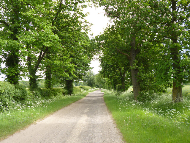
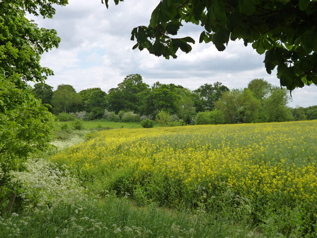
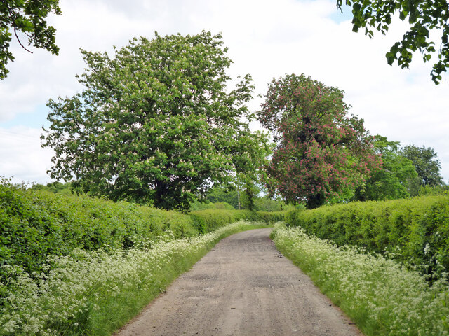
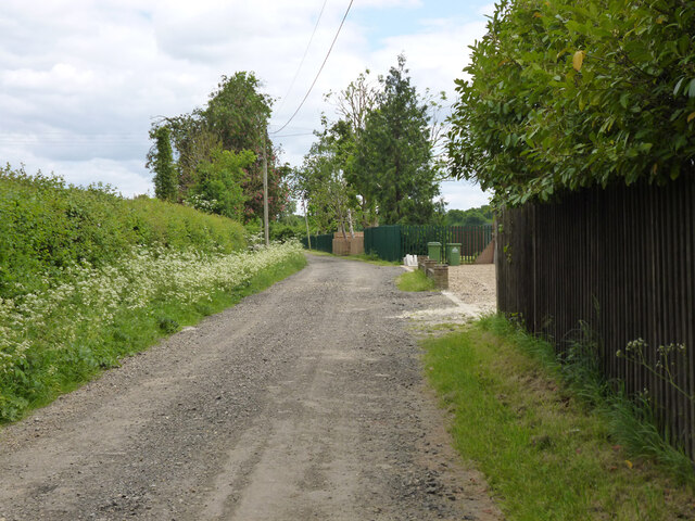
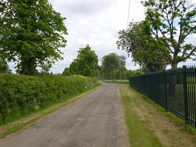
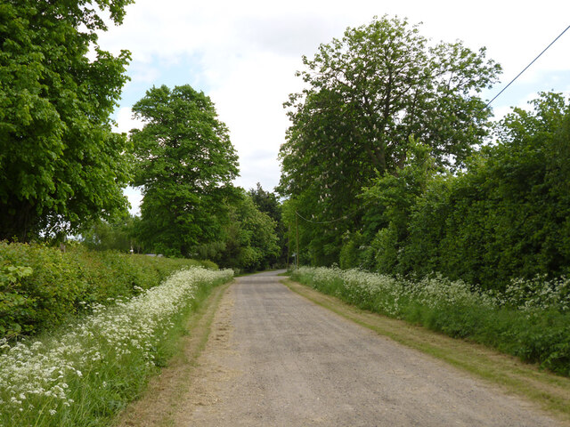
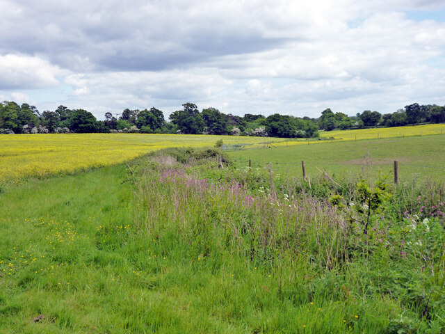
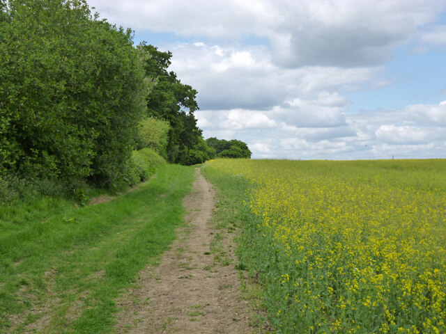
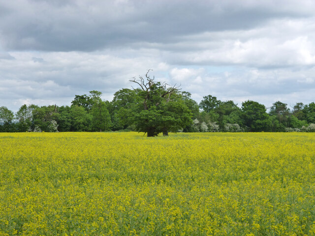
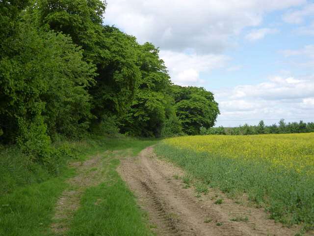
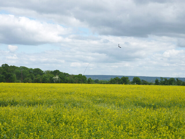
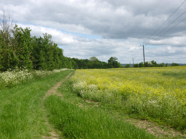
County Brook Plantation is a sprawling woodland located in the picturesque county of Hertfordshire, England. This idyllic forest covers a vast area and is renowned for its natural beauty and rich biodiversity. The plantation is home to a diverse range of flora and fauna, making it an ideal destination for nature enthusiasts and wildlife lovers.

The woodland is primarily composed of various species of deciduous and evergreen trees, creating a captivating and vibrant landscape throughout the year. Ancient oak, beech, and ash trees dominate the area, providing a haven for numerous woodland creatures and bird species. The plantation is also adorned with a variety of wildflowers, adding to its natural charm.

Traversing through County Brook Plantation, visitors can explore a network of well-maintained trails, allowing them to immerse themselves in the tranquility of nature. These paths meander through the forest, offering breathtaking views of the surrounding countryside and the meandering brook that runs through the plantation.

The plantation is not only a sanctuary for wildlife but also serves as an important habitat for rare and endangered species. Conservation efforts have been implemented to preserve the natural balance of the ecosystem, ensuring the long-term sustainability of the plantation.

County Brook Plantation is a popular destination for outdoor activities such as hiking, birdwatching, and photography. Its serene atmosphere and captivating beauty provide the perfect opportunity for visitors to connect with nature and escape the hustle and bustle of everyday life.

If you have any feedback on the listing, please let us know in the comments section below.

County Brook Plantation Images

Images are sourced within 2km of 51.683579/-0.059692687 or Grid Reference TL3400. Thanks to Geograph Open Source API. All images are credited.

Waltham Cross bus stand
High Street, Waltham Cross
Hunger Cure cafe on High Street, Waltham Cross
Waltham Cross Job Centre
Hedworth Avenue at the junction of High Street, Cheshunt
Oldpark Ride Bridleway Cheshunt 73 towards Theobalds Manor.
Oldpark Ride
Bridleway Cheshunt 73 towards Theobalds Manor.
Farmland near Theobalds Manor
Oldpark Ride Bridleway Cheshunt 73 towards Theobalds Manor.
Oldpark Ride
Bridleway Cheshunt 73 towards Theobalds Manor.
Oldpark Ride by Spring Farm Bridleway Cheshunt 73 towards Theobalds Manor.
Oldpark Ride by Spring Farm
Bridleway Cheshunt 73 towards Theobalds Manor.
Oldpark Ride Bridleway Cheshunt 73 towards Theobalds Manor.
Oldpark Ride
Bridleway Cheshunt 73 towards Theobalds Manor.
Oldpark Ride Bridleway Cheshunt 73 towards Theobalds Manor.
Oldpark Ride
Bridleway Cheshunt 73 towards Theobalds Manor.
Drain near Theobalds Manor Heading down to join Theobalds Brook.
Drain near Theobalds Manor
Heading down to join Theobalds Brook.
Footpath Cheshunt 49 by Home Wood Heading over the hill towards Broadfield Farm.
Footpath Cheshunt 49 by Home Wood
Heading over the hill towards Broadfield Farm.
Trees in a rape field Remains of a hedgerow.
Trees in a rape field
Remains of a hedgerow.
Footpath Cheshunt 49 by Home Wood Towards Broadfield Farm.
Footpath Cheshunt 49 by Home Wood
Towards Broadfield Farm.
Bird scarer kite above rape field An ingenious design, using a sort of flexible fishing rod and line to impart a lifelike motion to the 'kite' in the wind.
Bird scarer kite above rape field
An ingenious design, using a sort of flexible fishing rod and line to impart a lifelike motion to the 'kite' in the wind.
Footpath Cheshunt 49 Round the corner of the field on the way to Broadfield Farm.
Footpath Cheshunt 49
Round the corner of the field on the way to Broadfield Farm.
Show me another place!

County Brook Plantation is located at Grid Ref: TL3400 (Lat: 51.683579, Lng: -0.059692687)

Administrative County: Hertfordshire

District: Broxbourne

Police Authority: Hertfordshire

What 3 Words

///vase.switch.files. Near Waltham Cross, Hertfordshire

Nearby Locations

County Brook Plantation

Related Wikis

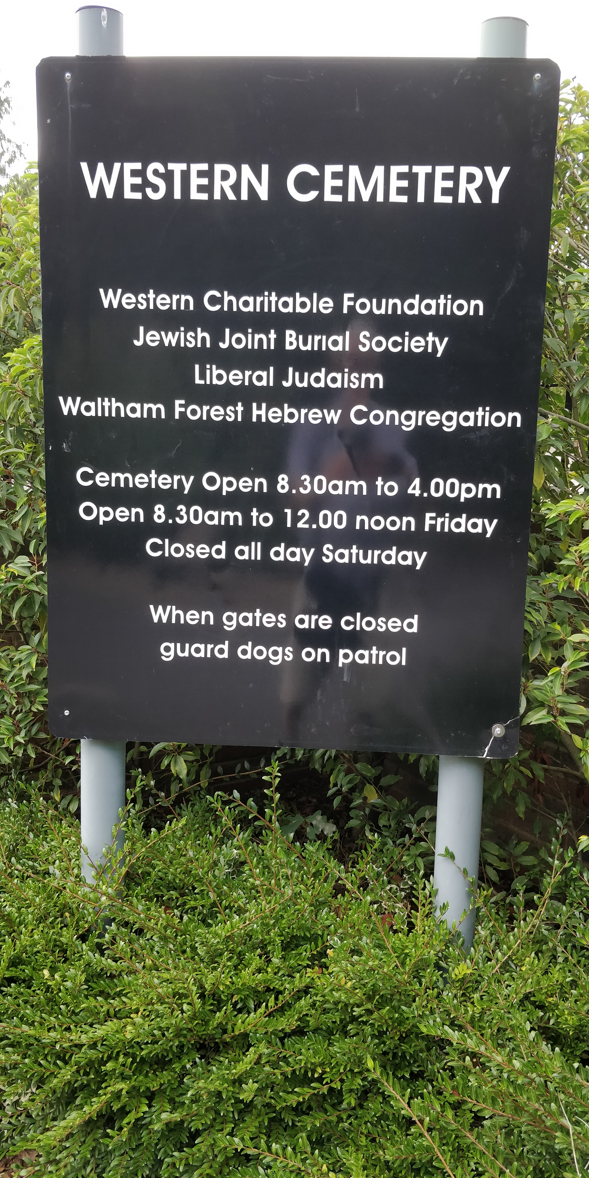
Western Cemetery (Cheshunt)

Western Cemetery is a Jewish cemetery at Bulls Cross Ride in Cheshunt in the Borough of Broxbourne, Hertfordshire EN7 5HT, England. It was established...

Capel Manor College

Capel Manor College is a special environmental college located in Enfield, London. The College has five campuses across the capital, Crystal Palace Park...

Bulls Cross

Bulls Cross is a road and hamlet in Enfield, England, on the outskirts of north London, forming part of the Metropolitan Green Belt. Although it now lies...
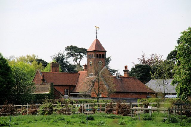
Theobalds House

Theobalds House (also known as Theobalds Palace) in the parish of Cheshunt in the English county of Hertfordshire, north of London, was a significant stately...

Theobalds Brook

Theobalds Brook is a minor tributary of the River Lea which rises in the hills south of Goffs Oak in Hertfordshire, England.

Bullsmoor

Bullsmoor is an area of Enfield, on the outskirts of north London. == Geography == Freezywater is to the south, Bulls Cross is to the west and Enfield...

Silcoates School

Silcoates School is a co-educational independent school in the village of Wrenthorpe near Wakefield, England. The school was founded in 1820 as the Northern...

St Ignatius College, Enfield

St Ignatius College is a Catholic voluntary aided secondary school for boys aged 11–18 in Enfield, London, England, founded by the Society of Jesus in...

Nearby Amenities

Located within 500m of 51.683579,-0.059692687
Created By: YahooApplet 1.0
Lat/Long: 51.6833554/-0.0654856
Created By: YahooApplet 1.0
Lat/Long: 51.6829366/-0.0635706
Created By: YahooApplet 1.0
Lat/Long: 51.6828015/-0.0636276
Created By: YahooApplet 1.0
Lat/Long: 51.683224/-0.0655634
Motorway Junction
Waltham Cross
Not Name: Great Cambridge Road Junction
Ref: 25
Lat/Long: 51.6825738/-0.0589929
Created By: YahooApplet 1.0
Lat/Long: 51.6824255/-0.0589513
Created By: YahooApplet 1.0
Lat/Long: 51.6824719/-0.0566173
Created By: YahooApplet 1.0
Lat/Long: 51.6826183/-0.0549865
Created By: YahooApplet 1.0
Lat/Long: 51.6823987/-0.0579048
Created By: YahooApplet 1.0
Lat/Long: 51.6824919/-0.0574434
Created By: YahooApplet 1.0
Lat/Long: 51.6826981/-0.0564885
Created By: YahooApplet 1.0
Lat/Long: 51.6826116/-0.0574649
Power: tower
Lat/Long: 51.6822341/-0.063873
Power: tower
Lat/Long: 51.6821693/-0.0599211
Power: tower
Lat/Long: 51.6820344/-0.056585
Parking
Created By: Potlatch 0.9c
Lat/Long: 51.6873308/-0.0577347
Barrier: bollard
Lat/Long: 51.6841019/-0.0550074
Fixme: gate?
Lat/Long: 51.6825627/-0.0539141
Barrier: kissing_gate
Lat/Long: 51.6846742/-0.0548878
Fixme: gate?
Lat/Long: 51.6796905/-0.0585153
Fixme: gate?
Lat/Long: 51.6798253/-0.0589063
Barrier: bollard
Lat/Long: 51.6795824/-0.0608095
Barrier: lift_gate
Lat/Long: 51.6796009/-0.0606223
Street Lamp
Lamp Model: Philips MA50
Lamp Type: SOX
Source: Personal memory
Lat/Long: 51.6826118/-0.0543779
Street Lamp
Lamp Type: SON
Source: Personal memory
Lat/Long: 51.6828596/-0.0547053
Street Lamp
Lamp Model: Philips MA50
Lamp Type: SOX
Source: Personal memory
Lat/Long: 51.6824838/-0.0555555
Street Lamp
Lamp Type: SON
Source: Personal memory
Lat/Long: 51.682414/-0.0563037
Street Lamp
Lamp Model: Philips MA50
Lamp Type: SOX
Source: Personal memory
Lat/Long: 51.683394/-0.0530813
Street Lamp
Lamp Model: Philips MA50
Lamp Type: SOX
Source: Personal memory
Lat/Long: 51.6825254/-0.0551532
Street Lamp
Lamp Model: Philips MA50
Lamp Type: SOX
Source: Personal memory
Lat/Long: 51.6827898/-0.0527873
Street Lamp
Lamp Model: Philips MA50
Lamp Type: SOX
Source: Personal memory
Lat/Long: 51.6825685/-0.0547616
Street Lamp
Lamp Type: SON
Source: Personal memory
Lat/Long: 51.6830924/-0.0527203
Street Lamp
Lamp Type: SON
Source: Personal memory
Lat/Long: 51.682384/-0.0567062
Street Lamp
Lamp Model: Philips MA50
Lamp Type: SOX
Source: Personal memory
Lat/Long: 51.6826568/-0.0539702
Street Lamp
Lamp Type: SON
Source: Personal memory
Lat/Long: 51.6830476/-0.0532059
Street Lamp
Lamp Type: SON
Source: Personal memory
Lat/Long: 51.6827266/-0.0557217
Street Lamp
Lamp Type: SON
Source: Personal memory
Lat/Long: 51.6827898/-0.0552417
Street Lamp
Lamp Type: SON
Source: Personal memory
Lat/Long: 51.6829395/-0.0541231
Street Lamp
Lamp Type: SON
Source: Personal memory
Lat/Long: 51.6824521/-0.0559202
Street Lamp
Lamp Type: SON
Source: Personal memory
Lat/Long: 51.6829977/-0.0536939
Street Lamp
Lamp Model: Philips MA50
Lamp Type: SOX
Source: Personal memory
Lat/Long: 51.6834302/-0.0526264
Street Lamp
Lamp Model: Philips MA50
Lamp Type: SOX
Source: Personal memory
Lat/Long: 51.6827565/-0.0531844
Street Lamp
Lamp Model: Philips MA50
Lamp Type: SOX
Source: Personal memory
Lat/Long: 51.6827183/-0.0535734
Street Lamp
Lamp Type: SON
Source: Personal memory
Lat/Long: 51.6825369/-0.0579077
Street Lamp
Lamp Model: Philips MA50
Lamp Type: SOX
Source: Personal memory
Lat/Long: 51.6833407/-0.0535763
Street Lamp
Lamp Model: Philips MA50
Lamp Type: SOX
Source: Personal memory
Lat/Long: 51.6832338/-0.0540882
Street Lamp
Lamp Type: SON
Source: Personal memory
Lat/Long: 51.6826533/-0.0562742
Street Lamp
Lamp Type: SON
Source: Personal memory
Lat/Long: 51.6828297/-0.0568778
Street Lamp
Lamp Model: Philips MA50
Lamp Type: SOX
Source: Personal memory
Lat/Long: 51.6832826/-0.0538736
Street Lamp
Lamp Type: SON
Source: Personal memory
Lat/Long: 51.6828796/-0.0564807
Street Lamp
Lamp Type: SON
Source: Personal memory
Lat/Long: 51.6825171/-0.0584657
Street Lamp
Lamp Type: SON
Source: Personal memory
Lat/Long: 51.6827898/-0.0572748
Street Lamp
Lamp Type: SON
Source: Personal memory
Lat/Long: 51.6825236/-0.0601834
Street Lamp
Lamp Type: SON
Source: Personal memory
Lat/Long: 51.6827599/-0.057669
Street Lamp
Lamp Type: SON
Source: Personal memory
Lat/Long: 51.6829411/-0.0560865
Street Lamp
Lamp Type: SON
Source: Personal memory
Lat/Long: 51.6826118/-0.0567893
Street Lamp
Lamp Model: Philips MA50
Lamp Type: SOX
Source: Personal memory
Lat/Long: 51.6831108/-0.0549198
Street Lamp
Lamp Type: SON
Source: Personal memory
Lat/Long: 51.6826833/-0.0597729
Street Lamp
Lamp Type: SON
Source: Personal memory
Lat/Long: 51.6826784/-0.0593652
Street Lamp
Lamp Type: SON
Source: Personal memory
Lat/Long: 51.6825569/-0.0607628
Street Lamp
Lamp Type: SON
Source: Personal memory
Lat/Long: 51.6830027/-0.0556949
Street Lamp
Lamp Type: SON
Source: Personal memory
Lat/Long: 51.6825685/-0.0573445
Street Lamp
Lamp Type: SON
Source: Personal memory
Lat/Long: 51.6827233/-0.0581303
Street Lamp
Lamp Type: SON
Source: Personal memory
Lat/Long: 51.682695/-0.0601834
Street Lamp
Lamp Model: Philips MA50
Lamp Type: SOX
Source: Personal memory
Lat/Long: 51.6831756/-0.0545174
Street Lamp
Lamp Type: SON
Source: Personal memory
Lat/Long: 51.6825985/-0.0613447
Street Lamp
Lamp Type: SON
Source: Personal memory
Lat/Long: 51.6825121/-0.0590451
Street Lamp
Lamp Type: SON
Source: Personal memory
Lat/Long: 51.6825171/-0.059612
Street Lamp
Lamp Type: SON
Source: Personal memory
Lat/Long: 51.6826899/-0.0589995
Street Lamp
Lamp Type: SON
Source: Personal memory
Lat/Long: 51.6827016/-0.0585515
Street Lamp
Lamp Type: SON
Source: Personal memory
Lat/Long: 51.6830625/-0.0553034
Street Lamp
Lamp Type: SON
Source: Personal memory
Lat/Long: 51.6826467/-0.0619081
Crossing
Crossing: unmarked
Lat/Long: 51.6799499/-0.0607213
Restaurant
Terrace Restaurant
Lat/Long: 51.6817804/-0.0545614
Historic: milestone
Lat/Long: 51.6807686/-0.0579937
Entrance: exit
Lat/Long: 51.6808031/-0.0578522
Entrance: main
Lat/Long: 51.6808054/-0.0577959
Speed Camera
Lat/Long: 51.6827017/-0.0613753
Speed Camera
Lat/Long: 51.6825332/-0.0614674
The data included in this document is from www.openstreetmap.org. The data is made available under ODbL.

Have you been to County Brook Plantation?

Leave your review of County Brook Plantation below (or comments, questions and feedback).