Blize Wood

Wood, Forest in Surrey Tandridge

England

Blize Wood

Succombs Hill This road is steep and on the bends quite narrow but a useful road to get down from the high ground of Warlingham to the Caterham Valley.
Succombs Hill Credit: Nigel Freeman

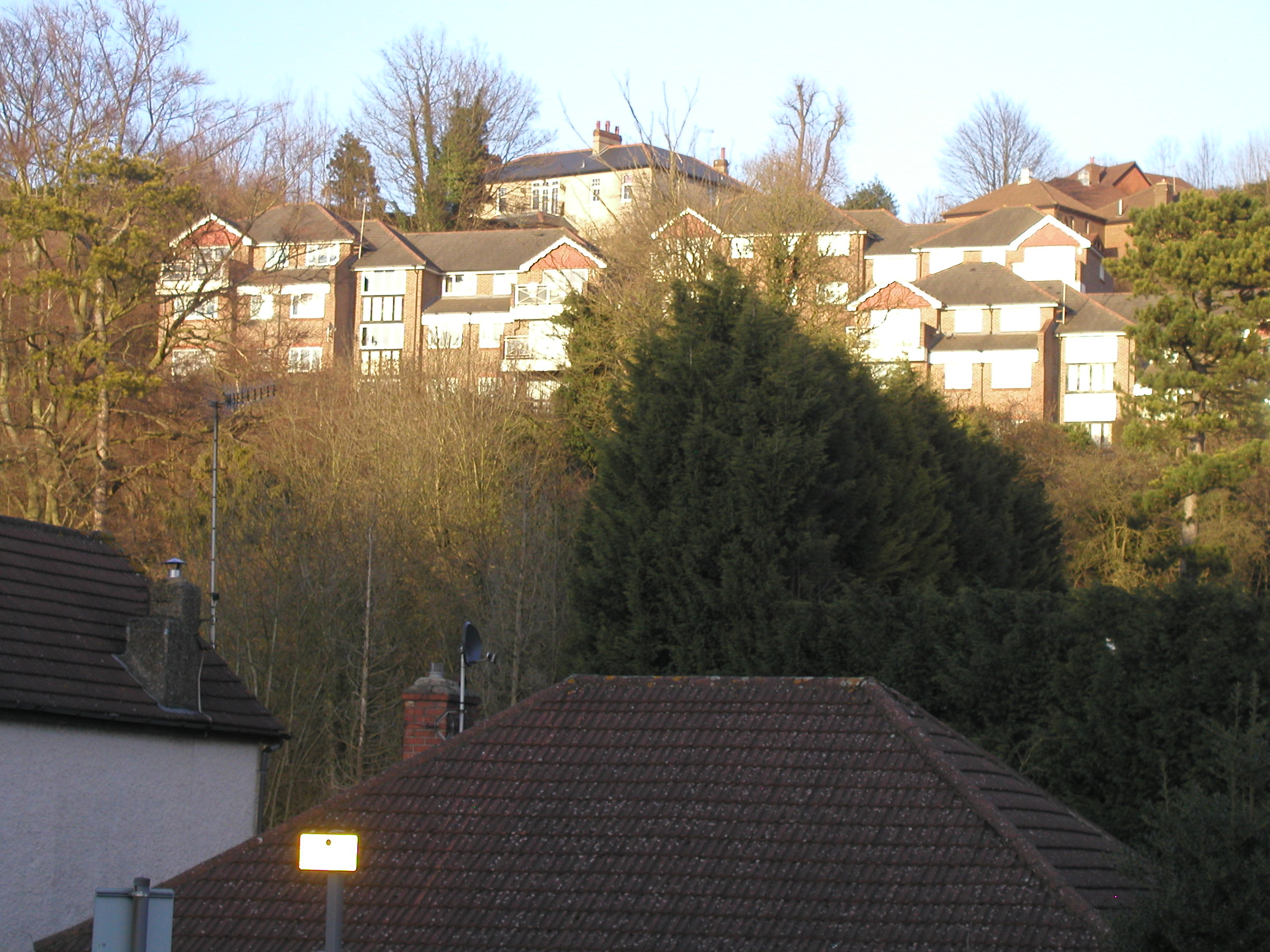
Blize Wood is a serene and enchanting forest nestled in the beautiful county of Surrey, England. Covering an area of approximately 100 acres, this woodland is a haven for nature enthusiasts and those seeking a peaceful retreat from the hustle and bustle of everyday life.

The wood is predominantly composed of native deciduous trees, including oak, beech, and birch, creating a diverse and vibrant ecosystem. The canopy of the trees forms a natural shelter, allowing sunlight to filter through and create a dappled effect on the forest floor. This, coupled with the gentle rustling of leaves and the sweet fragrance of wildflowers, creates a tranquil and captivating atmosphere.

Blize Wood is home to a rich variety of wildlife, making it a popular spot for birdwatchers and animal lovers. Visitors may be lucky enough to spot species such as woodpeckers, owls, and deer as they explore the well-maintained footpaths that wind through the forest. The wood also features a picturesque pond, where ducks and other waterfowl can be observed gliding across its tranquil surface.

Nature lovers are not the only ones drawn to Blize Wood; it also offers recreational opportunities for outdoor enthusiasts. The well-marked trails are suitable for walkers of all abilities, and there are designated areas for picnicking and enjoying the natural surroundings. The wood is accessible year-round and provides a breathtaking display of autumn colors as the leaves change hue.

Blize Wood serves as a reminder of the importance of preserving and appreciating the natural beauty that Surrey has to offer. It is truly a hidden gem, providing a sanctuary for both wildlife and visitors seeking solace in the great outdoors.

If you have any feedback on the listing, please let us know in the comments section below.

Blize Wood Images

Images are sourced within 2km of 51.302044/-0.082310454 or Grid Reference TQ3357. Thanks to Geograph Open Source API. All images are credited.

Succombs Hill This road is steep and on the bends quite narrow but a useful road to get down from the high ground of Warlingham to the Caterham Valley.
Succombs Hill
This road is steep and on the bends quite narrow but a useful road to get down from the high ground of Warlingham to the Caterham Valley.
The Caterham Bypass This Bypass road dates from the 1930s. It was entirely dual carriageway until recent years when one lane on the northern route was closed. This was a road safety measure following several serious accidents.
The Caterham Bypass
This Bypass road dates from the 1930s. It was entirely dual carriageway until recent years when one lane on the northern route was closed. This was a road safety measure following several serious accidents.
Woldingham Road CR3 Looking west, from the end of Halliloo Valley Road.
Woldingham Road CR3
Looking west, from the end of Halliloo Valley Road.
Warlingham - Westhall Road A typical residential road in this area, looking downhill as the roads goes towards Whyteleafe.
Warlingham - Westhall Road
A typical residential road in this area, looking downhill as the roads goes towards Whyteleafe.
Whyteleafe station Whyteleafe station, situated near a level crossing.  The buildings next to the station are some local office buildings and the centre of the town is just around the corner.
Whyteleafe station
Whyteleafe station, situated near a level crossing. The buildings next to the station are some local office buildings and the centre of the town is just around the corner.
RAF War Memorial Set inside the remains of a second World War munitions bunker, this war memorial commemorates the lives lost of pilots who flew on missions from nearby Kenley aerodrome.
RAF War Memorial
Set inside the remains of a second World War munitions bunker, this war memorial commemorates the lives lost of pilots who flew on missions from nearby Kenley aerodrome.
Kenley Airfield A strange airfield - most airfields are strictly out of bounds and surrounded by barbed wire fences.  This airfield was protected with numerous signs warning that transgressing across the yellow line was dangerous.  The line was tenuous at best at times.  Outside the line, the area was known as Kenley Common. Inside - Kenley airfield where gliders could be seen landing!
Kenley Airfield
A strange airfield - most airfields are strictly out of bounds and surrounded by barbed wire fences. This airfield was protected with numerous signs warning that transgressing across the yellow line was dangerous. The line was tenuous at best at times. Outside the line, the area was known as Kenley Common. Inside - Kenley airfield where gliders could be seen landing!
Down train to Caterham The Class 455 train, still in Connex South Central livery, is photographed looking north-west from the overbridge carrying the London Loop walk
Down train to Caterham
The Class 455 train, still in Connex South Central livery, is photographed looking north-west from the overbridge carrying the London Loop walk
"Skaterham", Caterham. Surrey This building, formerly the chapel of the Coldstream Guards barracks (now removed) has been converted into a roller-skating rink for youngsters.
"Skaterham", Caterham. Surrey
This building, formerly the chapel of the Coldstream Guards barracks (now removed) has been converted into a roller-skating rink for youngsters.
De Stafford College, Caterham, Surrey A comprehensive school of Surrey Education Authority
De Stafford College, Caterham, Surrey
A comprehensive school of Surrey Education Authority
Mature trees at Salmons Lane West, Caterham, Surrey A fine stand of mixed deciduous trees including beech, oak and ash.
Mature trees at Salmons Lane West, Caterham, Surrey
A fine stand of mixed deciduous trees including beech, oak and ash.
Footbridge over Caterham branch railway, Surrey Looking northwestwards towards Purley.  The bridge allows pedestrian access from Stafford Road to Croydon Road, Caterham.
Footbridge over Caterham branch railway, Surrey
Looking northwestwards towards Purley. The bridge allows pedestrian access from Stafford Road to Croydon Road, Caterham.
Caterham On The Hill old fire station Caterham On The Hill old fire station, High Street, Caterham, Surrey. This is a 'replica' of the original, built to the original plans in 1998 - see <a href="https://www.geograph.org.uk/photo/587717">TQ3355 : Fire Station plaque</a>
Caterham On The Hill old fire station
Caterham On The Hill old fire station, High Street, Caterham, Surrey. This is a 'replica' of the original, built to the original plans in 1998 - see TQ3355 : Fire Station plaque
Fire Station plaque This plaque on the door of <a href="https://www.geograph.org.uk/photo/587144">SK4461 : Mansfield Road</a> explains its origins
Fire Station plaque
This plaque on the door of SK4461 : Mansfield Road explains its origins
Former building at RAF Kenley 1979 I took this photo in 1979, can anyone identify its purpose at RAF Kenley?  Many such buildings at RAF Kenley have been demolished over the last few decades but one or two survive.  Most recently, many new houses have been built and I was pleased to see that some of the roads have been named after pilots who flew from Kenley during WWII.
Former building at RAF Kenley 1979
I took this photo in 1979, can anyone identify its purpose at RAF Kenley? Many such buildings at RAF Kenley have been demolished over the last few decades but one or two survive. Most recently, many new houses have been built and I was pleased to see that some of the roads have been named after pilots who flew from Kenley during WWII.
Officer's Mess Kenley Aerodrome 1979 This is the officers mess photographed in 1979 before it was renovated and used as offices for an organisation researching into radio transmitting.  On the original photo, it is possible to see battle damage from the raid on August 18th 1940.
Officer's Mess Kenley Aerodrome 1979
This is the officers mess photographed in 1979 before it was renovated and used as offices for an organisation researching into radio transmitting. On the original photo, it is possible to see battle damage from the raid on August 18th 1940.
Miniature railway at Upper Warlingham 27 September 1987 was the first day of electric operation to East Grinstead on the (then) Southern Region of British Railways.  To celebrate this auspicious occasion, various events were arranged at stations along the line, including the provision of this small railway at Upper Warlingham.  Perhaps it was not well publicised, but it seemed that few children turned up to see it.
Miniature railway at Upper Warlingham
27 September 1987 was the first day of electric operation to East Grinstead on the (then) Southern Region of British Railways. To celebrate this auspicious occasion, various events were arranged at stations along the line, including the provision of this small railway at Upper Warlingham. Perhaps it was not well publicised, but it seemed that few children turned up to see it.
Upper Warlingham station On the first day of electric services on the East Grinstead line, a '4-CIG' unit is seen on a Down working.
Upper Warlingham station
On the first day of electric services on the East Grinstead line, a '4-CIG' unit is seen on a Down working.
Show me another place!

Blize Wood is located at Grid Ref: TQ3357 (Lat: 51.302044, Lng: -0.082310454)

Administrative County: Surrey

District: Tandridge

Police Authority: Surrey

What 3 Words

///rating.vivid.thing. Near Whyteleafe, Surrey

Related Wikis

Sutton Common Rovers F.C.

Sutton Common Rovers Football Club is a semi-professional football club currently competing in the Isthmian League South Central Division. Originally based...

AC London F.C.

Academic Club London Football Club, commonly known as AC London, was a semi-professional football club based in London, England. The club was expelled...

Whyteleafe F.C.

Whyteleafe Football Club was an English football club based in Whyteleafe, Surrey. The club was established in 1946 and joined the Athenian League in 1981...

AFC Whyteleafe

AFC Whyteleafe is an English football club based in Whyteleafe, Surrey. The club was established in 2021 and plays at the Whyteleafe Stadium in Church...

Whyteleafe South railway station

Whyteleafe South railway station serves part of the suburban village of Whyteleafe in the district of Tandridge, Surrey, England. The station and all trains...

Whyteleafe

Whyteleafe is a village in the district of Tandridge, Surrey, England, with a few streets falling inside the London Borough of Croydon. The village, in...

Upper Warlingham railway station

Upper Warlingham railway station is on the Oxted line serving Warlingham and Whyteleafe in Surrey, England. It is in Travelcard Zone 6, 15 miles 33 chains...

Sunnydown School

Sunnydown School is a special boarding secondary school situated in the town of Caterham in Surrey, England. Founded in 1949, it is the second oldest special...

Nearby Amenities

Located within 500m of 51.302044,-0.082310454
Traffic Calming: hump
Lat/Long: 51.3055519/-0.0862091
Traffic Calming: hump
Lat/Long: 51.3009383/-0.0883986
Traffic Calming: hump
Lat/Long: 51.3029155/-0.0874143
Railway: level_crossing
Lat/Long: 51.3031037/-0.0766583
Bus Stop
Badgers Walk
Bench: no
Naptan AtcoCode: 40004410105A
Naptan Bearing: N
Naptan CommonName: Badgers Walk
Naptan Indicator: Opp
Naptan Landmark: Badgers Walk
Naptan NaptanCode: surdmwmg
Naptan Street: Whyteleafe Hill
Naptan Verified: no
Public Transport: platform
Shelter: no
Source: naptan_import
Tactile Paving: no
Wheelchair: limited
Lat/Long: 51.3055241/-0.0862987
Bus Stop
Badgers Walk
Bench: yes
Naptan AtcoCode: 40004410105B
Naptan Bearing: S
Naptan CommonName: Badgers Walk
Naptan Indicator: adj
Naptan Landmark: Badgers Walk
Naptan NaptanCode: surdmwmj
Naptan Street: Whyteleafe Hill
Naptan Verified: no
Public Transport: platform
Shelter: no
Source: naptan_import
Tactile Paving: no
Wheelchair: limited
Lat/Long: 51.3050984/-0.0862017
Bus Stop
Whyteleafe South Station
Local Ref: B
Naptan AtcoCode: 40004410114A
Naptan Bearing: NW
Naptan CommonName: Whyteleafe South Railway Station
Naptan Indicator: adj
Naptan Landmark: Whyteleafe South Station
Naptan NaptanCode: surdpada
Naptan Street: Godstone Road
Naptan Verified: no
Public Transport: platform
Ref: 74243
Shelter: yes
Source: naptan_import
Wheelchair: yes
Lat/Long: 51.3034399/-0.0765149
Bus Stop
Whyteleafe South Station
Local Ref: A
Naptan AtcoCode: 40004410114B
Naptan Bearing: SE
Naptan CommonName: Whyteleafe South Railway Station
Naptan Indicator: Opp
Naptan Landmark: Whyteleafe South Station
Naptan NaptanCode: surdpadg
Naptan Street: Godstone Road
Naptan Verified: no
Public Transport: platform
Ref: 55106
Source: naptan_import
Wheelchair: yes
Lat/Long: 51.3038682/-0.0765432
Bus Stop
Radio Agency
Bench: no
Naptan AtcoCode: 40004410226A
Naptan Bearing: N
Naptan CommonName: Radio Agency
Naptan Indicator: O/s
Naptan Landmark: Radio Agency
Naptan NaptanCode: surdpmgj
Naptan Street: Whyteleafe Hill
Naptan Verified: no
Public Transport: platform
Shelter: no
Source: naptan_import
Tactile Paving: no
Wheelchair: no
Lat/Long: 51.3014552/-0.0883177
Bus Stop
Radio Agency
Bench: no
Naptan AtcoCode: 40004410226B
Naptan Bearing: S
Naptan CommonName: Radio Agency
Naptan Indicator: Opp
Naptan Landmark: Radio Agency
Naptan NaptanCode: surdpmgm
Naptan Street: Whyteleafe Hill
Naptan Verified: no
Public Transport: platform
Shelter: no
Source: naptan_import
Tactile Paving: no
Wheelchair: limited
Lat/Long: 51.3022353/-0.0877252
Barrier: lift_gate
Lat/Long: 51.3027193/-0.0753146
Traffic Calming: hump
Lat/Long: 51.3041582/-0.0866285
Barrier: kissing_gate
Lat/Long: 51.3053006/-0.0863503
Crossing
Lat/Long: 51.3029265/-0.0760207
Crossing
Lat/Long: 51.3029385/-0.0761732
Railway: level_crossing
Lat/Long: 51.3031187/-0.0766181
Post Box
Post Box Type: pillar
Ref: CR3 1
Royal Cypher: EVIIR
Royal Cypher Wikidata: Q33102324
Lat/Long: 51.3033164/-0.0764619
Traffic Calming: hump
Lat/Long: 51.3035311/-0.0870097
Joysons Hill
Natural: peak
Lat/Long: 51.3063297/-0.083952
Whyteleafe South
Naptan AtcoCode: 9100WHYTLFS
Network: National Rail
Network Website: https://www.nationalrail.co.uk/stations/whs/
Network Wikidata: Q26334
Postal Code: CR3 0BD
Public Transport: station
Railway: station
Ref Crs: WHS
Wikidata: Q2674703
Wikipedia: en:Whyteleafe South railway station
Lat/Long: 51.3037508/-0.0772314
Fuel
Shell
Addr City: Whyteleafe
Addr Country: GB
Addr Housenumber: 408
Addr Postcode: CR3 0BB
Addr Street: Godstone Road
Addr Suburb: Caterham
Addr Village: Whyteleafe
Brand: Shell
Brand Wikidata: Q110716465
Fhrs Authority: Tandridge
Fhrs Id: 106416
Opening Hours: 24/7
Phone: +44 1883 625180
Ref Navads: NVDS353_12038638
Website: https://find.shell.com/gb/fuel/12038638-shell-little-waitrose-whyteleafe
Lat/Long: 51.3042223/-0.077035
Post Box
Collection Times: Mo-Fr 09:00, Sa 07:00
Drive Through: no
Operator: Royal Mail
Post Box Type: pillar
Ref: CR3 191D
Royal Cypher: GR
Royal Cypher Wikidata: Q33102273
Source: survey
Lat/Long: 51.3050761/-0.0862519
Coal tax obelisk
Historic: boundary_stone
Inscription: 14 & 15 VICT C 146
Material: stone
Note: Coal tax boundary marker 170
Lat/Long: 51.3044716/-0.0776736
Coal tax post
Historic: boundary_stone
Inscription: 24 & 25 VICT CAP 42
Material: iron
Note: Coal tax boundary marker 171
Lat/Long: 51.3045993/-0.0770998
Whyteleafe South
Public Transport: stop_position
Railway: stop
Ref: 1
Train: yes
Lat/Long: 51.3039497/-0.0774429
Whyteleafe South
Public Transport: stop_position
Railway: stop
Ref: 2
Train: yes
Lat/Long: 51.3033723/-0.0768531
Speed Camera
Direction: 350
Maxspeed: 30 mph
Lat/Long: 51.3042494/-0.0768671
The data included in this document is from www.openstreetmap.org. The data is made available under ODbL.

Have you been to Blize Wood?

Leave your review of Blize Wood below (or comments, questions and feedback).