Common Plantation

Wood, Forest in Surrey Tandridge

England

Common Plantation

Road Junction of B2037 with minor road to Burstow. Newhouse Farm in the Background A junction with a busy road. Most of this square is farmland, with the B road cutting across from E-W. Newhouse Farm dominates the view in the distance. View taken from Burstow road, looking SSE.
Road Junction of B2037 with minor road to Burstow. Newhouse Farm in the Background Credit: Pete Chapman

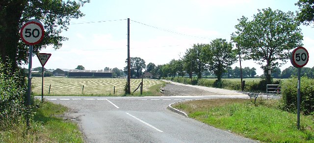
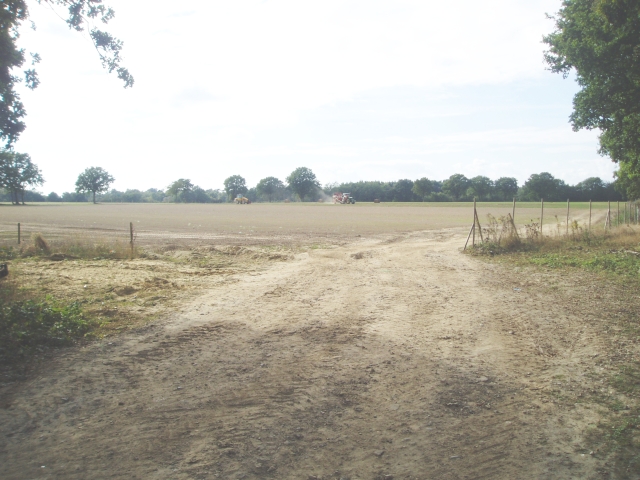
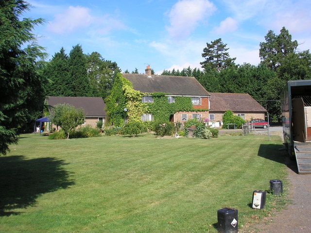
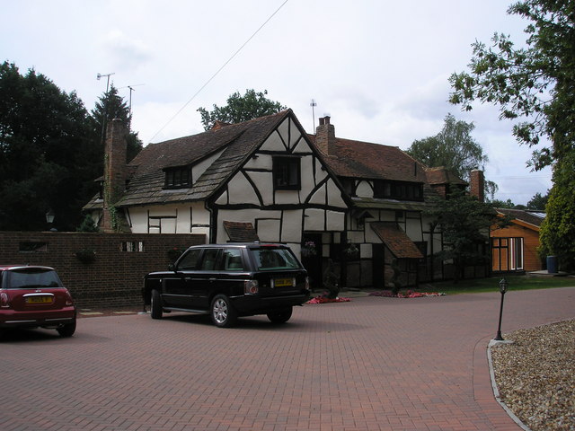
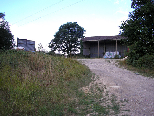
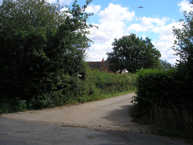
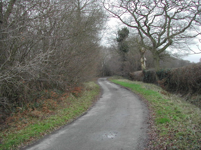
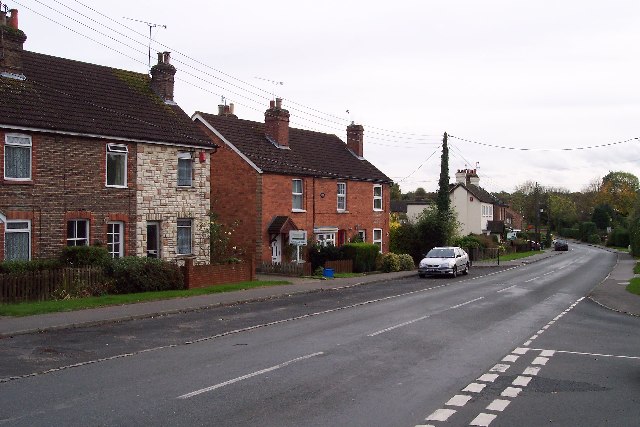
Common Plantation, Surrey is a picturesque woodland located in the county of Surrey, England. Covering an expansive area, it is a popular destination for nature enthusiasts, hikers, and birdwatchers. The plantation is situated near the town of Wood, within close proximity to Forest, making it easily accessible to visitors from the surrounding areas.

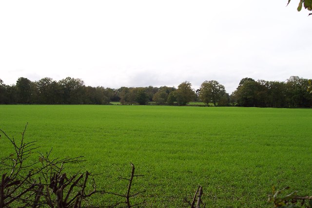
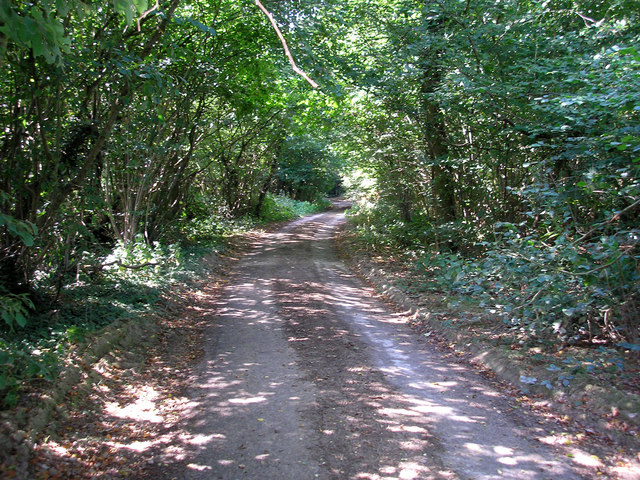
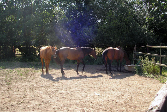
The woodland is characterized by its diverse range of trees, including oak, beech, and birch, which create a stunning canopy overhead. The forest floor is carpeted with a variety of flora, such as bluebells, wild garlic, and ferns, adding to the enchanting atmosphere.

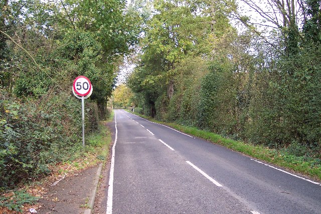
Common Plantation boasts numerous walking trails and pathways, catering to both leisurely strolls and more challenging hikes. These trails offer visitors the opportunity to explore the plantation's natural beauty at their own pace. The woodland also features designated picnic areas, allowing visitors to relax and enjoy the tranquility of the surroundings.

Birdwatchers flock to the plantation, attracted by its rich avian population. The woodland provides a habitat for a wide range of bird species, including woodpeckers, nuthatches, and various species of tit. Binoculars and cameras are a must for those hoping to catch a glimpse of these feathered inhabitants.

Overall, Common Plantation, Surrey is a haven of natural beauty and serenity. Its diverse tree species, vibrant flora, and abundant birdlife make it a must-visit destination for nature lovers seeking an escape from the hustle and bustle of everyday life.

If you have any feedback on the listing, please let us know in the comments section below.

Common Plantation Images

Images are sourced within 2km of 51.150244/-0.09558769 or Grid Reference TQ3340. Thanks to Geograph Open Source API. All images are credited.

Road Junction of B2037 with minor road to Burstow. Newhouse Farm in the Background A junction with a busy road. Most of this square is farmland, with the B road cutting across from E-W. Newhouse Farm dominates the view in the distance. View taken from Burstow road, looking SSE.
Road Junction of B2037 with minor road to Burstow. Newhouse Farm in the Background
A junction with a busy road. Most of this square is farmland, with the B road cutting across from E-W. Newhouse Farm dominates the view in the distance. View taken from Burstow road, looking SSE.
Turf Farming Perry Farm is flat and ideal for producing turves.
Turf Farming
Perry Farm is flat and ideal for producing turves.
Road in a rural area Taken from TQ322400 looking almost north shows the smaller of two roads in the square, which is very rural.
Road in a rural area
Taken from TQ322400 looking almost north shows the smaller of two roads in the square, which is very rural.
A very rural square Taken from the b.o.a.t. at TQ327405 looking west. A very rural square.
A very rural square
Taken from the b.o.a.t. at TQ327405 looking west. A very rural square.
Sheridan Farm, West Park Road, Surrey Sheridan Farm lies just south of the B2028 near Domewood.  The breeding and rearing of racehorses is an important activity here.
Sheridan Farm, West Park Road, Surrey
Sheridan Farm lies just south of the B2028 near Domewood. The breeding and rearing of racehorses is an important activity here.
Paygate, West Park Road (B2028), Surrey This splendid Tudor house lies on the south side of the B2028, though not easily visible from the road, owing to the fence.
Paygate, West Park Road (B2028), Surrey
This splendid Tudor house lies on the south side of the B2028, though not easily visible from the road, owing to the fence.
Open barns, Chithurst Farm, Surrey Chithurst Farm is reached by a long and narrow lane leading southwards from Croydonbarns Lane
Open barns, Chithurst Farm, Surrey
Chithurst Farm is reached by a long and narrow lane leading southwards from Croydonbarns Lane
Chithurst Lane, Surrey The status of this lane south of Chithurst Farm is not known to me.  There are no public footpath or bridleway markings on the OS map, where it is just shown as a 'white' road.  Whether it actually emerges anywhere at the southern end I do not know.  As can be seen from the photograph, it is barely motorable.
Chithurst Lane, Surrey
The status of this lane south of Chithurst Farm is not known to me. There are no public footpath or bridleway markings on the OS map, where it is just shown as a 'white' road. Whether it actually emerges anywhere at the southern end I do not know. As can be seen from the photograph, it is barely motorable.
Dowlands Farm, Dowlands Lane, Surrey Dowlands Farm drowses in the late morning sun, while high above an airliner begins its landing approach to Gatwick Airport.
Dowlands Farm, Dowlands Lane, Surrey
Dowlands Farm drowses in the late morning sun, while high above an airliner begins its landing approach to Gatwick Airport.
The Hedgehog Inn, Copthorne Formerly the Effingham Arms the Hedgehog is now a restaurant pub and has acquired the adjacent house (in the left of shot) to provide guest rooms. In a sense it's assumed the function of the old-fashioned inn. The exterior has hardly changed since the 1950s <span class="nowrap"><a title="http://www.francisfrith.com/search/england/west+sussex/copthorne/photos/copthorne_C422005.htm" rel="nofollow ugc noopener" href="http://www.francisfrith.com/search/england/west+sussex/copthorne/photos/copthorne_C422005.htm">Link</a><img style="margin-left:2px;" alt="External link" title="External link - shift click to open in new window" src="https://s1.geograph.org.uk/img/external.png" width="10" height="10"/></span>.

It's the occasional meeting place for local members of the Guinea Pig Club <span class="nowrap"><a title="http://en.wikipedia.org/wiki/Guinea_Pig_Club" rel="nofollow ugc noopener" href="http://en.wikipedia.org/wiki/Guinea_Pig_Club">Link</a><img style="margin-left:2px;" alt="External link" title="External link - shift click to open in new window" src="https://s1.geograph.org.uk/img/external.png" width="10" height="10"/></span> who will have witnessed the changes over the years.
The Hedgehog Inn, Copthorne
Formerly the Effingham Arms the Hedgehog is now a restaurant pub and has acquired the adjacent house (in the left of shot) to provide guest rooms. In a sense it's assumed the function of the old-fashioned inn. The exterior has hardly changed since the 1950s LinkExternal link. It's the occasional meeting place for local members of the Guinea Pig Club LinkExternal link who will have witnessed the changes over the years.
Accommodation for the Hedgehog House converted into guest rooms to provide accommodation for <a href="https://www.geograph.org.uk/photo/620618">TQ3340 : The Hedgehog Inn, Copthorne</a>. The structure built on to the right of the house looks new but may simply have been repointed as it appears on a photograph from the 1950s <span class="nowrap"><a title="http://www.francisfrith.com/search/england/west+sussex/copthorne/photos/copthorne_C422005.htm" rel="nofollow ugc noopener" href="http://www.francisfrith.com/search/england/west+sussex/copthorne/photos/copthorne_C422005.htm">Link</a><img style="margin-left:2px;" alt="External link" title="External link - shift click to open in new window" src="https://s1.geograph.org.uk/img/external.png" width="10" height="10"/></span>.
Accommodation for the Hedgehog
House converted into guest rooms to provide accommodation for TQ3340 : The Hedgehog Inn, Copthorne. The structure built on to the right of the house looks new but may simply have been repointed as it appears on a photograph from the 1950s LinkExternal link.
Footpath near Chithurst Farm This public footpath, Horne FP351, heads through the gateway towards the stile and footbridge into the copse opposite (not the gate a little to the left).
Footpath near Chithurst Farm
This public footpath, Horne FP351, heads through the gateway towards the stile and footbridge into the copse opposite (not the gate a little to the left).
Chithurst Lane The lane is a no-through road for motor vehicles, but still maintained by the county council as far as Brick Barns Farm, useable if you don't mind the odd pothole (see also <a href="https://www.geograph.org.uk/photo/212606">TQ3341 : Chithurst Lane, Surrey</a>). Beyond Brick Barns Farm is a bridleway which connects with West Park Road (B2028), although the entire route was perhaps once a through road. For a minor country lane, it cuts a remarkably wide swathe through the fields: nearly 30m between the field boundaries on either side.
Chithurst Lane
The lane is a no-through road for motor vehicles, but still maintained by the county council as far as Brick Barns Farm, useable if you don't mind the odd pothole (see also TQ3341 : Chithurst Lane, Surrey). Beyond Brick Barns Farm is a bridleway which connects with West Park Road (B2028), although the entire route was perhaps once a through road. For a minor country lane, it cuts a remarkably wide swathe through the fields: nearly 30m between the field boundaries on either side.
Bridleway at Brick Barns Farm Public bridleway Horne 346 runs south from the farm (in continuation of Chithurst Lane), round the corner of Downswood Cottage, and then east out to West Park Road (B2028). Like Chithurst Lane (see <a href="https://www.geograph.org.uk/photo/643293">TQ3341 : Chithurst Lane</a>), the bridleway cuts an extravagant 17m between boundaries, suggesting a more important origin than its lowly status today.
Bridleway at Brick Barns Farm
Public bridleway Horne 346 runs south from the farm (in continuation of Chithurst Lane), round the corner of Downswood Cottage, and then east out to West Park Road (B2028). Like Chithurst Lane (see TQ3341 : Chithurst Lane), the bridleway cuts an extravagant 17m between boundaries, suggesting a more important origin than its lowly status today.
Garden Centre at Snowhill Some large gold fish in the pond.
Garden Centre at Snowhill
Some large gold fish in the pond.
Horses at Sheridan Farm
Haskins Garden Centre at Snowhill
Show me another place!

Common Plantation is located at Grid Ref: TQ3340 (Lat: 51.150244, Lng: -0.09558769)

Administrative County: Surrey

District: Tandridge

Police Authority: Surrey

What 3 Words

///budget.hardly.crass. Near Copthorne, West Sussex

Nearby Locations

Common Plantation

Related Wikis

A264 road

The A264 is an east–west road in southern England that runs from Pembury in west Kent to Five Oaks in West Sussex. == History == There have been a number...

Copthorne, West Sussex

Copthorne is a village in the Mid Sussex district of West Sussex, England. It lies close to Gatwick Airport, 25.5 miles (41 km) south of London, 21.5 miles...

Crawley Down Monastery

The Monastery of the Holy Trinity, Crawley Down is an Anglican monastery located at Crawley Down in West Sussex, England. The monastery belongs to the...

Burstow

Burstow is a village and civil parish in the Tandridge district of Surrey, England. Its largest settlement is Smallfield. Smallfield is 2.5 miles (4.0...

Hedgecourt

Hedgecourt is a 33.6-hectare (83-acre) biological Site of Special Scientific Interest (SSSI) west of Felbridge in Surrey. An area of 5-hectare (12-acre...

Crawley Down Gatwick F.C.

Crawley Down Gatwick Football Club is a football club based in Crawley Down, West Sussex, England. They are currently members of the Southern Combination...

Fernhill, West Sussex

Fernhill is a hamlet close to Gatwick Airport in West Sussex, England. Its fields and farmhouses formerly straddled the county boundary between Surrey...

Imberdown (electoral division)

Imberdown is an electoral division of West Sussex in the United Kingdom, and returns one member to sit on West Sussex County Council. == Extent == The...

Nearby Amenities

Located within 500m of 51.150244,-0.09558769
Effingham House
Building: yes
Source: npe
Lat/Long: 51.1478429/-0.1004426
Barrier: stile
Lat/Long: 51.1523552/-0.0972893
Barrier: stile
Lat/Long: 51.1514418/-0.0919522
Barrier: stile
Lat/Long: 51.1518659/-0.0933759
Barrier: yes
Lat/Long: 51.1499643/-0.1012891
Barrier: yes
Lat/Long: 51.1501483/-0.1010976
The data included in this document is from www.openstreetmap.org. The data is made available under ODbL.

Have you been to Common Plantation?

Leave your review of Common Plantation below (or comments, questions and feedback).