Bransland Wood

Wood, Forest in Surrey Tandridge

England

Bransland Wood

Stone House Farm...looking South-East from Prince of Wales' Road Location is centre of grid square. Postcode RH1 5QU.
Stone House Farm...looking South-East from Prince of Wales' Road Credit: Rib

Bransland Wood, located in Surrey, England, is a captivating woodland area that covers an extensive area of approximately 200 acres. The wood is situated within the larger Surrey Hills Area of Outstanding Natural Beauty, offering visitors a truly picturesque and tranquil experience.

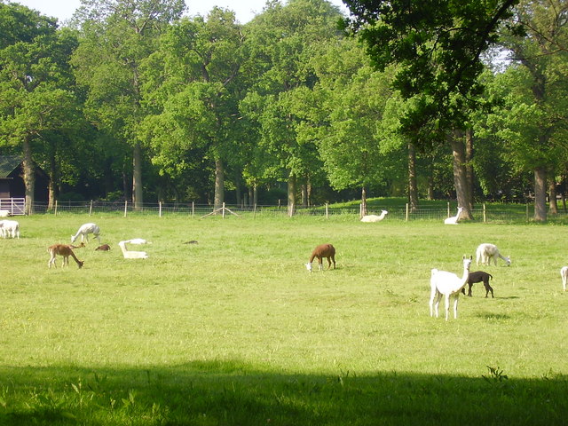
Comprised mainly of ancient woodland, Bransland Wood boasts a rich biodiversity with a diverse range of flora and fauna. The wood is predominantly composed of broadleaf trees such as oak, beech, and chestnut, creating a dense canopy that provides shade and shelter for a variety of wildlife species.

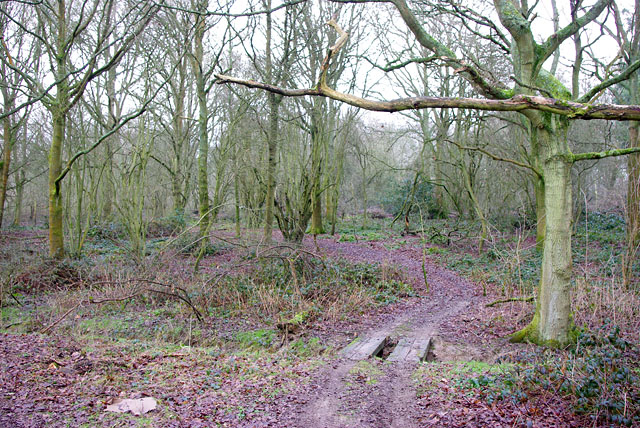
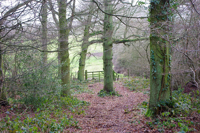
The woodland is crisscrossed with well-maintained footpaths and trails, allowing visitors to explore its beauty at their own pace. These paths offer stunning views of the surrounding countryside and lead to hidden gems such as peaceful clearings and babbling brooks. Nature enthusiasts will delight in the opportunity to spot a wide array of wildlife, including deer, badgers, foxes, and a plethora of bird species.

Bransland Wood also holds historical significance, with remnants of ancient earthworks and barrows dating back to the Bronze Age. These archaeological features add a sense of intrigue and wonder to the wood, making it a popular destination for history buffs and those interested in the region's past.

Overall, Bransland Wood in Surrey stands as a testament to the natural beauty and ecological importance of woodlands. Its enchanting atmosphere, coupled with its diverse flora and fauna, make it a haven for nature lovers and a must-visit destination for anyone seeking solace in the embrace of nature.

If you have any feedback on the listing, please let us know in the comments section below.

Bransland Wood Images

Images are sourced within 2km of 51.219085/-0.10278642 or Grid Reference TQ3248. Thanks to Geograph Open Source API. All images are credited.

Stone House Farm...looking South-East from Prince of Wales' Road Location is centre of grid square. Postcode RH1 5QU.
Stone House Farm...looking South-East from Prince of Wales' Road
Location is centre of grid square. Postcode RH1 5QU.
Coopers Hill Road Nutfield. The railway, which maintains a remarkably straight course between Redhill and Tonbridge, goes over the road and the M23 motorway goes over both. A mobile phone base station can be seen.
Coopers Hill Road
Nutfield. The railway, which maintains a remarkably straight course between Redhill and Tonbridge, goes over the road and the M23 motorway goes over both. A mobile phone base station can be seen.
The Maltings at Henhaw Farm, Cooper's Hill road, Nutfield. The building has a date stone showing 1895. It is now residential accommodation.
The Maltings
at Henhaw Farm, Cooper's Hill road, Nutfield. The building has a date stone showing 1895. It is now residential accommodation.
Coldharbour Farm now a private house
Coldharbour Farm
now a private house
from bridge in Outwood Lane Unlikely though it may seem this, the Redhill to Tonbridge Line <span class="nowrap"><a title="http://en.wikipedia.org/wiki/Redhill_to_Tonbridge_Line" rel="nofollow ugc noopener" href="http://en.wikipedia.org/wiki/Redhill_to_Tonbridge_Line">Link</a><img style="margin-left:2px;" alt="External link" title="External link - shift click to open in new window" src="https://s1.geograph.org.uk/img/external.png" width="10" height="10"/></span> , was part of the first rail route from London to Dover. The planners were not interested in serving the settlements en route so it takes a remarkably straight route. The Bletchingley Tunnel can be seen in the background - see <a href="https://www.geograph.org.uk/photo/206453">TQ3348 : Air shaft of Bletchingley Tunnel</a>.
from bridge in Outwood Lane
Unlikely though it may seem this, the Redhill to Tonbridge Line LinkExternal link , was part of the first rail route from London to Dover. The planners were not interested in serving the settlements en route so it takes a remarkably straight route. The Bletchingley Tunnel can be seen in the background - see TQ3348 : Air shaft of Bletchingley Tunnel.
St Mark's Foundation A private chapel at South Park Farm, listed grade II and occasionally used for public services.
St Mark's Foundation
A private chapel at South Park Farm, listed grade II and occasionally used for public services.
Wychcroft Retreat House Anglican Diocese of Southwark Retreat House used for residential training and quiet days
Wychcroft Retreat House
Anglican Diocese of Southwark Retreat House used for residential training and quiet days
Beside Outwood Lane A lone and rather sick tree in the park land south of Bletchingley
Beside Outwood Lane
A lone and rather sick tree in the park land south of Bletchingley
Air shaft of Bletchingley Tunnel When the Bletchingley railway tunnel <span class="nowrap"><a title="http://en.wikipedia.org/wiki/Redhill_to_Tonbridge_Line" rel="nofollow ugc noopener" href="http://en.wikipedia.org/wiki/Redhill_to_Tonbridge_Line">Link</a><img style="margin-left:2px;" alt="External link" title="External link - shift click to open in new window" src="https://s1.geograph.org.uk/img/external.png" width="10" height="10"/></span> was made in the 1830s trains were steam powered and slow by today's standards. Although the tunnel is just over a kilometre long, eleven air shafts were provided to vent the smoke. This is Shaft No. 2. The tunnel can be seen in <a href="https://www.geograph.org.uk/photo/174476">TQ3248 : from bridge in Outwood Lane</a>.
Air shaft of Bletchingley Tunnel
When the Bletchingley railway tunnel LinkExternal link was made in the 1830s trains were steam powered and slow by today's standards. Although the tunnel is just over a kilometre long, eleven air shafts were provided to vent the smoke. This is Shaft No. 2. The tunnel can be seen in TQ3248 : from bridge in Outwood Lane.
Outwood Lane, Surrey Outwood Lane is not a classified road, but it sees plenty of use as it connects the picture-book village of Outwood with the A25.  It is seen here  looking north in a quiet moment.
Outwood Lane, Surrey
Outwood Lane is not a classified road, but it sees plenty of use as it connects the picture-book village of Outwood with the A25. It is seen here looking north in a quiet moment.
Bridleway alongside an oak wood, Surrey This lane is the western limb of a tangle of bridleways that straggle across country for many miles north and east of the village of Outwood.  This western section probably sees less use by riders than the main network, as it debouches onto the rather busy Outwood Lane, a motor road where, sadly, not all drivers show proper courtesy to equestrians.
Bridleway alongside an oak wood, Surrey
This lane is the western limb of a tangle of bridleways that straggle across country for many miles north and east of the village of Outwood. This western section probably sees less use by riders than the main network, as it debouches onto the rather busy Outwood Lane, a motor road where, sadly, not all drivers show proper courtesy to equestrians.
Grounds of Harewood House, Surrey The usually lush green parkland is brown and parched after record July temperatures and very little rain.
Grounds of Harewood House, Surrey
The usually lush green parkland is brown and parched after record July temperatures and very little rain.
North Lodge, Harewood House, Surrey Many country-house lodges were built in very elaborate and decorative styles, but this one is much more utilitarian.  It lies on the east side of the road connecting Outwood village with the A25.
North Lodge, Harewood House, Surrey
Many country-house lodges were built in very elaborate and decorative styles, but this one is much more utilitarian. It lies on the east side of the road connecting Outwood village with the A25.
Llamas and/or alpacas, Nutfield Park Farm, South Nutfield These animals graze in a field alongside Kings Cross Lane
Llamas and/or alpacas, Nutfield Park Farm, South Nutfield
These animals graze in a field alongside Kings Cross Lane
Bletchingley 3 natural gas well Inside the small enclosure, seen through the gates to the larger area. Currently operated by Star Energy.
Bletchingley 3 natural gas well
Inside the small enclosure, seen through the gates to the larger area. Currently operated by Star Energy.
Parkgate Cottages Just beyond the cottages is the start of a bridleway heading east.
Parkgate Cottages
Just beyond the cottages is the start of a bridleway heading east.
Track into woods Branching north from the public bridleway into Crookedfield Shaw is a track used by a quad bike or similar - probably a gamekeeper's route.
Track into woods
Branching north from the public bridleway into Crookedfield Shaw is a track used by a quad bike or similar - probably a gamekeeper's route.
Path out of the wood Branching south from the track used as a public bridleway, this private path into the field has not merited such a big gate for a long time.
Path out of the wood
Branching south from the track used as a public bridleway, this private path into the field has not merited such a big gate for a long time.
Show me another place!

Bransland Wood is located at Grid Ref: TQ3248 (Lat: 51.219085, Lng: -0.10278642)

Administrative County: Surrey

District: Tandridge

Police Authority: Surrey

What 3 Words

///part.spoil.chairs. Near Bletchingley, Surrey

Nearby Locations

Bransland Wood

Related Wikis

Brewing Industry Research Foundation

The Brewing Industry Research Foundation is now part of Campden BRI, a research association serving all sectors of the food and drink industry. The Brewing...

Bletchingley Castle

Bletchingley Castle is a ruined castle and set of earthworks partly occupied by three buildings. The Scheduled Ancient Monument is directly beside the...

Nutfield railway station

Nutfield railway station is on the Redhill to Tonbridge Line and serves Nutfield, Surrey, England. It is about a mile south of Nutfield itself, located...

Church of St John the Baptist, Outwood

The Church of St John the Baptist, Outwood, is the parish church of Outwood, Surrey, England. == Clergy and style of worship == Part of the Diocese of...

Bletchingley

Bletchingley (historically "Blechingley") is a village in Surrey, England. It is on the A25 road to the east of Redhill and to the west of Godstone, has...

Redhill Aerodrome

Redhill Aerodrome (ICAO: EGKR) is an operational general aviation aerodrome located 1.5 NM (2.8 km; 1.7 mi) south-east of Redhill, Surrey, England, in...

Graeme Hendrey Wood

Graeme Hendrey Wood is a 10-hectare (25-acre) nature reserve east of Bletchingley in Surrey. It is managed by the Surrey Wildlife Trust.This former sand...

Outwood Windmill

Outwood Windmill is a Grade I listed post mill in Outwood, Surrey. Built in 1665 by Thomas Budgen, a miller from Nutfield in Surrey, it is Britain's oldest...

Nearby Amenities

Located within 500m of 51.219085,-0.10278642
Poundhill
Building: yes
Lat/Long: 51.2217383/-0.1016712
BLETCHINGLEY3
Disused: yes
Man Made: petroleum_well
Ref GB Decc: LR/25-3
Source: DECC
Lat/Long: 51.2220639/-0.0988094
Man Made: tower
Tower Type: communication
Lat/Long: 51.2228717/-0.1063738
Bench
Backrest: no
Seats: 3
Lat/Long: 51.2199729/-0.0997339
Barrier: bollard
Lat/Long: 51.2199064/-0.0996736
Power: pole
Source: Bing
Lat/Long: 51.220912/-0.0997607
Power: pole
Source: Bing
Lat/Long: 51.2187793/-0.1086724
Power: pole
Source: Bing
Lat/Long: 51.2184265/-0.1096112
Power: pole
Source: Bing
Lat/Long: 51.2192077/-0.1071623
Power: pole
Source: Bing
Lat/Long: 51.2200023/-0.1047054
Power: pole
Source: Bing
Lat/Long: 51.2195891/-0.1060036
Power: pole
Source: Bing
Lat/Long: 51.2203131/-0.1029807
Power: pole
Source: Bing
Lat/Long: 51.2206407/-0.1011702
Power: pole
Source: Bing
Lat/Long: 51.2210708/-0.0989172
Power: pole
Source: Bing
Lat/Long: 51.2213748/-0.0994483
Power: pole
Source: Bing
Lat/Long: 51.2215613/-0.1000357
The data included in this document is from www.openstreetmap.org. The data is made available under ODbL.

Have you been to Bransland Wood?

Leave your review of Bransland Wood below (or comments, questions and feedback).