Convent Wood

Wood, Forest in Surrey

England

Convent Wood

Grange Road, Upper Norwood Grange Road is a residential road on a hillside in Upper Norwood, in the suburbs of south London.
Grange Road, Upper Norwood Credit: Malc McDonald

Convent Wood, located in Surrey, England, is a picturesque woodland area that offers a serene and peaceful escape from the bustling city life. Spanning over several hectares, this enchanting forest is known for its lush greenery, diverse flora, and tranquil atmosphere.

The woodland is primarily composed of a mix of deciduous and evergreen trees, including oak, beech, and fir. These trees create a dense canopy that provides shade and shelter to a wide range of wildlife, making Convent Wood a haven for nature enthusiasts and wildlife lovers alike.

The forest floor is adorned with a rich carpet of wildflowers, ferns, and moss, creating a vibrant and diverse ecosystem. Walking through the woodland, visitors may come across various species of birds, such as woodpeckers and owls, as well as small mammals like squirrels and rabbits.

Convent Wood offers a network of well-maintained walking trails, allowing visitors to explore the forest at their own pace. Whether it's a leisurely stroll or an adventurous hike, there are options to suit every preference. The trails meander through the forest, passing by tranquil streams and hidden ponds, offering opportunities for relaxation and contemplation.

The woodland is easily accessible, with ample parking facilities and nearby public transportation options. It is a popular destination for families, nature enthusiasts, and dog walkers, with designated areas for picnicking and barbecue. The forest management ensures the preservation of the natural beauty of Convent Wood, making it a cherished natural gem in the heart of Surrey.

If you have any feedback on the listing, please let us know in the comments section below.
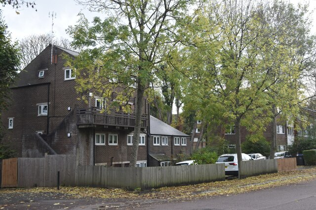
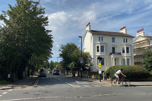
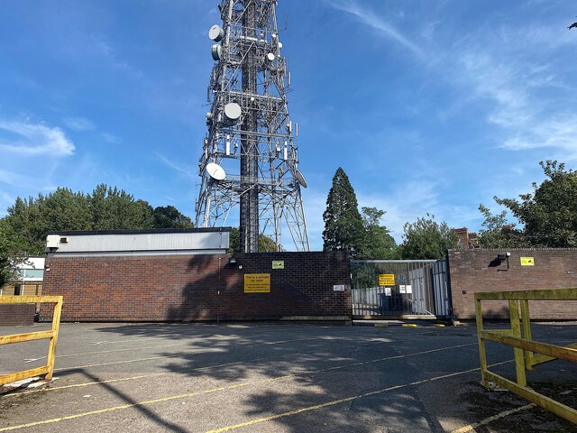
Convent Wood Images

Images are sourced within 2km of 51.420326/-0.097240681 or Grid Reference TQ3270. Thanks to Geograph Open Source API. All images are credited.

Grange Road, Upper Norwood Grange Road is a residential road on a hillside in Upper Norwood, in the suburbs of south London.
Grange Road, Upper Norwood
Grange Road is a residential road on a hillside in Upper Norwood, in the suburbs of south London.
Flats in Auckland Road
Entrance to Stambourne Woodland Walk A path through woodland which leads up to Church Road, Crystal Palace.
Entrance to Stambourne Woodland Walk
A path through woodland which leads up to Church Road, Crystal Palace.
Green Lane, Norbury Green Lane forms part of the short B273 road through Norbury, in the suburbs of south London.
Green Lane, Norbury
Green Lane forms part of the short B273 road through Norbury, in the suburbs of south London.
Camden Gardens, Norbury Camden Gardens is a minor residential road in Norbury, in the suburbs of south London.  The houses are semi-detached.
Camden Gardens, Norbury
Camden Gardens is a minor residential road in Norbury, in the suburbs of south London. The houses are semi-detached.
Norbury Crescent, Norbury Norbury Crescent is a residential road in Norbury, in the suburbs of south London.
Norbury Crescent, Norbury
Norbury Crescent is a residential road in Norbury, in the suburbs of south London.
Sylvan Hill, Upper Norwood Church Road, behind the camera, runs along a ridge. Side roads are level for a short distance then traffic drops out of sight. Busy.
Photo number 7649605.
Sylvan Hill, Upper Norwood
Church Road, behind the camera, runs along a ridge. Side roads are level for a short distance then traffic drops out of sight. Busy. Photo number 7649605.
Woodview Mews, Church Road, Upper Norwood Behind 273 and 275 Church Road is this 8-year old development of flats and houses; the six timber-clad frontages represent 11 dwellings. The side porch of 273 shows on the left. As I was framing a shot a local resident appeared and asked if I was an architectural photographer or a bailiff. Bailiffs in Upper Norwood? Who would have thought – but it was a period of suddenly high interest rates.
Photo number 7649646.
Woodview Mews, Church Road, Upper Norwood
Behind 273 and 275 Church Road is this 8-year old development of flats and houses; the six timber-clad frontages represent 11 dwellings. The side porch of 273 shows on the left. As I was framing a shot a local resident appeared and asked if I was an architectural photographer or a bailiff. Bailiffs in Upper Norwood? Who would have thought – but it was a period of suddenly high interest rates. Photo number 7649646.
Flats 283-321 Church Road, Upper Norwood Managed by the London Borough of Croydon.
Photo number 7649659.
Flats 283-321 Church Road, Upper Norwood
Managed by the London Borough of Croydon. Photo number 7649659.
Upper Beulah Hill, Upper Norwood A cyclist (only one!) turns the corner into Church Road, which runs level along a ridge to the Crystal Palace 'triangle'. At weekends the area is heaving with cyclists –  getting up here is a challenge for the legs and the gears. There are any number of steep climbs to choose from.
Photo number 7649672.
Upper Beulah Hill, Upper Norwood
A cyclist (only one!) turns the corner into Church Road, which runs level along a ridge to the Crystal Palace 'triangle'. At weekends the area is heaving with cyclists – getting up here is a challenge for the legs and the gears. There are any number of steep climbs to choose from. Photo number 7649672.
This is a good school, Upper Norwood By Church Road, All Saints Church of England primary school proclaims its 2019 rating by Ofsted.
Photo number 7649678.
This is a good school, Upper Norwood
By Church Road, All Saints Church of England primary school proclaims its 2019 rating by Ofsted. Photo number 7649678.
All Saints churchyard, Upper Norwood The full name of the church is All Saints and St Margaret, in the Diocese of Southwark.
Photo number 7649687.
All Saints churchyard, Upper Norwood
The full name of the church is All Saints and St Margaret, in the Diocese of Southwark. Photo number 7649687.
War memorial, All Saints churchyard, Upper Norwood This memorial, that has no easily visible inscriptions, is compelling in its dignity and simplicity. It is listed Grade II. The list entry explains that it was unveiled in 1920 at St Margaret's Church, Chevening Road, Upper Norwood and moved here before 2008. <span class="nowrap"><a title="https://historicengland.org.uk/listing/the-list/list-entry/1442630?section=official-list-entry" rel="nofollow ugc noopener" href="https://historicengland.org.uk/listing/the-list/list-entry/1442630?section=official-list-entry">Link</a><img style="margin-left:2px;" alt="External link" title="External link - shift click to open in new window" src="https://s1.geograph.org.uk/img/external.png" width="10" height="10"/></span> 
Photo number 7649769.
War memorial, All Saints churchyard, Upper Norwood
This memorial, that has no easily visible inscriptions, is compelling in its dignity and simplicity. It is listed Grade II. The list entry explains that it was unveiled in 1920 at St Margaret's Church, Chevening Road, Upper Norwood and moved here before 2008. LinkExternal link Photo number 7649769.
Tombs, All Saints Churchyard, Upper Norwood Photo number 7649785.
Tombs, All Saints Churchyard, Upper Norwood
Photo number 7649785.
Private car park, Upper Norwood Photo taken from South Norwood Hill A215, the access to a site that OpenStreetMap labels Croydon Transmitting Station and the A-Z TV Station. Signs proclaim arqiva Croydon.
Photo number 7649852.
Private car park, Upper Norwood
Photo taken from South Norwood Hill A215, the access to a site that OpenStreetMap labels Croydon Transmitting Station and the A-Z TV Station. Signs proclaim arqiva Croydon. Photo number 7649852.
Outlook, All Saints Churchyard, Upper Norwood The TV transmitter is a big presence; there's no escaping it. The brick building is a telephone exchange.
Photo number 7649873.
Outlook, All Saints Churchyard, Upper Norwood
The TV transmitter is a big presence; there's no escaping it. The brick building is a telephone exchange. Photo number 7649873.
Wilkinson Gardens, Upper Norwood Hopefully there is good TV reception.
Photo number 7649883.
Wilkinson Gardens, Upper Norwood
Hopefully there is good TV reception. Photo number 7649883.
Beaulieu Heights: the house, Upper Norwood There is more information with <a href="https://www.geograph.org.uk/photo/1774983">TQ3369 : Beaulieu Heights, South Norwood Hill</a> from 2010. A glimpse of the former grounds is <a href="https://www.geograph.org.uk/photo/7649912">TQ3369 : Beaulieu Heights: the park, Upper Norwood</a>. Postcode district may after all be SE19 not SE25.
Photo number 7649904.
Beaulieu Heights: the house, Upper Norwood
There is more information with TQ3369 : Beaulieu Heights, South Norwood Hill from 2010. A glimpse of the former grounds is TQ3369 : Beaulieu Heights: the park, Upper Norwood. Postcode district may after all be SE19 not SE25. Photo number 7649904.
Show me another place!

Convent Wood is located at Grid Ref: TQ3270 (Lat: 51.420326, Lng: -0.097240681)

Unitary Authority: Croydon

Police Authority: Metropolitan

What 3 Words

///joke.soaks.chains. Near Thornton Heath, London

Related Wikis

Convent Wood

Convent Wood is a small area of ancient woodland in the London Borough of Croydon. The wood is in the freehold of the Sisters of Our Lady of Fidelity some...

The Cedars School

The Cedars School is an 11–18 boys, Roman Catholic, private school and sixth form. It is located in the Upper Norwood area of the London Borough of Croydon...

The Norwood School

The Norwood School is a co-educational community school at the south end of the London Borough of Lambeth, for girls and boys aged 11–18. The school is...

Norwood New Town

Norwood New Town is a largely residential, former working-class enclave within the larger district of Upper Norwood in South London. It is within the London...

Nearby Amenities

Located within 500m of 51.420326,-0.097240681
Barrier: bollard
Bicycle: yes
Foot: yes
Lat/Long: 51.4198598/-0.0907654
Noexit: yes
Lat/Long: 51.4192024/-0.0911184
Turning Circle
Lat/Long: 51.4193463/-0.0937089
Noexit: yes
Lat/Long: 51.4191159/-0.0910765
Turning Circle
Lat/Long: 51.4180165/-0.0976591
Noexit: yes
Lat/Long: 51.4205223/-0.0948065
Ref GB Tflcid: RWG215163
Traffic Calming: hump
Lat/Long: 51.4172611/-0.0940454
Barrier: bollard
Bicycle: yes
Foot: yes
Lat/Long: 51.4197517/-0.0905272
Post Box
Collection Times: Mo-Fr 09:00; Sa 07:00
Drive Through: no
Operator: Royal Mail
Operator Wikidata: Q638098
Post Box Design: type_k
Post Box Type: pillar
Ref: SE19 18D
Ref GB Uprn: 10015357050
Royal Cypher: EIIR
Royal Cypher Wikidata: Q33102113
Source: survey
Lat/Long: 51.4213281/-0.0906182
Turning Circle
Lat/Long: 51.4191167/-0.0928438
Post Box
Brand: Royal Mail
Brand Wikidata: Q638098
Collection Times: Mo-Fr 17:30, Sa 11:00
Drive Through: no
Operator: Royal Mail
Operator Wikidata: Q638098
Post Box Design: type_b
Post Box Type: pillar
Postal Code: SE19
Ref: SE19 51
Royal Cypher: EVIIIR
Royal Cypher Wikidata: Q33102195
Source: survey
Lat/Long: 51.4169101/-0.0972851
Bus Stop
Biggin Hill
Bench: no
Bus: yes
Local Ref: SA
Naptan AtcoCode: 490003992S
Naptan Bearing: S
Naptan CommonName: Biggin Hill (SE19)
Naptan Indicator: Stop SA
Naptan Verified: no
Public Transport: platform
Shelter: no
Lat/Long: 51.418824/-0.1036414
Bus Stop
Convent Hill
Bench: no
Bus: yes
Local Ref: NK
Naptan AtcoCode: 490005559N
Naptan Bearing: N
Naptan CommonName: Convent Hill
Naptan Indicator: NK
Naptan Verified: no
Public Transport: platform
Ref: 48026
Shelter: no
Source Ref: naptan
Lat/Long: 51.4183826/-0.1015282
Bus Stop
Convent Hill
Bench: yes
Bus: yes
Local Ref: SB
Naptan AtcoCode: 490005559S
Naptan Bearing: S
Naptan CommonName: Convent Hill
Naptan Indicator: SB
Naptan Street: BEULAH HILL
Naptan Verified: no
Public Transport: platform
Ref: 58593
Shelter: yes
Source Ref: naptan
Lat/Long: 51.4182394/-0.1005667
Bus Stop
Crystal Terrace
Local Ref: F
Naptan AtcoCode: 490005876N
Naptan Bearing: N
Naptan CommonName: Crystal Terrace
Naptan Indicator: Stop F
Naptan Street: HERMITAGE ROAD
Naptan Verified: no
Public Transport: platform
Lat/Long: 51.4206381/-0.0935123
Bus Stop
Crystal Terrace
Local Ref: G
Naptan AtcoCode: 490005876S
Naptan Bearing: S
Naptan CommonName: Crystal Terrace
Naptan Indicator: Stop G
Naptan Street: HERMITAGE ROAD
Naptan Verified: no
Public Transport: platform
Lat/Long: 51.4209313/-0.0928961
Bus Stop
Chevening Road / Hermitage Road
Bench: no
Naptan AtcoCode: 490008081E
Naptan Bearing: N
Naptan CommonName: Chevening Road Hermitage Road
Naptan Street: CHEVENING ROAD
Naptan Verified: no
Public Transport: platform
Shelter: no
Lat/Long: 51.4190851/-0.0947851
Bus Stop
Chevening Road / Hermitage Road
Bench: yes
Naptan AtcoCode: 490008081W
Naptan Bearing: N
Naptan CommonName: Chevening Road Hermitage Road
Naptan Street: CHEVENING ROAD
Naptan Verified: no
Public Transport: platform
Shelter: yes
Lat/Long: 51.4188345/-0.0942714
Bus Stop
Norwood Park
Bench: yes
Local Ref: K
Naptan AtcoCode: 490010449N
Naptan Bearing: N
Naptan CommonName: Norwood Park
Naptan Indicator: Stop K
Public Transport: platform
Ref: 47882
Shelter: yes
Lat/Long: 51.4240881/-0.0979959
Bus Stop
Norwood Park
Local Ref: B
Naptan AtcoCode: 490010449S
Naptan Bearing: S
Naptan CommonName: Norwood Park
Naptan Indicator: Stop B
Public Transport: platform
Ref: 56892
Shelter: yes
Lat/Long: 51.423349/-0.0972932
Bus Stop
Norwood School
Local Ref: E
Naptan AtcoCode: 490010452W1
Naptan Bearing: E
Naptan CommonName: Tivoli Road Norwood School
Naptan Indicator: Stop E
Naptan Verified: no
Public Transport: platform
Lat/Long: 51.4226392/-0.0985715
Bus Stop
Tivoli Road
Naptan AtcoCode: 490010452W2
Naptan Bearing: N
Naptan CommonName: Tivoli Road Norwood School
Naptan Verified: no
Public Transport: platform
Lat/Long: 51.4225779/-0.1010982
Bus Stop
Rockmount Primary School
Bench: no
Naptan AtcoCode: 490011622E
Naptan Bearing: E
Naptan CommonName: Rockmount Road
Naptan Indicator: Stop
Naptan Street: CHEVENING ROAD
Naptan Verified: no
Public Transport: platform
Shelter: no
Lat/Long: 51.4180092/-0.0911191
Bus Stop
Salter's Hill
Local Ref: C
Naptan AtcoCode: 490011876S
Naptan Bearing: S
Naptan CommonName: Salter's Hill Central Hill
Naptan Indicator: Stop C
Public Transport: platform
Ref: 50870
Lat/Long: 51.4228119/-0.0937561
Bus Stop
Salter's Hill
Local Ref: J
Naptan AtcoCode: 490011876W
Naptan Bearing: W
Naptan CommonName: Salter's Hill Central Hill
Naptan Indicator: Stop J
Public Transport: platform
Ref: 55282
Lat/Long: 51.4227602/-0.0946035
Bus Stop
Tivoli Road
Naptan AtcoCode: 490013686E
Naptan Bearing: E
Naptan CommonName: Tivoli Road
Naptan Verified: no
Public Transport: platform
Lat/Long: 51.422689/-0.101934
Bus Stop
Hermitage Road
Bench: yes
Bus: yes
Local Ref: NJ
Naptan AtcoCode: 490015337N
Naptan Bearing: N
Naptan CommonName: Hermitage Road Beulah Road
Naptan Indicator: Stop NJ
Naptan Verified: no
Public Transport: platform
Shelter: yes
Lat/Long: 51.4171015/-0.0983481
Bus Stop
Hermitage Road
Bus: yes
Local Ref: SC
Naptan AtcoCode: 490015337S
Naptan Bearing: S
Naptan CommonName: Hermitage Road Beulah Road
Naptan Indicator: SC
Naptan Verified: no
Public Transport: platform
Lat/Long: 51.4163956/-0.0965189
Bus Stop
Hermitage Road
Local Ref: H
Naptan AtcoCode: 490015338N
Naptan Bearing: N
Naptan CommonName: Hermitage Road Central Hill
Naptan Indicator: Stop H
Public Transport: platform
Ref: 75610
Lat/Long: 51.4216607/-0.0913645
Bus Stop
Hermitage Road
Local Ref: D
Naptan AtcoCode: 490015338S
Naptan Bearing: S
Naptan CommonName: Hermitage Road Central Hill
Naptan Indicator: Stop D
Public Transport: platform
Ref: 51463
Lat/Long: 51.4216461/-0.0910456
Post Box
Collection Times: Mo-Fr 17:30; Sa 10:30
Drive Through: no
Operator: Royal Mail
Operator Wikidata: Q638098
Post Box Mounting: brick_pillar
Post Box Type: wall
Ref: SE19 20
Royal Cypher: EVIIR
Royal Cypher Wikidata: Q33102324
Source: survey
Lat/Long: 51.4227567/-0.0941904
Post Box
Collection Times: Mo-Fr 17:30; Sa 11:00; Su off
Drive Through: no
Operator: Royal Mail
Operator Wikidata: Q638098
Post Box Design: type_b
Post Box Type: pillar
Ref: SE19 50
Ref GB Uprn: 10015407229
Royal Cypher: GR
Royal Cypher Wikidata: Q33102273
Source: survey
Lat/Long: 51.4195694/-0.0945534
Post Box
Brand: Royal Mail
Brand Wikidata: Q638098
Collection Times: Mo-Fr 09:00; Sa 07:00
Drive Through: no
Operator: Royal Mail
Operator Wikidata: Q638098
Post Box Design: type_b
Post Box Type: pillar
Ref: SE19 52
Royal Cypher: GVIR
Royal Cypher Wikidata: Q33102169
Source: survey
Lat/Long: 51.4195749/-0.1010044
Post Box
Brand: Royal Mail
Brand Wikidata: Q638098
Collection Times: Mo-Fr 17:30; Sa 11:00
Drive Through: no
Operator: Royal Mail
Operator Wikidata: Q638098
Post Box Design: type_b
Post Box Type: pillar
Ref: SE19 28
Royal Cypher: GR
Royal Cypher Wikidata: Q33102273
Source: survey
Lat/Long: 51.4171941/-0.1000967
Post Box
Brand: Royal Mail
Brand Wikidata: Q638098
Collection Times: Mo-Fr 17:30; Sa 11:30
Drive Through: no
Operator: Royal Mail
Operator Wikidata: Q638098
Post Box Design: type_b
Post Box Type: pillar
Ref: SE19 16
Royal Cypher: GR
Royal Cypher Wikidata: Q33102273
Source: survey
Lat/Long: 51.4188687/-0.1040135
Place Of Worship
Virgo Fidelis Convent
Lat/Long: 51.4225677/-0.096581
Crossing
Crossing: unmarked
Crossing Island: yes
Lat/Long: 51.4228317/-0.0951289
Crossing
Crossing: unmarked
Crossing Island: yes
Lat/Long: 51.4222051/-0.0920872
Upper Norwood
Place: suburb
Wikidata: Q123292
Lat/Long: 51.4164053/-0.0940347
Traffic Calming: bump
Lat/Long: 51.4168885/-0.0931977
Traffic Calming: bump
Lat/Long: 51.4176814/-0.0949787
Crossing
Crossing: unmarked
Crossing Island: yes
Crossing Markings: no
Tactile Paving: yes
Lat/Long: 51.4181593/-0.1002136
Hermitage Road
Bus: yes
Local Ref: H
Public Transport: stop_position
Lat/Long: 51.4216804/-0.0913118
Hermitage Road
Bus: yes
Local Ref: D
Public Transport: stop_position
Lat/Long: 51.4215065/-0.0909151
Salter's Hill
Bus: yes
Local Ref: J
Public Transport: stop_position
Lat/Long: 51.4228139/-0.0945961
Salter's Hill
Bus: yes
Local Ref: C
Public Transport: stop_position
Lat/Long: 51.4227745/-0.093778
Norwood Park
Bus: yes
Local Ref: B
Public Transport: stop_position
Lat/Long: 51.423324/-0.0973622
Norwood Park
Bus: yes
Local Ref: K
Public Transport: stop_position
Lat/Long: 51.4241069/-0.0979137
Entrance: yes
Lat/Long: 51.4199412/-0.0912953
Entrance: yes
Lat/Long: 51.4201349/-0.0917107
Entrance: yes
Lat/Long: 51.4197634/-0.0917712
Entrance: yes
Lat/Long: 51.4196686/-0.0915766
Bicycle Parking
Capacity: 4
Lat/Long: 51.4196919/-0.0947115
Bicycle Parking
Access: yes
Bicycle Parking: stands
Capacity: 12
Covered: no
Lat/Long: 51.4242538/-0.0978984
Bench
Lat/Long: 51.4245666/-0.0950133
Barrier: bollard
Lat/Long: 51.42306/-0.0945704
Barrier: bollard
Lat/Long: 51.4244053/-0.0998241
Barrier: bollard
Lat/Long: 51.4243896/-0.0998708
Bench
Backrest: yes
Lat/Long: 51.4237926/-0.0954909
Bench
Backrest: yes
Lat/Long: 51.4226434/-0.0934961
Bench
Backrest: yes
Lat/Long: 51.4240746/-0.0975834
Bench
Backrest: yes
Lat/Long: 51.4225564/-0.0936386
Bench
Lat/Long: 51.4170992/-0.0933334
Bench
Lanfranc Memorial Bench
Backrest: yes
Material: wood
Seats: 4
Lat/Long: 51.4176496/-0.0999489
Bench
Lat/Long: 51.4178563/-0.0950108
Bench
Backrest: no
Lat/Long: 51.4233883/-0.0952949
Crossing
Crossing: unmarked
Crossing Markings: no
Tactile Paving: no
Lat/Long: 51.4186919/-0.1034091
Crossing
Crossing: unmarked
Crossing Markings: no
Tactile Paving: no
Lat/Long: 51.4186356/-0.1030214
Generator Method: photovoltaic
Generator Output Electricity: yes
Generator Source: solar
Generator Type: solar_photovoltaic_panel
Location: roof
Power: generator
Lat/Long: 51.4176732/-0.0955106
Generator Method: photovoltaic
Generator Output Electricity: yes
Generator Source: solar
Generator Type: solar_photovoltaic_panel
Location: roof
Power: generator
Lat/Long: 51.4164823/-0.0946408
Generator Method: photovoltaic
Generator Output Electricity: yes
Generator Source: solar
Generator Type: solar_photovoltaic_panel
Location: roof
Power: generator
Lat/Long: 51.4163219/-0.0942056
Generator Method: photovoltaic
Generator Output Electricity: yes
Generator Source: solar
Generator Type: solar_photovoltaic_panel
Location: roof
Power: generator
Lat/Long: 51.4204268/-0.0925975
Generator Method: photovoltaic
Generator Output Electricity: yes
Generator Source: solar
Generator Type: solar_photovoltaic_panel
Power: generator
Lat/Long: 51.4172465/-0.0977144
Generator Method: photovoltaic
Generator Output Electricity: yes
Generator Source: solar
Generator Type: solar_photovoltaic_panel
Power: generator
Lat/Long: 51.4172746/-0.1003658
Generator Method: photovoltaic
Generator Output Electricity: yes
Generator Source: solar
Generator Type: solar_photovoltaic_panel
Power: generator
Lat/Long: 51.4173738/-0.100939
Generator Method: photovoltaic
Generator Output Electricity: yes
Generator Source: solar
Generator Type: solar_photovoltaic_panel
Power: generator
Lat/Long: 51.4176686/-0.1013993
Generator Method: photovoltaic
Generator Output Electricity: yes
Generator Source: solar
Generator Type: solar_photovoltaic_panel
Power: generator
Lat/Long: 51.4177208/-0.1011566
Generator Method: photovoltaic
Generator Output Electricity: yes
Generator Source: solar
Generator Type: solar_photovoltaic_panel
Power: generator
Lat/Long: 51.4181461/-0.1014076
Barrier: yes
Lat/Long: 51.4238482/-0.1012011
Crossing
Crossing: marked
Crossing Island: no
Crossing Ref: zebra
Tactile Paving: yes
Traffic Calming: table
Lat/Long: 51.4185617/-0.0911045
Traffic Calming: table
Lat/Long: 51.4213981/-0.1012647
Traffic Calming: choker
Lat/Long: 51.4233937/-0.0938611
Addr Housenumber: 24
Addr Street: Founders Gardens
Lat/Long: 51.4175972/-0.0982695
Addr Housenumber: 23
Addr Street: Founders Gardens
Lat/Long: 51.4175654/-0.0982232
Addr Housenumber: 22
Addr Street: Founders Gardens
Lat/Long: 51.4175544/-0.098156
Addr Housenumber: 21
Addr Street: Founders Gardens
Lat/Long: 51.4175323/-0.0981499
Addr Housenumber: 20
Addr Street: Founders Gardens
Lat/Long: 51.4175001/-0.0981024
Addr Housenumber: 19
Addr Street: Founders Gardens
Lat/Long: 51.4174892/-0.0980357
Addr Housenumber: 18
Addr Street: Founders Gardens
Lat/Long: 51.4174674/-0.0980286
Addr Housenumber: 17
Addr Street: Founders Gardens
Lat/Long: 51.4174355/-0.0979821
Addr Housenumber: 16
Addr Street: Founders Gardens
Lat/Long: 51.4174232/-0.0979123
Addr Housenumber: 15
Addr Street: Founders Gardens
Lat/Long: 51.4174049/-0.097899
Addr Housenumber: 14
Addr Street: Founders Gardens
Lat/Long: 51.4173727/-0.0978517
Addr Housenumber: 13
Addr Street: Founders Gardens
Lat/Long: 51.4173612/-0.0977838
Addr Housenumber: 12
Addr Street: Founders Gardens
Lat/Long: 51.4173317/-0.0977257
Addr Housenumber: 11
Addr Street: Founders Gardens
Lat/Long: 51.4172971/-0.0976867
Addr Housenumber: 10
Addr Street: Founders Gardens
Lat/Long: 51.4172797/-0.0976187
Addr Housenumber: 9
Addr Street: Founders Gardens
Lat/Long: 51.4172789/-0.0975863
Addr Housenumber: 8
Addr Street: Founders Gardens
Lat/Long: 51.4172425/-0.0975441
Addr Housenumber: 7
Addr Street: Founders Gardens
Lat/Long: 51.4172272/-0.0974806
Addr Housenumber: 6
Addr Street: Founders Gardens
Lat/Long: 51.4172304/-0.0974444
Addr Housenumber: 5
Addr Street: Founders Gardens
Lat/Long: 51.4171949/-0.0974036
Addr Housenumber: 4
Addr Street: Founders Gardens
Lat/Long: 51.4171789/-0.0973388
Addr Housenumber: 2
Addr Street: Founders Gardens
Lat/Long: 51.4171481/-0.0972639
Addr Housenumber: 3
Addr Street: Founders Gardens
Lat/Long: 51.4171838/-0.0973038
Addr Housenumber: 1
Addr Street: Founders Gardens
Lat/Long: 51.4171323/-0.0971986
Traffic Calming: hump
Lat/Long: 51.4236777/-0.093379
Traffic Calming: hump
Lat/Long: 51.4225006/-0.0921171
Traffic Calming: table
Lat/Long: 51.4209348/-0.0930466
Crossing
Crossing: unmarked
Crossing Island: no
Tactile Paving: yes
Traffic Calming: hump
Lat/Long: 51.4183701/-0.0926059
Bench
Backrest: no
Lat/Long: 51.4184625/-0.0931008
Bench
Backrest: yes
Material: wood
Seats: 2
Lat/Long: 51.4237799/-0.0935415
Bench
Backrest: yes
Material: wood
Seats: 2
Lat/Long: 51.4234213/-0.0947835
Bench
Backrest: yes
Material: wood
Seats: 2
Lat/Long: 51.4235831/-0.094638
Bench
Backrest: yes
Material: wood
Seats: 2
Lat/Long: 51.4236993/-0.09494
Traffic Calming: cushion
Lat/Long: 51.4214873/-0.0905523
Traffic Calming: hump
Lat/Long: 51.4218661/-0.0919586
Crossing
Crossing: traffic_signals
Lat/Long: 51.4227977/-0.0941728
Traffic Calming: hump
Lat/Long: 51.4230289/-0.0945007
Crossing
Crossing: unmarked
Crossing Island: yes
Lat/Long: 51.4227358/-0.0966067
Crossing
Crossing: unmarked
Crossing Island: yes
Tactile Paving: yes
Lat/Long: 51.4228666/-0.0969844
Crossing
Crossing: unmarked
Crossing Island: yes
Tactile Paving: yes
Lat/Long: 51.4226606/-0.0971826
Give Way
Direction: forward
Lat/Long: 51.4227726/-0.0969064
Tactile Paving: yes
Lat/Long: 51.4228421/-0.0970625
Crossing
Crossing: traffic_signals
Lat/Long: 51.4226184/-0.1008247
Crossing
Crossing: unmarked
Crossing Island: no
Tactile Paving: yes
Traffic Calming: table
Lat/Long: 51.4226717/-0.1013852
Crossing
Crossing: unmarked
Crossing Markings: no
Tactile Paving: no
Lat/Long: 51.4178004/-0.0998129
Crossing
Crossing: unmarked
Crossing Markings: no
Tactile Paving: no
Lat/Long: 51.4178507/-0.0999609
Crossing
Crossing: unmarked
Crossing Island: no
Crossing Markings: no
Tactile Paving: no
Lat/Long: 51.4183321/-0.1012443
Give Way
Direction: forward
Lat/Long: 51.4179224/-0.0999383
Give Way
Direction: forward
Lat/Long: 51.4187348/-0.1031194
Crossing
Crossing: unmarked
Crossing Island: no
Crossing Markings: no
Tactile Paving: no
Lat/Long: 51.4174131/-0.0988441
Crossing
Crossing: unmarked
Crossing Island: yes
Crossing Markings: no
Tactile Paving: yes
Lat/Long: 51.4178246/-0.0995659
Give Way
Direction: forward
Lat/Long: 51.4176829/-0.0991389
Crossing
Crossing: unmarked
Crossing Island: yes
Crossing Markings: no
Lat/Long: 51.4181362/-0.1004543
Give Way
Direction: forward
Lat/Long: 51.4181109/-0.1002437
Barrier: kerb
Kerb: lowered
Lat/Long: 51.4168388/-0.0976682
Crossing
Crossing: marked
Crossing Island: no
Crossing Markings: yes
Tactile Paving: yes
Lat/Long: 51.4168065/-0.0977039
Give Way
Direction: backward
Lat/Long: 51.4167055/-0.0973957
Give Way
Direction: forward
Lat/Long: 51.417166/-0.0970638
Give Way
Direction: forward
Lat/Long: 51.4176341/-0.0966507
Give Way
Direction: backward
Lat/Long: 51.4180107/-0.0963178
Give Way
Direction: forward
Lat/Long: 51.4181705/-0.096048
Crossing
Crossing: unmarked
Crossing Island: no
Crossing Markings: no
Tactile Paving: yes
Lat/Long: 51.41672/-0.0973827
Barrier: kerb
Kerb: lowered
Lat/Long: 51.4176105/-0.0966961
Crossing
Crossing: unmarked
Crossing Island: no
Crossing Markings: no
Tactile Paving: yes
Lat/Long: 51.4176407/-0.0966712
Barrier: kerb
Kerb: lowered
Lat/Long: 51.4176599/-0.0966555
Barrier: kerb
Kerb: lowered
Lat/Long: 51.4171355/-0.0971238
Barrier: kerb
Kerb: lowered
Lat/Long: 51.4172146/-0.0970523
Crossing
Crossing: unmarked
Crossing Markings: no
Lat/Long: 51.417369/-0.0967274
Traffic Calming: table
Lat/Long: 51.4178177/-0.0964128
Traffic Calming: table
Lat/Long: 51.416812/-0.0972978
Traffic Calming: hump
Lat/Long: 51.4180843/-0.0958433
Barrier: bollard
Material: metal
Lat/Long: 51.4173104/-0.0939777
Crossing
Crossing: unmarked
Crossing Island: no
Crossing Markings: no
Tactile Paving: no
Lat/Long: 51.4181462/-0.095988
Crossing
Crossing: unmarked
Crossing Island: no
Tactile Paving: yes
Lat/Long: 51.4181442/-0.0918063
Give Way
Direction: forward
Lat/Long: 51.418081/-0.091468
Give Way
Direction: backward
Lat/Long: 51.4186199/-0.090944
Crossing
Crossing: unmarked
Crossing Island: no
Tactile Paving: yes
Lat/Long: 51.4180918/-0.0914597
Barrier: bollard
Lat/Long: 51.4183819/-0.0928485
Crossing
Lat/Long: 51.422683/-0.0964723
Give Way
Direction: backward
Lat/Long: 51.4226515/-0.1013853
Crossing
Crossing: unmarked
Crossing Island: yes
Tactile Paving: yes
Lat/Long: 51.4216074/-0.0911536
Give Way
Direction: forward
Lat/Long: 51.4200685/-0.0941134
Traffic Calming: choker
Lat/Long: 51.4195756/-0.0946244
Give Way
Direction: forward
Lat/Long: 51.4188404/-0.0906676
Crossing
Crossing: marked
Lat/Long: 51.4234251/-0.0974467
Give Way
Direction: backward
Lat/Long: 51.4233264/-0.1014404
Give Way
Direction: forward
Lat/Long: 51.4234513/-0.1014405
Traffic Calming: bump
Lat/Long: 51.4230309/-0.1013887
Traffic Calming: bump
Lat/Long: 51.4237654/-0.1014058
Give Way
Direction: backward
Lat/Long: 51.4238513/-0.101374
Crossing
Crossing: unmarked
Lat/Long: 51.4234512/-0.1014609
Crossing
Crossing: unmarked
Lat/Long: 51.4233264/-0.1014602
Bench
Lat/Long: 51.4233898/-0.1017274
Noexit: yes
Lat/Long: 51.4167645/-0.1005701
Stop
Direction: forward
Lat/Long: 51.4170492/-0.1002536
Traffic Calming: island
Lat/Long: 51.4169589/-0.1001919
Give Way
Lat/Long: 51.4196142/-0.09991
Give Way
Direction: forward
Lat/Long: 51.4201523/-0.0994691
Traffic Calming: hump
Lat/Long: 51.4185435/-0.0957689
Give Way
Direction: forward
Lat/Long: 51.4187385/-0.0956425
Give Way
Direction: backward
Lat/Long: 51.4191074/-0.0951046
Crossing
Crossing: unmarked
Crossing Island: no
Tactile Paving: yes
Traffic Calming: table
Lat/Long: 51.4190977/-0.0950739
Give Way
Direction: forward
Lat/Long: 51.4200675/-0.0939833
Ref GB Tflcid: RWG215155
Traffic Calming: cushion
Lat/Long: 51.4185921/-0.0933475
Ref GB Tflcid: RWG215203
Traffic Calming: cushion
Lat/Long: 51.4218207/-0.101368
Ref GB Tflcid: RWG215156
Traffic Calming: cushion
Lat/Long: 51.418922/-0.0944573
Ref GB Tflcid: RWG215202
Traffic Calming: cushion
Lat/Long: 51.4213968/-0.1005278
Ref GB Tflcid: RWG215199
Traffic Calming: cushion
Lat/Long: 51.4219508/-0.1003159
Bicycle Parking
Bicycle Parking: stands
Capacity: 6
Ref GB Tflcid: RWG207308
Lat/Long: 51.4180751/-0.0912364
Tactile Paving: yes
Lat/Long: 51.4228926/-0.0969033
The data included in this document is from www.openstreetmap.org. The data is made available under ODbL.

Have you been to Convent Wood?

Leave your review of Convent Wood below (or comments, questions and feedback).