Asthall Leigh
Settlement in Oxfordshire West Oxfordshire
England
Asthall Leigh

Asthall Leigh is a small village located in the district of West Oxfordshire, Oxfordshire, England. Situated about 6 miles west of the town of Witney, Asthall Leigh is nestled in the picturesque Windrush Valley, surrounded by rolling hills and lush countryside. The village is part of the larger parish of Asthall, which also includes the hamlet of Asthall.
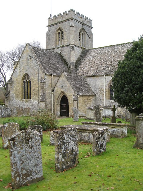
Asthall Leigh is renowned for its rich history and charming architecture. The village is home to several Grade II listed buildings, including the picturesque St. Nicholas' Church, which dates back to the 12th century. The church features a unique tower and a beautifully preserved interior, showcasing medieval wall paintings and intricate stained glass windows.
The village is also famous for its connection to the literary world. Asthall Manor, a magnificent Jacobean mansion located on the outskirts of the village, was once the childhood home of the Mitford sisters, a notable British literary family. The manor has been host to many literary figures, including renowned writers such as John Betjeman and Evelyn Waugh.
Asthall Leigh offers a tranquil and idyllic setting, with its meandering country lanes and stunning views of the Oxfordshire countryside. The village is a popular destination for nature lovers and walkers, with many footpaths and bridleways that lead through the surrounding fields and woodlands.
Despite its small size, Asthall Leigh has a vibrant community spirit, with various community events and activities organized throughout the year. The village also benefits from its proximity to Witney, which provides residents with access to a range of amenities, including shops, schools, and recreational facilities.
In summary, Asthall Leigh is a picturesque village in Oxfordshire that combines natural beauty, historical charm, and literary significance, making it an appealing destination for visitors and a desirable place to live.
If you have any feedback on the listing, please let us know in the comments section below.
Asthall Leigh Images
Images are sourced within 2km of 51.812956/-1.557534 or Grid Reference SP3012. Thanks to Geograph Open Source API. All images are credited.


Asthall Leigh is located at Grid Ref: SP3012 (Lat: 51.812956, Lng: -1.557534)
Administrative County: Oxfordshire
District: West Oxfordshire
Police Authority: Thames Valley
What 3 Words
///geek.fallen.smokers. Near Minster Lovell, Oxfordshire
Nearby Locations
Related Wikis
Minster Lovell
Minster Lovell is a village and civil parish on the River Windrush about 2+1⁄2 miles (4 km) west of Witney in Oxfordshire. The 2011 Census recorded the...

Minster Lovell Priory
Minster Lovell Priory was a priory in Minster Lovell, Oxfordshire, England. Its current site is lost, though it is thought to have been west of St Kenelm...

Worsham, Oxfordshire
Worsham is a hamlet on the River Windrush about 3.5 miles (5.6 km) west of Witney. 0.25 miles (400 m) east of Worsham on the north side of the Windrush...

Asthall
Asthall or Asthal is a village and civil parish on the River Windrush in Oxfordshire, about 6 miles (10 km) west of Witney. It includes the hamlets of...

Minster Lovell Hall
Minster Lovell Hall is a ruin in Minster Lovell, an English village in the Oxfordshire Cotswolds. The ruins are situated by the River Windrush. == History... ==
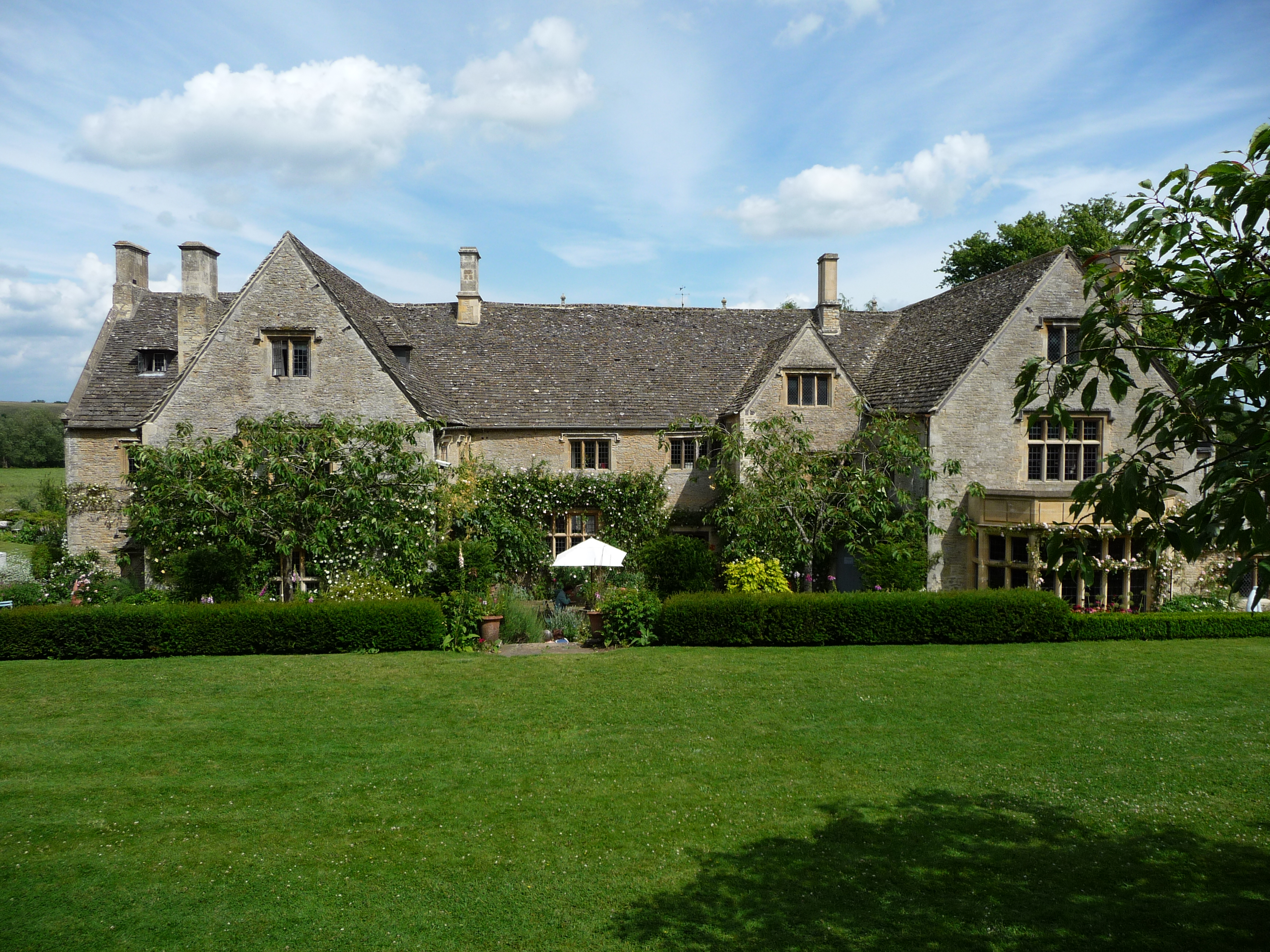
Asthall Manor
Asthall Manor is a gabled Jacobean Cotswold manor house in Asthall, Oxfordshire. It was built in about 1620 and altered and enlarged in about 1916. The...

Swinbrook
Swinbrook is a village and former civil parish, now in the parish of Swinbrook and Widford, in the West Oxfordshire district, in the county of Oxfordshire...
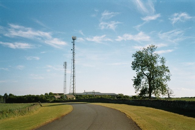
Leafield Technical Centre
Leafield Technical Centre is a former radio transmission station, now turned motorsports centre of excellence, located in the hamlet of Langley, in the...
Nearby Amenities
Located within 500m of 51.812956,-1.557534Have you been to Asthall Leigh?
Leave your review of Asthall Leigh below (or comments, questions and feedback).