Erwarton

Settlement in Suffolk Babergh

England

Erwarton

Small bridge and bend, lane towards Harkstead
Small bridge and bend, lane towards Harkstead Credit: Robin Webster

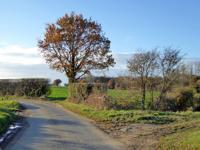
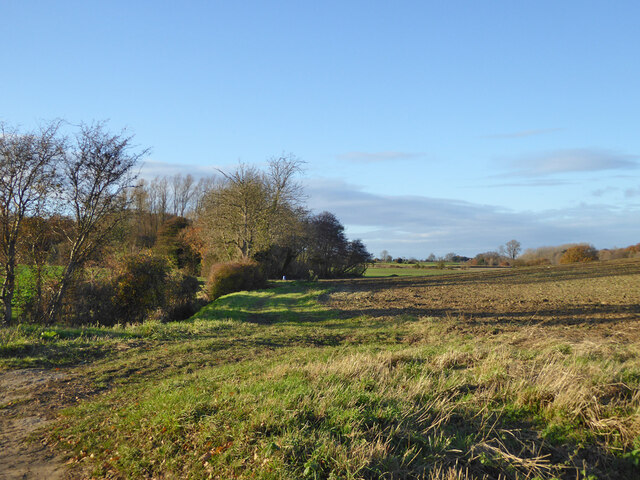
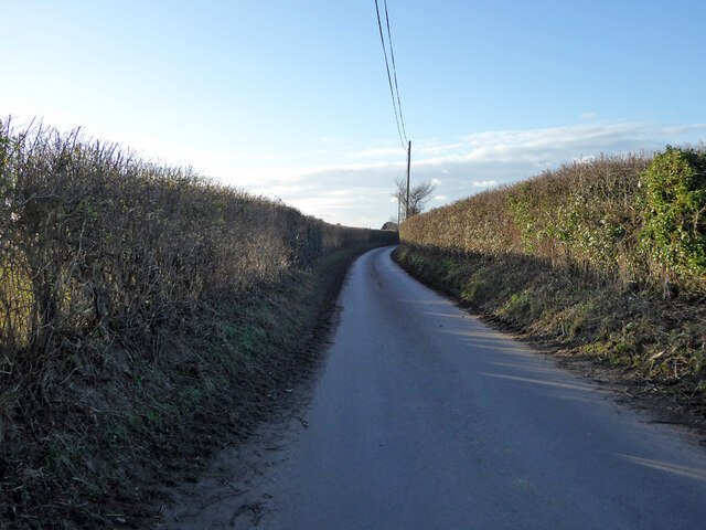
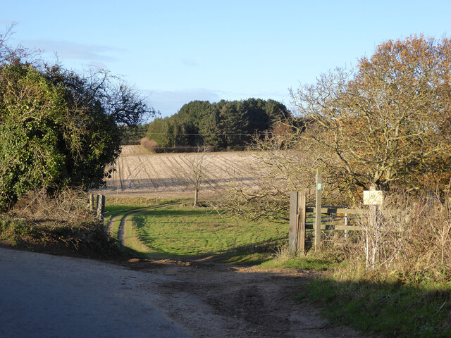
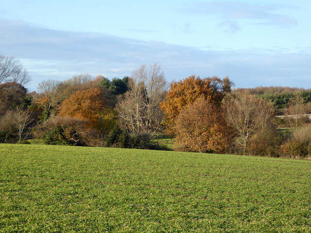
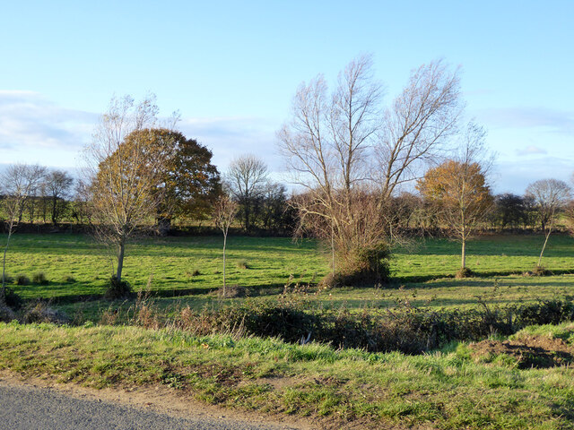
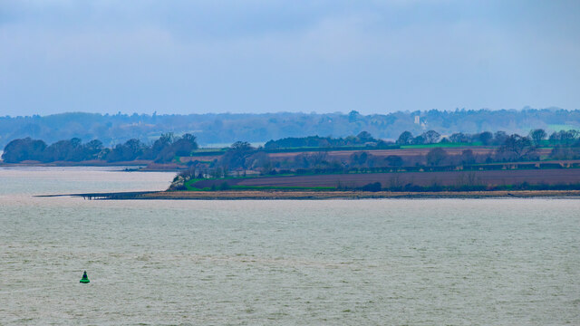
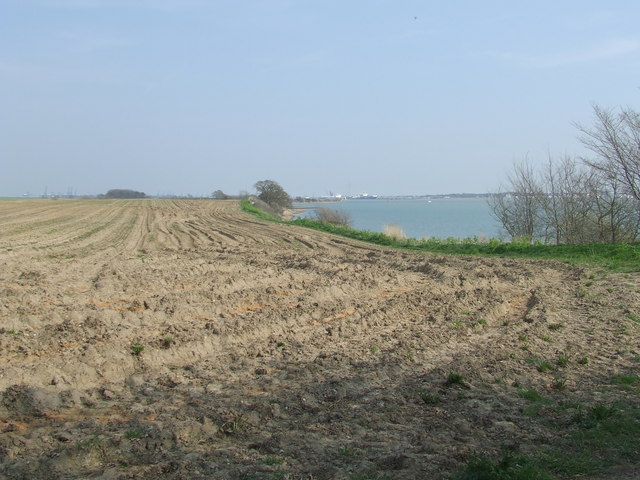
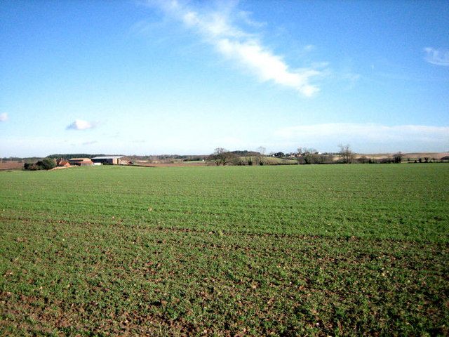
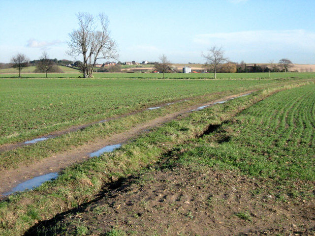
Erwarton is a small village located in the southern part of Suffolk, England. Situated along the picturesque River Orwell, it is a tranquil and charming place known for its natural beauty and rich history. The village is set amidst rolling countryside, offering stunning views and a peaceful atmosphere.

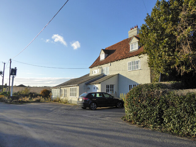
One of the notable landmarks in Erwarton is Erwarton Hall, a beautiful Grade I listed Tudor mansion. This historic building dates back to the 16th century and is renowned for its architectural elegance and grandeur. It was once the home of Anne Boleyn's family, adding to its historical significance.

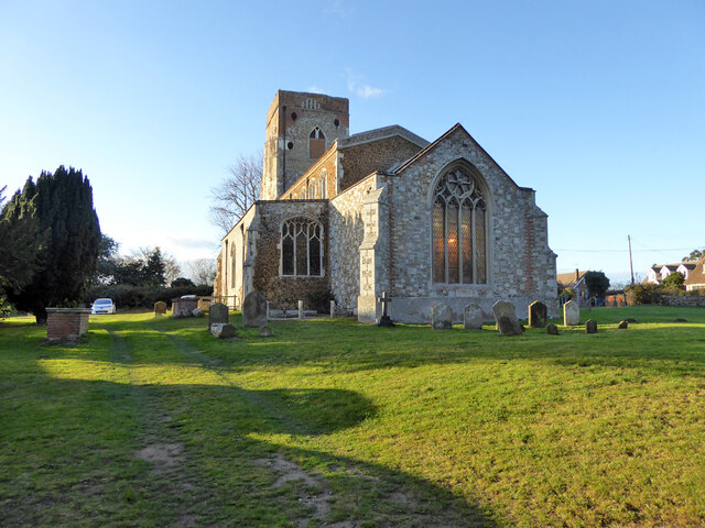
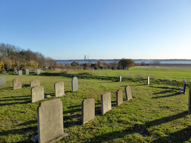
In addition to its architectural gems, Erwarton boasts a thriving community. The village has a local church, St. Mary's, which is a lovely example of medieval architecture. This place of worship adds to the village's charm and offers a sense of tranquility.

Erwarton is also a popular destination for outdoor enthusiasts. The surrounding countryside offers ample opportunities for walking, cycling, and exploring the scenic countryside. The River Orwell is particularly appealing for boating and fishing enthusiasts, with its calm waters and stunning views.

While Erwarton is a small village, it is conveniently located near larger towns and cities. The nearby town of Ipswich is just a short drive away and offers a wide range of amenities, including shopping centers, restaurants, and cultural attractions.

Overall, Erwarton is a hidden gem in Suffolk, offering a perfect blend of natural beauty, historical landmarks, and a close-knit community. It is a place where visitors can escape the hustle and bustle of city life and immerse themselves in the tranquility of the English countryside.

If you have any feedback on the listing, please let us know in the comments section below.

Erwarton Images

Images are sourced within 2km of 51.965283/1.224114 or Grid Reference TM2134. Thanks to Geograph Open Source API. All images are credited.

Small bridge and bend, lane towards Harkstead
Fields along stream valley Country east of Harkstead.
Fields along stream valley
Country east of Harkstead.
Lane towards Erwarton Erwarton Hall Farm is ahead.
Lane towards Erwarton
Erwarton Hall Farm is ahead.
Erwarton church St. Mary's is a grade I listed building, oldest parts 15th century.
Erwarton church
St. Mary's is a grade I listed building, oldest parts 15th century.
View from Erwarton churchyard Towards Parkeston Quay.
View from Erwarton churchyard
Towards Parkeston Quay.
The Queens Head, Erwarton (closed), 2017 It had been closed for some years, with rumours of reopening from time to time, with no result.  Evidently lived in, however.
The Queens Head, Erwarton (closed), 2017
It had been closed for some years, with rumours of reopening from time to time, with no result. Evidently lived in, however.
Rat Hill towards Shop Corner
Field gateway off Rat Hill Footpaths go straight on and right here.
Field gateway off Rat Hill
Footpaths go straight on and right here.
Late autumn trees Along a stream north of Rat Hill.
Late autumn trees
Along a stream north of Rat Hill.
Small stream valley The stream along this valley drains to Johnny All Alone Creek, on the Stour.
Small stream valley
The stream along this valley drains to Johnny All Alone Creek, on the Stour.
Erwarton Ness
Erwarton Ness
Suffolk Coastal & Heaths Path A small part of the Suffolk Coastal & Heaths Path with the River Stour south of Harkstead Suffolk.
Suffolk Coastal & Heaths Path
A small part of the Suffolk Coastal & Heaths Path with the River Stour south of Harkstead Suffolk.
Drift Wood Closeup of the remains of a tree beached on the shore of the River Stour along with many others washed and bleached by the weather south of Harkstead Suffolk.
Drift Wood
Closeup of the remains of a tree beached on the shore of the River Stour along with many others washed and bleached by the weather south of Harkstead Suffolk.
Seaweed-festooned old jetty Heading south from Needle Corner in <a href="https://www.geograph.org.uk/gridref/TM1934">TM1934</a>, past the abandoned Sparrow Hall, you reach the Orwell at this point, where an old jetty stands, long since abandoned.  It is not alone: <a href="https://www.geograph.org.uk/photo/660274">TM2133 : Abandoned jetty at Erwarton Ness</a>, just a little further east.
Seaweed-festooned old jetty
Heading south from Needle Corner in TM1934, past the abandoned Sparrow Hall, you reach the Orwell at this point, where an old jetty stands, long since abandoned. It is not alone: TM2133 : Abandoned jetty at Erwarton Ness, just a little further east.
Fallen soldier by abandoned jetty Lying next to <a href="https://www.geograph.org.uk/photo/661371">TM1933 : Seaweed-festooned old jetty</a>, this long-dead tree has been swung around by the tide to face the opposite direction to the one it presumably faced when it fell from a nearby bank.
Fallen soldier by abandoned jetty
Lying next to TM1933 : Seaweed-festooned old jetty, this long-dead tree has been swung around by the tide to face the opposite direction to the one it presumably faced when it fell from a nearby bank.
Undulating farmland North of the River Stour.
Undulating farmland
North of the River Stour.
Track east This farm track runs parallel to the River Stour towards Beaumont Hall. See also <a href="https://www.geograph.org.uk/photo/660645">TM2033 : Across the square to Beaumont Hall</a> from a south-easterly direction.
Track east
This farm track runs parallel to the River Stour towards Beaumont Hall. See also TM2033 : Across the square to Beaumont Hall from a south-easterly direction.
Footpath following field edge The footpath, following a field edge, runs parallel to the River Stour, which can be seen in the distance.
Footpath following field edge
The footpath, following a field edge, runs parallel to the River Stour, which can be seen in the distance.
Show me another place!

Erwarton is located at Grid Ref: TM2134 (Lat: 51.965283, Lng: 1.224114)

Administrative County: Suffolk

District: Babergh

Police Authority: Suffolk

What 3 Words

///tripling.dressings.stealing. Near Shotley Gate, Suffolk

Related Wikis

Erwarton

Erwarton or Arwarton is a small village and civil parish in the Babergh district of Suffolk, England. The parish includes the hamlet of Shop Corner. Located...

River Stour, Suffolk

The River Stour (, pronounced rhyming with either "tour" or "sour") is a major river in East Anglia, England. It is 47 miles (76 km) long and forms most...

Shotley

Shotley is a village and civil parish 8 miles (13 km) south-east of Ipswich in the English county of Suffolk. It is in the Babergh district and gives its...

Harkstead

Harkstead is a village and civil parish in the county of Suffolk, England. The village is located on the northern bank of the River Stour estuary at Holbrook...

Harwich refinery

Harwich refinery is a 500,000 tonnes per year refining, processing, blending and storage facility near the port of Harwich in the UK. The refinery was...

Ganges Wood

Ganges Wood is a woodland in Suffolk, England, near the village of Shotley Gate. It covers a total area of 2.21 hectares (5.46 acres). It is owned and...

Harwich International Port

Harwich International Port is a North Sea seaport in Essex, England, and one of the Haven ports. It lies on the south bank of the River Stour one mile...

HMS Badger (shore establishment)

HMS Badger was a shore establishment of the Royal Navy on the east coast of the United Kingdom. She was commissioned on 13 September 1939 was the flagship...

Nearby Amenities

Located within 500m of 51.965283,1.224114
Bus Stop
Queens Head
Naptan AtcoCode: 390010003
Naptan Bearing: E
Naptan BusStopType: CUS
Naptan CommonName: Queens Head
Naptan Indicator: adj
Naptan Landmark: Queens Head
Naptan NaptanCode: sufadadj
Naptan Street: The Street
Naptan Verified: no
Source: naptan_import
Lat/Long: 51.9654804/1.2241492
Bus Stop
Queens Head
Bench: no
Bin: no
Bus: yes
Lit: no
Naptan AtcoCode: 390010004
Naptan Bearing: W
Naptan CommonName: Queens Head
Naptan Indicator: opp
Naptan Landmark: Queens Head
Naptan NaptanCode: sufadadm
Naptan Street: The Street
Naptan Verified: no
Public Transport: platform
Shelter: no
Source: naptan_import
Tactile Paving: no
Lat/Long: 51.9653645/1.2241118
Post Box
Collection Times: Mo-Fr 09:00; Sa 07:00
Operator: Royal Mail
Operator Type: private
Operator Wikidata: Q638098
Post Box Mounting: pier
Post Box Type: lamp
Ref: IP9 1237
Royal Cypher: EIIR
Royal Cypher Wikidata: Q33102113
Lat/Long: 51.9654835/1.2244559
Generator Method: photovoltaic
Generator Output Electricity: yes
Generator Source: solar
Generator Type: solar_photovoltaic_panel
Location: roof
Power: generator
Lat/Long: 51.9667172/1.229766
The data included in this document is from www.openstreetmap.org. The data is made available under ODbL.

Have you been to Erwarton?

Leave your review of Erwarton below (or comments, questions and feedback).