Heaselands Plantation

Wood, Forest in Sussex Mid Sussex

England

Heaselands Plantation

House to the east of Ansty This fine house is seen from a footpath leading east from Ansty to Furnace Wood.
House to the east of Ansty Credit: Marathon

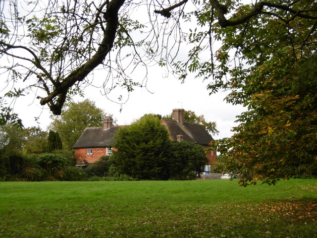
Heaselands Plantation is a picturesque woodland located in Sussex, England. Covering an area of approximately 200 acres, the plantation is known for its diverse range of plant species and tranquil atmosphere. It is situated near the village of Wood, within close proximity to the popular High Weald Area of Outstanding Natural Beauty.

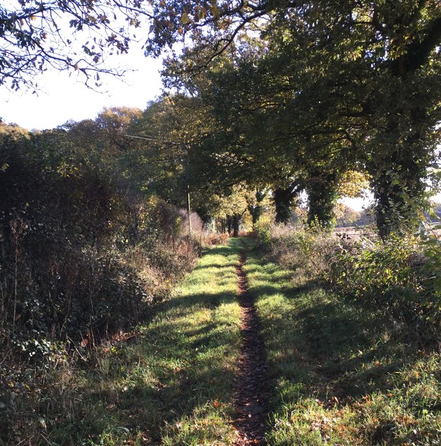
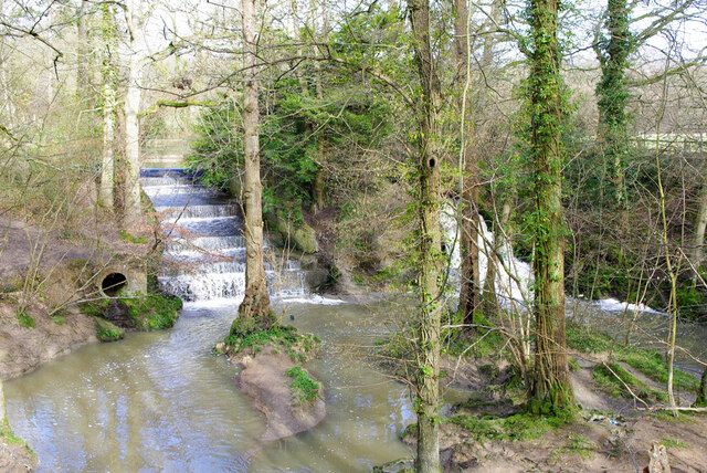
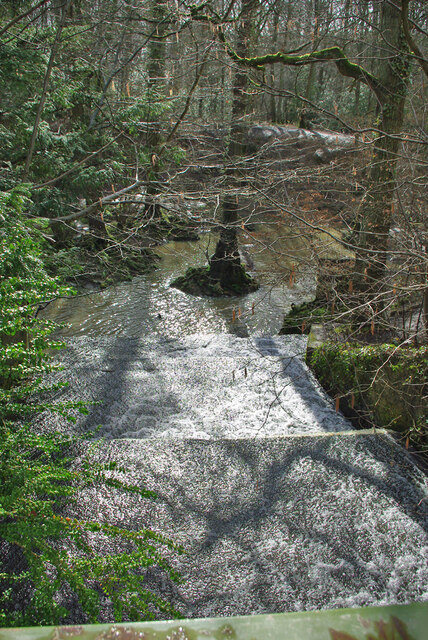
The woodland at Heaselands Plantation consists of a mixture of broadleaf and coniferous trees, creating a beautiful and varied landscape. Visitors can expect to find majestic oak, beech, and birch trees, as well as Douglas fir and Scots pine. The plantation is managed sustainably, with regular tree planting and maintenance efforts to ensure the preservation of its natural beauty.

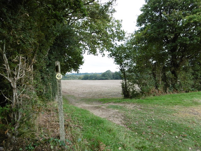
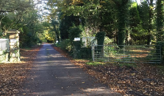
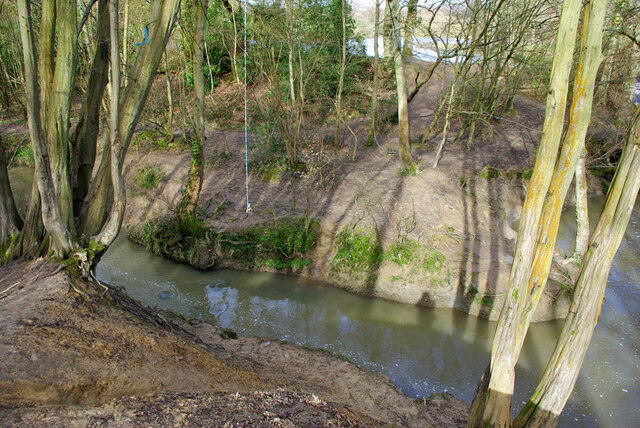
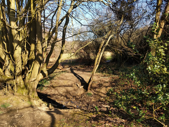
The plantation offers numerous walking trails, allowing visitors to explore the woodland at their own pace. These paths wind through dense vegetation and open glades, providing breathtaking views of the surrounding countryside. Birdwatchers will be delighted by the variety of avian species that call Heaselands Plantation their home, including woodpeckers, nuthatches, and various songbirds.

In addition to its natural wonders, Heaselands Plantation also boasts a rich cultural history. It is believed that the woodland has been managed for timber production for centuries, with records dating back to the 17th century. The plantation has also been used for recreational purposes, with locals and visitors alike enjoying its beauty for walking, picnicking, and wildlife observation.

Overall, Heaselands Plantation is a true gem of Sussex, offering a serene escape into nature with its diverse woodland and peaceful ambiance.

If you have any feedback on the listing, please let us know in the comments section below.

Heaselands Plantation Images

Images are sourced within 2km of 50.990074/-0.12891132 or Grid Reference TQ3122. Thanks to Geograph Open Source API. All images are credited.

House to the east of Ansty This fine house is seen from a footpath leading east from Ansty to Furnace Wood.
House to the east of Ansty
This fine house is seen from a footpath leading east from Ansty to Furnace Wood.
The footpath turns left here It then turns right again just beyond the hedge on the left before heading to Furnace Wood in the distance.
The footpath turns left here
It then turns right again just beyond the hedge on the left before heading to Furnace Wood in the distance.
Entrance to Moonhill Place A public footpath follows the driveway to Moonhill Place whilst the bridleway leaves to the right through the gateway.
Entrance to Moonhill Place
A public footpath follows the driveway to Moonhill Place whilst the bridleway leaves to the right through the gateway.
Bridleway heading East Looking eastwards along the Bridleway near to Moonhill Farm.
Bridleway heading East
Looking eastwards along the Bridleway near to Moonhill Farm.
Leaving Ansty On the private lane leaving Ansty.
Leaving Ansty
On the private lane leaving Ansty.
Path in Big Wood, Bedelands Farm A local nature reserve.
Path in Big Wood, Bedelands Farm
A local nature reserve.
Spillways, Valebridge Pond On the eastern branch of the River Adur.
Spillways, Valebridge Pond
On the eastern branch of the River Adur.
Blue rope hanging over River Adur Standard equipment for such places.
Blue rope hanging over River Adur
Standard equipment for such places.
Spillway, Valebridge Pond On the eastern branch of the River Adur.
Spillway, Valebridge Pond
On the eastern branch of the River Adur.
Pond by Freek's Lane Probably dug for iron - Freek's Lane crosses a clay-ironstone seam about here.
Pond by Freek's Lane
Probably dug for iron - Freek's Lane crosses a clay-ironstone seam about here.
Glimpse of a field east of Freek's Lane
Freek's Lane heading north It is footpath 96CR and very much a footpath rather than a lane here.
Freek's Lane heading north
It is footpath 96CR and very much a footpath rather than a lane here.
Freek's Lane heading north It is footpath 96CR and very much a footpath rather than a lane here.
Freek's Lane heading north
It is footpath 96CR and very much a footpath rather than a lane here.
Freek's Lane heading north It is footpath 96CR and very much a footpath rather than a lane here.
Freek's Lane heading north
It is footpath 96CR and very much a footpath rather than a lane here.
Woodland east of Freek's Lane
Woodland drainage running down to River Adur To the east of Freek's Lane.
Woodland drainage running down to River Adur
To the east of Freek's Lane.
Footpath junction near River Adur Freek's Lane, if it is still called that, continues straight on, changing footpath number from 96CR to 94CR. Right is 95CR, following the Adur valley up to the Valebridge pond bay.
Footpath junction near River Adur
Freek's Lane, if it is still called that, continues straight on, changing footpath number from 96CR to 94CR. Right is 95CR, following the Adur valley up to the Valebridge pond bay.
Show me another place!

Heaselands Plantation is located at Grid Ref: TQ3122 (Lat: 50.990074, Lng: -0.12891132)

Administrative County: West Sussex

District: Mid Sussex

Police Authority: Sussex

What 3 Words

///prove.boring.slick. Near Haywards Heath, West Sussex

Related Wikis

Ashenground and Bolnore Woods

Ashenground and Bolnore Woods is a 14.4-hectare (36-acre) Local Nature Reserve in Haywards Heath in West Sussex. It is owned and managed by Mid Sussex...

Warden Park Secondary Academy

Warden Park Secondary Academy is a coeducational secondary school based in Cuckfield (near Haywards Heath), West Sussex, England. == Description == There...

Battle of Muster Green

The Battle of Muster Green (also known as the Battle of Haywards Heath) was a minor battle of major significance that took place during the first week...

Whitemans Green

Whiteman's Green is a place in the north of the large village and civil parish of Cuckfield in the Mid Sussex District of West Sussex, England. It is located...

Holy Trinity Church, Cuckfield

Holy Trinity Church is an Anglican church in the village of Cuckfield in the district of Mid Sussex; one of seven local government districts in the English...

Haywards Heath Town (electoral division)

Haywards Heath Town is an electoral division of West Sussex in the United Kingdom, and returns one member to sit on West Sussex County Council. == Extent... ==

St Wilfrid's Church, Haywards Heath

St Wilfrid's Church is an Anglican church in the town of Haywards Heath in the district of Mid Sussex, one of seven local government districts in the English...

Bedelands Farm Nature Reserve

Bedelands Farm Nature Reserve is a 35.2-hectare (87-acre) Local Nature Reserve on the northern outskirts of Burgess Hill in West Sussex. It is owned and...

Nearby Amenities

Located within 500m of 50.990074,-0.12891132
Barrier: kissing_gate
Foot: designated
Lat/Long: 50.99269/-0.126914
Barrier: kissing_gate
Lat/Long: 50.9902791/-0.1351683
A273 Issacs Lane
Naptan AtcoCode: 4400EG0361
Naptan Bearing: N
Naptan BusStopType: CUS
Naptan CommonName: A273 Issacs Lane
Naptan Indicator: HAR
Naptan Landmark: Hail & Ride
Naptan NaptanCode: wsxdtjmd
Naptan Street: A273. Heaselands Lodge
Naptan Verified: no
Source: naptan_import
Lat/Long: 50.9895165/-0.129431
Post Box
Brand: Royal Mail
Brand Wikidata: Q638098
Brand Wikipedia: en:Royal Mail
Operator: Royal Mail
Operator Wikidata: Q638098
Post Box Type: lamp
Ref: RH16 76D
Royal Cypher: EIIR
Royal Cypher Wikidata: Q33102113
Lat/Long: 50.9927442/-0.1267225
Addr City: Haywards Heath
Addr Housename: Pear Tree Cottages
Addr Postcode: RH16 4SA
Addr Street: Isaac's Lane
Lat/Long: 50.9933362/-0.1265374
Addr City: Haywards Heath
Addr Housename: Heasewood Stable Cottages
Addr Postcode: RH16 4RZ
Addr Street: Isaac's Lane
Lat/Long: 50.9872696/-0.1309935
The data included in this document is from www.openstreetmap.org. The data is made available under ODbL.

Have you been to Heaselands Plantation?

Leave your review of Heaselands Plantation below (or comments, questions and feedback).