The Warren

Wood, Forest in Hertfordshire Welwyn Hatfield

England

The Warren

Apple Daycare, Little Berkhamsted
Apple Daycare, Little Berkhamsted Credit: David Howard

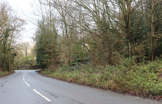
The Warren, located in Hertfordshire, is a picturesque and enchanting woodland area that covers a vast expanse of land. It is renowned for its natural beauty and tranquil atmosphere, making it a popular destination for nature lovers and outdoor enthusiasts alike.

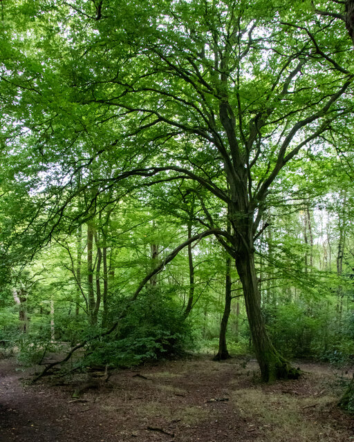
The woodland is characterized by its dense canopy of trees, predominantly consisting of oak, beech, and birch. These towering trees create a sense of serenity, providing a haven for various species of wildlife, including deer, foxes, and numerous bird species.

The Warren offers a network of well-maintained walking trails, allowing visitors to explore the area at their own pace. The trails wind their way through the woodland, leading visitors to hidden gems such as secluded ponds, ancient ruins, and breathtaking viewpoints.

This wood also boasts an impressive array of flora, with a carpet of bluebells in the spring and vibrant wildflowers throughout the summer months. These vibrant bursts of color add to the overall charm and beauty of the Warren.

In addition to its natural wonders, the Warren also provides recreational facilities such as picnic areas and designated camping spots. This allows visitors to fully immerse themselves in the peaceful surroundings and make the most of their visit.

Overall, the Warren in Hertfordshire is a captivating woodland retreat, offering a tranquil escape from the hustle and bustle of everyday life. With its diverse flora and fauna, well-maintained trails, and serene atmosphere, it is a must-visit destination for anyone seeking a connection with nature.

If you have any feedback on the listing, please let us know in the comments section below.
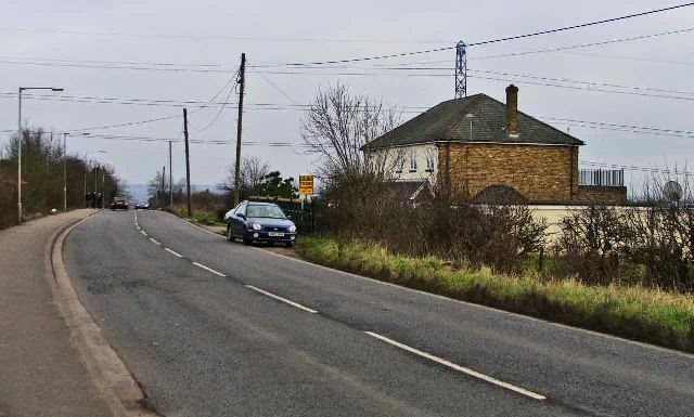
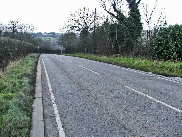
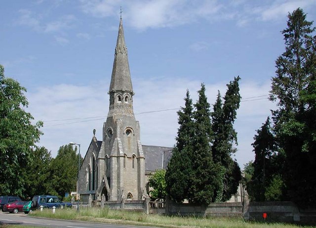
The Warren Images

Images are sourced within 2km of 51.73534/-0.11497282 or Grid Reference TL3005. Thanks to Geograph Open Source API. All images are credited.

Apple Daycare, Little Berkhamsted
Church Road, Little Berkhamsted
Epping Green It's the road and village name.
Epping Green
It's the road and village name.
House in Epping Green
Westfield Grove, Broxbourne Woods National Nature Reserve Managed by the Woodland Trust, as part of Wormley Wood.

See Woodland Trust website: <span class="nowrap"><a title="https://www.woodlandtrust.org.uk/visiting-woods/woods/wormley-wood-nut-wood/" rel="nofollow ugc noopener" href="https://www.woodlandtrust.org.uk/visiting-woods/woods/wormley-wood-nut-wood/">Link</a><img style="margin-left:2px;" alt="External link" title="External link - shift click to open in new window" src="https://s1.geograph.org.uk/img/external.png" width="10" height="10"/></span> -

"One of only two areas of oak-hornbeam forest in the UK, Wormley Wood & Nut Wood are of European importance and are both listed as a Special Area of Conservation (SAC).

Wormley Wood is largely ancient woodland which has been coppiced from the medieval period."
Westfield Grove, Broxbourne Woods National Nature Reserve
Managed by the Woodland Trust, as part of Wormley Wood. See Woodland Trust website: LinkExternal link - "One of only two areas of oak-hornbeam forest in the UK, Wormley Wood & Nut Wood are of European importance and are both listed as a Special Area of Conservation (SAC). Wormley Wood is largely ancient woodland which has been coppiced from the medieval period."
St Mary's Church Newgate Street Quite a handsome church
St Mary's Church Newgate Street
Quite a handsome church
Cuffley world War 2 Anti-tank Blocks This railway bridge at Cuffley was also an intersection with a road and a river and is protected by no less than 85 anti-tank blocks. This is the most extensive surviving group of anti-tank obstacles in Hertfordshire. 

For more info visit <span class="nowrap"><a title="http://www.pillboxesuk.co.uk" rel="nofollow ugc noopener" href="http://www.pillboxesuk.co.uk">Link</a><img style="margin-left:2px;" alt="External link" title="External link - shift click to open in new window" src="https://s1.geograph.org.uk/img/external.png" width="10" height="10"/></span>
Cuffley world War 2 Anti-tank Blocks
This railway bridge at Cuffley was also an intersection with a road and a river and is protected by no less than 85 anti-tank blocks. This is the most extensive surviving group of anti-tank obstacles in Hertfordshire. For more info visit LinkExternal link
Darnicle Hill, Cheshunt, Hertfordshire Darnicle Hill, Cheshunt, looking east.
Darnicle Hill, Cheshunt, Hertfordshire
Darnicle Hill, Cheshunt, looking east.
Darnicle Hill, Cheshunt, Hertfordshire Darnicle Hill, Cheshunt, looking west.
Darnicle Hill, Cheshunt, Hertfordshire
Darnicle Hill, Cheshunt, looking west.
Darnicle Hill Nursery, Darnicle Hill, Cheshunt Darnicle Hill Nursery is on the North side of the road.  L A Dingemans, Specialist Lettuce Growers, operate from this nursery
Darnicle Hill Nursery, Darnicle Hill, Cheshunt
Darnicle Hill Nursery is on the North side of the road. L A Dingemans, Specialist Lettuce Growers, operate from this nursery
St Mary's Ponsbourne, Newgate Street, Hertfordshire
The Gables Restaurant, New Park Road, Newgate Street This restaurant serves Mediterranean food.
The Gables Restaurant, New Park Road, Newgate Street
This restaurant serves Mediterranean food.
Cottages, Bucks Alley, near Epping Green, Hertfordshire
Track leading to Bucks Farm, Bucks Alley Track leading to Bucks Farm from Bucks Alley near Epping Green, Hertfordshire
Track leading to Bucks Farm, Bucks Alley
Track leading to Bucks Farm from Bucks Alley near Epping Green, Hertfordshire
Coal Tax post no 24, Wormley Wood. Coal Tax Posts were markers defining the area within which the Corporation of London could charge duty on coal entering the area. This area had been expanded in 1851 but then reduced in 1861 to coincide with the Metropolitan Police District of the day, the limits of which were between about 20 km and 30km from Charing Cross. It is from this latter time that most of the existing posts date. The post stands in a secluded corner of Wormley Wood, part of 360 acres of woodland purchased from the Gascoyne Cecil Estate. It had been in that family since queen Elizabeth I's minister Sir William Cecil bought it 300 years ago.
Coal Tax post no 24, Wormley Wood.
Coal Tax Posts were markers defining the area within which the Corporation of London could charge duty on coal entering the area. This area had been expanded in 1851 but then reduced in 1861 to coincide with the Metropolitan Police District of the day, the limits of which were between about 20 km and 30km from Charing Cross. It is from this latter time that most of the existing posts date. The post stands in a secluded corner of Wormley Wood, part of 360 acres of woodland purchased from the Gascoyne Cecil Estate. It had been in that family since queen Elizabeth I's minister Sir William Cecil bought it 300 years ago.
House and Byway to Newgate Street Substantial dwelling beside White Stubbs Lane. It was the North Lodge to Ponsbourne Park, hence the ornate style.
House and Byway to Newgate Street
Substantial dwelling beside White Stubbs Lane. It was the North Lodge to Ponsbourne Park, hence the ornate style.
Old Claypits Farm Looking into the farmyard from White Stubbs Lane.
Old Claypits Farm
Looking into the farmyard from White Stubbs Lane.
Fletchers Garden Centre Pansies and Geraniums, amongst other varieties, outside the shop at Fletchers Garden Centre.
Fletchers Garden Centre
Pansies and Geraniums, amongst other varieties, outside the shop at Fletchers Garden Centre.
Show me another place!

The Warren is located at Grid Ref: TL3005 (Lat: 51.73534, Lng: -0.11497282)

Administrative County: Hertfordshire

District: Welwyn Hatfield

Police Authority: Hertfordshire

What 3 Words

///yarn.flown.reap. Near Cuffley, Hertfordshire

Nearby Locations

The Warren Newgate Street

Related Wikis

Newgate Street, Hertfordshire

Newgate Street is a village near Cuffley, in Hatfield civil parish, in the Welwyn Hatfield district of Hertfordshire, England. It is approximately six...

Tolmers Park

Tolmers Park is a manor house in Newgate Street Village near Hatfield in Hertfordshire, England. == Early history == The early history of the manor is...

Little Berkhamsted

Little Berkhamsted is a village and civil parish in Hertfordshire, England, five miles south-west of the town of Hertford. The village is in a hilly location...

Broxbourne Woods

Broxbourne Woods are a 239.1 hectare National Nature Reserve west of Broxbourne in Hertfordshire. The site is Hertfordshire's only National Nature Reserve...

Northaw Great Wood

Northaw Great Wood is a 223.6-hectare (553-acre) biological Site of Special Scientific Interest (SSSI) near Cuffley in Hertfordshire, England. It covers...

Bayford, Hertfordshire

Bayford is a village and civil parish in the East Hertfordshire district of Hertfordshire, England. According to the 2001 census it had a population of...

Cuffley

Cuffley is a village in the civil parish of Northaw and Cuffley, in the Welwyn Hatfield district of south-east Hertfordshire located between Cheshunt and...

Wormley-Hoddesdonpark Wood North

Wormley-Hoddesdonpark Wood North is a 143.9-hectare (356-acre) woodland area in Hertfordshire which has been designated as a biological site of Special...

Nearby Amenities

Located within 500m of 51.73534,-0.11497282
Ele: 117.886475
Lat/Long: 51.7385878/-0.119378
Created By: YahooApplet 1.0
Lat/Long: 51.7391434/-0.115908
Created By: YahooApplet 1.0
Lat/Long: 51.7386119/-0.1154359
Created By: YahooApplet 1.0
Lat/Long: 51.738293/-0.1147493
Created By: YahooApplet 1.0
Lat/Long: 51.7386916/-0.1146205
Created By: YahooApplet 1.0
Lat/Long: 51.7390105/-0.1146205
Created By: YahooApplet 1.0
Lat/Long: 51.739356/-0.1143201
Created By: YahooApplet 1.0
Lat/Long: 51.7395154/-0.1139339
Created By: YahooApplet 1.0
Lat/Long: 51.7390636/-0.1116165
Created By: YahooApplet 1.0
Lat/Long: 51.7381335/-0.111874
Created By: YahooApplet 1.0
Lat/Long: 51.7372831/-0.1121315
Created By: YahooApplet 1.0
Lat/Long: 51.7372831/-0.1129898
Created By: YahooApplet 1.0
Lat/Long: 51.7365389/-0.1131614
Created By: YahooApplet 1.0
Lat/Long: 51.7365655/-0.1121315
Created By: YahooApplet 1.0
Lat/Long: 51.7364592/-0.1111015
Created By: YahooApplet 1.0
Lat/Long: 51.7355024/-0.1109727
Created By: YahooApplet 1.0
Lat/Long: 51.7350772/-0.1111873
Created By: YahooApplet 1.0
Lat/Long: 51.7349443/-0.1105436
Created By: YahooApplet 1.0
Lat/Long: 51.7344128/-0.1103719
Created By: YahooApplet 1.0
Lat/Long: 51.7342533/-0.1097282
Created By: YahooApplet 1.0
Lat/Long: 51.7336952/-0.110844
Created By: YahooApplet 1.0
Lat/Long: 51.734652/-0.1115306
Created By: YahooApplet 1.0
Lat/Long: 51.7346785/-0.111874
Created By: YahooApplet 1.0
Lat/Long: 51.7345191/-0.1121315
Created By: YahooApplet 1.0
Lat/Long: 51.7353164/-0.1132902
Created By: YahooApplet 1.0
Lat/Long: 51.7352367/-0.1139339
Created By: YahooApplet 1.0
Lat/Long: 51.7347583/-0.1141056
Created By: YahooApplet 1.0
Lat/Long: 51.7338546/-0.1141914
Created By: YahooApplet 1.0
Lat/Long: 51.7335357/-0.1143201
Created By: YahooApplet 1.0
Lat/Long: 51.7331636/-0.1141914
Created By: YahooApplet 1.0
Lat/Long: 51.732756/-0.1142641
Created By: YahooApplet 1.0
Lat/Long: 51.7329844/-0.1150955
Created By: YahooApplet 1.0
Lat/Long: 51.7330293/-0.1165985
Created By: YahooApplet 1.0
Lat/Long: 51.7326054/-0.1165946
Created By: YahooApplet 1.0
Lat/Long: 51.7323131/-0.1168521
Created By: YahooApplet 1.0
Lat/Long: 51.7322068/-0.117453
Created By: YahooApplet 1.0
Lat/Long: 51.7323397/-0.1185258
Created By: YahooApplet 1.0
Lat/Long: 51.731941/-0.1187404
Created By: YahooApplet 1.0
Lat/Long: 51.7359231/-0.119246
Barrier: kissing_gate
Lat/Long: 51.7347164/-0.1198913
Barrier: kissing_gate
Lat/Long: 51.7347552/-0.1211735
RW Paintball
Leisure: pitch
Sport: paintball
Website: https://rwpaintball.co.uk/locations/newgate-street-village/
Lat/Long: 51.7371263/-0.1173259
Barrier: kissing_gate
Lat/Long: 51.7351184/-0.1205251
Barrier: kissing_gate
Lat/Long: 51.7347468/-0.1205252
Turning Circle
Lat/Long: 51.7313019/-0.1142541
The data included in this document is from www.openstreetmap.org. The data is made available under ODbL.

Have you been to The Warren?

Leave your review of The Warren below (or comments, questions and feedback).